Huygens Sunk Into Soft Ground

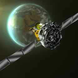
Huygens descent and landing overview. Image credit: ESA Click to enlarge
The Surface Science Package (SSP) revealed that Huygens could have hit and cracked an ice ?pebble? on landing, and then it slumped into a sandy surface possibly dampened by liquid methane. Had the tide on Titan just gone out?

The SSP comprised nine independent sensors, chosen to cover the wide range of properties that be encountered, from liquids or very soft material to solid, hard ice. Some were designed primarily for landing on a solid surface and others for a liquid landing, with eight also operating during the descent.

Extreme and unexpected motion of Huygens at high altitudes was recorded by the SSP?s two-axis tilt sensor tilt sensor, suggesting strong turbulence whose meteorological origin remains unknown.

Penetrometry and accelerometry measurements on impact revealed that the surface was neither hard (like solid ice) nor very compressible (like a blanket of fluffy aerosol). Huygens landed on a relatively soft surface resembling wet clay, lightly packed snow and either wet or dry sand.

The probe had penetrated about 10 cm into surface, and settling gradually by a few millimetres after landing and tilting by a fraction of a degree. An initial high penetration force is best explained by the probe striking one of the many pebbles seen in the DISR images after landing.

Acoustic sounding with SSP over the last 90 m above the surface revealed a relatively smooth, but not completely flat, surface surrounding the landing site. The probe?s vertical velocity just before landing was determined with high precision as 4.6 m/s and the touchdown location had an undulating topography of around 1 metre over an area of 1000 sq. metres.

Those sensors intended to measure liquid properties (refractometer, permittivity and density sensors) would have performed correctly had the probe landed in liquid. The results from these sensors are still being analysed for indications of trace liquids, since the Huygens GCMS detected evaporating methane after touchdown.

Together with optical, radar and infrared spectrometer images from Cassini and images from the DISR instrument on Huygens, these results indicate a variety of possible processes modifying Titan?s surface.

Fluvial and marine processes appear most prominent at the Huygens landing site, although aeolian (wind-borne) activity cannot be ruled out. The SSP and HASI impact data are consistent with two plausible interpretations for the soft material: solid, granular material having a very small or zero cohesion, or a surface containing liquid.

In the latter case, the surface might be analogous to a wet sand or a textured tar/wet clay. The ?sand? could be made of ice grains from impact or fluvial erosion, wetted by liquid methane. Alternatively it might be a collection of photochemical products and fine-grained ice, making a somewhat sticky ?tar?.

The uncertainties reflect the exotic nature of the materials comprising the solid surface and possible liquids in this extremely cold (?180 ?C) environment.

Original Source: ESA Portal

Titan’s Atmosphere Surprised Scientists

Huygens probe descending through Titan’s atmosphere. Image credit: ESA Click to enlarge
Strong turbulence in the upper atmosphere, a second ionospheric layer and possible lightning were among the surprises found by the Huygens Atmospheric Structure Instrument (HASI) during the descent to Titan?s surface.

HASI provided measurements from an altitude of 1400 km down to the surface of the physical characteristics of the atmosphere and surface, such as temperature and density profiles, electrical conductivity, and surface structure. The Huygens SSP made measurements just above and on the surface of Titan.

High-altitude atmospheric structure had been inferred from earlier solar occultation measurements by Voyager, but the middle atmosphere (200?600 km) was not well determined, although telescopic observations indicated a complex vertical structure.

Very little was known about the surface of Titan because it is hidden by a thick ‘haze’ – initial speculation was that the surface was covered by a deep hydrocarbon ocean, but infrared and radar measurements showed definite albedo contrasts ?possibly consistent with lakes, but not with a global ocean.

Earlier observations showed that the surface pressure on Titan was comparable to that on Earth, and that methane formed a plausible counterpart to terrestrial water for cloud and rain formation. There was also speculation on the possibility of lightning occurring in Titan?s atmosphere that could affect the chemical composition of the atmosphere.

HASI found that in the upper part of the atmosphere, the temperature and density were both higher than expected. The temperature structure shows strong wave-like variations of 10-20 K about a mean of about 170 K. This, together with other evidence, indicates that Titan?s atmosphere has many different layers.

Models of Titan’s ionosphere predicted that galactic cosmic rays would produce an ionospheric layer with a maximum concentration of electrons between 70 and 90 km altitude. HASI also surprised the Huygens team by finding a second lower ionospheric layer, between 140 km and 40 km, with electrical conductivity peaking near 60 km.

HASI may also have seen the signature of lightning. Several electrical field impulse events were observed during the descent, caused by possible lightning activity in the spherical waveguide formed by the surface of Titan and the inner boundary of its ionosphere.

The vertical resolution of the temperature measurement was sufficient to resolve the structure of the planetary boundary layer. This boundary layer had a thickness of about 300 m at the place and time of landing. The surface temperature was accurately measured at 93.65?0.25 K and the pressure 1467?1 hPa (very close to measurements made earlier by Voyager, about 95K and 1400 hPa).

Original Source:ESA Portal

Mars Express Confirms Liquid Water Once Existed on Mars’ Surface

Mars Express’s OMEGA instrument adds detail to Candor Chasma. Image credit: ESA Click to enlarge
From previous observations, Mars must have undergone water-driven processes, which left their signature in surface structures such as channel systems and signs of extensive aqueous erosion. However, such observations do not necessarily imply the stable presence of liquid water on the surface over extended periods of time during the Martian history.

The data collected by OMEGA unambiguously reveal the presence of specific surface minerals which imply the long-term presence of large amounts of liquid water on the planet.

These ‘hydrated’ minerals, so called because they contain water in their crystalline structure, provide a clear ‘mineralogical’ record of water-related processes on Mars.

During 18 months of observations OMEGA has mapped almost the entire surface of the planet, generally at a resolution between one and five kilometres, with some areas at sub-kilometre resolution.

The instrument detected the presence of two different classes of hydrated minerals, ‘phyllosilicates’ and ‘hydrated sulphates’, over isolated but large areas on the surface.

Both minerals are the result of a chemical alteration of rocks. However, their formation processes are very different and point to periods of different environmental conditions in the history of the planet.

Phyllosilicates, so-called because of their characteristic structure in thin layers (‘phyllo’ = thin layer), are the alteration products of igneous minerals (minerals of magmatic origin) sustaining a long-term contact with water. An example of phyllosilicate is clay.

Phyllosilicates were detected by OMEGA mainly in the Arabia Terra, Terra Meridiani, Syrtis Major, Nili Fossae and Mawrth Vallis regions, in the form of dark deposits or eroded outcrops.

Hydrated sulphates, the second major class of hydrated minerals detected by OMEGA, are also minerals of aqueous origin. Unlike phyllosilicates, which form by an alteration of igneous rocks, hydrated sulphates are formed as deposits from salted water; most sulphates need an acid water environment to form. They were spotted in layered deposits in Valles Marineris, extended exposed deposits in Terra Meridiani, and within dark dunes in the northern polar cap.

When did the chemical alteration of the surface that led to the formation of hydrated minerals occur? At what point of Mars’s history was water standing in large quantities on the surface? OMEGA’s scientists combined their data with those from other instruments and suggest a likely scenario of what may have happened.

“The clay-rich, phyllosilicate deposits we have detected were formed by alteration of surface materials in the very earliest times of Mars,” says Jean-Pierre Bibring, OMEGA Principal Investigator.

“The altered material must have been buried by subsequent lava flows we observe around the spotted areas. Then, the material would have been exposed by erosion in specific locations or excavated from an altered crust by meteoritic impacts,” Bibring adds.

Analysis of the surrounding geological context, combined with the existing crater counting techniques to calculate the relative age of surface features on Mars, places the formation of phyllosilicates in the early Noachian era, during the intense cratering period. The Noachian era, lasting from the planet’s birth to about 3.8 thousand million years ago, is the first and most ancient of the three geological eras on Mars.

“An early active hydrological system must have been present on Mars to account for the large amount of clays, or phyllosilicates in general, that OMEGA has observed,” says Bibring.

The long-term contact with liquid water that led to the phyllosilicate formation could have existed and be stable at the surface of Mars, if the climate was warm enough. Alternatively, the whole formation process could have occurred through the action of water in a warm, thin crust.

OMEGA data also show that the sulphate deposits are distinct from, and have been formed after, the phyllosilicate ones. To form, sulphates do not need a particularly long-term presence of liquid water, but water must be there and it must be acidic.

The detection and mapping of these two different kinds of hydrated minerals point to two major climatic episodes in the history of Mars: an early ? Noachian ? moist environment in which phyllosilicates formed, followed by a more acid environment in which the sulphates formed. These two episodes were separated by a Mars global climatic change.

“If we look at today’s evidence, the era in which Mars could have been habitable and sustained life would be the early Noachian, traced by the phyllosilicates, rather than the sulphates. The clay minerals we have mapped could still retain traces of a possible biochemical development on Mars,” Bibring concludes.

Original Source:ESA Portal

Mars Express Finds a Buried Impact Crater

MARSIS ‘radargrams’ of buried basin on Mars. Image credit: ESA Click to enlarge
For the first time in the history of planetary exploration, the MARSIS radar on board ESA’s Mars Express has provided direct information about the deep subsurface of Mars.

First data include buried impact craters, probing of layered deposits at the north pole and hints of the presence of deep underground water-ice.

The subsurface of Mars has been so far unexplored territory. Only glimpses of the Martian depths could be deduced through analysis of impact crater and valley walls, and by drawing cross-sections of the crust deduced from geological mapping of the surface.

With measurements taken only for a few weeks during night-time observations last summer, MARSIS – the Mars Advanced Radar for Subsurface and Ionospheric Sounding – is already changing our perception of the Red Planet, adding to our knowledge the missing ‘third’ dimension: the Martian interior.

First results reveal an almost circular structure, about 250 km in diameter, shallowly buried under the surface of the northern lowlands of the Chryse Planitia region in the mid-latitudes on Mars. The scientists have interpreted it as a buried basin of impact origin, possibly containing a thick layer of water-ice-rich material.

To draw this first exciting picture of the subsurface, the MARSIS team studied the echoes of the radio waves emitted by the radar, which passed through the surface and then bounced back in the distinctive way that told the ‘story’ about the layers penetrated.

These echo structures form a distinctive collection that include parabolic arcs and an additional planar reflecting feature parallel to the ground, 160 km long. The parabolic arcs correspond to ring structures that could be interpreted as the rims of one or more buried impact basins. Other echoes show what may be rim-wall ‘slump blocks’ or ‘peak-ring’ features.

The planar reflection is consistent with a flat interface that separates the floor of the basin, situated at a depth of about 1.5 to 2.5 km, from a layer of overlying different material. In their analysis of this reflection, scientists do not exclude the intriguing possibility of a low-density, water-ice-rich material at least partially filling the basin.

“The detection of a large buried impact basin suggests that MARSIS data can be used to unveil a population of hidden impact craters in the northern lowlands and elsewhere on the planet,” says Jeffrey Plaut, Co-Principal Investigator on MARSIS. “This may force us to reconsider our chronology of the formation and evolution of the surface.”

MARSIS also probed the layered deposits that surround the north pole of Mars, in an area between 10? and 40? East longitude. The interior layers and the base of these deposits are poorly exposed. Prior interpretations could only be based on imaging, topographic measurements and other surface techniques.

Two strong and distinct echoes coming from the area correspond to a surface reflection and subsurface interface between two different materials. By analysis of the two echoes, the scientists were able to draw the likely scenario of a nearly pure, cold water-ice layer thicker than 1 km, overlying a deeper layer of basaltic regolith. This conclusion appears to rule out the hypothesis of a melt zone at the base of the northern layered deposits.

To date, the MARSIS team has not observed any convincing evidence for liquid water in the subsurface, but the search has only just begun. “MARSIS is already demonstrating the capability to detect structures and layers in the subsurface of Mars which are not detectable by other sensors, past or present,” says Giovanni Picardi, MARSIS Principal Investigator.

“MARSIS holds exciting promise to address, and possibly solve, a number of open questions of major geological significance,” he concluded.

Original Source:ESA Portal

What Mars Looked Like Billions of Years Ago

A view of “Burns Cliff” by Opportunity. Image credit: NASA/JPL/Cornell. Click to enlarge
Life may have had a tough time getting started in the ancient environment that left its mark in the Martian rock layers examined by NASA’s Opportunity rover. The most thorough analysis yet of the rover’s discoveries reveals the challenges life may have faced in the harsh Martian environment.

“This is the most significant set of papers our team has published,” said Dr. Steve Squyres of Cornell University, Ithaca, N.Y. He is principal investigator for the science instruments on Opportunity and its twin Mars Exploration Rover, Spirit. The lengthy reports reflect more thorough analysis of Opportunity’s findings than earlier papers.

Scientists have been able to deduce that conditions in the Meridiani Planum region of Mars were strongly acidic, oxidizing, and sometimes wet. Those conditions probably posed stiff challenges to the potential origin of Martian life.

Based on Opportunity’s data, nine papers by 60 researchers in volume 240, issue 1 of the journal Earth and Planetary Science Letters discuss what this part of the Martian Meridiani Planum region was like eons ago. The papers present comparisons to some harsh habitats on Earth and examine the ramifications for possible life on Mars.

Dr. Andrew Knoll of Harvard University, Cambridge, Mass., a co-author of the paper, said, “Life that had evolved in other places or earlier times on Mars, if any did, might adapt to Meridiani conditions, but the kind of chemical reactions we think were important to giving rise to life on Earth simply could not have happened at Meridiani.”

Scientists analyzed data about stacked sedimentary rock layers 23 feet thick, exposed inside “Endurance Crater.” They identified three divisions within the stack. The lowest, oldest portion had the signature of dry sand dunes; the middle portion had windblown sheets of sand. Particles in those two layers were produced in part by previous evaporation of liquid water. The upper portion, with some layers deposited by flowing water, corresponded to layers Opportunity found earlier inside a smaller crater near its landing site.

Materials in all three divisions were wet both before and after the layers were deposited by either wind or water. Researchers described chemical evidence that the sand grains deposited in the layers had been altered by water before the layers formed. Scientists analyzed how acidic water moving through the layers after they were in place caused changes such as the formation of hematite-rich spherules within the rocks.

Experimental and theoretical testing reinforces the interpretation of changes caused by acidic water interacting with the rock layers. “We made simulated Mars rocks in our laboratory, then infused acidic fluids through them,” said researcher Nicholas Tosca from the State University of New York, Stony Brook. “Our theoretical model shows the minerals predicted to form when those fluids evaporate bear a remarkable similarity to the minerals identified in the Meridiani outcrop.”

The stack of layers in Endurance Crater resulted from a changeable environment perhaps 3.5 to 4 billion years ago. The area may have looked like salt flats occasionally holding water, surrounded by dunes. The White Sands region in New Mexico bears a similar physical resemblance. For the chemistry and mineralogy of the environment, an acidic river basin named Rio Tinto, in Spain, provides useful similarities, said Dr. David Fernandez-Remolar of Spain’s Centro de Astrobiologia and co-authors.

Many types of microbes live in the Rio Tinto environment, one of the reasons for concluding that ancient Meridiani could have been habitable. However, the organisms at Rio Tinto are descended from populations that live in less acidic and stressful habitats. If Meridiani had any life, it might have had to originate in a different habitat.

“You need to be very careful when you are talking about the prospect for life on Mars,” Knoll said. “We’ve looked at only a very small parcel of Martian real estate. The geological record Opportunity has examined comes from a relatively short period out of Mars’ long history.”

NASA’s Jet Propulsion Laboratory, Pasadena, Calif., manages the Mars Exploration Rover project. Images and information about the rovers and their discoveries are available at http://www.nasa.gov/vision/universe/solarsystem/mer_main.html .

Original Source: NASA News Release

Teeny Tiny Solar System

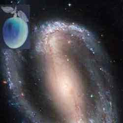
An artist’s concept of the miniature solar system (top) compared to a known solar sytem. Image credit: NASA/JPL Click to enlarge
Scientists using a combination of ground-based and orbiting telescopes have discovered a failed star, less than one-hundredth the mass of the Sun, possibly in the process of forming a solar system. It is the smallest known star-like object to harbor what appears to be a planet-forming disk of rocky and gaseous debris, which one day could evolve into tiny planets and create a solar system in miniature. A team led by Kevin Luhman, assistant professor of astronomy and astrophysics at Penn State University, will discuss this finding in the 10 December 2005 issue of Astrophysical Journal Letters.

The discovered object, called a brown dwarf, is described as a “failed star” because it is not massive enough to sustain nuclear fusion like our Sun. The object is only eight times more massive than Jupiter. The fact that a brown dwarf this small could be in the midst of creating a solar system challenges the very definition of star, planet, moon and solar system.

“Our goal is to determine the smallest ‘sun’ with evidence for planet formation,” said Luhman. “Here we have a sun that is so small it is the size of a planet. The question then becomes, what do we call any little bodies that might be born from this disk: planets or moons?” If this protoplanetary disk does form into planets, the whole system would be a miniaturized version of our solar system — with the central “sun”, the planets, and their orbits all roughly 100 times smaller.

Luhman’s team detected the brown dwarf, called Cha 110913-773444, with NASA’s Spitzer Space Telescope, the Hubble Space Telescope, and two telescopes in the Chilean Andes, the Blanco telescope of the Cerro Tololo Inter-American Observatory and the Gemini South telescope, both international collaborations funded in part by the National Science Foundation. Luhman led a similar observation last year that uncovered a 15-Jupiter-mass brown dwarf with a protoplanetary disk.

Brown dwarfs are born like stars, condensing out of thick clouds of gas and dust. But unlike stars, brown dwarfs do not have enough mass — and therefore do not have enough pressure and temperature in their cores — to sustain nuclear fusion. They remain relatively cool objects visible in lower-energy wavelengths such as infrared. A protoplanetary disk is a flat disk made up of dust and gas that is thought to clump together to form planets. Our solar system was formed from such a disk about five billion years ago. NASA’s Spitzer telescope has found dozens of disk-sporting brown dwarfs so far, several of which show the initial stages of the planet-building process. The material in these disks is beginning to stick together into what may be the “seeds” of planets.

With Spitzer, the science team spotted Cha 110913-773444 about 500 light years away in the constellation Chamaeleon. This brown dwarf is young, only about 2 million years old. The team studied properties of the brown dwarf with infrared instruments on the other observatories. The cool, dim protoplanetary disk was detectable only with Spitzer’s Infrared Array Camera, which was developed at the Harvard-Smithsonian Center for Astrophysics.

In the past decade, advances in astronomy have led to the detection of small brown dwarfs and massive extra-solar planets, which has brought about a quandary in taxonomy. “There are two camps when it comes to defining planets versus brown dwarfs,” said team member Giovanni Fazio of the Harvard-Smithsonian Center for Astrophysics. “Some go by size, and others go by how the object formed. For instance, this new object would be called a planet based on its size, but a brown dwarf based on how it formed.” If one were to call the object a planet, Fazio said, then Spitzer may have discovered its first “moon-forming” disk. No matter what the final label may be, one thing is clear: The universe produces some strange solar systems very different from our own. Other members of the discovery team are Lucia Adame and Paola D’Alessio of the National Autonomous University of Mexico and Nuria Calvet and Lee Hartmann of the University of Michigan.

The 4-meter Blanco Telescope at the Cerro Tololo Inter-American Observatory in Chile is part of the National Optical Astronomy Observatory, which is operated by the Association of Universities for Research in Astronomy (AURA) Inc. under a cooperative agreement with the National Science Foundation. The nearby 8-meter Gemini South telescope also is managed by AURA. NASA’s Goddard Space Flight Center, Greenbelt, Md., built Spitzer’s Infrared Array Camera. The instrument’s principal investigator is Giovanni Fazio. The Jet Propulsion Laboratory, Pasadena, Calif., manages the Spitzer mission for NASA. Science operations are conducted at the Spitzer Science Center at the California Institute of Technology in Pasadena.

Original Source:Penn State University

Ice Volcanoes on Enceladus

Saturn’s moon Enceladus backlit by the Sun. Image credit: NASA/JPL/SSI Click to enlarge
Recent Cassini images of Saturn’s moon Enceladus backlit by the sun show the fountain-like sources of the fine spray of material that towers over the south polar region. This image was taken looking more or less broadside at the “tiger stripe” fractures observed in earlier Enceladus images. It shows discrete plumes of a variety of apparent sizes above the limb of the moon.

The Cassini-Huygens mission is a cooperative project of NASA, the European Space Agency and the Italian Space Agency. The Jet Propulsion Laboratory, a division of the California Institute of Technology in Pasadena, manages the mission for NASA’s Science Mission Directorate, Washington, D.C. The Cassini orbiter and its two onboard cameras were designed, developed and assembled at JPL. The imaging operations center is based at the Space Science Institute in Boulder, Colo.

For more information about the Cassini-Huygens mission visit http://saturn.jpl.nasa.gov . The Cassini imaging team homepage is at http://ciclops.org .

Original Source: NASA/JPL/SSI News Release

Hayabusa Successfully Collects an Asteroid Sample

Hayabusa Muses-C. Image credit: ISAS Click to enlarge
With a maneuver that scientists compared to landing a jumbo jet in a moving Grand Canyon, Japan’s asteroid explorer, Hayabusa, touched down on the surface of the asteroid Itokawa Saturday for the second time in a week and this time it successfully collected a sample of the surface soils, the Japan Aerospace Exploration Agency (JAXA) announced several hours after its bird had flown.

The world’s first mission to attempt to land on an asteroid, collect samples, and return them to Earth has completed what is, arguably, the most difficult challenge on its agenda, and will begin the long journey back to Earth in early December. If all goes as planned, the sample will be returned in a capsule slated to land in the Australian outback in June 2007.

Every command necessary for the sampling was carried out, JAXA announced Saturday evening Japan Standard Time (JST) on its website, and agency officials firmly believe that the mission succeeded in the world’s first collection of samples of surface materials from an asteroid. It is highly probable, according to the agency, that the asteroid explorer has snatched several grams of surface samples from the near Earth asteroid named after the “father” of Japan’s space program, Hideo Itokawa, but the exact volume will not be known until the spacecraft returns safely to Earth.

The spacecraft was on its own once it began to carry out the series of commands for Saturday’s touch-down, because signals take around 17 minutes to get from Earth to Hayabusa. The spacecraft’s autonomous navigation relies on the Optical Navigation Camera and Light Detection and Ranging (ONC/LD&R) instrument that measures the distance to and the shapes of the asteroid surface. Once the data from those and other instruments are fully analyzed, more specific details will be forthcoming.

Hayabusa which means “falcon” in Japanese — flew up and away from the asteroid after snatching its prey, and was subsequently “restored” by its ground team and instructed to return to its home orbit around 7 kilometers away from the asteroid. Japan, meanwhile, is soaring into space exploration history with a flight that has provided a stellar boost for the Japanese space program, and cause for major celebration in the homeland.

“This is a superb achievement, a great moment is space exploration,” said Planetary Society Executive Director Louis D. Friedman. “Automated surface sample return from another world has been done only from the Moon, and only by the Russians. This venture by the Japanese space agency is bold, and Hayabusa has been brilliantly executed mission.”

Hayabusa which was developed at the Institute of Space and Astronautical Science (ISAS), a space science research division of JAXA — launched from Japan’s Kagoshima Space Center on May 9, 2003 and arrived in September of this year despite being rocked on the way by several solar flares, and losing one of its three reaction wheels used to control the spacecraft’s orientation, point instruments, antennas, or subsystems at chosen targets.

Since then it has met with other misfortunes, including the loss of another reaction wheel and the loss of its tiny robot lander, Minerva, which it released at the wrong time. Still, from every mishap, Hayabusa has rebounded. “It’s the little spacecraft that could,” marveled Donald K. Yeomans, senior research scientist at the Jet Propulsion Laboratory (JPL) and the U.S. project scientist for the mission during an interview with The Planetary Society. “And the operations guys are working their tails off around the clock.”

The touch-down landing Saturday was Hayabusa’s second and final attempt to collect a sample from the small asteroid, which, according to the latest Japanese measurements is only 540 meters by 310 meters by 250 meters (about 1800 feet by 1000 feet by 820 feet), and is some 180 million miles from Earth. Although the spacecraft did bounce down twice and even settled on Itokawa’s surface for 30 minutes last weekend — marking a milestone as the first Japanese spacecraft to land on an extraterrestrial body — the sample collection device did not deploy, so that attempt to get a sample failed.

This time around, Hayabusa began its descent around 10:00 p.m., JST, Friday, November 25. By 7:15 a.m., the following morning, it was just 14 meters above Itokawa. At around 8:45 a.m., at least one tantulum pellet was fired through the cylinder in the sample collection device and into the surface at 300 meters per second and the ejecta from that cratering effect was captured and secured in the sample chamber.

The handful of dirt and dust that Hayabusa snatched Saturday may seem a small prize for all the effort, but the knowledge these samples hold about our solar system is by all accounts great. Asteroids preserve in their make-up the pristine materials that went into formation of the solar system, unlike the Moon or other larger planetary bodies that have undergone thermal alterations over the eons.

Hayabusa is “the next giant step forward” in understanding the role of near-Earth asteroids in the origin of the solar system, their potential threat to Earth, and the future use of their raw materials to expand human presence beyond Earth, according to Yeomans. “Near Earth asteroids are easier to land on than the Moon itself, some of them, and they’re far more rich in minerals,” he pointed out. “If you’re going to build structures in space, you’re not going to build them on the ground and launch them, you’re going to look for raw materials up there and asteroids provide some ready supplies of minerals, metals, and possibly water.”

Perhaps even more remarkable than Hayabusa’s achievements is the fact that the Japanese have pulled this mission off for a price tag of about $170-million-dollars [about one-third the cost of a NASA Discovery mission], and with a small mission operations team at the helm. “That is extraordinary,” said Yeomans.

Before the mission launched, Yeomans and others at JPL and NASA provided JAXA and ISAS division, with the ephemeris, a table that shows the coordinates of a celestial body at a number of specific times during a given period — essentially “directions” on how to get to the asteroid. NASA is tracking the spacecraft with the Deep Space Network (DSN) and the Americans there are providing some back-up navigation assistance. However, Hayabusa is not relying on NASA for navigation. In Yeomans’ words: “Since the spacecraft arrived at the asteroid it, has been Japan’s show.”

And what a show it’s been.

Original Source: NASA Astrobiology

Shadows Cast By Venus

Venus at the beach on Nov. 19th. Image credit: Pete Lawrence. Click to enlarge
It’s often said (by astronomers) that Venus is bright enough to cast shadows.

So where are they?

Few people have ever seen a Venus shadow. But they’re there, elusive and delicate?and, if you appreciate rare things, a thrill to witness.

Attention, thrill-seekers: Venus is reaching its peak brightness for 2005 and casting its very best shadows right now.

Amateur astronomer Pete Lawrence of Selsey, UK, photographed the elusive shadow of Venus just two weeks ago. It was a quest that began in the 1960s:

“When I was a young boy,” recalls Lawrence, “I read a book written by Sir Patrick Moore in which he mentioned the fact that there were only three bodies in the sky capable of casting a shadow on Earth. The sun and moon are pretty obvious, but it was the third that fascinated me — Venus.”

Forty years passed.

Then, “quite by chance a couple of months ago,” he continues, “I found myself in Sir Patrick’s home. The conversation turned to things that had never been photographed. He told me that there were few, if any, decent photographs of a shadow caused by the light from Venus. So the challenge was set.”

On Nov. 18th, Lawrence took his own young boys, Richard (age 14) and Douglas (12), to a beach near their home. “There was no ambient lighting, no moon, no manmade lights, only Venus and the stars. It was the perfect venue to make my attempt.” On that night, and again two nights later, they photographed shadows of their camera’s tripod, shadows of patterns cut from cardboard, and shadows of the boy’s hands?all by the light of Venus.

The shadows were very delicate, “the slightest movement destroyed their distinct sharpness. It is difficult,” he adds, “for a cold human being to stand still long enough for the amount of time needed to catch the faint Venusian shadow.”

Difficult, yes, but worth the effort, he says. After all, how many people have seen themselves silhouetted by the light of another planet?

If you’d like to try, this is the week. Your attempt must come before Dec. 3rd. After that, the crescent moon will join Venus in the evening sky, and any shadows you see then will be moon shadows.

Instructions: Find a dark site (very dark) with clear skies and no manmade lights. Be there at sunset. You’ll see Venus glaring in the southern sky: diagram. When the sky fades to black, turn your back on Venus (otherwise it will spoil your night vision). Hold your hand in front of a white screen?e.g., a piece of paper, a portable white board, a white T-shirt stretched over a rock?and let the shadow materialize.

Can’t see it? Venus shadows are elusive. “Young eyes help,” notes Lawrence, whose teenage sons saw the shadows more easily than he did.

Shadows or not, before you go home, be sure to look at Venus directly through binoculars or a small telescope. Like the moon, Venus has phases, and this week it is a lovely crescent. Aside: If Venus is at peak brightness, shouldn’t it be full? No. Venus is full when it is on the opposite side of the sun, fully illuminated yet far from Earth. Venus is much brighter now, as a crescent, because Earth and Venus are on the same side of the sun. Venus is nearby, big and bright.

Look at Venus or look away from it. Either way, it’s a great view.

Original Source: NASA News Release