Book Review: The Road to Reality

Physics, the study of what we observe, and mathematics, the study of relationships, are intimately intertwined. Often where one goes, the other quickly follows. One may lay the frame work, while the other fleshes out the tone and texture. Roger Penrose, the Emeritus Rouse Ball Professor of Mathematics at Oxford University, has been lecturing since at least the early 1960’s. His passion is twistor theory, an alternative to the contemporary continuous spacetime associated with Einstein’s theory and standard quantum mechanics. Twistor theory and others look to define a grand unifying theory (the math) to combine spacetime, gravity and the probabilistic properties of quanta (the observed).

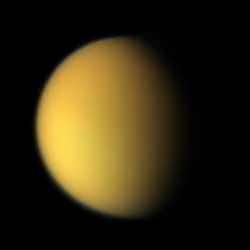
Penrose in his book, however, doesn’t shove the reader into the deep end of theories without any floatation. Twistor theory, string theory and others reside at the very end. The beginning covers the elemental mathematics. Using qualitative language and expressions such as ‘beautiful’ and ‘elegant’, he relates back to the Greeks and number theory, then on through geometry (similar triangles) and complex numbers (i) to end up with functions. Of course, functions aren’t themselves a destination, they are just a jumping off point for calculus, surfaces, manifolds and spaces. Using all the tricks of the lecturer’s trade, Penrose does an admirable job in delivering knowledge solely from the pages. Diagrams and graphs bring vision to abstract notions of infinite spaces, bundles, n-surfaces and manifolds. Layouts for thought experiments (e.g. photon travel to Titan) convey a simple view to many arguments. Problems sprinkled throughout the book, much like homework assignments, force the reader to delve deeper into certain points of view. And of course, copious references, whether to seminal articles by Newton or recent accounts by today’s researchers, litter the paragraphs and these each trace to expansive notes at the chapter’s end. Given this aid, there certainly is no cause to drown while wading through the complexity of the ideas within.

For yes, the ideas within are complex. Even though no prior knowledge is assumed, some formal training in mathematics or physics would certainly aid the reader. The relative significance and value of Riemann surfaces, conformal mappings and holomorphic functions aren’t readily apparent to the mathematic novice though each has importance. But don’t dismay, for as math is the basis, it isn’t presented for its own sake, rather for its value in contributing to our knowledge of the physics. For example, appropriate math and physics led to the relationship of energy to matter which led to the field of nuclear science. Quantum computing is progressing along the same lines. These are discussed as well as black holes, the dual wave and particle nature of photons, the esoteric nature of gravity and the entropic flow of our universe. For it is the qualities of these elements, such as their reflective or invariant attributes, that must be mirrored in the mathematical relations that model them. Though complex, for those who enjoy this subject, the presentation is invigorating, well paced and thorough.

There is, however, an admitted touch of bias in that Penrose is more contradictory than supportive when it comes to the direction taken by some of today’s researchers. He is certainly not supportive of string theory. He recites many short comings of this as well as his own favourite, twistor theory. Other theories get their comeuppance. In a philosophical section, he goes so far as to contemplate reviewing the current bases for modelling the physics or re-examining the meaning of reality. This is perhaps where the title of the book originates, but still the title seems a bit out of place. The theme of a road never appears in the book, nor is that of reality much included. This book does, however, provide a great mathematical basis for pursuing the investigation of physics. It doesn’t shirk from raising difficulties, dead ends or complete unknowns. With the citations and the progressively more current subject matter, a reader can easily dive in to learn more or maybe to select an area to make their own contribution.

A grand unifying theory is a bit of a holy grail for some mathematicians and physicists. Continual progress is trumpeted through the journals and maybe the theory is just around the next corner. To be prepared for this, or to perhaps consider making your own contribution, read The Road to Reality by Roger Penrose, a smoothly written, finely scoped book showing the contributions that math is making in this and other searches of the physics of nature.

Read more reviews or purchase a copy online from Amazon.com.

Review by Mark Mortimer.

Mystery of Martian Icecaps Explained

Hubble view of Mars, including its polar ice caps. Image credit: NASA. Click to enlarge.
NASA scientists have solved an age-old mystery by finding that Mars’ southern polar cap is offset from its geographical south pole because of two different polar climates.

Weather generated by the two martian regional climates creates conditions that cause the red planet’s southern polar ice to freeze out into a cap whose center lies about 93 miles (150 kilometers) from the actual south pole, according to a scientific paper included in the May 12 issue of the journal, Nature.

“Mars’ permanent south polar cap is offset from its geographic south pole, which was a mystery going back to the first telescopic observations of Mars,” said the paper’s lead author, Anthony Colaprete, a space scientist from NASA Ames Research Center, located in California’s Silicon Valley. “We found that the offset is a result of two martian regional climates, which are on either side of the south pole,” he said.

The scientists found that the location of two huge craters in the southern hemisphere of Mars is the root cause of the two distinct climates.

“The two craters’ unique landscapes create winds that establish a low pressure region over the permanent ice cap in the western hemisphere,” Colaprete explained.

Just as on Earth, low-pressure weather systems are associated with cold, stormy weather and snow. “On Mars, the craters anchor the low pressure system that dominates the southern polar ice cap, and keep it in one location,” Colaprete said.

According to the scientists, the low-pressure system results in white fluffy snow, which appears as a very bright region over the ice cap. In contrast, the scientists also report that ‘black ice’ forms in the eastern hemisphere, where martian skies are relatively clear and warm.

“The eastern hemisphere of the south pole region gets very little snow, and clear ice forms over the martian soil there,” Colaprete said. Black ice forms when the planet’s surface is cooling, but the atmosphere is relatively warm, according to scientists. “A similar process occurs on Earth when black ice forms over highways,” Colaprete explained.

Colaprete’s co-authors include Jeffrey Barnes, Oregon State University, Corvallis; Robert Haberle, also of NASA Ames; Jeffery Hollingsworth, San Jose State University Foundation, NASA Ames; and Hugh Kieffer and Timothy Titus, both from the U.S. Geological Survey, Flagstaff, Ariz.

Original Source: NASA News Release

Probing the Atmosphere of an Extrasolar Planet

The suitcase-sized MOST space telescope. Image credit: MOST. Click to enlarge.
MOST, Canada’s first space telescope, has turned up an important clue about the atmosphere and cloud cover of a mysterious planet around another star, by playing a cosmic game of `hide and seek’ as that planet moves behind its parent star in its orbit.

The exoplanet, with a name only an astrophysicist could love, HD209458b (orbiting the star HD209458a), cannot be seen directly in images, so the scientists on the MOST (Microvariability & Oscillations of STars) Satellite Team have been using their space telescope to look for the dip in light when the planet disappears behind the star. “We can now say that this puzzling planet is less reflective than the gas giant Jupiter in our own Solar System,” MOST Mission Scientist Dr. Jaymie Matthews announced today at the annual meeting of the Canadian Astronomical Society in Montréal. “This is telling us about the nature of this exoplanet’s atmosphere, and even whether it has clouds.”

Many of the planets discovered around other stars, known as exoplanets or extrasolar planets, hug surprisingly close to their parent stars; HD209458b orbits at only 1/20th of the Earth-Sun distance (an Astronomical Unit or AU). It could never support life as we know it. But understanding HD209458b is a key piece in the puzzle of planet formation and evolution that is revising theories of our own Solar System, and estimates of how common are habitable worlds in our Galaxy. How a giant ball of gas that is larger than the planet Jupiter (which orbits 5 AU from our Sun) got so close to its star, and how its atmosphere responds to the powerful radiation and gravitation fields of that star, are still open questions to exoplanetary scientists.

“The way this planet reflects light back to us from the star is sensitive to its atmospheric composition and temperature,” describes Jason Rowe, a Ph.D. student at the University of British Columbia who processed the MOST data. “HD209458b is reflecting back to us less than 1/10,000th of the total visible light coming directly from the star. That means it reflects less than 30-40% of the light it receives from its star, which already eliminates many possible models for the exoplanetary atmosphere.” By comparison, the planet Jupiter would reflect about 50% of the light in the wavelength range seen by MOST.

“Imagine trying to see a mosquito buzzing around a 400-Watt streetlamp. But not at the street corner, or a few blocks away, but 1000 km away!” explains Dr. Matthews. “That’s equivalent to what we’re trying to do with MOST to detect the planet in the HD209458 system.”

The planet was detected directly earlier this year in the infrared by NASA’s US$720M Spitzer Space Observatory. At a wavelength of 24 micrometres, about 50,000 times longer than the light waves seen by human eyes, the exoplanet HD209458b is actually faintly glowing, with what physicists call “thermal emission.” MOST looks at the Universe in the same wavelength range as the eye. By combining the Spitzer far-infrared thermal result with the MOST visible light reflection limit, theoreticians are now able to develop a realistic model of the atmosphere of this so-called “hot Jupiter.”

And MOST has not given up on HD209458b. “It can orbit, but it can’t hide,” quips Dr. Matthews. “MOST will put this system under a 45-day stakeout at the end of the summer to continue to improve our detection limit. Eventually, the planet will emerge from the noise and we’ll have a clearer picture of the composition of the exoplanet atmosphere and even its weather – temperature, pressure and cloud cover.”

A scientific paper on these results will be submitted soon, by Jason Rowe and Dr. Jaymie Matthews (UBC), Dr. Sara Seager (Carnegie Institute of Washington), Dr. Dimitar Sasselov (Harvard-Smithsonian Center for Astrophysics), and the rest of the MOST Science Team, with members from UBC, the University of Toronto, Université de Montréal, St. Mary’s University, and the University of Vienna.

Dr. Seager, a world leader in the field of modelling exoplanet atmospheres, emphasises the challenge of this kind of science: “We’re like weather forecasters trying to understand winds and clouds on a world we can’t even see. It’s hard enough for meteorologists to tell you whether it will be cloudy tomorrow in your hometown here on Earth. Imagine what it’s like to try to forecast weather on a planet 150 light years away!”

Dr. Sasselov is also excited by MOST’s early findings: “This capability of MOST is paving the way to the great prize – the discovery of Earth-sized planets. The search for other worlds like home is now on.” Dr. Matthews can’t resist adding, “Not bad for a space telescope with a mirror the size of a pie plate and a price tag of Can$10M, eh?”

MOST (Microvariability & Oscillations of STars) is a Canadian Space Agency mission. Dynacon Inc. of Mississauga, Ontario, is the prime contractor for the satellite and its operation, with the University of Toronto Institute for Aerospace Studies (UTIAS) as a major subcontractor. The University of British Columbia (UBC) is the main contractor for the instrument and scientific operations of the MOST mission. MOST is tracked and operated through a global network of ground stations located at UTIAS, UBC and the University of Vienna.

Original Source: CASCA News Release

Testing Strategies to Get Opportunity Unstuck

NASA engineers working with testing rover to get it unstuck. Image credit: NASA/JPL. Click to enlarge.
Mars rover engineers are using a testing laboratory to simulate specific Mars surface conditions where NASA’s rover Opportunity has spun its wheels in a small dune. Careful testing is preceding any commands for Opportunity to resume moving to get out of the dune and continue exploring.

The rover team at NASA’s Jet Propulsion Laboratory, Pasadena, Calif., has cooked up recipes combining various sandy and powdery materials for the best simulation on Earth of the dune where Opportunity dug itself in to wheel-hub depth last week. The team has not asked Opportunity to turn its wheels at all since the rover bogged down during a drive on April 26.

“We choose to proceed cautiously, so we don’t expect to begin actually driving out of the dune before next week, possibly later,” said Jim Erickson, rover project manager at JPL. “Both Opportunity and Spirit have already provided many more months of scientific exploration than anyone expected. By taking good care of them, we hope to keep them exploring for more months to come. Tests so far have sustained our optimism about Opportunity’s ability to drive out of this dune, but we have more testing ahead to understand how robust that capability is.”

Opportunity had driven about 40 meters (131 feet) of a planned 90-meter (295-foot) drive on the rover’s 446th martian day when its wheels began slipping. The rover was driving backwards at the time. The team frequently alternates between backwards and forwards driving to keep wheel lubrication well distributed. The wheels kept rotating enough times to have covered the rest of the distance if they hadn’t been slipping, but the rover eventually barely inched forward. After a turn at the end of the planned drive, Opportunity sensed that it had not turned properly and stopped moving.

Opportunity is positioned across the ridge of an elongated dune or ripple of soft sand that is about one-third meter (one foot) tall and 2.5 meters (8 feet) wide. “We’ve climbed over dozens of ripples, but this one is different in that it seems to be a little taller and to have a steeper slope, about 15 degrees on part of its face,” said Mark Maimone, a JPL rover mobility engineer.

Last week, engineers arranged a simulated dune using sand that was already at JPL’s rover testing facility and put a test rover into a comparably dug-in position. The test rover had no difficulty driving away, even when sunk in belly-deep. However, that sand offered better traction than the finer, looser material that appears to make up the surface at Opportunity’s current position. “We needed to do tests using material more like what Opportunity is in, something that has a fluffier texture and cakes onto the wheels,” said JPL rover engineer Rick Welch, who is leading the tests.

Experimenting with different mixtures, engineers and scientists came up with a recipe that includes play sand for children’s sandboxes, diatomaceous earth for swimming pool filters and mortar clay powder. Then they went to several home supply and hardware stores to find enough bags and boxes of the ingredients to make more than 2 tons of the simulated Mars sand for more realistic mobility tests, said JPL rover mobility engineer Jeff Biesiadecki.

Dr. Robert Sullivan of Cornell University, Ithaca, N.Y., a rover science team member, worked with engineers in the JPL testbed to match the properties of the test sand as closely as possible with those of the sand beneath Opportunity, based on images of wheels and wheel tracks on Mars. “We found that when the wheels dig in, the material we’re using does stick to the wheels and fills the gaps between the cleats, but it doesn’t stick when you’re just driving over it. That’s good because it’s the same as what we see in the images from Opportunity,” Sullivan said.

Experiments indicate that in this more powdery material, the test rover positioned comparably to Opportunity can drive out after some initial wheel-spinning. More testing, analysis, planning and review will precede any actual commands for Opportunity to begin driving away from the dune.

Meanwhile, Opportunity has been using its cameras to study its surroundings at the edge of a region called “Etched Terrain.” Since landing more than 15 months ago, it has driven 5.35 kilometers (3.32 miles). Spirit, halfway around Mars, has recently been using all of its research tools to examine an outcrop called “Methuselah,” the first outcrop of layered rock that Spirit has found. The rover has also been taking short movies of dust-carrying whirlwinds called “dust devils.” On some afternoons, the rover sees several at once moving across the plain. Spirit has driven a total of 4.31 kilometers (2.68 miles).

Original Source: NASA News Release

Mosaic of Titan’s Surface

Mosaic of Huygens’ Titan images showing its landing spot. Image credit: ESA. Click to enlarge.
As the large amount of data collected by the ESA Huygens probe during its descent onto Titan is being processed, new views of this fascinating world become available.

The Descent Imager Spectral Radiometer (DISR) team have now produced the first complete ?stereographic? and ?gnomonic? mosaic images. Using special image projection techniques, the team combined a series of images captured by Huygens while rotating on its axis at an altitude of about 20 kilometres.

The DISR on board Huygens took its series of photographs of the ever-approaching surface in sets of three, or ?triplets?, as it dropped through Titan?s atmosphere on 14 January this year. The images sent back to Earth partially overlap, due to the probe?s rotation during the descent and due to the overlap between the fields of view of the different cameras.

DISR scientists are studying these images for similarities, such as physical features common to more than one image, and are constructing ?mosaics?, like jigsaw puzzles.

There are many different ways of rendering three-dimensional objects into two dimensions. Different kinds of projections for maps or photographs are able to represent realistically things like size, areas, distances and perspective. One particular kind of projection used for spheres in two dimensions (for example on some maps of Earth or the celestial sphere) is ?stereographic? projection.

A ?gnomonic? projection has also been produced, and this tends to make the surface appear as if it was flat. This type of projection is often found on maps used by navigators and aviators in determining the shortest distance between two points. However there is a lot of distortion of scale at the outer edges of gnomonic projections.

On the stereographic view, like that through a ?fish-eye? lens, the bright area to the north (top of the image) and west is higher than the rest of the terrain, and covered in dark lines that appear to be drainage channels. These lead down to what appears to be a shoreline with river deltas and sand bars.

The current interpretation of these lines is that they are cut by flowing liquid methane. Some of them may have been produced by precipitation run-off, producing a dense network of narrow channels and features with sharp branching angles. Some others may have been produced by sapping or sub-surface flows, giving shape to short stubby channels that join at 90 degree angles.

The largest run off channel starts at about the 12 o?clock position from an inlet on the shoreline and stretches to the left. The largest sapping channel starts at the 9 o? clock position and goes in a straight line up and left. The dark wide corridor to the west just below the sapping channel appears to be a major flow channel that empties into the mud flats of the lakebed.

The bright shapes to the north-east and east look to be ridges of ice gravel that are slightly higher than the flats around them, and the probe landing is believed to be just south-west of the semi-circular shape. The light and dark areas to the south are still of unknown nature.

On the gnomonic projection, the landing site is approaching and the surface features become sharper. North is at the top of the image. From lower left to upper right appears to be a ridge of ice boulders projecting through the darker lakebed material.

They are thought to slow the major flow from the west and cause the fluid to pond on the north-west side of the image, causing sedimentation of the dark material. Seepage between the boulders cuts the sediment into channels as the fluid continues to the south-east.

The members of the Huygens DISR instrument team are based throughout the USA and Europe, with the largest contributing groups from the University of Arizona, USA, the Max Planck Institute, Germany, and the Paris Observatory, Meudon, France.

Original Source: ESA News Release

Titan’s Atmosphere is Looking Very Familiar

Image of Titan’s thick hazy atmosphere which is surprisingly similar to the early Earth. Image credit: NASA/JPL/SSI. Click to enlarge.
Titan’s atmospheric winds, temperature and mixing have been revealed by new observations from the Cassini spacecraft. The thick atmosphere of Saturn’s giant moon is rich in organic compounds, whose chemistry may be similar to that which occurred on Earth before the emergence of life.

“Titan is not just a dot in the sky; these new observations show that Titan is a rich, complex world much like the Earth in some ways,” said Dr. Michael Flasar of NASA’s Goddard Space Flight Center, Greenbelt, Md., Composite Infrared Spectrometer instrument (CIRS) principal investigator. Flasar is lead author of a paper on this research published May 13 in the Journal Science.

The CIRS science team found evidence for an isolated polar vortex similar to one that occurs on Earth. CIRS’ observations indicated that strong winds circulating around Titan’s north pole isolate the atmosphere there during the polar night. Mixing of the polar region with the lower latitude regions of the atmosphere is inhibited during this time. On Earth, the south polar atmosphere is isolated for months during the long Antarctic winter allowing the formation of polar stratospheric clouds. Normally inert chlorine compounds (such as chlorine nitrate) undergo chemical reactions on the cloud crystals that free molecular chlorine. In the spring, sunlight decomposes the molecular chlorine, leading to the famous annual Antarctic ?ozone hole?. Titan’s atmosphere contains no ozone; however the CIRS results show that a large part of its atmosphere is isolated during the polar night, and that could allow unusual and complex chemistry to occur.

Like Earth, Titan’s axis of rotation is tilted, so its poles also experience a long night during winter. The polar winter on Titan is many earth years long, because Saturn orbits the sun once in almost 30 years. Currently it is early winter in Titan’s northern hemisphere. The CIRS team found significant temperature differences between Titan’s north pole and the equator. The team used this observation to derive the speed of circumpolar winds around the north pole. The team believes these winds are isolating the atmosphere around Titan’s north pole because the CIRS data showed that the concentration of several heavy organic (carbon-containing) molecules is highest there.

Heavy organic molecules form naturally in Titan’s atmosphere, blanketing the moon with an orange haze. Titan?s atmosphere consists of about 98 percent nitrogen with most of the remainder being methane. When these molecules rise to the upper atmosphere, they are broken apart by sunlight and the fragments form heavier organic molecules like propane, ethane, acetylene, hydrogen cyanide, and even more complex molecules. Because the stratospheric air over the winter pole is cold, it sinks and brings down the heavy organic compounds that formed higher up. If the air over Titan’s north pole is isolated during the winter, the heavy organics should build up in the stratosphere over the season. This is just what the CIRS team is seeing.

“We don’t know if there are even more similarities to Earth’s ozone hole process, like polar clouds that react with molecules in the atmosphere, simply because we haven’t seen them yet,” said Flasar. “But we wouldn’t be surprised to discover them, nor would we be surprised to find that Titan has some unique twists of its own. This is what makes science so exciting. Nature is too rich for us to predict exactly what we will find when we go exploring.”

The research was funded by NASA and the European Space Agency. The Cassini-Huygens mission is a cooperative project of NASA, the European Space Agency and the Italian Space Agency. The Jet Propulsion Laboratory, a division of the California Institute of Technology in Pasadena, manages the Cassini-Huygens mission for NASA’s Science Mission Directorate, Washington, D.C.

Original Source: NASA News Release

Podcast: NASA Tests a Solar Sail

Imagine a solar powered sail that could propel a space craft through the vacuum of space like a wind that drives a sail here on Earth. The energy of photons steaming from the Sun alone would provide the thrust. NASA and other space agencies are taking the idea seriously and are working on various prototype technologies. Edward Montgomory is the Technology Area Manager of Solar Sail Propulsion at NASA. They just tested a 20-meter (66 foot) sail at the Glenn research center’s Plum Brook facility in Sandusky, Ohio.
Continue reading “Podcast: NASA Tests a Solar Sail”

Audio: NASA Tests a Solar Sail

A 20-metre solar sail being tested. Image credit: NASA. Click to enlarge.
Listen to the interview: NASA Tests a Solar Sail (3.7 mb)

Or subscribe to the Podcast: universetoday.com/audio.xml

Fraser Cain – Can you give me some background on solar sails in general?

Edward Montgomery ? This is a technology that our agency has been interested in for some time, but the history goes back several hundred years to Fredrick Sander at the turn of the century (19th). In more recent times, we have found that advances in a couple of particular areas have made it something that we really have to look into. The composite materials that have been coming out in the last couple of years, such as in sports equipment that is made out of ultra, lightweight rods, and film technology which in some ways is related to the materials industry and integrated circuits fields for instance and paint additives. These fields have made it possible to build structures in space that are gossamer-like and we have never really been able to do that till a couple of decades before (now) and once you can get the kind of mass down really low, then it doesn’t take a lot for force to get some acceleration and some good propulsion out of it.

How can light provide propulsion to aluminum foil in space?

That’s a very fascinating property that light has; it doesn’t really have mass, so it can’t bounce off of something, but in fact it does interact with obstructions; it does impart momentum to it and this was theorized by Einstein and it has been proven in a number of laboratory experiments.

What is the technology that you are testing at NASA right now?

We are taking one particular solar sail concept which is a square sail; it has 4 booms that come out and in between the booms are triangular sails and that system is designed to carry payloads that are relatively modest in size: the Robotic Science payload. We’re looking at several missions to the inner solar system to study the physics of the Sun and how it interacts with the Earth.

So you would be sending your solar sail in from our position; the Earth’s orbit, closer into the Sun? Sounds kind of backwards to me.

Well, the thrust that the sail can produce is proportional to the strength of the sunlight and as you go closer to the Sun, the strength of that propulsion goes up as the square of the distance as you get closer so actually, it works much more efficiently close to the Sun. The missions that have been planned to look at the outer solar system; almost all of them have involved first going to the inner solar system flying close to the Sun and getting a good boost and then going out. But the near term missions that we are looking at are missions that hover; they don’t go really fast. There is a balance point between the Earth’s gravitational pull and the Sun’s gravitational pull called the Lagrange point, and we have satellites that site there now. That doesn’t require any particular propulsion, but if you want to sit and hover at some point closer to the Sun (to get to) that particular point in space, then you have to have some propulsion capabilities and our scientists have an intense interest at wanting to be at that point. You can imagine how that might be an advantageous place to put some instruments in between the Earth and the Sun to understand how that physical property is.

Ok, so I understand; it would be as if the Sun was a fan and you had your sail and you let it drift down towards the Sun to the point that the force of the Sun’s energy coming off of it is perfectly balanced to hold the solar sail at the point. It wouldn’t go any further or go any closer.

Right. That is correct.

What kind of experiments would you be interested in doing if you could get that close and be able to station keep?

I’m a propulsion engineer, not a research scientist; they can do a much better job of explaining what exactly they’re studying, but some of the instruments that they plan to put on it measure the magnetosphere, they measure high energy particles as they go by. Of particular interest is sensing coronal mass ejections; these are the large flare events that happen on the Sun, that once they reach Earth can really disrupt our communications and they actually can harm and destroy sensitive electronic equipment. Such a flare in 1986 caused several million dollars of damage in North America alone so we want to be able to predict those events when they are happening and if we have enough warning time, we can turn our equipment off or in particular conditions, keep them from getting hurt so it is important to know when a coronal mass ejection is coming.

What could the future hold for this technology, with being able to explore the outer solar system?

Well, that’s a good point. As I just mentioned, these coronal mass ejections also can be very harmful to our astronauts so NASA is looking in the near future to going back to the Moon and Mars which there has been a lot of discussion of. We’ll need to be able to predict when these events (coronal mass ejections) happen so that our astronauts can get to safe havens from those events, so we will probably need to have these warning satellites positioned near the moon and mars and possibly around the solar system for a warning in doing that. (After that) eventually in the future there is an intense interest in wanting to understand the structure of our solar system outside the orbit of Pluto, particularly the Heliopause, now the Voyager space craft has just entered that region; there’s been some interesting results coming back in there; and there is a lot that we’d like to know about in that region of space. Just beyond that is something called the Oort Cloud which is supposedly the area of space where a lot of the comets that we see live most of their lives, but occasionally they come into the Sun. So there’s quite a bit of science to be done; observing and exploration just beyond the edges of the solar system.

Would anything be different in building a solar sail to that could travel out into the outer solar system then what you are working on right now?

It doesn’t have to be. You could take the technology that we are pursuing now to do these coronal mass ejection signals and you could send that sail on a mission. The problem is that it would take or more to get to those Oort Clouds and out into the Heliopause. If we can build a sail that is a order of magnitude or a tenth of the weight for the same amount of area; that is performs 10 times better if you will, then we can make that same mission in half the time, so to really start considering that mission, we will want to build higher performing sails to really do it and to do it within our lifetime, if you will.

What is the time frame now on forward with the prototype you are testing and your future plans?

That’s something that there is a lot of studying going on in the agency right now; particularly, there is a science advisory committee that’s meeting and determining what their science priorities are and that will set the need date for when sails need to be ready. When it can be ready?, well what we’ve been doing over the last 3 years that has culminated in these tests at Plumbrook is to do the best we can on the ground to design and operate a solar sail in a simulated space environment. The next step is to go up into space and that’s going to be an important step. We really have to have a flight of the solar sail and see how it operates in space: the loads on the structure of the sail are much, much less than they are here on the ground. Gravity puts a load on the sails 4000 times higher than what the Sun will do. So a really true environment is in space and we have to take it (the sail) up to test it out. That’s another 3-5 years to do that sort of thing, and then it will be ready to be infused into a science mission; 3-5 years nominal space mission planning and development phase. So, within the next decade, certainly, I expect to see a solar sail flying.

Did Iapetus Consume One of Saturn’s Rings?

Saturn’s moon Iapetus and its strange “rindge”. Image credit: NASA/JPL/SSI. Click to enlarge.
Is there any more mysterious and beautiful planet for the observer than Saturn? While all four gas giants in our solar system have a ring system, only Saturn’s can be seen from Earth. Backyard astronomers have long been thrilled to witness its two bright rings and the dark Cassini division, while observatory telescopes have identified many separate rings and gaps. Not until the beginning of the 1980’s when Voyager made it’s “fly-by” were we aware of more than a thousand individual rings bound by the gravity of Saturn and its many small moons. The rings themselves are nothing more than icy particles ranging in size from dust motes to boulders. Joining in this intricate dance are the satellites – from Mercury-sized atmospheric Titan to tumbling, eccentrically orbiting Hyperion. Since the late 18th century we have known of Titan, Mimas, Enceladus, Tethys, Dione, Rhea and Iapetus. Our studies have revealed that four of the moons play a key role in shaping Saturn’s ring system – Pan, Atas, Pandora and Prometheus. We know that Enceladus’ highly reflective surface is comprised of ice and that Iapetus is much brighter one one side than the other…

And may have collected a ring as it swept through orbital changes.

From the time of its discovery in 1672, we have been aware the leading hemisphere of Iapetus is fully a magnitude darker than the trailing side. Thanks to the Cassini mission’s images taken in December 2004, the presence of a large equatorial ridge has been discovered on Iapetus’ dark side.

According to a Geophysical Research Letter submitted on the 29th of April by Paulo C.C. Freire of Arecibo Observatory, “…this ridge and the dark coating of the hemisphere on which it lies are intimately interlinked and are the result of a collision with the edge of a primordial Saturnian ring, ultimately caused by a sudden change in the orbit of Iapetus”. Says Freire, “Because of its unique nature, we will henceforth refer to the equatorial ridge of Iapetus simply as ‘the Rindge’ to mean that this feature is not a ridge in the usual sense of the term; i.e., a mountain chain caused by tectonic process. This model naturally explains all of the unique features of this satellite; and is probably the solution to one of the oldest mysteries in solar system astronomy.”

One of the scientific goals of the Cassini fly-by imaging was to shed some light on Iapetus’ dark side, called Cassini Regio. To the surprise of the researchers, it revealed a great equatorial ridge unlike anything else found in the solar system – a ridge so symmetrical relative to the Cassini Regio that the two features must be linked, as acknowledged previously by Carolyn Porco – head of the Cassini Imaging Team. The majority of the clues point to how the ring system and the forming moons once orbited Saturn itself.

Current understanding of the formation of the solar system (and, in a smaller scale, the Saturnian system) indicates that many planetoids (and proto-satellites) may have once started in orbits that later became unstable. They could have collided with each other, or been ejected from their system by close encounters with others. In the case of Saturn, it is possible they could have been tidally disrupted when approaching Saturn’s gravity and formed ring systems. Closer to the planet, in an area known as the “Roche Zone”, the tidal pull of Saturn prevents proto-satellite formation from ring particles. In order for the ring collision theory to match what Cassini has imaged, Iapetus had to have been one of these moons with unstable orbits.

Evidence points to the fact that something changed Iapetus’ orbit before colliding with ring material. Had this not happened, the ring would have adjusted to Iapetus’ gravity as evidenced by satellites currently imbedded within the rings. In the case of these satellites – no collision scenario can occur. In Iapetus’ circumstance, its orbit was necessarily eccentric, or no velocity differences would exist between Iapetus and the ring particles and again – no collisions would occur.

An impact with a ring also suggests this changed orbit had a perisaturnium at the outer edge of the Roche Zone, where rings can exist for longer periods of time. This is a clue that Iapetus was quite probably much closer to Saturn than its present orbit. “The existence of the rindge suggests the orbit of Iapetus at the time of the collision was equatorial” says Freire, “otherwise, with its present inclination a collision with a ring would not produce a sharp edge, but something more like a wispy dark coating of the leading hemisphere.” In conclusion, a satellite with an equatorial and eccentric orbit has a very large probability of interacting further with other satellites – providing the means to change yet again to a different orbit.

Now that we have set the stage, how do the images taken of this unique rindge support the theory? According to Freire, “The ring collisions scenario naturally produces a linear feature exactly at the equator: this is the geometric intersection of a ring plane and the surface of a moon with a (previously) equatorial orbit.” Very careful consideration has been given to tectonics, but such a perfectly linear formation – located exactly at the equator – is unlikely to result from tectonic processes and Iapetus shows no signs of volcanic activity.

“Another key feature of the rindge is that its height varies extremely slowly with longitude,” says Freire, “This can be expected from deposition of material from a ring, but such a constant height has never been observed for any tectonic feature. If the origin of the rindge was tectonic and preceded the dark coating, then it should not necessarily be confined to Cassini Regio. If it postdated the coating, then the rindge being built from an upwelling from the interior of Iapetus should be much brighter than the surrounding surface.”

Considerable analysis has been given to the information that Cassini imaging has provided. The longitudinal length of the ridge is less than 180 degrees, which suggests that Iapetus was never fully inside the ring region – indicating that it just collided with a ring edge. Celestial mechanics considerations indicate that a collision with a ring edge should have caused an eastward motion of the particle’s impacts relative to the surface of the satellite. “This accounts for an important observed fact: although Cassini Regio is symmetrical relative to the rindge in the north/south direction, it is not so in the east/west direction.” This collision model suggests that the rindge would be taller on the western side where the impacts were closer to vertical and then would slowly digress moving eastward – a fact supported by the images. With millions of impact craters being formed every second along a line, this pattern would become unmistakable. The sublimation of the ices contained in the impacting particles would produce a transient atmosphere, with a strong pressure gradient away from the rindge. This gradient would produce fast winds capable of carrying fine dust. Says Freire, “In our hypothesis, the dust deposited by such winds is the dark coating of the region known today as Cassini Regio.” Such a scenario is supported by other evidence: “The dark streaks observed at the edge of Cassini Regio indicate that it was a wind blowing from the equator that deposited the ‘dust’. We can be certain of this because Cassini imagery shows clearly that the dust is deposited downward from the crater rims.” This can’t be accounted for by ballistic flight of the particles from the equator, as suggested by the leader of the Cassini Imaging Team, Carolyn Porco. It can’t be produced in present-day Iapetus, since it has no atmosphere. The conclusion that a transient atmosphere once existed becomes inescapable.

Could these exciting findings truly be from an earlier impact with one of Saturn’s rings? The clues certainly seem to make the pieces of the puzzle fit together neatly. Thanks to work done by researchers like Paulo Freire, we may have solved a 333 year-old solar system mystery.

Written by Tammy Plotner, with many thanks to Paulo Freire for his contributions.

Dione and Tethys

Saturn’s moons Dione and Tethys poised above Saturn’s rings. Image credit: NASA/JPL/SSI. Click to enlarge.
Saturn’s moon Dione occults part of Saturn’s distant rings while Tethys hovers below. Dione is 1,118 kilometers (695 miles) across, while Tethys is 1,071 kilometers, 665 miles) across.

This image offers excellent contrast with a previously released view (see Sister Moons) that showed the bright, wispy markings on Dione’s trailing hemisphere. The huge impact structure Odysseus (450 kilometers, or 280 miles across) is near the limb of Tethys. Compared with the battered surface of Tethys, Dione appears much smoother from this distance.

The image was taken in visible light with the Cassini spacecraft narrow-angle camera on March 19, 2005, at a distance of approximately 2.7 million kilometers (1.7 million miles) from Saturn. The image scale is approximately 15 kilometers (9 miles) per pixel.

The Cassini-Huygens mission is a cooperative project of NASA, the European Space Agency and the Italian Space Agency. The Jet Propulsion Laboratory, a division of the California Institute of Technology in Pasadena, manages the mission for NASA’s Science Mission Directorate, Washington, D.C. The Cassini orbiter and its two onboard cameras were designed, developed and assembled at JPL. The imaging team is based at the Space Science Institute, Boulder, Colo.

For more information about the Cassini-Huygens mission visit http://saturn.jpl.nasa.gov . For additional images visit the Cassini imaging team homepage http://ciclops.org .

Original Source: NASA/JPL/SSI News Release