Image credit: NASA
Things seem to start simple then get more complex. Life is like that. And perhaps nowhere is this notion truer than when we investigate the origins of life. Did the earliest single cell life-forms coalesce from organic molecules here on Earth? Or is it possible that – like dandelions wafting spore above spring grass – cosmic winds carry living things from world to world later to take root and flourish? And if this is the case, how precisely does such a “dia-spora” occur?
450 years before the common era, Greek philosopher Anaxagoras of Ionia proposed that all living things sprung from certain ubiquitous “seeds of life”. Today’s notion of such “seeds” is far more sophisticated than anything Anaxagoras could possibly envision – limited as he was to simple observations of living things such as budding plant & flowering tree, crawling & buzzing insect, loping animal or walking human; not too mention natural phenomena like sound, wind, rainbows, earthquakes, eclipses, Sun, and Moon. Surprisingly modern in thought, Anaxagoras could only guess as to the details…
Some 2300 hundreds years later – during the 1830s – Swedish chemist J?ns Jackob Berzelius confirmed that carbon compounds were found in certain meteorites “fallen from the heavens”. Berzelius himself however, held that these carbonates were contaminates originating with the Earth itself – but his finding contributed to theories propounded by later thinkers including the physician H.E. Richter and physicist Lord Kelvin.
Panspermia received its first real treatment by Hermann von Helmholtz in 1879, but it was another Swedish chemist – 1903 Nobel Prize winning Svante Arrhenius – who popularized the concept of life originating from space in 1908. Perhaps surprisingly, that theory was based on the notion that radiation pressure from the Sun – and other stars – “blew” microbes about like tiny solar sails – and not as the result of finding carbon compounds in stony meteorite.
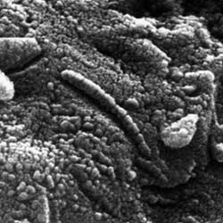
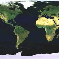
The theory that simple forms of life travel in ejecta from other worlds ? embedded in rock blasted from planetary surfaces by the impact of large objects – is the basis for “lithopanspermia”. There are numerous advantages to this hypothesis – simple, hardy forms of life are often found in mineral deposits on Earth in forbidding locales. Worlds – such as our own or Mars – are occasionally blasted by asteroids and comets large enough to hurl rock at speeds exceeding escape velocities. Mineral in rocks can shield microbes from shock and radiation (associated with impact craters) as well as hard radiation from the Sun as stony meteors move through space. The hardiest forms of life also have the ability to survive in a cold vacuum by going into stasis – reducing chemical interactions to zero while maintaining biological structure well enough to later thaw and multiply in more salubrious environs.
In fact several examples of such ejecta are now available on earth for scientific analysis. Stony meteors can include some very sophisticated forms of organic materials (carbonaceous chondrites have been found that include amino and carboxylic acids). Fossilized remnants from Mars in particular – though subject to various non-organic interpretations – are in the possession of institutions such as NASA. The theory and practice of “lithopanspermia” looks very promising – although such a theory can only explain where the simplest forms of life come from – and not how it originated to begin with.
In a paper entitled “Lithopanspermia in Star Forming Clusters” published April 29, 2005, cosmologists Fred C. Adams of the University of Michigan Center for Theoretical Physics and David Spergel of the Department of Astrophysical Sciences of Princeton University discuss the probability of carbonaceous chondrite distribution of microbial life within early star clusters. According to the duo, “the chances of biological material spreading from one system to another is greatly enhanced … due to the close proximity of the systems and low relative velocities.”
According to the authors, previous studies have looked into the likelihood that life-bearing rocks (typically exceeding 10 kgs in weight) play a role in the spread of life within isolated planetary systems and found “the odds of both meteroid and biological transfer are exceedingly low.” However “odds of transfer increase in more crowded environments” and “Since the time scale for planet formation and the time that young stars are expected to live in birth clusters are roughly comparable, about 10 – 30 million years, debris from planet formation has a good chance of being transferred from one solar system to another.”
Ultimately Fred and David conclude “young star clusters provide an efficient means of transferring rocky material from solar system to solar system. If any system in the birth aggregate supports life, then many other systems in the cluster can capture life bearing rocks.”
To arrive at this conclusion, the duo performed “a series of numerical calculations to estimate the distribution of ejection speeds for rocks” based on size and mass. They also considered the dynamics of early star forming groups and clusters. This was essential to help determine rock recapture rates by planets in neighboring systems. Finally they had to make certain assumptions about the frequency of life-encapsulated materials and the survivability of life-forms embedded within them. All this led up to a sense of “the expected number of successful lithopanspermia events per cluster.”
Based on methods used to arrive at this conclusion and thinking only in terms of present distances between solar systems, the duo estimated the probability that Earth has exported life to other systems. Over the age of life on Earth (some 4.0 Byr) Fred and David estimate that the Earth has ejected some 40 billion life-bearing stones. Of the estimated 10 bio-stones per annum, nearly 1 (0.9) will land on a planet suitable for further growth and proliferation.
Most cosmologists tend to address the “hard-science questions” of the origin of the Universe as a whole. Fred says that “exobiology is intrinsically interesting” to him and that he and “David were summer students together in New York in 1981” where they worked on “issues related to planetary atmospheres and climate, issues that are close to questions of exobiology.” Fred also says that he “spends a healthy fraction of research time on problems associated with star and planet formation.” Fred acknowledges David’s special role in thinking “up the idea of looking at panspermia in clusters; when we talked about it, it became clear that we had all the pieces of the puzzle. We just had to put them together.”
This interdisciplinary approach to cosmology and exobiology also led Fred and David to look at the question of lithopanspermia between clusters themselves. Again using methods developed to explore the proliferation of life within clusters, and later applied to the exportation of life from the Earth itself to other non-solar system planets, Fred and David were able to conclude that “a young cluster is more likely to capture life from outside than to give rise to life spontaneously.” And “Once seeded, the cluster provides an effective amplification mechanism to infect other members” within that cluster itself.
Ultimately however, Fred and David can not answer the question of where and under what conditions the first seeds of life took form. In fact, they are willing to admit that “if the spontaneous origin of life were sufficiently common, there would be no need for any panspermia mechanism to explain the presence of life.”
But according to Fred and David, once life gets a foothold somewhere, it manages to get around quite handily.
Written by Jeff Barbour
