Did Volcanoes Cause the Great Dying?

For the last three years evidence has been building that the impact of a comet or asteroid triggered the biggest mass extinction in Earth history, but new research from a team headed by a University of Washington scientist disputes that notion.

In a paper published Jan. 20 by Science Express, the online version of the journal Science, the researchers say they have found no evidence for an impact at the time of “the Great Dying” 250 million years ago. Instead, their research indicates the culprit might have been atmospheric warming because of greenhouse gases triggered by erupting volcanoes.

The extinction occurred at the boundary between the Permian and Triassic periods at a time when all land was concentrated in a supercontinent called Pangea. The Great Dying is considered the biggest catastrophe in the history of life on Earth, with 90 percent of all marine life and nearly three-quarters of land-based plant and animal life going extinct.

“The marine extinction and the land extinction appear to be simultaneous, based on the geochemical evidence we found,” said UW paleontologist Peter Ward, lead author of the paper. “Animals and plants both on land and in the sea were dying at the same time, and apparently from the same causes — too much heat and too little oxygen.”

The paper is to be published in the print edition of Science in a few weeks. Co-authors are Roger Buick and Geoffrey Garrison of the UW; Jennifer Botha and Roger Smith of the South African Museum; Joseph Kirschvink of the California Institute of Technology; Michael De Kock of Rand Afrikaans University in South Africa; and Douglas Erwin of the Smithsonian Institution.

The Karoo Basin of South Africa has provided the most intensively studied record of Permian-Triassic vertebrate fossils. In their work, the researchers were able to use chemical, biological and magnetic evidence to correlate sedimentary layers in the Karoo to similar layers in China that previous research has tied to the marine extinction at the end of the Permian period.

Evidence from the marine extinction is “eerily similar” to what the researchers found in the Karoo Basin, Ward said. Over seven years, they collected 126 reptile or amphibian skulls from a nearly 1,000-foot thick section of exposed Karoo sediment deposits from the time of the extinction. They found two patterns, one showing gradual extinction over about 10 million years leading up to the boundary between the Permian and Triassic periods, and the other for a sharp increase in extinction rate at the boundary that then lasted another 5 million years.

The scientists said they found nothing in the Karoo that would indicate a body such as an asteroid hit around the time of the extinction, though they looked specifically for impact clays or material ejected from a crater left by such an impact.

They contend that if there was a comet or asteroid impact, it was a minor element of the Permian extinction. Evidence from the Karoo, they said, is consistent with a mass extinction resulting from catastrophic ecosystem changes over a long time scale, not sudden changes associated with an impact.

The work, funded by the National Aeronautics and Space Administration’s Astrobiology Institute, the National Science Foundation and the National Research Foundation of South Africa, provides a glimpse of what can happen with long-term climate warming, Ward said.

In this case, there is ample evidence that the world got much warmer over a long period because of continuous volcanic eruptions in an area known as the Siberian Traps. As volcanism warmed the planet, large stores of methane gas frozen on the ocean floor might have been released to trigger runaway greenhouse warming, Ward said. But evidence suggests that species began dying out gradually as the planet warmed until conditions reached a critical threshold beyond which most species could not survive.

“It appears that atmospheric oxygen levels were dropping at this point also,” he said. “If that’s true, then high and intermediate elevations would have become uninhabitable. More than half the world would have been unlivable, life could only exist at the lowest elevations.”

He noted that the normal atmospheric oxygen level is around 21 percent, but evidence indicates that at the time of the Great Dying it dropped to about 16 percent — the equivalent of trying to breathe at the top of a 14,000-foot mountain.

“I think temperatures rose to a critical point. It got hotter and hotter until it reached a critical point and everything died,” Ward said. “It was a double-whammy of warmer temperatures and low oxygen, and most life couldn’t deal with it.”

Original Source: UW News Release

Egg-Shaped Regulus is Spinning Fast

For decades, scientists have observed that Regulus, the brightest star in the constellation Leo, spins much faster than the sun. But thanks to a powerful new telescopic array, astronomers now know with unprecedented clarity what that means to this massive celestial body.

A group of astronomers, led by Hal McAlister, director of Georgia State University’s Center for High Angular Resolution Astronomy, have used the center’s array of telescopes to detect for the first time Regulus’ rotationally induced distortions. Scientists have measured the size and shape of the star, the temperature difference between its polar and equatorial regions, and the orientation of its spin axis. The researchers’ observations of Regulus represent the first scientific output from the CHARA array, which became routinely operational in early 2004.

Most stars rotate sedately about their spin axes, McAlister says. The sun, for example, completes a full rotation in about 24 days, which means its equatorial spin speed is roughly 4,500 miles per hour. Regulus’ equatorial spin speed is nearly 700,000 miles per hour and its diameter is about five times greater than the sun’s. Regulus also bulges conspicuously at its equator, a stellar rarity.

Regulus’ centrifugal force causes it to expand so that its equatorial diameter is one-third larger than its polar diameter. In fact, if Regulus were rotating about 10 percent faster, its outward centrifugal force would exceed the inward pull of gravity and the star would fly apart, says McAlister, CHARA’s director and Regents Professor of Astronomy at Georgia State.

Because of its distorted shape, Regulus, a single star, exhibits what is known as “gravity darkening” ? the star becomes brighter at its poles than at its equator — a phenomenon previously only detected in binary stars. According to McAlister, the darkening occurs because Regulus is colder at its equator than at its poles. Regulus’ equatorial bulge diminishes the pull of gravity at the equator, which causes the temperature there to decrease. CHARA researchers have found that the temperature at Regulus’ poles is 15,100 degrees Celsius, while the equator’s temperature is only 10,000 Celsius. The temperature variation causes the star to be about five times brighter at its poles than at its equator. Regulus’ surface is so hot that the star is actually nearly 350 times more luminous than the sun.

CHARA researchers discovered another oddity when they determined the orientation of the star’s spin axis, says McAlister.

“We’re looking at the star essentially equator-on, and the spin axis is tilted about 86 degrees from the north direction in the sky,” he says. “But, curiously enough, the star is moving through space in the same direction its pole is pointing. Regulus is moving like an enormous spinning bullet through space. We have no idea why this is the case.”

Astronomers viewed Regulus using CHARA’s telescopes for six weeks last spring to obtain interferometric data that, combined with spectroscopic measurements and theoretical models, created a picture of the star that reveals the effects of its incredibly fast spin. The results will be published this spring in The Astrophysical Journal.

The CHARA array, located atop Mt. Wilson in southern California, is among a handful of new “super” instruments composed of multiple telescopes optically linked to function as a single telescope of enormous size. The array consists of six telescopes, each containing a light-collecting mirror one meter in diameter. The telescopes are arranged in the shape of a “Y,” with the outermost telescopes located about 200 meters from the center of the array.

A precise combination of the light from the individual telescopes allows the CHARA array to behave as if it were a single telescope with a mirror 330 meters across. The array can’t show very faint objects detected by telescopes such as the giant 10-meter Keck telescopes in Hawaii, but scientists can see details in brighter objects nearly 100 times sharper than those obtainable using the Keck array. Working at infrared wavelengths, the CHARA array can see details as small as 0.0005 arcseconds. (One arcsecond is 1/3,600 of a degree, equivalent to the angular size of a dime seen from a distance of 2.3 miles.) In addition to Georgia State researchers, the CHARA team includes collaborators from the National Optical Astronomy Observatories in Tucson, Ariz., and NASA’s Michelson Science Center at the California Institute of Technology in Pasadena.

The CHARA array was constructed with funding from the National Science Foundation, Georgia State, the W. M. Keck Foundation, and the David and Lucile Packard Foundation. The NSF also has awarded funds for ongoing research at the CHARA array.

Original Source: Georgia State University

Swift Sees the Birth of a Black Hole

The NASA-led Swift mission has detected and imaged its first gamma-ray burst, likely the birth cry of a brand new black hole.

The bright and long burst occurred on January 17. It was in the midst of exploding, as Swift autonomously turned to focus in less than 200 seconds. The satellite was fast enough to capture an image of the event with its X-Ray Telescope (XRT), while gamma rays were still being detected with the Burst Alert Telescope (BAT).

“This is the first time an X-ray telescope has imaged a gamma-ray burst, while it was bursting,” said Dr. Neil Gehrels, Swift’s Principal Investigator at NASA’s Goddard Space Flight Center, Greenbelt, Md. “Most bursts are gone in about 10 seconds, and few last upwards of a minute. Previous X-ray images have captured the burst afterglow, not the burst itself.”

“This is the one that didn’t get away,” said Prof. John Nousek, Swift’s Mission Operations Director at Penn State University, State College, Pa. “And this is what Swift was built to do: to detect these fleeting gamma-ray bursts and focus its telescopes on them autonomously within about a minute. The most exciting thing is this mission is just revving up.”

Swift has three main instruments. The BAT detects bursts and initiates the autonomous slewing to bring the XRT and the Ultraviolet/Optical Telescope (UVOT) within focus of the burst. In December the BAT started detecting bursts, including a remarkable triple detection on December 19. Today’s announcement marks the first BAT detection autonomously followed by XRT detection, demonstrating the satellite is swiftly slewing as planned. The UVOT is still being tested, and it was not collecting data when the burst was detected.

Scientists will need several weeks to fully understand this burst, GRB050117, so named for the date of detection. Telescopes in orbit and on Earth will turn to the precise burst location provided by Swift to observe the burst afterglow and the region surrounding the burst.

“We are frantically analyzing the XRT data to understand the X-ray emission seen during the initial explosion and the very early afterglow,” said Dr. David Burrows, the XRT lead at Penn State. “This is a whole new ballgame. No one has ever imaged X-rays during the transition of a gamma-ray burst from the brilliant flash to the fading embers.”

When the UVOT is fully operational, both the XRT and UVOT will provide an in-depth observation of the gamma-ray burst and its afterglow. The burst is gone in a flash, but scientists can study the afterglow to learn about what caused the burst, much like a detective hunts for clues at a crime scene.

The origin of gamma-ray bursts remains a mystery. At least some appear to originate in massive star explosions. Others might be the result of merging black holes or neutron stars. Any of these scenarios likely will result in the formation of a new black hole.

Several of these bursts occur daily somewhere in the visible universe. No prompt X-ray emission (coincident with the gamma-ray burst) has been previously imaged, because it usually takes hours to turn an X-ray telescope towards a burst. Scientists expect Swift to be fully operational by February 1.

Swift, still in its checkout phase, is an international collaboration launched on November 20, 2004. It is a NASA mission in partnership with the Italian Space Agency and the Particle Physics and Astronomy Research Council, United Kingdom.

The spacecraft was built in collaboration with national laboratories, universities and international partners, including Penn State University; Los Alamos National Laboratory, New Mexico; Sonoma State University, Rohnert Park, Calif.; Mullard Space Science Laboratory in Dorking, Surrey, England; the University of Leicester, England; Brera Observatory in Milan; and ASI Science Data Center in Frascati, Italy.

For more information about Swift on the Web, visit:

http://www.nasa.gov/swift

Original Source: NASA News Release

Titan is a World Both Familiar and Alien

On 14 January ESA’s Huygens probe made an historic first ever descent to the surface of Titan, 1.2 billion kilometres from Earth and the largest of Saturn’s moons. Huygens travelled to Titan as part of the joint ESA/NASA/ASI Cassini-Huygens mission. Starting at about 150 kilometres altitude, six multi-function instruments on board Huygens recorded data during the descent and on the surface. The first scientific assessments of Huygens’ data were presented during a press conference at ESA head office in Paris on 21 January.

“We now have the key to understanding what shapes Titan’s landscape,” said Dr Martin Tomasko, Principal Investigator for the Descent Imager-Spectral Radiometer (DISR), adding: “Geological evidence for precipitation, erosion, mechanical abrasion and other fluvial activity says that the physical processes shaping Titan are much the same as those shaping Earth.”

Spectacular images captured by the DISR reveal that Titan has extraordinarily Earth-like meteorology and geology. Images have shown a complex network of narrow drainage channels running from brighter highlands to lower, flatter, dark regions. These channels merge into river systems running into lakebeds featuring offshore ‘islands’ and ‘shoals’ remarkably similar to those on Earth.

Data provided in part by the Gas Chromatograph and Mass Spectrometer (GCMS) and Surface Science Package (SSP) support Dr Tomasko’s conclusions. Huygens’ data provide strong evidence for liquids flowing on Titan. However, the fluid involved is methane, a simple organic compound that can exist as a liquid or gas at Titan’s sub-170?C temperatures, rather than water as on Earth.

Titan’s rivers and lakes appear dry at the moment, but rain may have occurred not long ago.

Deceleration and penetration data provided by the SSP indicate that the material beneath the surface’s crust has the consistency of loose sand, possibly the result of methane rain falling on the surface over eons, or the wicking of liquids from below towards the surface.

Heat generated by Huygens warmed the soil beneath the probe and both the GCMS and SSP detected bursts of methane gas boiled out of surface material, reinforcing methane’s principal role in Titan’s geology and atmospheric meteorology — forming clouds and precipitation that erodes and abrades the surface.

In addition, DISR surface images show small rounded pebbles in a dry riverbed. Spectra measurements (colour) are consistent with a composition of dirty water ice rather than silicate rocks. However, these are rock-like solid at Titan’s temperatures.

Titan’s soil appears to consist at least in part of precipitated deposits of the organic haze that shrouds the planet. This dark material settles out of the atmosphere. When washed off high elevations by methane rain, it concentrates at the bottom of the drainage channels and riverbeds contributing to the dark areas seen in DISR images.

New, stunning evidence based on finding atmospheric argon 40 indicates that Titan has experienced volcanic activity generating not lava, as on Earth, but water ice and ammonia.

Thus, while many of Earth’s familiar geophysical processes occur on Titan, the chemistry involved is quite different. Instead of liquid water, Titan has liquid methane. Instead of silicate rocks, Titan has frozen water ice. Instead of dirt, Titan has hydrocarbon particles settling out of the atmosphere, and instead of lava, Titanian volcanoes spew very cold ice.

Titan is an extraordinary world having Earth-like geophysical processes operating on exotic materials in very alien conditions.

“We are really extremely excited about these results. The scientists have worked tirelessly for the whole week because the data they have received from Huygens are so thrilling. This is only the beginning, these data will live for many years to come and they will keep the scientists very very busy”, said Jean-Pierre Lebreton, ESA’s Huygens Project Scientist and Mission manager.

The Cassini-Huygens mission is a cooperation between NASA, ESA and ASI, the Italian space agency. The Jet Propulsion Laboratory (JPL), a division of the California Institute of Technology in Pasadena, is managing the mission for NASA’s Office of Space Science, Washington DC. JPL designed, developed and assembled the Cassini orbiter while ESA operated the Huygens atmospheric probe.

Original Source: ESA News Release

Opportunity Finds an Iron Meteorite

NASA’s Mars Exploration Rover Opportunity has found an iron meteorite, the first meteorite of any type ever identified on another planet.

The pitted, basketball-size object is mostly made of iron and nickel according to readings from spectrometers on the rover. Only a small fraction of the meteorites fallen on Earth are similarly metal-rich. Others are rockier. As an example, the meteorite that blasted the famous Meteor Crater in Arizona is similar in composition.

“This is a huge surprise, though maybe it shouldn’t have been,” said Dr. Steve Squyres of Cornell University, Ithaca, N.Y., principal investigator for the science instruments on Opportunity and its twin, Spirit.

The meteorite, dubbed “Heat Shield Rock,” sits near debris of Opportunity’s heat shield on the surface of Meridiani Planum, a cratered flatland that has been Opportunity’s home since the robot landed on Mars nearly one year ago.

“I never thought we would get to use our instruments on a rock from someplace other than Mars,” Squyres said. “Think about where an iron meteorite comes from: a destroyed planet or planetesimal that was big enough to differentiate into a metallic core and a rocky mantle.”

Rover-team scientists are wondering whether some rocks that Opportunity has seen atop the ground surface are rocky meteorites. “Mars should be hit by a lot more rocky meteorites than iron meteorites,” Squyres said. “We’ve been seeing lots of cobbles out on the plains, and this raises the possibility that some of them may in fact be meteorites. We may be investigating some of those in coming weeks. The key is not what we’ll learn about meteorites — we have lots of meteorites on Earth — but what the meteorites can tell us about Meridiani Planum.”

The numbers of exposed meteorites could be an indication of whether the plain is gradually eroding away or being built up.

NASA Chief Scientist Dr. Jim Garvin said, “Exploring meteorites is a vital part of NASA’s scientific agenda, and discovering whether there are storehouses of them on Mars opens new research possibilities, including further incentives for robotic and then human-based sample-return missions. Mars continues to provide unexpected science ‘gold,’ and our rovers have proven the value of mobile exploration with this latest finding.”

Initial observation of Heat Shield Rock from a distance with Opportunity’s miniature thermal emission spectrometer suggested a metallic composition and raised speculation last week that it was a meteorite. The rover drove close enough to use its Moessbauer and alpha particle X-ray spectrometers, confirming the meteorite identification over the weekend.

Opportunity and Spirit successfully completed their primary three-month missions on Mars in April 2004. NASA has extended their missions twice because the rovers have remained in good condition to continue exploring Mars longer than anticipated. They have found geological evidence of past wet environmental conditions that might have been hospitable to life.

Opportunity has driven a total of 2.10 kilometers (1.30 miles). Minor mottling from dust has appeared in images from the rover’s rear hazard-identification camera since Opportunity entered the area of its heat-shield debris, said Jim Erickson of NASA’s Jet Propulsion Laboratory, Pasadena, Calif., rover project manager. The rover team plans to begin driving Opportunity south toward a circular feature called “Vostok” within about a week.

Spirit has driven a total of 4.05 kilometers (2.52 miles). It has been making slow progress uphill toward a ridge on “Husband Hill” inside Gusev Crater.

JPL, a division of the California Institute of Technology in Pasadena, has managed NASA’s Mars Exploration Rover project since it began in 2000. Images and additional information about the rovers and their discoveries are available on the Internet at http://www.nasa.gov/vision/universe/solarsystem/mer_main.html and at http://marsrovers.jpl.nasa.gov.

Original Source: NASA/JPL News Release

Brown Dwarfs are Heavier Than Previously Thought

Thanks to the powerful new high-contrast camera installed at the Very Large Telescope, photos have been obtained of a low-mass companion very close to a star. This has allowed astronomers to measure directly the mass of a young, very low mass object for the first time.

The object, more than 100 times fainter than its host star, is still 93 times as massive as Jupiter. And it appears to be almost twice as heavy as theory predicts it to be.

This discovery therefore suggests that, due to errors in the models, astronomers may have overestimated the number of young “brown dwarfs” and “free floating” extrasolar planets.

A winning combination
A star can be characterised by many parameters. But one is of uttermost importance: its mass. It is the mass of a star that will decide its fate. It is thus no surprise that astronomers are keen to obtain a precise measure of this parameter.

This is however not an easy task, especially for the least massive ones, those at the border between stars and brown dwarf objects. Brown dwarfs, or “failed stars”, are objects which are up to 75 times more massive than Jupiter, too small for major nuclear fusion processes to have ignited in its interior.

To determine the mass of a star, astronomers generally look at the motion of stars in a binary system. And then apply the same method that allows determining the mass of the Earth, knowing the distance of the Moon and the time it takes for its satellite to complete one full orbit (the so-called “Kepler’s Third Law”). In the same way, they have also measured the mass of the Sun by knowing the Earth-Sun distance and the time – one year – it takes our planet to make a tour around the Sun.

The problem with low-mass objects is that they are very faint and will often be hidden in the glare of the brighter star they orbit, also when viewed in large telescopes.

Astronomers have however found ways to overcome this difficulty. For this, they rely on a combination of a well-considered observational strategy with state-of-the-art instruments.

High contrast camera
First, astronomers searching for very low mass objects look at young nearby stars because low-mass companion objects will be brightest while they are young, before they contract and cool off.

In this particular case, an international team of astronomers [1] led by Laird Close (Steward Observatory, University of Arizona), studied the star AB Doradus A (AB Dor A). This star is located about 48 light-years away and is “only” 50 million years old. Because the position in the sky of AB Dor A “wobbles”, due to the gravitational pull of a star-like object, it was believed since the early 1990s that AB Dor A must have a low-mass companion.

To photograph this companion and obtain a comprehensive set of data about it, Close and his colleagues used a novel instrument on the European Southern Observatory’s Very Large Telescope. This new high-contrast adaptive optics camera, the NACO Simultaneous Differential Imager, or NACO SDI [2], was specifically developed by Laird Close and Rainer Lenzen (Max-Planck-Institute for Astronomy in Heidelberg, Germany) for hunting extrasolar planets. The SDI camera enhances the ability of the VLT and its adaptive optics system to detect faint companions that would normally be lost in the glare of the primary star.

A world premiere
Turning this camera towards AB Dor A in February 2004, they were able for the first time to image a companion so faint – 120 times fainter than its star – and so near its star.

Says Markus Hartung (ESO), member of the team: “This world premiere was only possible because of the unique capabilities of the NACO SDI instrument on the VLT. In fact, the Hubble Space Telescope tried but failed to detect the companion, as it was too faint and too close to the glare of the primary star.”

The tiny distance between the star and the faint companion (0.156 arcsec) is the same as the width of a one Euro coin (2.3 cm) when seen 20 km away. The companion, called AB Dor C, was seen at a distance of 2.3 times the mean distance between the Earth and the Sun. It completes a cycle around its host star in 11.75 years on a rather eccentric orbit.

Using the companion’s exact location, along with the star’s known ‘wobble’, the astronomers could then accurately determine the companion’s mass. The object, more than 100 times fainter than its close primary star, has one tenth of the mass of its host star, i.e., it is 93 times more massive than Jupiter. It is thus slightly above the brown dwarf limit.

Using NACO on the VLT, the astronomers further observed AB Dor C at near infrared wavelengths to measure its temperature and luminosity.

“We were surprised to find that the companion was 400 degrees (Celsius) cooler and 2.5 times fainter than the most recent models predict for an object of this mass,” Close said.

“Theory predicts that this low-mass, cool object would be about 50 Jupiter masses. But theory is incorrect: this object is indeed between 88 to 98 Jupiter masses.”

These new findings therefore challenge current ideas about the brown dwarf population and the possible existence of widely publicized “free-floating” extrasolar planets.

Indeed, if young objects hitherto identified as brown dwarfs are twice as massive as was thought, many must rather be low-mass stars. And objects recently identified as “free-floating” planets are in turn likely to be low-mass brown dwarfs.

For Close and his colleagues, “this discovery will force astronomers to rethink what masses of the smallest objects produced in nature really are.”

More information
The work presented here appears as a Letter in the January 20 issue of Nature (“A dynamical calibration of the mass-luminosity relation at very low stellar masses and young ages” by L. Close et al.).

Notes
[1]: The team is composed of Laird M. Close, Eric Nielsen, Eric E. Mamajek and Beth Biller (Steward Observatory, University of Arizona, Tucson, USA), Rainer Lenzen and Wolfgang Brandner (Max-Planck Institut for Astronomie, Heidelberg, Germany), Jose C. Guirado (University of Valencia, Spain), and Markus Hartung and Chris Lidman (ESO-Chile).

[2]: The NACO SDI camera is a unique type of camera using adaptive optics, which removes the blurring effects of Earth’s atmosphere to produce extremely sharp images. SDI splits light from a single star into four identical images, then passes the resulting beams through four slightly different (methane-sensitive) filters. When the filtered light beams hit the camera’s detector array, astronomers can subtract the images so the bright star disappears, revealing a fainter, cooler object otherwise hidden in the star’s scattered light halo (“glare”). Unique images of Saturn’s satellite Titan obtained earlier with NACO SDI were published in ESO PR 09/04.

Original Source: ESO News Release

Perspective View of Claritas Fossae

This image, taken by the High Resolution Stereo Camera (HRSC) on board ESA?s Mars Express spacecraft, shows Claritas Fossae, a series of linear fractures located in the Tharsis region of Mars.

The HRSC obtained this image during orbit 563, with a resolution of approximately 62 metres per pixel. The image shows a region centred around latitude 25? South and longitude 253? East.

Claritas Fossae is located on the Tharsis rise, south of the three large volcanoes known as the Tharsis Montes, and extends roughly north to south for approximately 1800 kilometres. The linear fractures of Claritas Fossae have widths ranging from a few kilometres to 100 kilometres, and the region is about 150 kilometres wide in the north and 550 kilometres wide in the south.

These fractures are radial to the Tharsis rise, consistent with the idea that they are the result of enormous stresses associated with formation of the 8-10 kilometre high Tharsis rise. Faults running east to west are also visible in the colour image and may have a similar origin.

In the east of the colour image, a prominent linear feature with a dark shadow is visible. This is most likely a normal fault, the eastern edge of a 100 kilometre wide ?graben?. A graben is a block of Mars’s crust which has dropped down due to an extension, or pulling, of the crust. This graben is characterised by a smooth surface and the difference in height between the edge of the graben and the plains east of the normal fault is roughly 2.3 kilometres. Alternatively, this feature may have resulted from surface collapse due to magma withdrawal.

The smooth surfaces in the image suggest this terrain has been resurfaced by lava flows. The observation that the lava flows have covered some of these faults, particularly in the west and north-east of the image, suggests that Claritas Fossae is older than the surrounding terrain.

The outline of a crater with a diameter of 50 kilometres is visible in the centre of the image. The softened appearance of the crater, and especially the observation that fractures extend across the crater, suggest this crater pre-dates the formation of the fractures. South of this crater, a faint outline is visible with a diameter of 70 kilometres, which may be another ancient crater.

West of these two craters, there is a small region with an interesting morphology, shown in the close-up image. These features seem to be weakly influenced by the north-south fractures. While the cause of emplacement of this terrain is still unclear, collapse of the surface due to the removal of subsurface ice might be responsible for these features.

By supplying new image data for Clarita Fossae, the HRSC camera allows improved study of the complex geology and history of the area. The stereo and colour capability of the HRSC camera provides scientists with the opportunity to better understand the Red Planet?s morphology, the evolution of rocks and landforms, and helps to pave the way for future Mars missions.

Original Source: ESA News Release

Book Review: Rocket Science

Rocketry itself has a long history. Possibly its first instance saw gunpowder-driven, arrow-type rockets fired by the ancient Chinese. The modern history of rocketry, especially its science, gathered steam throughout the 1900s as advances in physics and the provisions of necessary materials made a thorough study possible. Within this book many of the relevant physical relationships show how to analyse rocket performance. These include the basics: the laws of thermodynamics, enthalpy and gravitational force, as well as the more particular: thrust, specific impulse and mass ratios. Whenever equations first arise, examples guide the reader (e.g. comparative specific impulses for turbojets, ramjets, scramjets and rockets). However, no derivations or messy calculus appear, so no one will be overcome by the mathematics often associated with rocketry.

The discussion of the necessary materials principally revolves around the fuel. This isn’t surprising, as fuel accounts for well above 90% of the mass of a typical rocket. The many possible fuel types have their pro’s and con’s listed, e.g. whether storable, cryogenic, hypergolic, expensive or toxic. The different containment shapes and methods get described, as do the metals used to contain and support the fuel. Esoteric fuels, such as nuclear fission or fusion, have their due but the authors acknowledge that these are not likely to be a fuel source in the near future.

To compete their overview of rocketry, the authors first identify some of the key players in the pre-World War II time frame. Then they show how the German’s successes with the V-1, V-2 and Rheinbote during World War II led directly to the acquisition and enhancement of this technology by the USA and the USSR. Next, however, the authors pointedly show how these two countries diverged in their pursuits. The USSR stayed with a few capable techniques and from there developed a workhorse capability that today is providing the sole support for the International Space Station. The USA, on the other hand, has pursued many technologies and techniques; almost regularly spending billions of dollars to get to a demonstration phase only to drop further development. With this in mind, a final brief but insightful expos? on the future of rocket development shortlists the needs required to further people’s adventure into space.

As an overview, this book brings together a lot of information into a short, concise, yet expansive text. Facts and figures support many observations and opinions. Quotes and quips from bygone movers and shakers (e.g. Von Braun) add spice and warmth to these numbers. Many tables and figures show the progress (or lack thereof) within the industry. Photographs, both colour and black and white, show many of the rocket systems in use today. Most of NASA’s dreams and hopes (e.g. the NERVA, the nuclear rocket engine) have schematics and/or photographs as well, to round out the information provided.

Perhaps what isn’t expected is the information on satellite production and usage, solar sail utility, sex in space and politics. That is, this book includes more about the rocket or space industry than just the science of rockets. Some of the diversions, however, are worthwhile. For example, the authors include business details like the ‘cost per mile’ or ‘cost per person’. All in all though, this breadth of information makes for a handy reference to a general practitioner or an excellent introduction to a young student with a burgeoning interest in space.

Rockets just might be the pinnacle technical achievement of humankind. With artful combinations of liquids within a shaped chamber or from the pull of materials from a cylinder’s wall, a rocket counters the force of gravity to send people and material off our world. Alfred J. Zaehringer and Steve Whitfield in their book ‘Rocket Science‘ provide the facts, figures and photos to guide any interested person in some of the wizardry of rockets. Rocket science can appear daunting but with this book, anyone can easily delve into the magic.

To get your own copy, visit Countdown Creations.

Review by Mark Mortimer

ESA and Russia Get Closer

Image credit: ESA
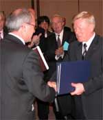
Today in Moscow, ESA Director General, Jean-Jacques Dordain and the Head of the Russian Federal Space Agency, Anatoly Perminov signed an agreement for long-term cooperation and partnership in the development, implementation and use of launchers.

This agreement, which comes within the general framework of the Agreement between ESA and the Russian Federation for Cooperation and Partnership in the Exploration and Use of Outer Space for Peaceful Purposes, will strengthen cooperation between ESA and Russia, ESA?s first partner in the long-term cooperation on access to space.

ESA-Russian partnership is based on two main pillars: the exploitation of the Russian Soyuz launcher from Europe?s Spaceport in French Guiana and cooperation, without exchange of funds, on research and development in preparation for future launchers.

The Soyuz at Europe?s Spaceport programme covers the construction of the Soyuz launch facilities in French Guiana and the adaptations that Soyuz will need to enable it to be launched from French Guiana. A number of ESA Member States have signed up for this optional ESA programme and their contributions will be supplemented by a loan to Arianespace from the European Investment Bank, guaranteed by the French Government as a temporary measure pending the creation by the European Commission of a guarantee reserve mechanism. Complementary funding from the European Union is also envisaged.

Work to prepare the Spaceport for Soyuz is already underway in French Guiana as the first launch from Europe?s Spaceport is scheduled to take place in 2007.

Today?s agreement will also allow work to begin on the second pillar: preparation activities for the development of future space transport systems. Europe and the Russian Federation will collaborate in developing the technology needed for future launchers. Russian and European engineers will work together to develop reusable liquid engines, reusable liquid stages and experimental vehicles.

ESA?s aim is to have a new generation launcher ready by 2020.

Original Source: ESA News Release

Giant Iceberg on Collision Course

Some anticipated the ‘collision of the century’: the vast, drifting B15-A iceberg was apparently on collision course with the floating pier of ice known as the Drygalski ice tongue. Whatever actually happens from here, Envisat’s radar vision will pierce through Antarctic clouds to give researchers a ringside seat.

A collision was predicted to have already occurred by now by some authorities, but B-15A’s drift appears to have slowed markedly in recent days, explains Mark Drinkwater of ESA’s Ice/Oceans Unit: “The iceberg may have run aground just before colliding. This supports the hypothesis that the seabed around the Drygalski ice tongue is shallow, and surrounded by deposits of glacial material that may have helped preserve it from past collisions, despite its apparent fragility.

“What may be needed to release it from its present stalled location is for the surface currents to turn it into the wind, combined with help from a mixture of wind, tides and bottom melting to float it off its perch.”

To follow events for yourself, visit ESA’s Earthwatching site, where the latest images from Envisat’s Advanced Synthetic Aperture Radar (ASAR) instrument are being posted online daily.

Opposing ice objects
The largest floating object on Earth, the bottle-shaped B-15A iceberg is around 120 kilometres long with an area exceeding 2500 square kilometres, making it about as large as the entire country of Luxembourg.

B15-A is the largest remaining segment of the even larger B-15 iceberg that calved from the Ross Ice Shelf in March 2000. Equivalent in size to Jamaica, B-15 had an initial area of 11 655 square kilometres but subsequently broke up into smaller pieces.

Since then B-15A has found its way to McMurdo Sound, where its presence has blocked ocean currents and led to a build-up of sea ice. This has led to turn to resupply difficulties for the United States and New Zealand scientific stations in the vicinity and the starvation of numerous local penguins unable to forage the local sea.

ESA’s Envisat has been tracking the progress of B-15A for more than two years. An animated flyover based on past Envisat imagery begins by depicting the region as it was in January 2004, as seen by the optical Medium Resolution Imaging Spectrometer (MERIS) instrument (View the full animation – Windows Media Player, 3Mb).

The animation then moves four months back in time to illustrate the break-up of the original, larger B-15A (the current B-15A having inherited its name), split asunder by storms and currents while run aground on Ross Island, as observed by repeated ASAR observations. The animation ends with a combined MERIS/ASAR panorama across Victoria Land, including a view of the the Erebus ice tongue, similar to B-15A’s potential ‘victim’, the Drygalski ice tongue.

As the animation shows, ASAR is extremely useful for tracking changes in polar ice. ASAR can peer through the thickest polar clouds and work through local day and night. And because it measures surface texture, the instrument is also extremely sensitive to different types of ice ? so the radar image clearly delineates the older, rougher surface of ice tongues from surrounding sea ice, while optical sensors simply show a continuity of snow-covered ice.

“An ice tongue is ‘pure’ glacial ice, while the surrounding ice is fast ice, which is a form of saline sea ice,” Drinkwater says. “To the radar there is extreme backscatter contrast between the relatively pure freshwater ice tongue ? which originated on land as snow ? and the surrounding sea ice, due to their very different physical and chemical properties.”

The Drygalski ice tongue is located at the opposite end of McMurdo Sound from the US and New Zealand bases. Large and (considered) permanent enough to be depicted on standard atlas maps of the Antarctic continent, the long narrow tongue stretches 70 kilometres out to sea as an extension of the land-based David Glacier, which flows through coastal mountains of Victoria Land.

Measurements show the Drygalski ice tongue has been growing seaward at a rate of between 50 and 900 metres a year. Ice tongues are known to rapidly change their size and shape and waves and storms weaken their ends and sides, breaking off pieces to float as icebergs.

First discovered by British explorer Robert Falcon Scott in 1902, the Drygalski ice tongue is around 20 km wide. Its floating glacial ice is between 50 and 200 metres thick. The tongue’s history has been traced back at least as far as 4000 years. One source has been radiocarbon dating of guano from penguin rookeries in the vicinity ? the ice tongue has a body of open water on its north side that its presence blocks from freezing, sustaining the penguin population.

ESA’s Envisat environmental satellite
“The Drygalski ice tongue has been remarkably resilient over at least the last century,” Drinkwater concludes. “In spite of its apparent vulnerability, shallower bathymetry of the area ? enhanced by deposition of glacial sediments ? may play an important role in diverting the larger icebergs with more significant draught around this floating promontory.

“This may rule out its potential catastrophic removal from collision with a large drifting berg in the short term. That leaves the elements of temperature variations, wave and tidal flexure, or bending, to weaken and periodically whittle pieces off the end of the ice promontory.”

The 400-kilometre swath, 150-metre resolution images shown here of B-15A and the Drygalski ice tongue are from ASAR working in Wide Swath Mode (WSM). Envisat also monitors Antarctica in Global Monitoring Mode (GMM), with the same swath but a resolution of one kilometre, enabling rapid mosaicking of the whole of Antarctica to monitor changes in sea ice extent, ice shelves and iceberg movement.

Often prevailing currents transport icebergs far from their initial calving areas way across Antarctica, as with B-15D, another descendant of B-15, which has travelled a quarter way counterclockwise (westerly) around the continent at an average velocity of 10 km a day.

ASAR GMM images are routinely provided to a variety of users including the US National Oceanic and Atmospheric Administration (NOAA) National Ice Center, responsible for tracking icebergs worldwide.

ASAR imagery is also being used operationally to track icebergs in the Arctic by the Northern View and ICEMON consortia, providing ice monitoring services as part of the Global Monitoring for Environment and Security (GMES) initiative, jointly backed by ESA and the European Union. The two consortia are considering plans to extend their services to the Antarctic.

This year also sees the launch of ESA’s CryoSat, a dedicated ice-watching mission designed to precisely map changes in the thickness of polar ice sheets and floating sea ice.

CryoSat should answer the question of whether the kind of icesheet calving that gave rise to B-15 and its descendants are becoming more common, as well as improving our understanding of the relationship between

Original Source: ESA News Release