Something Oozed on Titan’s Surface

This synthetic aperture radar image of the surface of Saturn’s moon Titan was acquired on Oct. 26, 2004, when the Cassini spacecraft flew approximately 2,500 kilometers (1,553 miles) above the surface and acquired radar data for the first time.

The radar illumination was from the south: dark regions may represent areas that are smooth, made of radar-absorbing materials, or are sloped away from the direction of illumination. A striking bright feature stretches from upper left to lower right across this image, with connected ‘arms’ to the East. The fact that the lower (southern) edges of the features are brighter is consistent with the structure being raised above the relatively featureless darker background. Comparisons with other features and data from other instruments will help to determine whether this is a cryovolcanic flow, where water-rich liquid has welled up from Titan’s warm interior.

The image covers an area about 150 kilometers (90 miles) square, and is centered at about 45 degrees north, 30 degrees west in the northern hemisphere of Titan, over a region that has not yet been imaged optically. The smallest details seen on the image are around 1 kilometer (.62 mile) across. Features are less clear at the bottom of the image where the viewing was less favorable. A faint horizontal seam between the radar beams can be seen half way up in this image.

The Cassini-Huygens mission is a cooperative project of NASA, the European Space Agency and the Italian Space Agency. The Jet Propulsion Laboratory, a division of the California Institute of Technology in Pasadena, manages the Cassini-Huygens mission for NASA’s Science Mission Directorate, Washington, D.C. The Cassini orbiter and its two onboard cameras were designed, developed and assembled at JPL. The radar instrument team is based at JPL, working with team members from the United States and several European countries.

For more information about the Cassini-Huygens mission visit http://saturn.jpl.nasa.gov.

Original Source: NASA/JPL News Release

Interview with David A. Hardy

There are few people who have astronomical bodies named after them in recognition of their hard work over the years, so TV astronomer Sir Patrick Moore and space artist David A. Hardy are true space companions: both have asteroids named after them. Their friendship goes back half a decade.

“In almost all of the books that Patrick and I have done together, he gives me a free hand – he knows that I have a good knowledge of astronomy etc., and has complete confidence in my ability (especially, after 50 years!). In the early days, if he wrote the text first, he sent it to me or we would meet to discuss which parts needed illustrating and how. But in the case of Futures – you’ll notice that my name appears first on the cover – the choice of subjects and illustrations were mine. Patrick approved them, and then wrote the text. In many cases, I wrote some notes of my own first, which he then incorporated. As his health allows him to type only slowly and inaccurately now (on his 1908 Woodstock), he sent me the typescript, which I passed to my wife Ruth to transcribe into Word on her Mac, and I then emailed it to the publisher.”

Both Sir Patrick and David A. Hardy have been keen artists in their own respect. Patrick has a talent for writing clear concise books and features on astronomy, and he’s presented the BBCs “The Sky at Night” program every month for more than 48 years. He began as a school teacher, and humbled by his mother’s artistic talent for colourful drawings of sweet looking aliens canoing down a Martian canal or driving a car around on the rings of Saturn, Sir Patrick took to writing books and continues writing today.

They’re both in a good position to have watched space exploration change over the last half century, participating in and popularizing the many discoveries that have been made. So what is the better approach, making an alien looking world or making the detail as accurate as possible?

“Where possible, I try to do both. But remember that this is astronomical art, not science fiction, and in a book like this I would not include anything that is not accurate according to current knowledge, or at least scientifically possible. This means that paintings done in the 1950s or 60s showing, say, Mars or Titan with a blue sky were accurate for our state of knowledge at the time. Where I have included alien life or signs of civilization, it is based on scientific extrapolation. My favourite of these is the alien life on a planet in a globular cluster (page 99 in Futures: 50 Years in Space), as I believe the idea to be quite original: a type of photosynthesis producing oxygen inside balloon-like organisms, which then float in a carbon dioxide atmosphere.

“I think my paintings, whether traditional or digital, are pretty realistic, aren’t they? I don’t see any need to go as far as super-realism, as that can lead to rather bland art with little character or emotion. I have painted in the styles of Mondrian, Pollock, Picasso on occasion, but only for special commissions. Romanticism, yes – the painting of Antares (page 80) was, as stated, painted deliberately in the style of the Hudson River School of artists. I’ve seen some of those (often huge) originals while in the USA, and love them! I hope that the work of space artists can help to inspire the public to further exploration, just as those artists did in the great days of the opening up of the US West, which in turn led to the creation of National Parks, like Yellowstone and Yosemite.”

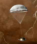
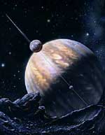
The planet Saturn with its rings is now becoming visible again after its period of invisibility in the eastern sky, and is certainly at the centre of attention right now as Cassini continues to send back “postcards”; most recently of the planet’s largest moon Titan. Yet some artists still paint Saturn inaccurately.

“Saturn is beautiful, with its rings, but views of Saturn from its moons in the media are almost always incorrect,” explained David, “since they show Saturn with the rings wide open, whereas from all but one of the satellites (Iapetus) the rings appear as a straight line.”

When asked what about his favorite planet, David said, “I suppose I would have to say that my favorite is Mars. I’d need time to think about the second part, but I would comment that on a frivolous note I thought of Michael Jackson, whose face has surely changed as many times as that of Mars over the years!”

As we press on into 21st century, we have many more planetary close encounters awaiting us. And David A. Hardy and Sir Patrick Moore will be right there to help us get a sense of what it would be like to stand in distant places of the Universe, and appreciate how much is out there, waiting for us to discover.

If you’re interested in Futures: 50 Years in Space, please read Universe Today’s review. You can also visit Amazon.com to read more reviews, or purchase a copy online (or Amazon.co.uk). You can also visit David’s website at http://www.astroart.org, or the BBC’s website for Sir Patrick Moore’s “The Sky at Night”.

David A. Hardy was interviewed by Richard Pearson.

Rover Toolkits are Still Full

All the scientific tools on NASA’s two Mars Exploration Rovers are still working well, a full 10 months after Spirit’s dramatic landing.

The ones on Spirit are adding fresh evidence about the history of layered bedrock in a hill the rover is climbing.

“Our leading hypothesis is that these rocks originated as volcanic ash that fell from the air or moved in ground-hugging ash flows, and that minerals in them were altered by water,” said Dr. Ray Arvidson of Washington University, St. Louis, deputy principal investigator for the mission.

“This is still a working hypothesis, not a firm conclusion, but all the instruments have contributed clues that fit,” he said. “However, it is important to point out that we have just begun to characterize the textures, mineralogy and chemistry of these layered rocks. Other hypotheses for their origin focus on the role of transport and deposition by water. In fact, it may turn out that volcanism, water and wind have produced the rocks that Spirit is examining. We are just beginning to put together the big picture.”

Both rovers completed three-month primary missions in April. NASA has extended their missions twice because they have remained productive longer than anticipated.

“We’re still making good progress even though Spirit has two types of problems with its wheels,” said Jim Erickson, rover project manager at NASA’s Jet Propulsion Laboratory, Pasadena, Calif. “We are working around those problems successfully, but they might be a sign of things to come, as mechanical parts wear out during our exploration of Mars.”

One question for continuing investigations as Spirit heads for rocks higher in the “Columbia Hills,” is what the environment was like when water altered the minerals. Possibilities include water in the volcanic magma mixture before the ash erupted, surface water transporting the ash while it was still loose after the eruption, and ground water soaking through the rocks that solidified from the accumulated ash.

Some clues for a volcanic-ash origin come from a layered rock dubbed “Uchben.” Researchers pointed Spirit’s microscopic imager at a spot on Uchben scoured with the rock abrasion tool. The images reveal sand-size particles, many of them sharply angular in shape and some quite rounded. The angularity is consistent with transport by an eruption. Particles carried across the surface by wind or water usually tumble together and become more rounded. Uchben’s rounded particles may be volcanic clumps, may be concretions similar to what Opportunity has found, or may be particles tumbled in a water environment.

Evidence for alteration by water comes mainly from identification of minerals and elements in the rocks by the rover’s Moessbauer spectrometer and alpha particle X-ray spectrometer.

The rovers’ principal investigator, Dr. Steve Squyres of Cornell University, Ithaca, N.Y., said, “We have really made headway just in the last several weeks in understanding these rocks. The most likely origin is debris that blasted out of a volcano, was transported by air or water to its present location, and settled out in layers.”

Opportunity, meanwhile, examined a lumpy boulder called “Wopmay” inside “Endurance Crater.” The slope of the ground and loose surface material around the rock prevented Opportunity from getting firm enough footing to use its rock abrasion tool. Evidence from the spectrometers and microscopic imager is consistent with scientists’ earlier hypothesis that rocks near the bottom of the crater were affected by water both before and after the crater formed. The evidence is still not conclusive, Squyres said.

Opportunity is heading toward the base of “Burns Cliff,” a tall exposure of layered rock in the wall of the crater. However, if the rover encounters more of the poor traction found around Wopmay, planners may change course and drive up out of the crater.

JPL, a division of the California Institute of Technology in Pasadena, manages the Mars Exploration Rover project for NASA’s Science Mission Directorate, Washington. Images and additional information about the project are available from JPL at http://marsrovers.jpl.nasa.gov and from Cornell University at http://athena.cornell.edu.

Original Source: NASA/JPL News Release

Second Black Hole at the Heart of the Milky Way

Using archived science verification data from the Hokupa?a/QUIRC Adaptive Optics system on Gemini North, a French/US team of astronomers led by Jean-Pierre Maillard of the Institut d?Astrophysique de Paris has confirmed the physical association of a cluster of massive stars in the infrared source IRS 13 near the center of the Milky Way galaxy.

The team also used data from Hubble Space Telescope, the Chandra X-Ray Observatory, the Canada-France-Hawai?i Telescope (CFHT), and the Very Large Array to provide broad spectral coverage to complement the Gemini data. The Gemini observations consisted of deconvolved H and Kp band images that identified the existence of two formerly undetected sources within IRS 13E. In all, seven individual massive stars appear to be associated with what the team believes was once a larger cluster of massive stars held together by a central intermediate-mass black hole of about 1,300 solar masses. (This black hole is distinct from the black hole at the galactic center which has a mass of about four million solar masses.) The seven individual stars of IRS 13E seen within a diameter of about 0.5″ (or projected 0.6 light-year across) are co-moving westward with a similar velocity of about 280 kilometers per second in the plane of the sky.

The compactness of the cluster and the common proper motion of the components suggest that they are kept together by a massive source, a stellar black hole at the center of IRS 13E. The size of the cluster allow to infer a mean orbit radius. The radial velocities (+/- 30 kilometers per second) of the individual stars derived from the BEAR Fourier Transform Spectrometer (CFHT) measurements can be used to estimate the average orbital velocity. The authors then explored a range of orbital assumptions and were able to constraint the mass of the holding black hole to about 1,300 solar masses rather robustly.

The team also speculates that this cluster was once located farther from the galactic center, where the stars could form away from the extreme gravitational influence of the central supermassive black hole. IRS 13E seems to be the wreckage or remnant core of a once larger cluster of stars that is now spiraling towards Sgr A* at the galactic center.

This theory also explains the existence of other massive stars around the galactic center, which are thought to be stars stripped from the cluster due to the gravitational environment around the galaxy?s central black hole.

The Gemini data for this work were obtained by a team led by Francois Rigaut (Gemini Observatory) as part of an adaptive optics demonstration run in July 2000. The results are published in Astronomy and Astrophysics, Volume 423, pgs 155-167 (2004)

Original Source: Gemini News Release

Triple Eclipse on Jupiter

At first glance, Jupiter looks like it has a mild case of the measles. Five spots – one colored white, one blue, and three black – are scattered across the upper half of the planet.

Closer inspection by NASA’s Hubble Space Telescope reveals that these spots are actually a rare alignment of three of Jupiter’s largest moons – Io, Ganymede, and Callisto – across the planet’s face.

In this image, the telltale signatures of this alignment are the shadows [the three black circles] cast by the moons. Io’s shadow is located just above center and to the left; Ganymede’s on the planet’s left edge; and Callisto’s near the right edge. Only two of the moons, however, are visible in this image. Io is the white circle in the center of the image, and Ganymede is the blue circle at upper right. Callisto is out of the image and to the right.

On Earth, we witness a solar eclipse when our Moon’s shadow sweeps across our planet’s face as it passes in front of our Sun. Jupiter, however, has four moons roughly the same size as Earth’s Moon. The shadows of three of them occasionally sweep simultaneously across Jupiter. The image was taken March 28, 2004, with Hubble’s Near Infrared Camera and Multi-Object Spectrometer.

Seeing three shadows on Jupiter happens only about once or twice a decade. Why is this triple eclipse so unique?

Io, Ganymede, and Callisto orbit Jupiter at different rates. Their shadows likewise cross Jupiter’s face at different rates. For example, the outermost moon Callisto orbits the slowest of the three satellites. Callisto’s shadow moves across the planet once for every 20 shadow crossings of Io. Add the crossing rate of Ganymede’s shadow and the possibility of a triple eclipse becomes even more rare. Viewing the triple shadows in 2004 was even more special, because two of the moons were crossing Jupiter’s face at the same time as the three shadows.

Jupiter appears in pastel colors in this photo because the observation was taken in near-infrared light. Astronomers combined images taken in three near-infrared wavelengths to make this color image. The photo shows sunlight reflected from Jupiter’s clouds. In the near infrared, methane gas in Jupiter’s atmosphere limits the penetration of sunlight, which causes clouds to appear in different colors depending on their altitude.

Studying clouds in near-infrared light is very useful for scientists studying the layers of clouds that make up Jupiter’s atmosphere. Yellow colors indicate high clouds; red colors lower clouds; and blue colors even lower clouds in Jupiter’s atmosphere. The green color near the poles comes from a thin haze very high in the atmosphere. Ganymede’s blue color comes from the absorption of water ice on its surface at longer wavelengths. Io’s white color is from light reflected off bright sulfur compounds on the satellite’s surface.

“I’m increasingly aware that some of the most interesting things in astronomy and astrophysics, for instance, can change the way people understand the universe, how it got started and where it’s going. I found those Voyager pictures of the moons of Jupiter incredibly exciting, these beautiful color pictures showing volcanoes on the surface”. -Robert C. Richardson, Nobel Laureate, Physics, Cornell, (1996)

In viewing this rare alignment, astronomers also tested a new imaging technique. To increase the sharpness of the near-infrared camera images, astronomers speeded up Hubble’s tracking system so that Jupiter traveled through the telescope’s field of view much faster than normal. This technique allowed scientists to take rapid-fire snapshots of the planet and its moons. They then combined the images into one single picture to show more details of the planet and its moons.

Original Source: NASA Astrobiology

First Gamma Ray Image

A team of UK astronomers working with international partners has produced the first ever image of an astronomical object using high energy gamma rays, helping to solve a 100 year old mystery – the origin of cosmic rays. Their research, published in the Journal Nature on November 4th, was carried out using the High Energy Stereoscopic System (H.E.S.S.), an array of four telescopes, in Namibia, South-West Africa.

The astronomers studied the remnant of a supernova that exploded some 1,000 years ago, leaving behind an expanding shell of debris which, seen from the Earth, is twice the diameter of the Moon. The resulting image helps to solve a mystery that has been puzzling scientists for almost 100 years – the origin of cosmic rays. Cosmic rays are extremely energetic particles that continually bombard the Earth, thousands of them passing through our bodies every day. The production of gamma rays in this supernova shock wave tells us that it is acting like a giant particle accelerator in space, and thus a likely source of the cosmic rays in our galaxy.

Dr Paula Chadwick of the University of Durham said “This picture really is a big step forward for gamma-ray astronomy and the supernova remnant is a fascinating object. If you had gamma-ray eyes and were in the Southern Hemisphere, you could see a large, brightly glowing ring in the sky every night.”

Professor Ian Halliday, CEO of PPARC which funds UK participation in HESS said “These results provide the first unequivocal proof that supernovae are capable of producing large quantities of galactic cosmic rays – something we have long suspected, but never been able to confirm.”

Gamma rays are the most penetrating form of radiation we know, around a billion times more energetic than the X-rays produced by a hospital X-ray machine. This makes it very difficult to use them to create an image – they just pass straight through any surface which we might use to reflect them, for instance. However, luckily for life on Earth, gamma rays from objects in outer space are stopped by the atmosphere; when this happens, a faint flash of blue light is produced, lasting for a few billionths of a second. The astronomers used images of these flashes of light, called Cherenkov radiation, to make a gamma ray ‘image’ for the first time.

Original Source: PPARC News Release

Earth Will Be Watching When Huygens Arrives

Image credit: ESA
When ESA?s Huygens probe plunges into the atmosphere of Saturn?s largest moon, Titan, on 14 January 2005, telescopes on Earth will be watching the remote world.

Observations of Titan from Earth will help to understand the global condition of the atmosphere, while Huygens is passing through a tiny section of it. As Huygens drifts down, its instruments and cameras will be collecting vital information about the atmosphere and surface.

The Cassini mothership will be listening, so that it can later transmit the results to Earth but, while Cassini is pointing its high-gain antenna at Huygens, it cannot watch Titan with its cameras. So telescopes on Earth will try to do the job.

The telescopes located around the Pacific Ocean will be used because Titan will be in view from these areas at the time of the Huygens descent. An observation from space, by the NASA/ESA Hubble Space Telescope, is also planned.

The most exciting possibility is that the observations may show a tiny, bright speck at the moment Huygens enters the atmosphere.

This point of light will be the ?fireball?, created by friction as the probe?s heatshield hurtles through the denser parts of the moon?s atmosphere and the spacecraft shoots across Titan?s sky like a giant meteor.

Although the chances of seeing the fireball are faint, the best location to be looking from happens to coincide with the largest single telescope in the world: the 10-metre Keck telescope. Situated on the summit of the dormant volcano Mauna Kea, on Hawaii, Keck will be directly in line with Titan at the moment of the Huygens descent.

In addition to optical telescopes, a string of radio telescopes across America, Australia, China and Japan will team up to listen for the faint radio signal of Huygens itself. If they hear this tiny call, they will be able to help determine, after weeks of processing the Huygens amount of data that will be collected, the precise landing location for the probe on Titan?s surface.

Jean-Pierre Lebreton, Huygens Project Scientist, will be in ESA?s European Space Operations Centre (ESOC) at Darmstadt, Germany, during the descent of the probe. As any space scientist knows, planetary descents can be risky things. However, Lebreton says that preparations for the day of descent are going well, and adds, ?We have no time to get nervous, there is too much work to do.?

Original Source: ESA News Release

Alaskan Martian Update, Eclipse Photos, and More

It’s a bit of a slow news day today. I’m not sure why… some kind of election, or something. Anyway, I wanted to give you an update on Ray Collins, who shut himself in a greenhouse in Alaska to figure out how much space would be required to feed an astronaut. He ate the last of his potatoes, and exited Mars Base Zero on Tuesday. You can read his final update, and if you’re interested in getting involved, or sharing ideas, they’ve got some ambitious plans and I’m sure they’d love to hear from you.

Second, thanks to everyone who sent in your stories and pictures of last week’s lunar eclipse. It’s great to see how an event like this can really bring people together, and help encourage an appreciation for the beautiful night skies. So, check them out, and share your experience if you hadn’t already.

Finally, a reminder to head out in the next couple of morning and enjoy the Venus/Jupiter planetary conjunction. The two planets are already close together in the sky, and getting closer. It’s really beautiful.

Enjoy!

Fraser Cain
Publisher
Universe Today

Book Review: Space – A History of Space Exploration in Photographs

Andrew Chaikin divides humankind’s history of space and his book into six chapters. The beginning shows a cross section of a model rocket based on Konstantin Tsiolkovsky’s designs and a wonderful portraiture of this figurehead of space travel. Thereafter comes a steady and well mixed parade of photographs of people, machines and views from space. It ends with photographs of Yang Liwei in his cabin and the launch of his Shenzhou 5 rocket. Many are related to outstanding achievements like the docking of the space shuttle to Mir though some are of crisis events like the damaged Apollo 13 craft. With the book’s chronological ordering, a reader can easily grasp the challenges and accomplishments that occurred in our escape from the bounds of Earth.

Starting each of the six chapters is a narrative that provides some context into the events of the time. Mostly this contains an overview of the political situation and the significant space events. The result is a perspective on the contents and importance of the following photographs. Also, annotations attached to each photograph clearly tell the reader about the subject and the date which it was taken.

The photographs themselves are all superbly clear. Most are in colour and are well sized and positioned to provide optimum impact. Some might be rare, such as one of the checkout of Apollo 14 and 15’s lunar module at the Kennedy Space Center, or another of the Soviet Union’s one man lunar lander. But, for the most part, the pictures are or, at least were, well known.

The main value of this book is its depth. It includes authentic photographs to cover the complete span of human space endeavours. This collection gives feeling to the power of the ever present natural forces and the precocious nature of our advances. However, even though this book was enjoyable to read through once, thereafter, much like a family photo album, it will likely stay put on a shelf or coffee table until friends come over and show an interest.

Though the international space programs of today may not appear astounding, just remember that, only a short time ago, the first human blasted into space. Since then, humankind has really made significant achievements. Luckily cameras recorded many of these and Andrew Chaikin, in his book Space – A History of Space Exploration in Photographs presents an excellent collection. This book will give you a wonderful excuse to ignore a cold winter and curl up in your favourite chair to look at all the marvels we’ve accomplished.

This review is for the paperback edition, which was just released. The hardcover version was put out over a year ago, but Universe Today didn’t get a copy to review.

To get your own copy, visit Amazon.com.

Review by Mark Mortimer

Tithonium Chasma on Mars

This image, taken by the High Resolution Stereo Camera (HRSC) on board ESA?s Mars Express spacecraft, shows the western end of the Valles Marineris Canyon system on Mars.

The image was taken during orbit 442 with a ground resolution of approximately 52 metres per pixel. The displayed region is located at the beginning of the canyon system at about latitude 7? South and longitude 269? East.

The image shows the western end of the canyons Tithonium Chasma and Ius Chasma, part of the Valles Marineris canyon system, which are up to 5.5 kilometres deep.

The whole canyon system itself is the result of a variety of geological processes. Probably tectonic rifting, water and wind action, volcanism and glacial activity all have played major roles in its formation and evolution.

The canyon floors are covered by a dark, layered material, the so-called ?Interior Layered Deposits?. These deposits are marked by a system of polygonal cracks through which the underlying, lighter-coloured rock can be seen.

The Interior Layered Deposits are still a major topic of research. Parts of the deposits are most probably volcanic, while in other areas a sedimentary origin has been proposed.

The morphology of the valley flanks has been modified by ?slumping? and rockfalls. Slumping is when a substantial part of a mountain, cliff or hill ?breaks away? and slides more or less intact to the bottom of the slope.

Some of the major slumps here are more than thirty kilometres wide. The flanks are often covered to a large extent by their own ?talus?, or rock debris that has fallen from the sides of a cliff or steep slope.

The large, deeply eroded Crater Oudemans in the south of the area (bottom of the image) has a diameter of about 120 kilometres.

Around the central mount of the crater, large plains composed of dark rock can be seen. These plains are covered by lighter sediments, deposited through the action of the wind. Several systems of tectonic faults can be seen in the imaged area.

The most prominent is the system of Valles Marineris itself, running east-west. South of Crater Oudemans, smaller tectonic ?grabens? running from the south-west to the north-east can be seen. To the north of the large canyons, there are more fault systems.

The Valles Marineris region is one of the most studied areas on Mars. The canyon system is one of the major keys to the tectonic and volcanic history of this planet. Research on the sedimentary rocks and the products of erosion can also provide major insights into its climatic evolution.

Due to the stereo capability of the HRSC, the new image data gained can provide new insights into the geology of Mars. This will lead to a new, more precise reconstruction of Martian geological history.

Original Source: ESA News Release