Cargo Ship Launches with Supplies for the Station

A Russian cargo spacecraft is on its way to the International Space Station. The Progress resupply ship launched at 4:19:31 p.m. CST from the Baikonur Cosmodrome, Kazakhstan, and less than 10 minutes later settled into orbit. Moments after that, automatic commands deployed its solar arrays and navigational antennas.

As the Progress launched, Expedition 10 Commander and NASA Station Science Officer Leroy Chiao and Flight Engineer Salizhan Sharipov were a few minutes from the start of their sleep period. The Station was flying over western Chile at an altitude of 225 statute miles at the time of lift off.

Engine firings are scheduled overnight to raise and refine the Progress’ orbit and its path to the Station for an automated docking at 5:31 p.m. CST Dec. 25. It will dock to the aft port of the Station’s Zvezda living quarters module. This will be the 16th Progress spacecraft to dock with the Station. The Christmas Day docking will be broadcast live on NASA Television beginning at 4:30 p.m. CST. The Johnson Space Center newsroom will be open concurrent with the NASA TV coverage of docking.

The Progress is carrying 5,000 pounds of food, fuel, oxygen, water, spare parts and holiday presents to the crew. It’s loaded with 1,234 pounds of propellant, 110 pounds of oxygen and air, 926 pounds of water, and more than 2,700 pounds of spare parts, life support system components and experiment hardware. The manifest also includes about a 112-day supply of food in 69 containers to replenish the Station pantry. Other items on the Progress include new laptop computers, replacement parts for the U.S. spacesuits and additional components for the arrival next year of the European Automated Transfer Vehicle, another type of automated cargo craft.

Chiao and Sharipov are scheduled to open the hatch to the Progress shortly after 12 p.m. CST Sunday to begin unloading the cargo.

The Progress spacecraft that had been at the Station since August was undocked yesterday by Russian flight controllers at 1:37 p.m. CST. Filled with discarded items, it was commanded to deorbit about four hours later and burned up in the Earth’s atmosphere.

The crew also continued their science research this week. Chiao and Sharipov conducted another in a series of tests of the Advanced Diagnostic Ultrasound in Micro-G experiment.

On the first day, they took turns performing bone and dental scans on each other. One day later, after six hours of fasting, Sharipov was the subject for abdominal scans. Chiao also performed an abdominal scan on Sharipov to recover from a previous session during which data was lost.

They also used the Crew Medical Restraint System for positioning the subject and electrodes for electrocardiogram recording. The scanning and post-scan activities were videotaped and photographed for downlinking to the ground for interpretation. The experiment tests the diagnostic capability of ultrasound for medical contingencies that could occur in a space environment

Later in the week, Chaio and the ground team conducted their post-session analysis to discuss the successful ultrasound scans and in particular the abdominal scan conducted on Salizhan. Conducting the scans repeatedly increases the proficiency of crewmembers.

The experiment has already demonstrated the capability of non-medical personnel to downlink diagnostic information for evaluation by medical specialists on the ground. This “telemedicine” technique has application to emergency medical care in remote areas of the earth, as well as for astronaut crews traveling beyond low earth orbit.

Information about crew activities on the Space Station, future launch dates and Station sighting opportunities from Earth, is available on the Internet at:

http://spaceflight.nasa.gov/

For information about NASA and other agency missions, visit:

http://www.nasa.gov

Original Source: NASA News Release

Huygens Set to Detach Today

Image credit: ESA
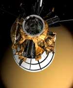
After a seven-year and 3.2 billion km journey from Earth to Saturn, ESA?s Huygens probe, travelling on board NASA?s Cassini mother craft and powered through an umbilical cable, is now ready to separate and continue its journey alone toward Titan, Saturn?s largest moon.

On Christmas night (25 December at 03:00 CET- orbiter time/04:08 CET on the ground) Huygens will be cut loose from Cassini and will coast toward Titan for 20 days, to arrive at its destination on 14 January.

?We have the green light for separation. The joint ESA/NASA team has done all that had to be done to be ready for release. We are looking forward to receiving data on 14 January at ESA?s Spacecraft Operations Centre in Darmstadt, Germany.?, said Claudio Sollazzo, ESA?s Head of Huygens Spacecraft Operations Unit at NASA/JPL in Pasadena, California.

At separation, tension-loaded springs will gently push Huygens away from Cassini onto a ballistic 4-million kilometre path to Titan. The Huygens probe will remain dormant until the on-board timer, which has been loaded on 21 December, wakes it up shortly before it reaches Titan’s upper atmosphere on 14 January.

?We will then have to wait patiently for the most exciting phase of our mission, when Cassini will send back to Earth the Huygens data. The Huygens descent will be accomplished in less then two and half hours and, if the probe survives the impact with the surface, we could expect up to two extra hours of science results before the onboard batteries die out? said Jean-Pierre Lebreton, ESA?s Huygens Mission Manager and Project Scientist, preparing to follow the separation from NASA/JPL in Pasadena.

At about 1200 km above the surface of Titan, the Huygens probe will begin a dramatic plunge through Titan?s thick haze, with the task to analyze the chemical makeup and composition of the moon?s atmosphere as it descends to touchdown on its surface. With Cassini listening to the probe for 4.5 hours, the data gathered during the descent and on the surface will be transmitted continuously by the probe and recorded onboard the Cassini orbiter.

Cassini will then turn away from Titan and point its antenna to Earth and relay the data through NASA’s Deep Space Network to JPL and on to ESA’s Space Operations Centre ESOC in Darmstadt, Germany where the Huygens probe data will be analysed by scientists.

After a successful probe release, on 28 December, the Cassini orbiter will perform a deflection manoeuvre to keep it from following Huygens into Titan’s atmosphere and to establish the required geometry between the probe and the orbiter for radio communications during the probe?s descent. The Cassini-Huygens mission is a cooperation between NASA, the European Space Agency and ASI, the Italian Space Agency. The Jet Propulsion Laboratory (JPL), a division of the California Institute of Technology in Pasadena, is managing the mission for NASA?s Office of Space Science, Washington.

Original Source: ESA News Release

Asteroid 2004 MN4 Gets the Highest Score on the Torino Scale

A recently rediscovered 400-meter Near-Earth Asteroid (NEA) is predicted to pass near the Earth on 13 April 2029. The flyby distance is uncertain and an Earth impact cannot yet be ruled out. The odds of impact, presently around 1 in 300, are unusual enough to merit special monitoring by astronomers, but should not be of public concern. These odds are likely to change on a day-to-day basis as new data are received. In all likelihood, the possibility of impact will eventually be eliminated as the asteroid continues to be tracked by astronomers around the world.

This object, 2004 mn4, is the first to reach a level 2 (out of 10) on the Torino Scale. According to the Torino Scale, a rating of 2 indicates “a discovery, which may become routine with expanded searches, of an object making a somewhat close but not highly unusual pass near the Earth. While meriting attention by astronomers, there is no cause for public attention or public concern as an actual collision is very unlikely. New telescopic observations very likely will lead to re-assignment to Level 0 [no hazard].” This asteroid should be easily observable throughout the coming months.

The brightness of 2003 qq47 suggests that its diameter is roughly 400 meters (1300 feet) and our current, but very uncertain, best estimate of the flyby distance in 2029 is about twice the distance of the moon, or about 780,000 km (480,000 miles). On average, an asteroid of this size would be expected to pass within 2 lunar distances of Earth every 5 years or so.

Most of this object’s orbit lies within the Earth’s orbit, and it approaches the sun almost as close as the orbit of Venus. 2004mn4’s orbital period about the sun is 323 days, placing it within the Aten class of NEAs, which have an orbital period less than one year. It has a low inclination with respect to the Earth’s orbit and the asteroid crosses near the Earth’s orbit twice on each of its passages about the sun.

2004 MN4 was discovered on 19 June 2004 by Roy Tucker, David Tholen and Fabrizio Bernardi of the NASA-funded University of Hawaii Asteroid Survey (UHAS), from Kitt Peak, Arizona, and observed over two nights. On 18 December, the object was rediscovered from Australia by Gordon Garradd of the Siding Spring Survey, another NASA-funded NEA survey. Further observations from around the globe over the next several days allowed the Minor Planet Center to confirm the connection to the June discovery, at which point the possibility of impact in 2029 was realized by the automatic SENTRY system of NASA’s Near-Earth Object Program Office. NEODyS, a similar automatic system at the University of Pisa and the University of Valladolid, Spain also detected the impact possibility and provided similar predictions.

Original Source: NASA News Release

Mars Volcanoes Were Active Recently

Image credit: ESA
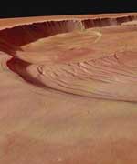
This perspective view, taken by the High Resolution Stereo Camera (HRSC) on board ESA’s Mars Express spacecraft, shows the complex caldera of Olympus Mons on Mars, the highest volcano in our Solar System. It may also offer the best chance to find more geologically recent volcanic activity on Mars.

“We would be very lucky to see [an eruption], but it would be a massive event,” said Gerhard Neukum in USA Today. Neukum is a professor at Berlin’s Free University and lead author of a study in Nature magazine suggesting a revised timeline for lava on Mars.

While Mars is littered with collapsed volcano remnants, none have been observed as active right now. The new images indicate some of these volcanoes are merely dormant, not dead. The timeline proposed from studying the complex Olympus Mons caldera suggests there have been lava flows from intense volcanic activity within the past 2 million years.

To geologists, two million years is regarded as recent since it corresponds to the last one percent of the planet’s history.

For instance, the curved striations on the left and foreground, in the southern part of the caldera, are tectonic faults. After lava production has ceased the caldera collapsed over the emptied magma chamber. Through the collapse the surface suffers from extension and so extensional fractures are formed.

“I suspect that as we get more spacecraft in orbit that it will increase the chances of seeing some kind of active eruption,” said Dr. James W. Head III, a professor of geological sciences at Brown. As quoted in Associated Press commentary, Dr. Head is one of more than 40 scientists who contributed to analysis of the images.

The level plain inside the crater on which these fractures can be observed represents the oldest caldera collapse. Later lava production caused new caldera collapses at different locations (the other circular depressions). They have partly destroyed the circular fracture pattern of the oldest one.

This perspective view of the caldera was calculated from the digital elevation model derived from the stereo channels and combined with the nadir and color channels of the HRSC.

University of Buffalo volcanologist, Dr. Tracy Gregg, discussed the scientific appeal of studying Martian volcanoes in detail. “If both of these [Opportunity and Spirit] landers survive with airbag technology, then it blows the doors wide open for future Mars landing sites with far more interesting terrain. A landing site near a volcano might be possible, now that the airbag technology has worked so wonderfully.”

The current generation of Mars missions has adopted the theme, “Follow the Water”, as a quest to understand the complex geological history of a planet that may have had significant reserves once. For that much warmer and wetter Mars, this motto also requires other ingredients for microbial life, including primordial “fire” in the form of biological temperature ranges and potentially geothermal heat.

“I’d like to see us land ON a volcano,” said Gregg. “Right on the flanks. Often the best place to look for evidence of life on any planet is near volcanoes.”

“That may sound counterintuitive, but think about Yellowstone National Park , which really is nothing but a huge volcano,” said Gregg. “Even when the weather in Wyoming is 20 below zero, all the geysers, which are fed by volcanic heat, are swarming with bacteria and all kinds of happy little things cruising around in the water. So, since we think that the necessary ingredients for life on earth were water and heat, we are looking for the same things on Mars, and while we definitely have evidence of water there, we still are looking for a source of heat.”

While Olympus Mons is dormant today, volcanologists are not entirely convinced more isn’t going on geothermally on Mars. “If you’d asked me [if there were not active surface volcanoes] 10 years ago–or even 5–I might’ve said yes,” said Gregg. “Now I’m not so sure.”

On Mars, “where would I look for recent volcanic activity? Depends on how you want to define it on Mars,” said Gregg. “I strongly suspect there are still molten (or at least mushy) magma bodies beneath the huge Tharsis volcanoes , and beneath Elysium Mons .”

“But the youngest surficial activity discovered to date (and it’s probably 1 million years old, which would be considered quite young, and possibly ‘active’ on Mars) is in a region that contains no large volcanic structures of any kind,” said Gregg. “Instead, there are cracks in the ground, and a few low-lying volcanoes that can’t even be seen except in the high-resolution topography (they are too subtle for imagery to reveal). This area is called Cerberus Fossae .”

Seeing important events surrounding Olympus Mons is not entirely just about geology, as the famed science fiction writer, Sir Arthur C. Clarke, indicated this was the site for his own version of desktop terraforming. “Soon after maps of the real Mars became available, I received a generous gift from computer genius John Hinkley–his Vistapro image-processing system. This prompted me to do some desktop terraforming (a word, incidently, invented by science fictions’ Grandest of Grand Masters, Jack Williamson). I must confess that in ‘The Snows of Olympus: A Garden on Mars’ (1995) I frequently allowed artistic considerations to override scientific ones. Thus I couldn’t resist putting a lake in the caldera of Mount Olympus, unlikely though it is that the strenuous efforts of future colonists will produce an atmosphere dense enough to permit liquid water at such an altitude.”

Original Source: NASA Astrobiology Magazine

Radio Telescopes Will Contribute to Huygens’ Mission

When the European Space Agency’s Huygens spacecraft makes its plunge into the atmosphere of Saturn’s moon Titan on January 14, radio telescopes of the National Science Foundation’s National Radio Astronomy Observatory (NRAO) will help international teams of scientists extract the maximum possible amount of irreplaceable information from an experiment unique in human history. Huygens is the 700-pound probe that has accompanied the larger Cassini spacecraft on a mission to thoroughly explore Saturn, its rings and its numerous moons.

The Robert C. Byrd Green Bank Telescope (GBT) in West Virginia and eight of the ten telescopes of the continent-wide Very Long Baseline Array (VLBA), located at Pie Town and Los Alamos, NM, Fort Davis, TX, North Liberty, IA, Kitt Peak, AZ, Brewster, WA, Owens Valley, CA, and Mauna Kea, HI, will directly receive the faint signal from Huygens during its descent.

Along with other radio telescopes in Australia, Japan, and China, the NRAO facilities will add significantly to the information about Titan and its atmosphere that will be gained from the Huygens mission. A European-led team will use the radio telescopes to make extremely precise measurements of the probe’s position during its descent, while a U.S.-led team will concentrate on gathering measurements of the probe’s descent speed and the direction of its motion. The radio-telescope measurements will provide data vital to gaining a full understanding of the winds that Huygens encounters in Titan’s atmosphere.

Currently, scientists know little about Titan’s winds. Data from the Voyager I spacecraft’s 1980 flyby indicated that east-west winds may reach 225 mph or more. North-south winds and possible vertical winds, while probably much weaker, may still be significant. There are competing theoretical models of Titan’s winds, and the overall picture is best summarized as poorly understood. Predictions of where the Huygens probe will land range from nearly 250 miles east to nearly 125 miles west of the point where its parachute first deploys, depending on which wind model is used. What actually happens to the probe as it makes its parachute descent through Titan’s atmosphere will give scientists their best-ever opportunity to learn about Titan’s winds.

During its descent, Huygens will transmit data from its onboard sensors to Cassini, the “mother ship” that brought it to Titan. Cassini will then relay the data back to Earth. However, the large radio telescopes will be able to receive the faint (10-watt) signal from Huygens directly, even at a distance of nearly 750 million miles. This will not be done to duplicate the data collection, but to generate new data about Huygens’ position and motions through direct measurement.

Measurements of the Doppler shift in the frequency of Huygens’ radio signal made from the Cassini spacecraft, in an experiment led by Mike Bird of the University of Bonn, will largely give information about the speed of Titan’s east-west winds. A team led by scientists at NASA’s Jet Propulsion Laboratory in Pasadena, CA, will measure the Doppler shift in the probe’s signal relative to Earth. These additional Doppler measurements from the Earth-based radio telescopes will provide important data needed to learn about the north-south winds.

“Adding the ground-based telescopes to the experiment will not only help confirm the data we get from the Cassini orbiter but also will allow us to get a much more complete picture of the winds on Titan,” said William Folkner, a JPL scientist.

Another team, led by scientists from the Joint Institute for Very Long Baseline Interferometry in Europe (JIVE), in Dwingeloo, The Netherlands, will use a world-wide network of radio telescopes, including the NRAO telescopes, to track the probe’s trajectory with unprecedented accuracy. They expect to measure the probe’s position within two-thirds of a mile (1 kilometer) at a distance of nearly 750 million miles.

“That’s like being able to sit in your back yard and watch the ball in a ping-pong game being played on the Moon,” said Leonid Gurvits of JIVE.

Both the JPL and JIVE teams will record the data collected by the radio telescopes and process it later. In the case of the Doppler measurements, some real-time information may be available, depending on the strength of the signal, but the scientists on this team also plan to do their detailed analysis on recorded data.

The JPL team is utilizing special instrumentation from the Deep Space Network called Radio Science Receivers. One will be loaned to the GBT and another to the Parkes radio observatory. “This is the same instrument that allowed us to support the challenging communications during the landing of the Spirit and Opportunity Mars rovers as well as the Cassini Saturn Orbit Insertion when the received radio signal was very weak,” said Sami Asmar, the JPL scientist responsible for the data recording.

When the Galileo spacecraft’s probe entered Jupiter’s atmosphere in 1995, a JPL team used the NSF’s Very Large Array (VLA) radio telescope in New Mexico to directly track the probe’s signal. Adding the data from the VLA to that experiment dramatically improved the accuracy of the wind-speed measurements.

“The Galileo probe gave us a surprise. Contrary to some predictions, we learned that Jupiter’s winds got stronger as we went deeper into its atmosphere. That tells us that those deeper winds are not driven entirely by sunlight, but also by heat coming up from the planet’s core. If we get lucky at Titan, we’ll get surprises there, too,” said Robert Preston, another JPL scientist.

The Huygens probe is a spacecraft built by the European Space Agency (ESA). In addition to the NRAO telescopes, the JPL Doppler Wind Experiment will use the Australia Telescope National Facility and other radio telescopes in Parkes, Mopra, and Ceduna, Australia; Hobart, Tasmania; Urumqi and Shanghai, China; and Kashima, Japan. The positional measurements are a project led by JIVE and involving ESA, the Netherlands Foundation for Research in Astronomy, the University of Bonn, Helsinki University of Technology, JPL, the Australia Telescope National Facility, the National Astronomical Observatories of China, the Shanghai Astronomical Observatory, and the National Institute for Communication Technologies in Kashima, Japan.

The Joint Institute for VLBI in Europe is funded by the national research councils, national facilities and institutes of The Netherlands (NWO and ASTRON), the United Kingdom (PPARC), Italy (CNR), Sweden (Onsala Space Observatory, National Facility), Spain (IGN) and Germany (MPIfR). The European VLBI Network is a joint facility of European, Chinese, South African and other radio astronomy institutes funded by their national research councils. The Australia Telescope is funded by the Commonwealth of Australia for operation as a National Facility managed by CSIRO.

The National Radio Astronomy Observatory is a facility of the National Science Foundation, operated under cooperative agreement by Associated Universities, Inc.

Original Source: NRAO News Release

Experiments Chosen For Lunar Orbiter

NASA has selected six proposals to provide instrumentation and associated exploration/science measurement investigations for the Lunar Reconnaissance Orbiter (LRO), the first spacecraft to be built as part of the Vision for Space Exploration.

The LRO mission is scheduled to launch in the fall of 2008 as part of NASA’s Robotic Lunar Exploration Program. The mission will deliver a powerful orbiter to the vicinity of the moon to obtain measurements necessary to characterize future robotic and human landing sites. It also will identify potential lunar resources and document aspects of the lunar radiation environment relevant to human biological responses.

Proposals were submitted to NASA in response to an Announcement of Opportunity released in June 2004. Instrumentation provided by these selected measurement investigations will be the payload of the mission scheduled to launch in October 2008.

“The payload we have selected for LRO builds on our collective experience in remote sensing of the Earth and Mars,” said NASA’s Deputy Associate Administrator for the Science Mission Directorate, Dr. Ghassem Asrar. “The measurements obtained by these instruments will characterize in unprecedented ways the moon’s surface and environment for return of humans in the next decade,” he added.

“LRO will deliver measurements that will be critical to the key decisions we must make before the end of this decade,” said NASA’s Associate Administrator for the Exploration Systems Mission Directorate, Craig Steidle. “We are extremely excited by this innovative payload, and we are confident it will fulfill our expectations and support the Vision for Space Exploration,” Steidle added.

“The instruments selected for LRO represent an ideal example of a dual use payload in which exploration relevance and potential scientific impact are jointly maximized,” NASA’s Chief Scientist, Dr. Jim Garvin said. “I am confident LRO will discover a ‘new moon’ for us, and in doing so shape our human exploration agenda for our nearest planetary neighbor for decades to come,” he said.

The selected proposals will conduct Phase A/B studies to focus on how proposed hardware can best be accommodated, completed, and delivered on a schedule consistent with the mission timeline. An Instrument Preliminary Design Review and Confirmation for Phase C Review will be held at the completion of Phase B.

Selected investigations and principal investigators:

“Lunar Orbiter Laser Altimeter (LOLA) Measurement Investigation” – principal investigator Dr. David E. Smith, NASA Goddard Space Flight Center (GSFC), Greenbelt, Md. LOLA will determine the global topography of the lunar surface at high resolution, measure landing site slopes and search for polar ices in shadowed regions.

“Lunar Reconnaissance Orbiter Camera” (LROC) – principal investigator Dr. Mark Robinson, Northwestern University, Evanston, Ill. LROC will acquire targeted images of the lunar surface capable of resolving small-scale features that could be landing site hazards, as well as wide-angle images at multiple wavelengths of the lunar poles to document changing illumination conditions and potential resources.

“Lunar Exploration Neutron Detector” (LEND) – principal investigator Dr. Igor Mitrofanov, Institute for Space Research, and Federal Space Agency, Moscow. LEND will map the flux of neutrons from the lunar surface to search for evidence of water ice and provide measurements of the space radiation environment which can be useful for future human exploration.

“Diviner Lunar Radiometer Experiment” – principal investigator Prof. David Paige, UCLA, Los Angeles. Diviner will map the temperature of the entire lunar surface at 300 meter horizontal scales to identify cold-traps and potential ice deposits.

“Lyman-Alpha Mapping Project” (LAMP) – principal investigator Dr. Alan Stern, Southwest Research Institute, Boulder, Colo. LAMP will observe the entire lunar surface in the far ultraviolet. LAMP will search for surface ices and frosts in the polar regions and provide images of permanently shadowed regions illuminated only by starlight.

“Cosmic Ray Telescope for the Effects of Radiation” (CRaTER) – principal investigator Prof. Harlan Spence, Boston University, Mass. CRaTER will investigate the effect of galactic cosmic rays on tissue-equivalent plastics as a constraint on models of biological response to background space radiation.

The LRO project is managed by GSFC. Goddard will acquire the launch system and spacecraft, provide payload accommodations, mission systems engineering, assurance, and management. For information about NASA and agency programs on the Internet, visit:

http://www.nasa.gov

Original Source: NASA News Release

Massive Galaxies are Still Forming

NASA’s Galaxy Evolution Explorer has spotted what appear to be massive “baby” galaxies in our corner of the universe. Previously, astronomers thought the universe’s birth rate had dramatically declined and only small galaxies were forming.

“We knew there were really massive young galaxies eons ago, but we thought they had all matured into older ones more like our Milky Way. If these galaxies are indeed newly formed, then this implies parts of the universe are still hotbeds of galaxy birth,” said Dr. Chris Martin. He is principal investigator for the Galaxy Evolution Explorer at the California Institute of Technology, Pasadena, Calif., and co-author of the study.

Martin and colleagues, led by Dr. Tim Heckman of Johns Hopkins University, Baltimore, Md., unearthed three-dozen bright, compact galaxies that greatly resemble the youthful galaxies of more than 10 billions years ago. These new galaxies are relatively close to us, ranging from two to four billion light-years away. They may be as young as 100 million to one billion years old. The Milky Way is approximately 10 billion years old.

The recent discovery suggests our aging universe is still alive with youth. It also offers astronomers their first, close-up glimpse at what our galaxy probably looked like when it was in its infancy.

“Now we can study the ancestors to galaxies much like our Milky Way in much more detail than ever before,” Heckman said. “It’s like finding a living fossil in your own backyard. We thought this type of galaxy had gone extinct, but in fact newborn galaxies are alive and well in the universe,” he added.

The new discoveries are of a type called ultraviolet luminous galaxies. They were discovered after the Galaxy Evolution Explorer scanned a large portion of the sky with its highly sensitive ultraviolet light detectors. Since young stars pack most of their light into ultraviolet wavelengths, young galaxies appear to the spacecraft like diamonds in a field of stones. Astronomers mined for these rare gems before, but missed them because they weren’t able to examine a large enough slice of the sky.

“The Galaxy Evolution Explorer surveyed thousands of galaxies before finding these few dozen ultraviolet-bright ones,” said Dr. Michael Rich, a co-author of the study from the University of California, Los Angeles.

The newfound galaxies are about 10 times as bright in ultraviolet wavelengths as the Milky Way. This indicates they are teeming with violent star-forming regions and exploding supernova, which are characteristics of youth.

When our universe was young, massive galaxies were regularly bursting into existence. Over time, the universe bore fewer and fewer galactic progeny, and its newborn galaxies grew up into ones that look like our own. Until now, astronomers thought they had seen the last of these giant babies.

The results will be published in an upcoming special issue of Astrophysical Journal Letters, along with several other papers describing new results from the Galaxy Evolution Explorer.

The Galaxy Evolution Explorer was launched on April 28, 2003. Its mission is to study the shape, brightness, size and distance of galaxies across 10 billion years of cosmic history. The Explorer’s 50-centimeter-diameter (19.7-inch) telescope sweeps the skies in search of ultraviolet-light sources.

Caltech leads the Galaxy Evolution Explorer mission and is responsible for science operations and data analysis. NASA’s Jet Propulsion Laboratory, Pasadena, Calif., manages the mission and built the science instrument. The mission was developed under NASA’s Explorers Program managed by the Goddard Space Flight Center, Greenbelt, Md. South Korea and France are the international partners in the mission.

For images and information about the Galaxy Evolution Explorer on the Internet, visit http://www.nasa.gov/centers/jpl/missions/galex.html. For information about NASA and agency programs on the Internet, visit http://www.nasa.gov.

Original Source: NASA News Release

Huygens Ready for Release

The highlights of the first year of the Cassini-Huygens mission to Saturn can be broken into two chapters: first, the arrival of the Cassini orbiter at Saturn in June, and second, the release of the Huygens probe on Dec. 24, 2004, on a path toward Titan.

Artist’s concept of Cassini releasing the Huygens probe to Titan.
The Huygens probe, built and managed by the European Space Agency (ESA), is bolted to Cassini and fed electrical power through an umbilical cable. It has been riding along during the nearly seven-year journey to Saturn largely in a “sleep” mode, awakened every six months for three-hour instrument and engineering checkups. In three days, it will be cut loose from its mother ship and will coast toward Saturn’s moon Titan, arriving on Jan. 14, 2005.

“As partners with ESA, one of our obligations was to carry the Huygens probe to Saturn and drop it off at Titan,” said Robert T. Mitchell, Cassini program manager at NASA’s Jet Propulsion Laboratory, Pasadena, Calif. “We’ve done the first part, and on Christmas Eve we will release Huygens and tension-loaded springs will gently push it away from Cassini onto a ballistic free-fall path to Titan.”

Once freed from Cassini, the Huygens probe will remain dormant until the onboard timer wakes it up shortly before the probe reaches Titan’s upper atmosphere on Jan. 14. Then it will begin a dramatic plunge through Titan’s murky atmosphere, tasting the chemical makeup and composition as it descends to touch down on its surface. The data gathered during this 2-1/2 hour descent will be transmitted from the probe to the Cassini orbiter. Afterward, Cassini will point its antenna to Earth and relay the data through NASA’s Deep Space Network to JPL and on to ESA’s Space Operations Center in Darmstadt, Germany, which serves as the operations center for the Huygens probe mission. From this control center, ESA engineers will be tracking the probe and scientists will be standing by to process the data from the probe’s six instruments.

Currently, both the orbiter and the probe are on an impact trajectory with Titan. This is the only way to ensure that Cassini delivers the probe in the right location. A confirmation of successful release is expected to be received from NASA’s Deep Space Network tracking stations at Madrid, Spain and Goldstone, Calif., shortly before 8:00 p.m. PST on Dec. 24. A team of JPL engineers and ESA mission managers will be monitoring spacecraft activities at JPL during the release phase of the mission.

On Dec. 27, the Cassini orbiter will perform a deflection maneuver to keep it from following Huygens into Titan’s atmosphere. This maneuver will also establish the required geometry between the probe and the orbiter for radio communications during the probe descent.

Two of the instruments on ESA’s Huygens probe, the descent imager and spectral radiometer camera and the gas chromatograph-mass spectrometer, are contributions from NASA and American academia.

The imaging camera will take advantage of the Huygens probe’s rotation, using two imagers to observe the surface of Titan during the late stages of descent for a view of the regions around the impact site. A side-looking imager will view the horizon and the underside of any cloud deck. More than just a camera, the instrument is designed to measure concentrations of argon and methane in the atmosphere and determine the size and density of particles. The instrument will also determine if the local surface is a solid or liquid, and if solid, its topography. The principal investigator is Dr. Martin G. Tomasko of the University of Arizona, Tucson, Ariz.

Although Titan’s atmosphere is primarily nitrogen and methane, scientists believe it contains many other gases that are present only in small amounts. These trace gases can reveal critical details about the origin and evolution of Titan’s atmosphere. Because trace gases are rare, they are difficult or impossible to observe remotely, so direct measurements must be made.

The gas chromatograph-mass spectrometer instrument will sample gas directly from Titan’s atmosphere as the Huygens probe descends by parachute. Data from the instrument will allow researchers to investigate the chemical composition, origin and evolution of the atmosphere of Titan. The instrument was designed and built by NASA’s Goddard Space Flight Center, Greenbelt, Md., and is led by the principal investigator, Dr. Hasso Niemann.

Updates on the Huygens probe release will be available at: http://saturn.jpl.nasa.gov and http://www.nasa.gov/cassini . The Cassini-Huygens mission is a cooperative project of NASA, the European Space Agency and the Italian Space Agency. JPL, a division of the California Institute of Technology in Pasadena, manages the Cassini mission for NASA’s Science Mission Directorate, Washington, D.C. JPL designed, developed and assembled the Cassini orbiter. The European Space Agency built and managed the development of the Huygens probe and is in charge of the probe operations. The Italian Space Agency provided the high-gain antenna, much of the radio system and elements of several of Cassini’s science instruments.

Original Source: NASA/JPL News Release

Delta 4 Heavy Launches, But Falls Short

The Boeing [NYSE: BA] Delta IV Heavy made its first flight today achieving the major test objectives despite placing its demonstration satellite in a lower than expected orbit.

The Delta IV Heavy lifted off from Space Launch Complex 37B, Cape Canaveral Air Force Station, Fla., at 4:50 p.m. EST, on a demonstration launch for the Air Force’s Evolved Expendable Launch Vehicle (EELV) program. The demonstration satellite was deployed following a 5-hour and 50-minute flight.

?The EELV program and Boeing invested in today’s demonstration launch to ensure that the Delta IV Heavy, the only EELV Heavy variant available, is ready to launch our nation’s most important national security payloads into space,? said Dan Collins, vice president of Boeing Expendable Launch Systems. ?While the demonstration satellite did not reach its intended orbit, we now have enough information and confidence in the Delta IV Heavy to move forward with preparations for the upcoming Defense Support Program launch in 2005.?

A preliminary review of the data indicates that a shorter than expected first-stage burn led to the low orbit. However, according to the Air Force EELV program office, the primary flight objectives were accomplished in today’s all-up test of the new launch vehicle. The heavy boost phase, the new five-meter upper stage and five-meter payload fairing, extended coast, upper stage third burn and payload separation, and activation and usage of Space Launch Complex 37B for a Heavy launch were all successfully demonstrated.

?I want to thank our entire Delta team, including our government and industry partners,? Collins said. ?Their efforts, hard work and focus have once again moved our industry forward. We have a very happy and confident customer, thanks to all the hard work put in by this team.?

A unit of The Boeing Company, Boeing Integrated Defense Systems is one of the world’s largest space and defense businesses. Headquartered in St. Louis, Boeing Integrated Defense Systems is a $27 billion business. It provides network-centric system solutions to its global military, government, and commercial customers. It is a leading provider of intelligence, surveillance and reconnaissance systems; the world’s largest military aircraft manufacturer; the world’s largest satellite manufacturer and a leading provider of space-based communications; the primary systems integrator for U.S. missile defense and Department of Homeland Security; NASA’s largest contractor; and a global leader in launch services.

Original Source: Boeing News Release

Mediterranean Heat Map Produced from Space

Image credit: ESA
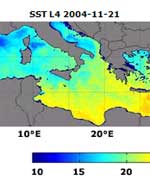
This ultra high-resolution sea surface temperature map of the Mediterranean could only have been made with satellites. Any equivalent ground-based map would need almost a million and a half thermometers placed into the water simultaneously, one for every two square kilometres of sea.

This most detailed ever heat map of all 2 965 500 square kilometres of the Mediterranean, the world’s largest inland sea is being updated on a daily basis as part of ESA’s Medspiration project.

With sea surface temperature (SST) an important variable for weather forecasting and increasingly seen as a key indicator of climate change, the idea behind Medspiration is to combine data from multiple satellite systems to produce a robust set of sea surface data for assimilation into ocean forecasting models of the waters around Europe and also the whole of the Atlantic Ocean.

For the Mediterranean Sea, the Medspiration product is being created to an unprecedented spatial resolution of two square kilometres, as Ian Robinson of the Southampton Oceanography Centre, managing the Medspiration Project explains: “The surface temperature distribution in the Mediterranean contains many finely detailed features that reveal eddies, fronts and plumes associated with the dynamics of water circulation. A resolution as fine as this is needed to allow these features to be properly tracked.”

The remaining ocean products are intended to have a still impressive spatial resolution of ten square kilometres. Overall results from the Medspiration project also feed into an even more ambitious scheme to combine all available SST data into a worldwide high-resolution product, known as the Global Ocean Data Assimilation Experiment (GODAE) High-Resolution Sea Surface Temperature Pilot Project (GHRSST-PP).

Its aim is to deliver to the user community a new generation of highly accurate worldwide SST products with a space resolution of less than ten kilometres every six hours.

As an important step towards achieving this goal, ESA has not only initiated Medspiration as the European contribution to the overall GHRSST-PP effort, but the Agency funded a GHRSST International Project Office, located at the Hadley Centre for Climate Prediction and Research, a part of the UK Met Office located in Exeter.

“Medspiration is at the forefront of the GHRSST-PP effort and is driving the operational demonstration of GHRSST-PP as an international system,” says Craig Donlon, head of the GHRSST Office. “GHRSST has developed with a ‘system of systems’ approach, demanding stable interfaces and comprehensive data handling and processing systems.

“Medspiration is ready to deliver the European component of GHRSST-PP. Over the next 12 months Medspiration will play a fundamental role in partnership with other operational groups in the USA, Australia and Japan as the GHRSST-PP system begins the operational delivery of a new generation of SST data products to European and international user communities in near real time.”

The temperature of the surface of the ocean is an important physical property that strongly influences the transfer of heat energy, momentum, water vapour and gases between the ocean and the atmosphere.

And because water takes a long time to warm up or cool down the sea surface functions as an enormous reservoir of heat: the top two metres of ocean alone store all the equivalent energy contained in the atmosphere.

The whole of their waters store more than a thousand times this same value ? climatologists sometimes refer to the oceans as the ‘memory’ of the Earth’s climate, and measuring SST on a long-term basis is the most reliable way to establish the rate of global warming.

Like thermometers in the sky, a number of different satellites measure SST on an ongoing basis. For example, the Advanced Along-Track Scanning Radiometer (AATSR) aboard ESA’s Envisat uses infrared wavelengths to acquire SST for a square kilometre of ocean to an accuracy of 0.2 ?C. In fact, thanks to its high accuracy, AATSR is helping to calibrate other sensors employed by the Medspiration project.

Other satellites may have decreased accuracy or resolution, but potentially make up for it with cloud-piercing microwave abilities or much larger measuring ‘footprints’. Combine all available satellite data together ? along with localised measurements from buoys and research ships – and you can achieve daily monitoring of the temperature of all the oceans covering 71% of the Earth’s surface. This information is then prepared for input into the relevant ‘virtual ocean’ ? a sophisticated computer model of the genuine article.

The combination of satellite and also available in-situ observations with numerical modelling ? a technique known as ‘data assimilation’ ? is an extremely powerful one. It has revolutionised atmospheric weather forecasting and is now being applied to the oceans.

Near real time observational inputs keep an ocean model from diverting too much from reality, while the outputs from the model make up for any gaps in coverage. With maximised coupling between actual observations and the numerical model, output data can be credibly used for operational tasks such as sea state and algal bloom forecasting, and predicting the path of oil spills. And these models can also be used to look deeper than just the ocean surface.

“The time is coming for operational monitoring and forecasting of three-dimensional global ocean structure,” comments Jean-Louis Fellous, Director for Ocean Research at France’s IFREMER, the French Research Institute for Exploitation of the Sea, a Medspiration project partner. “A project like Medspiration is a key contribution to this endeavour.

“With the capabilities offered by spaceborne SST sensors, by satellite altimeters and by the 1,500 profiling floats measuring temperature and salinity in the deep ocean ? and all this data being fed in near-real time to global ocean models, this vision is becoming a reality.”

Although the new map of the Mediterranean represents an important step forward, both Medspiration and GODAE GHRSST-PP remain works in progress at this point.

The main problem with monitoring high-resolution SST of the Mediterranean is cloud cover. To compensate the team has available a near real time data stream from four separate satellites ? two European, one American and one Japanese. Also applied is a technique called ‘objective analysis’ that minimises cloud effects by interpolating values from just outside the obscured area or from that area measured at times before or after cloud covered it.

Mixing satellite data together on a routine basis is fraught with difficulty because the thermal structure of the upper ocean is actually extremely complex, and different sensors may be measuring different values. There is also considerable day-to-night variability, with daytime temperatures varying with depth much more than those during the night.

Part of the aim of Medspiration is to fully account for this diurnal cycle, in order to improve the overall effectiveness of its data assimilation into ocean forecasting models.

Original Source: ESA News Release