Astronomers Find a Second Pluto

Image credit: NASA/JPL
NASA-funded researchers have discovered the most distant object orbiting Earth’s Sun. The object is a mysterious planet-like body three times farther from Earth than Pluto.

“The Sun appears so small from that distance that you could completely block it out with the head of a pin,” said Dr. Mike Brown, California Institute of Technology, Pasadena, Calif., associate professor of planetary astronomy and leader of the research team. The object, called “Sedna” for the Inuit goddess of the ocean, is 13 billion kilometers (8 billion miles) away, in the farthest reaches of the solar system.

This is likely the first detection of the long-hypothesized “Oort cloud,” a faraway repository of small icy bodies that supplies the comets that streak by Earth. Other notable features of Sedna include its size and reddish color. After Mars, it is the second reddest object in the solar system. It is estimated Sedna is approximately three-fourths the size of Pluto. Sedna is likely the largest object found in the solar system since Pluto was discovered in 1930.

Brown, along with Drs. Chad Trujillo of the Gemini Observatory, Hawaii, and David Rabinowitz of Yale University, New Haven, Conn., found the planet-like object, or planetoid, on Nov. 14, 2003. The researchers used the 48-inch Samuel Oschin Telescope at Caltech’s Palomar Observatory near San Diego. Within days, telescopes in Chile, Spain, Arizona and Hawaii observed the object. NASA’s new Spitzer Space Telescope also looked for it.

Sedna is extremely far from the Sun, in the coldest know region of our solar system, where temperatures never rise above minus 240 degrees Celsius (minus 400 degrees Fahrenheit). The planetoid is usually even colder, because it approaches the Sun only briefly during its 10,500-year solar orbit. At its most distant, Sedna is 130 billion kilometers (84 billion miles) from the Sun, which is 900 times Earth’s solar distance.

Scientists used the fact that even the Spitzer telescope was unable to detect the heat of the extremely distant, cold object to determine it must be less than 1,700 kilometers (about 1,000 miles) in diameter, which is smaller than Pluto. By combining available data, Brown estimated Sedna’s size at about halfway between Pluto and Quaoar, the planetoid discovered by the same team in 2002.

The elliptical orbit of Sedna is unlike anything previously seen by astronomers. However, it resembles that of objects predicted to lie in the hypothetical Oort cloud. The cloud is thought to explain the existence of certain comets. It is believed to surround the Sun and extend outward halfway to the star closest to the Sun. But Sedna is 10 times closer than the predicted distance of the Oort cloud. Brown said this “inner Oort cloud” may have been formed by gravity from a rogue star near the Sun in the solar system’s early days.

“The star would have been close enough to be brighter than the full moon, and it would have been visible in the daytime sky for 20,000 years,” Brown explained. Worse, it would have dislodged comets farther out in the Oort cloud, leading to an intense comet shower that could have wiped out some or all forms of life that existed on Earth at the time.

Rabinowitz said there is indirect evidence that Sedna may have a moon. The researchers hope to check this possibility with NASA’s Hubble Space Telescope. Trujillo has begun to examine the object’s surface with one of the world’s largest optical/infrared telescopes, the 8-meter (26-foot) Frederick C. Gillett Gemini Telescope on Mauna Kea, Hawaii. “We still don’t understand what is on the surface of this body. It is nothing like what we would have predicted or what we can explain,” he said.

Sedna will become closer and brighter over the next 72 years, before it begins its 10,500-year trip to the far reaches of the solar system. “The last time Sedna was this close to the Sun, Earth was just coming out of the last ice age. The next time it comes back, the world might again be a completely different place,” Brown said.

NASA’s Jet Propulsion Laboratory, Pasadena, Calif, manages the Spitzer Space Telescope. For more information about the research and images on the Internet, visit http://www.spitzer.caltech.edu/Media/releases/ssc2004-05. For information about NASA on the Internet, visit http://www.nasa.gov.

Original Source: NASA/JPL News Release

Background on the Rover Airbag System

Image credit: NASA/JPL
Here I was: 26 years old, I had never worked on a flight project before, and all eyes were on me. Every time I walked by the Pathfinder project office, Tony Spear, the project manager, would throw his arm around me and announce, “Hey everybody, the whole mission is riding on this guy right here.”

Our task was to design and build airbags for Pathfinder’s landing on Mars an approach that had never been used on any mission. Airbags may seem like a simple, low-tech product, but it was eye-opening to discover just how little we knew about them. We knew that the only way to find out what we needed to learn was to build prototypes and test them. We just didn’t know how ignorant we were going to be.

Airbags seemed like a crazy idea to a lot of people. Nobody ever said that, mind you, but there seemed to be a widespread feeling that the airbags weren’t going to work. “We’ll let you guys go off and fool around until you fall flat on your faces.” That was the unspoken message I received day after day.

Everyone’s main fear about using these giant airbags was that the lander would be buried in an ocean of fabric when the airbags deflated. I began the search for a solution by building scale models of the airbags and lander, and I played with them in my office for a couple of months.

I built the models out of cardboard and plastic, and taped them up with packing tape I got from the hardware store and ribbon from the fabric store. I used a small raft inflator that I had at home to pump up my model airbags. Over and over again, I filled the miniature airbags and then let them deflate, watching what happened.

I fooled around with a dozen or more approaches before I finally came up with something that I thought worked. Slowly but surely, I came up with the idea of using cords that zigzag through belt loops inside the airbags. Pull the cords a certain way, and the cords would draw in all of the fabric and contain it. Wait to open the lander until after all of the airbags had retracted, and the fabric would be tucked neatly underneath.

Testing on another scale
Once we built large-scale models to conduct drop tests, we started by doing simple vertical drops, first at 30 feet, and then up to 70 feet. The bags performed well, although the way they bounced like a giant ball was interesting to observe. People began to realize that the concept might just be reasonably sound. But we still had our doubters. Even after we had the mechanics figured out for the airbags, a big question remained: What about the rocky Martian terrain?

Landing on Mars, we had to accept whatever Mother Nature gave us. The Pathfinder wouldn’t have a landing strip. To simulate conditions on Mars, we brought in large lava rocks the size of a small office desk. They were real lava rocks that our geologists had gone out and picked; if you tried to handle one of them, you would cut up your hands.

The more landscape simulations we tested, the more we started tearing up the airbags. Things were not looking good. Once again, we realized that this was an area that we just didn’t understand. The challenge was to protect the bladder layer, essentially the inner tube of the airbag system, with as little fabric as possible because the project could not afford to just throw mass at the problem. We tried material after material heavy duty Kevlars and Vectrans among them applying them in dozens of different configurations to the outside of the airbag.

Ultimately, we knew that we could just throw on more and more material and come up with a reasonably performing airbag system, but the weight of that solution would have come at the expense of something else another component of Pathfinder would have to be sacrificed. We weren’t, however, going to Mars just to land there and take a few pictures. We wanted to go there and do science and we needed instruments to do that science. So there was a lot of motivation to come up with the lowest-mass, highest-performance airbag system that we could.

5, 4, 3, 2, 1
Each test became like a ritual, because it took between eight and ten hours to prepare the system including transporting the airbags into the vacuum chamber, getting all of the instrumentation wired up, raising the airbags up to the top of the chamber, making sure all the rocks were in the right place, and preparing the nets.

The vacuum chamber where we did the drop tests used so much power that we were only able to test in the middle of the night. Once the doors of the vacuum chamber were closed, it took three or four hours just to pump down the chamber. At that point, everybody either broke for dinner or went to relax for a while, before coming back at midnight or whatever the appointed hour was. Then we had another 45 minutes of going over all of the instrumentation, going through checklists, and then ultimately the countdown.

The last 30 seconds of the countdown were excruciating. All of that anticipation, and then the whole impact lasted less than one second.

When we finished a drop test, we knew right away whether it was a success or failure. Brian Muirhead, the flight systems manager, was always insistent that I call him immediately-no matter how late it was. At 4 a.m., I would call him at his home and have to give him the news, “Brian, we failed another test.”

Each test was followed by a high-pressure rush to figure out what went wrong, what test to run next, how to fix the extensively damaged bags, and how to simultaneously incorporate whatever new “experimental fix” we came up with. As a team, we agreed upon a course of action, usually in a surly, sleep-deprived mood over a greasy breakfast at a local diner. Then the ILC Dover folks would figure out any new patterns that needed to be generated as well as the detailed engineering to ensure the seams and stitch designs could handle the test loads. Our hero was our lead sewer, who incidentally sewed Neil Armstrong and Buz Aldren’s moon suits. She worked under less-than-ideal conditions while we slept and turned our sometimes unusual ideas into reality. Usually by the next day we were ready to do it all over again.

Tony Spear and Brian understood the challenges we were facing. They knew we had a solid team working on this, and I always kept them informed on the technical progress. They were always understanding, but that’s not to say they were always happy.

Back to the drawing board
We said, “Okay, let’s start doing analysis, computer modeling of the airbags and the impact against the rocks.” At the same time, we expanded our test program to understand how to optimize this airbag abrasion layer.

It turned out that the time, money, and effort we expended on the computer modeling didn’t pay off. Though we ran the most sophisticated programs available back in 1993 and 1994, the results didn’t help us design the abrasion layer. We had to rely on our prototypes.

After doing dozens of drop tests, looking at the data, and studying what was happening, we started to realize that a single layer of heavy material wasn’t the solution. Multiple layers of lightweight material might prove stronger.

We were forced to decide on the final abrasion layer design in order to meet our scheduled Qualification drop tests. In spacecraft terms, this is supposed to be the last test that you run in order to qualify your final design. By the time you get to that point, there is supposed to be no question whatsoever that you have a fully functioning system that meets all of the mission requirements. It is supposed to be a check-the-box process that the system is ready for flight. The problem was that at that point we had still only experienced partial success; we’d never had that A+, 100% grade on any of our drop tests.

Flying in to watch that last drop test, my plane was delayed. One of my colleagues at the test facility called and asked me, “Do you want us to wait for you?” I told him, “No, go ahead.”

When I got to the facility, the test crew wasn’t there. I went into the control room and ran into the guy who processes the videotapes. “So what happened?” I asked him. “Did you guys do the test?” He pointed at a VCR and said, “The video is in there. Just go ahead and press play.”

So, I hit play. Down comes the airbag in the video it hits the platform and explodes catastrophically. My heart sank. We weren’t going to make it. But then I realized that there was something strangely familiar about the video I had just watched. In an instant it came to me; they had put in the videotape from our worst drop test. The practical joke could mean only one thing: We had had a successful drop test, and were finally good to go.

Original Source: NASA/JPL Story

Atlas III Launches MBSAT Satellite

Image credit: ILS
An International Launch Services (ILS) Atlas III rocket blasted off early this morning, successfully orbiting the MBSAT satellite for Space Systems/Loral (SS/L). This was the 70th consecutive successful flight of an Atlas vehicle, and the second launch of the year conducted by ILS, a Lockheed Martin (NYSE: LMT) joint venture.

Liftoff was at 12:40 a.m. EST, and the SS/L 1300 model satellite separated from the rocket 29 minutes later. SS/L built the satellite and contracted with ILS to deliver it in orbit for Mobile Broadcasting Corp (MBCO) of Japan and SK Telecom of Korea. The state-of-the-art satellite will deliver digital multimedia information services such as CD-quality audio, MPEG-4 video and data to mobile users throughout Japan and Korea.

?This is a landmark launch for the Atlas team,? said ILS President Mark Albrecht. ?The Atlas rocket has a perfect record over more than a decade, but we?ll never get complacent. We still take it one launch at a time, and that discipline and dedication is what has given us the world?s most reliable vehicle.?

This was the fifth flight for the Atlas III vehicle, is one of three Atlas models currently being flown. It is a transitional vehicle between the Atlas II series that has been flying since 1991, and the powerful Atlas V, which made its debut successfully in 2002. The Atlas II, III and V families have achieved 100 percent success since mid-1993.

Albrecht noted that this is the 21st SS/L-built satellite launched by ILS vehicles, which include not only the Atlas family but also the Russian-built Proton rocket. ILS is a joint venture of Lockheed Martin, which builds the Atlas rocket, and Khrunichev State Research and Production Space Center, which builds the Proton vehicles. ILS, based in McLean, Va., markets and manages all missions for Atlas and commercial missions on Proton. ILS offers the broadest range of launch services in the world along with products with the highest reliability in the industry.

Original Source: ILS News Release

Help Support Universe Today

I’ve had several generous offers from readers wondering how they could donate money to help me maintain Universe Today; which, as you know is pretty much a labour of love. I’ve felt a little uncomfortable about the idea, but a few of you have been very persistent. 🙂

So, I’ve gone ahead and set up with Paypal so you can donate money to Universe Today. If you feel that this website and newsletter are of value to you, and you want to contribute, just click this link which will take you to a form where you can donate money with your credit card. Universe Today has always, and will always be free. This is totally voluntary, and I leave it up to you to contribute only if it’s something you want to do. Knowing me, I’ll probably just use additional funds to hire some additional writers.

Thanks for all your support and kindness, I really appreciate it.

Fraser Cain
Publisher
Universe Today

P.S. People have also been wanting updated pictures of Chloe and Logan. Here’s Chloe with her favorite alien brainsucker hat.

Cassini Sees Clumps in Saturn’s Rings

Image credit: NASA/JPL
Clumps seemingly embedded within Saturn’s narrow, outermost F ring can be seen in these two Cassini narrow angle camera images taken on Feb. 23, 2004 from a distance of 62.9 million kilometers (39 million miles). The images were taken nearly two hours apart using the camera’s broadband green filter, centered at 568 nanometers. Image scale is 377 kilometers (234 miles) per pixel.

The core of the F ring is about 50 kilometers (31 miles) wide, and from Cassini’s current distance, is not fully resolvable. Contrast has been greatly enhanced, and the images have been magnified, to aid visibility of the F Ring and the clump features.

The images show clumps as they revolve about the planet. Like all particles in Saturn’s ring system, these features orbit the planet in the same direction in which the planet rotates. This direction is clockwise as seen from Cassini’s southern vantage point below the ring plane. Two clumps in particular, one of them extended, can be seen in the upper part of the F ring in the image on the left, and in the lower part of the ring in the image on the right. Other knot-like irregularities in the ring’s brightness can also be seen in the right hand image.

Clumps such as these were first seen when the two Voyager spacecraft flew past Saturn in 1980 and 1981. It is not certain what causes these features, though several theories have been proposed, including meteoroid bombardment and inter-particle collisions in the F ring.

The Voyager data suggest that while the clumps change very little and can be tracked as they orbit for 30 days or more, no identified clump survived from the Voyager 1 flyby to the Voyager 2 flyby nine months later. Thus, scientists have only a rough idea of the lifetime of clumps in Saturn’s rings – a mystery that Cassini may help to answer.

The small dot at center right in the second image is one of Saturn’s small moons, Janus (181 kilometers, 112 miles across). Janus was discovered by ground-based astronomers in 1966, and was first resolved by the Voyager 1 spacecraft in 1980. The moon shares almost the same orbit with another small satellite, Epimetheus. Janus and Epimetheus, both thought to consist mostly of porous ices, play a role in maintaining the outer edge of Saturn’s A ring.

The Cassini-Huygens mission is a cooperative project of NASA, the European Space Agency and the Italian Space Agency. The Jet Propulsion Laboratory, a division of the California Institute of Technology in Pasadena, manages the Cassini-Huygens mission for NASA’s Office of Space Science, Washington, D.C. The imaging team is based at the Space Science Institute, Boulder, Colorado.

For information about the Cassini-Huygens mission, http://saturn.jpl.nasa.gov and the Cassini imaging team home page, http://ciclops.org.

Original Source: NASA/JPL News Release

Spirit Sees the Earth

Image credit: NASA/JPL
Consistently highly rated among those memorable ‘money-shots’ from the current Mars’ surface exploration is a view looking back towards the Earth. On Thursday, the Spirit rover team released the banner image showing the Earth as a tiny gray dot in the martian sky near the horizon.

The history of such views backwards towards the home planet, Terra Firma, have captivated the imagination for a generation of astronomers. This glimpse from the surface of another planet offers an unrivalled perspective that stretches beyond just seeing our home as one of many planets, or the only pale blue dot in our solar system.

As Carl Sagan’s widow, Anne Druyan , described this perspective image to Astrobiology Magazine, such earth views make “us look at this tiny planet, at the pale blue dot, and to see it in its real context, in its actual circumstances, in its true tininess. I don’t know anyone who’s able to really see that one-pixel Earth and not feel like they want to protect the Earth; that we have much more in common with each other than we’re likely to have with anyone anywhere else.”

The evocative phrase describing the Earth as a ‘pale blue dot’ was coined by Carl Sagan after seeing our planet as a single pixel. The view was taken from the departing Voyager spacecraft. The entire earth could be encompassed as a flicker of light. The first image of Earth ever taken from another planet that actually shows our home as a planetary disk was captured by the Mars Orbital Camera on May 8th.

One question that might be answerable from such a world-view is could a scientist on Mars identify from such a perspective that the Earth harbored life. In 1993, a team of researchers inspired by Carl Sagan, used an Earth fly-by of the Galileo spacecraft on its way to Jupiter to catch a glimpse of how the Earth might appear from afar. For astrobiologists, Sagan’s results were surprising.

Rather than seeing the Earth as an obvious candidate for life, the Galileo pictures gave surprisingly few clues of the biological potential of our own planet.

From afar, how Galileo missed the obvious signs of terrestrial life as we would have expected to see them, was at first disconcerting to the scientific community, because future missions aim to observe more distant extrasolar planets and detect what would be visible in the spectra–the ‘pale blue dot’ scenario.

One answer may lie in the fact that the spacecraft made its observations while still quite close to the Earth.

“The spectrograph was designed to look at small areas of Jupiter, so the field of view of the spectrograph was quite small,” said Nick Woolf of Arizona, in earlier discussions with the Astrobiology Magazine.

“Also, since the surface brightness of Jupiter [the Gaileo’s intended visual target] is far less than the Earth, the spectrograph detectors saturated except when the spectrograph was pointed at the darkest area of Earth – a cloud-free section of sea,” Woolf noted. The cloud-free sea is considered very dark relative to the dominance of bright clouds in a global picture of Earth. Thus it should come as no surprise that Galileo was successful in only imaging a relatively dark and lifeless planet, mainly because its design was not intended to look at Earth, but to probe Jupiter instead.

A spectroscope that might detect infrared or visible light looking back on Earth or outwards to other planets might focus mainly on four gases that are found in Earth’s atmosphere and linked to life:

* Water vapor A baseline sign, indicating the presence of liquid water, a requirement of known life.
* Carbon dioxide Can be created by biological and non-biological processes. Because it is necessary for photosynthesis, it would indicate the possible presence of green plants.
* Methane Considered suggestive of life, it also can be made both by biological and non-biological processes.
* Molecular oxygen (O2) – or its proxy, ozone (O3). The most reliable indicator of the presence of life, but still not conclusive.

Unless molecular oxygen in the atmosphere is constantly replenished by photosynthesis, it is quickly consumed in chemical reactions, in the atmosphere, on land and in seawater. So the presence of a large amount of oxygen in an extrasolar planet’s atmosphere would be a sign that it might host an ecosystem like present-day Earth’s.

An additional oxygen-related biosignature is the possibility of detecting green plants that make oxygen. Chlorophyll reflects near-infrared light very strongly, a phenomenon known as the “red edge” because the light is just beyond the range of colors human eyes can see. (If humans could see the red edge, plants would look red instead of green.) Near-infrared cameras would have no trouble picking up this distinctive signal.

Not only are earth-views aesthetically interesting, while offering a chance to test remote sensing scenarios, the rovers more practically depend on a daily sky view to navigate. The rover design does not possess any intrinsic way of knowing its orientation as north or south for instance, because Mars doesn’t offer a strong magnetic field that might typically give a compass reading. So scientists point the rover’s mobile panoramic camera to do a sun sighting daily, which also provides today’s orientation. Navigating by stars on Mars is also possible although the rovers’ solar power arrays typically are put into electronic sleep-modes at night to conserve power.

Spirit imaged stars on March 11, 2004, after it awoke during the martian night for a communication session with NASA’s Mars Global Surveyor orbiter. This image is an eight-second exposure. Longer exposures were also taken. The images tested the capabilities of the rover for night-sky observations. Scientists will use the results to aid planning for possible future astronomical observations from Mars.

Original Source: NASA Astrobiology Magazine

Santa Ana Winds Stimulate Marine Environment

Image credit: NASA/JPL
Southern California’s legendary Santa Ana winds wreak havoc every year, creating hot, dry conditions and fire hazards. Despite their often-destructive nature, a study of the “Devil Winds,” conducted using data from NASA’s Quick Scatterometer (Quikscat) spacecraft and its SeaWinds instrument shows the winds have some positive benefits.

“These strong winds, which blow from the land out into the ocean, cause cold water to rise from the bottom of the ocean to the top, bringing with it many nutrients that ultimately benefit local fisheries,” said Dr. Timothy Liu, a senior research scientist at NASA’s Jet Propulsion Laboratory, Pasadena, Calif., and Quikscat project scientist. Santa Ana consequences include vortices of cold water and high concentrations of chlorophyll 400 to 1,000 kilometers (248 to 621 miles) offshore.

Liu and Dr. Hua Hu of the California Institute of Technology, Pasadena, in a paper published last year in Geophysical Research Letters, revealed satellite observations of the Santa Ana effects on the ocean during three windy days in February 2003. According to the findings, Quikscat was able to identify the fine features of the coastal Santa Ana wind jets. It identified location, strength and extent, which other weather prediction products lack the resolution to consistently show, and moored ocean buoys lack sufficient coverage to fully represent.

Quikscat’s high-resolution images of air-sea interaction were used to measure wind forces on the ocean. Other satellites and instruments, like the Sea-viewing Wide Field-of-view Sensor (SeaWiFS) and the Advanced Very High Resolution Radiometer, onboard a National Oceanic and Atmospheric Administration polar orbiting weather satellite, were used to measure the temperature and biological production of the ocean surface, which respond to the wind.

The latter instrument showed sea surface temperatures dropped four degrees Celsius (seven degrees Fahrenheit) during the February 2003 Santa Anas. That was a sign that upwelling had occurred, meaning, deep cold water moved up to the ocean surface bringing nutrients. Images from SeaWiFS confirmed the increased biological productivity by measuring chlorophyll concentrations in the surface water. It went from negligible, in the absence of winds, to very active biological activity (more than 1.5 milligrams per cubic meter) in the presence of the winds.

“There really is no other system that can monitor Santa Ana winds over the entire oceanic region,” Liu said. “Scatterometers such as Quikscat have a large enough field of view and high enough resolution to easily identify the details of coastal winds, which can affect the transportation, ecology and economy of Southern California.”

High pressure develops inland when cold air is trapped over the mountains, driving the dry, hot and dusty Santa Anas (also called Santanas and Devil’s Breath) at high speeds toward the coast. The winds, occurring in fall, winter and spring, can reach 113 kilometers (70 miles) per hour. They happen at any time of day and usually reach peak strength in December. Telltale signs on the coast include good visibility inland, unusually low humidity and an approaching dark brown dust cloud.

The Quikscat satellite, launched in June 1999, operates in a Sun- synchronous, 800-kilometer (497-mile) near-polar orbit. It circles Earth every 100 minutes and takes approximately 400,000 daily measurements over 93 percent of the planet’s surface. It passes over Southern California about twice a day, skipping a day every three or four days.

Quikscat is part of an integrated Earth observation system managed by NASA’s Office of Earth Science. The NASA enterprise is dedicated to understanding the Earth as an integrated system and applying Earth System Science to improve prediction of climate, weather, and natural hazards using the unique vantage point of space.

For information about NASA programs on the Internet, visit:

http://www.nasa.gov.

For information about Quikscat and SeaWinds on the Internet, visit:

http://winds.jpl.nasa.gov.

Original Source: NASA/JPL News Release

Spirit at the Edge of Bonneville Crater

Image credit: NASA/JPL
NASA’s Spirit has begun looking down into a crater it has been approaching for several weeks, providing a view of what’s below the surrounding surface.

Spirit has also been looking up, seeing stars and the first observation of Earth from the surface of another planet. Its twin, Opportunity, has shown scientists a “mother lode” of hematite now considered a target for close-up investigation.

“It’s been an extremely exciting and productive week for both of the rovers,” said Spirit Mission Manager Jennifer Trosper at NASA’s Jet Propulsion Laboratory, Pasadena, Calif.

Dr. Chris Leger, a rover driver at JPL, said, “The terrain has been getting trickier and trickier as we’ve gotten close to the crater. The slopes have been getting steeper and we have more rocks.” Spirit has now traveled a total of 335 meters (1,099 feet).

Spirit’s new position on the rim of the crater nicknamed “Bonneville” offers a vista in all directions, including the crater interior. The distance to the opposite rim is about the length of two football fields, nearly 10 times the diameter of Opportunity’s landing-site crater halfway around the planet from Spirit.

Initial images from Spirit’s navigation camera do not reveal any obvious layers in “Bonneville’s” inner wall, but they do show tantalizing clues of rock features high on the far side, science-team member Dr. Matt Golombek of JPL said at a news briefing today. “This place where we’ve just arrived has opened up, and it’s going to take us a few days to get our arms around it.?

Scientists anticipate soon learning more about the crater from Spirit’s higher-resolution panoramic camera and the miniature thermal emission spectrometer, both of which can identify minerals from a distance. They will use that information for deciding whether to send Spirit down into the crater.

From the crater rim and during martian nighttime earlier today, Spirit took pictures of stars, including a portion of the constellation Orion. Shortly before dawn four martian days earlier, it photographed Earth as a speck of light in the morning twilight. The tests of rover capabilities for astronomical observations will be used in planning possible studies of Mars’ atmospheric characteristics at night. Those studies might include estimating the amounts of dust and ice particles in the atmosphere from their effects on starlight, said Dr. Mark Lemmon, a science team member from Texas A&M University, College Station.

Opportunity has been looking up, too. It has photographed Mars’ larger moon, Phobos, passing in front of the Sun twice in the past week, and Mars’ smaller moon, Deimos, doing so once.

Opportunity’s miniature thermal emission spectrometer has taken upward-looking readings of the atmospheric temperature at the same time as a similar instrument, the thermal emission spectrometer on NASA’s Mars Global Surveyor orbiter, took downward-pointed readings while passing overhead. “They were actually looking directly along the same path,” said science team member Dr. Michael Wolff of the Martinez, Ga., branch of the Space Science Institute, Boulder, Colo. The combined readings give the first full temperature profile from the top of Mars’ atmosphere to the surface.?

When pointed at the ground, Opportunity’s miniature thermal emission spectrometer has checked the abundance of hematite in all directions from the rover’s location inside its landing-site crater. This mineral, in its coarse-grained form, usually forms in a wet environment. Detection of hematite from orbit was the prime factor in selection of the Meridiani Planum region for Opportunity’s landing site.

“The plains outside our crater are covered with hematite,” said Dr. Phil Christensen of Arizona State University, Tempe, lead scientist for the instrument. “The rock outcrop we’ve been studying has some hematite. Parts of the floor of the crater, interestingly enough, have virtually none.” The pattern fits a theory that the crater was dug by an impact that punched through a hematite-rich surface layer, he said. One goal for Opportunity’s future work is to learn more about that surface layer to get more clues about the wet past environment indicated by sulfate minerals identified last week in the crater’s outcrop.

Christensen said that before Opportunity drives out of the crater in about 10 days, scientists plan to investigate one area on the inner slope of the crater that he called “the mother lode of hematite.”

JPL, a division of the California Institute of Technology in Pasadena, manages the Mars Exploration Rover project for NASA’s Office of Space Science, Washington, D.C. Images and additional information about the project are available from JPL at http://marsrovers.jpl.nasa.gov and from Cornell University at http://athena.cornell.edu.

Original Source: NASA/JPL News Release

Lawmakers Express Concerns Over Bush Initiative

Image credit: NASA
Expert witnesses before the House Science Committee today endorsed the broad outlines of the President’s space exploration initiative, but called for changes and refinements in some of its elements.

Specifically, several witnesses criticized the reductions proposed in NASA’s space science programs to pay for the initiative, and they urged NASA to come up with new ways to get fresh ideas into the program, including from entrepreneurs and the public. The witnesses also agreed that understanding and counteracting the effects of radiation in space on human physiology is one of the most serious hurdles to sustained human activity in space. Two of the witnesses argued that the moon might not be a sensible interim goal for the exploration initiative, but others endorsed the approach outlined in the President’s plan – first the space station, then the moon and then Mars.

Committee Chairman Sherwood Boehlert (R-NY) and Ranking Democrat Bart Gordon (D-TN) both emphasized their continuing concerns with the potential costs.

“I think all I need to say about my views this morning is to reiterate that I remain undecided about whether and how to undertake the exploration program. I would add that, as the outlines of the likely fiscal 2005 budget become clearer, my questions about the initiative only become more pressing,” said Boehlert.

Boehlert added that the fiscal 2005 NASA budget proposal needed to be reviewed in the context of the entire federal science budget. “My strong feeling, and I think it’s shared by others on this Committee, is that a society unwilling to invest in science and technology is a society willing to write its own economic obituary. So we’re looking in the broad category of science?and then NASA is a subset of that, and a subset of our investment in NASA is human versus unmanned. And so we’re trying to get answers to some very specific questions involving cost and risk – answers that are not easy to come up with.”

Gordon stated, “I support the goal of exploring our solar system. However, until I am convinced that the President’s plan to achieve that goal is credible and responsible, I am not prepared to give that plan my support.”

Witnesses had differing views on the costs. Dr. Michael Griffin, President and Chief Operating Officer of In-Q-Tel, said budget estimates of the cost of the President’s initiative – “$50-55 billion to rebuild a basic Apollo-like capability by 2020” – were overestimated. He noted this estimate was considerably higher than a 1991-1993 lunar outpost study he was involved in of which top-level cost estimates were about $30 billion in 2003 dollars, or 40 percent less than the President’s proposal.

Space and Aeronautics Subcommittee Chairman Dana Rohrabacher (R-CA) asked Dr. Griffin what he would “predict it would take us to go to the moon and then to go Mars?” Griffin answered, “I believe that the first expeditions to Mars should be accomplishable within an amount of funding approximately equal to what we spent on Apollo?in today’s dollars, about $130 billion. Certainly that would envelope it. I believe that it should be possible to return to the moon for in the neighborhood of $30 billion in today’s dollars. And those are both fairly comfortable amounts.” Griffin said those missions could “easily” be accomplished within those dollar amounts in 10 years, but “you would have to decide to do it and to allocate the money, but I think that’s the level of resource commitment that’s required.”

Dr. Donna Shirley, Director of the Science Fiction Museum and Hall of Fame in Seattle and former Manager of the Mars Exploration Program at NASA’s Jet Propulsion Laboratory said she thought Dr. Griffin’s numbers were “pretty good, provided that we do the stepping-stone to the moon and we don’t stop there and we don’t start building infrastructure and don’t start doing what we did with Space Station. If we go to the moon and then right on to Mars?those are not bad numbers.”

“I do not have the figures to either agree or disagree with Dr. Griffin’s. I do however fear that once committing to go back to the moon we’ll never make it to Mars,” added Dr. Laurence Young, Apollo Program Professor at the Massachusetts Institute of Technology and Founding Director of the National Space Biomedical Research Institute in Houston.

Dr. Lennard Fisk, Chair of the National Research Council’s Space Studies Board urged policymakers to consider a “learn-as-you-go” approach. “Deciding on these answers – how fast you go back to the moon, how much does it cost you, whether you go to Mars, is going to depend on each incremental step that we go?the moon appeals to me for the simple reason that we have an opportunity to go there and try out some of our technical solutions on the way and decide whether they’re going to be adequate?The cost of this thing should not – I don’t think we should try to find a number. We should try and find a number of what are the steps that we should take on which we learn something and we adjust our program to take the next logical step – incrementally walk through this thing,” said Dr. Fisk.

Mr. Norman Augustine, chair of the Advisory Committee on the Future of the U.S. Space Program and former Chief Executive Officer of Lockheed Martin, expressed his strong support for such a “stepwise” approach over such a long-term program. “If, for example, we are to pursue an objective that requires twenty years to achieve, that then implies we must have the sustained support of five consecutive presidential administrations, ten consecutive Congresses and twenty consecutive federal budgets – a feat the difficulty of which seems to eclipse any technological challenge space exploration may engender. This consideration argues for a major space undertaking that could be accomplished in step-wise milestones, each contributing to a uniting long-term goal?It is this consideration which justifies a mission to Mars with an initial step to the moon – as philosophically opposed to a return to the moon with a potential visit to Mars.”

Space and Aeronautics Subcommittee Ranking Member Nick Lampson (D-TX) noted, “Mr. Augustine states in his written testimony that ‘it would be a grave mistake to try to pursue a space program ‘on the cheap.’ To do so is in my opinion an invitation to disaster.’ I could not agree more.”

Young discussed one of the most difficult challenges facing human missions to the moon or Mars: the impact of spending long periods in space on the human body. Dr. Young stated, “Overall, the current suite of exercise countermeasures, relying primarily on treadmill, resistance devices, is unreliable, time consuming, and inadequate by itself to assure the sufficient physical conditioning of astronauts going to Mars. Radiation remains the most vexing and difficult issue.” He discussed some research being conducted, but noted much remains to be done. He also argued, “The proposal to limit [International Space Station] research to the impact of space on human health and to end support for other important microgravity science and space technology seems short-sighted.”

Shirley also expressed several concerns with the President’s plan, noting, “The costs of the program are difficult to evaluate but there appear to be several strategic flaws, including a possibly premature phase-out of the shuttle and premature focus on a specific approach. There is no real information on which to judge the impact of exploration on other NASA missions.” She recommended that the Administration revisit the nation’s space exploration goals and suggested a process including workshops and studies that would bring in a wide-range of new stakeholders and fully engage the public in the effort.

Original Source: House Committee on Science News Release

NASA’s Future Plans for Mars Exploration

Image credit: NASA/JPL
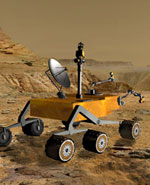
Since their arrivals on Mars, our two robotic wanderers have sent us incredible images and data from one of our nearest neighbors in the Solar System. The primary science objective of the Mars Exploration Rovers (MERs) is to determine to what degree the past action of liquid water on Mars has influenced the Red Planet’s environment over time.

While there is no direct evidence of liquid water on the surface of Mars today, the record of past water activity on Mars can be found in the rocks, minerals, and geologic landforms, particularly in some specific, diagnostic features that we believe form only in the presence of water. That is why both MERs are equipped with special tools to enable them to study a diverse collection of rocks and soils that may hold clues to past water activity on Mars and determine whether the planet ever had the potential to harbor life in the long-distant past, or, much less likely, today.

The information that NASA has gleaned in just the short amount of time that Spirit and Opportunity have been on the surface of Mars has been incredibly revealing. We have images that show rocks and surface structures in unprecedented detail. We are seeing a side of Mars that is vastly different from what we have encountered during past missions, because we targeted these special rovers to explore places that we knew would be compelling.

While we are incredibly pleased with the data and images we have obtained thus far and look forward to many more, we must not forget that traveling to and exploring Mars is a very challenging endeavor. As I have said many times before – both here on Capitol Hill and in the press – Mars is an extremely exciting and compelling Solar System destination, but it is also an incredibly difficult target, as history has often proven.

The landing and subsequent rollout of the two Rovers were practically picture perfect, which is a daunting engineering feat in and of itself, and one which makes me proud of NASA’s talented and capable Mars team. However, lest we became too confident about our Mars conquest, we were reminded of the significant challenges that operating on the Red Planet entails when the Spirit rover presented the Mars team with a serious technical challenge.

Spirit touched down in an area of Mars known as the Gusev Crater on January 4, 2004. After eighteen days of nearly flawless operation and after returning significant scientific data, including striking pictures of distant hills – and a rock affectionately dubbed “Adirondack ” – the Spirit rover developed an apparent communications problem that initially baffled the entire Mars team. In the ensuing days, Spirit sent us intermittent signals, and we sent the spacecraft numerous queries to try to diagnose the exact nature of the problem.

We were able to determine that the problem was related to software, and the team at JPL developed the necessary procedures and protocols to get Spirit back in business. Had Spirit’s communication problem been a hardware issue, we would be in much more dire straits for obvious reasons. Spirit is now performing as it was intended and continuing to explore its Martian surroundings.

Having actual data transmissions from Spirit’s descent to the Martian surface also provided significant benefits for the team planning the landing of the second Mars rover, Opportunity. Actual descent data from the first spacecraft were used to confirm our models of the behavior of the Martian atmosphere and weather – models which we depended on to plan Opportunity’s descent. The data from Spirit indicated that, while the descent was within the predicted limits of our engineering model, it was close to edge of the anticipated margins.

Armed with this new knowledge, NASA opted to open Opportunity’s parachute earlier to provide for a slower descent and a more gentle arrival on the Red Planet. On January 25, 2004, Opportunity bounced onto the opposite side of Mars – in an area called Meridiani Planum – from where its twin had landed.

The new landing location was “a world away ” from Gusev Crater in more ways than just distance. The initial images transmitted later that day fascinated the science team, revealing an area of dark soil and possible bedrock – a feature we have long searched for but never seen before on any planet’s surface – interspersed with patches of the more familiar red Martian soil. This region of Mars particularly interested planetary geologists because they believed it may contain abundant deposits of hematite, a mineral that, when found on Earth, has usually formed in the presence of persistent liquid water. We now know that their suspicions were correct.

On March 2, 2004, NASA announced that the Opportunity rover had found strong evidence that the area called Meridiani Planum was once soaking wet. Evidence found in an outcrop of rock led scientists to this important conclusion. Clues from the rocks’ composition, such as the presence of sulfates and salts, and the rocks’ physical attributes (e.g., niches where crystals once grew) helped make the case for a watery history. This area is scientifically compelling, and we intend to study it in further detail, hopefully revealing more secrets of the Red Planet.

Missions to Mars are launched approximately every two years (26 months), when the orbital alignments of the Earth and Mars allow the minimum amount of fuel to be used on the long trip. At each of these launch opportunities, NASA plans to send robotic spacecraft to Mars to continue searching for evidence of water, studying the rocks and soil of the planet, and attempting to answer the question, “Did life ever arise on Mars?” The Mars Exploration Program will attack this question by seeking to understand, in a systematic way, the current state and evolution of the atmosphere, surface, and interior of Mars, the potential for life on Mars in the past or present, and develop knowledge and technology necessary for future human exploration.

NASA’s Mars Program
This program is the result of an intensive planning process involving the broad science and technology community. The program incorporates the lessons learned from previous missions and builds upon, as well as responds to, scientific discoveries from past and on-going missions. In addition to the MERs, missions that comprise this systematic approach to Mars exploration are:

1. Mars Global Surveyor (MGS) – launched in 1996, this mission continues to return an unprecedented amount of data regarding Mars’ surface features and composition, atmosphere, weather, and magnetic properties. Scientists are using the data gathered from this mission both to learn about the Earth by comparing it to Mars and to build a comprehensive data set to aid in planning future missions. MGS also serves as a telecommunications relay for the MER missions, as well as a device for photographing landed spacecraft on the surface, such as the rovers.

2. Mars Odyssey – launched in 2001, the Odyssey orbiter is presently mapping the mineralogy and morphology of the Martian surface while achieving global mapping of the elemental composition of the surface and the abundance of hydrogen in the shallow subsurface. Its maps of hydrogen have suggested vast amounts of near-surface water ice in the polar regions of the planet. It also serves as a telecommunications relay for the MER missions.

3. Mars Reconnaissance Orbiter (MRO) – scheduled for launch in 2005, MRO will focus on analyzing the surface at unprecedented new scales in an effort to follow tantalizing hints of water detected in images from the MGS and Odyssey spacecraft and to bridge the gap between surface observations and measurements from orbit. For example, MRO will measure thousands of Martian landscapes at 20- to 30-centimeter (8- to 12-inch) resolution, enabling observation of features the size of beach balls, while also mapping their mineralogies. This will help NASA target future landed laboratories to the best sites to search for evidence of life.

4. Phoenix – scheduled to launch in 2007, this mission will conduct a stationary, surface-based investigation of water ice contained within Martian soils, as well as searching for organic molecules and observing modern climate dynamics. It aims to “follow the water” and measure indicator molecules at high-latitude sites where Mars Odyssey has discovered evidence of large water ice concentrations in the Martian soil. Phoenix was selected as the first of the competed Mars Scout missions.

5. Mars Science Laboratory (MSL) – schedule to launch in 2009, this next generation rover represents a major leap in surface measurements and pave the way for future sample return and astrobiology missions. A long-life power source is planned to allow the science laboratory to conduct experiments for up to two years. Instruments for this surface laboratory may provide direct evidence of organic materials, if any exist, and will be able to search up to several feet beneath the surface. MSL will also demonstrate technologies for accurate landing and hazard avoidance in order to reach what may be very promising, but difficult-to-reach, scientific sites. Its landing location will be based on observations by the Mars Reconnaissance Orbiter. In the ensuing decade, from 2011-2018, NASA plans additional science orbiters, rovers, and landers, and the first mission to return the most promising Martian samples to Earth.

Current strategies call for the first sample return mission to be launched by 2014. Options that would significantly increase the rate of missions launched and/or accelerate the schedule of exploration are under study. Technology development for advanced capabilities, such as miniaturized surface science instruments and deep drilling to several hundred feet, will also be carried out in this period.

NASA has developed a campaign to explore Mars that will change and adapt over time in response to what is discovered and learned with each mission. The plan is meant to be a robust, flexible, long-term program that will provide the highest probability for success. We are moving from the early era of global mapping and limited surface exploration to a much more intensive and discovery-responsive approach. We will establish a sustained presence in orbit around Mars and on the surface with long-duration exploration of some of the most scientifically promising and intriguing places on the planet.

We plan to “follow the water,” so that in the not-too-distant future we may finally know the answers to the most far-reaching questions about the Red Planet we humans have asked over the generations: Did life ever arise there, and does life exist there now?

What’s Next
On January 14, 2003, President Bush announced his new vision for NASA and the Nation’s space program, and just last month the President’s FY 2005 budget was released. Both of those events support and indeed strengthen NASA’s vision for Mars exploration over the next decade and beyond. NASA’s comprehensive, robotic approach to exploring Mars and learning the intricacies of its environment will not only seek to achieve the science goals outlined in this testimony, it will also serve as a solid foundation for the President’s vision of eventually conducting a human exploration mission to Mars.

Original Source: Astrobiology Magazine