One Month Until Spirit Lands

Image credit: NASA/JPL

NASA’s twin rovers, Spirit and Opportunity, are still on track to reach the Red Planet in early January. Spirit, which launched first, is scheduled to arrive on the evening of January 3, 2004 near the centre of Gusev Crater, which might have held a lake in the past. The spacecraft will jettison its cruise stage 15 minutes before hitting the top of the Martian atmosphere, and then will slow down to only 1,500 kph before deploying its parachute. 20 seconds later its retrorockets will fire and the spacecraft will cushion its final few metres with an airbag. The rover will then spend three months exploring the Martian surface.

NASA’S robotic Mars geologist, Spirit, embodying America’s enthusiasm for exploration, must run a grueling gantlet of challenges before it can start examining the red planet. Spirit’s twin Mars Exploration Rover, Opportunity, also faces tough Martian challenges.

“The risk is real, but so is the potential reward of using these advanced rovers to improve our understanding of how planets work,” said Dr. Ed Weiler, associate administrator for space science at NASA Headquarters, Washington.

Spirit is the first of two golf-cart-sized rovers headed for Mars landings in January. The rovers will seek evidence about whether the environment in two regions might once have been capable of supporting life. Engineers at NASA’s Jet Propulsion Laboratory (JPL), Pasadena, Calif., have navigated Spirit to arrive during the evening of Jan. 3, 2004, in the Eastern time zone.

Spirit will land near the center of Gusev Crater, which may have once held a lake. Three weeks later, Opportunity will reach the Meridiani Planum, a region containing exposed deposits of a mineral that usually forms under watery conditions.

“We’ve cleared two of the big hurdles, building both spacecraft and launching them,” said JPL’s Peter Theisinger, project manager for the Mars Exploration Rover Project. “Now we’re coming up on a third, getting them safely onto the ground,” he said.

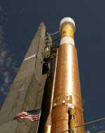
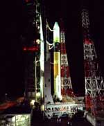
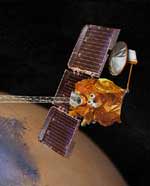
Since their launches on June 10 and July 7 respectively, each rover has been flying tucked inside a folded-up lander. The lander is wrapped in deflated airbags, cocooned within a protective aeroshell and attached to a cruise stage that provides solar panels, antennas and steering for the approximately seven month journey.

Spirit will cast off its cruise stage 15 minutes before hitting the top of the Martian atmosphere at 5,400 meters per second (12,000 miles per hour). Atmospheric friction during the next four minutes will heat part of the aeroshell to about 1,400 C (2,600 F) and slow the descent to about 430 meters per second (960 mph). Less than two minutes before landing, the spacecraft will open its parachute.

Twenty seconds later, it will jettison the bottom half of its aeroshell, exposing the lander. The top half of the shell, still riding the parachute, will lower the lander on a tether. In the final six seconds, airbags will inflate, retro rockets on the upper shell will fire, and the tether will be cut about 15 meters (49 feet) above the ground.

Several bounces and rolls could take the airbag-cushioned lander about a kilometer (0.6 mile) from where it initially lands. If any of the initial few bounces hits a big rock that’s too sharp, or if the spacecraft doesn’t complete each task at just the right point during the descent, the mission could be over. More than half of all the missions launched to Mars have failed.

JPL Director Dr. Charles Elachi said, “We have done everything we know that could be humanly done to ensure success. We have conducted more testing and external reviews for the Mars Exploration Rovers than for any previous interplanetary mission.”

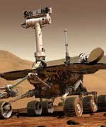
Landing safely is the first step for three months of Mars exploration by each rover. Before rolling off its lander, each rover will spend a week or more unfolding itself, rising to full height, and scanning surroundings. Spirit and Opportunity each weigh about 17 times as much as the Sojourner rover of the 1997 Mars Pathfinder mission. They are big enough to roll right over obstacles nearly as tall as Sojourner.

“Think of Spirit and Opportunity as robotic field geologists,” said Dr. Steve Squyres of Cornell University, Ithaca, N.Y., principal investigator for the rovers’ identical sets of science instruments. “They look around with a stereo, color camera and with an infrared instrument that can classify rock types from a distance. They go to the rocks that seem most interesting. When they get to one, they reach out with a robotic arm that has a handful of tools, a microscope, two instruments for identifying what the rock is made of, and a grinder for getting to a fresh, unweathered surface inside the rock,” he said.

JPL, a division of the California Institute of Technology in Pasadena, manages the Mars Exploration Rover project for NASA’s Office of Space Science, Washington. For information about the Mars Exploration Rover project on the Internet, visit:

http://space.mit.edu/HETE/

For Cornell University’s Web site about the science payload, visit:

http://athena.cornell.edu

Original Source: NASA/JPL News Release

Stardust Approaches Comet Wild 2

Image credit: NASA/JPL

NASA’s Stardust spacecraft took this photograph of its target, Comet Wild 2, while it was still 25 million kilometers away. The spacecraft is on track to reach the comet on January 2, 2004 when it will pass only 300 km away and capture particles of its tail to return to Earth for analysis – the best photographs are still to come. Mission planners will use these early images to help fine-tune Startdust’s trajectory to give it the closest possible approach to Wild 2’s centre.

Forty-nine days before its historic rendezvous with a comet, NASA’s Stardust spacecraft successfully photographed its quarry, comet Wild 2 (pronounced Vilt-2), from 25 million kilometers (15.5 million miles) away. The image, the first of many comet portraits it will take over the next four weeks, will aid Stardust?s navigators and scientists as they plot their final trajectory toward a Jan. 2, 2004 flyby and collection of samples from Wild 2.

?Christmas came early this year,? said Project Manager Tom Duxbury at NASA?s Jet Propulsion Laboratory, Pasadena, Calif. ?Our job is to aim a 5 meter (16 foot) long spacecraft at a 5.4 kilometer (3.3 mile) wide comet that is closing on it at six times the speed of a bullet. We plan to ?miss the comet? by all of 300 kilometers (188 miles), and all this will be happening 389 million kilometers (242 million miles) away from home. By finding the comet as early and as far away as we did, the complexity of our operations leading up to encounter just dropped drastically.?

The ball of dirty ice and rock, about as big as three Brooklyn Bridges laid end-to-end, was detected on November 13 by the spacecraft?s optical navigation camera on the very first attempt. The set of images was stored in Stardust?s onboard computer and downloaded the next day where mission navigator Dr. Shyam Bhaskaran processed them and noticed a white blob of light bisecting the base of a triangle made by three stars Stardust uses for deep space navigation.

?When I first looked at the picture I didn?t believe it,? said Bhaskaran. ?We were not expecting to observe the comet for at least another two weeks. But there it was, very close to where we thought it would be.?

The Wild 2 sighting was verified on November 18 using the second set of optical navigation images downloaded from Stardust. To make this detection, the spacecraft?s camera saw stars as dim as 11th visual magnitude, more than 1,500 times dimmer than a human can see on a clear night.

The early detection of Wild 2 provides mission navigators critical information on the comet?s position and orbital path. Future optical navigation images will allow them to do more fine-tuning. In turn, these new orbital plots will be used to plan the spacecraft?s approach trajectory correction maneuver. Stardust?s first such maneuver is planned for December 3.

Unlike other orbiting bodies, the paths of comets cannot be precisely predicted because their orbits about the Sun are not solely determined by gravity. The escape of gas, dust and rock from comets provides a “rocket effect” that causes them to stray from a predictable orbital path. The actual orbital path cannot be precisely determined from Earth-based telescopes because the comet is shrouded in a cloud of escaping gas and dust. What is seen from Earth is not the actual 5.4 kilometer (3.3 mile) wide body composed of rock and ice, but the cloud of debris and gas that envelops it.

?With these images we anticipate we will flyby comet Wild 2 at an altitude of 300 kilometers, give or take about 16 kilometers,? added Bhaskaran. ?Without them, we wouldn?t be able to safely get any closer to the comet than several thousand kilometers.?

Stardust will return to Earth in Jan. 2006 to make a soft landing at the U.S. Air Force Utah Test and Training Range. Its sample return capsule, holding microscopic particles of comet and interstellar dust, will be taken to the planetary material curatorial facility at NASA’s Johnson Space Center, Houston, where the samples will be carefully stored and examined.

Stardust?s cometary and interstellar dust samples will help provide answers to fundamental questions about the origins of the solar system. More information on the Stardust mission is available at http://stardust.jpl.nasa.gov .

Stardust, a part of NASA’s Discovery Program of low-cost, highly focused science missions, was built by Lockheed Martin Astronautics and Operations, Denver, Colo., and is managed by JPL for NASA’s Office of Space Science, Washington, D.C. JPL is a division of the California Institute of Technology in Pasadena. The principal investigator is astronomy professor Donald E. Brownlee of the University of Washington in Seattle.

Original Source: NASA/JPL News Release

Atlas Launches Classified Payload

Image credit: ILS

An Atlas IIAS rocket lifted off from Vandenberg Air Force Base, California this morning at 1004 UTC (5:04 am EST), carrying a classified payload for the National Reconnaissance Office. Although no details about the payload were disclosed, industry experts believe it was probably contained two or three Naval Ocean Surveillance System (NOSS) spacecraft, which track and identify boats on the ocean. This was the 67th consecutive successful Atlas flight.

An Atlas IIAS rocket successfully lifted off today at 2:04 a.m. PST (10:04 GMT) from this West Coast launch site, releasing a national security payload into transfer orbit 74 minutes later.

The launch was provided by McLean, Va.-based International Launch Services (ILS), from Vandenberg Space Launch Complex 3E, for the U.S. Air Force and the National Reconnaissance Office (NRO). Designated AC-164, this was the fourth Atlas mission this year, and the 67th consecutive successful Atlas flight. It also was ILS? fifth mission of 2003.

?ILS is honored to have a major role in enhancing our nation?s security, having now launched five NRO payloads,? said ILS President Mark Albrecht. ?ILS and Lockheed Martin share a long and valued partnership with the Office of Space Launch, and we take great pride in providing mission success.?

Albrecht added: ?Now we?re working toward NRO launches in 2004, 2005 and beyond, on Atlas III and Atlas V boosters from both Cape Canaveral, Fla., and from Vandenberg. With Atlas V capability at both coasts, we look forward to meeting NRO mission requirements well into the next decade.?

Lockheed Martin Corp. builds the Atlas family of rockets. Today?s vehicle, the Atlas IIAS, can lift 8,200 pounds to geosynchronous transfer orbit. The Atlas III can lift up to 9,920 pounds, and the current -production Atlas V is available in a range of configurations to lift payloads up to 19,000 pounds. Today?s mission was the final West Coast flight of the Atlas IIAS vehicle. Lockheed Martin soon will begin refurbishing Complex 3E, to accommodate Atlas V operations starting in 2005.

The Atlas V family is designed both for ILS commercial missions and to meet the U.S. Air Force requirements for the Evolved Expendable Launch Vehicle (EELV). The Atlas V vehicle has flown three commercial missions, all successfully. The first U.S. government Atlas V mission is set for 2005 with the Wideband Gapfiller Satellite #2 for the Air Force.

ILS is a joint venture of Lockheed Martin Corp. that markets and manages government and commercial missions on the Atlas rocket to customers worldwide. The company is headquartered near Washington, D.C.

The Atlas rockets and their Centaur upper stages are built by Lockheed Martin Space Systems Company in Denver, Colo.; Harlingen, Texas; and San Diego, Calif.

Original Source: ILS News Release

Chinese Moon Shot by 2020

According to a report by the Associated Press, the Chinese are planning to put humans on the Moon by 2020. If everything goes as planned, the Chinese will probably launch a probe to orbit the Moon in 2007, and land a spacecraft there in 2010. Since their first launch of a human in October 2003, China has been much more forthcoming about their spaceflight plans. Earlier this month China said that they will probably launch their next Shenzhou flight within two years, potentially carrying two humans into space.

Japanese Rocket Destroyed Shortly After Launch

Image credit: JAXA

The Japanese space program suffered a setback on Saturday when a booster failed to detach from an H2-A rocket. Operators forced the rocket to self destruct, as it wouldn’t be able to reach its intended orbit with the additional weight of the booster. The rocket was carrying two spy satellites which were intended to keep an eye on North Korea’s rocket program. Prior to Saturday’s failure, the H2-A rocket had launched five consecutive times safely, but insurance companies will probably require six safe launches before covering commercial launches.

The Japan Aerospace Exploration Agency (JAXA) launched the H-IIA Launch Vehicle No 6 (H-IIA F6) with the information gathering satellite #2 (IGS) onboard from the Tanegashima Space Center at 13:33 on November 29, 2003 (Japan Standard Time). However, the vehicle failed to jettison one of its two Solid Rocket Boosters (SRB-As). H-IIA F6 was consequently destroyed by a destruction command from the ground at 13:43:53 as the vehicle did not gain enough height and speed due to the failure.

JAXA has established an accident investigation team led by President Yamanouchi and is investigating the cause of the accident. JAXA will provide additional information when it becomes available.

Evidence for Planets Around Vega

Image credit: PPARC

Astronomers from the Particle Physics and Astronomy Research Council believe they’ve discovered a planetary system around Vega, one of the brightest stars in the sky. Not only that, the star system seems remarkably similar to our own Solar System. So far, they’ve found evidence for a Neptune-sized planet in the same orbit as our own Neptune. This means there could be smaller, rocky planets closer in to the star.

Astronomers at the Particle Physics and Astronomy Research Councils UK Astronomy Technology Centre (ATC) at the Royal Observatory, Edinburgh have produced compelling new evidence that Vega, one of the brightest stars in the sky, has a planetary system around it which is more like our own Solar System than any other so far discovered.

All of the hundred or so planets that have been discovered around other stars have been very large gaseous (Jupiter-like) planets orbiting close to their star. This is very unlike our own Solar System. New computer modelling techniques have shown that observations of the structure of a faint dust disk around Vega can be best explained by a Neptune-like planet orbiting at a similar distance to Neptune in our own solar system and having similar mass. The wide orbit of the Neptune-like planet means that there is plenty of room inside it for small rocky planets similar to the Earth the Holy Grail for astronomers wanting to know whether we are alone in the Universe.

The modelling, which is described today (1 December 2003) in The Astrophysical Journal, is based on observations taken with the world’s most sensitive submillimetre camera, SCUBA. The camera, built at the ATC, is operated on the James Clerk Maxwell Telescope in Hawaii. The SCUBA image shows a disk of very cold dust (-180 degrees centigrade) in orbit around the star.

The irregular shape of the disk is the clue that it is likely to contain planets explains astronomer Mark Wyatt, the author of the paper. Although we cant directly observe the planets, they have created clumps in the disk of dust around the star.

The modelling suggests that the Neptune-like planet actually formed much closer to the star than its current position. As it moved out to its current wide orbit over about 56 million years, many comets were swept out with it, causing the dust disk to be clumpy.

Exactly the same process is thought to have happened in our Solar System, said Wyatt, Neptune was pushed away from the Sun because of the presence of Jupiter orbiting inside it. So it appears that as well as having a Neptune-like planet, Vega may also have a more massive Jupiter-like planet in a smaller orbit.

The model can be tested in two ways as Wayne Holland, who made the original observations, explains The model predicts that the clumps in the disk will rotate around the star once every three hundred years. If we take more observations after a gap of a few years we should see the movement of the clumps. Also the model predicts the finer detail of the disks clumpiness which can be confirmed using the next generation of telescopes and cameras.

Paradoxically the star barely appears in the SCUBA image because it is far too hot to be seen with this kind of detector. Vega is, however, easily seen with the naked eye. It is the third brightest star visible from Northern latitudes and is bluish-white in colour. Tonight you can see it in the west at around 7pm.

Facts about Vega
* Vega is the fifth brightest star in the sky and the third brightest visible in the Northern hemisphere.
* It is 25 light years away from the Sun (1AU is the distance between the Earth and Sun).
* It has a diameter three times bigger than the Sun.
* It is 58 times brighter than the Sun.
* Together with Deneb and Altair, Vega forms the summer triangle.
* Vega is the brightest star in the constellation Lyra, the Harp. The lyre, or harp, is supposed to have been invented by the Greek God Hermes who gave it to his half-brother Apollo. Apollo then gave it to his son Orpheus, the musician of the Argonaughts.
* Vega was the first star ever to be photographed. During the night of July 16-17 1850 the historic picture was taken at Harvard Observatory using a 15 inch refractor telescope during a 100 second exposure.

Original Source: PPARC News Release

Neptune Emptied the Kuiper Belts

Image credit: NASA

Researchers from the Southwest Research Institute believe they have a theory that could help explain why there are so few objects in the Kuiper belt – a band of objects outside the orbit of Neptune. According to theories of how planetary systems form, there should be 100 times more material in the Kuiper belt than astronomers have observed. The researchers believe that the gas giants, including Neptune, formed closer to the Sun, and have slowly drifted further out over time. As Neptune migrated out, it could have pushed the Kuiper objects out of the solar system.

A new study by researchers at Southwest Research Institute (SwRI) and the Observatoire de la C?te d’Azur provides an explanation for one of the more mysterious aspects of the population of objects beyond Neptune. In doing so, it provides a unique glimpse into the proto-planetary disk from which the Solar System’s planets formed. Results will be published in the November 27 issue of Nature.

The Kuiper belt is a region of the Solar System that extends outward from Neptune’s orbit, containing billions of icy objects from kilometers to thousands of kilometers across. It was discovered in 1992 and, since that time nearly 1,000 objects have been cataloged. Some of these objects are very large – the largest having a diameter of more than 1,000 kilometers.

As astronomers have studied this structure, a mystery has unfolded. Like most of the planets in the Solar System, the large Kuiper belt objects are believed to have been formed from smaller objects that stuck together when they collided. For this process to have worked in the distant regions beyond Neptune, the Kuiper belt would have to contain more than 10 times the amount of material than is in the Earth. However, telescopic surveys of this region show that it currently contains roughly one-tenth the mass of the Earth, or less.

To solve the puzzle, researchers have been searching for several years for a way to remove more than 99 percent of the Kuiper belt’s material. However, Dr. Harold Levison (SwRI) and Dr. Alessandro Morbidelli (Observatoire de la C?te d’Azur of Nice, France) describe in their article, “Forming the Kuiper Belt by the Outerward Transport of Objects During Neptune’s Migration,” that the Kuiper belt may not have lost much mass at all.

“The mass depletion problem has been sticking in our throat for some time,” says Levison, a staff scientist in the SwRI Space Studies Department. “It looks like we may finally have a possible answer.”

Levison and Morbidelli argue that the proto-planetary disk from which the planets, asteroids and comets all formed had a heretofore unanticipated edge at the current location of Neptune, which is at 30 astronomical units (AU, the average distance between the Sun and Earth), and that the region now occupied by the Kuiper belt was empty. All the Kuiper belt objects we see beyond Neptune formed much closer to the Sun and were transported outward during the final stages of planet formation.

Researchers have known for 20 years that the orbits of the giant planets moved around as they formed. In particular, Uranus and Neptune formed closer to the Sun and migrated outward. Levison and Morbidelli show that Neptune could have pushed all the observed Kuiper belt objects outward as it migrated.

“We really didn’t solve the mass depletion problem, we circumvented it,” says Levison. “According to our work, the void beyond Neptune was probably devoid of objects.”

However, in this model, the region interior to 30 AU contained enough material for the Kuiper belt objects to form. The mechanisms employed by Neptune to push out the Kuiper belt only affected a small fraction of the objects. These became the objects seen by astronomers; the rest were scattered out of the Solar System by Neptune. This new theory explains many of the observable features of the outer Solar System, including the characteristics of the orbits of the Kuiper belt objects and the location of Neptune.

“One of the puzzling aspects of Neptune’s migration is why it stopped where it did,” says Morbidelli. “Our new model explains this as well. Neptune migrated until it hit the edge of the proto-planetary disk, at which point it abruptly stopped.”

NASA, the National Science Foundation and the Centre National de la Recherche Scientifique in Paris funded this research.

Original Source: SwRI News Release

Mars Odyssey Instrument Fails

Image credit: NASA/JPL

During a recent solar storm, an instrument on board NASA’s Mars Odyssey spacecraft failed, and so far, operators haven’t been able to get it working again. The Martian Radiation Environment (MARIE) was designed to measure the radiation in the Martian space environment, which will help mission planners understand what kinds of risks humans might face if they traveled to the Red Planet. Operators will continue their attempts to get the instrument working for a few weeks before writing it off.

The martian radiation environment experiment on NASA?s 2001 Mars Odyssey orbiter has collected data continuously from the start of the Odyssey mapping mission in March 2002 until late last month. The instrument has successfully monitored space radiation to evaluate the risks to future Mars-bound astronauts. Its measurements are the first of their kind to be obtained during an interplanetary cruise and in orbit around another planet.

On Oct. 28, 2003, during a period of intense solar activity, the instrument stopped working properly. Controllers? efforts to restore the instrument to normal operations have not been successful. These efforts will continue for the next several weeks or months.

The martian radiation environment experiment detects energetic charged particles, including galactic cosmic rays and particles emitted by the Sun in coronal mass ejections. The dose equivalent from galactic cosmic rays as measured by the instrument agrees well with predictions based on modeling. Validation of radiation models is a crucial step in predicting radiation-related health risks for crews of future missions.

“Even if the instrument provides no additional data in the future, it has been a great success at characterizing the radiation environment that a crewed mission to Mars would need to anticipate,” said Dr. Jeffrey Plaut, project scientist for Mars Odyssey at NASA’s Jet Propulsion Laboratory, Pasadena, Calif.

JPL manages the Mars Odyssey and Global Surveyor missions for NASA’s Office of Space Science, Washington, D.C. Investigators at Arizona State University, Tempe; University of Arizona, Tucson; NASA’s Johnson Space Center, Houston; the Russian Aviation and Space Agency, Moscow; and Los Alamos National Laboratory, Los Alamos, N.M., built and operate Odyssey science instruments. Information about NASA’s Mars exploration program is available on the Internet at: http://mars.jpl.nasa.gov.

Original Source: NASA/JPL News Release

Astronauts Hear a Crunching Sound on the Station

Astronauts on board the International Space Station heard what sounded like a tin can being crushed against the outer hull, bringing up the possibility that there was some damage to the station. The sound might have been produced by equipment on the station, or it could have been space junk brushing against the hull. A spokesman for the Russian Space Agency said that all the systems on the station are working properly, and an outside inspection of the station didn’t show any damage.

Images of Wetlands from Space

Image credit: ESA

The Earth’s wetlands are home to some of the most fragile and diverse ecosystems on the planet, and they’re under constant threat from human agriculture, pollution, and settlement. This month the European Space Agency began a program to map 50 wetland areas around the Earth from space to help keep track of their health. ESA’s Envisat is able to tell the difference between dry and waterlogged areas, and will be able to provide annual data about how various wetlands change throughout the seasons.

Dotted across varied regions of our planet are the waterlogged landscapes known as wetlands. Often inaccessible, these muddy areas are actually treasure houses of ecological diversity ? their overall value measured in trillions of Euros.

For much of the last century wetlands have been drained or otherwise degraded, but scientific understanding of their important roles in terms of biology and the water cycle has grown, spurring international efforts to preserve them. On 20 November ESA formally began a project to map wetlands from space, providing data on around 50 sites in 21 countries worldwide.

In 1971 an inter-governmental treaty established the Ramsar Convention on Wetlands, establishing a framework for the stewardship and preservation of wetlands. Today more than 1310 wetlands have been designated as Wetlands of International Importance, a total area of 111 million hectares. The Convention’s 138 national signatories are obliged to report on the state of listed wetlands they are responsible for.

ESA’s new ?1 million Globwetland project is producing satellite-derived and geo-referenced products including inventory maps and digital elevation models of wetlands and the surrounding catchment areas. These products will aid local and national authorities in fulfilling their Ramsar obligations, and should also function as a helpful tool for wetland managers and scientific researchers.

“The Ramsar Convention on Wetlands stresses that targeted assessment and monitoring information is vital for ensuring effective management planning for wetlands, their hydrology and their catchments,” explained Nick Davidson, Ramsar’s Deputy Secretary General. “Yet for wetland managers and decision-makers in many countries access to sound information about wetlands and how they are changing is often a critical gap.

“By working with users at site and catchment scales the Globwetland project should contribute significantly to helping achieve effective management of these critical important ecosystems for biodiversity and human well-being.”

With wetlands often made up of difficult and inaccessible terrain, satellites can help provide information on local topography, the types of wetland vegetation, land cover and use and the dynamics of the local water cycle. In particular radar imagery of the type provided by ESA’s Envisat is able to differentiate between dry and waterlogged surfaces, and so can provide multitemporal data on how given wetlands change seasonally.

Data gathered over four continents
Globwetland products are being provided for a wide range of terrain types to users across four continents: North and South America, Africa, Asia and Europe, including European Russia. In Spain the Globwetland end-user is the government’s Ministry of the Environment.

“We have previously used aerial photography to prepare wetland maps, but this is the first time we will use Earth Observation data,” said Jos? Ram?n Picatoste Ruggeroni, Director General of Nature Conservation and Subdirector General of Biodiversity Conservation. “The areas we are most interested in are land cover and land cover analysis, topography dynamics and subsidence layers, water cycle and quality maps.

“In co-operation with the Spanish regional authorities involved in nature conservation and local wetland managers, we hope to investigate the possibility of achieving a common standard of regularly updated geoinformation to monitor ecological changes in the Spanish Ramsar sites.”

At the other side of the continent, wetlands comprise a third of the territory of the Russian Federation, the majority of it in the form of peatlands. Through much of the 20th century these areas were regarded as wasteland and drained for peat extraction – ending up as unproductive lands that do not contribute either economically or in terms of biodiversity, and also cause ecological problems such as dust storms and uncontrolled carbon dioxide emissions from smouldering peat fires.

In Russia the Globwetland partner is the Ministry of Ecology and Land Use of Moscow region, and has a particular interest in using periodic satellite data to monitor peat fires and estimate how effective a new rewetting project is in preventing further outbreaks.

While in South Africa, Globwetland partner the Department of Environmental Affairs and Tourism (DEAT) seeks to use satellite data to help fulfil its Ramsar obligations for its existing three-site wetlands inventory. The Department also plans to map a separate site, the Prince Edward Islands Special Nature Reserve, for the first time.

South Africa hopes to propose the offshore Reserve for designation as a new Ramsar Wetland of International Importance, but its uncharted nature is currently an obstacle to achieving this. This Southern Ocean site is also being nominated next year as a UNESCO World Heritage Site.

Why are wetlands so valuable?
Studies of wetlands show they store and purify water for domestic use, recharge natural aquifers as they run low, retain nutrients in floodplains, help control flooding and shore erosion and regulate local climate.

Most of all, wetlands support life in spectacular variety and numbers: freshwater wetlands alone are home to four in ten of all the world’s species, and one in eight of global animal species.

An assessment of the monetary value of natural ecosystems published in Nature in 1997 arrived at a figure of 27.7 trillion Euros (33 trillion dollars), with wetland ecosystems making up ?12.5 trillion ($14.9 trillion) ? or 45% – of this total.

Much of human civilisation has been based around river valleys and floodplains. However, global freshwater consumption rose sixfold during the 20th century, a rate more than double that of population growth. And world population is set to rise by 70 million people a year for the next two decades.

Couple that trend with the threat of accelerating climate change, and biologically-productive and hydrologically-stabilising wetlands look like necessities we can ill do without.

Original Source: ESA News Release