India Launches Remote Sensing Satellite

Image credit: ISRO

An Indian PSLV rocket blasted off today from the Satish Dhawan Space Center carrying the IRS-P6 remote sensing satellite into an 821 km high polar orbit. The rocket was launched even though the weather was poor with heavy rains ? the wind, however, wasn?t a problem. IRS-P6 is the most advanced remote sensing satellite built by the Indian Space Research Organization (ISRO); it will primarily monitor natural resources, like water, agriculture, and gather land management data.

In its eighth flight conducted from Satish Dhawan Space Centre, (SDSC), SHAR, Sriharikota, today (October 17, 2003), ISRO’s Polar Satellite Launch Vehicle, PSLV-C5, successfully launched the Indian remote sensing satellite, RESOURCESAT-1 (IRS-P6) into a 821km high polar Sun Synchronous Orbit (SSO). The 1,360 kg RESOURCESAT-1 is the most advanced and heaviest remote sensing satellite launched by ISRO so far. PSLV forms an important component of the end to end system created by ISRO for natural resource planning and management.

PSLV-C5 lifted off from SDSC, SHAR, Sriharikota at 10:22 am with the ignition of the core first stage and four strap-on motors. The remaining two strap-on motors of the first stage were ignited at 25 sec after lift-off. After going through the planned flight events including the separation of the ground-lit strap-on motors, separation of air-lit strap-on motors and first stage, ignition of the second stage, separation of the payload fairing after the vehicle had cleared the dense atmosphere, second stage separation, third stage ignition, third stage separation, fourth stage ignition and fourth stage cut-off, RESOUCESAT-1 was systematically injected into orbit 1080 seconds after lift-off.

RESOURCESAT-1 was separated after suitable reorientation of the fourth stage-equipment bay combination to avoid any collision with the satellite. RESOURCESAT-1 has been placed in the polar Sun Synchronous Orbit (SSO) at an altitude of 821 km with an inclination of 98.76 deg with respect to the equator.

About PSLV
It may be noted that PSLV was designed and developed by ISRO to place 1,000 kg class Indian remote sensing satellites into polar Sun-synchronous Orbit (SSO). Since its first successful flight in October 1994, the capability of PSLV has been enhanced from 850 kg to the present 1,400 kg into 820 km Sun Synchronous Orbit. PSLV has also demonstrated multiple satellite launch capability. So far, it has launched seven Indian satellites as well as four small satellites for international customers.

The improvement in the payload capability of PSLV over successive flights has been achieved through several means — increase in the propellant loading of the first stage solid propellant motor and second and fourth stage liquid propellant motors, improvement in the performance of the third stage motor by optimizing motor case and enhanced propellant loading and employing a carbon composite payload adapter. The sequence of firing of the strap-on motors has also been changed from two ground-lit and four air-lit to the present four ground-lit and two air-lit sequence.

In the PSLV-C5, the metallic third stage adapter was replaced by the one built with carbon composites. Also, the liquid propellant second stage was operated at a higher chamber pressure for better performance.

In its present configuration, the 44.4 metre tall, 294 tonne PSLV has four stages using solid and liquid propulsion systems alternately. The first stage is one of the largest solid propellant boosters in the world and carries 138 tonne of Hydroxyl Terminated Poly Butadiene (HTPB) propellant. It has a diameter of 2.8 m. The motor case is made of maraging steel. The booster develops a maximum thrust of about 4,762 kN. Six strap-on motors, four of which are ignited on the ground, augment the first stage thrust. Each of these solid propellant strap-on motors carries nine tonne of solid propellant and produces 645 kN thrust.

The second stage employs indigenously built Vikas engine and carries 41.5 tonne of liquid propellant — UH25 as fuel and Nitrogen tetroxide (N2O4) as oxidiser. It generates a maximum thrust of about 800 kN.

The third stage uses 7.6 tonne of HTPB-based solid propellant and produces a maximum thrust of 246 kN. Its motor case is made of polyaramide fibre. The fourth and the terminal stage of PSLV has a twin engine configuration using liquid propellant. With a propellant loading of 2.5 tonne (Mono-methyl hydrazine and Mixed Oxides of Nitrogen), each of these engines generates a maximum thrust of 7.3 kN.

The 3.2 m diameter metallic bulbous payload fairing of PSLV is of isogrid construction and protects the spacecraft during the atmospheric regime of the flight. PSLV employs a large number of stage auxiliary systems for stage separation, payload fairing separation and jettisoning, etc.

PSLV control system includes: a) First stage; Secondary Injection Thrust Vector Control (SITVC) for pitch and yaw, reaction control thrusters for roll b) Second stage; Engine gimbal for pitch and yaw and, hot gas reaction control motor for roll control c) Third stage; flex nozzle for pitch and yaw and PS-4 RCS for roll control and d) Fourth stage; Engine gimbal for pitch, yaw and roll and, on-off RCS for control during the coast phase.

The inertial navigation system in the equipment bay, which is located on top of the fourth stage, guides the vehicle from lift-off to spacecraft injection into orbit. The vehicle is provided with instrumentation to monitor the vehicle performance during the flight. S-band PCM telemetry and C-band transponders cater to this requirement. The tracking system provides real-time information for flight safety and for preliminary orbit determination once the satellite is injected into orbit.

The Vikram Sarabhai Space Centre (VSSC), Thiruvananthapuram, designed and developed PSLV. The ISRO Inertial Systems Unit (IISU) at Thiruvananthapuram developed the inertial systems for the vehicle. The Liquid Propulsion Systems Centre, also at Thiruvananthapuram, developed the liquid propulsion stages for the second and fourth stages of PSLV as well as reaction control systems. The Satish Dhawan Space Centre (SDSC), SHAR processed the solid motors and carried out launch operations. ISTRAC provided telemetry, tracking and command support.

With seven successive successful launches, PSLV has proved itself as a reliable vehicle for launching Indian remote sensing satellites. Besides, it has been used for launching a geo-synchronous satellite, KALPANA-1. ISRO has proposed to use PSLV for India’s first unmanned mission to moon, Chandrayaan-1.

RESOURCESAT-1 carries three cameras as follows:
* A high resolution Linear Imaging Self Scanner (LISS-4) operating in three spectral bands in the Visible and Near Infrared Region (VNIR) with 5.8 metre spatial resolution and steerable up to + 26 deg across track to obtain stereoscopic imagery and achieve five day revisit capability
* A medium resolution LISS-3 operating in three spectral bands in VNIR and one in Short Wave Infrared (SWIR) band with 23.5 metre spatial resolution
* An Advanced Wide Field Sensor (AWiFS) operating in three spectral bands in VNIR and one band in SWIR with 56 metre spatial resolution.

RESOURCESAT-1 also carries a Solid State Recorder with a capacity of 120 Giga Bits to store the images taken by its cameras which can be read out later to the ground stations.

Soon after its injection into orbit, the solar panels on board RESOURCESAT-1 were deployed automatically to generate the necessary electrical power for the satellite. Further operations like three axis stabilisation are being carried out. The satellite health is being continuously monitored from the Spacecraft Control Centre at Bangalore with the help of ISTRAC network of stations at Bangalore, Lucknow, Mauritius, Bearslake in Russia and Biak in Indonesia. Further operations on the satellite like orbit trimming, checking out the various subsystems and, finally, switching on the cameras will be carried out in the coming days.

With ISRO Satellite Centre (ISAC), Bangalore, as the lead Centre, RESOURCESAT-1 was realised with major contributions from Space Applications Centre (SAC), Ahmedabad, Liquid Propulsion Systems Centre (LPSC) at Bangalore, and ISRO Inertial Systems Unit (IISU), Thiruvananthapuram. ISTRAC is responsible for initial and in-orbit operation of RESOURCESAT-1. The National Remote Sensing Agency ‘s (NRSA) Data Reception Station at Shadnagar near Hyderabad receives the data from RESOURCESAT-1.

Once commissioned, RESOURCESAT-1 will not only continue the services of IRS-1C and IRS-1D, but also enhance the remote sensing services by providing imageries with improved spatial resolution and additional spectral bands.

Original Source: ISRO News Release

Glaciers in Patagonia Melting Faster Then Expected

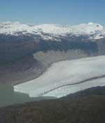
Image credit: NASA/JPL

New research from NASA shows that glaciers in the Patagonia region of South America are thinning out at an accelerated rate. Researchers compared data from the recent space shuttle topography mission in 2000 against historical surveys from the 1970s and 90s. The Patagonia glaciers are losing mass faster than other icefields, such as those in Alaska, which are five times larger. This different rate of melting is important, because it helps researchers understand some of the factors that could contribute other than just overall global climate change.

The Patagonia Icefields of Chile and Argentina, the largest non-Antarctic ice masses in the Southern Hemisphere, are thinning at an accelerating pace and now account for nearly 10 percent of global sea-level change from mountain glaciers, according to a new study by NASA and Chile’s Centro de Estudios Cientificos.

Researchers Dr. Eric Rignot of NASA’s Jet Propulsion Laboratory, Pasadena, Calif.; Andres Rivera of Universidad de Chile, Santiago, Chile; and Dr. Gino Casassa of Centro de Estudios Cientificos, Valdivia, Chile, compared conventional topographic data from the 1970s and 1990s with data from NASA’s Shuttle Radar Topography Mission, flown in February 2000. Their objective was to measure changes over time in the volumes of the 63 largest glaciers in the region.

Results of the study, published this week in the journal Science, conclude the Patagonia Icefields lost ice at a rate equivalent to a sea level rise of 0.04 millimeters (0.0016 inches) per year during the period 1975 through 2000. This is equal to nine percent of the total annual global sea-level rise from mountain glaciers, according to the 2001 Intergovernmental Panel on Climate Change Scientific Assessment. From 1995 through 2000, however, that rate of ice loss from the icefields more than doubled, to an equivalent sea level rise of 0.1 millimeters (0.004 inches) per year.

In comparison, Alaska’s glaciers, which cover an area five times larger, account for about 30 percent of total annual global sea-level rise from mountain glaciers. So what’s causing the increased Patagonia thinning?

Rignot and his colleagues concluded the answer is climate change, as evidenced by increased air temperatures and decreased precipitation over time. Still, those factors alone are not sufficient to explain the rapid thinning. The rest of the story appears to lie primarily in the unique dynamic response of the region’s glaciers to climate change.

“The Patagonia Icefields are dominated by so-called ‘calving’ glaciers,” Rignot said. “Such glaciers spawn icebergs into the ocean or lakes and have different dynamics from glaciers that end on land and melt at their front ends. Calving glaciers are more sensitive to climate change once pushed out of equilibrium, and make this region the fastest area of glacial retreat on Earth.?

Rignot said the study underscores NASA’s unique contributions to understanding changes in Earth’s cryosphere. “From the unique vantage point of space, the Shuttle Radar Topography Mission provided the first complete topographic coverage of the Patagonia Icefields,” he explained. “Researchers can now access data on this remote Earth region in its totality, allowing them to draw conclusions about the whole system, rather than just focusing on changes on a few glaciers studied from the ground or by aircraft.?

Rignot said scientists are particularly interested in studying how climate interacts with glaciers because it may be a good barometer of how the large ice sheets of Greenland and Antarctica will respond to future climate change. “We know the Antarctic peninsula has been warming for the past four decades, with ice shelves disappearing rapidly and glaciers behind them speeding up and raising sea level,” he noted. “Our Patagonia research is providing unique insights into how these larger ice masses may evolve over time in a warmer climate,” he said.

The Northern Patagonia Icefield in Chile and the Southern Patagonia Icefield in Chile and Argentina, cover 13,000 and 4,200 square kilometers (5,019 and 1,622 square miles), respectively. The region, spanning the Andes mountain range, is sparsely inhabited, with rough terrain and poor weather, restricting ground access by scientists. Precipitation in the region ranges from 2 to 11 meters (6.6 to 36 feet) of water equivalent per year, a snow equivalent of up to 30 meters (98.4 feet) a year. The icefields discharge ice and meltwater to the ocean on the west side and to lakes on the east side, via rapidly flowing glaciers. The fronts of most of these glaciers have been retreating over the past half- century or more.

The study benefited from ground experiments led jointly by Centro de Estudios Cientificos; Universidad de Chile; University of Washington, Seattle; and University of Alaska, Fairbanks, with funding by NASA, Fondecyt (Chilean National Science Foundation) and the National Science Foundation International Program.

The Shuttle Radar Topography Mission is a cooperative project of NASA, the National Imagery and Mapping Agency, and the German and Italian space agencies. Information about the Shuttle Radar Topography Mission is available at: http://www.jpl.nasa.gov/srtm/. The California Institute of Technology in Pasadena manages JPL for NASA.

Original Source: NASA News Release

Four Possible Causes for Contour’s Failure

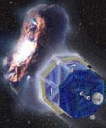
Image credit: NASA

NASA investigators have come up with four possible reasons why the Comet Nucleus Tour (CONTOUR) mission failed in August 2002. The mission launched in July 2002, and was supposed to visit at least two comets and study their icy nuclei, but something went wrong that caused the spacecraft to disappear from ground tracking stations. The most probably cause of the failure was a structural failure of the spacecraft while its solid rocket motor was firing, but the investigators are also considering a collision with debris, a catastrophic failure of the rocket motor, and loss of the spacecraft?s control systems.

NASA’s Comet Nucleus Tour (CONTOUR) Mishap Investigation Board (MIB) identified four possible causes for the failure of the comet-rendezvous mission launched in July 2002. The Board concluded the probable proximate cause for this accident was structural failure of the spacecraft due to plume heating during the embedded solid-rocket motor burn.

However, the lack of telemetry and observational data, immediately prior to and during the burn, and the lack of recoverable debris, leave open the possibility that one of several other problems could have led to the accident. The alternate possible causes are catastrophic failure of the solid rocket motor; collision with space debris or meteoroids; and loss of dynamic control of the spacecraft.

NASA was not able to re-establish contact with the spacecraft on August 15, 2002, following a propulsive maneuver involving the solid rocket motor. On August 22, 2002, the Associate Administrator for Space Science established the NASA CONTOUR Mishap Investigation Board with Theron Bradley Jr., NASA Chief Engineer, as chair. The purpose of the Board was to examine the processes, data and actions surrounding the events of August 15; to search for proximate and root causes; and develop recommendations that may be applicable to future missions.

Based on various facts and data, the MIB concluded the alternate possible causes were less likely than the identified proximate cause. Nonetheless, in the spirit of constructively improving future mission reliability, the Board drew conclusions, identified lessons learned, and made recommendations based on the broader range of possible causes, according to Bradley.

Launched on July 3, 2002, CONTOUR was intended to encounter at least two comets and perform a variety of investigations and analyses of the comet material. It remained in Earth orbit until August 15, 2002, when an integral Alliant Techsystems STAR? 30BP solid rocket motor was fired to leave orbit and begin the transit to the comet Encke.

CONTOUR was programmed to re-establish telemetry contact with the ground following the burn, however, no signal was received. The mission design did not provide for telemetry coverage during the solid rocket motor burn and no provision was made to optically observe the burn.

Active attempts to contact CONTOUR were unsuccessful. On August 16, 2002, limited ground observations identified what appeared to be three separate objects on slightly divergent trajectories near, but behind, CONTOUR’s expected position. Further attempts to contact CONTOUR were made through December 20, 2002, when NASA and Johns Hopkins University/Applied Physics Laboratory (APL), Laurel, Md., concluded the spacecraft was lost. The project manager at APL oversaw the technical implementation of the project and was responsible for the design, development, test and mission operations.

The MIB established Root Causes and Observations contributing to the failure, and recommendations for each in the Report.

“NASA will apply the lessons from CONTOUR to future missions,” Bradley said. He stated the report represented a lot of tough detective work by the many individuals and organizations involved in the investigation. “The lack of data meant the investigators could leave no stone unturned in their search for possible causes,” he said.

Original Source: NASA News Release

Shenzhou 5 Returns Safely to Earth

China?s first astronaut, Yang Liwei, emerged triumphantly from his Shenzhou 5 capsule yesterday after spending nearly 21 hours in space. The spacecraft landed in Inner Mongolia at 2223 GMT Wednesday (6:23 pm EDT); only a few kilometers from its intended landing spot. Liwei exited the vehicle within 30 minutes of landing and was perfectly healthy. Details about China?s future spaceflight plans are starting to emerge and could include another Shenzhou flight within a year or two. They?re also working on ideas for a space station and will probably send an unmanned probe to the Moon within a few years.

Chandra’s View of the Crescent Nebula

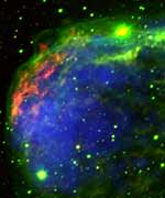
Image credit: Chandra

A new composite/optical image taken by the Chandra X-Ray Observatory shows a portion of the Crescent Nebula, a gaseous shell surrounding the massive star HD 192163. Early on in its life, the massive star expanded to become a red giant, and then compacted down again and began emitting an intense stellar wind that pushed material away at 4.8 million kph. We see the nebula from Earth because the wind is heating up the shell of material the star left when it was a red giant. The massive star is only 4.5 million years old, but it?s already nearing death; astronomers believe it will explode as a supernova within 100,000 years.

Massive stars lead short, spectacular lives. This composite X-ray(blue)/optical (red and green) image reveals dramatic details of a portion of the Crescent Nebula, a giant gaseous shell created by powerful winds blowing from the massive star HD 192163 (a.k.a. WR 136).

After only 4.5 million years (one-thousandth the age of the Sun), HD 192163 began its headlong rush toward a supernova catastrophe. First it expanded enormously to become a red giant and ejected its outer layers at about 20,000 miles per hour. Two hundred thousand years later ? a blink of the eye in the life of a normal star ? the intense radiation from the exposed hot, inner layer of the star began pushing gas away at speeds in excess of 3 million miles per hour!

When this high speed “stellar wind” rammed into the slower red giant wind, a dense shell was formed. In the image, a portion of the shell is shown in red. The force of the collision created two shock waves: one that moved outward from the dense shell to create the green filamentary structure, and one that moved inward to produce a bubble of million degree Celsius X-ray emitting gas (blue). The brightest X-ray emission is near the densest part of the compressed shell of gas, indicating that the hot gas is evaporating matter from the shell.

HD 192163 will likely explode as a supernova in about a hundred thousand years. This image enables astronomers to determine the mass, energy, and composition of the gaseous shell around this pre-supernova star. An understanding of such environments provides important data for interpreting observations of supernovas and their remnants.

Original Source: Chandra News Release

Chinese Launch is a Success

China joined an elite club of spacefarers on Wednesday with the launch of the Shenzhou 5 spacecraft from the Jiuquan desert launch site. At precisely 9:00am local time (0100 GMT), a Long March 2 rocket blasted into the sky carrying astronaut Yang Liwei into orbit – and into the history books.

China joined an elite club of spacefarers on Wednesday with the launch of the Shenzhou 5 spacecraft from the Jiuquan desert launch site. At precisely 9:00am local time (0100 GMT), a Long March 2 rocket blasted into the sky carrying astronaut Yang Liwei into orbit – and into the history books.

Liwei reached space 10 minutes after launch, and is set to orbit the Earth 14 times over the course of 21 hours. He’ll then de-orbit on Thursday, re-enter the Earth’s atmosphere and make a parachute landing in the Gobi desert. Just like the previous four passengerless Shenzhou spacecraft have done.

Only the United States and Russia have launched humans into space before today.

Liwei Chosen from Fourteen
China’s first man into space, Yang Liwei, is a 38-year old lieutenant in the People’s Liberation Army. He hails from Louzhong County in Liaoning province, an industrial area in northeast China. He’s the son of a teacher and an official at an agricultural firm.

Liwei was chosen from 14 astronauts who had been training for several years for this mission. Then three candidates were chosen to prepare for an actual launch. Officials said they’d be selecting their astronaut based on physical condition on the day of the launch – lucky Liwei.

Although the Shenzhou can carry three astronauts, only one was chosen for today’s flight.

Almost a Secret
The Chinese space program is renowned for its secrecy. Until today’s launch, space officials had kept everyone in the dark; announcing the launch of the previous Shenzhou spacecraft only after they’d successfully made it to orbit.

With Shenzhou 5, however, insiders and media were predicting an October 15 launch. Officials finally admitted last week that it was indeed their chosen date; to give government officials time to attend the launch. It’s believed that President Hu Jintao and his predecessor Jiang Zemin were there to watch Liwei blast off.

State officials were originally planning to broadcast the launch live on television, but they decided against it at the last minute to manage publicity in case of an accident.

NASA was one of the first groups to publicly congratulate the new spacefarers. NASA Administrator Sean O’Keefe said, “the Chinese people have a long and distinguished history of exploration. NASA wishes China a continued safe human space flight program.”

NASA Lab Will Study Astronaut’s Radiation

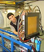
Image credit: NASA

NASA and the US Department of Energy have set up a new laboratory to study the effect of radiation on astronauts as they fly outside the Earth?s protective atmosphere. Located at the Brookhaven National Laboratory in Upton, New York, the $34 million NASA Space Radiation Laboratory will have 80 researchers annually. The teams will do a variety of experiments with the kinds of radiation found in space in hopes to better understand how it damages living tissue. This can help NASA predict risks and develop countermeasures when risking astronauts to long-term exposure to radiation.

Imagine a human spacecraft crew voyaging through space. A satellite sends a warning; energetic particles are being accelerated from the sun’s corona, sending dangerous radiation toward their spacecraft, but the crew isn’t worried. Long before their journey, researchers on Earth conducted experiments to accurately measure the hazards of space radiation and developed new materials and countermeasures to protect them.

To ensure the safety of spacecraft crews, NASA biologists and physicists will perform thousands of experiments at the new $34 million NASA Space Radiation Laboratory (NSRL) commissioned today at the Department of Energy’s (DOE) Brookhaven National Laboratory in Upton, N.Y. The laboratory, built in cooperation between NASA and DOE, is one of the few facilities that can simulate the harsh space radiation environment.

“Scientists will use this facility as a research tool to protect today’s crews on the International Space Station and to enable the next generation of explorers to safely go beyond Earth’s protected neighborhood,” said Guy Fogleman, director of the Bioastronautics Research Division, Office of Biological and Physical Research (OBPR), at NASA Headquarters in Washington.

Space radiation produced by the sun and other galactic sources is more dangerous and hundreds of times more intense than radiation sources, such as medical X-rays or normal cosmic radiation, usually experienced on Earth. When the intensely ionizing particles found in space strike human tissue, it can result in cell damage and may eventually lead to cancer.

Approximately 80 investigators will conduct research annually at the new facility. “The NSRL will enable us to triple the ability of researchers to perform radiobiology experiments and the resulting science knowledge,” said Frank Cucinotta, the program scientist for NASA’s Space Radiation Health Project at Johnson Space Center, Houston. “Scientists at universities and medical centers across the nation will use the facility to investigate how space radiation damages cells and tissues such as the eyes, brain and internal organs,” he said.

For each experiment, an accelerator produces beams of protons or heavy ions. These ions are typical of those accelerated in cosmic sources and by the sun. The beams of ions move through a 328-foot transport tunnel to the 400-square-foot, shielded target hall. There, they hit the target, which may be a biological sample or shielding material.

“Physicists will measure how specific particles interact with shielding material, ” said James Adams, the program scientist for the Space Radiation Shielding Program at NASA’s Marshall Space Flight Center in Huntsville, Ala. “We can use this knowledge to improve our ability to predict the effectiveness of various materials and to develop and test new materials.”

At NSRL, the radiation health team will perform extensive tests with biological samples placed in the path of the radiation. They will use the information to understand mechanisms of radiation damage to cells, predict risks, and develop countermeasures that mitigate radiation effects. “Advances in radiation detection, shielding and other radiation-mitigation techniques may be applied to workers in space and on Earth and may lead to improved use of radiation to treat disease on Earth and prevent radiation-induced illnesses,” Fogleman said.

Since the 1970s, NASA has been using particle accelerators to understand and mitigate the risks of space radiation. The NSRL will take advantage of the high-energy particle accelerators at Brookhaven National Laboratory, a DOE facility established in 1947. Construction of the new facility began in 1998, and was funded in part by NASA’s Office of Biological and Physical Research.

Original Source: NASA News Release

SIRTF Successfully Focused

Image credit: NASA

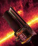
NASA?s recently launched Space Infrared Telescope Facility (SIRTF) passed an important milestone this week when it was successfully focused. The fourth, and last, of NASA?s great observatory has been in space since it was launched on August 25, and since then, it?s been slowly cooling down. The telescope is now only five degrees above Absolute Zero ? this will let it pick up the faint infrared emissions from distant objects in space without seeing its own heat. The observatory will eventually reveal previously unseen objects obscured by gas and dust.

The Space Infrared Telescope Facility, NASA’s fourth and final Great Observatory, has been successfully focused. This crucial milestone ? which will enable the observatory’s infrared eyes to see the cosmos in clear detail ? was achieved after a series of delicate adjustments were made to the telescope’s secondary mirror.

Since launch on Aug. 25, the Space Infrared Telescope Facility has performed as expected, proceeding through in-orbit checkout activities on schedule. In addition to achieving final focus, the telescope has cooled to an operating temperature of approximately 5 Kelvin (-268 Celsius or -451 Fahrenheit). This cold temperature will allow the observatory to detect the infrared radiation, or heat, from celestial objects without picking up its own infrared signature.

“The science community now has an outstanding observatory with which to study the universe,” said Dr. Michael Werner, project scientist for the mission at NASA’s Jet Propulsion Laboratory, Pasadena, Calif. “We are eager to complete the fine-tuning of the observatory and begin the science program.”

In-orbit checkout activities are scheduled to continue for 11 more days, after which a one-month science verification phase will occur. Following this, the science program will begin.

From its innovative Earth-trailing orbit around the Sun, the Space Infrared Telescope Facility will pierce the dusty darkness enshrouding much of the universe, revealing galaxies billions of light years away; brown dwarfs, or failed stars; and planet-forming discs around stars.

JPL, a division of the California Institute of Technology in Pasadena, manages the Space Infrared Telescope Facility for NASA’s Office of Space Science, Washington, D.C. Further information about the Space Infrared Telescope Facility is available at http://sirtf.caltech.edu/.

Original Source: NASA/JPL News Release

Happy Thanksgiving

I just wanted to let you all know that it’s Thanksgiving here in Canada today, so there won’t be an update of Universe Today until Tuesday, October 14. I’m too full of turkey to really think straight anyway. 😉

Take care,

Fraser Cain
Publisher
Universe Today

New Method for Finding Life on Mars

Image credit: NASA

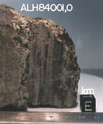
Is there life on Mars? A team of scientists from the University of Glasgow have developed a method they believe will help detect evidence of life in ancient rocks – perhaps helping uncover if there’s life on Mars. With their technique, the rocks are crushed to release tiny amounts of liquid water, and then special detectors are used to search for the presence of biomolecules in the water. Once the technique has been proven to work, the researchers believe it could be miniaturized and flown aboard future Mars landers.

A new UK project could help detect evidence of life on Mars and improve our understanding of how life evolved on Earth. The aim is to develop a technique that can identify biomolecules in water that have been trapped in rocks for millions to billions of years.

The three-year initiative will be carried out by geologists and bioengineers at the University of Aberdeen and the University of Glasgow, with funding from the UK’s Engineering and Physical Sciences Research Council.

The initiative is being led by Dr John Parnell of the University of Aberdeen’s Geology and Petroleum Geology Department, in collaboration with Professor Jonathan Cooper of the University of Glasgow’s Department of Electronics.

Professor Cooper says, ‘With our collaborators in Aberdeen, we are fortunate to have the possibility of working on one of the most exciting projects in the universe, the search for life on other planets!’

As well as analysing samples from Earth, the technique could be used to obtain important information from water sealed within rock samples brought back from Mars. The team will also consider how the technique could be miniaturised for incorporation into spacecraft that travel to other planets.

The research will explore significant technological challenges at the interface between the physical sciences and engineering. These include microfluidic methods for sample pre-concentration (ie the extraction and handling of exceptionally small amounts of fluid), single molecule detection technologies to locate very small amounts of biomaterials and the elimination of contaminants.

The project is highly innovative, attempting to access a source of biomolecules that have not been tapped before. Analysis of material dating from the time before the Earth’s fossil record became extensive is a major project aim, potentially resulting in our knowledge of the development of life on Earth being significantly enhanced.

Original Source: University of Glasgow News Release