NASA’s second Mars Explorer rover, Opportunity, is set for launch on the weekend atop a Delta II rocket from Cape Canaveral, Florida. If all goes well, the spacecraft will lift off at 0356 GMT Sunday (11:56 pm EDT Saturday) and join the previous rover, Spirit, en route to the Red Planet. Weather forecasts currently give the rover a 60% chance of acceptable conditions for flight. Opportunity is targeted to land at Meridiani Planum, which is a prime location for search for past life on Mars.
Odyssey Reveals More of Frosty Mars
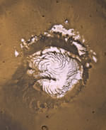
Image credit: NASA/JPL
It turns out that Mars has been hiding its water underneath a layer of dry ice. By tracking the seasonal changes at Mars northern ice cap, NASA’s Mars Odyssey spacecraft has watched how a layer of carbon dioxide permafrost comes and goes. When the permafrost dissipates in the Spring, Mars reveals a soil layer mixed with large amounts of water ice. In some places, the water ice content is more than 90% by volume. During the winter, the dry ice permafrost can reach more than a metre in thickness.
NASA’s Mars Odyssey spacecraft is revealing new details about the intriguing and dynamic character of the frozen layers now known to dominate the high northern latitudes of Mars. The implications have a bearing on science strategies for future missions in the search of habitats.
Odyssey’s neutron and gamma-ray sensors have tracked seasonal changes as layers of “dry ice” (carbon-dioxide frost or snow) accumulate during northern Mars’ winter and then dissipate in the spring, exposing a soil layer rich in water ice– the martian counterpart to permafrost.
Researchers used measurements of martian neutrons combined with height measurements from the laser altimeter on another NASA spacecraft, Mars Global Surveyor, to monitor the amount of dry ice during the northern winter and spring seasons.
“Once the carbon-dioxide layer disappears, we see even more water ice in northern latitudes than Odyssey found last year in southern latitudes,” said Odyssey’s Dr. Igor Mitrofanov of the Russian Space Research Institute (IKI), Moscow, lead author of a paper in the June 27 issue of the journal Science. “In some places, the water ice content is more than 90 percent by volume,” he said. Mitrofanov and co-authors used the changing nature of the relief of these regions, measured more than 2 years ago by the Global Surveyor’s laser altimeter science team, to explore the implications of the changes.
Mars Odyssey’s trio of instruments, called the gamma-ray spectrometer suite, can identify elements in the top meter (3 feet) or so of Mars’ surface. Mars Global Surveyor’s laser altimeter is precise enough to monitor meter-scale changes in the thickness of the seasonal frost, which can accumulate to depths greater than a meter. The new findings show a correlation in the springtime between Odyssey’s detection of dissipating carbon dioxide in latitudes poleward of 65 degrees north and Global Surveyor’s measurement of the thinning of the frost layer in prior years.
“Odyssey’s high-energy neutron detector allows us to measure the thickness of carbon dioxide at lower latitudes, where Global Surveyor’s altimeter does not have enough sensitivity,” Mitrofanov said. “On the other hand, the neutron detector loses sensitivity to measure carbon-dioxide thickness greater than one meter (3 feet), where the altimeter obtained reliable data. Working together, we can examine the whole range of dry-ice snow accumulations.”
“The synergy between the measurements from our two ‘eyes in the skies of Mars’ has enabled these new findings about the nature of near-surface frozen materials, and suggests compelling places to visit in future missions in order to understand habitats on Mars,” said Dr. Jim Garvin, NASA’s Lead Scientist for Mars Exploration.
Another report, to be published in the Journal of Geophysical Research-Planets, combines measurements from Odyssey and Global Surveyor to provide indications of how densely the winter layer of carbon-dioxide frost or snow is packed at northern latitudes greater than 85 degrees. The Odyssey data are used to estimate the mass of the deposit, which can then be compared with the thickness to obtain a density. The dry-ice layer appears to have a fluffy texture, like freshly fallen snow, according to the report by Dr. William Feldman of Los Alamos National Laboratory, N.M., and 11 co-authors. The study also found that once the dry ice disappears, the remaining surface near the pole is composed almost entirely of water ice.
“Mars is constantly changing,” said Dr. Jeffrey Plaut, Mars Odyssey project scientist at NASA’s Jet Propulsion Laboratory, Pasadena, Calif. With Mars Odyssey, we plan to examine these dynamics through additional seasons, to watch how the winter accumulations of carbon dioxide on each pole interact with the atmosphere in the current climate regime.”
Mitrofanov’s co-authors include researchers at the Institute for Space Research of the Russian Academy of Science, Moscow; MIT, Cambridge, MA; NASA’s Goddard Space Flight Center, Greenbelt, Md.; TechSource, Santa Fe, N.M.; and NASA Headquarters, Washington. Feldman’s co-authors include researchers at New Mexico State University, Las Cruces; Cornell University, Ithaca, N.Y.; and Observatoire Midi-Pyrenees, Toulouse, France.
JPL manages the Mars Odyssey and Mars Global Surveyor missions for NASA’s Office of Space Science in Washington. Investigators at Arizona State University, the University of Arizona, and NASA’s Johnson Space Center, Houston, built and operate Odyssey science instruments. The Russian Aviation and Space Agency supplied the high-energy neutron detector and Los Alamos National Laboratory supplied the neutron spectrometer. NASA’s Goddard Space Flight Center supplied Global Surveyor’s laser altimeter. Information about NASA’s Mars exploration program is available online at: http://mars.jpl.nasa.gov
Original Source: NASA/JPL News Release
Pegasus Rocket Launches Imaging Satellite
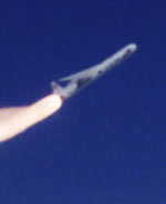
Image credit: Orbital Sciences
Orbital Sciences Pegasus rocket carried an Orbview-3 satellite into orbit Thursday. The Pegasus is different from most rockets because it’s carried underneath the wing of an aircraft and then launched from the air. The Pegasus detached from its L-1011 carrier aircraft and then placed the Orbview-3 high-resolution imaging satellite into a parking orbit 10 minutes later.
Orbital Sciences Corporation (NYSE: ORB) announced that earlier today, it successfully launched the company-built OrbView-3 high-resolution imaging satellite into its targeted orbit aboard the company’s Pegasus? rocket. The OrbView-3 satellite was accurately delivered into an initial “parking” orbit and, over the next several weeks, Orbital engineers will command the satellite to use its onboard propulsion system to reach its final circular operational orbit of 470 kilometers above the Earth, inclined at 97 degrees to the equator. Orbital designed, developed, built and tested the 304-kilogram OrbView-3 satellite for Orbital Imaging Corporation (ORBIMAGE) at the company’s Dulles, Virginia satellite manufacturing facility.
The powered flight sequence for the OrbView-3 mission took about 10 minutes, from the time the Pegasus rocket was released from its L-1011 carrier aircraft at approximately 2:55 p.m. (EDT) to the time that the satellite was deployed into orbit. Preliminary information indicates that the OrbView-3 satellite is working as planned in the early stages of its mission.
“We are very pleased with the results of the Pegasus launch and with the early indications that the OrbView-3 satellite is operating as expected,” said Mr. David W. Thompson, Orbital’s Chairman and Chief Executive Officer. “We look forward to delivering a highly-capable satellite that will allow ORBIMAGE to provide its customers with world-class imagery products.”
Orbital develops and manufactures small space systems for commercial, civil government and military customers. The company’s primary products are spacecraft and launch vehicles, including low-orbit, geostationary and planetary satellites for communications, remote sensing and scientific missions; ground- and air-launched rockets that deliver satellites into orbit; and missile defense boosters that are used as interceptor and target vehicles. Orbital also offers space-related technical services to government agencies and develops and builds satellite-based transportation management systems for public transit agencies and private vehicle fleet operators.
Original Source: Orbital News Release
Solar Aircraft Lost Over the Pacific
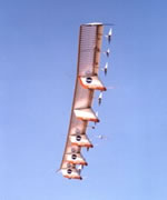
Image credit: NASA
NASA’s remotely piloted Helios aircraft was destroyed on Thursday when it broke up over the Pacific Ocean near the Hawaiian Islands. The Helios is a large flying covered with solar cells which is designed to fly at very high altitudes for very long durations – it broke the world altitude record when it reached 29,500 metres in August, 2001. In the future, fleets of these aircraft could replace the services of satellites for a fraction of the cost. The cause of the accident isn’t known.
The remotely operated Helios Prototype aircraft, a proof-of-concept solar-electric flying wing designed to operate at extremely high altitudes for long duration, was destroyed when it crashed today during a checkout flight from the U.S. Navy?s Pacific Missile Range Facility (PMRF) on the Hawaiian island of Kauai.
There was no property damage or injuries on the ground resulting from the accident. The remotely piloted aircraft came down within the confines of the PMRF test range over the Pacific Ocean west of the facility. Cause of the mishap is not yet known.
The solar-electric, propeller-driven aircraft had been flying under the guidance of ground-based mission controllers for AeroVironment, Inc., of Monrovia, Calif., the plane?s builder and operator. The lightweight flying wing had taken off from PMRF at about 10:06 a.m. on a functional checkout flight and had been aloft for about 29 minutes over the PMRF test range when the mishap occurred. The mishap occurred during a shakedown mission in preparation for a long-endurance mission of almost two days that had been planned for next month.
The Helios Prototype is one of several remotely piloted aircraft whose technological development has been sponsored and funded by NASA under the Environmental Research Aircraft and Sensor Technology (ERAST) program, managed by NASA?s Dryden Flight Research Center, Edwards, Calif. Current to power its electric motors and other systems was generated by high-efficiency solar cells spread across the upper surface of its 247-foot long wing during the day and by an experimental fuel cell-based electrical system at night. The Helios Prototype was designed to fly at altitudes of up to 100,000 feet on single-day atmospheric science and imaging missions, as well as perform multi-day telecommunications relay missions at altitudes of 50,000 to 65,000 feet.
The Helios Prototype set a world altitude record for winged aircraft of 96,863 feet during a flight from the Navy facility at Barking Sands, Kauai, in August 2001.
An accident investigation team will be formed by NASA and supported by AeroVironment and the U.S. Navy to determine the exact cause of the Helios Prototype mishap.
Original Source: NASA News Release
New Evidence that Stars Form Like Dominos
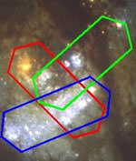
Image credit: Hubble
An international team of astronomers have gathered new evidence to support the “domino theory” of star formation; that star formation occurs in sequence in galaxies driven by the movements of gas and stars at the core. A new instrument attached to the 8m Gemini South Telescope, called CIRPASS, allowed the astronomers to measure the composition of a whole range of stars at the centre of galaxy M83. A detailed analysis of the data is now underway.
An international team of astronomers have used a unique instrument on the 8m Gemini South Telescope to determine the ages of stars across the central region of the barred spiral galaxy, M83. Preliminary results provide the first hints of a domino model of star formation where star formation occurs in a time sequence, driven by the movements of gas and stars in the central bar.
The new instrument, called CIRPASS, simultaneously produces 500 spectra, taken from across the whole region of interest, which act as a series of ‘fingerprints’. Encoded in these ‘fingerprints’ is not only all the information the team required to determine when individual groups of stars formed, but also information on their movements and chemical properties. Dr. Johan Knapen, project co-investigator, ‘The unique combination of a state-of-the-art instrument like CIRPASS with one of the most powerful telescopes available is now providing us with truly sensational observations.’
M83 is a grand design spiral galaxy undergoing an intense burst of star formation in its central bar region. Large scale images, of the visible light from the galaxy, taken with ground based telescopes, show a pronounced bar across the middle of the galaxy) seen as the diagonal white structure in figure 1 . Astronomers believe that it is the influence of this bar which leads a concentration of gas in the central regions of the galaxy from which stars are born. ‘The central region of M83 is enshrouded in dust, but by using CIRPASS, which operates in the infra-red not the visible, we are able to see through this dust and investigate the hidden physical processes at work in the galaxy,’ said Dr Ian Parry, leader of the CIRPASS instrumentation team.
Two competing theories strive to explain the burst of star formation in the centre of the galaxy, M83. One theory suggests that stars form randomly across the whole nuclear region. A second model, favoured by the observational team, proposes that star-formation is triggered by the bar structure. In this model, the rotation of gas and stars in the bar causes stars to be formed sequentially, in a domino manner.
Using a technique first demonstrated by Dr. Stuart Ryder and colleagues, the team searched for a hydrogen emission feature, the Paschen-beta line, within the galaxy’s ‘fingerprints’. The measurement of this feature indicates the presence of hot young stars. By comparing the strengths of the Paschen-beta emission with the amount of absorption from carbon-monoxide (arising in the cool atmospheres of old giant stars) the team are able determine the age of the stars in each region of the galaxy. ‘A detailed analysis of the data is underway but initial results hint at a complex sequence of star formation,’ said Dr Robert Sharp, instrument support scientist with CIRPASS.
Preliminary analysis of other emission features (due to Paschen-beta and ionized iron) revealed a potentially intriguing result. ‘Ionized iron enables us to trace past supernova explosions. The observations indicate that energy from exploding stars (supernovae) may be being passed into regions of undisturbed gas causing further massive star formation.’ said Dr. Stuart Ryder, principle investigator.
While some members of the instrument team are presenting their work at the Royal Society Science Exhibition in London, CIRPASS is back on the Gemini South Telescope in Chile, performing the next set of observations.
Original Source: Cambridge News Release
James Kennedy New Director for Kennedy Space Center

Image credit: NASA
James M. Kennedy was selected by NASA today as administrator of the agency’s Kennedy Space Center (KSC) in Florida. Prior to this assignment, Kennedy was the deputy director of NASA’s George C. Marshall Space Flight Center in Huntsville Alabama, and served as a project manager for the X-34 and DC-XA projects. He first joined NASA in 1968 and has received numerous awards during his tenure with the space agency.
William F. Readdy, Associate Administrator for Space Flight at NASA Headquarters in Washington, today named James W. Kennedy as the new Director of the agency’s Kennedy Space Center (KSC) in Florida. Kennedy has served as KSC’s Deputy Director since November 2002. He will succeed General Roy Bridges, who was appointed to lead NASA’s Langley Research Center, Hampton, Va., June 13.
“Along with his impeccable credentials, Jim brings stability to KSC at a time when we need it,” Readdy said making the announcement. “As we prepare to implement the findings of the Columbia Accident Investigation Board, Jim’s knowledge of the Space Shuttle and his leadership abilities are essential in making our ‘Return to Flight’ effort a success,” he said.
Prior to his assignment to KSC in 2002, Kennedy was deputy director of NASA’s George C. Marshall Space Flight Center in Huntsville, Ala.
Kennedy also served as project manager for major initiatives, such as the X-34 and the DC-XA, and he led the One NASA effort to help make the agency more effective and efficient by encouraging teamwork across all field centers. In early 1996, he was the manager for Marshall’s Space Shuttle Projects Resident Office at KSC. Kennedy returned to Marshall when he received a Senior Executive Service appointment in September 1996 and was named manager of the Solid Rocket Booster Project.
In 1998, he was selected as the Deputy Director of Science and Engineering, where he was responsible for establishing and maintaining a nationally recognized research and development capability in space research and technology. One year later, he became the Director of Engineering.
“Jim is the right person we need at the helm of the Kennedy Space Center, as we prepare to return to safe flight,” added NASA Administrator Sean O’Keefe. “He’s a distinguished engineer and a devoted public servant. I know his colleagues at KSC will give Jim their full support, and I am confident, under his guidance, the center will meet and exceed all the objectives facing us in the coming months,” O’Keefe said.
Kennedy first joined NASA in 1968 in the Aerospace Engineering Cooperative Education program at KSC. He earned a bachelor’s degree in mechanical engineering from Auburn University, Ala., in 1972. After being called to active duty in the U.S. Air Force, he earned his master’s degree in business administration from Georgia Southern University, Statesboro, in 1977.
Kennedy has received numerous awards during his NASA career, including Marshall’s Leadership Award, NASA’s Silver Snoopy Award, a Distinguished Service Medal and a Meritorious Rank Award. He also has received a Group Achievement Award and several Special Service and Performance Awards. In 2003, Kennedy received the National Space Club’s Astronautics Engineer of the Year Award.
Original Source: NASA News Release
Columbia Investigators Analyze NASA Culture
Investigators into the Columbia disaster believe they understand the events that led to the destruction of the shuttle, that falling foam created a crack in a critical heat shield. Now they’re looking into the culture and management in NASA to find out how to prevent problems from happening in the future. The accident investigation board said that fully half of their report will include will deal with management problems at NASA that could affect flight safety. The board hopes their recommendations will create a sense of urgency to help the agency create a safer replacement for the aging space shuttle.
Astronauts Announced For Canadian Arrow
A team of Canadian private rocket builders announced their astronaut selection today, as part of their preparations to launch the Canadian Arrow – a ship based on the original V2 design used in World War 2. The six astronauts include three pilots, an aerospace engineer, a Ukrainian astronaut (who was a backup for a 1997 space shuttle mission), and a 28-year old who has the potential to be the youngest astronaut ever. The Canadian Arrow is considered one of the front-runners to win the X-Prize, which gives $10 million to the first private group to place a three-person team in space.
Watch the Discovery Channel Tonight
Just to let you know, the Discovery Channel is planning to air two documentaries about the space shuttle Columbia disaster. The first is called “Coming Home: The Science of Re-entry”, and the second is “Columbia’s Final Mission: 16 Days” – they’ll be broadcasting them one after the other, so set aside two hours. Check your local listings, but I know they’re playing on both the US and Canadian stations.
Fraser Cain
Publisher
Universe Today
Summer Will Bring Mars’ Closest Approach
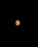
Image credit: Ron Wayman
Earth and Mars are rapidly converging, and are expected to reach their closest point on August 27, 2003. Already amateur astronomers with modest telescopes are reporting they can see features on the surface of Mars with greater clarity, including the planet’s polar ice caps. On August 27, the two planets will only be 56 million km apart; the closest they’ve been for 60,000 years. The planet is currently visible in the morning sky, but over the course of the summer it will move to the point that it’s easy to spot in the evening sky – it’ll be hard to miss since it’ll be nearly the brightest object in the sky.
Count slowly: one one-thousand, two one-thousand, three one-thousand…. You just got about 30 km closer to the planet Mars.
Earth and Mars are rapidly converging. On August 27, 2003–the date of closest approach–the two worlds will be 56 million km apart. That’s a long way by Earth standards, but only a short distance on the scale of the solar system. NASA, the European Space Agency and Japan are all sending spacecraft to Mars this year. It’s a good time to go.
Between now and August, Mars will brighten until it “blazes forth against the dark background of space with a splendor that outshines Sirius and rivals the giant Jupiter himself.” Astronomer Percival Lowell, who famously mapped the canals of Mars, wrote those words to describe the planet during a similar close encounter in the 19th century.
Already Mars is eye-catching. You can see it this month in the morning sky–bright, steady and remarkably red. Only Venus near the sun is brighter.
Amateur astronomers looking through backyard telescopes have reported in recent days great views of Mars’s south polar cap. Made of frozen water and carbon dioxide (“dry ice”), it reflects sunlight well. “I can see the polar ice vividly using my 8-inch telescope,” says Ron Wayman of Tampa, Florida. He’s also spotted “some faint darker-shaded areas on the surface.”
Such markings will become clearer in the weeks ahead. On June 1st Mars was 12.5 arcseconds across and it glowed like a -1st magnitude star. On August 27th it will be twice as wide (25 arcseconds) and six times brighter (magnitude -2.9).
Much has been made of the fact that the August 27th encounter with Mars is the closest in some 60,000 years. Neanderthals were the last to observe Mars so favorably placed. This is true. It’s also a bit of hype. Mars and Earth have been almost this close many times in recent history.
Some examples: Aug. 23, 1924; Aug. 18, 1845; Aug. 13, 1766. In each case Mars and Earth were approximately 56 million km apart.
Astronomers call these close encounters “perihelic oppositions.” Perihelic means Mars is near perihelion–its closest approach to the sun. (The orbit of Mars, like that of all planets, is an ellipse, so the distance between the sun and Mars varies.) Opposition means that the sun, Earth and Mars are in a straight line with Earth in the middle. Mars and the sun are on opposite sides of the sky. When Mars is at opposition and at perihelion–at the same time–it is very close to Earth.
August 27th is indeed the best perihelic opposition since the days of the Neanderthals, but it scarcely differs from other more recent ones. That’s fine because all perihelic oppositions of Mars are spectacular.
Mars is a morning planet now. You have to wake up early to see it. Soon, though, it will be more conveniently placed. By mid-July Mars will rise in the east around 11 p.m. local time. In late August it will appear as soon as the sun sets. It won’t be long before everyone can see Mars at a civilized hour.
We’ll be telling more stories about Mars in the weeks ahead. This one, though, is finished. Did you make it to the end? Congratulations! You’re now 2000 km closer to Mars.
Original Source: NASA Science Story
