SpaceX Launches the First of Thousands of Space Internet Satellites, but Didn’t Quite Catch the Fairing

SpaceX Falcon 9 booster stationed at Launch Complex 4 East (SLC-4E) at the Vandenburg Air Force Base. Credit: SpaceX

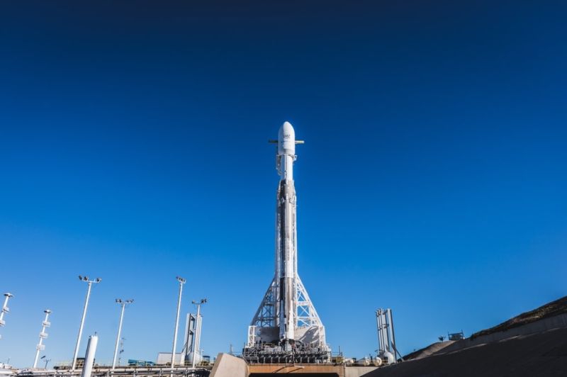
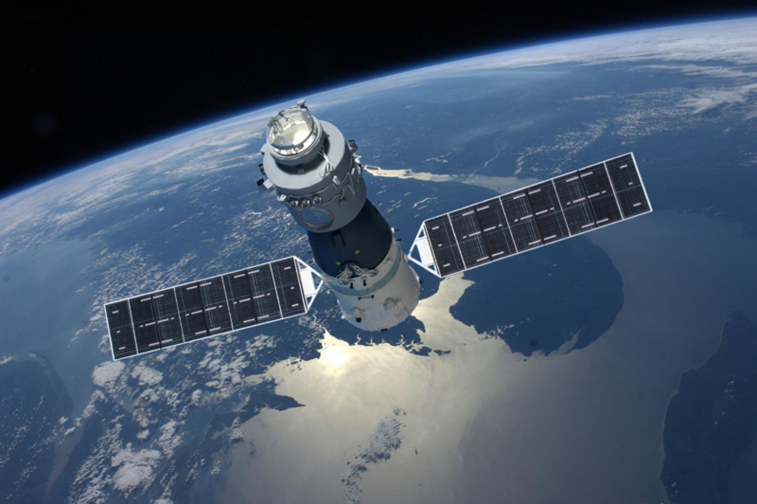
After multiple delays, SpaceX’s PAZ mission launched from from Space Launch Complex 4 East (SLC-4E) at Vandenburg Air Force Base on the morning of Thursday, February 22nd. Shortly after it reached orbit, the rocket deployed its payload (the PAZ Earth Observing satellite) as well as and two Starlink demonstrations satellites that will test SpaceX’s ability to provide broadband internet service from orbit.

In addition, this launch was the first time that SpaceX would be attempting to “catch” the payload fairings from a Falcon 9 rocket using a retrieval ship. As part of their plan to make their rockets fully reusable, the rocket’s fairings were equipped with deployable chutes that would control their descent to the Pacific Ocean. Once there, the newly-commissioned “Mr. Steven” retrieval ship would be waiting to catch them in its net.

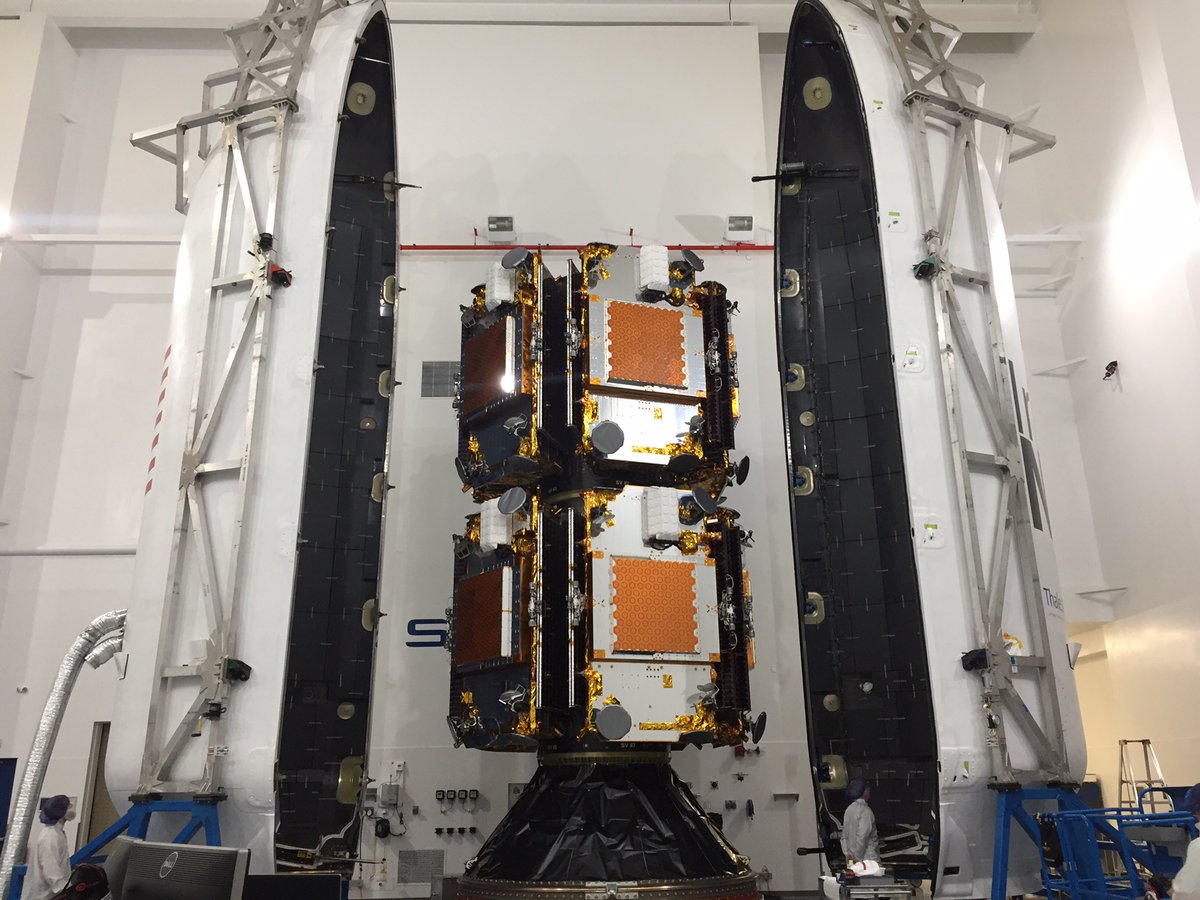
As noted, the primary mission for this launch was the deployment of the the PAZ satellite to low-Earth orbit. This  synthetic-aperture radar satellite was commisioned by Hisdesat, a Spanish commercial satellite company, for governmental and commercial use. Its purpose s to generate high-resolution images of the Earth’s surface, regardless of whether there are clouds covering the ground.

https://www.instagram.com/p/BfgHKDNAplx/

The secondary payload consisted of two experimental satellites  – Microsat-2a and 2b – which are the first phase in SpaceX’s plan to deliver broadband internet service to the entire world. The plan calls for the deployment of more satellites in phases, reaching a total of 4,000 by 2024. However, it was the attempted retrieval of the rocket’s payload fairings that was of particular interest during the launch.

To be fair, this would not be the first time that SpaceX’s attempted to retrieve payload fairings. In March of 2017, SpaceX successfully recovered the fairings for one of their Falcon 9s, which allowed them to recoup an estimated $6 million dollars from that launch. At present, SpaceX indicates that the cost of an individual Falcon 9 launch is estimated to be around $62 million.

If the payload fairings could be recovered regularly, that means that the company could stand to recoup an additional 10% from every individual Falcon 9 launch. These additional savings would not only make the company more competitive, but could allow for additional mission profiles that are currently considered too expensive.

On Thursday Morning, SpaceX founder Elon Musk posted a picture of Mr. Steven taking to sea on Instagram with the following statement:

“Going to try to catch the giant fairing (nosecone) of Falcon 9 as it falls back from space at about eight times the speed of sound. It has onboard thrusters and a guidance system to bring it through the atmosphere intact, then releases a parafoil and our ship with basically a giant catcher’s mitt welded on tries to catch it.”

The launch, which was covered via webcast, went as planned. After taking off amid clear skies, the Falcon 9 reached orbit and deployed the PAZ satellite without incident, and the two Starlink satellites were deployed shortly thereafter. However, the webcast ended without providing any information about the status of the retrieval of the payload fairings.

At 7:14 am, Musk tweeted an update about the attempted retrieval, indicating that the fairings had landed in the ocean a few hundred meters from where Mr. Steven was waiting to catch them. While unsuccessful, Musk was optimistic about future attempts to retrieve payload fairings, saying:

“Missed by a few hundred meters, but fairing landed intact in water. Should be able catch it with slightly bigger chutes to slow down descent.”

As always, Musks seems undeterred by a setback and the company is moving ahead with its plans for expanded reusability. If successful, future attempts at retrieval are likely to involve the second stages of the Falcon 9 and Falcon Heavy rockets. Given all the possibilities that this will allow for, there are many who want to see Musk’s latest venture to succeed.

In the meantime, check out this webcast of the launch:

Further Reading: ArsTechnica

Here’s How SpaceX is Planning to Recover Rocket Fairings: a Boat With a Net Called Mr. Steven

"Mr. Steven", SpaceX's platform for retrieving fairings, is taking to sea. Credit: Pauline Acalin/Teslarati

When visionary entrepreneur Elon Musk founded SpaceX in 2002, he did so with the intention of rekindling human space exploration and sending humans to Mars. Intrinsic to this vision was the reduction of costs associated with individual launches, which has so far been focused on the development of reusable first-stage rockets. However, the company recently announced that they are looking to make their rocket’s payload fairings reusable as well.

The payload fairing is basically the disposable shell at the top of the rocket that protects the cargo during launch. Once the rocket reaches orbit, the fairings falls away to release the payload to space and are lost. But if they could be retrieved, it would reduce launch cost by additional millions. Known as “Mr. Steven”, this new retrieval system consists of a platform ship, extended arms, and a net strung between them.

Mr. Steven is not unlike SpaceX’s Autonomous Spaceport Drone Ships (ASDS), which are used to retrieve first stage rocket boosters at sea. SpaceX has two operational drone ships, including Just Read the Instructions – which is stationed in the Pacific to retrieve launches from Vandenberg – and Of Course I Still Love You, which is stationed in the Atlantic to retrieve launches from Canaveral.

The first ten IridiumNEXT satellites are stacked and encapsulated in the Falcon 9 fairing for launch from Vandenberg Air Force Base, Ca., in early 2017. Credit: Iridium

Recently, Teslarati’s Pauline Acalin captured some photographs of Mr. Steven while it was docked on the California coast near Vandenberg Air Force Base, where it preparing to head out to sea in support of the latest Falcon 9 launch. Known as the PAZ Mission, this launch will place a series of Spanish imaging satellites in orbit, as well as test satellites that will be part of SpaceX’s plan to provide broadband internet service.

Originally scheduled for Wednesday, February 21st, the launch was scrubbed due to strong upper level winds. It is currently scheduled to take place at 6:17 a.m. PST (14:17 UTC) on Thursday, February 22nd, from Space Launch Complex 4 East (SLC-4E) at the Vandenburg Air Force Base. After the cargo is deployed to orbit, the fairings will fall back slowly to Earth thanks to a set of geotagged parachutes.

These chutes will guide the fairings down to the Pacific Ocean, where Mr. Steven will sail to meet them. The fairings, if all goes as planned, will touch down gently into the net and be recovered for later use. In March of 2017, SpaceX successfully recovered a fairing for the first time, which allowed them to recoup an estimated $6 million dollars from that launch.

At present, SpaceX indicates that the cost of an individual Falcon 9 launch is an estimated $62 million. If the payload fairings can be recovered regularly, that means that the company stands to recoup an additional 10% of every individual Falcon 9 launch.

This news comes on the heels of SpaceX having successfully launched their Falcon Heavy rocket, which carried a Tesla Roadster with “Spaceman” into orbit. The launch was made all the more impressive due to the fact that two of the three rocket boosters used were successfully recovered. The core booster unfortunately crashed while attempted to land on one of the ASDS at sea.

At this rate, SpaceX may even start trying to recover their rocket’s second stages in the not-too-distant future. If indeed all components of a rocket are reusable, the only costs associated with individual launches will be the one-time manufacturing cost of the rocket, the cost of fuel, plus any additional maintenance post-launch.

For fans of space exploration and commercial aerospace, this is certainly exciting news! With every cost-cutting measure, the possibilities for scientific research and crewed missions increase exponentially. Imagine a future where it costs roughly the same to deploy space habitats to orbit as it does to deploy commercial satellites, and sending space-based solar arrays to orbit (and maybe even building a space elevator) is financially feasible!

It might sound a bit fantastic, but when the costs are no longer prohibitive, a lot of things become possible.

Further Reading: Teslatari, TechCrunch

Astronomers Find The Most Distant Supernova Ever: 10.5 Billion Light-Years Away

This image shows the incredibly distant and ancient supernova DES16C2nm. The supernova was discovered by the Dark Energy Survey. Image: Mat Smith and DES collaboration.

Astronomers have discovered the most distant supernova yet, at a distance of 10.5 billion light years from Earth. The supernova, named DES16C2nm, is a cataclysmic explosion that signaled the end of a massive star some 10.5 billion years ago. Only now is the light reaching us. The team of astronomers behind the discovery have published their results in a new paper available at arXiv.

“…sometimes you just have to go out and look up to find something amazing.” – Dr. Bob Nichol, University of Portsmouth.

The supernova was discovered by astronomers involved with the Dark Energy Survey (DES), a collaboration of astronomers in different countries. The DES’s job is to map several hundred million galaxies, to help us find out more about dark energy. Dark Energy is the mysterious force that we think is causing the accelerated expansion of the Universe.

DES16C2nm was first detected in August 2016. Its distance and extreme brightness were confirmed in October that year with three of our most powerful telescopes – the Very Large Telescope and the Magellan Telescope in Chile, and the Keck Observatory, in Hawaii.

This image from 2015 shows the same area of sky before DES16C2nm exploded. Image: Mat Smith and DES collaboration.

DES16C2nm is what’s known as a superluminous supernova (SLSN), a type of supernova only discovered 10 years ago. SLSNs are the rarest—and the brightest—type of supernova that we know of. After the supernova exploded, it left behind a neutron star, which is the densest type of object in the universe. The extreme brightness of SLSNs, which can be 100 times brighter than other supernovae, are thought to be caused by material falling into the neutron star.

“It’s thrilling to be part of the survey that has discovered the oldest known supernova.” – Dr Mathew Smith, lead author, University of Southampton

Lead author of the study Dr Mathew Smith, of the University of Southampton, said: “It’s thrilling to be part of the survey that has discovered the oldest known supernova. DES16C2nm is extremely distant, extremely bright, and extremely rare – not the sort of thing you stumble across every day as an astronomer.”

Dr. Smith went on to say that not only is the discovery exciting just for being so distant, ancient, and rare. It’s also providing insights into the cause of SLSNs: “The ultraviolet light from SLSN informs us of the amount of metal produced in the explosion and the temperature of the explosion itself, both of which are key to understanding what causes and drives these cosmic explosions.”

“Now we know how to find these objects at even greater distances, we are actively looking for more of them as part of the Dark Energy Survey.” – Co-author Mark Sullivan, University of Southampton.

Now that the international team behind the Dark Energy Survey has found one of the SLSNs, they want to find more. Co-author Mark Sullivan, also of the University of Southampton, said: “Finding more distant events, to determine the variety and sheer number of these events, is the next step. Now we know how to find these objects at even greater distances, we are actively looking for more of them as part of the Dark Energy Survey.”

The instrument used by DES is the newly constructed Dark Energy Camera (DECam), which is mounted on the Victor M. Blanco 4-meter Telescope at the Cerro Tololo Inter-American Observatory (CTIO) in the Chilean Andes. DECam is an extremely sensitive 570-megapixel digital camera designed and built just for the Dark Energy Survey.

The DECam in operation at its home in the Chilean Andes. The extremely sensitive, 570 megapixel camera is mounted on the Victor M. Blanco 4-meter Telescope at the Cerro Tololo Inter-American Observatory. Image: DES/CTIO

The Dark Energy Survey involves more than 400 scientists from over 40 international institutions. It began in 2013, and will wrap up its five year mission sometime in 2018. The DES is using 525 nights of observation to carry out a deep, wide-area survey to record information from 300 million galaxies that are billions of light-years from Earth. DES is designed to help us answer a burning question.

According to Einstein’s General Relativity Theory, gravity should be causing the expansion of the universe to slow down. And we thought it was, until 1998 when astronomers studying distant supernovae found that the opposite is true. For some reason, the expansion is speeding up. There are really only two ways of explaining this. Either the theory of General Relativity needs to be replaced, or a large portion of the universe—about 70%—consists of something exotic that we’re calling Dark Energy. And this Dark Energy exerts a force opposite to the attractive force exerted by “normal” matter, causing the expansion of the universe to accelerate.

“…sometimes you just have to go out and look up to find something amazing.” – Dr. Bob Nichol, University of Portsmouth.

To help answer this question, the DES is imaging 5,000 square degrees of the southern sky in five optical filters to obtain detailed information about each of the 300 million galaxies. A small amount of the survey time is also used to observe smaller patches of sky once a week or so, to discover and study thousands of supernovae and other astrophysical transients. And this is how DES16C2nm was discovered.

Study co-author Bob Nichol, Professor of Astrophysics and Director of the Institute of Cosmology and Gravitation at the University of Portsmouth, commented: “Such supernovae were not thought of when we started DES over a decade ago. Such discoveries show the importance of empirical science; sometimes you just have to go out and look up to find something amazing.”

Weekly Space Hangout: Feb 21, 2018: Dr. Jessie Christiansen and “Exoplanet Explorers”

Hosts:
Fraser Cain (universetoday.com / @fcain)
Dr. Paul M. Sutter (pmsutter.com / @PaulMattSutter)
Dr. Kimberly Cartier (KimberlyCartier.org / @AstroKimCartier )
Dr. Morgan Rehnberg (MorganRehnberg.com / @MorganRehnberg & ChartYourWorld.org)

Special Guests:
Dr. Jessie Christiansen is a Caltech staff scientist and co-founder (with UC Santa Cruz astronomer Dr. Ian Crossfield) of the citizen-scientist project Exoplanet Explorers which examines data from the Kepler K2 mission.

In April, 2017, Exoplanet Explorers detected a 5-planet system with the potential for 6th planet as well. This system, named K2-138, is unique because it is the first multi-planet system to be discovered entirely by a group of citizen scientists. A paper titled The K2-138 System: A Near-resonant Chain of Five Sub-Neptune Planets Discovered by Citizen Scientists has been accepted for publication in The Astronomical Journal. You can access the published version of the article here: https://authors.library.caltech.edu/84280/1/Christiansen_2018_AJ_155_57.pdf

You can also learn more about Dr. Christiansen by visiting her webpage.

Announcements:
If you would like to join the Weekly Space Hangout Crew, visit their site here and sign up. They’re a great team who can help you join our online discussions!

We record the Weekly Space Hangout every Wednesday at 5:00 pm Pacific / 8:00 pm Eastern. You can watch us live on Universe Today, or the Weekly Space Hangout YouTube page – Please subscribe!

Some of The Last Glaciers in The Tropics. They’ll be Gone in About a Decade

Side by side comparison of images taken of the Puncak Jaya icefields in New Guinea on Nov. 3rd, 1988 (left) and Dec. 5th, 2017 (right). Credit: NASA/EO

One of the most visible signs of Climate Change are the ways in which glaciers and ice sheets have been disappearing all over the world. This trend is not reserved to the Arctic ice cap or the Antarctic Basin, of course. On every part of the planet, scientists have been monitoring glaciers that have been shrinking in the past few decades to determine their rate of loss.

These activities are overseen by NASA’s Earth Observatory, which relies on instruments like the Landsat satellites to monitor seasonal ice losses from orbit. As these satellites demonstrated with a series of recently released images, the Puncak Jaya ice sheets on the south pacific island of Papua/New Guinea have been receding in the past three decades, and are at risk of disappearing in just a decade.

The Papau province of New Guinea has a very rugged landscape that consists of the mountains that make up Sudirman Range. The tallest peaks in this range are Puncak Jaya and Ngga Pulu, which stand 4,884 meters (16,020 feet) and 4,862 meters (15,950 feet) above sea level, respectively. Despite being located in the tropics, the natural elevation of these peaks allows them to sustain small fields of “permanent” ice.

Image of the Puncak Jaya icefields, taken on Nov 3, 1988. Credit: NASA/EO

Given the geography, these ice fields are incredibly rare. In fact, within the tropics, the closest glacial ice is found 11,200 km (6,900 mi) away on Mount Kenya in Africa. Otherwise, one has to venture north for about 4,500 km (2,800 mi) to Mount Tate in central Japan, where glacial ice is more common since it is much farther away from the equator.

Sadly, these rare glaciers are becoming more threatened with every passing year. Like all tropical glaciers in the world today, the glaciers on the slopes around Puncak Jaya have been shrinking at a such a rate that scientists estimate that they could be gone within a decade. This was illustrated by a pair of Landsat images that show how the ice fields have shrunk over the past thirty years.

The first of these images (shown above) was acquired on November 3rd, 1988, by the Thematic Mapper instrument aboard the Landsat 5 satellite. The second image (shown below) was acquired on December 5th, 2017, by the Operational Land Imager (OLI) on the Landsat 8 satellite. These false-color images are a combination of shortwave infrared, infrared, near-infrared, and red light.

The extent of the ice fields are shown in light blue, whereas rocky areas are represented in brown, vegetation in green, and clouds in white. The gray circular area near the center of the 2017 image is the Grasberg mine, the largest gold and second-largest copper mine in the world. This mine expanded considerably between the 1980s and 2000s are a result of a boom in copper prices.

Image of the Puncak Jaya icefields in New Guinea, taken on December 5, 2017. Credit: NASA/EO

As the images show, in 1988, there were five masses of ice resting on the mountain slopes – the Meren, Southwall, Carstensz, East Northwall Firn and West Northwall Firn glaciers. However, by 2017, only the Carstensz and a small portion of the East Northwall Firn glaciers remained. As Christopher Shuman, a research professor at the University of Maryland Baltimore County and NASA’s Goddard Space Flight Center, explained:

“The ice area losses since the 1980s here are quite striking, visible in the contrast of the blue ice with the reddish bedrock. Even though the area still gets snowfalls, it is clearly not sustaining these glacial remnants.”

Similarly, in 2009, images taken by Landsat 5 of these same glaciers (see below) indicated that the Meren and Southwall glaciers had disappeared. Meanwhile, the Carstensz, East Northwall Firn and West Northwall Firn glaciers had retreated dramatically. Based on the rate of loss, scientists estimated at the time that all of Puncak Jaya’s glaciers would be gone within 20 years.

As these latest images demonstrate, their estimates were right on the money. At their current rate, what remains of the Carstensz and East Northwall Firn glaciers will be gone by the late 2020s. The primary cause of the ice loss is rising air temperatures, which leads to rapid sublimation. However, changes in humidity levels, precipitation patterns and cloudiness can also have an impact.

Image of the Puncak Jaya icefields in New Guinea, October 9, 2009. Credit: NASA/EO

Humidity is also important, since it affects how readily glaciers can lose mass directly to the atmosphere. Where the air is more moist, ice is able to make the transition to water more easily, and can be returned to the glacier in the form of precipitation. Where the air is predominately dry, ice makes the transition directly from a solid form to a gaseous form (aka. sublimation).

Temperature and precipitation are also closely linked to ice loss. Where temperatures are low enough, precipitation takes the form of snow, which can sustain glaciers and cause them to grow. Rainfall, on the other hand, will cause ice sheets to melt and recede. And of course, clouds affect how much sunlight reaches the glacier’s surface, which results in warming and sublimation.

For many tropical glaciers, scientists are still working out the relative importance of these factors and attempting to determine to what extent anthropogenic factors plays a role. In the meantime, tracking how these changes are leading to ice loss in the tropical regions provides scientists with a means of comparison when studying ice loss in other parts of the world.

As Andrew Klein, a geography professor at Texas A & M University who has studied the region, explained:

“Glacier recession continues in the tropics—these happen to be the last glaciers in the eastern tropics. Fortunately, the impact will be limited given their small size and the fact that they do not represent a significant water resource.”

Satellites continue to play an important role in the monitoring process, giving scientist the ability to map glacier ice loss, map seasonal changes, and draw comparisons between different parts on the planet. They also allow scientists to monitor remote and inaccessible areas of the planet to see how they too are being affected. Last, but not least, they allow scientists to estimate the timing of a glacier’s disappearance.

Click on the posted images to enlarge the ice fields, or follow these link to see image comparisons.

Further Reading: NASA Earth Observatory

OSIRIS-REx Sends Home an Image of the Earth and Moon

Image of the Earth-Moon system, taken by the OSIRIS-REx spacecraft on Jan. 17th 2018. Credit: NASA/Goddard/University of Arizona/Lockheed Martin

On September 8th. 2016, NASA’s Origins, Spectral Interpretation, Resource Identification, Security, Regolith Explorer (OSIRIS-REx) launched from Earth to rendezvous with the asteroid 101955 Bennu. This mission will be the first American robotic spacecraft to rendezvous with an asteroid, which it will reach by December of 2018, and return samples to Earth for analysis (by September 24th, 2023).

Since that time, NASA has been keeping the public apprised of the mission’s progress, mainly by sending back images taken by the spacecraft. The latest image was one of the Earth and Moon, which the spacecraft took using its NavCam 1 imager on January 17th, 2018. As part of an engineering test, this image shows just how far the probe has ventured from Earth.

Image of the Earth-Moon system, taken by the OSIRIS-REx spacecraft on Jan. 17th 2018. Credit: NASA/Goddard/University of Arizona/Lockheed Martin

The image was taken when the spacecraft was at a distance of 63.6 million km (39.5 million mi) from the Earth and Moon. When the camera acquired the image, the spacecraft was moving at a speed of 8.5 km per second (19,000 mph) away from Earth. Earth can be seen in the center of the image as the brightest of the two spots while the smaller, dimmer Moon appears to the right.

Several constellations are also visible in the surrounding space, including the Pleiades cluster in the upper left corner. Hamal, the brightest star in Aries, is also visible in the upper right corner of the image. Meanwhile, the Earth-Moon system is nestled between the five stars that make up the head of Cetus the Whale.

This is merely the latest in a string of photographs that show how far OSIRIS-REx has ventured from Earth. On October 2nd, 2017, the probe’s MapCam instrument took a series of images of the Earth and Moon while the probe was at a distance of 5 million km (3 million mi) – about 13 times the distance between the Earth and the Moon. NASA then created a composite image to create a lovely view of the Earth-Moon system (see below).

The Earth-Moon system, as imaged by NASA’s OSIRIS-REx mission. Credit: NASA/OSIRIS-REx team and the University of Arizona

On September 22nd, 2017, the probe also snapped a “Blue Marble” image of Earth (seen below) while it was at a distance of just 170,000 km (106,000 mi). The image was captured just a few hours after OSIRIS-REx had completed its critical Earth Gravity Assist (EGA) maneuver, which slung it around the Earth and on its way towards the asteroid Bennu for its scheduled rendezvous in December of 2018.

On both of these occasions, the images were taken by the probe’s MapCam instrument, a medium-range camera designed to capture images of outgassing around Bennu and help map its surface in color. The NavCam 1 instrument, by contrast, is a grayscale imager that is part of Touch-And-Go Camera System (TAGCAMS) navigation camera suite.

A color composite image of Earth taken on Sept. 22, 2017 by the MapCam camera on NASA’s OSIRIS-REx spacecraft just hours after the spacecraft completed its Earth Gravity Assist at a range of approximately 106,000 miles (170,000 kilometers). Credit: NASA/Goddard/University of Arizona

The design, construction and testing of this instrument was carried out by Malin Space Science Systems, and Lockheed Martin is responsible for its operation. By the time OSIRIS-REx begins to approach asteroid Bennu in December of 2018, we can expect that the probes cameras will once again be busy.

However, by this time, they will be turned towards its destination. As it nears Bennu, its cameras will need to be calibrated yet again by snapping images of the asteroid on approach. And we, the public, can expect that more beautiful composite images will be shared as a result.

Further Reading: NASA

How Badly Will Humanity Freak Out if We Discover Alien Life?

The Search for Extraterrestrial Intelligence (SETI) listens for radio signals from other civilizations. In this image, radio-telescopes in SETI's Allen Telescope Array (ATA) are hard at work with the Milky Way in the background. Image: SETI

The discovery of alien life is one of those things that everyone thinks about at some point. Hollywood has made their version of first contact very clear: huge alien vessels appear over Earth’s cities, panic ensues, and Will Smith saves the day with a Windows 3.1 virus. It’s lots of fun—and who knows?—it may end up being accurate. (Not the Windows 3.1 part.) But sci-fi books and movies aside, what do we really know about our attitude to the discovery of alien life?

We have an organization (SETI) dedicated to detecting the presence of alien civilizations, and we have a prominent scientist (Stephen Hawking) warning against advertising our own presence. Those represent the extremes—actively seeking out alien life vs. hiding from it—but what is the collective attitude towards the discovery of alien life? Scientists at Arizona State University (ASU) have studied that issue and detailed their results in a new study published in the journal Frontiers of Psychology.

The team of scientists tried to gauge people’s reactions to the discovery of alien life in three separate parts of their study. In the first case, they examined media reports of past announcements about the discovery of alien life, for example the announcement in 1996 that evidence of microbial life had been found in a Martian metorite.

Secondly, they asked a sample of over 500 people what their own reactions, and the reactions of the rest of humanity, would be to the hypothetical announcement of alien life.

Thirdly, the 500 people were split into two groups. Half were asked to read and respond to a real newspaper story announcing the discovery of fossilized Martian microbial life. The other half were asked to read and respond to a newspaper article announcing the creation of synthetic life by Craig Venter.

Martian meteorite ALH84001 was found in Antarctica in 1984 by a group of meteorite hunters from the US. Scientists who studied it suggested that it contained evidence of ancient Martian microbial life. Image: By Jstuby at English Wikipedia, CC BY-SA 3.0, https://commons.wikimedia.org/w/index.php?curid=47556214

In all three cases the life was microbial in nature. Microbial life is the simplest life form, so it should be what we expect to find. This is certainly true in our own Solar System, since the existence of any other intelligent life has been ruled out here, while microbial life has not.

Also, in all three cases, the language of the respondents and the language in the media reports was analyzed for positive and negative words. A specialized piece of software called Linguistic Inquiry and Word Count (LIWC) was used. It’s text-analysis software that scans written language and identifies instances of words that reflect positive affect, negative affect, reward, or risk. (You can try LIWC here for fun, if you like.)

Electron microscope images of the Martian meteorite ALH84001 showed chain-like structures that resembled living structures. Image: NASA

Analyzing Media Reports

The media reports used in the study were all from what the team considers reputable journalism outlets like The New York Times and Science Magazine. The reports were about things like unidentified signals from space that could have been alien in nature, fossilized microbial remains in meteorites, and the discovery of exoplanets in the habitable zones of other solar systems. There were 15 articles in total.

The authors of the study wanted to find out how people would react to the discovery of alien life, and to the discovery of potentially habitable exoplanets which might harbor life. In this artist’s illustration, exoplanets orbit a young, red dwarf star. Credit: NASA/JPL-Caltec

Overall, the study showed that language in media reports about alien life was more positive than negative, and emphasized reward rather than risk. So people generally find the potential of alien life to be a positive thing and something to be looked forward to. However, this part of the study showed something else: People were more positively disposed towards news of alien life that was microbial than they were towards alien life that could be present on exoplanets, where, presumably, it might be more than merely microbial. So, microbes we can handle, but something more advanced and a little doubt starts to creep in.

Reactions to Hypothetical Announcements of Alien Life

This part of the study aimed to assess people’s beliefs regarding how both they as individuals—and humanity as a whole—might react to the discovery of alien microbial life. The same LIWC software was used to analyze the written responses of the 500 people in the sample group.

The results were similar to the first part of the study, at least for the individuals themselves. Positive affect was more predominant than negative aspect, and words reflecting reward were more predominant than words reflecting risk. This probably isn’t surprising, but the study did show something more interesting.

When participants were asked about how the rest of humanity would respond to the announcement of alien life, the response was different. While positive language still outweighed negative language, and reward still outweighed risk, the differences weren’t as pronounced as they were for individuals. So people seem to think that others won’t be looking forward to the discovery of alien life as much as they themselves do.

Actual Reactions to the Discovery of Extraterrestrial Life

This is hard to measure since we haven’t actually discovered any yet. But there have been times when we thought we might have.

In this part of the study, the group of 500 respondents was split into two groups of 250. The first was asked to read an actual 1996 New York Times article announcing the discovery of fossilized microbes in the Martian meteorite. The second group was asked to read a New York Times article from 2010 announcing the creation of life by Craig Venter. The goal was to find out if the positive bias towards the discovery of microbial life was specific to microbial life, or to scientific advancements overall.

Saturn’s moon Enceladus could harbor microbial life in the warm salty water thought to exist under its frozen surface. Respondents in the study seemed to like that possibility. Credits: NASA/JPL-Caltech/Space Science Institute

This part of the study found the same emphasis on positive affect over negative affect, and reward over risk. This held true in both cases: the Martian microbial life article, and the artificially created life article. The type of article played a minor role in people’s responses. Results were slightly more positive towards the Martian life story than the artificial life story.

Overall, this study shows that people seem positively disposed towards the discovery of alien life. This is reflected in media coverage, people’s personal responses, and people’s expectations of how others would react.

This is really just the tip of the iceberg, though. As the authors say in their study, this is the first empirical attempt to understand any of this. And the study was only 500 people, all Americans.

How different the results might be in other countries and cultures is still an open question. Would populations whose attitudes are more strongly shaped by religion respond differently? Would the populations of countries that have been invaded and dominated by other countries be more nervous about alien life or habitable exoplanets? There’s only conjecture at this point.

Maybe we’re novelty-seekers and we thrive on new discoveries. Or maybe we’re truth-seekers, and that’s reflected in the study. Maybe some of the positivity reflects our fear of being alone. If Earth is the only life-supporting world, that’s a very lonely proposition. Not only that, but it’s an awesome responsibility: we better not screw it up!

Still, the results are encouraging for humanity. We seem, at least according to this first study, open to the discovery of alien life.

But that might change when the first alien ship casts its shadow over Los Angeles.

Russia and China Are Working on Space and Counterspace Weapons

The first Long March 5 rocket being rolled out for launch at Wenchang in late October 2016. Credit: Su Dong/China Daily

Every year, the Department of National Intelligence (DNI) releases its Worldwide Threat Assessment of the US Intelligence Community. This annual report contains the intelligence community’s assessment of potential threats to US national security and makes recommendations accordingly. In recent years, these threats have included the development and proliferation of weapons, regional wars, economic trends, terrorism, cyberterrorism, etc.

This year’s assessment, which was released on February 8th, 2018, was certainly a mixed bag of warnings. Among the many potential threats to national security, the authors emphasized the many recent developments taking place in space. According to their assessment, the expansion of the global space industry, growing cooperation between the private and public sector, and the growth of various states in space, could constitute a threat to US national security.

Naturally, the two chief actors that are singled out were China and Russia. As they indicate, these countries will be leading the pack in the coming years when it comes to expanding space-based reconnaissance, communications and navigation systems. This will not only enable their abilities (and those of their allies) when it comes to space-based research, but will have military applications as well.

The second flight of the Long March 5 lifting off from Wenchang on July 2nd, 2017. Credit: CNS

As they state in the section of the report titled “Space and Counhttps://www.dni.gov/files/documents/Newsroom/Testimonies/2018-ATA—Unclassified-SSCI.pdfterspace“:

“Continued global space industry expansion will further extend space-enabled capabilities and space situational awareness to nation-state, nonstate, and commercial space actors in the coming years, enabled by the increased availability of technology, private-sector investment, and growing international partnerships for shared production and operation… All actors will increasingly have access to space-derived information services, such as imagery, weather, communications, and positioning, navigation, and timing for intelligence, military, scientific, or business purposes.”

A key aspect of this development is outlined in the section titled “Emerging and Disruptive Technology,” which addresses everything from the development of AI and internet technologies to additive manufacturing and advanced materials. In short, it not just the development of new rockets and spacecraft that are at issue here, but the benefits brought about by cheaper and lighter materials, more rapid information sharing and production.

“Emerging technology and new applications of existing technology will also allow our adversaries to more readily develop weapon systems that can strike farther, faster, and harder and challenge the United States in all warfare domains, including space,” they write.

Artist’s illustration of China’s 8-ton Tiangong-1 space station, which is expected to fall to Earth in late 2017. Credit: CMSE

Specifically, anti-satellite (ASAT) weapons are addressed as the major threat. Such technologies, according to the report, have the potential to reduce US and allied military effectiveness by disrupting global communications, navigation and coordination between nations and armies. These technologies could be destructive, in the form of anti-satellite missiles, but also nondestructive – i.e. electromagnetic pulse (EMP) devices. As they indicate:

“We assess that, if a future conflict were to occur involving Russia or China, either country would justify attacks against US and allied satellites as necessary to offset any perceived US military advantage derived from military, civil, or commercial space systems. Military reforms in both countries in the past few years indicate an increased focus on establishing operational forces designed to integrate attacks against space systems and services with military operations in other domains.”

The authors further anticipate that Russian and Chinese destructive ASAT technology could reach operational capacity within a few years time. To this end, they cite recent changes in the People’s Liberation Army (PLA), which include the formation of military units that have training in counter-space operations and the development of ground-launched ASAT missiles.

While they are not certain about Russia’s capability to wage ASAT warfare, they venture that similar developments are taking place. Another area of focus is the development of directed-energy weapons for the purpose of blinding or damaging space-based optical sensors. This technology is similar to what the US investigated decades ago for the sake of strategic missile defense – aka. the Strategic Defense Initiative (SDI).

An artist’s concept of a Space Laser Satellite Defense System. Credit: USAF

While these weapons would not be used to blow up satellites in the conventional sense, they would be capable of blinding or damaging sensitive space-based optical sensors. On top of that, the report cites how Russia and China continue to conduct on-orbit activities and launching satellites that are deemed “experimental”. A good example of this was a recent proposal made by researchers from the Information and Navigation College at China’s Air Force Engineering University.

The study which detailed their findings called for the deployment of a high-powered pulsed ablative laser that could be used to break up space junk. While the authors admit that such technology can have peaceful applications – ranging from satellite inspection, refueling and repair – they could also be used against other spacecraft. While the United States has been researching the technology for decades, China and Russia’s growing presence in space threatens to tilt this balance of power.

Moreover, there are the loopholes in the existing legal framework – as outlined in the Outer Space Treaty – which the authors believe China and Russia are intent on exploiting:

“Russia and China continue to publicly and diplomatically promote international agreements on the nonweaponization of space and “no first placement” of weapons in space. However, many classes of weapons would not be addressed by such proposals, allowing them to continue their pursuit of space warfare capabilities while publicly maintaining that space must be a peaceful domain.”

Artist’s impression of a laser removing orbital debris, based on NASA pictures. Credit: Fulvio314/NASA/Wikipedia Commons

For example, the Outer Space Treaty bars signatories from placing weapons of mass destruction in orbit of Earth, on the Moon, on any other celestial body, or in outer space in general. By definition, this referred to nuclear devices, but does not extend to conventional weapons in orbit. This leaves room for antisatellite platforms or other conventional space-based weapons that could constitute a major threat.

Beyond China and Russia, the report also indicates that Iran’s growing capabilities in rocketry and missile technology could pose a threat down the road. As with the American and Russian space programs, developments in space rocketry and ICBMs are seen as being complimentary to each other:

“Iran’s ballistic missile programs give it the potential to hold targets at risk across the region, and Tehran already has the largest inventory of ballistic missiles in the Middle East. Tehran’s desire to deter the United States might drive it to field an ICBM. Progress on Iran’s space program, such as the launch of the Simorgh SLV in July 2017, could shorten a pathway to an ICBM because space launch vehicles use similar technologies.”

All told, the report makes some rather predictable assessments. Given China and Russia’s growing power in space, it is only natural that the DNI would see this as a potential threat. However, that does not mean that one should assume an alarmist attitude. When it comes to assessing threats, points are awarded for considering every contingency. But if history has taught us anything, it’s that assessment and realization are two very different things.

Remember Sputnik? The lesson there was clear. Don’t panic!

Further Reading: DNI

Astronomers Observe the Rotating Accretion Disk Around the Supermassive Black Hole in M77

Artist’s impression of the dusty gaseous torus around an active supermassive black hole. ALMA revealed the rotation of the torus very clearly for the first time. Credit: ALMA (ESO/NAOJ/NRAO)

During the 1970s, scientists confirmed that radio emissions coming from the center of our galaxy were due to the presence of a Supermassive Black Hole (SMBH). Located about 26,000 light-years from Earth between the Sagittarius and Scorpius constellation, this feature came to be known as Sagittarius A*. Since that time, astronomers have come to understand that most massive galaxies have an SMBH at their center.

What’s more, astronomers have come to learn that black holes in these galaxies are surrounded by massive rotating toruses of dust and gas, which is what accounts for the energy they put out. However, it was only recently that a team of astronomers, using the the Atacama Large Millimeter/submillimeter Array (ALMA), were able to capture an image of the rotating dusty gas torus around the supermassive black hole of M77.

The study which details their findings recently appeared in the Astronomical Journal Letters under the title “ALMA Reveals an Inhomogeneous Compact Rotating Dense Molecular Torus at the NGC 1068 Nucleus“. The study was conducted by a team of Japanese researchers from the National Astronomical Observatory of Japan – led by Masatoshi Imanishi – with assistance from Kagoshima University.

The central region of the spiral galaxy M77. The NASA/ESA Hubble Space Telescope imaged the distribution of stars. ALMA revealed the distribution of gas in the very center of the galaxy. Credit: ALMA (ESO/NAOJ/NRAO)/Imanishi et al./NASA/ESA Hubble Space Telescope and A. van der Hoeven

Like most massive galaxies, M77 has an Active Galactic Nucleus (AGN), where dust and gas are being accreted onto its SMBH, leading to higher-than-normal luminosity. For some time, astronomers have puzzled over the curious relationship that exists between SMBHs and galaxies. Whereas more massive galaxies have larger SMBHs, host galaxies are still 10 billion times larger than their central black hole.

This naturally raises questions about how two objects of vastly different scales could directly affect each other. As a result, astronomers have sought to study AGN is order to determine how galaxies and black holes co-evolve. For the sake of their study, the team conducted high-resolution observations of the central region of M77, a barred spiral galaxy located about 47 million light years from Earth.

Using ALMA, the team imaged the area around M77’s center and were able to resolve a compact gaseous structure with a radius of 20 light-years. As expected, the team found that the compact structure was rotating around the galaxies central black hole. As Masatoshi Imanishi explained in an ALMA press release:

“To interpret various observational features of AGNs, astronomers have assumed rotating donut-like structures of dusty gas around active supermassive black holes. This is called the ‘unified model’ of AGN. However, the dusty gaseous donut is very tiny in appearance. With the high resolution of ALMA, now we can directly see the structure.”

Motion of gas around the supermassive black hole in the center of M77. The gas moving toward us is shown in blue and that moving away from us is in red. Credit: ALMA (ESO/NAOJ/NRAO), Imanishi et al.

In the past, astronomers have observed the center of M77, but no one has been able to resolve the rotating torus at its center until now. This was made possible thanks to the superior resolution of ALMA, as well as the selection of molecular emissions lines. These emissions lines include hydrogen cyanide (HCN) and formyl ions (HCO+), which emit microwaves only in dense gas, and carbon monoxide – which emits microwaves under a variety of conditions.

The observations of these emission lines confirmed another prediction made by the team, which was that the torus would be very dense. “Previous observations have revealed the east-west elongation of the dusty gaseous torus,” said Imanishi. “The dynamics revealed from our ALMA data agrees exactly with the expected rotational orientation of the torus.”

However, their observations also indicated that the distribution of gas around an SMBH is more complicated that what a simple unified model suggests. According to this model, the rotation of the torus would follow the gravity of the black hole; but what Imanishi and his team found indicated that gas and dust in the torus also exhibit signs of highly random motion.

These could be an indication that the AGN at the center of M77 had a violent history, which could include merging with a small galaxy in the past. In short, the team’s observations indicate that galactic mergers may have a significant impact on how AGNs form and behave. In this respect, their observations of M77s torus are already providing clues as to the galaxy’s history and evolution.

NASA’s Spitzer Space Telescope captured this stunning infrared image of the center of the Milky Way Galaxy, where the black hole Sagittarius A resides. Credit: NASA/JPL-Caltech

The study of SMBHs, while intensive, is also very challenging. On the one hand, the closest SMBH (Sagittarius A*) is relatively quiet, with only a small amount of gas accreting onto it. At the same time, it is located at the center of our galaxy, where it is obscured by intervening dust, gas and stars. As such, astronomers are forced to look to other galaxies to study how SMBHs and their galaxies co-exist.

And thanks to decades of study and improvements in instrumentation, scientists are beginning to get a clear glimpse of these mysterious regions for the first time. By being able to study them in detail, astronomers are also gaining valuable insight into how such massive black holes and their ringed structures could coexist with their galaxies over time.

Further Reading: ALMA, arXiv

Opportunity Just Saw its 5,000th Sunrise on Mars

NASA's Mars Exploration Rover Opportunity recorded the dawn of the rover's 4,999th Martian day, or sol, with its Panoramic Camera (Pancam) on Feb. 15, 2018, yielding this processed, approximately true-color scene. Credits: NASA/JPL-Caltech/Cornell/Arizona State Univ./Texas A&M

It’s been a time of milestones for Mars rovers lately! Last month (on January 26th, 2018), NASA announced that the Curiosity rover had spent a total of 2,000 days on Mars, which works out to 5 years, 5 months and 21 days. This was especially impressive considering that the rover was only intended to function on the Martian surface for 687 days (a little under two years).

But when it comes to longevity, nothing has the Opportunity rover beat! Unlike Curiosity, which relied on a Multi-Mission Radioisotope Thermoelectric Generator (MMRTG) for power, the solar-powered Opportunity recently witnessed its five-thousandth sunrise on Mars. This means that the rover has remained in continuous operation for 5000 sols, which works out to 5137.46 Earth days.

This five-thousandth sunrise began on Friday, Feb. 16th, 2018 – roughly 14 Earth years (and 7.48 Martian years) after the rover first landed. From its position on the western rim of the Endeavour Crater, the sunrise appeared over the basin’s eastern rim, about 22 km (14 mi) away. This location, one-third of the way down “Perseverance Valley”, is more than 45 km (28 mi) from Opportunity’s original landing site.

Mosaic view looking down from inside the upper end of “Perseverance Valley” on the inner slope of Endeavour Crater’s western rim. Credit: NASA/JPL/Cornell/Marco Di Lorenzo/Ken Kremer/kenkremer.com

This is especially impressive when you consider that the original science mission was only meant to last 90 sols (92.47 Earth days) and NASA did not expect the rover to survive its first Martian winter. And yet, the rover has not only survived all this time, it continues to send back scientific discoveries from the Red Planet. As John Callas, the Opportunity Project Manager at NASA’s Jet Propulsion Laboratory, explained in a NASA press release:

“Five thousand sols after the start of our 90-sol mission, this amazing rover is still showing us surprises on Mars… We’ve reached lots of milestones, and this is one more, but more important than the numbers are the exploration and the scientific discoveries.”

For instance, the rover has provided us with 225,000 images since its arrival, and revealed that ancient Mars was once home to extensive groundwater and surface water. Beginning in 2008, it began working its way across the  Endeavour Crater in order to get a glimpse deeper into Mars’ past. By 2011, it had reached the crater’s edge and confirmed that mineral-rich water once flowed through the area.

At present, researchers are using Opportunity to investigate the processes that shaped Perseverance Valley, an area that descends down the slope of the western rim of Endeavour Crater. Here too, Opportunity has learned some fascinating things about the Red Planet. For instance, the rover has conducted observations of possible “rock stripes” in the valley, which could be indicative of its valley’s origin.

Textured rows on the ground in this portion of “Perseverance Valley” are under investigation by NASA’s Mars Exploration Rover Opportunity. Credits: NASA/JPL-Caltech

These stripes are of interest to scientists because of the way they resemble rock stripes that appear on mountain slopes here on Earth, which are the result of repeated cycles of freezing and thawing on wet soil. On Mauna Kea, for example, soil freezes every night, but is often dry due to the extreme elevation. This causes soils that have high concentrations of silt, sand and gravel to expand, pushing the larger particles up.

These particles then form stripes as they fall downhill, or are moved by wind or rainwater, and cause the ground to expand less in this space. This process repeats itself over and over, creating a pattern that leads to distinct stripes. As Opportunity observed, there are slopes within the Perseverance Valley where soil and gravel particles appear to have formed into rows that run parallel to the slope, alternating between rows that have more and less gravel.

In the case of the Perseverance Valley’s stripes, scientists are not sure how they formed, but think they could be the result of water, wind, downhill transport, other processes, or a combination thereof. Another theory posits that features like these could be the result of changes in Mars tilt (obliquity) which happen over the course of hundreds of thousands of years.

During these periods, Mars’ axial tilt increases to the point where water frozen at the poles will vaporize and become deposited as snow or frost nearer to the equator. As Ray Arvidson, the Opportunity Deputy Principal Investigator at Washington University, explahttps://www.nasa.gov/feature/jpl/long-lived-mars-rover-opportunity-keeps-finding-surprisesined:

“One possible explanation of these stripes is that they are relics from a time of greater obliquity when snow packs on the rim seasonally melted enough to moisten the soil, and then freeze-thaw cycles organized the small rocks into stripes. Gravitational downhill movement may be diffusing them so they don’t look as crisp as when they were fresh.”

Stone stripes on the side of a volcanic cone on Mauna Kea, Hawaii, which are made of small rock fragments that are aligned downhill. These are formed when freeze-thaw cycles lift them out of the finer-grained regolith and move them to the sides, forming stone stripes. Credits: Washington University in St. Louis/NASA

Having the chance to investigate these features is therefore quite the treat for the Opportunity science team. “Perseverance Valley is a special place, like having a new mission again after all these years.” said Arvidson. “We already knew it was unlike any place any Mars rover has seen before, even if we don’t yet know how it formed, and now we’re seeing surfaces that look like stone stripes. It’s mysterious. It’s exciting. I think the set of observations we’ll get will enable us to understand it.”

Given the state of the Martian surface, it is a safe bet that wind is largely responsible for the rock stripes observed in Perseverance Valley. In this respect, they would be caused by sand blown uphill from the crater floor that sorts larger particles into rows parallel to the slope. As Robert Sullivan, an Opportunity science-team member of Cornell University, explained:

“Debris from relatively fresh impact craters is scattered over the surface of the area, complicating assessment of effects of wind. I don’t know what these stripes are, and I don’t think anyone else knows for sure what they are, so we’re entertaining multiple hypotheses and gathering more data to figure it out.”

Despite being in service for a little over 14 years, and suffering its share of setbacks, Opportunity is once again in a position to reveal things about Mars’ past and how it evolved to become what it is today. Never let it be said that an old rover can’t reveal new secrets! If there’s one thing Opportunity has proven during its long history of service on Mars, it is that the underdog can make some of the greatest contributions.

Further Reading: NASA, NASA (2)