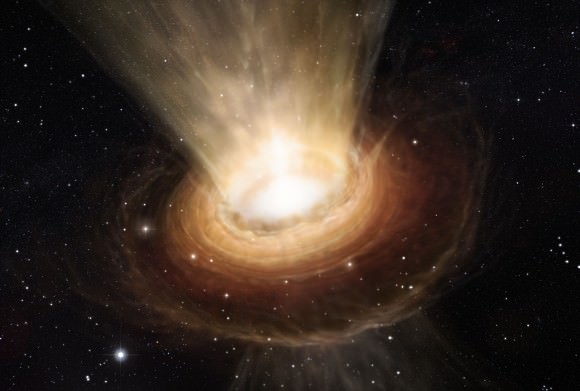
One of the things I love about astronomy is how it’s rapidly changing and evolving over time. Every day there are new discoveries, and advancements in theories that take us incrementally forward in our understanding of the Universe.
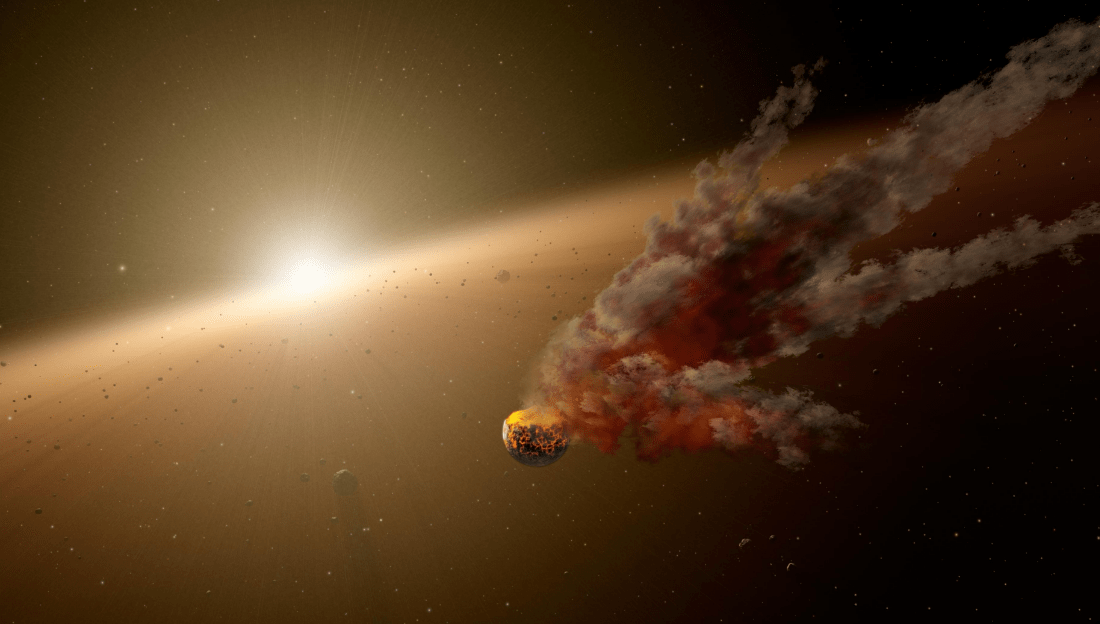
One of the best examples of this is dark matter; mysterious and invisible but a significant part of the Universe and accounting for the vast majority of mass out there.
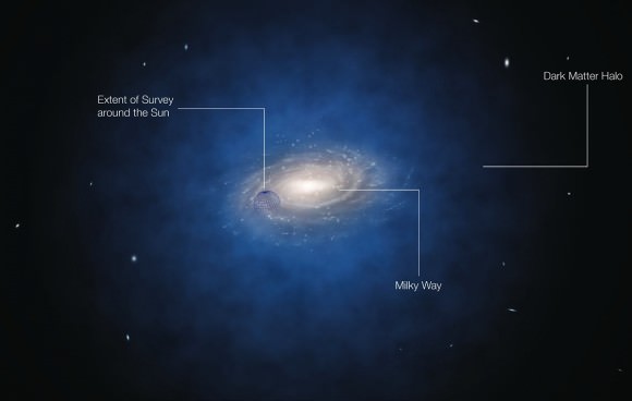
It was first theorized almost 100 years ago when astronomers surveyed the total mass of distant galaxy clusters and found that the visible mass we can see must be just a fraction of the total material in the clusters. When you add up the stars and gas, galaxies move and rotate in ways that indicate there’s a huge halo of invisible matter surrounding it.
Some of the best evidence came from Vera Rubin and Kent Ford in the 60s and 70s, when they measured the rotational velocity of edge-on spiral galaxies. They estimated that there must be about 6 times as much dark matter as regular matter.
Dark matter became a serious mystery in astronomy, and many observers and theorists have spent the last half century trying to work out what it is.
And dark matter hasn’t given up its secrets easily. Originally, astronomers thought it might not actually be invisible mass, but a misunderstanding of how gravity works at the largest scales.
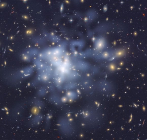
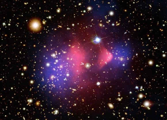
But over the last few decades, techniques have been developed, using the gravity of dark matter itself to measure how it bends light from more distant objects. Astronomers don’t know what dark matter is, but they’re able to use it as a telescope. Now that’s impressive.
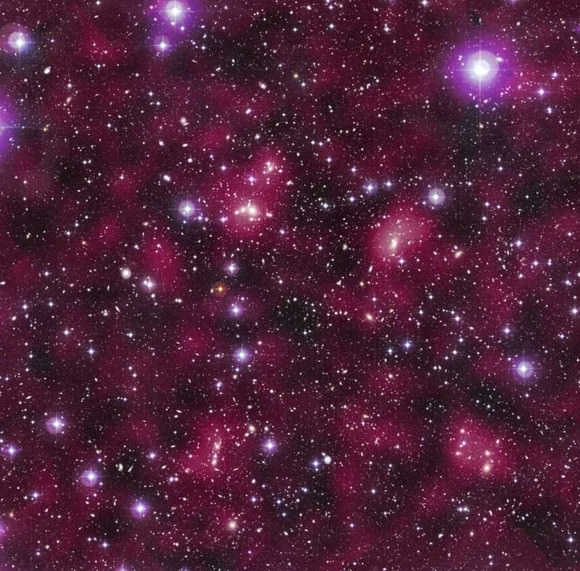
They’ve found amazing features in the dark matter web out there, vast walls and filaments defining the largest scale structures in the Universe. Clusters where dark matter and its gas have been separated from each other.
Remember, we are at the cutting edge of this mystery, and you’re watching it unfold in real time. 25 years from now, I’m sure we’ll look back at our quaint attempts to understand dark matter.
One of the most interesting questions I have right now is: could there be dark matter galaxies? Completely invisible to our eyes, but able to interact through gravity?
Of course, in times like this, I like to bring in a ringer. Someone who has dedicated their life to the study of these questions.
And today, I’ve got with my Sarah Pearson, a graduate student in astronomy at Columbia University and the host of “Space with Sarah”. Sarah studies the formation and interactions of dwarf galaxies surrounding the Milky Way to understand how galaxies built up at the earliest times in the Universe and form the large galaxies we see at present day.
Fraser: Sarah, welcome to the Guide to Space.
Sarah: Hi Fraser, thanks.
Fraser: Can you talk a little bit about how astronomers map out the distribution of dark matter in the Universe?
Sarah: Yes, definitely. So that is a hard question, as you just explained, we don’t see the dark matter. But one assumption about the Universe we live in is that the light matter or baryonic matter. For example, what you, me and stars consist of, and also galaxies, kind of trace out where the dark matter is located.
So one assumption is that the light matter follows the dark matter. In that way we can actually map out to huge distances, kind of how galaxies and clusters of galaxies are located in our Universe. And we imagine that the dark matter structure is somewhat similar.
And also recently, very large scale structure simulations of our own Universe have addressed this by kind of starting out with an almost uniform distribution of dark matter in the very early Universe. And what they see is when they let the Universe evolve in time, for example, when the Universe is expanding, you kind of have these dark matter clumps forming into galaxies in all these filaments that you discussed.
You can kind of trace out the location of dark matter by understanding the expansion of space versus gravity that creates the galaxies that we see.
Fraser: And I know in the observations that you see these different distributions of matter and dark matter, it’s not the perfect 1:6 radio that I just mentioned before. You actually see clumping of dark matter that’s sometimes separated from regular matter. So can you actually have whole galaxies that are entirely made of dark matter?
Sarah: Yes, that’s one of the topics I’m super excited about. I work on some of these dark matter only galaxies, and the way you can think about it is that the dark matter is almost uniformly distributed in the early Universe. But some of it is slightly denser than other parts, which collapses down into galaxies. And a lot of those galaxies will actually be a lot smaller than the Milky Way. And because they’re so small, they have a hard time actually holding onto the matter within them.
We think that when star formation turned on in these galaxies, you might actually blow out a lot of the gas that might create more stars, but you won’t blow out the dark matter. That means you could end up with these small tiny galaxies that only have dark matter. They might have some gas, but they’re very hard for us astronomers to find.
Fraser: Well, if they are dark matter, and the dark matter is invisible, how do we find them?
Sarah: Oh, great question. So for example, around our own galaxy Milky Way, it’s hypothesized in our current paradigm of cosmology and the way we think about the Universe, there should actually be thousands of dark matter clumps, these dark matter galaxies, kind of orbiting our own galaxy.
Some of these might be destroyed when they pass through the huge Milky Way disk, that’s one way of destroying them. The smaller ones might be destroyed just by the tides as they orbit around the galaxy. However, we imagine that some of them might survive. Actually they can plough through what we call stellar streams, which are formed when a real galaxy falls into our own Milky Way and tidally stretched out. You should be able to see these density signatures in the stellar stream, and that might indicate what type of dark matter halo that ploughed through them.
Fraser: You hinted at a way that they could form. You’ve got these stars as they’re early forming and blasting themselves apart and the clump of dark matter can’t hold onto them, so that part is gone. Is that the main way these might form, are there other ways you can get these dark galaxies?
Sarah: A different hypothesis is if you have an AGN, an active galactic nuclei within a galaxy from a black hole, you could actually that way blow out a lot of the gas from a galaxy as well. But it’s still not really clear to us astronomers what type of galaxies and if small galaxies would have these active galactic nuclei.
So the best theory right now is that some of them might have attracted a lot of gas initially because they didn’t have a lot of gravity to pull in the gas. But also, because this gas is completely lost. Also from stars exploding, actually, not just from stars turning on initially.
Fraser: And I know that astronomers and physicists are trying to search for dark matter in the Large Hadron Collider, and try to see if they can understand the underlying particle. Does the search that you’re working on give us any sense of that underlying nature of dark matter?
Sarah: Yeah, also a great question, because for example if dark matter is cold. The cold dark matter paradigm is very popular right now. Which states that dark matter might be a very massive weakly interacting particle. When we’re saying warm or cold dark matter, we’re also referring to how fast it’s moving. And depending on what kind of particle dark matter is, that kind of sets the structure for of the early Universe.
So we can start to count, if we have cold dark matter, we would expect to see a certain amount of these cold dark galaxies, where that amount would be different, if we had warm dark matter.
Fraser: That’s really cool, so the observations that you do give the physicists a better idea of what they should be looking for in their particle accelerators, and the two sides can work together. That’s really great.
Okay Sarah, place your bets. What do you think is the most likely candidate for dark matter?
Sarah: I still think this is a hard question, and I’m not sure if the particle physicists yet think we’re helping them. We’re still approaching things from different sides, but we’ll see.
I still think it’s going to be one of those weakly interactive massive particles that we just haven’t detected yet.
Fraser: Thank you so much for joining me on the Guide to Space Sarah, I really appreciate you explaining these dark matter galaxies to us.
Well there you have it. Dark matter is strange, strange stuff. We still don’t know what it is, but we can see how it moves, interacts with matter through its gravity. And we can see how it can form entire galaxies of just dark matter.
A big thanks to Sarah Pearson. If you haven’t already, go and check out her YouTube channel: Space with Sarah. She’s covering big topics, like wondering when the Sun will shut off, how big the Universe is, and how galaxies can collide in an expanding Universe.