This summer has seen a violent outbreak of forest fires across Canada and North America. According to the Canadian Interagency Forest Fire Center (CIFFC), there were 911 active fires across the country on July 13th, nearly 600 of which were characterized as “out-of-control.” More than half of these active fires are taking place in the provinces of British Columbia, driven by a combination of unusual heat, dry lightning, and drought. The situation is becoming increasingly common thanks to rising global temperatures, diminished rainfall, changing weather patterns, and other related effects of Climate Change.
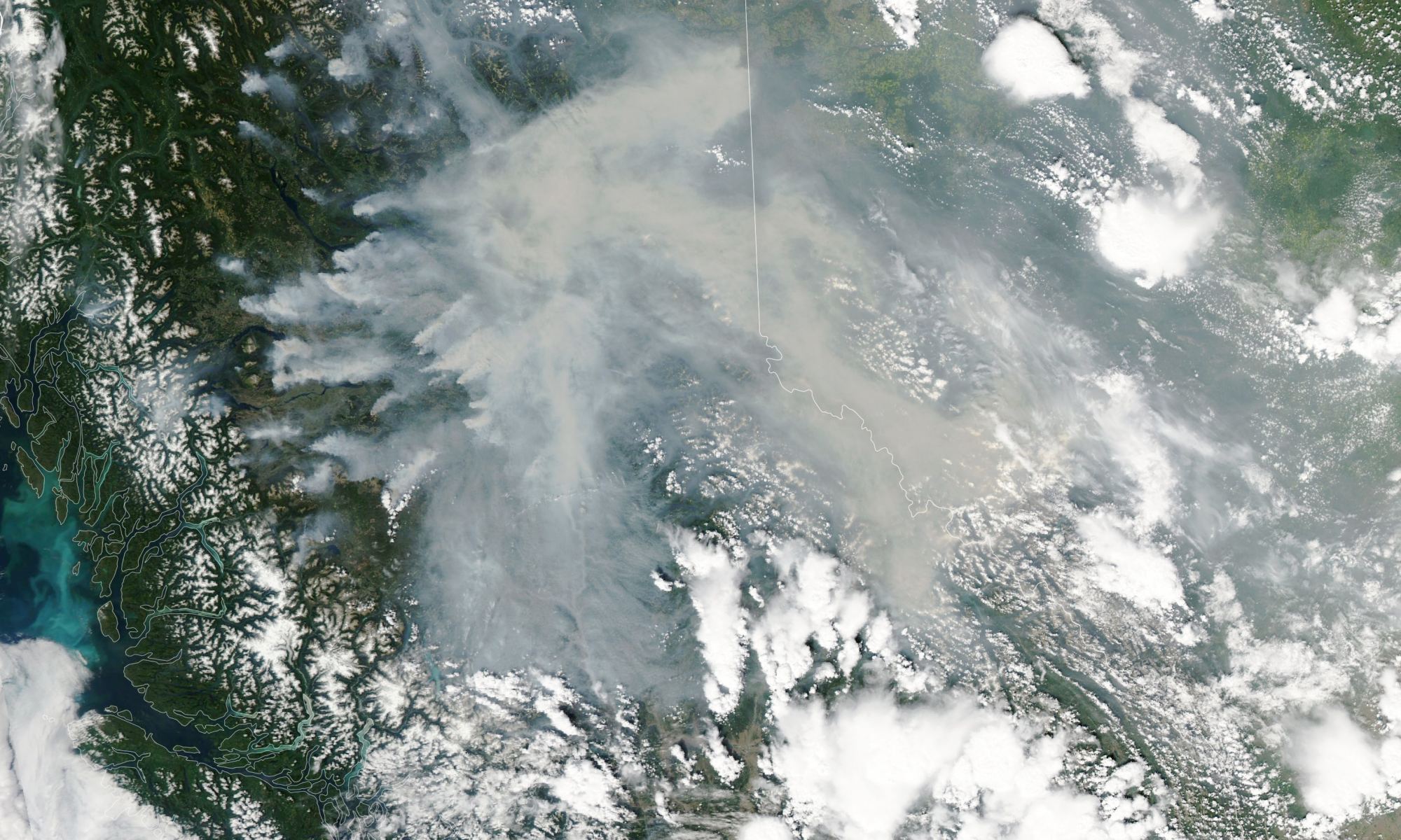
Monitoring forest fires and other meteorological phenomena is an important task for which Earth Observation missions like NASA’s Aqua satellite were created. On July 12th, with six weeks left in the Canadian fire season, Aqua captured images of some of the largest fires over British Columbia using its Moderate Resolution Imaging Spectroradiometer (MODIS) instrument. The image above shows some of the biggest “hot spots” in the province, which produced dense plumes of smoke blowing eastward through the Rocky Mountains and into Alberta and the Northwest Territories.
Continue reading “Forest Fires in British Columbia are Bad This Year. THIRTY Times Worse Than Average”


