[/caption]
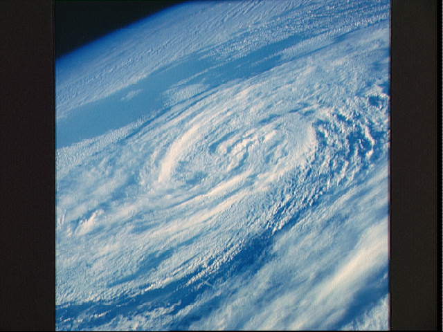
The Coriolis effect is one of those terms that you hear used from time to time, but it never seems to get fully explained, so you are left wondering ‘what is the Coriolis effect?’ The Coriolis effect is the apparent curvature of global winds, ocean currents, and everything else that moves freely across the Earth’s surface. The curvature is due to the rotation of the Earth on its axis. The effect was discovered by the nineteenth century French engineer Gaspard C. Coriolis. He used mathematical formulas to explain that the path of any object set in motion above a rotating surface will curve in relation to objects on that surface.
If not for the Earth’s rotation, global winds would blow in straight north-south lines. What actually happens is that global winds blow diagonally. The Coriolis effect influences wind direction around the world in this way: in the Northern Hemisphere it curves winds to the right; in the Southern Hemisphere it curves them left. The exception is with low pressure systems. In these systems there is a balance between the Coriolis effect and the pressure gradient force and the winds flow in reverse.
Satellites appear to follow curved paths when plotted on world maps because the Earth is a sphere and the shortest distance between two points on a sphere is not a straight line. Two-dimensional maps distort a three-dimensional surface in some way. The distortion increases with closer to the poles. In the northern hemisphere a satellite’s orbit using the shortest possible route will appear to follow a path north of the straight line from beginning to end, and then curve back toward the equator. This occurs because the latitudes, which are projected as straight horizontal lines on most world maps, are in fact circles on the surface of a sphere, which get smaller as they get closer to the pole. This happens simply because the Earth is a sphere and would be true if the Earth didn’t rotate. The Coriolis effect is of course also present, but its effect on the plotted path is much smaller, but increases in importance when calculating a trajectory or end destination. The effect becomes very important when you need to plot trajectories for missiles or artillery fire.
To sum up ‘what is the Coriolis effect’, it is an important meteorological force that is used to predict the path of storms and explains why a projectile will not hit a target at a great distance if the Earth’s rotation is not accounted for.
We have written many articles about Coriolis Effect for Universe Today. Here’s an article about the hurricane, and here’s an article about the Earth’s rotation.
If you’d like more info on Coriolis Effect, check out NASA’s Solar System Exploration Guide on Earth. And here’s a link to NASA’s Earth Observatory.
We’ve also recorded an episode of Astronomy Cast all about planet Earth. Listen here, Episode 51: Earth.
Sources:
University of Oregon
Wikipedia
NASA

