Mercury Down Under

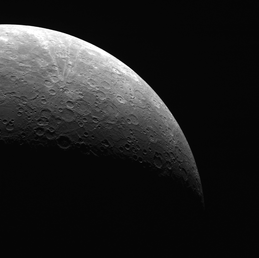
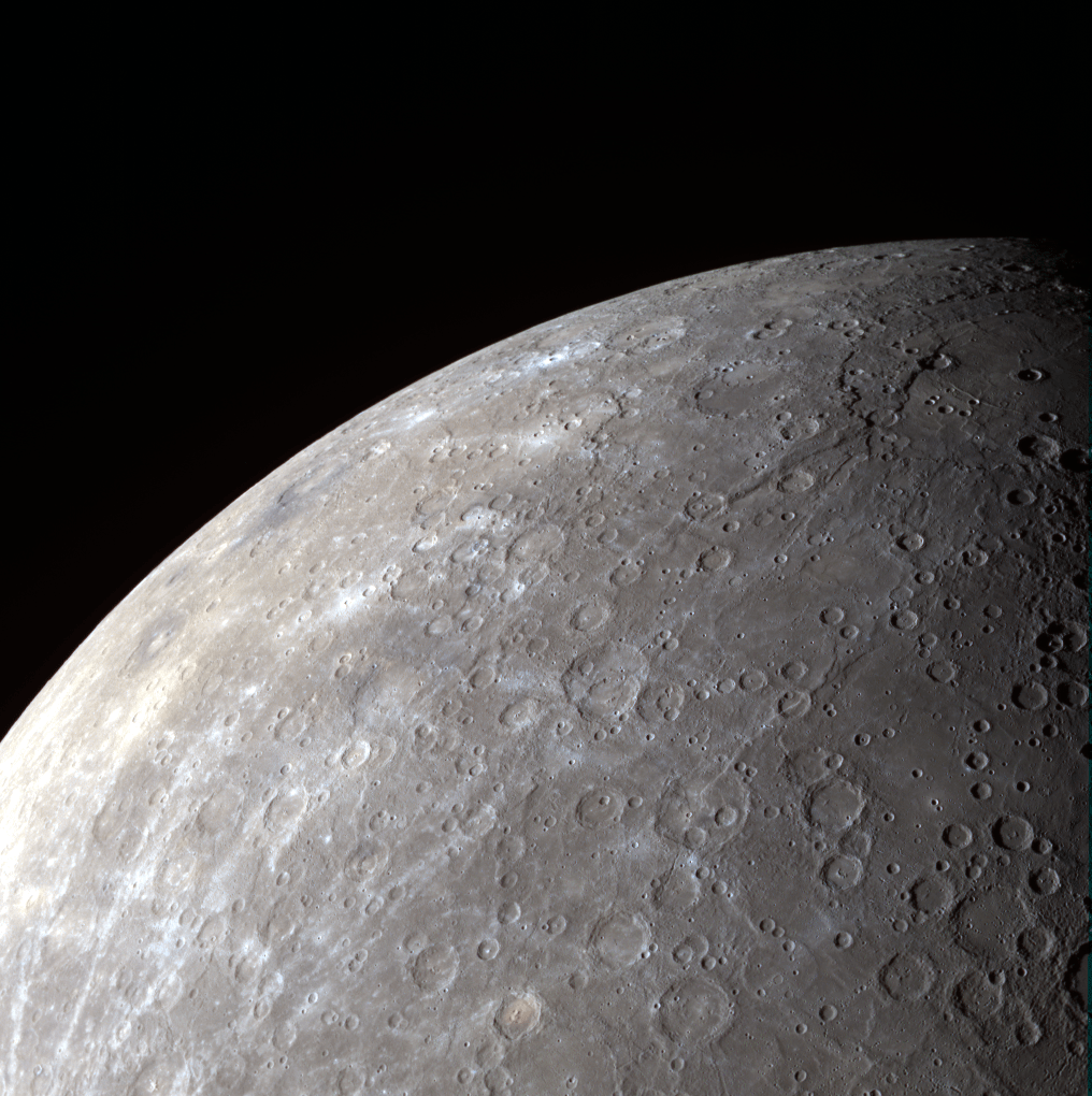
MESSENGER wide-angle camera image of Mercury's southern hemisphere.

[/caption]

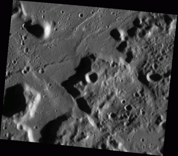
NASA’s MESSENGER spacecraft, about to wrap up its first full year in orbit around Mercury, captured this view of the planet’s heavily-cratered southern hemisphere on August 28, 2011. Because of its orbit, MESSENGER gets particularly good panoramic views of Mercury’s underside.

Here’s why…

MESSENGER’s orbit, established on March 18, 2011 at 00:45 UTC, is not a simple circling path around the first rock from the Sun. Instead it is highly elliptical, bringing it 124 miles (200 km) above Mercury’s north pole at its closest and more than 9,420 miles (15,193 km) from its south pole at its farthest! (See diagram below.)

The close approaches over the northern hemisphere allow MESSENGER to study the Caloris basin, Mercury’s largest surface feature and, at over 960 miles (1,550 km) across, one of the largest impact craters in the entire Solar System.

The view of Mercury’s southern hemisphere above features some notable craters as well: the relatively youthful 444-mile (715-km) -wide Rembrandt basin is seen at top right, while the smaller pit-floor crater Kipling can be discerned to its left, just below the planet’s limb.

When craters are larger than 300 km in diameter, they are referred to as basins.

During its 12 months in orbit MESSENGER will have experienced only two days on Mercury! This is because Mercury rotates very slowly on its axis, completing a full solar day (sunrise to sunrise) every 176 Earth days. (And you thought your work day seemed to last forever!)
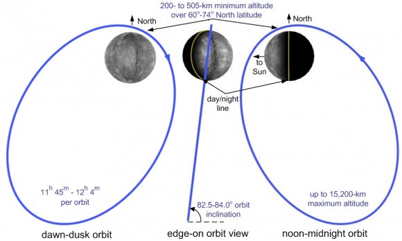
Three perspectives of MESSENGER's orbit.

Find out more about the MESSENGER mission here.

Image credit: NASA/Johns Hopkins University Applied Physics Laboratory/Carnegie Institution of Washington. 

Degas: a Crater Painted Blue

MESSENGER wide-angle camera image of Degas crater

[/caption]

This image, acquired by NASA’s MESSENGER spacecraft on December 12, 2011, reveals the blue coloration of the 32-mile (52-km) -wide Degas crater located in Mercury’s Sobkou Planitia region.

Degas’ bright central peaks are highly reflective in this view, and may be surrounded by hollows — patches of sunken, eroded ground first identified by MESSENGER last year.

Such blue-colored material within craters has been increasingly identified as more of Mercury’s surface is revealed in detail by MESSENGER images. It is likely due to an as-yet-unspecified type of dark subsurface rock, revealed by impact events.

The slightly larger, more eroded crater that Degas abuts is named Brontë.

The image was acquired with MESSENGER’s Wide Angle Camera (WAC) of the Mercury Dual Imaging System (MDIS), using filters 9, 7, 6 (996, 748, 433 nanometers) in red, green, and blue, respectively.

Image credit: NASA/Johns Hopkins University Applied Physics Laboratory/Carnegie Institution of Washington.

Bright Peaks, Dark Shadows

MESSENGER image of Mercury's Amaral crater

[/caption]

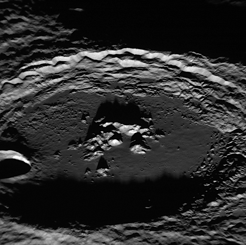
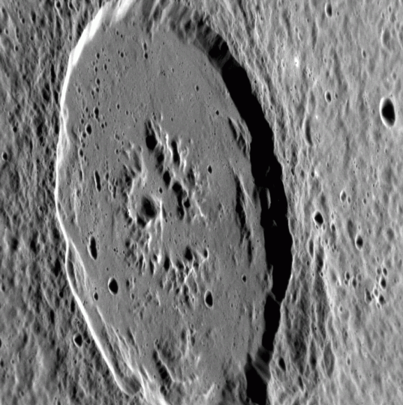
The 68-mile (109-km) -wide Amaral crater on Mercury reveals its brightly-tipped central peaks in this image, acquired by NASA’s MESSENGER spacecraft on Feb. 4, 2012. Long shadows are cast by the crater’s peaks and rugged rim (north is to the left.)

The image was acquired as a high-resolution targeted observation with MESSENGER’s Narrow-Angle Camera (NAC) on its Mercury Dual Imaging System (MDIS).

Amaral’s bright peaks were first spotted during MESSENGER’s first flyby of Mercury in Jan. 2008. With a smooth floor, visible ejecta and small secondary craters, Amaral appeared noticeably younger than the heavily cratered surface around it.

Amaral's "blue" peaks seen in a color-enhanced global image acquired Jan. 14, 2008.

Its central peaks also attracted astronomers’ interest, as they were seen to possess a striking blue hue in color-enhanced images that likely indicates rocks with different composition from the surrounding surface.

Amaral’s peaks resemble those of the slightly larger crater Eminescu, which is now known to contain recently-discovered features called hollows. It’s not yet known if Amaral also contains hollows, but it’s suspected that they may be present on the tips of the peaks.

The crater is named after Brazilian artist Tarsila do Amaral. She lived from 1886 to 1973 and is considered to be one of the leading Latin American modernist painters.

Image credit: NASA/Johns Hopkins University Applied Physics Laboratory/Carnegie Institution of Washington.

Kuiper’s Color Close-Up

[/caption]

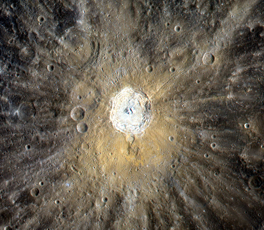
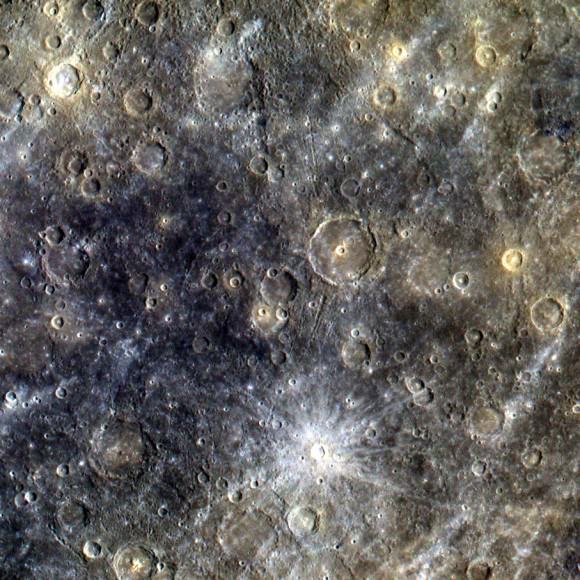
The pale-orange coloration around the 39-mile (62-km) -wide Kuiper crater on Mercury is evident in this image, a color composition made from targeted images acquired by NASA’s MESSENGER spacecraft on September 2, 2011.

The color may be due to compositional differences in the material that was ejected during the impact that formed the crater.

Kuiper crater is named after Gerard Kuiper, a Dutch-American astronomer who was a member of the Mariner 10 team. He is regarded by many as the father of modern planetary science.

“Kuiper studied the planets… at a time when they were scarcely of interest to other astronomers. But with new telescopes and instrumentation, he showed that there were great things to discover, which is as true today as it was then.”

– Dr. Bill McKinnon, Professor of Planetary Sciences at Washington University in St. Louis

Airless worlds like Mercury are constantly bombarded with micrometeoroids and charged solar particles in an effect known as “space weathering”. Craters with bright rays — like Kuiper — are thought to be relatively young because they have had less exposure to space weathering than craters without such rays.

See the original image release on the MESSENGER site here.

Image credit: NASA/Johns Hopkins University Applied Physics Laboratory/Carnegie Institution of Washington

Asteroid’s Unusual Light and Dark Crater

A 5-km-wide crater on Vesta displays light and dark material.

[/caption]

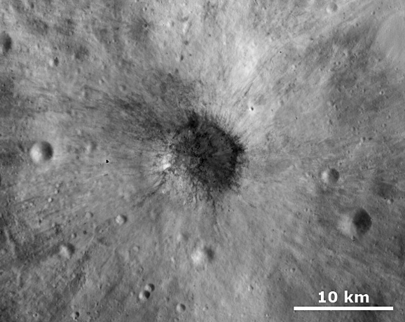
Light and dark material spreads outward from a 5-km-wide crater on Vesta in this image from NASA’s Dawn spacecraft, acquired on October 22, 2011. While craters with differently-toned materials have been previously seen on the asteroid, it is unusual to find one with such a large amount of ejecta of different albedos.

This is a crop of a larger version which was released today on the Dawn website.

This brightness image was taken through the clear filter of Dawn’s framing camera. The distance to the surface of Vesta is 700 kilometers (435 miles) and the image has a resolution of about 70 meters (230 feet) per pixel.

Orbit map: Where is Dawn now?

Vesta resides in the main asteroid belt between the orbits of Mars and Jupiter and is thought to be the source of many of the meteorites that fall to Earth. The Dawn spacecraft successfully entered orbit around Vesta on July 16, 2011.

After its investigation of Vesta, Dawn will leave orbit and move on to Ceres. It will become the first spacecraft to orbit two different worlds.

Image Credit: NASA/ JPL-Caltech/ UCLA/ MPS/ DLR/ IDA

More “Hollowed Ground” on Mercury

MESSENGER captures image of curious "hollows" around a crater peak

[/caption]

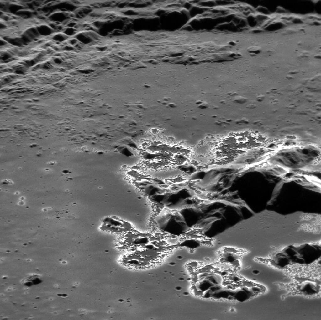
The latest featured image from NASA’s MESSENGER spacecraft, soon to complete its first year in orbit around Mercury, shows the central peak of the 78-mile (138-km) – wide crater Eminescu surrounded by more of those brightly-colored surface features dubbed “hollows”. Actually tinted a light blue color, hollows may be signs of an erosion process unique to Mercury because of its composition and close proximity to the Sun.

First noted in September of last year, hollows have now been identified in many areas across Mercury. They showed up in previous images as only bright spots, but once MESSENGER established orbit in March of 2011 and began high-resolution imaging of Mercury’s surface it became clear that these features were something totally new.

The lack of craters within hollows seems to indicate that they are relatively young features. In fact, they may be part of a process that continues even now.

“Analysis of the images and estimates of the rate at which the hollows may be growing led to the conclusion that they could be actively forming today,” said David Blewett of the Johns Hopkins University Applied Physics Laboratory (APL).

One hypothesis is that the hollows are formed by the sublimation of subsurface material exposed during the creation of craters, around which they are most commonly seen. Being so close to the Sun (29 million miles/46 million km at closest) and lacking a protective atmosphere like Earth’s, Mercury is constantly being scoured by the powerful solar wind. This relentless stream of charged particles may literally be “sandblasting” exposed volatile materials off the planet’s surface!

The image above shows an area approximately 41 miles (66 km) across. It has been rotated to enhance perspective; see the original image and caption here.

Image: NASA/Johns Hopkins University Applied Physics Laboratory/Carnegie Institution of Washington

What Lies Beneath

Collapse pit on Mars reveals opening to an underground cave

[/caption]

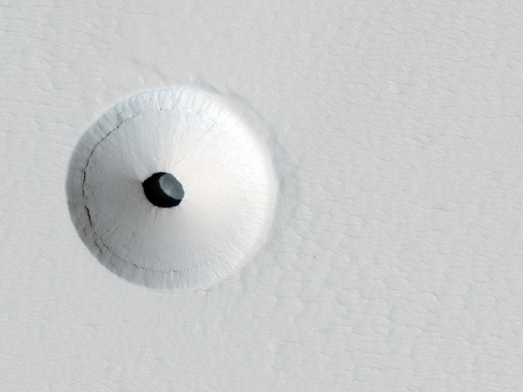
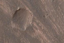
What would make a great home for a giant Martian ant lion? I’d have to say this pit, imaged by the HiRISE camera aboard the Mars Reconnaissance Orbiter!

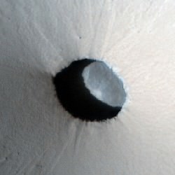
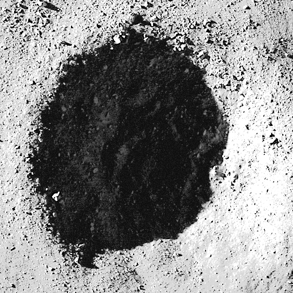
Earlier this year a crater was spotted with a dark spot at its center. When the team took a closer look with the high-resolution camera they saw that the spot is actually a 35-meter (115-foot) -wide skylight that opens into an underground cavern. The cavern is most likely a section of an empty lava tube, leftovers from ancient Martian volcanic activity.

Detail of the skylight

Based on the shadows it’s estimated that the pit is about 20 meters (65 feet) deep. But, how much of that is material piled up on the floor of the cavern from the surrounding crater itself? And what caused the crater to form in the first place? These are questions that remain to be answered.

The HiRISE image itself is false-color, the hues denoting the texture and composition of the surface material and not the actual color as would be seen in visible light.

As far as a giant Martian ant lion… well, unless there are some giant Martian ants around for it to snack on, I’m going to assume there’s nobody home!

Image credit: NASA / JPL / University of Arizona.

Messages from Mercury

MESSENGER's view from Mercury's south pole

[/caption]

It’s been just over two months since the MESSENGER spacecraft successfully entered orbit around Mercury, back on March 18, and it’s been enthusiastically returning image after image of our solar system’s innermost planet at a unprecedented rate. Which, of course, is just fine with us!

The image above shows Mercury’s southern hemisphere and the bright rays of the 50-km-wide crater Han Kan. It was acquired on May 17, 2011.

Below are more recent images from MESSENGER… some of which show regions and features that have never previously been mapped – or even named!

Unnamed double peak-ring basin. Acquired May 13.
Detail of the mountains that make up the rim of Caloris Basin. Acquired May 5.
Narrow-angle camera view of the 100-km-wide Atget crater. Acquired May 10.
Color map of Mercury's surface. The bright crater is Snorri (21km wide). Acquired April 15.

Click on the images to see more detail on the MESSENGER mission site.

MESSENGER’s orbit about Mercury is highly elliptical, taking it 200 kilometers (124 miles) above its northern surface at the closest pass and 15,193 kilometers (9,420 miles) away from the south pole at furthest. Check out this video showing an animation of how a typical MESSENGER orbit would be executed.

Image credits: Credit: NASA/Johns Hopkins University Applied Physics Laboratory/Carnegie Institution of Washington.

The MESSENGER spacecraft is the first ever to orbit the planet Mercury, and the spacecraft’s seven scientific instruments and radio science investigation are unraveling the history and evolution of the Solar System’s innermost planet. During the one-year primary mission, MDIS is scheduled to acquire more than 75,000 images in support of MESSENGER’s science goals.

More Evidence of Liquid Erosion on Mars?

Possible water-formed gullies cut through sedimentary layers in Terby Crater


[/caption]

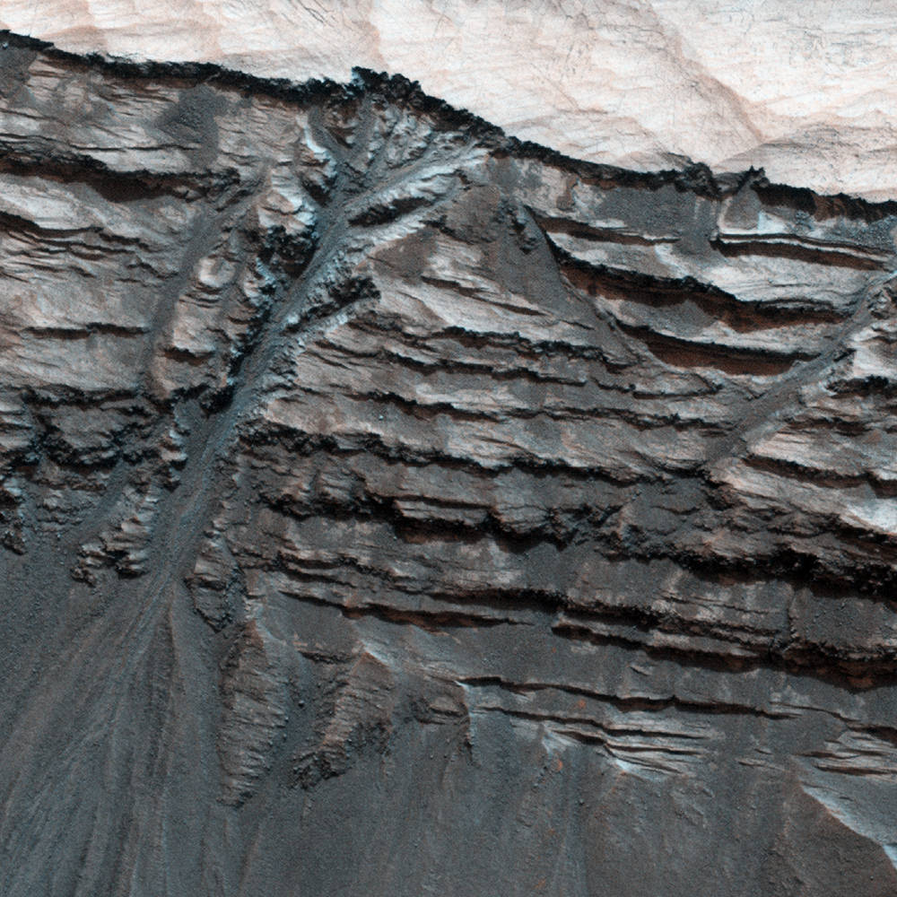
Terby Crater, a 170-km-wide (100-mile-wide) crater located on the northern edge of the vast Hellas Planitia basin in Mars’ southern hemisphere, is edged by variable-toned layers of sedimentary rock – possibly laid down over millennia of submersion beneath standing water. This image (false-color) from the HiRISE camera aboard the Mars Reconnaissance Orbiter shows a portion of Terby’s northern wall with what clearly looks like liquid-formed gullies slicing through the rock layers, branching from the upper levels into a main channel that flows downward, depositing a fan of material at the wall’s base.

But, looks can be deceiving…


Terby Crater. Credit: NASA/JPL/University of Arizona

Dry processes – especially on Mars, where large regions have been bone-dry for many millions of years – can often create the same effects on the landscape as those caused by running water. Windblown Martian sand and repetitive dry landslides can etch rock in much the same way as liquid water, given enough time. But the feature seen above in Terby seem to planetary scientists to be most likely the result of liquid erosion… especially considering that the sedimentary layers themselves seem to contain clay materials, which only form in the presence of liquid water. Is it possible that some water existed beneath Mars’ surface long after the planet’s surface dried out? Or that it’s still there? Only future exploration will tell for sure.

“While formation by liquid water is one of the proposed mechanisms for gully formation on Mars, there are others, such as gravity-driven mass-wasting (like a landslide) that don’t require the presence of liquid water. This is still an open question that scientists are actively pursuing.”

– Nicole Baugh, HiRISE Targeting Specialist

Terby Crater was once on the short list of potential landing sites for the new Mars Science Laboratory (aka Curiosity) rover but has since been removed from consideration. Still, it may one day be visited by a future robotic mission and have its gullies further explored from ground level.

Click here to see the original image on the HiRISE site.

Image credit: NASA / JPL / University of Arizona

Look Inside a Lunar Crater

Brightening the shadowed area reveals details of the crater floor...and even more boulders!

[/caption]

The crater shown above is located in the lunar highlands and is filled with and surrounded by boulders of all sizes and shapes. It is approximately 550 meters (1800 feet) wide yet is still considered a small crater, and could have been caused by either a direct impact by a meteorite or by an ejected bit of material from another impact. Scientists studying the Moon attempt to figure out how small craters like this were formed by their shapes and the material seen around them…although sometimes the same results can be achieved by different events.

For example, when an object from space strikes the Moon, it is typically traveling around 20 km per second (12 miles/sec). If the impact site happens to have a very hard subsurface, it can make a crater with scattered bouldery chunks composed of the hard material around it. But, if a large piece of ejected material from another impact were to strike the lunar surface at a much slower speed, as ejecta typically do (since they travel slower than incoming space debris and the Moon’s escape velocity is fairly low, meaning any ejecta that does fall back to the surface must be traveling slower than 2.38 km/s,) then the ejected chunk could break apart on impact and scatter boulders of itself around the crater…regardless of subsurface composition.

Really the only way to tell for sure which scenario has taken place around a given crater – such as the one above – is to collect and return samples from the site so they can be tested. (Of course that’s much easier said than done!)

You can read more about this image on Arizona State University’s Lunar Reconnaissance Orbiter Camera site here.

And as an added treat, take a look deep into the shadows of the crater’s interior below…I tweaked the image curves in Photoshop to wrestle some of the details out of there!


Brightening the shadowed area reveals details of the crater floor...and even more boulders!

Image credit: NASA/GSFC/Arizona State University. (Edited by J. Major.)

P.S.: Want to see both image versions combined? Click here. (Thanks to Mike C. for the suggestion!)