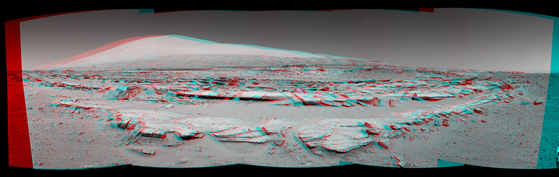
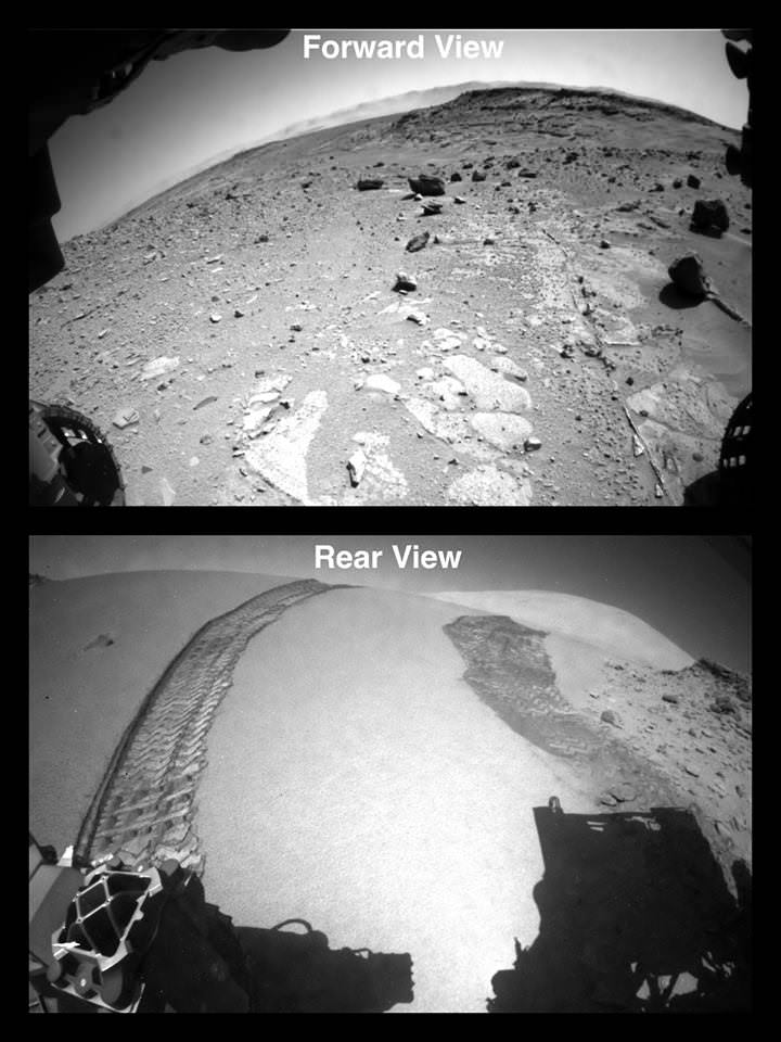
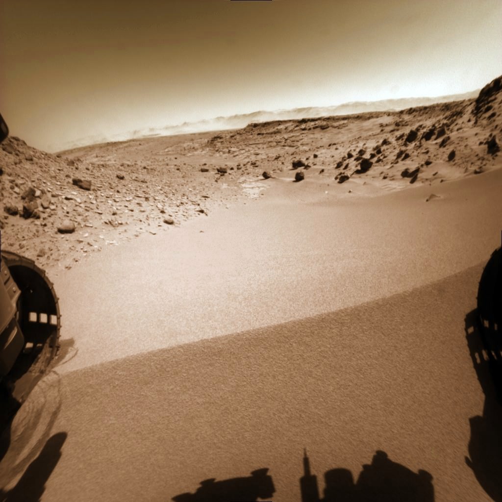
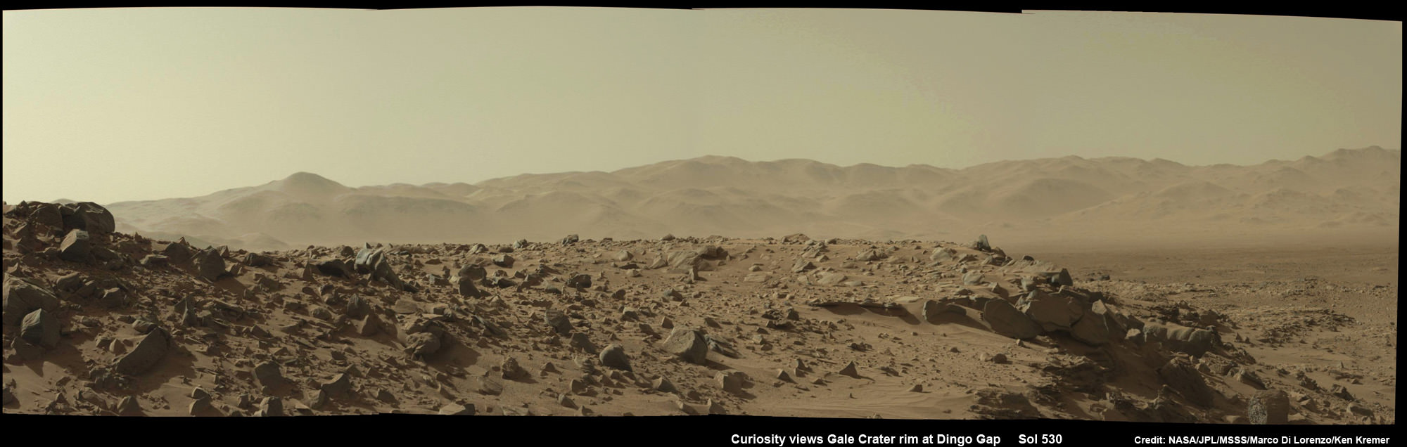
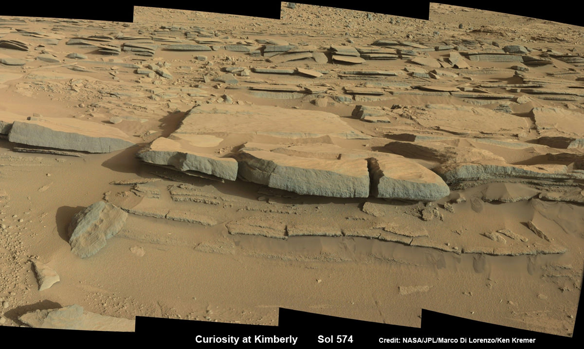
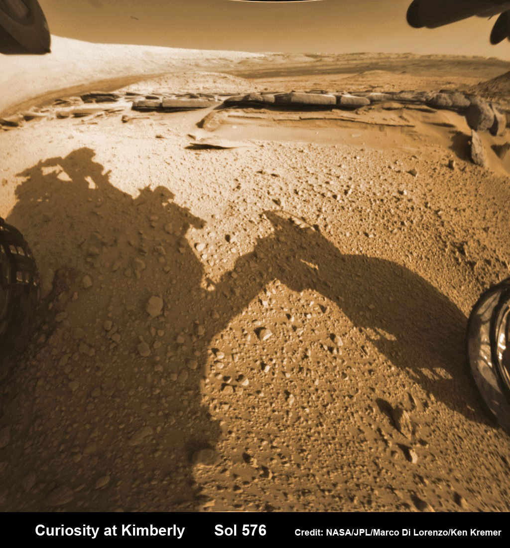
Martian landscape with rows of curved rock outcrops at ‘Kimberley’ in the foreground and spectacular Mount Sharp on the horizon. NASA’s Curiosity Mars rover pulled into Kimberly waypoint dominated by layered rock outcrops as likely drilling site. This colorized navcam camera photomosaic was assembled from imagery taken on Sol 576 (Mar. 20, 2014).
Credit: NASA/JPL-Caltech/Marco Di Lorenzo/Ken Kremer-kenkremer.com
See additional Curiosity Mars photomosaics below[/caption]
KENNEDY SPACE CENTER, FL – NASA’s Curiosity rover has just pulled into gorgeous terrain chock full of curvy rock outcrops at Kimberley that’s suitable for contact science and drilling action, according to the mission team.
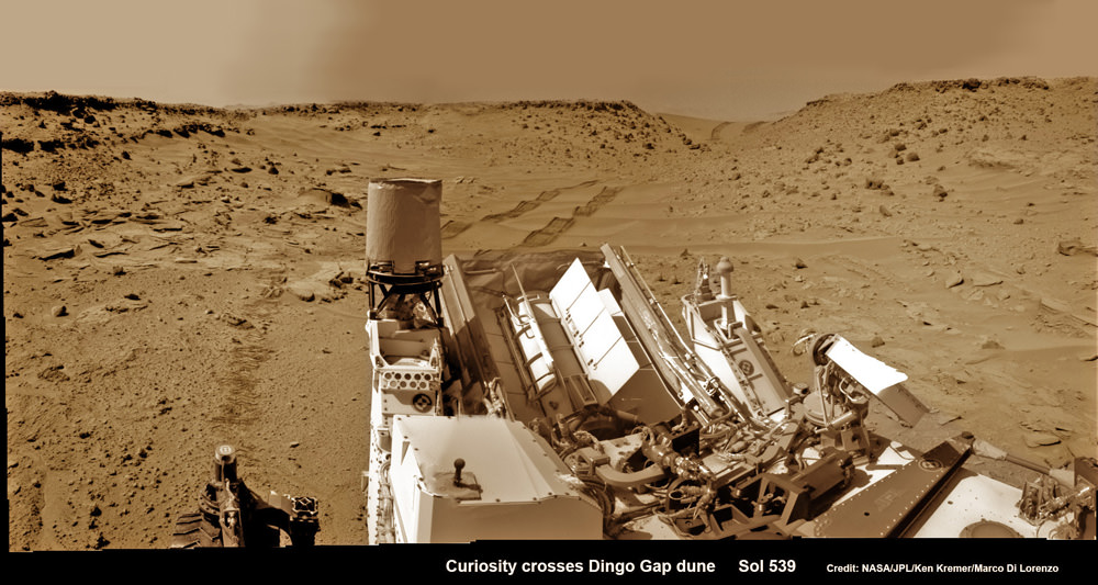
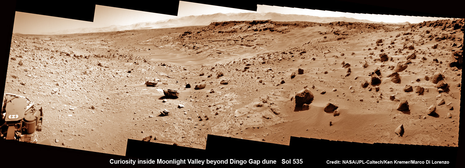
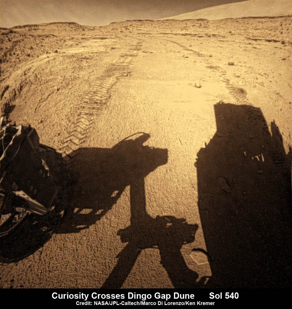
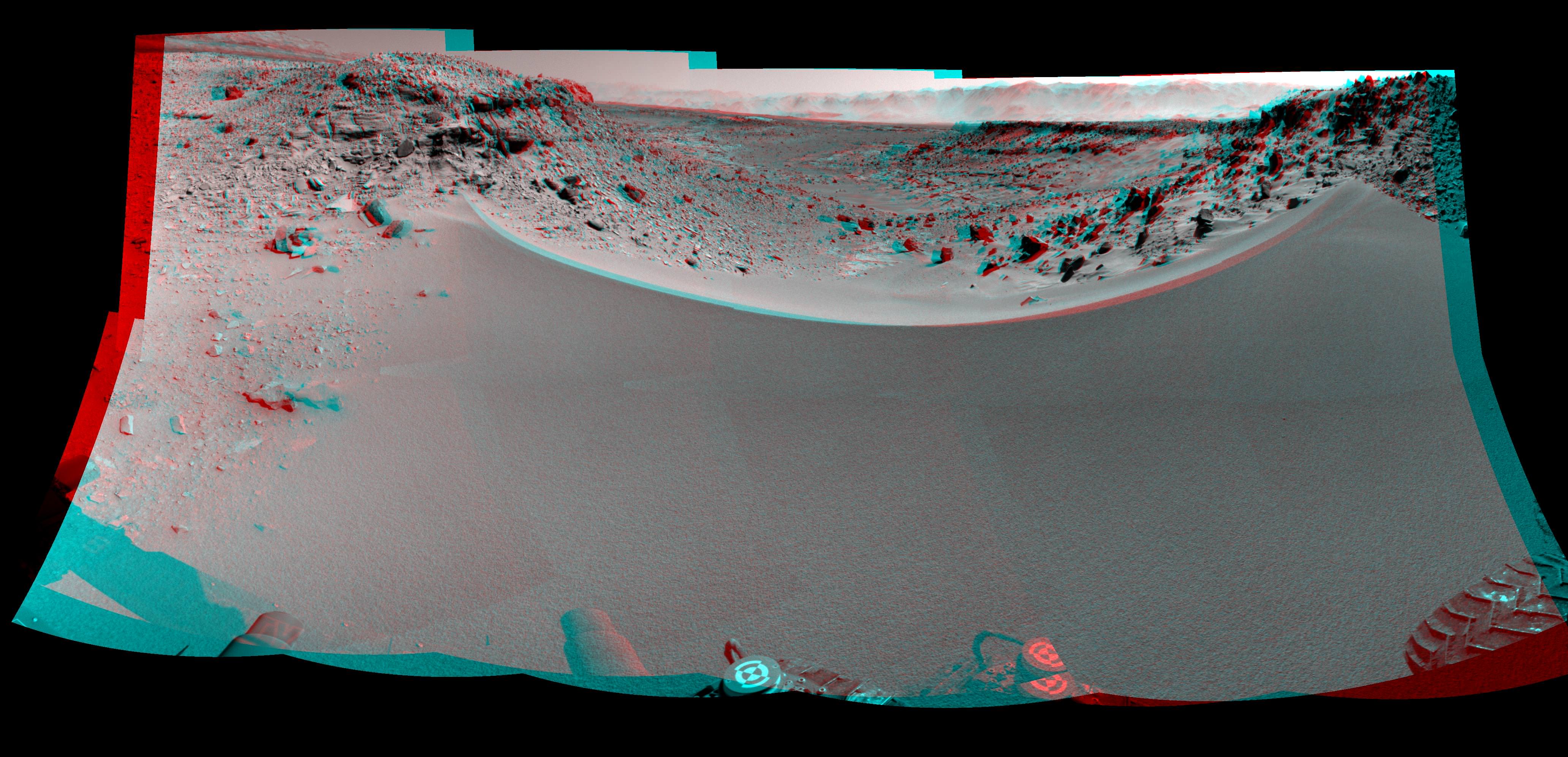
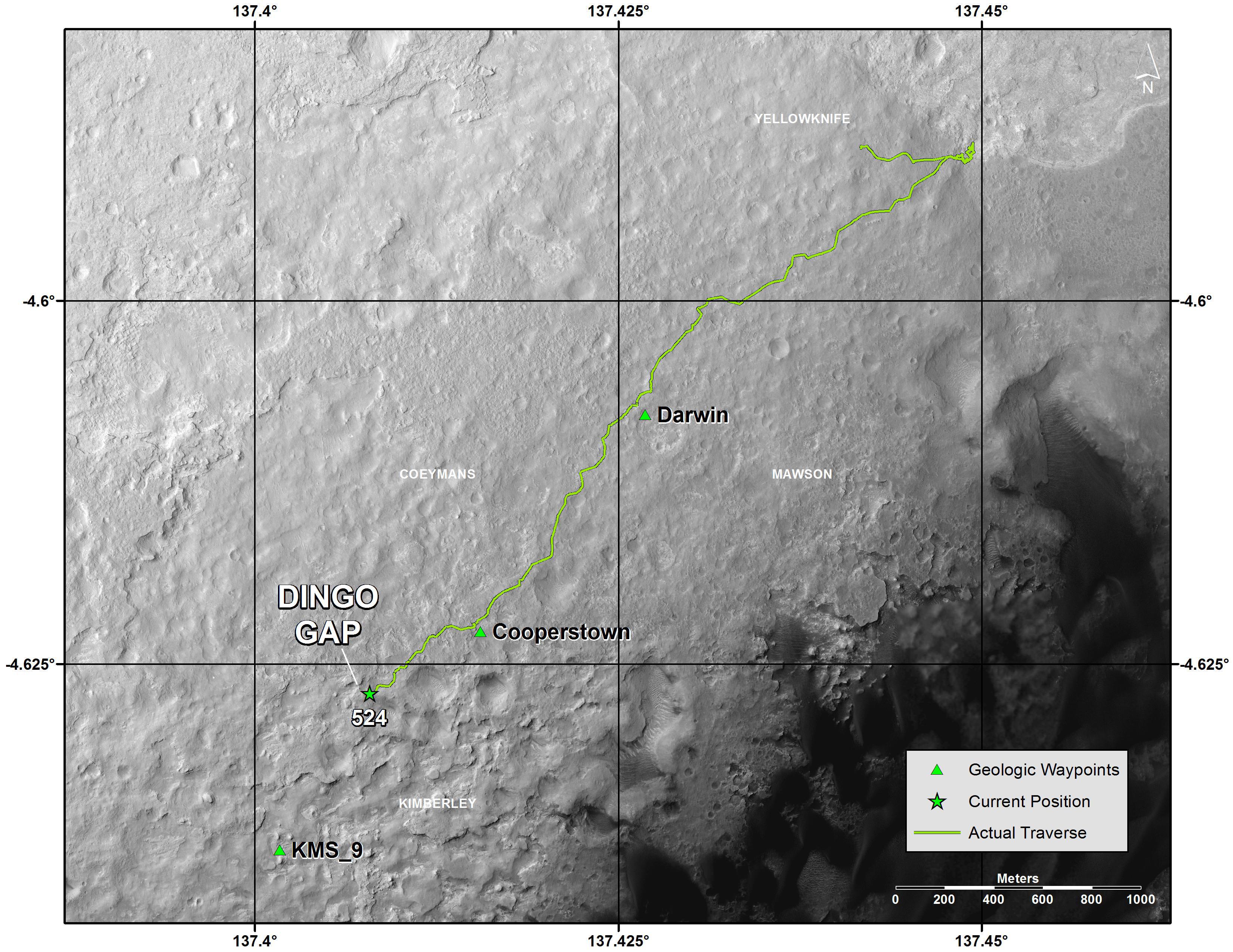
The six wheeled Martian dune buggy drove into the dazzling Kimberley waypoint this week after traversing a swath of otherworldly dune fields since passing through a gateway known as the ‘Dingo Gap’ sand dune some six weeks ago.
The robot’s arm has been deployed to investigate the most scientifically productive spots to touch Kimberley’s textured outcrops for detailed scrutiny.
The science team has been hunting for tasty rock outcrops suitable for the first drilling campaign since she departed the dried out lakebed at Yellowknife Bay in July 2013 and began her epic trek across the floor of Gale Crater towards the base of Mount Sharp.
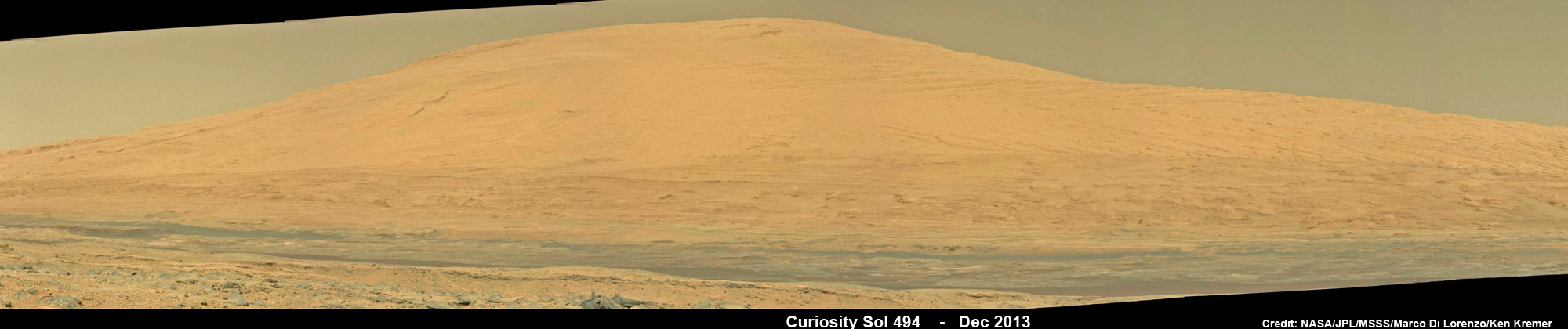
With each passing Sol, or Martian day, Mount Sharp looms larger and larger and the historical layers with deposits of hydrated minerals potentially indicative of an alien habitable zone come ever clearer into focus.
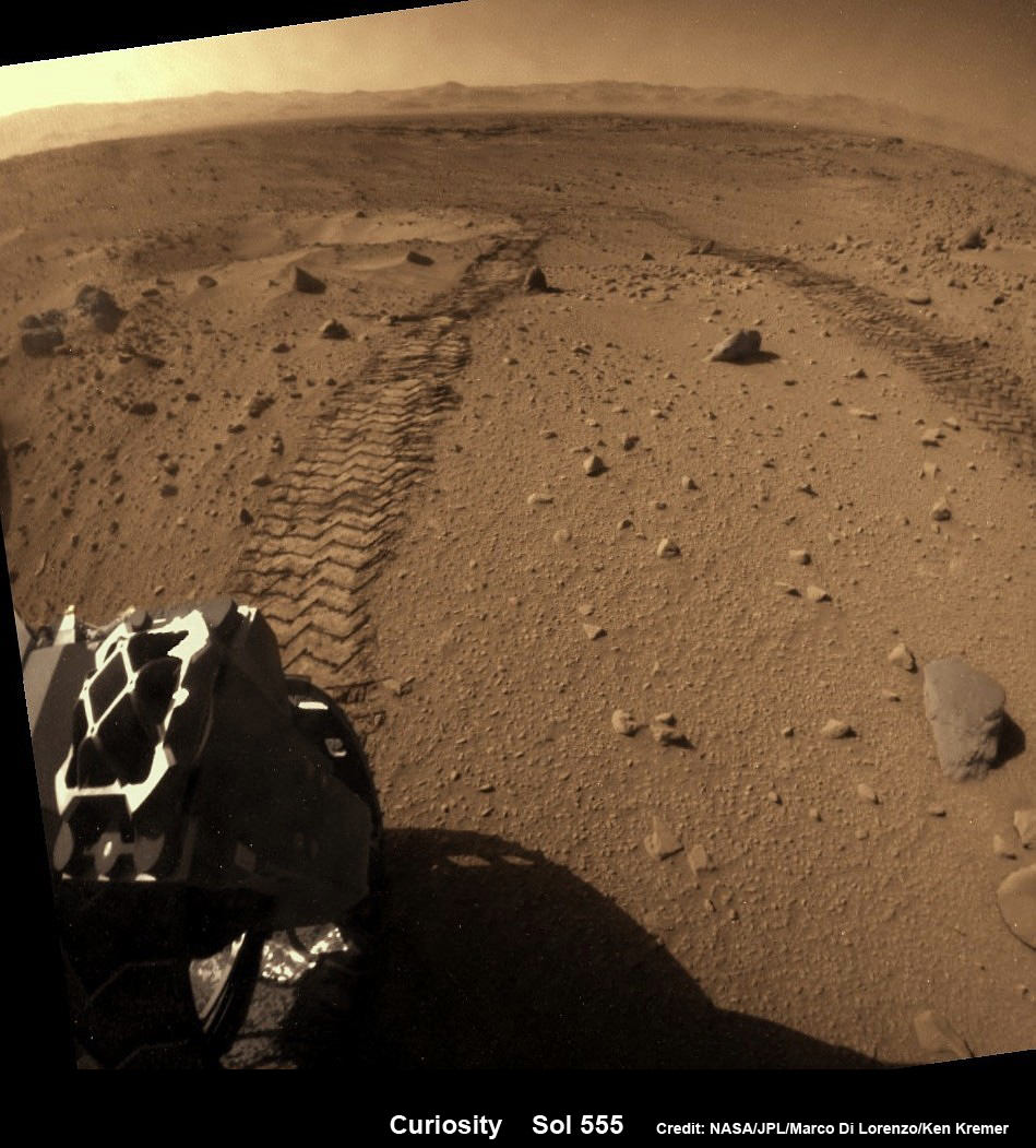
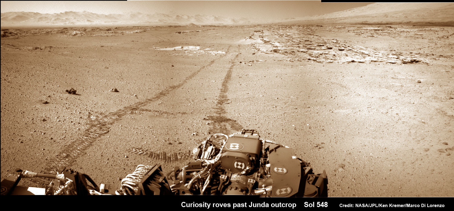
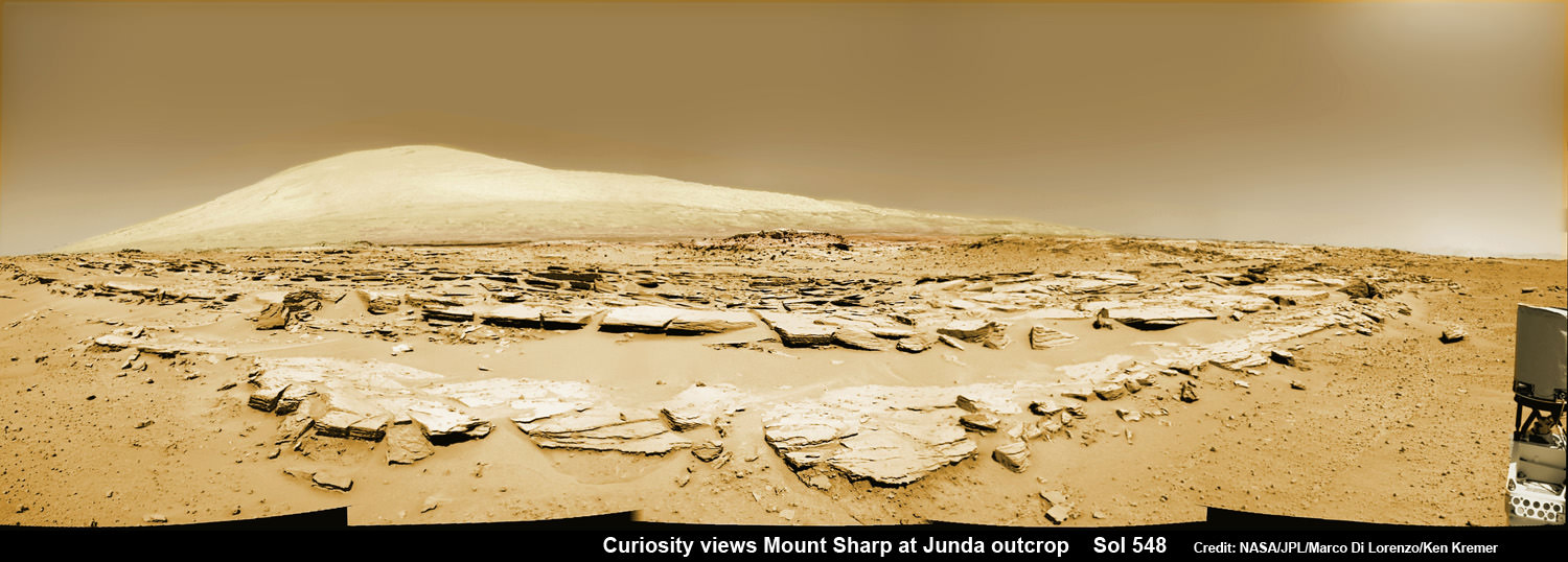
About a month ago on Feb. 19 (Sol 548), Curiosity couldn’t resist the urge to pause mid dune drive, just like a tourist, and snap fabulous imagery of multiple rows of striated rocks at the Junda outcrop – see our mosaics below.
Junda appeared remarkably similar to Kimberley, about 1 kilometer back.

So after executing a final series of short bumps edging ever closer to the outcrops this week, Curiosity parked at the periphery of Kimberley on Thursday, March 20, Sol 576, and captured breathtaking imagery of the rocky rows dominated by towering Mount Sharp on the distant horizon.
See our photomosaics showing the spectacularly inviting terrain around Kimberley and Junda – above and below by Marco Di Lorenzo and Ken Kremer.
“The images [at Kimberley] show nice outcrops in front of the rover, suitable for contact science,” according to science team member Ken Herkenhoff in a mission update.
This weekend, the state of the art robot is conducting contact science with the cameras and spectrometers on the terminus of the 7 foot long robotic arm and the mast mounted ChemCam laser and high resolution cameras to determine the best spot for drilling and sampling.
The team commanded Curiosity to clean out the arms CHIMRA sample handling mechanism in anticipation of boring into the Martian outcrops and delivering powdery, pulverized samples of cored Martian rocks to the SAM and CheMin miniaturized chemistry labs waiting patiently inside the robots belly to eat something exciting from the Red Planet.
“The arm will be deployed to “thwack” and vibrate CHIMRA to clean out any remnants of the “John Klein” [drilling] sample, followed by Mastcam and RMI imaging of the CHIMRA sieve,” says Herkenhoff.
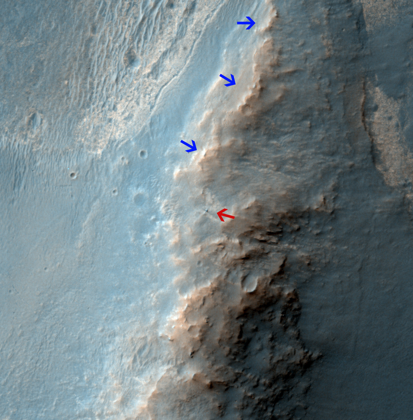
Scientists directed Curiosity on a pinpoint drive to Kimberly after their interest was piqued by orbital images taken by the powerful telescopic camera on NASA’s Mars Reconnaissance Orbiter (MRO) circling overhead.
“At Kimberly, we see three terrain types exposed and a relatively dust-free surface,” said science team collaborator Katie Stack of the California Institute of Technology, Pasadena.
The missions science focus has shifted to “search for that subset of habitable environments which also preserves organic carbon,” says Curiosity Principal Investigator John Grotzinger, of the California Institute of Technology in Pasadena.
Organic molecules are the building blocks of life as we know it.
The sedimentary foothills of Mount Sharp, which reaches 3.4 miles (5.5 km) into the Martian sky, is the 1 ton robots ultimate destination inside Gale Crater because it holds caches of water altered minerals. Such minerals could possibly indicate locations that sustained potential Martian life forms, past or present, if they ever existed.
Curiosity discovered a habitable zone at Yellowknife via two drilling operations at the John Klein and Cumberland outcrops and thereby accomplished the primary goal of the mission.
To date Curiosity’s odometer stands at 6.2 kilometers. She has taken over 132,000 images.
The robot has somewhat over another 4 kilometers to go to reach the base of Mount Sharp.
She may arrive at the lower reaches of Mount Sharp sometime in mid 2014, but must first pass through a potentially treacherous dune field.
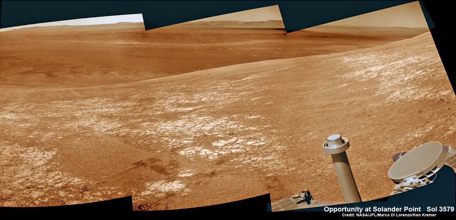
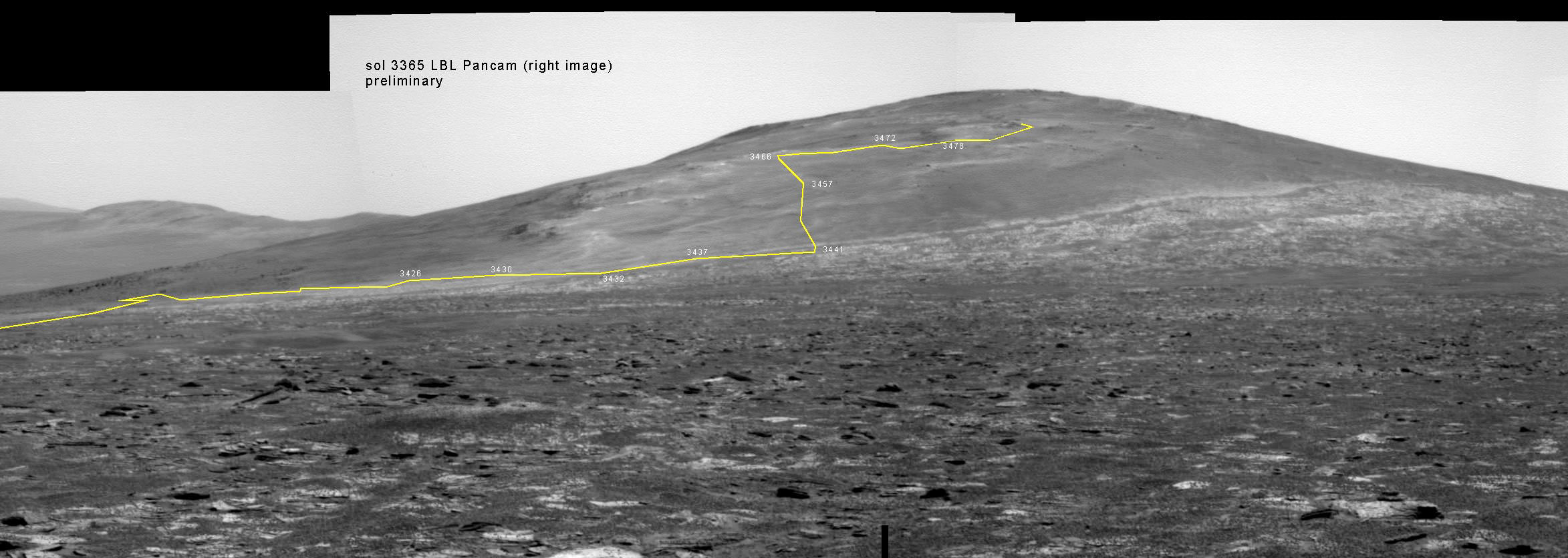
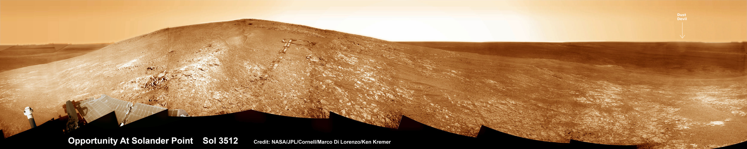
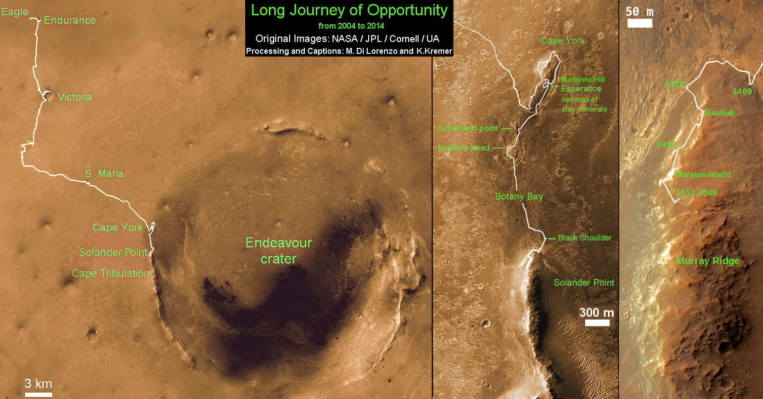
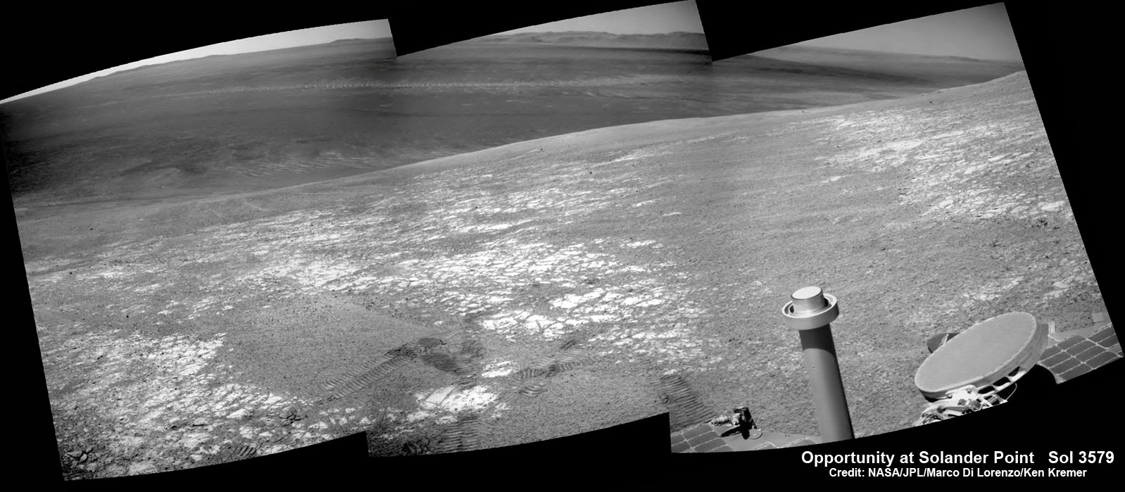
Meanwhile, NASA’s sister Opportunity rover is exploring clay mineral outcrops by the summit of Solander Point on the opposite side of Mars at the start of her 2nd Decade investigating the Red Planet’s mysteries.
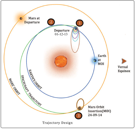
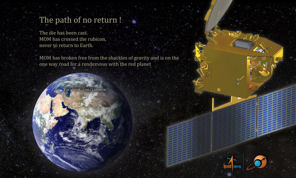
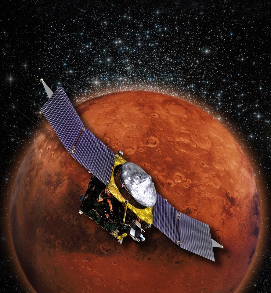
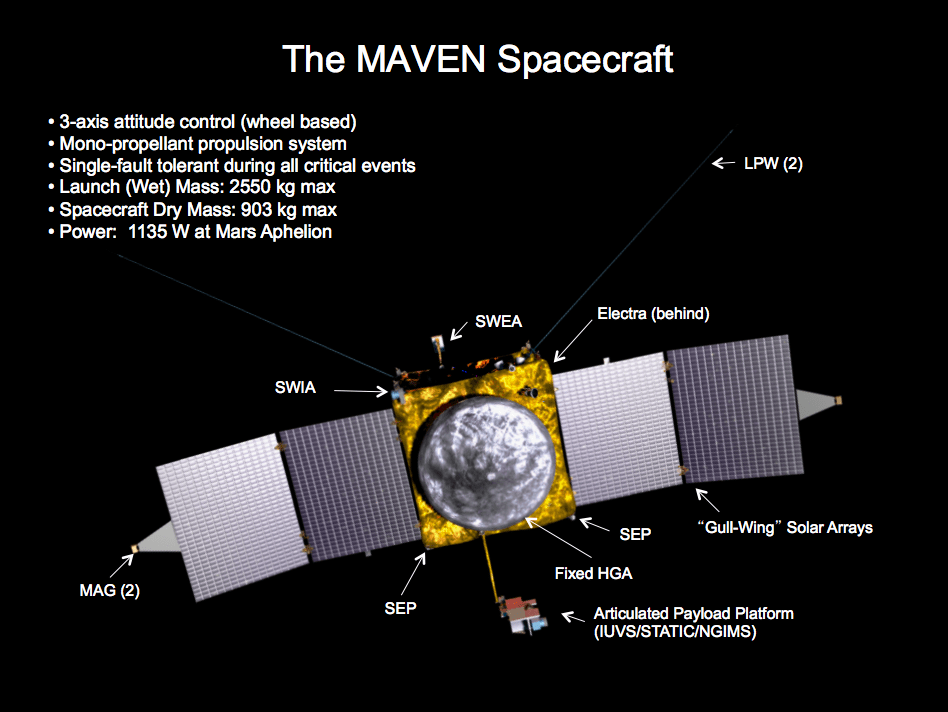
A pair of new orbiters are streaking to the Red Planet to fortify Earth’s invasion fleet- NASA’s MAVEN and India’s MOM.
Stay tuned here for Ken’s continuing Curiosity, Opportunity, Chang’e-3, SpaceX, Orbital Sciences, LADEE, MAVEN, MOM, Mars and more planetary and human spaceflight news.
Learn more at Ken’s upcoming presentations at the NEAF convention on April 12/13 and at Washington Crossing State Park, NJ on April 6. Also evenings at the Quality Inn Kennedy Space Center, Titusville, FL, March 24/25 and March 29/30.