‘Walk on Mars’ with Moonwalker Buzz Aldrin at Limited Engagement ‘Destination Mars’ Holographic Exhibit at KSC Visitor Complex

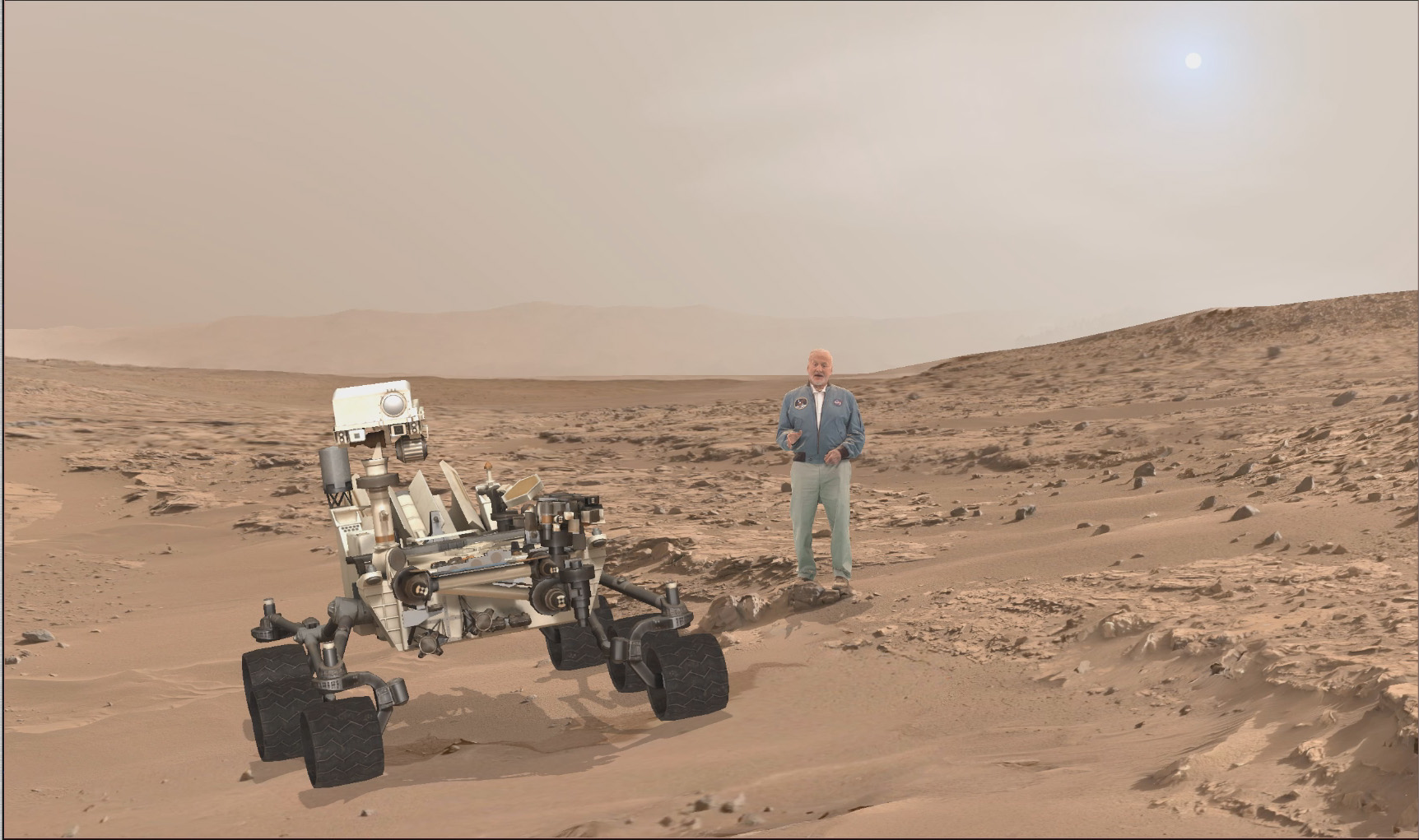
A scene from ‘Destination Mars’ of Buzz Aldrin and NASA’s Curiosity Mars rover with the Gale crater rim in the distance. The new, limited time interactive exhibit is now showing at the Kennedy Space Center visitor complex in Florida through Jan 1, 2017. Credit: NASA/JPL/Microsoft
A scene from ‘Destination Mars’ of Buzz Aldrin and  NASA’s Curiosity Mars rover with the Gale crater rim in the distance. The new, limited time interactive exhibit is now showing at the Kennedy Space Center visitor complex in Florida through Jan 1, 2017. Credit: NASA/JPL/Microsoft
A scene from ‘Destination Mars’ of Buzz Aldrin and NASA’s Curiosity Mars rover with the Gale crater rim in the distance. The new, limited time interactive exhibit is now showing at the Kennedy Space Center visitor complex in Florida through Jan 1, 2017. Credit: NASA/JPL/Microsoft

KENNEDY SPACE CENTER VISITOR COMPLEX, FL- Think a Holodeck adventure on Star Trek guided by real life Apollo 11 moonwalker Buzz Aldrin and you’ll get a really good idea of what’s in store for you as you explore the surface of Mars like never before in the immersive new ‘Destination Mars’ interactive holographic exhibit opening to the public today, Monday, Sept.19, at the Kennedy Space Center visitor complex in Florida.

The new Red Planet exhibit was formally opened for business during a very special ribbon cutting ceremony featuring Buzz Aldrin as the star attraction – deftly maneuvering the huge ceremonial scissors during an in depth media preview and briefing on Sunday, Sept. 18, 2016, including Universe Today.

The fabulous new ‘Destination Mars’ limited engagement exhibit magically transports you to the surface of the Red Planet via Microsoft HoloLens technology.

It literally allows you to ‘Walk on Mars’ using real imagery taken by NASA’s Mars Curiosity rover and explore the alien terrain, just like real life scientists on a geology research expedition.
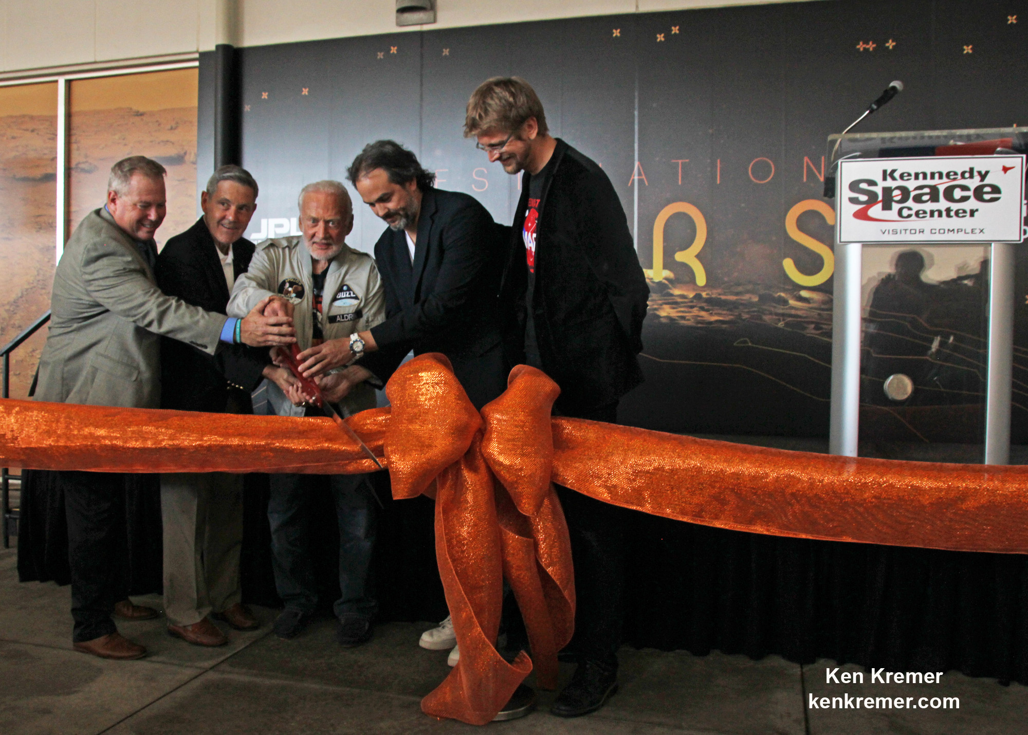
A ceremonial ribbon is cut for the opening of new "Destination: Mars" experience at the Kennedy Space Center visitor complex in Florida during media preview on Sept. 18, 2016. From the left are Therrin Protze, chief operating officer of the visitor complex; center director Bob Cabana; Apollo 11 astronaut Buzz Aldrin; Kudo Tsunoda of Microsoft; and Jeff Norris of NASA's Jet Propulsion Laboratory in Pasadena, California. Credit: Ken Kremer/kenkremer.com
A ceremonial ribbon is cut for the opening of new “Destination: Mars” experience at the Kennedy Space Center visitor complex in Florida during media preview on Sept. 18, 2016. From the left are Therrin Protze, chief operating officer of the visitor complex; center director Bob Cabana; Apollo 11 astronaut Buzz Aldrin; Kudo Tsunoda of Microsoft; and Jeff Norris of NASA’s Jet Propulsion Laboratory in Pasadena, California. Credit: Ken Kremer/kenkremer.com

“Technology like HoloLens leads us once again toward exploration,” Aldrin said during the Sept. 18 media preview. “It’s my hope that experiences like “Destination: Mars” will continue to inspire us to explore.”

Destination Mars was jointly developed by NASA’s Jet Propulsion Laboratory – which manages the Curiosity rover mission for NASA – and Microsoft HoloLens.

A ceremonial ribbon is cut for the opening of new "Destination: Mars" experience at the Kennedy Space Center visitor complex in Florida during media preview on Sept. 18, 2016. From the left are Therrin Protze, chief operating officer of the visitor complex; center director Bob Cabana; Apollo 11 astronaut Buzz Aldrin; Kudo Tsunoda of Microsoft; and Jeff Norris of NASA's Jet Propulsion Laboratory in Pasadena, California. Credit: Dawn Taylor Leek
A ceremonial ribbon is cut for the opening of new “Destination: Mars” experience at the Kennedy Space Center visitor complex in Florida during media preview on Sept. 18, 2016. From the left are Therrin Protze, chief operating officer of the visitor complex; center director Bob Cabana; Apollo 11 astronaut Buzz Aldrin; Kudo Tsunoda of Microsoft; and Jeff Norris of NASA’s Jet Propulsion Laboratory in Pasadena, California. Credit: Dawn Taylor Leek

Buzz was ably assisted at the grand ribbon cutting ceremony by Bob Cabana, former shuttle commander and current Kennedy Space Center Director, Therrin Protze, chief operating officer of the visitor complex, Kudo Tsunoda of Microsoft, and Jeff Norris of NASA’s Jet Propulsion Laboratory in Pasadena, California.

The experience is housed in a pop-up theater that only runs for the next three and a half months, until New Years Day, January 1, 2017.

Before entering the theater, you will be fitted with specially adjusted HoloLens headsets individually tailored to your eyes.

The entire ‘Destination Mars’ experience only lasts barely 8 minutes.
So, if you are lucky enough to get a ticket inside you’ll need to take advantage of every precious second to scan around from left and right and back, and top to bottom. Be sure to check out Mount Sharp and the rim of Gale Crater.

You’ll even be able to find a real drill hole that Curiosity bored into the Red Planet at Yellowknife Bay about six months after the nailbiting landing in August 2012.

During your experience you will be guided by Buzz and Curiosity rover driver Erisa Hines of JPL. They will lead you to areas of Mars where the science team has made many breakthrough discoveries such as that liquid water once flowed on the floor of Curiosity’s Gale Crater landing site.
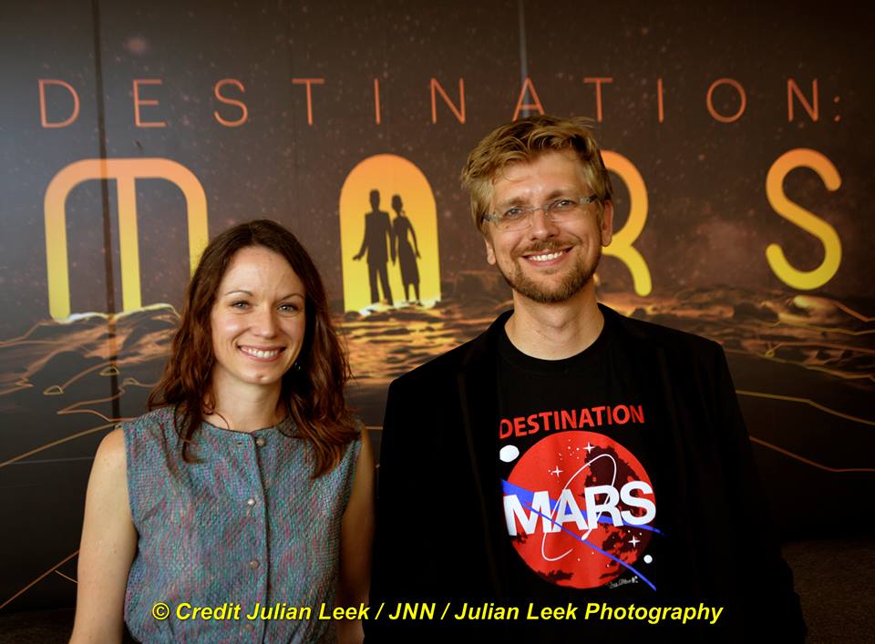
Curiosity rover driver Erisa Hines and Jeff Norris of NASA's Jet Propulsion Laboratory at the grand opening for Destination Mars at the Kennedy Space Center visitor complex in Florida on Sept. 18, 2016. Credit Julian Leek
Curiosity rover driver Erisa Hines and Jeff Norris of NASA’s Jet Propulsion Laboratory at the grand opening for Destination Mars at the Kennedy Space Center visitor complex in Florida on Sept. 18, 2016. Credit Julian Leek

The scenes come to life based on imagery combining the Mastcam color cameras and the black and white navcam cameras, Jeff Norris of NASA’s Jet Propulsion Laboratory in Pasadena, California, told Universe Today in an interview.

Among the surface features visited is Yellowknife Bay where Curiosity conducted the first interplanetary drilling and sampling on another planet in our Solar System. The sample were subsequently fed to and analyzed by the pair of miniaturized chemistry labs – SAM and CheMin – inside the rovers belly.

They also guide viewers to “a tantalizing glimpse of a future Martian colony.”

“The technology that accomplishes this is called “mixed reality,” where virtual elements are merged with the user’s actual environment, creating a world in which real and virtual objects can interact, “ according to a NASA description.

“The public experience developed out of a JPL-designed tool called OnSight. Using the HoloLens headset, scientists across the world can explore geographic features on Mars and even plan future routes for the Curiosity rover.”

Curiosity is currently exploring the spectacular looking buttes in the Murray Buttes region in lower Mount Sharp. Read my recent update here.
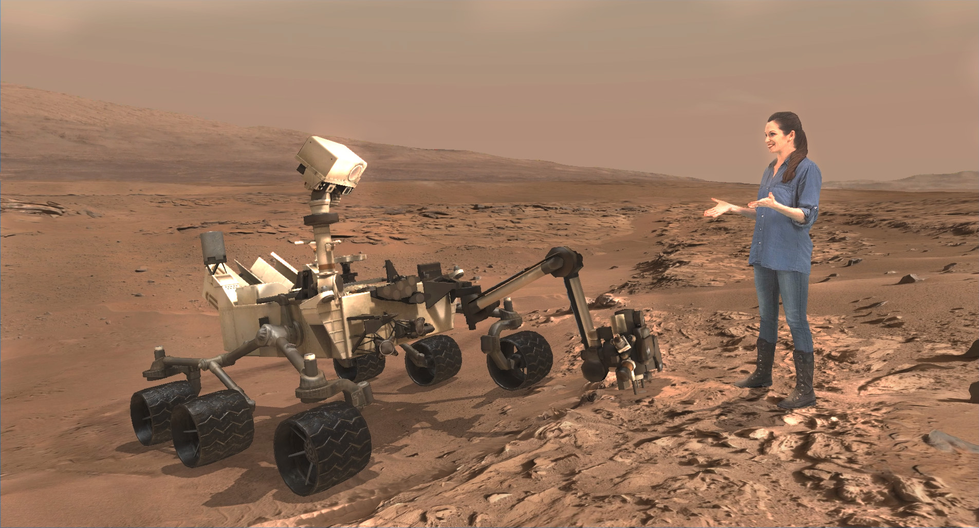
A scene from ‘Destination Mars’ of Erisa Hines and  NASA’s Curiosity Mars rover with Mount Sharp Gale crater rim in the distance. The new, limited time interactive exhibit is now showing at the Kennedy Space Center visitor complex in Florida through Jan 1, 2017. Credit: NASA/JPL/Microsoft
A scene from ‘Destination Mars’ of Erisa Hines and NASA’s Curiosity Mars rover with Mount Sharp Gale crater rim in the distance. The new, limited time interactive exhibit is now showing at the Kennedy Space Center visitor complex in Florida through Jan 1, 2017. Credit: NASA/JPL/Microsoft

Be sure to pay attention or your discovery walk on Mars will be over before you know it. Personally, as a Mars lover and Mars mosaic maker I was thrilled by the 3 D reality and I was ready for more.
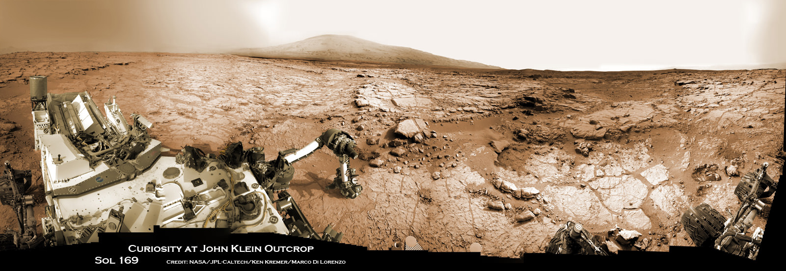
Curiosity accomplished Historic 1st drilling into Martian rock at John Klein outcrop on Feb 8, 2013 (Sol 182) and discovered a habitable zone, shown in this context mosaic view of the Yellowknife Bay basin taken on Jan. 26 (Sol 169). The robotic arm is pressing down on the surface at John Klein outcrop of veined hydrated minerals – dramatically back dropped with her ultimate destination; Mount Sharp. Credit: NASA/JPL-Caltech/Ken Kremer-kenkremer.com/Marco Di Lorenzo

This limited availability, timed experience is available on a first-come, first-served basis. Reservations must be made the day of your visite at the Destination: Mars reservation counter, says the KSC Visitor Complex (KSCVC).

You can get more information or book a visit to Kennedy Space Center Visitor Complex, by clicking on the website link:

https://www.kennedyspacecenter.com/things-to-do/destination-mars.aspx

Be sure to visit this spectacular holographic exhibit before it closes on New Year’s Day 2017 because it is only showing at KSCVC.

There are no plans to book it at other venues, Norris told me.
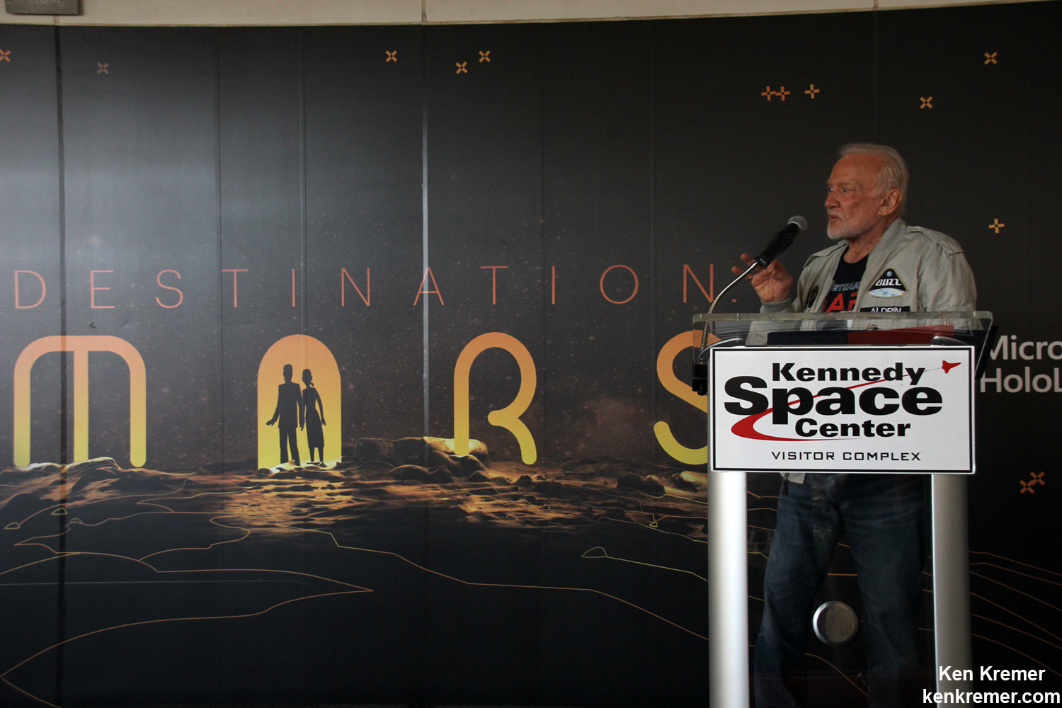
Apollo 11 moonwalker Buzz Aldrin describes newly opened ‘Destination Mars’ holographic experience during media preview at the Kennedy Space Center visitor complex in Florida on Sept. 18, 2016.
Apollo 11 moonwalker Buzz Aldrin describes newly opened ‘Destination Mars’ holographic experience during media preview at the Kennedy Space Center visitor complex in Florida on Sept. 18, 2016. Credit: Ken Kremer/kenkremer.com

As of today, Sol 1465, September 19, 2016, Curiosity has driven over 7.9 miles (12.7 kilometers) since its August 2012 landing inside Gale Crater, and taken over 354,000 amazing images.
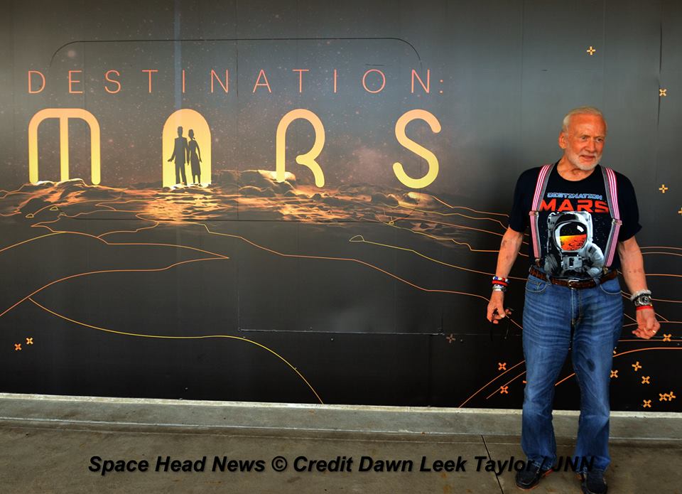
Apollo 11 moonwalker Buzz Aldrin during media preview of newly opened ‘Destination Mars’ holographic experience at the Kennedy Space Center visitor complex in Florida on Sept. 18, 2016.  Credit Julian Leek
Apollo 11 moonwalker Buzz Aldrin during media preview of newly opened ‘Destination Mars’ holographic experience at the Kennedy Space Center visitor complex in Florida on Sept. 18, 2016. Credit Julian Leek

Stay tuned here for Ken’s continuing Earth and planetary science and human spaceflight news.
Ken Kremer

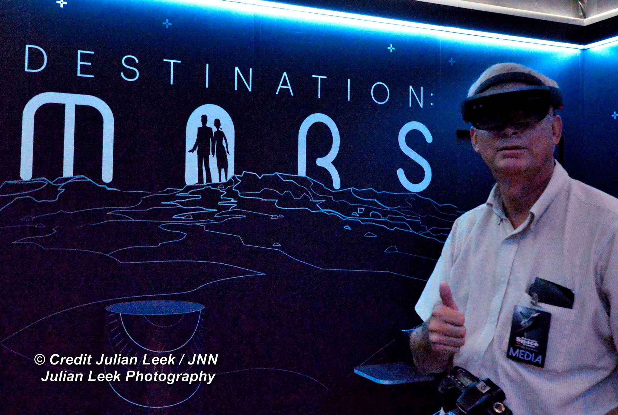
Inside the Destination Mars exhibit area, Ken Kremer of Universe Today is fitted with the Microsoft HoloLens gear. Credit Julian Leek
Inside the Destination Mars exhibit area, Ken Kremer of Universe Today is fitted with the Microsoft HoloLens headset gear. Credit Julian Leek

Stunning New Images Of Mars From The Curiosity Rover

Murray formation: rocks laid down by water and sculpted by wind
Finely layered rocks within the "Murray formation" layer of lower Mount Sharp on Mars. Credit: NASA

Since its deployment in 2012 to the surface of Mars, the Curiosity rover has sent back many breathtaking images of the Red Planet. In addition to snapping photos of the comet Siding Spring and Earth from the surface, not to mention some wonderful panoramic selfies, the rover has also taken countless images that show the geology and surface features of Mars’ in stunning detail.

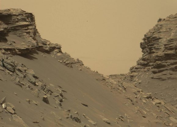
And with the latest photos to be released by NASA, the Curiosity rover has provided us with a wonderful look at the “Murray Buttes” region, which is in the lower part of Mount Sharp. These images were taken by the Curiosity Mast Camera (Mastcam) on Sept. 8th, and provide some lovely insight into the geological history of the region.

Using these images, the Curiosity team hopes to assemble another impressive color mosaic that will give a detailed look at the region’s rocky, desert-like landscape. As you can see from the images provided, the region is characterized by mesas and buttes, which are the eroded remnants of ancient sandstone. Much like other spots around Mount Sharp, the area is of particular interest to the Curiosity team.

Sloping buttes and layered outcrops within the "Murray formation" layer of lower Mount Sharp. Credit: NASA
Sloping buttes and layered outcrops within the “Murray formation” layer of lower Mount Sharp. Credit: NASA

For years, scientists have understood that the rock layers that form the base of Mount Sharp accumulated as a result of sediment being deposited within the ancient lake bed billions of years ago. In this respect, the geological formations are similar to those found in the desert regions of the southwestern United States.

Ashwin Vasavada, the Curiosity Project Scientist of NASA’s Jet Propulsion Laboratory, told Universe Today via email:

” The Murray Buttes region of Mars is reminiscent of parts of the American southwest because of its butte and mesa landscape. In both areas, thick layers of sediment were deposited by wind and water, eventually resulting in a “layer cake” of bedrock that then began to erode away as conditions changed.  In both places, more resistant sandstone layers cap the mesas and buttes because they protect the more easily eroded, fine-grained rock underneath. 

“Like at Monument Valley near the Utah-Arizona border, at Murray Buttes there are just small remnants of these layers that once covered the surface more completely.  There were wind-driven sand dunes at both places, too, that now appear as cross-bedded sandstone layers.  There are of course many differences between Mars and the American Southwest.  For example, there were large inland seas in the Southwest, while at Gale crater there were lakes.”

These sediment layers are believed to have been laid down over the course of 2 billion years, and may have completely filled the crater at one time. Since it is widely believed that lakes and streams existed in the Gale Crater 3.3 – 3.8 billion years ago, some of the lower sediment layers may have originally been deposited on a lake bed.

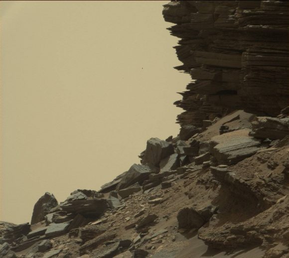
A hillside outcrop with finely layered rocks within the "Murray formation" layer of lower Mount Sharp. Credit: NASA
A hillside outcrop with finely layered rocks within the “Murray formation” layer of lower Mount Sharp. Credit: NASA

For this reason, the Curiosity team also took drill samples from the Murray Buttes area for analysis. This began on Sept. 9th, after the rover was finished taking pictures of the area. As Vasavada explained:

“The Curiosity team is drilling regularly as the rover ascends Mount Sharp. We are drilling into the fine-grained rock that was deposited within lakes in order to see how the lake chemistry, and therefore the environment, changed over time. Curiosity drilled into the coarser sandstone that forms the upper layers of the buttes when the rover crossed the Naukluft Plateau earlier in 2016.”

After the drilling is completed, Curiosity will continue farther south and higher up Mount Sharp, leaving behind these spectacular formations. These pictures represent Curiosity‘s last stop in the Murray Buttes, where the rover has been spending the past month.

And as of this past September 11th, 2016, Curiosity has been on the planet Mars for a total of 4 years and 36 days (or 1497 Earth days; 1458 sols) since it landed on August 6th, 2012.

One has to wonder how the pareidolia folks are going to interpret these ones. After “seeing” a rat, a lizard, a doughnut, a coffin, and so forth, what’s left? Might I suggest that the top image kind of looks like a statue-column?

Further Reading: NASA – Solar System Exploration

Curiosity Rover’s Proximity To Possible Water Raises Planetary Protection Concerns

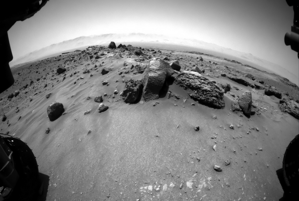
View from the Curiosity rover at the foot of Aeolis Mons, before the rover starts to climb the mountain. Credit: NASA

After four years on Mars, the Curiosity rover has made some pretty impressive discoveries. These have ranged from characterizing what Mars’ atmosphere was like billions of years ago to discovering organic molecules and methane there today. But arguably the biggest discovery Curiosity has made has been uncovering evidence of warm, flowing water on Mars’ surface.

Unfortunately, now faced with what could be signs of water directly in its path, NASA is forced to enact strict protocols. These signs take the form of dark streaks that have been observed along the sloping terrain of Aeolis Mons (aka. Mount Sharp), which the rover has been preparing to climb. In order to prevent contamination, the rover must avoid any contact with them, which could mean a serious diversion.

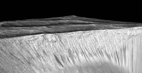
These sorts of dark streaks are known as recurring slope lineae (RSLs) because of their tendency to appear, fade away and re­appear seasonally on steep slopes. The first RSLs were reported in 2011 by the Mars Reconnaissance Orbiter in a variety of locations, and are now seen as proof that water still periodically flows on Mars (albiet in the form of salt-water).

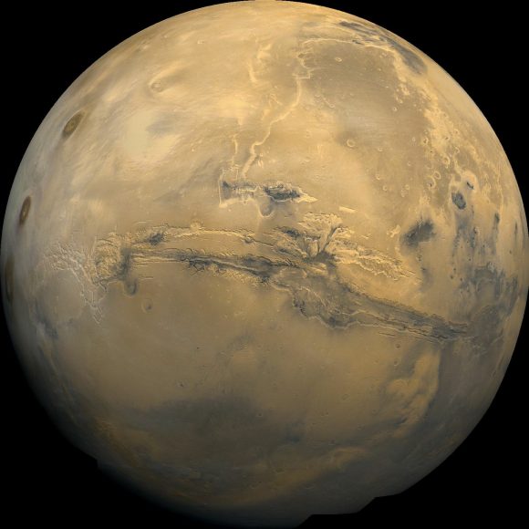
Mosaic of the Valles Marineris hemisphere of Mars, similar to what one would see from orbital distance of 2500 km. Credit: NASA/JPL-Caltech
Mosaic of the Valles Marineris hemisphere of Mars, as it would appear from orbit. Credit: NASA/JPL-Caltech

Since that time, a total of 452 possible RSLs have been observed, mostly in Mars’s southern mid-latitudes or near the equator (particularly in Mars’ Valles Marineris). They are generally a few meters wide, and appear to lengthen at the warmest times of the year, then fade during the colder times.

These seasonal flows of salt water are believed to have come from ice trapped about a meter below the surface. Ordinarily, such features would present an opportunity to conduct research. But doing so would cause the water source to be contaminated by Earth microbes aboard Curiosity. And right now, Curiosity has bigger fish to fry (so to speak).

During its planned climb, Curiosity was supposed to pass within a few kilometers of an RSL. However, if NASA determines that the risk is too high, the rover will have to alter its course. Unfortunately, that presents a major challenge, since there is currently only one clear route between Curiosity’s current location and its next destination.

But then again, Curiosity may not have to alter its course at all. Or it could find a route that lets it still accomplish its scientific goals, depending on the circumstances. As Ashwin R. Vasavada, the Project Scientist at the Mars Science Laboratory, told Universe Today via email:

“It may depend on the distance between the rover and a potentially sensitive region, for example.  Based on that understanding, we’ll determine the right course of action. For example, it may be possible to achieve Curiosity’s science goals while maintaining a safe distance. Another possible outcome is that we determine that there are no Recurring Slope Lineae on Mount Sharp.”

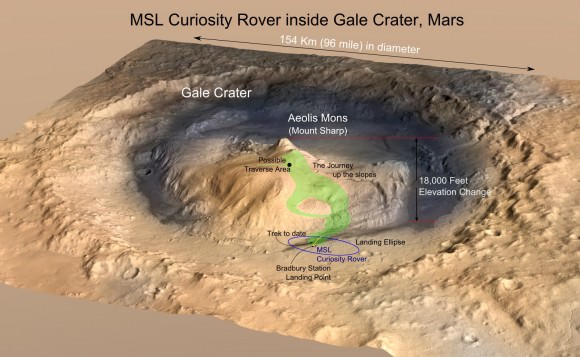
MRO image of Gale Crater illustrating the landing location and trek of the Rover Curiosity. In 2 years, Curiosity traversed 3 miles to reach the base of Mount Sharp. The next two years of trekking are likely to be at least as challenging. (Credits: NASA/JPL, illustration, T.Reyes)
MRO image of Gale Crater illustrating the landing location and trek of the Rover Curiosity. Credit: NASA/JPL, illustration, T.Reyes

For years, NASA scientists have been seeking to obtain samples from different locations around Mount Sharp. By studying the sedimentary deposits in the mountainside, the rover’s science team hopes to see how Mars’ environment changed over the past 3 billion years. As Vasavada explained:

“Curiosity’s science mission has focused on understanding whether the area around 5-km high Mount Sharp ever had conditions suitable for life. We’ve already found evidence for an ancient, 3-billion-year-old habitable environment out on the plains around the mountain, and in the lowest levels of the mountain.”

“The geology indicates that a series of lakes once was present in the basin of the crater, before the mountain took shape. Curiosity will continue climbing lower Mount Sharp to see how long these habitable conditions lasted. Every step higher we go, we encounter rocks that are a bit younger, but still around 3 billion years old.”

In the end, the job of determining the risk falls to NASA’s Planetary Protection Office. In addition to reviewing the current predicament, the issue of pre-mission safety standards is also likely to come up. Prior to its deployment to Mars, the Curiosity rover was only partially sterilized, and it is currently unknown how long Earth microbes could survive in the Martian atmosphere, or how far they could be carried in Mars’ atmosphere.

These dark streaks, called recurring slope lineae, are on a sloped wall on a crater on Mars. A new study says they may have been formed by boiling water. Image: NASA/JPL-Caltech/Univ. of Arizona
These dark streaks, called recurring slope lineae (RSL), are on the sloped wall of a crater on Mars. Credit: NASA/JPL-Caltech/Univ. of Arizona

Answering these questions and coming up with new protocols that will address them in advance will come in handy for future missions – particularly the Mars 2020 Rover mission. In the course of its mission, which will include obtaining samples and leaving them behind for possible retrieval by a future crewed mission, the rover is likely to encounter several RSLs.

One of the Mars 2020 rover’s primary tasks will be finding evidence of microbial life, so ensuring that Earth microbes don’t get in the way will be of extreme importance. And with crewed missions on the horizon, knowing how we can prevent contaminating Mars with our own germs (of which there are many) is paramount!

On its currently project path, the Curiosity rover would not get closer than 2 km from the potential RSL (which it is currently 5 km from). And as Vasavada indicated, it is not known at the present time what alternate routes Curiosity could take, or if a diversion in the rover’s path will effect it’s overall mission.

“It’s unclear at this time,” he said. “But I’m optimistic that we can find a solution that protects Mars, allows us to accomplish our mission goals, and even gives us new insight into modern water on Mars, if it is there.”

Further Reading: Nature

Curiosity Rover Captures Full-Circle Panorama of Enticing ‘Murray Buttes’ on Mars

This 360-degree panorama was acquired by the Mast Camera (Mastcam) on NASA's Curiosity Mars rover as the rover neared features called "Murray Buttes" on lower Mount Sharp. Credit: NASA/JPL-Caltech/MSSS
This 360-degree panorama was acquired by the Mast Camera (Mastcam) on NASA's Curiosity Mars rover as the rover neared features called "Murray Buttes" on lower Mount Sharp.  Credit: NASA/JPL-Caltech/MSSS
This 360-degree panorama was acquired by the Mast Camera (Mastcam) on NASA’s Curiosity Mars rover as the rover neared features called “Murray Buttes” on lower Mount Sharp. Credit: NASA/JPL-Caltech/MSSS

Four years after a nail biting touchdown on the Red Planet, NASA’s SUV-sized Curiosity rover is at last nearing the long strived for “Murray Buttes” formation on the lower reaches of Mount Sharp.

This is a key milestone for the Curiosity mission because the “Murray Buttes” are the entry way along Curiosity’s planned route up lower Mount Sharp.

Ascending and diligently exploring the sedimentary lower layers of Mount Sharp, which towers 3.4 miles (5.5 kilometers) into the Martian sky, is the primary destination and goal of the rovers long term scientific expedition on the Red Planet.

The area features eroded mesas and buttes that are reminiscent of the U.S. Southwest.

So the team directed the rover to capture a 360-degree color panorama using the robots mast mounted Mastcam camera earlier this month on Aug. 5.

The full panorama shown above combines more than 130 images taken by Curiosity on Aug. 5, 2016, during the afternoon of Sol 1421 by the Mastcam’s left-eye camera.

In particular note the dark, flat-topped mesa seen to the left of the rover’s arm. It stands about 50 feet (about 15 meters) high and, near the top, about 200 feet (about 60 meters) wide.

Coincidentally, Aug. 5 also marks the fourth anniversary of the six wheeled rovers landing on the Red Planet via the unprecedented Sky Crane maneuver.

You can explore this spectacular Mars panorama in great detail via this specially produced 360-degree panorama from JPL. Simply move the magnificent view back and forth and up and down and all around with your mouse or mobile device.

Video Caption: This 360-degree panorama was acquired on Aug. 5, 2016, by the Mastcam on NASA’s Curiosity Mars rover as the rover neared features called “Murray Buttes” on lower Mount Sharp. The dark, flat-topped mesa seen to the left of the rover’s arm is about 50 feet (about 15 meters) high and, near the top, about 200 feet (about 60 meters) wide.

“The buttes and mesas are capped with rock that is relatively resistant to wind erosion. This helps preserve these monumental remnants of a layer that formerly more fully covered the underlying layer that the rover is now driving on,” say rover scientists.

“The relatively flat foreground is part of a geological layer called the Murray formation, which formed from lakebed mud deposits. The buttes and mesas rising above this surface are eroded remnants of ancient sandstone that originated when winds deposited sand after lower Mount Sharp had formed. Curiosity closely examined that layer — the Stimson formation — during the first half of 2016 while crossing a feature called “Naukluft Plateau” between two exposures of the Murray formation.”

Three years ago, the team informally named the site to honor Caltech planetary scientist Bruce Murray (1931-2013), a former director of NASA’s Jet Propulsion Laboratory, Pasadena, California. JPL manages the Curiosity mission for NASA.

As of today, Sol 1447, August 31, 2016, Curiosity has driven over 7.9 miles (12.7 kilometers) since its August 2012 landing, and taken over 348,500 amazing images.

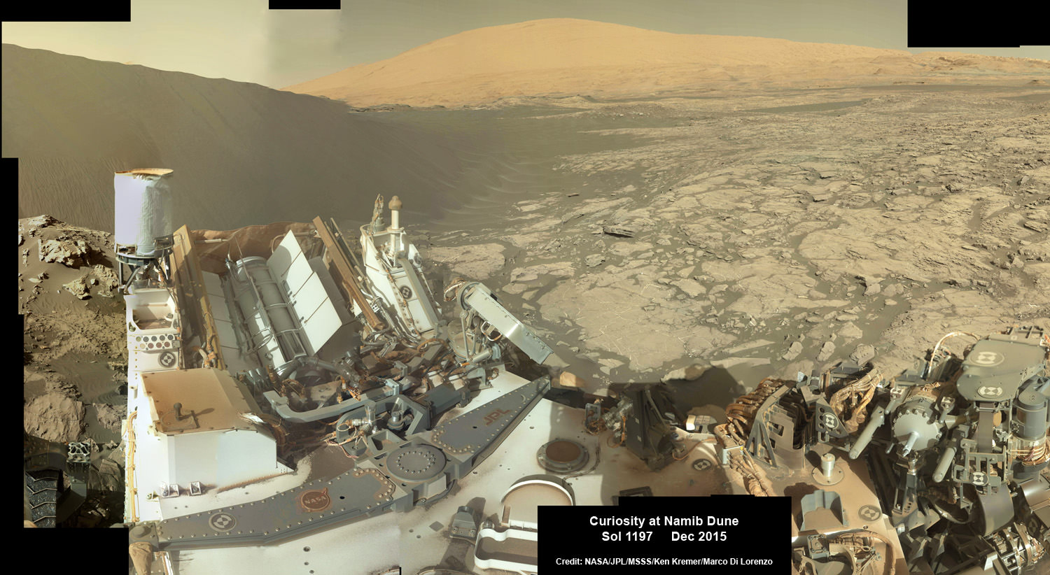
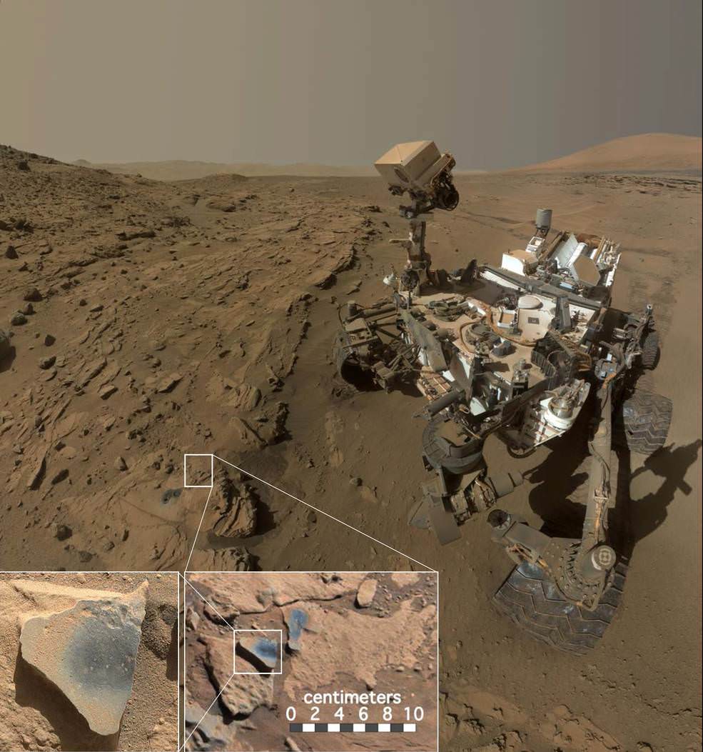
Curiosity explores Red Planet paradise at Namib Dune during Christmas 2015 - backdropped by Mount Sharp.  Curiosity took first ever self-portrait with Mastcam color camera after arriving at the lee face of Namib Dune.  This photo mosaic shows a portion of the full self portrait and is stitched from Mastcam color camera raw images taken on Sol 1197, Dec. 19, 2015.  Credit: NASA/JPL/MSSS/Ken Kremer/kenkremer.com/Marco Di Lorenzo
Curiosity explores Red Planet paradise at Namib Dune during Christmas 2015 – backdropped by Mount Sharp. Curiosity took first ever self-portrait with Mastcam color camera after arriving at the lee face of Namib Dune. This photo mosaic shows a portion of the full self portrait and is stitched from Mastcam color camera raw images taken on Sol 1197, Dec. 19, 2015. Credit: NASA/JPL/MSSS/Ken Kremer/kenkremer.com/Marco Di Lorenzo

Stay tuned here for Ken’s continuing Earth and planetary science and human spaceflight news.

Ken Kremer

NASA Goes With Atlas V To Launch Mars 2020 Rover

The deployment of the Mars 2020 rover will be the next step in their "Journey to Mars". Credit: NASA

NASA’s Mars Exploration Program has accomplished some truly spectacular things in the past few decades. Officially launched in 1992, this program has been focused on three major goals: characterizing the climate and geology of Mars, looking for signs of past life, and preparing the way for human crews to explore the planet.

And in the coming years, the Mars 2020 rover will be deployed to the Red Planet and become the latest in a long line of robotic rovers sent to the surface. In a recent press release, NASA announced that it has awarded the launch services contract for the mission to United Launch Alliance (ULA) – the makers of the Atlas V rocket.

The mission is scheduled to launch in July of 2020 aboard an Atlas V 541 rocket from Cape Canaveral in Florida, at a point when Earth and Mars are at opposition. At this time, the planets will be on the same side of the Sun and making their closest approach to each other in four years, being just 62.1 million km (38.6 million miles) part.

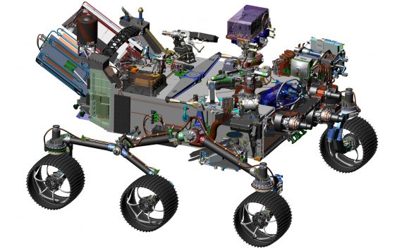
The design of NASA's Mars 2020 rover leverages many successful features of the agency's Curiosity rover, which landed on Mars in 2012, but it adds new science instruments and a sampling system to carry out the new goals for the 2020 mission. Credits: NASA
The design of NASA’s Mars 2020 rover combines proven features with some new science instruments and a sampling system. Credits: NASA

Following in the footsteps of the Curiosity, Opportunity and Spirit rovers, the goal of Mars 2020 mission is to  determine the habitability of the Martian environment and search for signs of ancient Martian life. This will include taking samples of soil and rock to learn more about Mars’ “watery past”.

But whereas these and other members of the Mars Exploration Program were searching for evidence that Mars once had liquid water on its surface and a denser atmosphere (i.e. signs that life could have existed), the Mars 2020 mission will attempt to find actual evidence of ancient microbial life.

The design of the rover also incorporates several successful features of Curiosity. For instance, the entire landing system (which incorporates a sky crane and heat shield) and the rover’s chassis have been recreated using leftover parts that were originally intended for Curiosity.

There’s also the rover’s radioisotope thermoelectric generator – i.e. the nuclear motor – which was also originally intended as a backup part for Curiosity. But it will also have several upgraded instrument on board that allow for a new guidance and control technique. Known as “Terrain Relative Navigation”, this new landing method allows for greater maneuverability during descent.

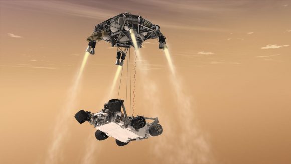
Artist's impression of the Mars 2020 with its sky crane landing system deployed. Credit: NASA/JPL
Artist’s impression of the Mars 2020, with its sky crane landing system deployed. Credit: NASA/Mars Science Laboratory

Another new feature is the rover’s drill system, which will collect core samples and store them in sealed tubes. These tubes will then be left in a “cache” on the surface, where they will be retrieved by future missions and brought back to Earth – which will constitute the first sample-return mission from the Red Planet.

In this respect, Mars 2020 will help pave the way for a crewed mission to the Red Planet, which NASA hopes to mount sometime in the 2030s. The probe will also conduct numerous studies designed to improve landing techniques and assess the planet’s natural resources and hazards, as well as coming up with methods to allow astronauts to live off the environment.

In terms of hazards, the probe will be looking at Martian weather patterns, dust storms, and other potential environmental conditions that will affect human astronauts living and working on the surface. It will also test out a method for producing oxygen from the Martian atmosphere and identifying sources of subsurface water (as a source of drinking water, oxygen, and hydrogen fuel).

As NASA stated in their press release, the Mars 2020 mission will “offer opportunities to deploy new capabilities developed through investments by NASA’s Space Technology Program and Human Exploration and Operations Mission Directorate, as well as contributions from international partners.”

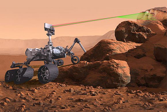
The microphone for the upcoming Mars mission will be attached to the SuperCam, seen here in this illustration zapping a rock with its laser. Credit: NASA/JPL-Caltech
Illustration of the Mars 2020 mission zapping a rock with its laser. Credit: NASA/JPL-

They also emphasized the opportunities to learn ho future human explorers could rely on in-situ resource utilization as a way of reducing the amount of materials needed to be shipped – which will not only cut down on launch costs but ensure that future missions to the planet are more self-reliant.

The total cost for NASA to launch Mars 2020 is approximately $243 million. This assessment includes the cost of launch services, processing costs for the spacecraft and its power source, launch vehicle integration and tracking, data and telemetry support.

The use of spare parts has also meant reduced expenditure on the overall mission. In total, the Mars 2020 rover and its launch will cost and estimated $2.1 billion USD, which represents a significant savings over previous missions like the Mars Science Laboratory – which cost a total of $2.5 billion USD.

Between now and 2020, NASA also intends to launch the Interior Exploration using Seismic Investigations, Geodesy and Heat Transport (InSight) lander mission, which is currently targeted for 2018. This and the Mars 2020 rover will be the latest in a long line of orbiters, rovers and landers that are seeking to unlock the mysteries of the Red Planet and prepare it for human visitors!

Further Reading: NASA, Mars 2020 Rover

Curiosity Finds Ancient Mars Likely Had More Oxygen and Was More Hospitable to Life

This scene shows NASA's Curiosity Mars rover at a location called "Windjana," where the rover found rocks containing manganese-oxide minerals, which require abundant water and strongly oxidizing conditions to form. Credits: NASA/JPL-Caltech/MSSS
This scene shows NASA’s Curiosity Mars rover at a location called “Windjana,” where the rover found rocks containing manganese-oxide minerals, which require abundant water and strongly oxidizing conditions to form. Credits: NASA/JPL-Caltech/MSSS

New chemical science findings from NASA’s Mars rover Curiosity indicate that ancient Mars likely had a higher abundance of molecular oxygen in its atmosphere compared to the present day and was thus more hospitable to life forms, if they ever existed.

Thus the Red Planet was much more Earth-like and potentially habitable billions of years ago compared to the cold, barren place we see today.

Curiosity discovered high levels of manganese oxide minerals in rocks investigated at a location called “Windjana” during the spring of 2014.

Manganese-oxide minerals require abundant water and strongly oxidizing conditions to form.

“Researchers found high levels of manganese oxides by using a laser-firing instrument on the rover. This hint of more oxygen in Mars’ early atmosphere adds to other Curiosity findings — such as evidence about ancient lakes — revealing how Earth-like our neighboring planet once was,” NASA reported.

The newly announced results stem from results obtained from the rovers mast mounted ChemCam or Chemistry and Camera laser firing instrument. ChemCam operates by firing laser pulses and then observes the spectrum of resulting flashes of plasma to assess targets’ chemical makeup.

“The only ways on Earth that we know how to make these manganese materials involve atmospheric oxygen or microbes,” said Nina Lanza, a planetary scientist at Los Alamos National Laboratory in New Mexico, in a statement.

“Now we’re seeing manganese oxides on Mars, and we’re wondering how the heck these could have formed?”

The discovery is being published in a new paper in the American Geophysical Union’s Geophysical Research Letters. Lanza is the lead author.

The manganese oxides were found by ChemCam in mineral veins investigated at “Windjana” and are part of geologic timeline being assembled from Curiosity’s research expedition across of the floor of the Gale Crater landing site.

Scientists have been able to link the new finding of a higher oxygen level to a time when groundwater was present inside Gale Crater.

“These high manganese materials can’t form without lots of liquid water and strongly oxidizing conditions,” says Lanza.

“Here on Earth, we had lots of water but no widespread deposits of manganese oxides until after the oxygen levels in our atmosphere rose.”

The high-manganese materials were found in mineral-filled cracks in sandstones in the “Kimberley” region of the crater.

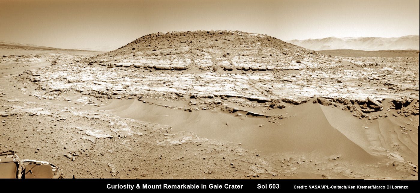
Curiosity’s Panoramic view of Mount Remarkable at ‘The Kimberley Waypoint’ where rover conducted 3rd drilling campaign inside Gale Crater on Mars. The navcam raw images were taken on Sol 603, April 17, 2014, stitched and colorized. Credit: NASA/JPL-Caltech/Ken Kremer – kenkremer.com/Marco Di Lorenzo.  Featured on APOD - Astronomy Picture of the Day on May 7, 2014
Curiosity’s Panoramic view of Mount Remarkable at ‘The Kimberley Waypoint’ where rover conducted 3rd drilling campaign inside Gale Crater on Mars. The navcam raw images were taken on Sol 603, April 17, 2014, stitched and colorized. Credit: NASA/JPL-Caltech/Ken Kremer – kenkremer.com/Marco Di Lorenzo. Featured on APOD – Astronomy Picture of the Day on May 7, 2014

High concentrations of manganese oxide minerals in Earth’s ancient past correspond to a major shift in our atmosphere’s composition from low to high oxygen atmospheric concentrations. Thus its reasonable to suggest the same thing happened on ancient Mars.

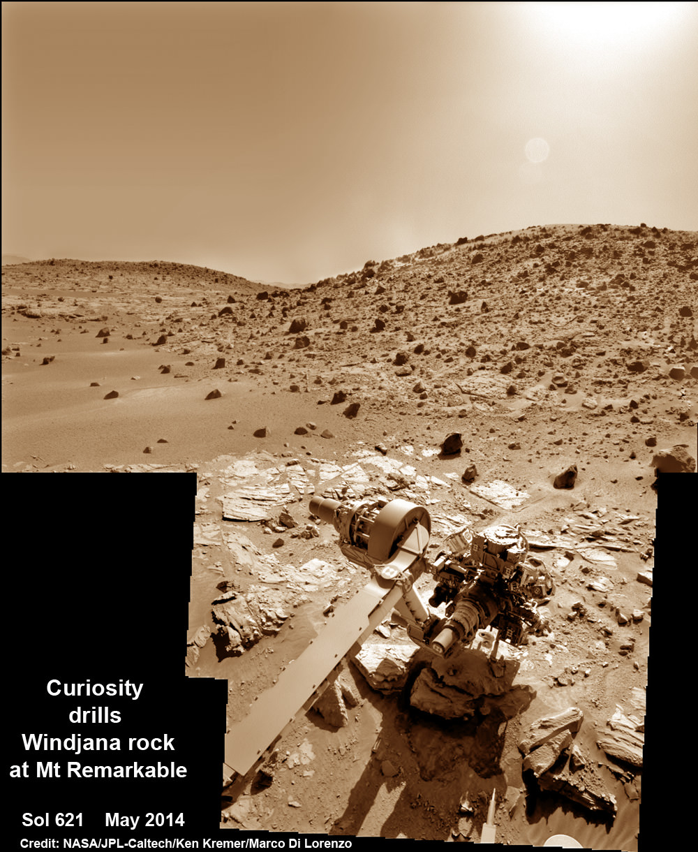
As part of the investigation, Curiosity also conducted a drill campaign at Windjana, her 3rd of the mission.

Composite photo mosaic shows deployment of NASA Curiosity rovers robotic arm and two holes after drilling into ‘Windjana’ sandstone rock on May 5, 2014, Sol 621, at Mount Remarkable as missions third drill target for sample analysis by rover’s chemistry labs.  The navcam raw images were stitched together from several Martian days up to Sol 621, May 5, 2014 and colorized.   Credit: NASA/JPL-Caltech/Ken Kremer - kenkremer.com/Marco Di Lorenzo
Composite photo mosaic shows deployment of NASA Curiosity rovers robotic arm and two holes after drilling into ‘Windjana’ sandstone rock on May 5, 2014, Sol 621, at Mount Remarkable as missions third drill target for sample analysis by rover’s chemistry labs. The navcam raw images were stitched together from several Martian days up to Sol 621, May 5, 2014 and colorized. Credit: NASA/JPL-Caltech/Ken Kremer – kenkremer.com/Marco Di Lorenzo

How much manganese oxide was detected and what is the meaning?

“The Curiosity rover observed high-Mn abundances (>25 wt% MnO) in fracture-filling materials that crosscut sandstones in the Kimberley region of Gale crater, Mars,” according to the AGU paper.

“On Earth, environments that concentrate Mn and deposit Mn minerals require water and highly oxidizing conditions, hence these findings suggest that similar processes occurred on Mars.”

“Based on the strong association between Mn-oxide deposition and evolving atmospheric dioxygen levels on Earth, the presence of these Mn-phases on Mars suggests that there was more abundant molecular oxygen within the atmosphere and some groundwaters of ancient Mars than in the present day.”

Stay tuned here for Ken’s continuing Earth and planetary science and human spaceflight news.

Ken Kremer

HiRISE Captures Curiosity on the Naukluft Plateau

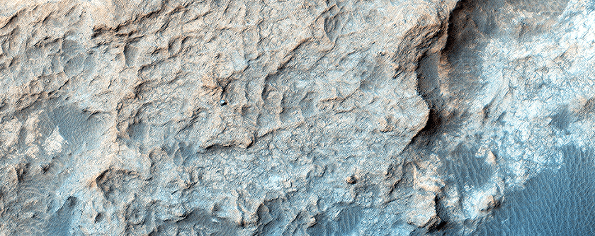
MSL Curiosity on the Naukluft Plateau on the Martian surface. This image was captured by HiRise on the Mars Reconnaissance Orbiter. Image: NASA/JPL/University of Arizona

Viewing orbital images of the rovers as they go about their business on the surface of Mars is pretty cool. Besides being of great interest to anyone keen on space in general, they have scientific value as well. New images from the High Resolution Imaging Science Equipment (HiRise) camera aboard the Mars Reconnaissance Orbiter (MRO) help scientists in a number of ways.

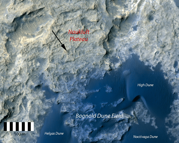
Recent images from HiRise show the Mars Science Laboratory (MSL) Curiosity on a feature called the Naukluft Plateau. The Plateau is named after a mountain range in Namibia, and is the site of Curiosity’s 10th and 11th drill targets.

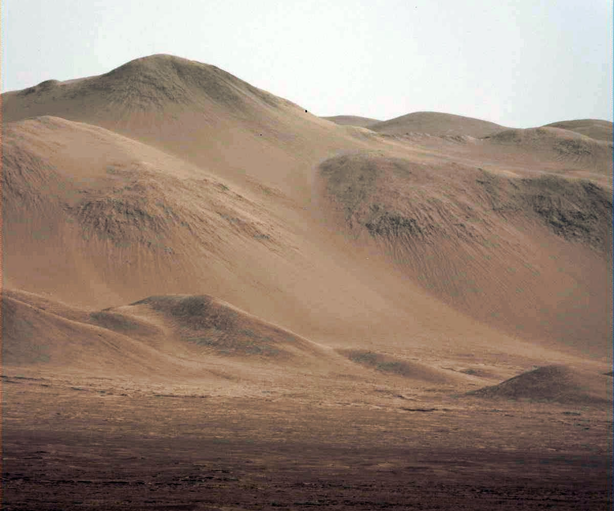
Orbital imagery of the rovers is used to track the activity of sand dunes in the areas the rovers are working in. In this case, the dune field is called the Bagnold Dunes. HiRise imagery allows a detailed look at how dunes change over time, and how any tracks left by the rover are filled in with sand over time. Knowledge of this type of activity is a piece of the puzzle in understanding the Martian surface.

Curiosity on the Naukluft Plateau as captured by HiRise. Image: NASA/JPL/University of Arizona

But the ability to take such detailed images of the Martian surface has other benefits, as well. Especially as we get nearer to a human presence on Mars.

Orbital imaging is turning exploration on its ear. Throughout human history, exploration required explorers travelling by land and sea to reconnoiter an area, and to draw maps and charts later. We literally had no idea what was around the corner, over the mountain, or across the sea until someone went there. There was no way to choose a location for a settlement until we had walked the ground.

From the serious (SpaceX, NASA) to the fanciful (MarsOne), a human mission to Mars, and an eventual established presence on Mars, is a coming fact. The how and the where are all connected in this venture, and orbital images will be a huge part of choosing where.

Tracking the changes in dunes over time will help inform the choice for human landing sites on Mars. The types and density of sand particles may be determined by monitoring rover tracks as they fill with sand. This may be invaluable information when it comes to designing the types of facilities used on Mars. Critical infrastructure in the form of greenhouses or solar arrays will need to be placed very carefully.

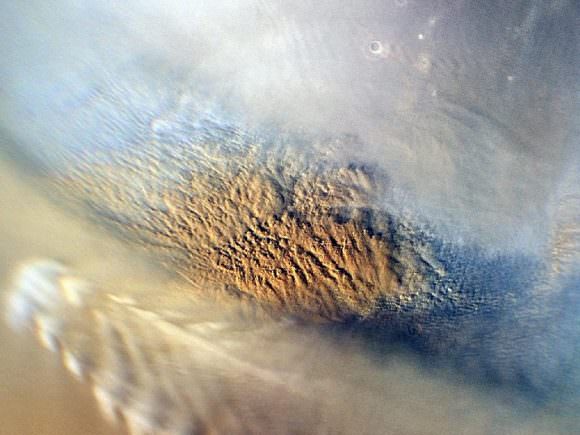
Sci-Fi writers have exaggerated the strength of sand storms on Mars to great effect, but they are real. We know from orbital monitoring, and from rovers, that Martian sandstorms can be very powerful phenomena. Of course, a 100 km/h wind on Earth is much more dangerous than on Mars because of the density of the atmosphere. Martian air is 1% the density of Earth’s, so on Mars the 100 km/h wind wouldn’t do much.

But it can pick up dust, and that dust can foul important equipment. With all this in mind, we can see how these orbital images give us an important understanding of how sand behaves on Mars.

This Martian sandstorm was captured by the MRO's Mars Color Imager instrument. Scientists were monitoring such storms prior to Curiosity's arrival on Mars. Image: NASA/JPL-Caltech/MSSS
This Martian sandstorm was captured by the MRO’s Mars Color Imager instrument. Scientists were monitoring such storms prior to Curiosity’s arrival on Mars. Image: NASA/JPL-Caltech/MSSS

There’s an unpredictability factor to all this too. We can’t always know in advance how important or valuable orbital imagery will be in the future. That’s part of doing science.

But back to the cool factor.

For the rest of us, who aren’t scientists, it’s just plain cool to be able to watch the rovers from above.

And, look at all the Martian eye candy!

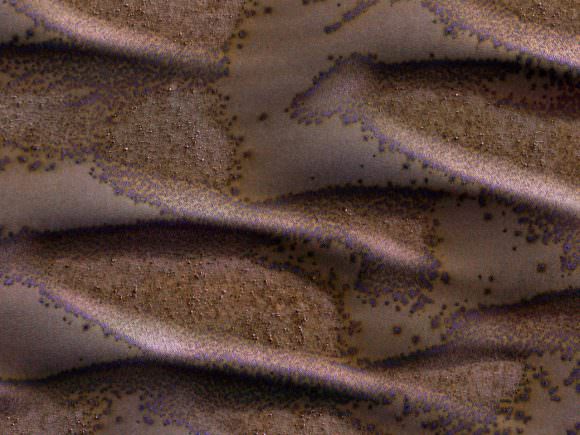
These sand dunes in the southern hemisphere of Mars are just starting their seasonal defrost of carbon dioxide. Image: NASA/JPL/University of Arizona

Curiosity Cores Hole in Mars at ‘Lubango’ Fracture Zone

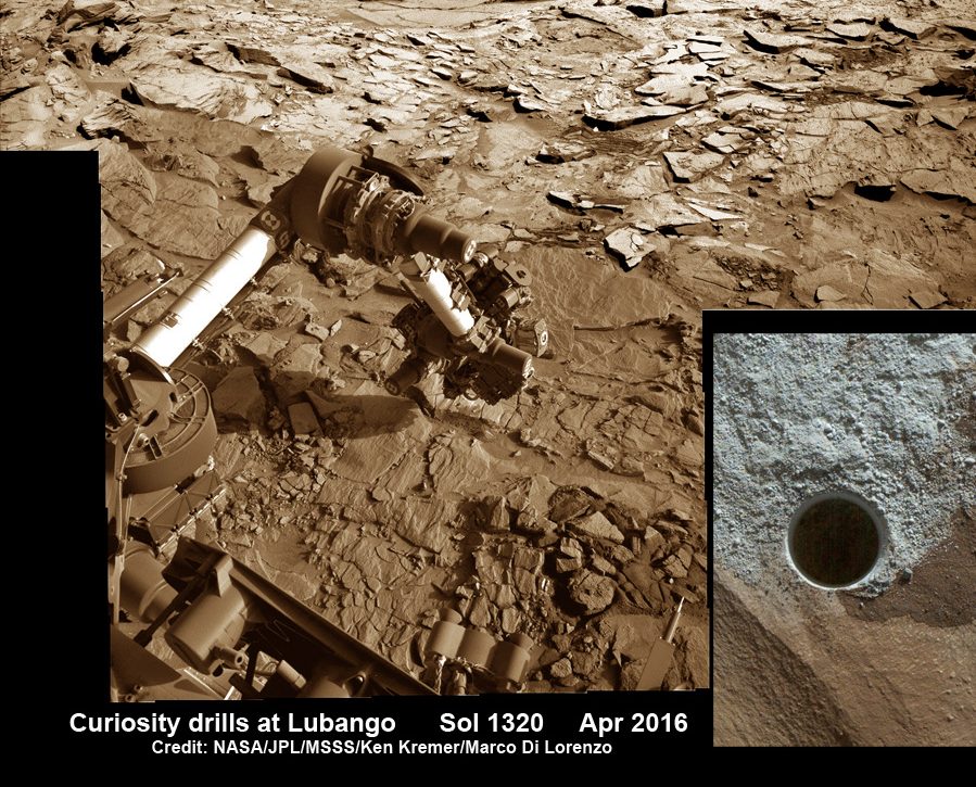
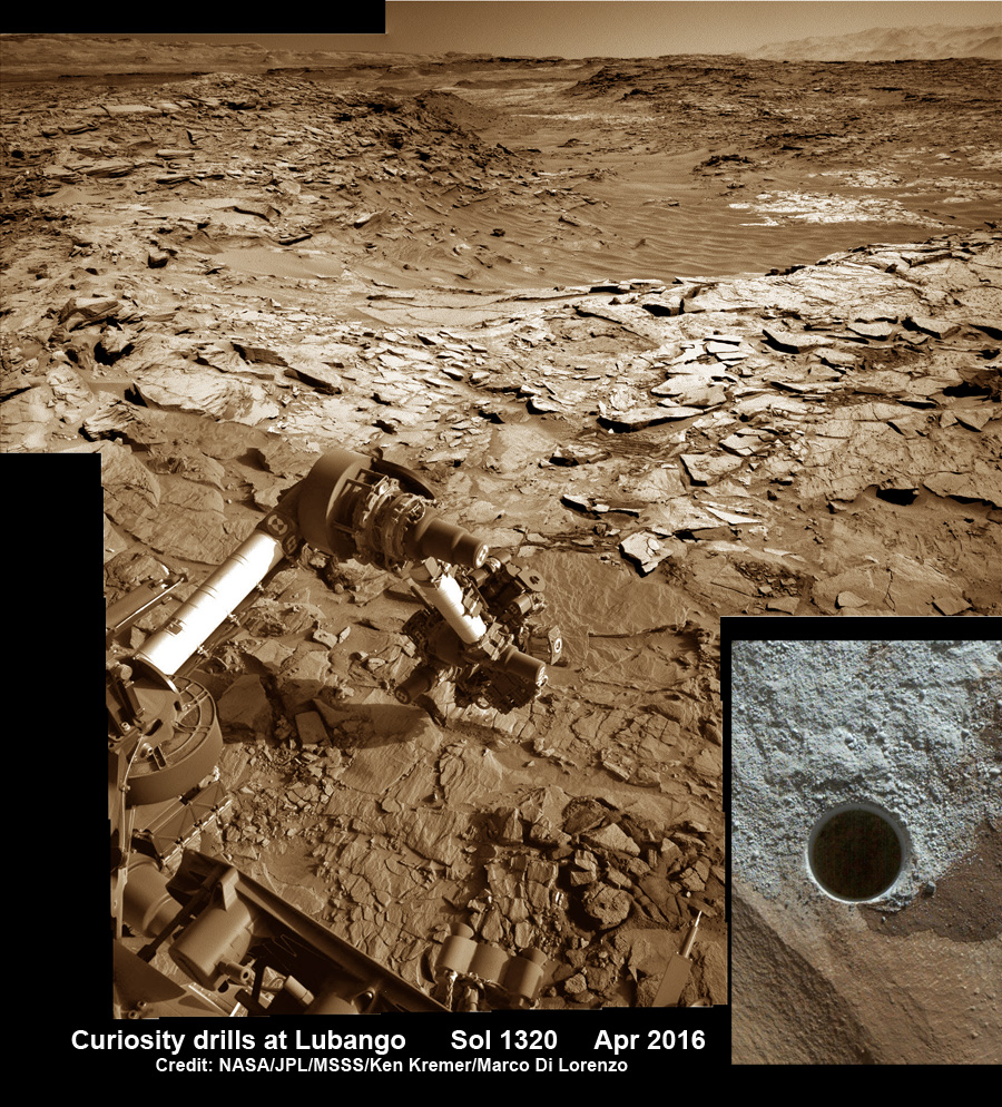
Curiosity rover reached out with robotic arm and drilled into ‘Lubango’ outcrop target on Sol 1320, Apr. 23, 2016, in this photo mosaic stitched from navcam camera raw images and colorized. Lubango is located in the Stimson unit on the lower slopes of Mount Sharp inside Gale Crater. MAHLI camera inset image shows drill hole up close on Sol 1321. Credit: NASA/JPL/MSSS/Ken Kremer/kenkremer.com/Marco Di Lorenzo
Curiosity rover reached out with robotic arm and drilled into ‘Lubango’ outcrop target on Sol 1320, Apr. 23, 2016, in this photo mosaic stitched from navcam  camera raw images and colorized.  Lubango is located in the Stimson unit on the lower slopes of Mount Sharp inside Gale Crater.  MAHLI camera inset image shows drill hole up close on Sol 1321.  Credit: NASA/JPL/Ken Kremer/kenkremer.com/Marco Di Lorenzo
Curiosity rover reached out with robotic arm and drilled into ‘Lubango’ outcrop target on Sol 1320, Apr. 23, 2016, in this photo mosaic stitched from navcam camera raw images and colorized. Lubango is located in the Stimson unit on the lower slopes of Mount Sharp inside Gale Crater. MAHLI camera inset image shows drill hole up close on Sol 1321. Credit: NASA/JPL/MSSS/Ken Kremer/kenkremer.com/Marco Di Lorenzo

NASA’s Curiosity Mars Science Laboratory (MSL) rover successfully bored a brand new hole in Mars at a tantalizing sandstone outcrop in the ‘Lubango’ fracture zone this past weekend on Sol 1320, Apr. 23, and is now carefully analyzing the shaken and sieved drill tailings for clues to Mars watery past atop the Naukluft Plateau.

“We have a new drill hole on Mars!” reported Ken Herkenhoff, Research Geologist at the USGS Astrogeology Science Center and an MSL science team member, in a mission update.

“All of the activities planned for last weekend have completed successfully.”

“Lubango” counts as the 10th drilling campaign since the one ton rover safely touched down on the Red Planet some 44 months ago inside the targeted Gale Crater landing site, following the nailbiting and never before used ‘sky crane’ maneuver.

After transferring the cored sample to the CHIMRA instrument for sieving it, a portion of the less than 0.15 mm filtered material was successfully delivered this week to the CheMin miniaturized chemistry lab situated in the rovers belly.

CheMin is now analyzing the sample and will return mineralogical data back to scientists on earth for interpretation.

The science team selected Lubango as the robots 10th drill target after determining that it was altered sandstone bedrock and had an unusually high silica content based on analyses carried out using the mast mounted ChemCam laser instrument.

Indeed the rover had already driven away for further scouting and the team then decided to return to Lubango after examining the ChemCam results. They determined the ChemCam and other data observation were encouraging enough – regarding how best to sample both altered and unaltered Stimson bedrock – to change course and drive backwards.

Lubango sits along a fracture in an area that the team dubs the Stimson formation, which is located on the lower slopes of humongous Mount Sharp inside Gale Crater.

This mid-afternoon, 360-degree panorama was acquired by the Mast Camera (Mastcam) on NASA's Curiosity Mars rover on April 4, 2016, as part of long-term campaign to document the context and details of the geology and landforms along Curiosity's traverse since landing in August 2012.  Credit: NASA/JPL-Caltech/MSSS
This mid-afternoon, 360-degree panorama was acquired by the Mast Camera (Mastcam) on NASA’s Curiosity Mars rover on April 4, 2016, as part of long-term campaign to document the context and details of the geology and landforms along Curiosity’s traverse since landing in August 2012. Credit: NASA/JPL-Caltech/MSSS

Since early March, the rover has been traversing along a rugged region dubbed the Naukluft Plateau.

“The team decided to drill near this fracture to better understand both the altered and unaltered Stimson bedrock,” noted Herkenhoff.

See our photo mosaic above showing the geologically exciting terrain surrounding Curiosity with its outstretched 7-foot-long (2-meter-long) robotic arm after completing the Lubango drill campaign on Sol 1320. The mosaic was created by the imaging team of Ken Kremer and Marco Di Lorenzo.

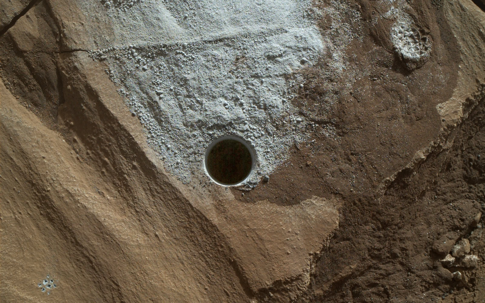
Its again abundantly clear from the images that beneath the rusty veneer of the Red Planet lies a greyish interior preserving the secrets of Mars ancient climate history.

Curiosity rover views ‘Lubango’ drill target up close in this MAHLI camera image taken on Sol 1321, Apr. 24, 2016, processed to enhance details. Credit: NASA/JPL/Ken Kremer/kenkremer.com/Marco Di Lorenzo
Curiosity rover views ‘Lubango’ drill target up close in this MAHLI camera image taken on Sol 1321, Apr. 24, 2016, processed to enhance details. Credit: NASA/JPL/MSSS/Marco Di Lorenzo/Ken Kremer/kenkremer.com

The team then commanded Curiosity to dump the unsieved portion of the sample onto the ground and examine the leftover drill tailing residues with the Mastcam, Navcam, MAHLI multispectral characterization cameras and the APXS spectrometer. ChemCam is also being used to fire laser shots in the wall of the drill hole to make additional chemical measurements.

To complement the data from Lubango, scientists are now looking around the area for a suitable target of unaltered Stimson bedrock as the 11th drill target.

“The color information provided by Mastcam is really helpful in distinguishing altered versus unaltered bedrock,” explained MSL science team member Lauren Edgar, Research Geologist at the USGS Astrogeology Science Center, in a mission update.

The ChemCam laser has already shot at the spot dubbed “Oshikati,” a potential target for the next drilling campaign.

“On Sunday we will drive to our next drilling location, which is on a nearby patch of normal-looking Stimson sandstone,” wrote Ryan Anderson, planetary scientist at the USGS Astrogeology Science Center and a member of the ChemCam team on MSL in today’s (Apr. 28) mission update.

As time permits, the Navcam imager is also being used to search for dust devils.

As I reported here, Opportunity recently detected a beautiful looking dust devil on the floor of Endeavour crater on April 1. Dust devil detections by the NASA rovers are relatively rare.

Curiosity has been driving to the edge of the Naukluft Plateau to reach the interesting fracture zone seen in orbital data gathered from NASA’s Mars orbiter spacecraft.

Curiosity images Naukluft Plateau in this photo mosaic stitched from Mastcam camera raw images taken on Sol1296.  Credit: NASA/JPL/MSSS/Marco Di Lorenzo/Ken Kremer/kenkremer.com
Curiosity images Naukluft Plateau in this photo mosaic stitched from Mastcam camera raw images taken on Sol1296. Credit: NASA/JPL/MSSS/Marco Di Lorenzo/Ken Kremer/kenkremer.com

The rover is almost finished crossing the Naukluft Plateau which is “the most rugged and difficult-to-navigate terrain encountered during the mission’s 44 months on Mars,” says NASA.

Prior to climbing onto the Naukluft Plateau the rover spent several weeks investigating sand dunes including the two story tall Namib dune.

Curiosity explores Red Planet paradise at Namib Dune during Christmas 2015 - backdropped by Mount Sharp.  Curiosity took first ever self-portrait with Mastcam color camera after arriving at the lee face of Namib Dune.  This photo mosaic shows a portion of the full self portrait and is stitched from Mastcam color camera raw images taken on Sol 1197, Dec. 19, 2015.  Credit: NASA/JPL/MSSS/Ken Kremer/kenkremer.com/Marco Di Lorenzo
Curiosity explores Red Planet paradise at Namib Dune during Christmas 2015 – backdropped by Mount Sharp. Curiosity took first ever self-portrait with Mastcam color camera after arriving at the lee face of Namib Dune. This photo mosaic shows a portion of the full self portrait and is stitched from Mastcam color camera raw images taken on Sol 1197, Dec. 19, 2015. Credit: NASA/JPL/MSSS/Ken Kremer/kenkremer.com/Marco Di Lorenzo

As of today, Sol 1325, April 28, 2016, Curiosity has driven over 7.9 miles (12.7 kilometers) since its August 2012 landing, and taken over 320,100 amazing images.

Spectacular Mastcam camera view of Gale Crater rim from Curiosity on Sol 1302 enhanced to bring out detail.   Credit: NASA/JPL/MSSS/Marco Di Lorenzo/Ken Kremer/kenkremer.com
Spectacular Mastcam camera view of Gale Crater rim from Curiosity on Sol 1302 enhanced to bring out detail. Credit: NASA/JPL/MSSS/Marco Di Lorenzo/Ken Kremer/kenkremer.com

Stay tuned here for Ken’s continuing Earth and planetary science and human spaceflight news.
Ken Kremer

SpaceX Announces Plan to Launch Private Dragon Mission to Mars in 2018

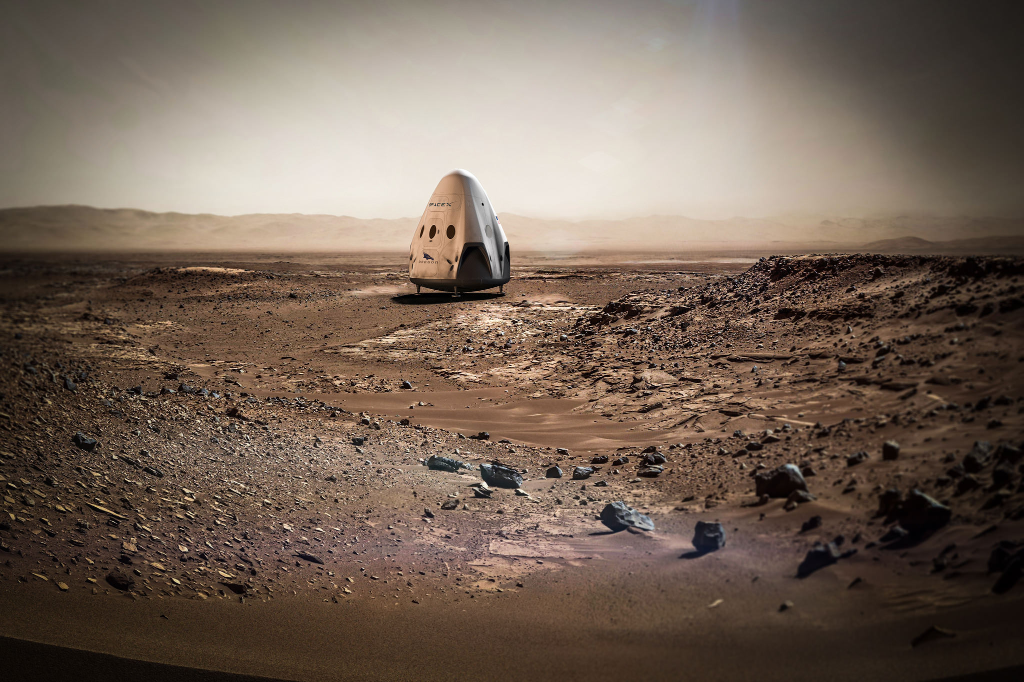
Artists concept for sending SpaceX Red Dragon spacecraft to land propulsively on Mars as early as 2020. Credit: SpaceX
Artists concept for sending SpaceX Red Dragon spacecraft to land propulsively on Mars as early as 2018.  Credit: SpaceX
Artists concept for sending SpaceX Red Dragon spacecraft to land propulsively on Mars as early as 2018. Credit: SpaceX

SpaceX announced plans today, April 27, for the first ever private mission to Mars which involves sending an uncrewed version of the firms Dragon spacecraft to accomplish a propulsive soft landing – and to launch it as soon as 2018 including certain technical assistance from NASA.

Under a newly signed space act agreement with NASA, the agency will provide technical support to SpaceX with respect to Mars landing technologies for the new spacecraft known as a ‘Red Dragon’ and possibly also for science activities.

“SpaceX is planning to send Dragons to Mars as early as 2018,” the company posted in a brief announcement today on Facebook and other social media about the history making endeavor.

The 2018 commercial Mars mission involves launching the ‘Red Dragon’ – also known as Dragon 2 – on the SpaceX Falcon Heavy rocket from Launch Pad 39A at NASA’s Kennedy Space Center in Florida. It’s a prelude to eventual human missions.

The Red Dragon initiative is a commercial endeavor that’s privately funded by SpaceX and does not include any funding from NASA. The agreement with NASA specifically states there is “no-exchange-of-funds.”

As of today, the identity and scope of any potential science payload is undefined and yet to be determined.

Hopefully it will include a diverse suite of exciting research instruments from NASA, or other entities, such as high powered cameras and spectrometers characterizing the Martian surface, atmosphere and environment.

SpaceX CEO and billionaire founder Elon Musk has previously stated his space exploration goals involve helping to create a Mars colony which would ultimately lead to establishing a human ‘City on Mars.’

Musk is also moving full speed ahead with his goal of radically slashing the cost of access to space by recovering a pair of SpaceX Falcon 9 first stage boosters via successful upright propulsive landings on land and at sea – earlier this month and in Dec. 2015.

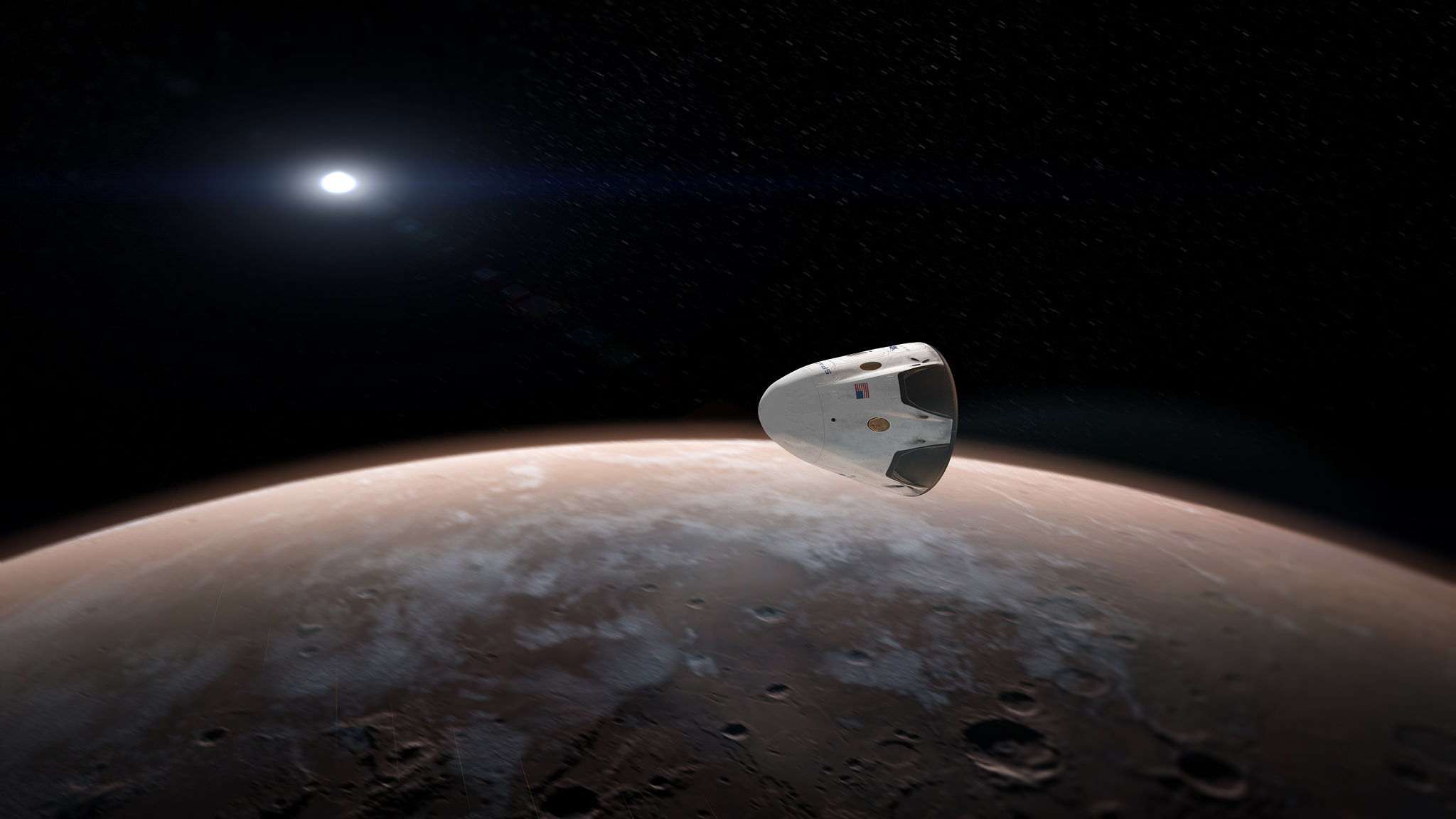
Artists concept for sending SpaceX Red Dragon spacecraft to land propulsively on Mars as early as 2018.  Credit: SpaceX
Artists concept for sending uncrewed SpaceX Red Dragon spacecraft to land propulsively on Mars as early as 2018. Credit: SpaceX

The 2018 liftoff campaign marks a significant step towards fulfilling Musk’s Red Planet vision. But we’ll have to wait another 5 months for concrete details.

“Red Dragon missions to Mars will also help inform the overall Mars colonization architecture that SpaceX will reveal later this year,” SpaceX noted.

Musk plans to reveal the details of the Mars colonization architecture later this year at the International Astronautical Congress (IAC) being held in Guadalajara, Mexico from September 26 to 30, 2016.

Landing on Mars is not easy. To date only NASA has successfully soft landed probes on Mars that returned significant volumes of useful science data.

In the meantime a few details about the SpaceX Red Dragon have emerged.

The main goal is to propulsively land something 5-10 times the size of anything previously landed before.

“These missions will help demonstrate the technologies needed to land large payloads propulsively on Mars,” SpaceX further posted.

NASA’s 1 ton Curiosity rover is the heaviest spaceship to touchdown on the Red Planet to date.

Artists concept for sending SpaceX Red Dragon spacecraft to Mars as early as 2018.  Credit: SpaceX
Artists concept for sending SpaceX Red Dragon spacecraft to Mars as early as 2018. Credit: SpaceX

As part of NASA’s agency wide goal to send American astronauts on a human ‘Journey to Mars’ in the 2030s, NASA will work with SpaceX on some aspects of the Red Dragon initiative to further the agency’s efforts.

According to an amended space act agreement signed yesterday jointly by NASA and SpaceX officials – that originally dates back to November 2014 – this mainly involves technical support from NASA and exchanging entry, descent and landing (EDL) technology, deep space communications, telemetry and navigation support, hardware advice, and interplanetary mission and planetary protection advice and consultation.

“We’re particularly excited about an upcoming SpaceX project that would build upon a current “no-exchange-of-funds” agreement we have with the company,” NASA Deputy Administrator Dava Newman wrote in a NASA blog post today.

“In exchange for Martian entry, descent, and landing data from SpaceX, NASA will offer technical support for the firm’s plan to attempt to land an uncrewed Dragon 2 spacecraft on Mars.”

“This collaboration could provide valuable entry, descent and landing data to NASA for our journey to Mars, while providing support to American industry,” NASA noted in a statement.

The amended agreement with NASA also makes mention of sharing “Mars Science Data.”

As of today, the identity, scope and weight of any potential science payload is undefined and yet to be determined.

Perhaps it could involve a suite of science instruments from NASA, or other entities, such as cameras and spectrometers characterizing various aspects of the Martian environment.

In the case of NASA, the joint agreement states that data collected with NASA assets is to be released within a period not to exceed 6 months and published where practical in scientific journals.

The Red Dragon envisioned for blastoff to the Red Planet as soon as 2018 would launch with no crew on board on a critical path finding test flight that would eventually pave the way for sending humans to Mars – and elsewhere in the solar system.

“Red Dragon Mars mission is the first test flight,” said Musk.

“Dragon 2 is designed to be able to land anywhere in the solar system.”

However, the Dragon 2 alone is far too small for a round trip mission to Mars – lasting some three years or more.

“But wouldn’t recommend transporting astronauts beyond Earth-moon region,” tweeted Musk.

“Wouldn’t be fun for longer journeys. Internal volume ~size of SUV.”

Furthermore, for crewed missions it would also have to be supplemented with additional modules for habitation, propulsion, cargo, science, communications and more. Think ‘The Martian’ movie to get a realistic idea of the complexity and time involved.

Red Dragon’s blastoff from KSC pad 39A is slated to take place during the Mars launch window opening during April and May 2018.

The inaugural liftoff of the Falcon Heavy is currently scheduled for late 2016 after several years postponement.

If all goes well, Red Dragon could travel to Mars at roughly the same time as NASA’s next Mission to Mars – namely the InSight science lander, which will study the planets deep interior with a package of seismometer and heat flow instruments.

InSight’s launch on a United Launch Alliance Atlas V is targeting a launch window that begins May 5, 2018, with a Mars landing scheduled for Nov. 26, 2018. Liftoff was delayed from this year due to a flaw in the French-built seismometer.

SpaceX Red Dragon spacecraft launches to Mars on SpaceX Falcon Heavy as soon as 2018 in this artists comcept.  Credit: SpaceX
SpaceX Red Dragon spacecraft launches to Mars on SpaceX Falcon Heavy as soon as 2018 in this artists comcept. Credit: SpaceX

Whoever wants to land on Mars also has to factor in the relevant International treaties regarding ‘Planetary Protection’ requirements.

Wherever the possibility for life exists, the worlds space agency’s who are treaty signatories, including NASA, are bound to adhere to protocols limiting contamination by life forms from Earth.

SpaceX intends to take planetary protection seriously. Under the joint agreement, SpaceX is working with relevant NASA officials to ensure proper planetary protection procedures are followed. One of the areas of collaboration with NASA is for them to advise SpaceX in the development a Planetary Protection Plan (PPP) and assist with the implementation of a PPP including identifying existing software/tools.

Red Dragon is derived from the SpaceX crew Dragon vehicle currently being developed under contract for NASA’s Commercial Crew Program (CCP) to transport American astronauts back and forth to low Earth orbit and the International Space Station (ISS).

SpaceX and Boeing were awarded commercial crew contracts from NASA back in September 2014.

Both firms hope to launch unmanned and manned test flights of their SpaceX Crew Dragon and Boeing CST-100 Starliner spacecraft to the ISS starting sometime in 2017.

The crew Dragon is also an advanced descendent of the original unmanned cargo Dragon that has ferried tons of science experiments and essential supplies to the ISS since 2012.

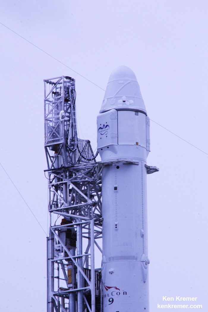
A SpaceX Falcon 9 rocket and Dragon cargo ship are set to liftoff on a resupply mission to the International Space Station (ISS) from launch pad 40 at Cape Canaveral, Florida on Jan. 6, 2015. File photo.  Credit: Ken Kremer – kenkremer.com
A SpaceX Falcon 9 rocket and Dragon cargo ship are set to liftoff on a resupply mission to the International Space Station (ISS) from launch pad 40 at Cape Canaveral, Florida on Jan. 6, 2015. File photo. Credit: Ken Kremer – kenkremer.com

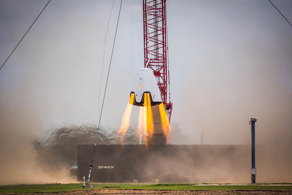
To enable propulsive landings, SpaceX recently conducted hover tests using a Dragon 2 equipped with eight side-mounted SuperDraco engines at their development testing facility in McGregor, TX.

These are “Key for Mars landing,” SpaceX wrote.

“We are closer than ever before to sending American astronauts to Mars than anyone, anywhere, at any time has ever been,” Newman states.

SpaceX Dragon 2 crew vehicle, powered by eight SuperDraco engines, conducts propulsive hover test at the company’s rocket development facility in McGregor, Texas.  Credit: SpaceX
SpaceX Dragon 2 crew vehicle, powered by eight SuperDraco engines, conducts propulsive hover test at the company’s rocket development facility in McGregor, Texas. Credit: SpaceX

Stay tuned here for Ken’s continuing Earth and planetary science and human spaceflight news.
Ken Kremer

Opportunity Robustly in Action on 12th Anniversary of Red Planet Touchdown

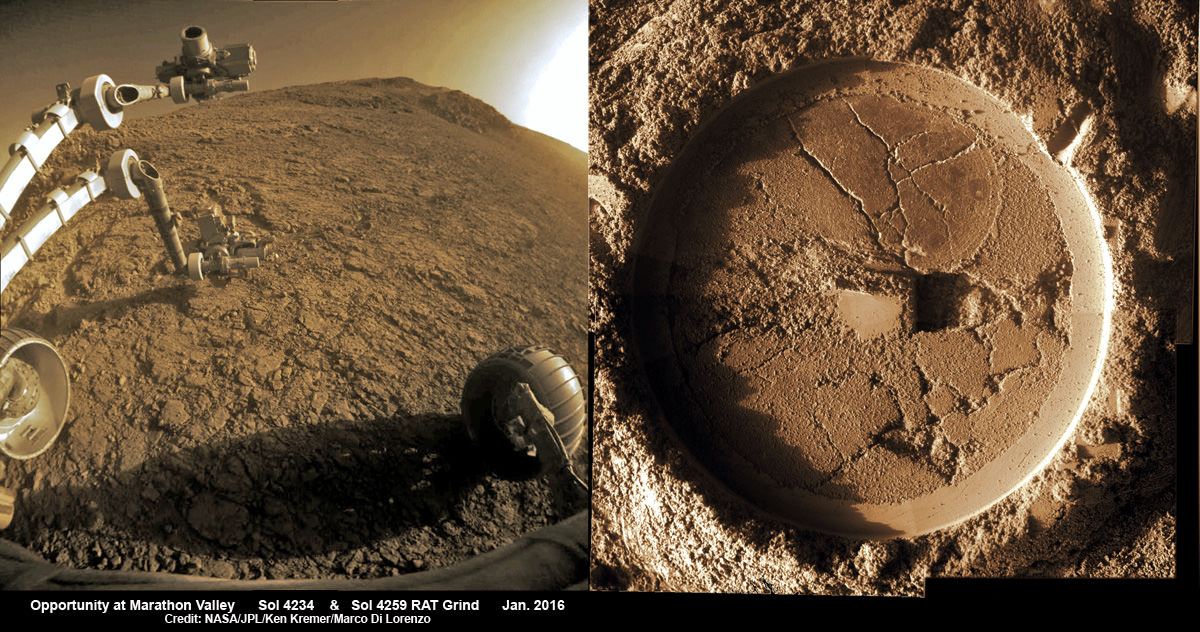
Composite hazcam camera image (left) shows the robotic arm in motion as NASA’s Mars Exploration Rover Opportunity places the tool turret on the target named “Private John Potts” on Sol 4234 to brush away obscuring dust. Rover is actively working on the southern side of “Marathon Valley” which slices through western rim of Endeavour Crater. On Sol 4259 (Jan. 16, 2016), Opportunity completed grinds with the Rock Abrasion Tool (RAT) to exposure rock interior for elemental analysis, as seen in mosaic (right) of four up close images taken by Microscopic Imager (MI). Credit: NASA/JPL/Cornell/Ken Kremer/kenkremer.com/Marco Di Lorenzo
Composite hazcam camera image (left) shows the robotic arm in motion as NASA’s Mars Exploration Rover Opportunity places the tool turret on the target named "Private John Potts" on Sol 4234 to brush away obscuring dust.  Rover is actively working on the southern side of "Marathon Valley" which slices through western rim of Endeavour Crater.  On Sol 4259 (Jan. 16,  2016), Opportunity completed grinds with the Rock Abrasion Tool (RAT) to exposure rock interior for elemental analysis, as seen in mosaic (right) of four up close images taken by  Microscopic Imager (MI).  Credit: NASA/JPL/Cornell/Ken Kremer/kenkremer.com/Marco Di Lorenzo
Composite hazcam camera image (left) shows the robotic arm in motion as NASA’s Mars Exploration Rover Opportunity places the tool turret on the target named “Private John Potts” on Sol 4234 to brush away obscuring dust. Rover is actively working on the southern side of “Marathon Valley” which slices through western rim of Endeavour Crater. On Sol 4259 (Jan. 16, 2016), Opportunity completed grinds with the Rock Abrasion Tool (RAT) to exposure rock interior for elemental analysis, as seen in mosaic (right) of four up close images taken by Microscopic Imager (MI). Credit: NASA/JPL/Cornell/Ken Kremer/kenkremer.com/Marco Di Lorenzo

NASA’s world famous Mars Exploration Rover Opportunity continues blazing a daily trail of unprecedented science first’s, still swinging her robotic arm robustly into action at a Martian “Mining Zone” on the 12th anniversary of her hair-raising Red Planet touchdown this week, a top rover scientist told Universe Today.

“Looks like a mining zone!” Opportunity Deputy Principal Investigator Ray Arvidson, of Washington University in St. Louis, explained to Universe Today. On Jan. 24 the rover marked 4267 Sols and a dozen years and counting exploring Mars. Continue reading “Opportunity Robustly in Action on 12th Anniversary of Red Planet Touchdown”