Dawn Starts Steep Descent to Most Dazzling Orbit of Ceres

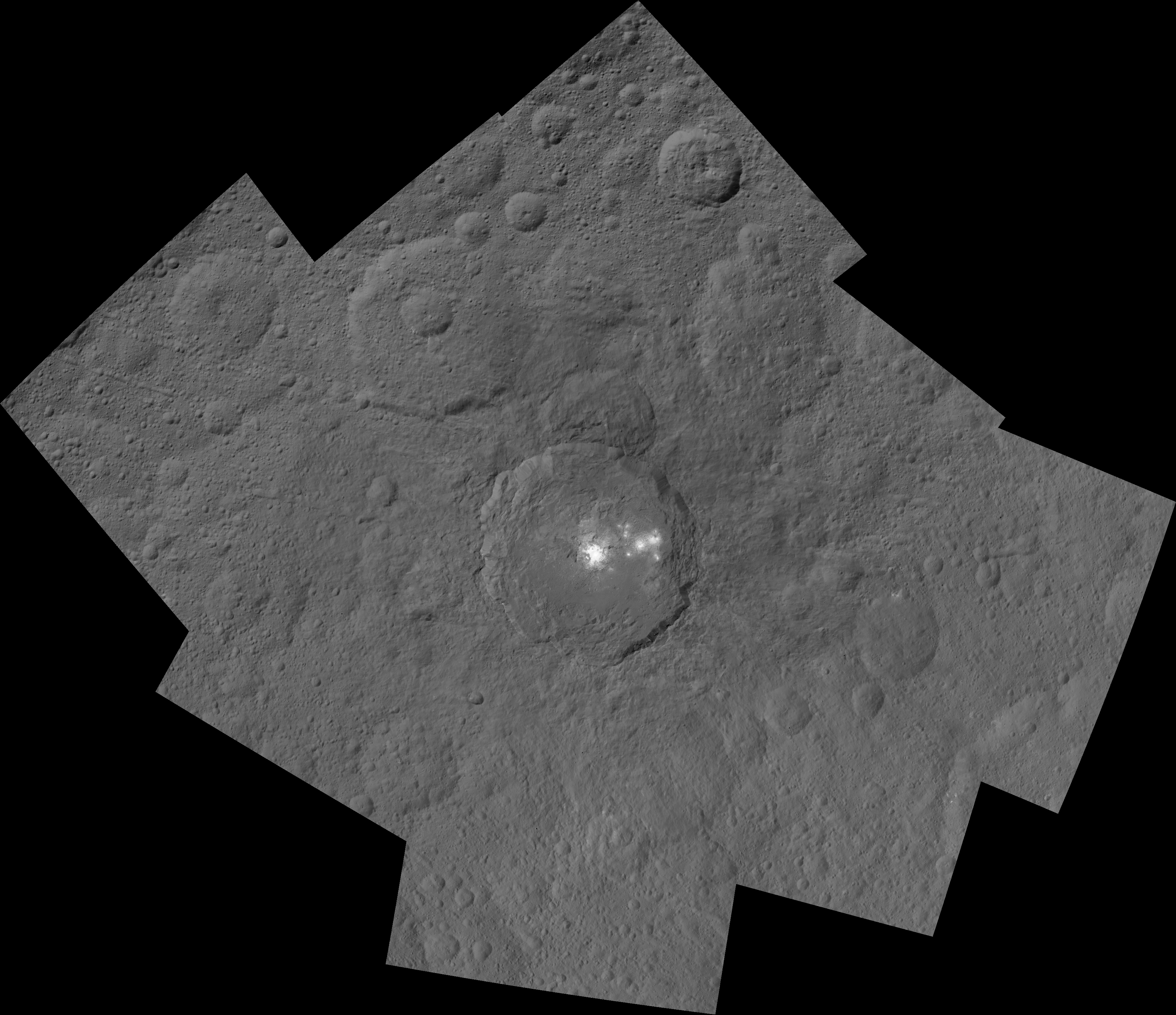
This mosaic shows Ceres' Occator crater and surrounding terrain from an altitude of 915 miles (1,470 kilometers), as seen by NASA's Dawn spacecraft. Occator is about 60 miles (90 kilometers) across and 2 miles (4 kilometers) deep. Credits: NASA/JPL-Caltech/UCLA/MPS/DLR/IDA

The most dazzling views ever seen of dwarf planet Ceres and its mysterious bright spots are what’s on tap by year’s end as NASA’s amazing Dawn spacecraft starts a gradual but steep descent over the next two months to its lowest and final orbit around the bizarre icy body.

Engineers at NASA’s Jet Propulsion Laboratory (JPL) successfully fired up the probes exotic ion propulsion system to begin lowering Dawn’s orbital altitude to less than a quarter of what it has been for the past two months of intense mapping operations.

On Oct. 23, Dawn began a seven-week-long dive that uses ion thruster #2 to reduce the spacecrafts vantage point from 915 miles (1,470 kilometers) at the High Altitude Mapping Orbit (HAMO) down to less than 235 miles (380 kilometers) above Ceres at the Low Altitude Mapping Orbit (LAMO).

Dawn is slated to arrive at LAMO by mid-December, just in time to begin delivering the long awaiting Christmas treats.

Ceres has absolutely tantalized researchers far beyond their wildest expectations.

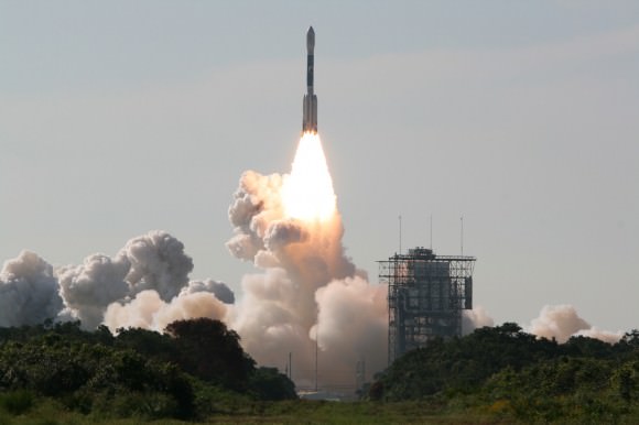
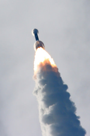
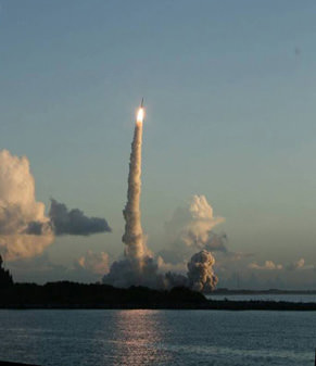
When Dawn arrives at LAMO it will be the culmination of an eight year interplanetary voyage that began with a blastoff on September 27, 2007 by a United Launch Alliance (ULA) Delta II Heavy rocket from Space Launch Complex-17B (SLC-17B) at Cape Canaveral Air Force Station, Florida.

LAMO marks Dawn’s fourth, lowest and final science orbit at Ceres where the highest resolution observations will be gathered and images from the framing camera will achieve a resolution of 120 feet (35 meters) per pixel.
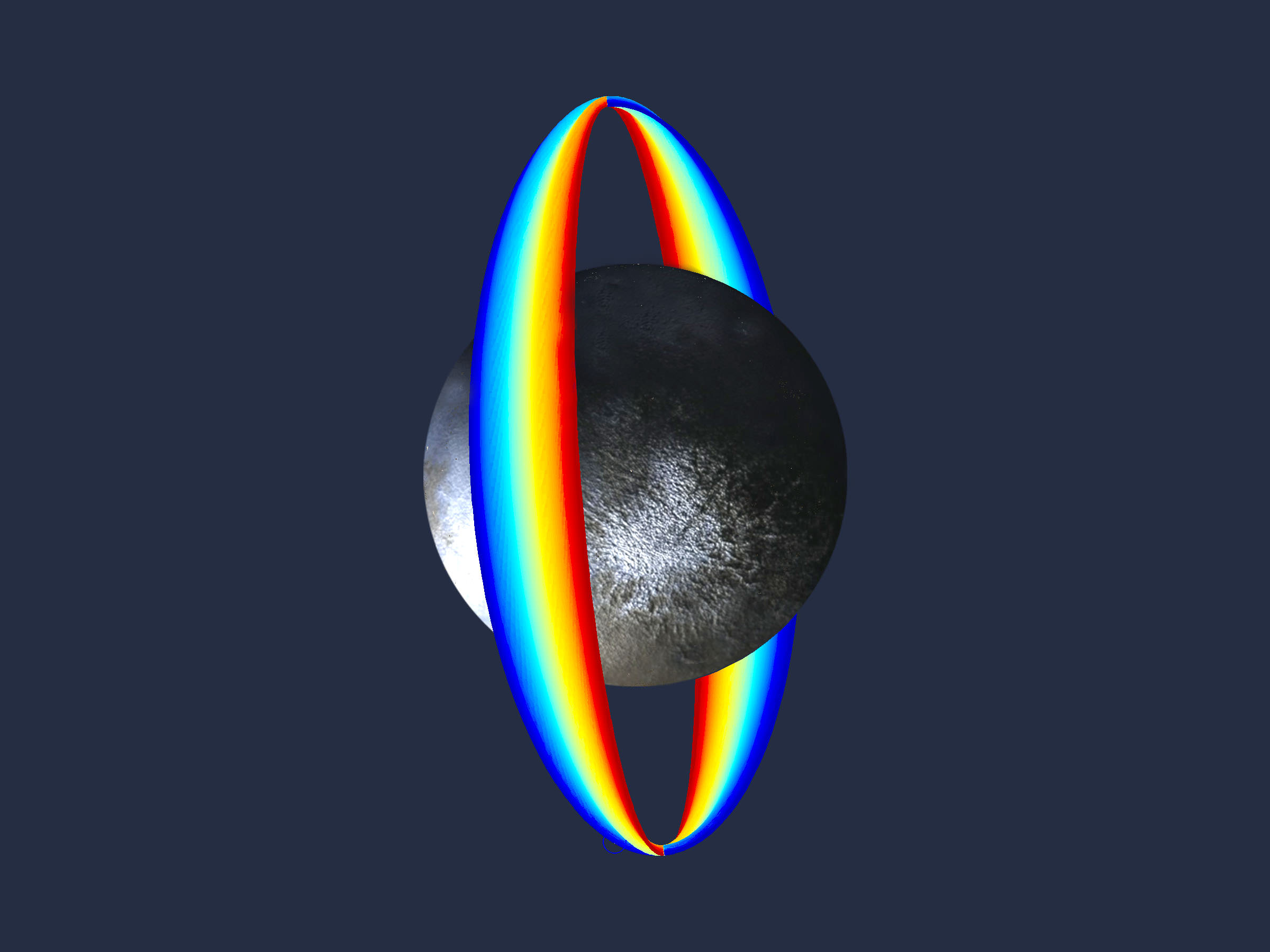
Dawn’s low altitude mapping orbit LAMO. This shows how the orbit naturally shifts slightly (relative to the sun) during the three months of LAMO, starting in blue and ending in red. The spacecraft completes each revolution in 5.5 hours, and Ceres rotates in 9.1 hours, so Dawn will be able to view the entire surface. Credit: NASA/JPL

At LAMO, researchers hope to finally resolve the enduring mystery of the nature of the bright spots that have intrigued science and the general public since they were first glimpsed clearly early this year as Dawn was on its final approach to Ceres.

Dawn arrived in orbit this past spring on March 6, 2015.
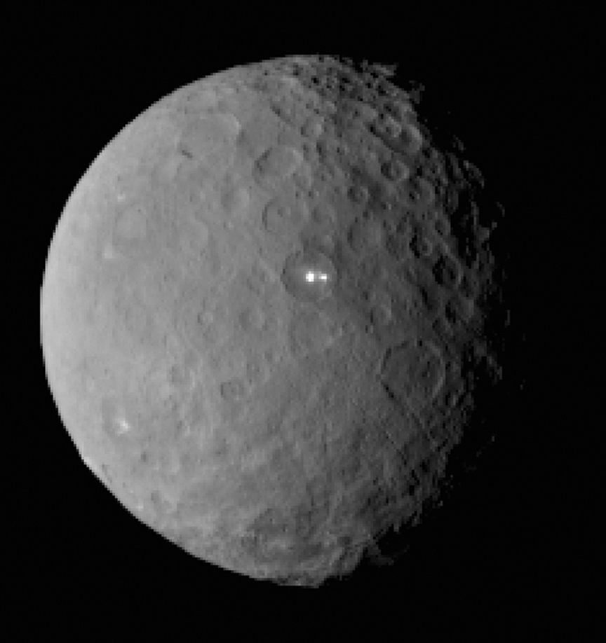
This image was taken by NASA's Dawn spacecraft of dwarf planet Ceres on Feb. 19 from a distance of nearly 29,000 miles (46,000 km). It shows that the brightest spot on Ceres has a dimmer companion, which apparently lies in the same basin. See below for the wide view. Credit: NASA/JPL-Caltech/UCLA/MPS/DLR/IDA
This image was taken by NASA’s Dawn spacecraft of dwarf planet Ceres on Feb. 19 from a distance of nearly 29,000 miles (46,000 km). It shows that the brightest spot on Ceres has a dimmer companion, which apparently lies in the same basin. See below for the wide view. Credit: NASA/JPL-Caltech/UCLA/MPS/DLR/IDA

The science team has just released a new mosaic of the brightest spots on Ceres found at Occator crater and the surrounding terrain – see above.

The images were taken from the HAMO altitude of 915 miles (1,470 kilometers) during the first of six mapping cycles. They have a resolution of 450 feet (140 meters) per pixel.

Occator measures about 60 miles (90 kilometers) across and 2 miles (4 kilometers) deep.
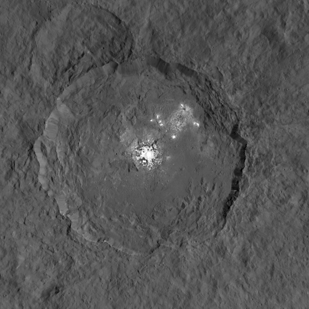
This image, made using images taken by NASA's Dawn spacecraft during the mission's High Altitude Mapping Orbit (HAMO) phase, shows Occator crater on Ceres, home to a collection of intriguing bright spots.  Credits: NASA/JPL-Caltech/UCLA/MPS/DLR/IDA
This image, made using images taken by NASA’s Dawn spacecraft during the mission’s High Altitude Mapping Orbit (HAMO) phase, shows Occator crater on Ceres, home to a collection of intriguing bright spots. Credits: NASA/JPL-Caltech/UCLA/MPS/DLR/IDA

Because the spots are so bright they are generally overexposed. Therefore the team took two sets of images, with shorter and longer exposure times, to maximize the details of the interior of Occator.

“This view uses a composite of two images of Occator: one using a short exposure that captures the detail in the bright spots, and one where the background surface is captured at normal exposure.”

The bright spots at Occator crater remain the biggest Cerean mystery.

So far the imagery and other science data may point to evaporation of salty water from the interior as the source of the bright spots.

“Occasional water leakage on to the surface could leave salt there as the water would sublime,” Prof. Chris Russell, Dawn principal investigator told Universe Today exclusively.

“The big picture that is emerging is that Ceres fills a unique niche.”

“Ceres fills a unique niche between the cold icy bodies of the outer solar system, with their rock hard icy surfaces, and the water planets Mars and Earth that can support ice and water on their surfaces,” Russell, of the University of California, Los Angeles, told me.

Dawn has peeled back Ceres secrets as the spacecraft orbits lower and lower. Detailed measurements gathered to date have yielded global mineral and topographic maps from HAMO with the best resolution ever as the science team painstakingly stitched together the probes spectral and imaging products.

And the best is yet to come at LAMO.

At HAMO, Dawn’ instruments, including the Framing Camera and Visible and Infrared Spectrometer (VIR) were aimed at slightly different angles in each mapping cycle allowing the team to generate stereo views and construct 3-D maps.

“The emphasis during HAMO is to get good stereo data on the elevations of the surface topography and to get good high resolution clear and color data with the framing camera,” Russell explained.
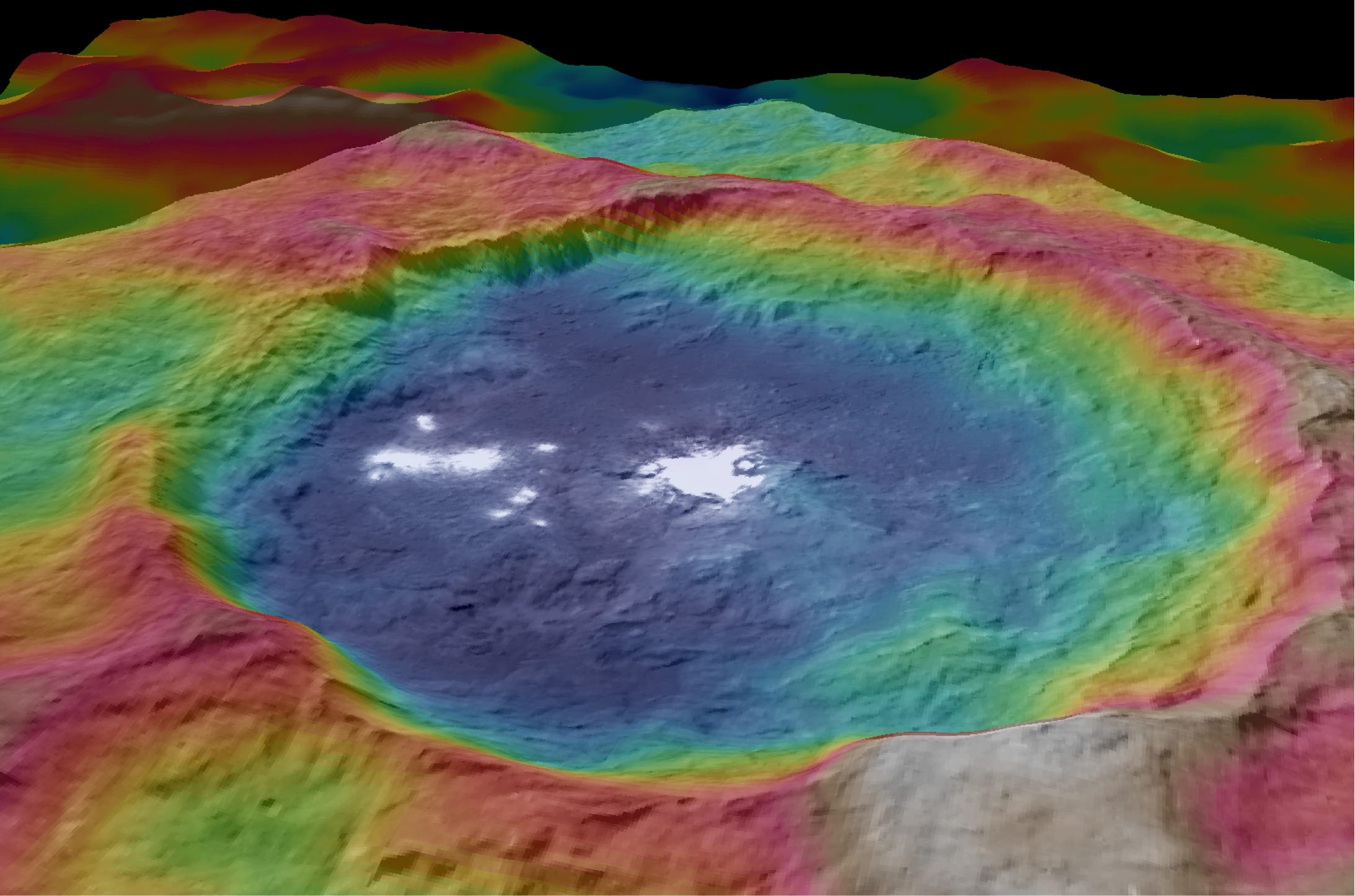
This view from NASA's Dawn spacecraft is a color-coded topographic map of Occator crater on Ceres. Blue is the lowest elevation, and brown is the highest. The crater, which is home to the brightest spots on Ceres, is approximately 56 miles (90 kilometers wide).  Credits: NASA/JPL-Caltech/UCLA/MPS/DLR/IDA
This view from NASA’s Dawn spacecraft is a color-coded topographic map of Occator crater on Ceres. Blue is the lowest elevation, and brown is the highest. The crater, which is home to the brightest spots on Ceres, is approximately 56 miles (90 kilometers wide). Credits: NASA/JPL-Caltech/UCLA/MPS/DLR/IDA

Dawn is Earth’s first probe in human history to explore any dwarf planet, the first to explore Ceres up close and the first to orbit two celestial bodies.

The asteroid Vesta was Dawn’s first orbital target where it conducted extensive observations of the bizarre world for over a year in 2011 and 2012.

Ceres is a Texas-sized world, ranks as the largest object in the main asteroid belt between Mars and Jupiter, and may have a subsurface ocean of liquid water that could be hospitable to life.
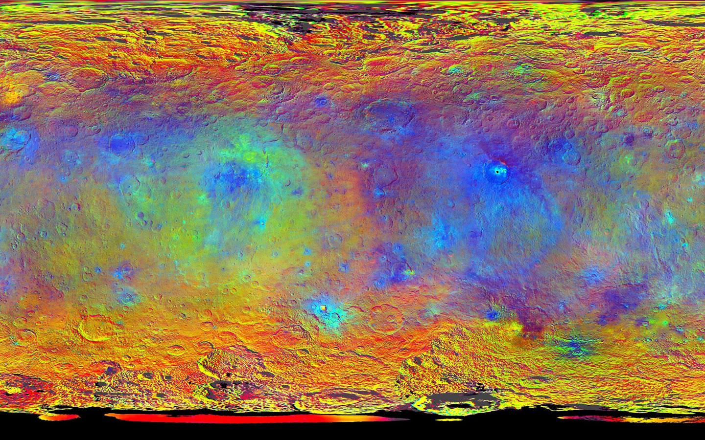
This map-projected view of Ceres was created from images taken by NASA's Dawn spacecraft during its high-altitude mapping orbit, in August and September, 2015.  This color coded map can provide valuable insights into the mineral composition of the surface, as well as the relative ages of surface features.  Credits: NASA/JPL-Caltech/UCLA/MPS/DLR/IDA
This map-projected view of Ceres was created from images taken by NASA’s Dawn spacecraft during its high-altitude mapping orbit, in August and September, 2015. This color coded map can provide valuable insights into the mineral composition of the surface, as well as the relative ages of surface features. Credits: NASA/JPL-Caltech/UCLA/MPS/DLR/IDA

The mission is expected to last until at least March 2016, and possibly longer, depending upon fuel reserves.

“It will end some time between March and December,” Dr. Marc Rayman, Dawn’s chief engineer and mission director based at NASA’s Jet Propulsion Laboratory, Pasadena, California, told Universe Today.

Stay tuned here for Ken’s continuing Earth and planetary science and human spaceflight news.
Ken Kremer

Dawn at Ceres
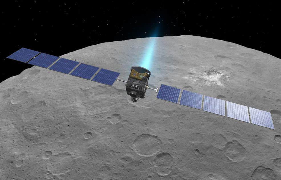
An artist’s conception shows NASA’s Dawn spacecraft flying above Ceres. This view incorporates actual imagery from the Dawn mission. Credit: NASA/JPL-Caltech/UCLA/MPS/DLR/IDA

NASA Launches Revolutionary Earth Science Satellite Measuring Soil Moisture Cycle

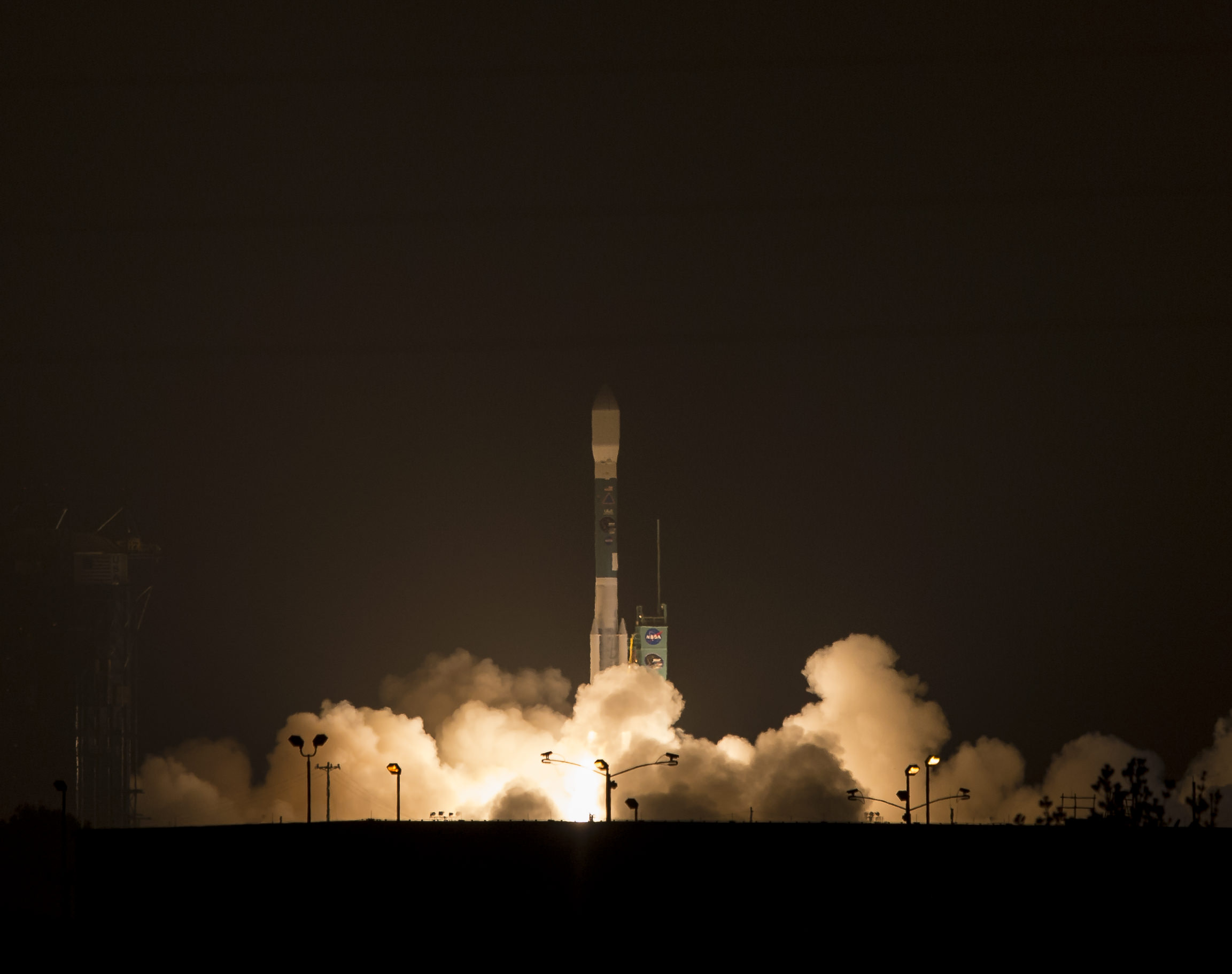
NASA's Soil Moisture Active Passive (SMAP) observatory, on a United Launch Alliance Delta II rocket, is seen after the mobile service tower was rolled back Friday, Jan. 30 at Space Launch Complex 2, Vandenberg Air Force Base, Calif. Image Credit: NASA/Bill Ingalls

NASA’s Soil Moisture Active Passive (SMAP) observatory, on a United Launch Alliance Delta II rocket, is seen after the mobile service tower was rolled back Friday, Jan. 30 at Space Launch Complex 2, Vandenberg Air Force Base, Calif.
Image Credit: NASA/Bill Ingalls
Story updated[/caption]

At dawn this morning (Jan. 31) NASA launched an advanced Earth science satellite aimed at making measurements of our planet’s surface soil moisture and freeze/thaw states from space that will revolutionize our understanding of the water, energy, and carbon cycles driving all life on Earth, aid weather forecasting and improve climate change models.

NASA’s new Soil Moisture Active Passive (SMAP) observatory thundered off the pad at 6:22 a.m. PST (9:22 a.m. EST) Saturday atop a two stage United Launch Alliance Delta II rocket from Space Launch Complex 2 on Vandenberg Air Force Base, California.

The $916 million satellite successfully separated from the rocket’s second stage some 57 minutes after the flawless liftoff and was injected into an initial 411- by 425-mile (661- by 685-kilometer) orbit. The spacecraft then deployed its solar arrays and telemetry indicated it was in excellent health.

“We’re in contact with SMAP and everything looks good right now,” NASA Launch Manager Tim Dunn said.

“Deployment of the solar arrays is underway. We just couldn’t be happier.”

SMAP separated from the second stage while pointed toward the sun as seen in the video below from a rocket mounted camera:

Video Caption: A camera on the second stage of the Delta II rocket captured this footage as the SMAP spacecraft pushed itself away from the rocket to complete the delivery of the Earth-observing spacecraft to its proper orbit following Jan. 31, 2015 liftoff. Credit: NASA TV/ULA

SMAP is NASA’s 1st Earth observing satellite designed to make high resolution global observations of Earth’s vital surface soil moisture content and freeze/thaw cycle just below your feet. It will aid global forecasting and have broad applications for science and society.

SMAP’s combined radar and radiometer instruments will peer into the top 2 inches (5 centimeters) of soil, through clouds and moderate vegetation cover, day and night, to produce the highest-resolution, most accurate soil moisture maps ever obtained from space, says NASA.

The blastoff of SMAP successfully concluded NASA’s ambitious plans to launch a record breaking total of five Earth science satellites in less than a year’s time.

“The launch of SMAP completes an ambitious 11-month period for NASA that has seen the launch of five new Earth-observing space missions to help us better understand our changing planet,” said NASA Administrator Charles Bolden.

“Scientists and policymakers will use SMAP data to track water movement around our planet and make more informed decisions in critical areas like agriculture and water resources.”

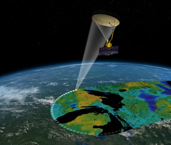
Artist's rendering of the Soil Moisture Active Passive satellite. The width of the region scanned on Earth’s surface during each orbit is about 620 miles (1,000 kilometers).  Image credit: NASA/JPL-Caltech
Artist’s rendering of the Soil Moisture Active Passive satellite. The width of the region scanned on Earth’s surface during each orbit is about 620 miles (1,000 kilometers). Image credit: NASA/JPL-Caltech

SMAP is projected to last for at least a three year primary mission.

The prior NASA Earth science instrument launched was the Cloud Aerosol Transport System (CATS) payload hauled to space by the SpaceX CRS-4 Dragon on Jan. 10, 2015 and recently installed on the exterior of the ISS. Read my CATS installation story – here.

The three earlier NASA Earth science missions launched over the past year included ISS-RapidScat in September 2014, the Global Precipitation Measurement (GPM) Core Observatory, a joint mission with the Japan Aerospace Exploration Agency, in February 2014, and the Orbiting Carbon Observatory-2 (OCO-2) carbon observatory in July 2014.

“Congratulations to the NASA Launch Services Program team, JPL and all of our mission partners on today’s successful launch of the SMAP satellite,” said Jim Sponnick, ULA vice president, Atlas and Delta Programs.

“It is our honor to launch this important Earth science mission to help scientists observe and predict natural hazards, and improve our understanding of Earth’s water, energy and carbon cycles.”

SMAP will provide high-resolution, space-based measurements of soil moisture and its state — frozen or thawed — a new capability that will allow scientists to better predict natural hazards of extreme weather, climate change, floods and droughts, and help reduce uncertainties in our understanding of Earth’s water, energy and carbon cycles, according to a NASA description.

The mission will map the entire globe every two to three days for at least three years and provide the most accurate and highest-resolution maps of soil moisture ever obtained. The spacecraft’s final circular polar orbit will be 426 miles (685 kilometers), at an inclination of 98.1 degrees. The spacecraft will orbit Earth once every 98.5 minutes and repeat the same ground track every eight days.

“All subsystems are being powered on and checked out as planned,” Kent Kellogg, the SMAP project manager, during a post-launch press conference.

“Communications, guidance and control, computers and power are all operating nominally.”

The observatory is in excellent health. Its instruments will be turned on in 11 days.

Today’s blastoff of SMAP marks ULA’s second successful launch this month as well as the second of 13 planned for 2015. ULA’s first launch of 2015 was MUOS-3 from Cape Canaveral on Jan. 20.

ULA’s next launch involves NASA’s Magnetospheric Multiscale Mission (MMS) to study Earth’s magnetic reconnection. It is scheduled for launch on an Atlas V 421 booster on March 12 from Cape Canaveral. See my up close visit with MMS and NASA Administrator Charles Bolden at NASA Goddard Space Flight Center detailed in my story – here.

Stay tuned here for Ken’s continuing Earth and planetary science and human spaceflight news.

Ken Kremer

NASA’s Carbon Dioxide Greenhouse Gas Observatory Captures ‘First Light’ at Head of International ‘A-Train’ of Earth Science Satellites

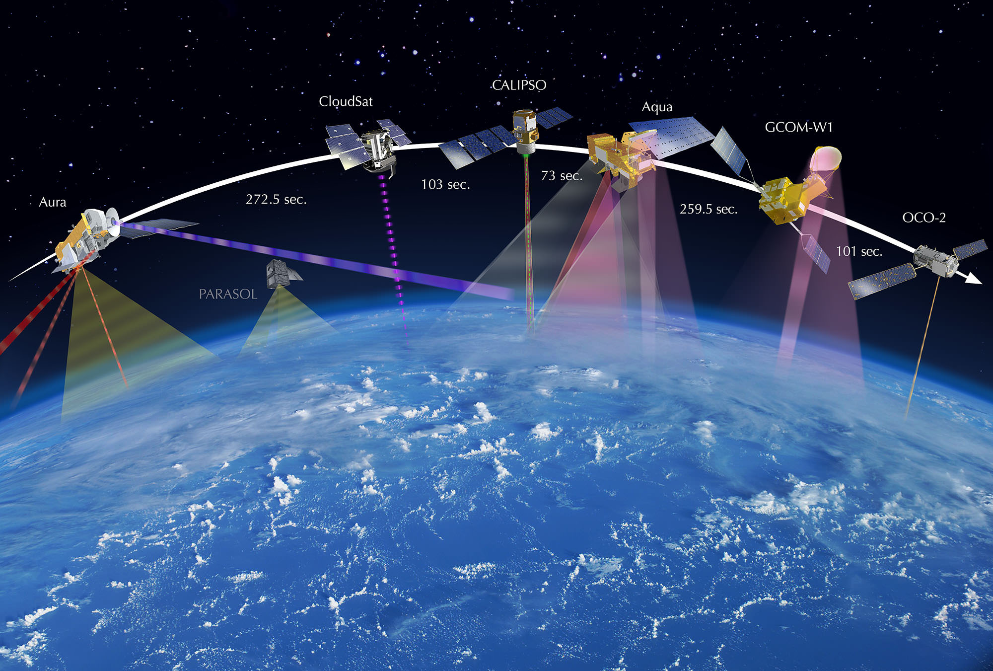
OCO-2 leads the international Afternoon Constellation, or A-Train, of Earth-observing satellites as shown in this artist's concept. Japan’s Global Change Observation Mission - Water (GCOM-W1) satellite and NASA’s Aqua, CALIPSO, CloudSat and Aura satellites follow. Credit: NASA

NASA’s first spacecraft dedicated to studying Earth’s atmospheric climate changing carbon dioxide (CO2) levels and its carbon cycle has reached its final observing orbit and taken its first science measurements as the leader of the world’s first constellation of Earth science satellites known as the International “A-Train.”

The Orbiting Carbon Observatory-2 (OCO-2) is a research satellite tasked with collecting the first global measurements of atmospheric carbon dioxide (CO2) – the leading human-produced greenhouse gas and the principal human-produced driver of climate change.

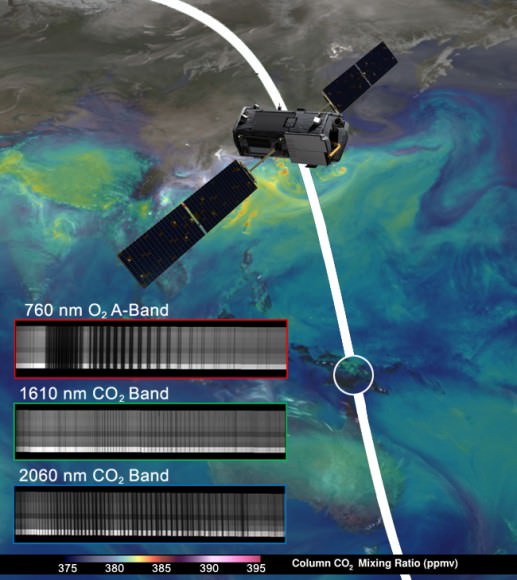
The ‘first light’ measurements were conducted on Aug. 6 as the observatory flew over central Papua New Guinea and confirmed the health of the science instrument. See graphic below.

NASA's OCO-2 spacecraft collected "first light” data Aug. 6 over New Guinea. OCO-2’s spectrometers recorded the bar code-like spectra, or chemical signatures, of molecular oxygen or carbon dioxide in the atmosphere. The backdrop is a simulation of carbon dioxide created from GEOS-5 model data.  Credit:  NASA/JPL-Caltech/NASA GSFC
NASA’s OCO-2 spacecraft collected “first light” data Aug. 6 over New Guinea. OCO-2’s spectrometers recorded the bar code-like spectra, or chemical signatures, of molecular oxygen or carbon dioxide in the atmosphere. The backdrop is a simulation of carbon dioxide created from GEOS-5 model data. Credit:
NASA/JPL-Caltech/NASA GSFC

Before the measurements could begin, mission controllers had to cool the observatory’s three-spectrometer instrument to its operating temperatures.

“The spectrometer’s optical components must be cooled to near 21 degrees Fahrenheit (minus 6 degrees Celsius) to bring them into focus and limit the amount of heat they radiate. The instrument’s detectors must be even cooler, near minus 243 degrees Fahrenheit (minus 153 degrees Celsius), to maximize their sensitivity,” according to a NASA statement.

The team still has to complete a significant amount of calibration work before the observatory is declared fully operational.

OCO-2 was launched
just over a month ago during a spectacular nighttime blastoff on July 2, 2014, from Vandenberg Air Force Base, California, atop a the venerable United Launch Alliance Delta II rocket.

OCO-2 arrived at its final 438-mile (705-kilometer) altitude, near-polar orbit on Aug. 3 at the head of the international A-Train following a series of propulsive burns during July. Engineers also performed a thorough checkout of all of OCO-2’s systems to ensure they were functioning properly.

“The initial data from OCO-2 appear exactly as expected — the spectral lines are well resolved, sharp and deep,” said OCO-2 chief architect and calibration lead Randy Pollock of JPL, in a statement.

“We still have a lot of work to do to go from having a working instrument to having a well-calibrated and scientifically useful instrument, but this was an important milestone on this journey.”

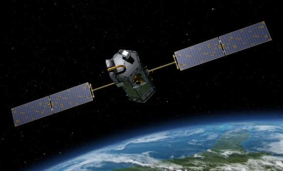
Artist's rendering of NASA's Orbiting Carbon Observatory (OCO)-2, one of five new NASA Earth science missions set to launch in 2014, and one of three managed by JPL. Credit:  NASA-JPL/Caltech
Artist’s rendering of NASA’s Orbiting Carbon Observatory (OCO)-2, one of five new NASA Earth science missions set to launch in 2014, and one of three managed by JPL. Credit: NASA-JPL/Caltech

OCO-2 now leads the A-Train constellation, comprising five other international Earth orbiting monitoring satellites that constitute the world’s first formation-flying “super observatory” that collects an unprecedented quantity of nearly simultaneous climate and weather measurements.

Scientists will use the huge quantities of data to record the health of Earth’s atmosphere and surface environment as never before possible.

OCO-2 is followed in orbit by the Japanese GCOM-W1 satellite, and then by NASA’s Aqua, CALIPSO, CloudSat and Aura spacecraft, respectively. All six satellites fly over the same point on Earth within 16 minutes of each other. OCO-2 currently crosses the equator at 1:36 p.m. local time.

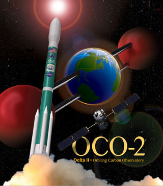
OCO-2 poster. Credit: ULA/NASA

The 999 pound (454 kilogram) observatory is the size of a phone booth.

OCO-2 is equipped with a single science instrument consisting of three high-resolution, near-infrared spectrometers fed by a common telescope. It will collect global measurements of atmospheric CO2 to provide scientists with a better idea of how CO2 impacts climate change and is responsible for Earth’s warming.

During a minimum two-year mission the $467.7 million OCO-2 will take near global measurements to locate the sources and storage places, or ‘sinks’, for atmospheric carbon dioxide, which is a critical component of the planet’s carbon cycle.

OCO-2 was built by Orbital Sciences as a replacement for the original OCO which was destroyed during the failed launch of a Taurus XL rocket from Vandenberg back in February 2009 when the payload fairing failed to open properly and the spacecraft plunged into the ocean.

The OCO-2 mission will provide a global picture of the human and natural sources of carbon dioxide, as well as their “sinks,” the natural ocean and land processes by which carbon dioxide is pulled out of Earth’s atmosphere and stored, according to NASA.

Here’s a NASA description of how OCO-2 collects measurements.

As OCO-2 flies over Earth’s sunlit hemisphere, each spectrometer collects a “frame” three times each second, for a total of about 9,000 frames from each orbit. Each frame is divided into eight spectra, or chemical signatures, that record the amount of molecular oxygen or carbon dioxide over adjacent ground footprints. Each footprint is about 1.3 miles (2.25 kilometers) long and a few hundred yards (meters) wide. When displayed as an image, the eight spectra appear like bar codes — bright bands of light broken by sharp dark lines. The dark lines indicate absorption by molecular oxygen or carbon dioxide.

It will record around 100,000 precise individual CO2 measurements around the worlds entire sunlit hemisphere every day and help determine its source and fate in an effort to understand how human activities impact climate change and how we can mitigate its effects.

OCO-2 mission  description. Credit: NASA
OCO-2 mission description. Credit: NASA

At the dawn of the Industrial Revolution, there were about 280 parts per million (ppm) of carbon dioxide in Earth’s atmosphere. As of today the CO2 level has risen to about 400 parts per million, which is the most in at least 800,000 years, says NASA.

OCO-2 is the second of NASA’s five new Earth science missions planned to launch in 2014 and is designed to operate for at least two years during its primary mission. It follows the successful blastoff of the joint NASA/JAXA Global Precipitation Measurement (GPM) Core Observatory satellite on Feb 27.

Stay tuned here for Ken’s continuing Earth and Planetary science and human spaceflight news.
Ken Kremer

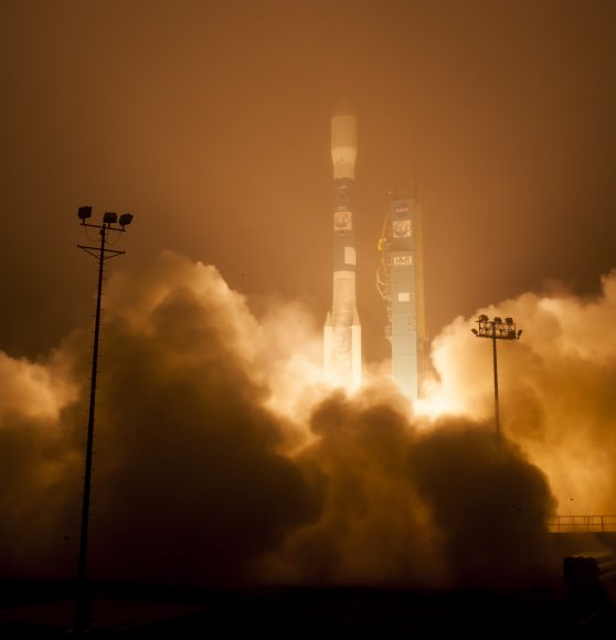
The Orbiting Carbon Observatory-2, NASA's first mission dedicated to studying carbon dioxide in Earth's atmosphere, lifts off from Vandenberg Air Force Base, California, at 2:56 a.m. Pacific Time, July 2, 2014 on a Delta II rocket.  The two-year mission will help scientists unravel key mysteries about carbon dioxide. Credit: NASA/Bill Ingalls
The Orbiting Carbon Observatory-2, NASA’s first mission dedicated to studying carbon dioxide in Earth’s atmosphere, lifts off from Vandenberg Air Force Base, California, at 2:56 a.m. Pacific Time, July 2, 2014 on a Delta II rocket. The two-year mission will help scientists unravel key mysteries about carbon dioxide. Credit: NASA/Bill Ingalls

NASA’s Carbon Observatory Blasts off on Workhorse Delta II to Measure Carbon Dioxide Greenhouse Gas and Watch Earth Breathe

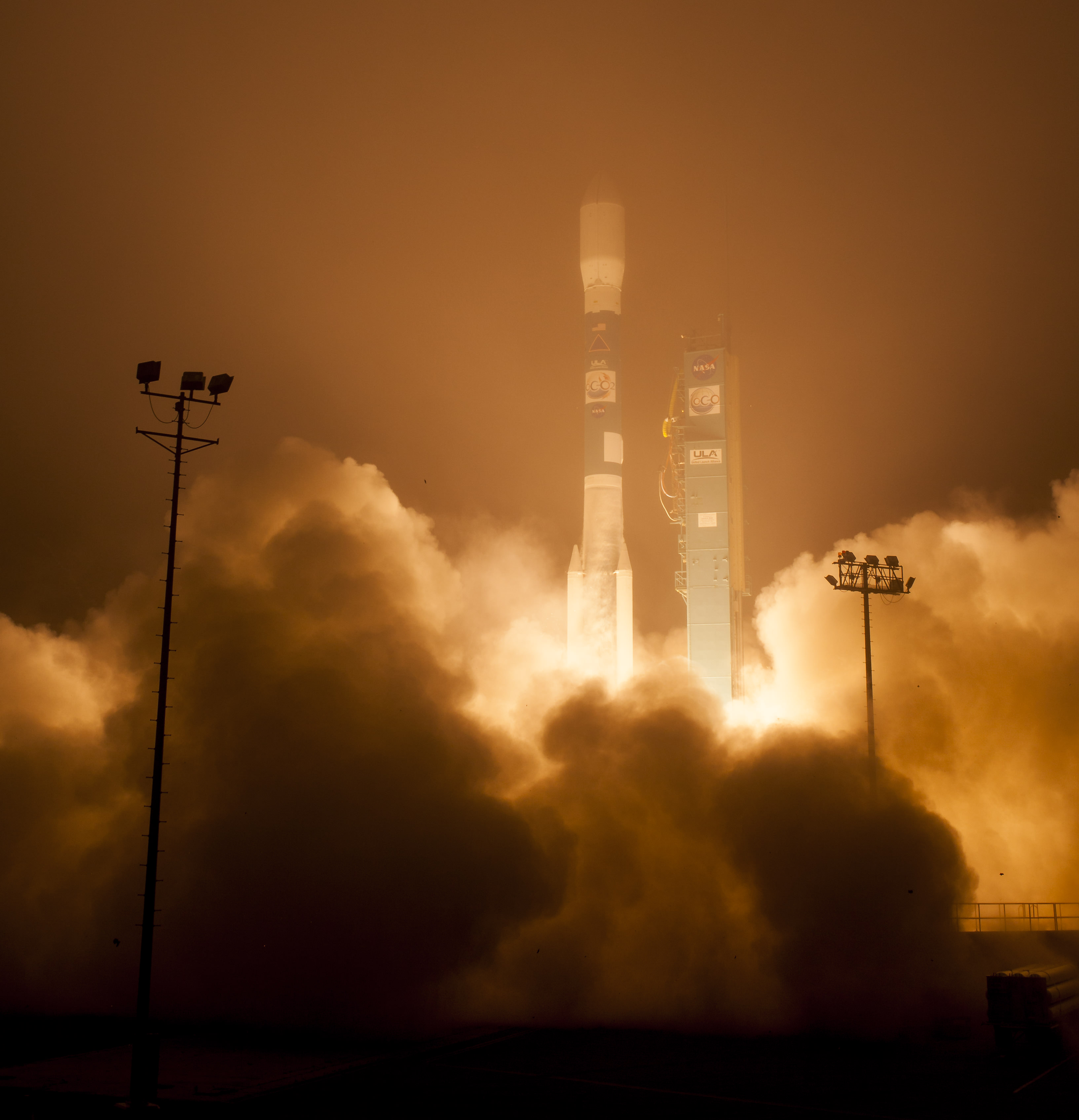
The Orbiting Carbon Observatory-2, NASA's first mission dedicated to studying carbon dioxide in Earth's atmosphere, lifts off from Vandenberg Air Force Base, California, at 2:56 a.m. Pacific Time, July 2, 2014 on a Delta II rocket. The two-year mission will help scientists unravel key mysteries about carbon dioxide. Credit: NASA/Bill Ingalls

The Orbiting Carbon Observatory-2, NASA’s first mission dedicated to studying carbon dioxide in Earth’s atmosphere, lifts off from Vandenberg Air Force Base, California, at 2:56 a.m. Pacific Time, July 2, 2014 on a Delta II rocket. The two-year mission will help scientists unravel key mysteries about carbon dioxide. Credit: NASA/Bill Ingalls
Story updated[/caption]

Following a nearly three-year long hiatus, the workhorse Delta II rocket successfully launched NASA’s first spacecraft dedicated to watching Earth breathe by studying Earth’s atmospheric carbon dioxide (CO2) – the leading human-produced greenhouse gas and the principal human-produced driver of climate change.

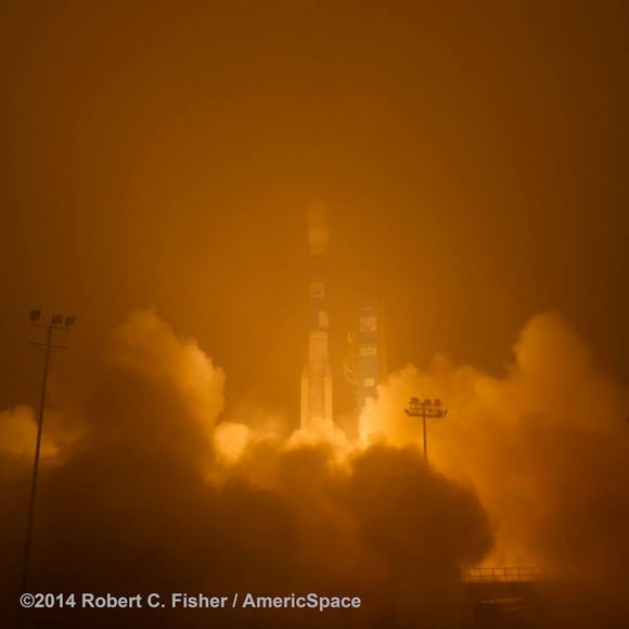
The Orbiting Carbon Observatory-2 (OCO-2) raced to orbit earlier this morning, during a spectacular nighttime blastoff at 2:56 a.m. PDT (5:56 a.m. EDT), Tuesday, July 2, 2014, from Vandenberg Air Force Base, California, atop a United Launch Alliance Delta II rocket.

The flawless launch marked the ‘return to flight’ of the venerable Delta II and was broadcast live on NASA TV.

Blastoff of NASA’s Orbiting Carbon Observatory-2 dedicated to studying carbon dioxide in Earth's atmosphere, from Vandenberg Air Force Base, California, at 2:56 a.m. Pacific Time, July 2, 2014. Credit: Robert Fisher/America/Space
Blastoff of NASA’s Orbiting Carbon Observatory-2 dedicated to studying carbon dioxide in Earth’s atmosphere, from Vandenberg Air Force Base, California, at 2:56 a.m. Pacific Time, July 2, 2014. Credit: Robert Fisher/America/Space

A camera mounted on the Delta II’s second stage captured a breathtaking live view of the OCO-2 spacecraft during separation from the upper stage, which propelled it into an initial 429-mile (690-kilometer) orbit.

The life giving solar arrays were unfurled soon thereafter and NASA reports that the observatory is in excellent health.

“Climate change is the challenge of our generation,” said NASA Administrator Charles Bolden in a statement.

“With OCO-2 and our existing fleet of satellites, NASA is uniquely qualified to take on the challenge of documenting and understanding these changes, predicting the ramifications, and sharing information about these changes for the benefit of society.”

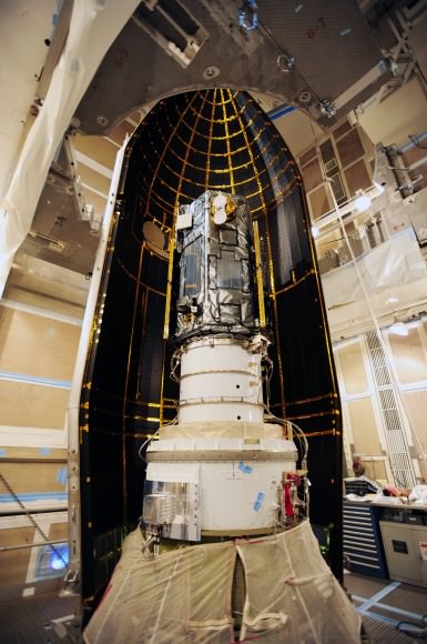
NASA's Orbiting Carbon Observatory-2, or OCO-2, inside the payload fairing in the mobile service tower at Space Launch Complex 2 on Vandenberg Air Force Base in California. The fairing will protect OCO-2 during launch aboard a United Launch Alliance Delta II rocket, scheduled for 5:56 a.m. EDT on July 1. OCO-2 is NASA’s first mission dedicated to studying atmospheric carbon dioxide, the leading human-produced greenhouse gas driving changes in Earth’s climate.   Credit: NASA/30th Space Wing USAF
NASA’s Orbiting Carbon Observatory-2, or OCO-2, inside the payload fairing in the mobile service tower at Space Launch Complex 2 on Vandenberg Air Force Base in California. The fairing will protect OCO-2 during launch aboard a United Launch Alliance Delta II rocket, which occurred at 5:56 a.m. EDT on July 2. OCO-2 is NASA’s first mission dedicated to studying atmospheric carbon dioxide, the leading human-produced greenhouse gas driving changes in Earth’s climate. Credit: NASA/30th Space Wing USAF

Over the next three weeks the OCO-2 probe will undergo a thorough checkout and calibration process. It will also be maneuvered into a 438-mile (705-kilometer) altitude, near-polar orbit where it will become the lead science probe at the head of the international Afternoon Constellation, or “A-Train,” of Earth-observing satellites.

“The A-Train, the first multi-satellite, formation flying “super observatory” to record the health of Earth’s atmosphere and surface environment, collects an unprecedented quantity of nearly simultaneous climate and weather measurements,” says NASA.

Science operations begin in about 45 days.

The 999 pound (454 kilogram) observatory is the size of a phone booth.

OCO-2 is equipped with a single science instrument consisting of three high-resolution, near-infrared spec¬trometers fed by a common telescope. It will collect global measurements of atmospheric CO2 to provide scientists with a better idea of how CO2 impacts climate change and is responsible for Earth’s warming.

OCO-2 poster. Credit: ULA/NASA

During a minimum two-year mission the $467.7 million OCO-2 will take near global measurements to locate the sources and storage places, or ‘sinks’, for atmospheric carbon dioxide, which is a critical component of the planet’s carbon cycle.

OCO-2 was built by Orbital Sciences as a replacement for the original OCO which was destroyed during the failed launch of a Taurus XL rocket from Vandenberg back in February 2009 when the payload fairing failed to open properly and the spacecraft plunged into the ocean.

The OCO-2 mission will provide a global picture of the human and natural sources of carbon dioxide, as well as their “sinks,” the natural ocean and land processes by which carbon dioxide is pulled out of Earth’s atmosphere and stored, according to NASA.

“This challenging mission is both timely and important,” said Michael Freilich, director of the Earth Science Division of NASA’s Science Mission Directorate in Washington.

“OCO-2 will produce exquisitely precise measurements of atmospheric carbon dioxide concentrations near Earth’s surface, laying the foundation for informed policy decisions on how to adapt to and reduce future climate change.”

It will record around 100,000 precise individual CO2 measurements around the worlds entire sunlit hemisphere every day and help determine its source and fate in an effort to understand how human activities impact climate change and how we can mitigate its effects.

At the dawn of the Industrial Revolution, there were about 280 parts per million (ppm) of carbon dioxide in Earth’s atmosphere. As of today the CO2 level has risen to about 400 parts per million.

“Scientists currently don’t know exactly where and how Earth’s oceans and plants have absorbed more than half the carbon dioxide that human activities have emitted into our atmosphere since the beginning of the industrial era,” said David Crisp, OCO-2 science team leader at NASA’s Jet Propulsion Laboratory in Pasadena, California, in a statement.

“Because of this, we cannot predict precisely how these processes will operate in the future as climate changes. For society to better manage carbon dioxide levels in our atmosphere, we need to be able to measure the natural source and sink processes.”

OCO-2 is the second of NASA’s five new Earth science missions planned to launch in 2014 and is designed to operate for at least two years during its primary mission. It follows the successful blastoff of the joint NASA/JAXA Global Precipitation Measurement (GPM) Core Observatory satellite on Feb 27.

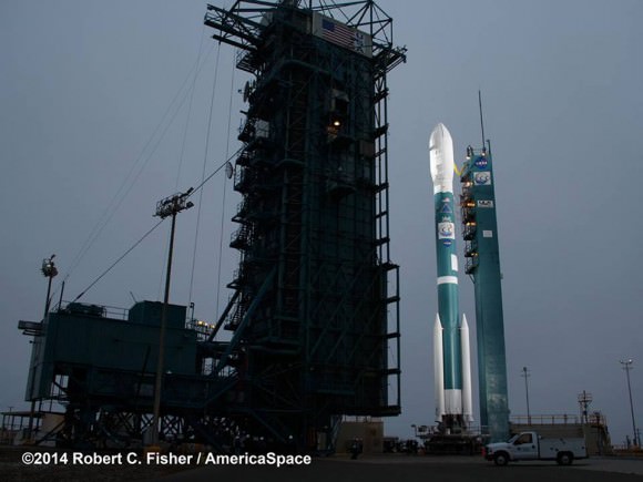
Prelaunch view of NASA’s Orbiting Carbon Observatory-2 and United Launch Alliance Delta II rocket unveiled at  Space Launch Complex 2 at Vandenberg Air Force Base in California. Credit: Robert Fisher/America/Space
Prelaunch view of NASA’s Orbiting Carbon Observatory-2 and United Launch Alliance Delta II rocket unveiled at Space Launch Complex 2 at Vandenberg Air Force Base in California. Credit: Robert Fisher/America/Space

The two stage Delta II 7320-10 launch vehicle is 8 ft in diameter and approximately 128 ft tall and was equipped with a trio of first stage strap on solid rocket motors. This marked the 152nd Delta II launch overall and the 51st for NASA since 1989.

The last time a Delta II rocket flew was nearly three years ago in October 2011 from Vandenberg for the Suomi National Polar-Orbiting Partnership (NPP) weather satellite.

The final Delta II launch from Cape Canaveral on Sept. 10, 2011 boosted NASA’s twin GRAIL gravity mapping probes to the Moon.

The next Delta II launch later this year from Vandenberg involves NASA’s Soil Moisture Active Passive (SMAP) mission and counts as another of NASA’s five Earth science missions launching in 2014.

Stay tuned here for Ken’s continuing OCO-2, GPM, Curiosity, Opportunity, Orion, SpaceX, Boeing, Orbital Sciences, MAVEN, MOM, Mars and more Earth & Planetary science and human spaceflight news.
Ken Kremer

NASA Set to Launch OCO-2 Observatory on July 1 – Sniffer of Carbon Dioxide Greenhouse Gas

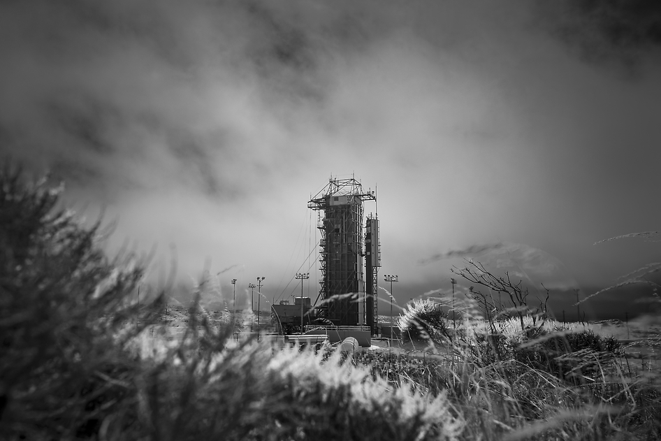
NASA’s Orbiting Carbon Observatory-2 (OCO-2) at the Launch Pad. This black-and-white infrared view shows the launch gantry, surrounding the United Launch Alliance Delta II rocket with the Orbiting Carbon Observatory-2 (OCO-2) satellite onboard. The photo was taken at Space Launch Complex 2, Friday, June 27, 2014, Vandenberg Air Force Base, Calif. OCO-2 is set for a July 1, 2014 launch. Credit: NASA/Bill Ingalls

NASA’s Orbiting Carbon Observatory-2 (OCO-2) at the Launch Pad
This black-and-white infrared view shows the launch gantry, surrounding the United Launch Alliance Delta II rocket with the Orbiting Carbon Observatory-2 (OCO-2) satellite onboard. The photo was taken at Space Launch Complex 2, Friday, June 27, 2014, Vandenberg Air Force Base, Calif. OCO-2 is set for a July 1, 2014 launch. Credit: NASA/Bill Ingalls[/caption]

After a lengthy hiatus, the workhorse Delta II rocket that first launched a quarter of a century ago and placed numerous renowned NASA science missions into Earth orbit and interplanetary space, as well as lofting dozens of commercial and DOD missions, is about to soar again this week on July 1 with NASA’s Orbiting Carbon Observatory-2 (OCO-2) sniffer to study atmospheric carbon dioxide (CO2).

OCO-2 is NASA’s first mission dedicated to studying atmospheric carbon dioxide, the leading human-produced greenhouse gas and the principal human-produced driver of climate change.

The 999 pound (454 kilogram) observatory is equipped with one science instrument consisting of three high-resolution, near-infrared spectrometers fed by a common telescope. It will collect global measurements of atmospheric CO2 to provide scientists with a better idea of how CO2 impacts climate change.

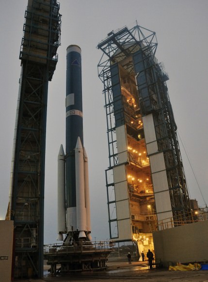
OCO-2's Delta II Rocket, First Stage  At Space Launch Complex 2 on Vandenberg Air Force Base in California, the mobile service tower rolls away from the launch stand supporting the first stage of the Delta II rocket for NASA's Orbiting Carbon Observatory-2 mission. Three solid rocket motors (white) have been attached to the first stage. The photo was taken during operations to mate the rocket's first and second stages. Credit: NASA/Randy Beaudoin
OCO-2’s Delta II Rocket, First Stage At Space Launch Complex 2 on Vandenberg Air Force Base in California, the mobile service tower rolls away from the launch stand supporting the first stage of the Delta II rocket for NASA’s Orbiting Carbon Observatory-2 mission. Three solid rocket motors (white) have been attached to the first stage. The photo was taken during operations to mate the rocket’s first and second stages. Credit: NASA/Randy Beaudoin

The $467.7 million OCO-2 mission is set to blastoff atop the United Launch Alliance (ULA) Delta II rocket on Tuesday, July 1 from Space Launch Complex 2 at Vandenberg Air Force Base in California.

Liftoff is slated for 5:56 a.m. EDT (2:56 a.m. PDT) at the opening of a short 30-second launch window.

NASA TV will broadcast the launch live with countdown commentary beginning at 3:45 a.m. EDT (12:45 a.m. PDT): http://www.nasa.gov/multimedia/nasatv/

The California weather prognosis is currently outstanding at 100 percent ‘GO’ for favorable weather conditions at launch time.

OCO-2 poster. Credit: ULA/NASA

The two stage Delta II 7320-10 launch vehicle is 8 ft in diameter and approximately 128 ft tall. It is equipped with a trio of strap on solid rocket motors. This marks the 152nd Delta II launch overall and the 51st for NASA since 1989.

The last time a Delta II rocket flew was nearly three years ago in October 2011 from Vandenberg for the Suomi National Polar-Orbiting Partnership (NPP) weather satellite.

The final Delta II launch from Cape Canaveral on Sept. 10, 2011 boosted NASA’s twin GRAIL gravity mapping probes to the Moon.

The Delta II will boost OCO-2 into a 438-mile (705-kilometer) altitude, near-polar orbit. Spacecraft separation from the rocket occurs 56 minutes 15 seconds after launch.

It will lead a constellation of five other international Earth monitoring satellites that circle Earth.

NASA's Orbiting Carbon Observatory-2, or OCO-2, inside the payload fairing in the mobile service tower at Space Launch Complex 2 on Vandenberg Air Force Base in California. The fairing will protect OCO-2 during launch aboard a United Launch Alliance Delta II rocket, scheduled for 5:56 a.m. EDT on July 1. OCO-2 is NASA’s first mission dedicated to studying atmospheric carbon dioxide, the leading human-produced greenhouse gas driving changes in Earth’s climate.   Credit: NASA/30th Space Wing USAF
NASA’s Orbiting Carbon Observatory-2, or OCO-2, inside the payload fairing in the mobile service tower at Space Launch Complex 2 on Vandenberg Air Force Base in California. The fairing will protect OCO-2 during launch aboard a United Launch Alliance Delta II rocket, scheduled for 5:56 a.m. EDT on July 1. OCO-2 is NASA’s first mission dedicated to studying atmospheric carbon dioxide, the leading human-produced greenhouse gas driving changes in Earth’s climate. Credit: NASA/30th Space Wing USAF

The phone-booth sized OCO-2 was built by Orbital Sciences and is a replacement for the original OCO which was destroyed during the failed launch of a Taurus XL rocket from Vandenberg back in February 2009 when the payload fairing failed to open properly.

OCO-2 is the second of NASA’s five new Earth science missions launching in 2014 and is designed to operate for at least two years during its primary mission. It follows the successful blastoff of the joint NASA/JAXA Global Precipitation Measurement (GPM) Core Observatory satellite on Feb 27.

Orbiting Carbon Observatory-2 (OCO-2) mission will provide a global picture of the human and natural sources of carbon dioxide, as well as their “sinks,” the natural ocean and land processes by which carbon dioxide is pulled out of Earth’s atmosphere and stored, according to NASA..

“Carbon dioxide in the atmosphere plays a critical role in our planet’s energy balance and is a key factor in understanding how our climate is changing,” said Michael Freilich, director of NASA’s Earth Science Division in Washington.

“With the OCO-2 mission, NASA will be contributing an important new source of global observations to the scientific challenge of better understanding our Earth and its future.”

Artist's rendering of NASA's Orbiting Carbon Observatory (OCO)-2, one of five new NASA Earth science missions set to launch in 2014, and one of three managed by JPL. Credit:  NASA-JPL/Caltech
Artist’s rendering of NASA’s Orbiting Carbon Observatory (OCO)-2, one of five new NASA Earth science missions set to launch in 2014, and one of three managed by JPL. Credit: NASA-JPL/Caltech

It will record around 100,000 CO2 measurements around the world every day and help determine its source and fate in an effort to understand how human activities impact climate change and how we can mitigate its effects.

At the dawn of the Industrial Revolution, there were about 280 parts per million (ppm) of carbon dioxide in Earth’s atmosphere. As of today the CO2 level has risen to about 400 parts per million.

Stay tuned here for Ken’s continuing OCO-2, GPM, Curiosity, Opportunity, Orion, SpaceX, Boeing, Orbital Sciences, MAVEN, MOM, Mars and more Earth & Planetary science and human spaceflight news.
Ken Kremer

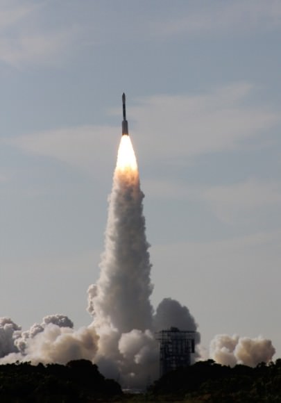
Blastoff of twin GRAIL A and B lunar gravity mapping spacecraft on a Delta II Heavy rocket on Sept. 10 from Pad 17B Cape Canaveral Air Force Station in Florida at 9:08 a.m. EDT. Credit: Ken Kremer/kenkremer.com
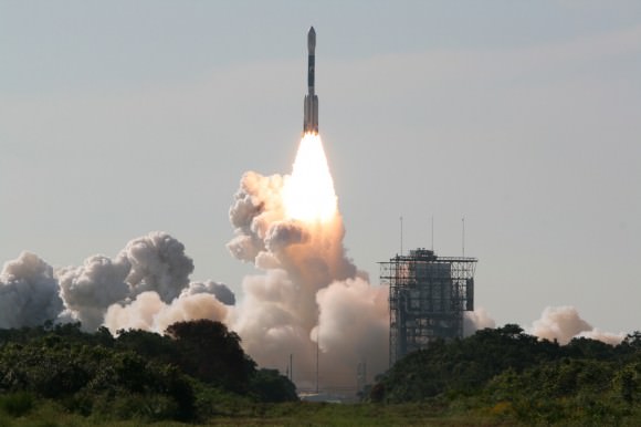
Blastoff of twin GRAIL A and B lunar gravity mapping spacecraft on a Delta II Heavy rocket on Sept. 10, 2011, from Pad 17B Cape Canaveral Air Force Station in Florida at 9:08 a.m. EDT. Credit: Ken Kremer/kenkremer.com

1st Student Selected MoonKAM Pictures Look Inspiringly Home to Earth

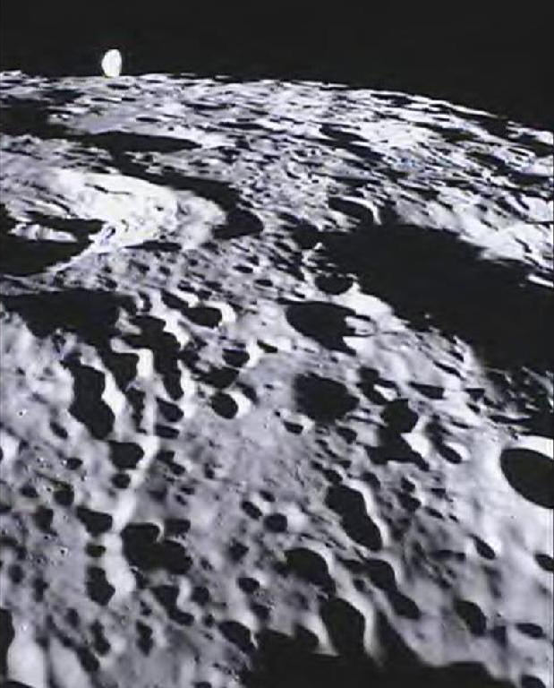
Student-run MoonKAM Imager Looks Homeward. This image of the far side of the lunar surface, with Earth in the background, was taken by the MoonKAM system board the Ebb spacecraft as part of the first image set taken from lunar orbit from March 15 – 18, 2012. A little more than half-way up and on the left side of the image is the crater De Forest. Due to its proximity to the southern pole, DeForest receives sunlight at an oblique angle when it is on the illuminated half of the Moon. NASA/Caltech-JPL/MIT/SRS

[/caption]

The first student selected photos of the Moon’s surface snapped by NASA’s new pair of student named Lunar Mapping orbiters – Ebb & Flow – have just been beamed back and show an eerie view looking back to the Home Planet – and all of Humanity – barely rising above the pockmarked terrain of the mysterious far side of our nearest neighbor in space.

Congratulations to Americas’ Youth on an outstanding and inspiring choice !!

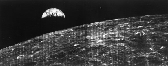
The student photo is reminiscent of one of the iconic images of Space Exploration – the first full view of the Earth from the Moon taken by NASA’s Lunar Orbiter 1 back in August 1966 (see below).

The images were taken in the past few days by the MoonKAM camera system aboard NASA’s twin GRAIL spacecraft currently circling overhead in polar lunar orbit, and previously known as GRAIL A and B. The formation-flying probes are soaring over the Moon’s north and south poles.
The nearly identical ships were rechristened as Ebb and Flow after Fourth grade students from the Emily Dickinson Elementary School in Bozeman, Mont., won the honor to rename both spacecraft by submitting the winning entries in a nationwide essay competition sponsored by NASA.

“The Bozeman 4th graders had the opportunity to target the first images soon after our science operations began,” said Maria Zuber, GRAIL principal investigator of the Massachusetts Institute of Technology in Cambridge, Mass., to Universe Today.

“It is impossible to overstate how thrilled and excited we are !”

The initial packet of some 66 student-requested digital images from the Bozeman kids were taken by the Ebb spacecraft from March 15-17 and downlinked to Earth March 20. They sure have lots of exciting classwork ahead analyzing all those lunar features !

“GRAIL’s science mapping phase officially began on March 6 and we are collecting science data,” Zuber stated.

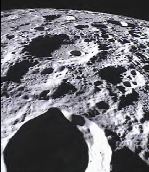
Far Side of Moon Imaged by MoonKAM
This image of the lunar surface was taken by the MoonKAM system onboard NASA’s Ebb spacecraft on March 15, 2012. The 42.3-mile-wide (68-kilometer-wide) crater in the middle of the image (with the smaller crater inside) is Poinsot. Crater Poinsot, named for the French mathematician Louis Poinsot, is located on the northern part of the moon's far side. The target was selected by 4th grade students at Emily Dickinson Elementary School in Montana who had the honor of choosing the first MoonKAM images after winning a nationwide contest. NASA/Caltech-JPL/MIT/SRS

GRAIL’s science goal is to map our Moon’s gravity field to the highest precision ever. This will help deduce the deep interior composition, formation and evolution of the Moon and other rocky bodies such as Earth and also determine the nature of the Moon’s hidden core.

Engaging students and the public in science and space exploration plays a premier role in the GRAIL project. GRAIL is NASA’s first planetary mission to carry instruments – in the form of cameras – fully dedicated to education and public outreach.

Over 2,700 schools in 52 countries have signed up to participate in MoonKAM.

Ebb and Flow - New Names for the GRAIL Twins in Lunar Orbit
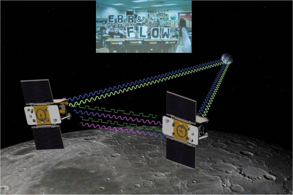
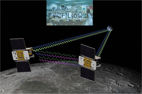
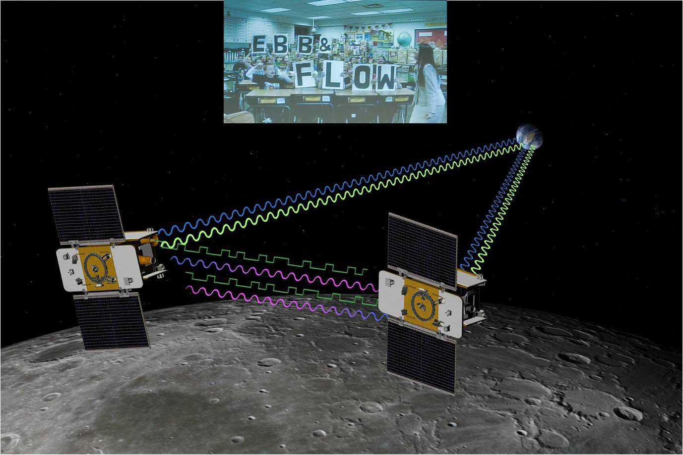
4th Grade Students from Bozeman, Montana (inset) won NASA’s contest to rename the GRAIL A and GRAIL B spacecraft and also chose the first lunar targets to be photographed by the onboard MoonKAM camera system. Artist concept of twin GRAIL spacecraft flying in tandem orbits around the Moon to measure its gravity field Credit: NASA/JPL -M ontage: Ken Kremer

5th to 8th grade students can send suggestions for lunar surface targets to the GRAIL MoonKAM Mission Operations Center at UC San Diego, Calif. Students will use the images to study lunar features such as craters, highlands, and maria while also learning about future landing sites.

NASA calls MoonKAM – “The Universe’s First Student-Run Planetary Camera”. MoonKAM means Moon Knowledge Acquired by Middle school students.

The MoonKAM project is managed by Dr Sally Ride, America’s first female astronaut.

“What might seem like just a cool activity for these kids may very well have a profound impact on their futures,” Ride said in a NASA statement. “The students really are excited about MoonKAM, and that translates into an excitement about science and engineering.”

“MoonKAM is based on the premise that if your average picture is worth a thousand words, then a picture from lunar orbit may be worth a classroom full of engineering and science degrees,” says Zuber. “Through MoonKAM, we have an opportunity to reach out to the next generation of scientists and engineers. It is great to see things off to such a positive start.”

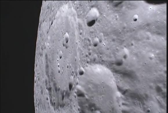
MoonKAM image from NASA’s Ebb Lunar Mapping orbiter. This lunar target was selected by the 4th graders at Emily Dickinson Elementary School in Montana who won the contest to rename the GRAIL probes in a nationwide essay contest. NASA/Caltech-JPL/MIT/SRS

Altogether there are eight MoonKAM cameras aboard Ebb and Flow – one 50 mm lens and three 6 mm lenses. Each probe is the size of a washing machine and measures just over 3 feet in diameter and height.

Snapping the first images was delayed a few days by the recent series of powerful solar storms.

“Due to the extraordinary intensity of the storms we took the precaution of turning off the MoonKAMs until the solar flux dissipates a bit,” Zuber told me.

“GRAIL weathered the storm well. The spacecraft and instrument are healthy and we are continuing to collect science data.”

The washing-machine sized probes have been flying in tandem around the Moon since entering lunar orbit in back to back maneuvers over the New Year’s weekend. Engineers spent the past two months navigating the spaceship duo into lower, near-polar and near-circular orbits with an average altitude of 34 miles (55 kilometers) that are optimized for science data collection and simultaneously checking out the spacecraft systems.

Ebb and Flow were launched to the Moon on September 10, 2011 aboard a Delta II rocket from Cape Canaveral, Florida and took a circuitous 3.5 month low energy path to the moon to minimize the overall costs.

The Apollo astronauts reached the Moon in just 3 days. NASA’s next generation Orion space capsule currently under development will send American astronauts back to lunar orbit by 2021 or sooner.

NASA has just granted an extension to the GRAIL mission. Watch for my follow-up report detailing the expanded science goals of GRAIL’s extended lunar journey.

One of the first two remote images of Earth taken from the distance of the Moon on August 23, 1966 by NASA’s Lunar Orbiter 1 spacecraft. Credit: NASA

…….

March 24 (Sat): Free Lecture by Ken Kremer at the New Jersey Astronomical Association, Voorhees State Park, NJ at 830 PM. Topic: Atlantis, the End of Americas Shuttle Program, Orion, SpaceX, CST-100, Moon and the Future of NASA Human & Robotic Spaceflight

Twin NASA Science Probes Start Lunar Gravity Mapping

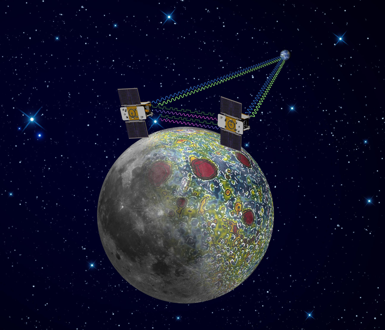
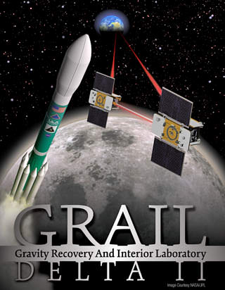
Twin GRAIL Lunar Probes Ebb and Flow Start Lunar Gravity Science. GRAIL probes use precision formation-flying technique to map Lunar Gravity, as depicted in this artist's rendering. Radio signals traveling between the two spacecraft provide scientists with exact measurements which will result in the most accurate gravity map of the moon ever made. Credit: NASA/JPL-Caltech

[/caption]

NASA’s twin lunar orbiting GRAIL (Gravity Recovery and Interior Laboratory) spacecraft christened Ebb and Flow have kicked off their science collection phase aimed at precisely mapping our Moon’s gravity field, interior composition and evolution, the science team informed Universe Today.

“GRAIL’s science mapping phase officially began Tuesday (March 6) and we are collecting science data,” said Maria Zuber, GRAIL principal investigator of the Massachusetts Institute of Technology in Cambridge, to Universe Today.

“It is impossible to overstate how thrilled and excited we are !”

“The data appear to be of excellent quality,” Zuber told me.

GRAIL’s goal is to provide researchers with a better understanding of how the Moon, Earth and other rocky planets in the solar system formed and evolved over its 4.5 billion years of history.

NASA’s Dawn spacecraft is currently mapping the gravity field of Asteroid Vesta in high resolution from low orbit.

Despite more than 100 missions to the Moon there is still a lot we don’t know about the Moon says Zuber, like why the near side is flooded with magma and smooth and the back side is rough, not smooth and completely different.

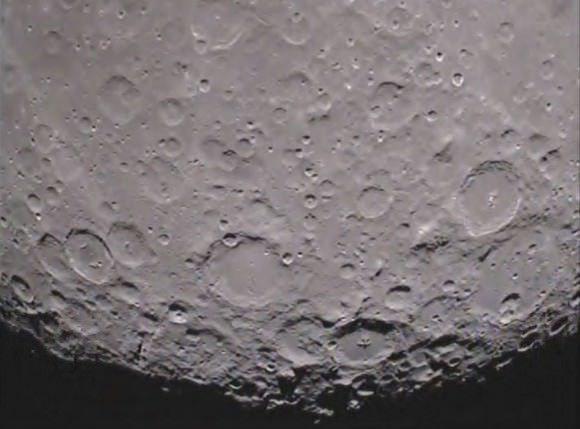
South pole of the far side of the moon as seen as seen in this 1st image from the MoonKAM camera aboard GRAIL mission’s Ebb spacecraft. Credit: NASA/JPL-Caltech

The formation-flying spacecraft will make detailed science measurements from lunar orbit with unparalleled precision to within 1 micron – the width of a human red blood cell – by transmitting Ka-band radio signals between each other and Earth to help unlock the mysteries of the Moon’s deep interior.

“We’ve worked on calibrating the alignment of the Ka-band antennae to establish the optimal alignment. We’ve verified the data pipeline and are spending a lot of time working with the raw data to make sure that we understand its intricacies,” Zuber explained.

The washing-machine sized probes have been flying in tandem around the Moon since entering lunar orbit in back to back maneuvers over the New Year’s weekend. Engineers have spent the past two months navigating the spaceship duo into lower, near-polar and near-circular orbits with an average altitude of 34 miles (55 kilometers), that are optimized for science data collection, and simultaneously checking out the spacecraft systems.

GRAIL A and B gravity mappers rocket to the moon atop a Delta II Heavy booster on Sept. 10 from Cape Canaveral, Florida. View to Space Launch Complex 17 gantry from Press Site 1. Credit: Ken Kremer

Ebb and Flow were launched to the Moon on September 10, 2011 aboard a Delta II rocket from Cape Canaveral, Florida and took a circuitous 3.5 month low energy path to the moon to minimize the overall costs. The Apollo astronauts reached the Moon in just 3 days.

I asked Zuber to describe the team’s activities putting the mirror image probes to work peering to the central core of our nearest neighbor in unprecedented detail.

“Last Wednesday (Feb. 29) we achieved the science orbit and on Thursday (March 1) we turned the spacecraft to ‘orbiter point’ configuration to test the instrument and to monitor temperatures and power.”

“When we turned on the instrument we established the satellite-to-satellite radio link immediately. All vital signs were nominal so we left the spacecraft in orbiter point configuration and have been collecting science data since then. At the same time, we’ve continued performing calibrations and monitoring spacecraft and instrument performance, such as temperatures, power, currents, voltages, etc., and all is well,” said Zuber.

Measurements gathered over the next 84 days will be used to create high-resolution maps of the Moon’s near side and far side gravitational fields that are 100 to 1000 times more precise than ever before and that will enable researchers to deduce the internal structure and composition of our nearest neighbor from the outer surface crust down to the deep hidden core.

As one satellite follows the other, in the same orbit, they will perform high precision range-rate measurements to precisely measure the changing distance between each other. As they fly over areas of greater and lesser gravity caused by visible features such as mountains, craters and masses hidden beneath the lunar surface, the distance between the two spacecraft will change slightly.

“GRAIL is great. Everything is in place to get science data now,” said Sami Asmar, a GRAIL co-investigator from NASA’s Jet Propulsion Lab in Pasadena, Calif. “Soon we’ll get a very high resolution and global gravity map of the Moon.”

The data collected will be translated into gravitational field maps of the Moon that will help unravel information about the makeup of the Moon’s core and interior composition.

GRAIL will gather three complete gravity maps over the three month mission which is expected to conclude around May 29. If the probes survive a solar eclipse in June and if NASA funding is available, then they may get a bonus 3 month extended mission.

Ebb and Flow - New Names for the GRAIL Twins in Lunar Orbit
4th Grade Students from Montana (inset) win NASA’s contest to rename the GRAIL A and GRAIL B spacecraft. Artist concept of twin GRAIL spacecraft flying in tandem orbits around the Moon to measure its gravity field Credit: NASA/JPL Montage: Ken Kremer

NASA sponsored a nation-wide student contest for America’s Youth to choose new names for the twin probes originally known as GRAIL A and GRAIL B. 4th graders from the Emily Dickinson Elementary School in Bozeman, Montana submitted the winning entries -Ebb and Flow. The new names won because they astutely describe the probes movements in orbit to collect the science data.

The GRAIL twins are also equipped with a very special camera dubbed MoonKAM (Moon Knowledge Acquired by Middle school students) whose purpose is to inspire kids to study science.

By having their names selected, the 4th graders from Emily Dickinson Elementary have also won the prize to choose the first target on the Moon to photograph with the MoonKAM cameras, which are managed by Dr Sally Ride, America’s first female astronaut.

“MoonKAMs on both Ebb and Flow were turned on Monday, March 5, and all appears well, Zuber said. “The Bozeman 4th graders will have the opportunity to target the first images a week after our science operations begin.”

America’s Youth Christen NASA’s Twin New Lunar Craft – Ebb & Flow

Ebb and Flow - New Names for the GRAIL Twins in Lunar Orbit. 4th Grade Students from Montana win NASA’s contest to rename the GRAIL A and GRAIL B spacecraft. Artist concept of twin GRAIL spacecraft flying in tandem orbits around the Moon to measure its gravity field in unprecedented detail and unravel the hidden mysteries of the lunar interior’s composition. Credit: NASA/JPL Montage:Ken Kremer

[/caption]

A classroom of America’s Youth from an elementary school in Bozeman, Montana submitted the stellar winning entry in NASA’s nationwide student essay contest to rename the twin GRAIL lunar probes that just achieved orbit around our Moon on New Year’s Eve and New Year’s Day 2012

“Ebb” & “Flow” – are the dynamic duo’s official new names and were selected because they clearly illuminate the science goals of the gravity mapping spacecraft and how the Moon’s influence mightily affects Earth every day in a manner that’s easy for everyone to understand.

“The 28 students of Nina DiMauro’s class at the Emily Dickinson Elementary School have really hit the nail on the head,” said GRAIL principal investigator Prof. Maria Zuber of the Massachusetts Institute of Technology in Cambridge, Mass.

“We asked the youth of America to assist us in getting better names.”

“We chose Ebb and Flow because it’s the daily example of how the Moon’s gravity is working on the Earth,” said Zuber during a media briefing held today (Jan. 17) at NASA Headquarters in Washington, D.C. The terms ebb and flow refer to the movement of the tides on Earth due to the gravitational pull from the Moon.

“We were really impressed that the students drew their inspiration by researching GRAIL and its goal of measuring gravity. Ebb and Flow truly capture the spirit and excitement of our mission.”

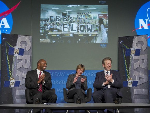
Leland Melvin, NASA Associate Administrator for Education, left, Maria Zuber, GRAIL Prinicipal Investigator at the Massachusetts Institute of Technology, and James Green, Director of the Planetary Science Division in the Science Mission Directorate at NASA Headquarters, right, applaud students from Emily Dickinson Elementary School in Bozeman, Mont. during a news conference, Tuesday, Jan. 17, 2012, at NASA Headquarters in Washington. Nine hundred classrooms and more than 11,000 students from 45 states, as well as Puerto Rico and the District of Columbia, participated in a contest that began in October 2011 to name the twin lunar probes. Credit: NASA/Paul E. Alers

Ebb and Flow are flying in tandem around Earth’s only natural satellite, the first time such a feat has ever been attempted.

As they fly over mountains, craters and basins on the Moon, the spaceships will move back and forth in orbit in an “ebb and flow” like response to the changing lunar gravity field and transmit radio signals to precisely measure the variations to within 1 micron, the width of a red blood cell.

The breakthrough science expected from the mirror image twins will provide unprecedented insight into what lurks mysteriously hidden beneath the surface of our nearest neighbor and deep into the interior.

The winning names from the 4th Graders of Emily Dickinson Elementary School were chosen from essays submitted by nearly 900 classrooms across America with over 11,000 students from 45 states, Puerto Rico and the District of Columbia, Zuber explained.

The students themselves announced “Ebb” and “Flow” in a dramaric live broadcast televised on NASA TV via Skype.

“We are so thrilled that our names were chosen and excited to share this with you. We can’t believe we won! We are so honored. Thank you!” said Ms. DiMauro as the very enthusiastic students spelled out the names by holding up the individual letters one-by-one on big placards from their classroom desks in Montana.

Watch the 4th Grade Kids spell the names in this video!

Until now the pair of probes went by the rather uninspiring monikers of GRAIL “A” and “B”. GRAIL stands for Gravity Recovery And Interior Laboratory.

The twin crafts’ new names were selected jointly by Prof. Zuber and Dr. Sally Ride, America’s first woman astronaut, and announced during today’s NASA briefing.


NASA’s naming competition was open to K-12 students who submitted pairs of names and a short essay to justified their suggestions.

“Ebb” and “Flow” (GRAIL A and GRAIL B) are the size of washing machines and were launched side by side atop a Delta II booster rocket on September 10, 2011 from Cape Canaveral, Florida.

They followed a circuitous 3.5 month low energy path to the Moon to minimize the fuel requirements and overall costs.

So far the probes have completed three burns of their main engines aimed at lowering and circularizing their initial highly elliptical orbits. The orbital period has also been reduced from 11.5 hours to just under 4 hours as of today.

“The science phase begins in early March,” said Zuber. At that time the twins will be flying in tandem at 55 kilometers (34 miles) altitude.

The GRAIL twins are also equipped with a very special camera dubbed MoonKAM (Moon Knowledge Acquired by Middle school students) whose purpose is to inspire kids to study science.

“GRAIL is NASA’s first planetary spacecraft mission carrying instruments entirely dedicated to education and public outreach,” explained Sally Ride. “Over 2100 classrooms have signed up so far to participate.”

Thousands of middle school students in grades five through eight will select target areas on the lunar surface and send requests for study to the GRAIL MoonKAM Mission Operations Center in San Diego which is managed by Dr. Ride in collaboration with undergraduate students at the University of California in San Diego.

By having their names selected, the 4th graders from Emily Dickinson Elementary have also won the prize to choose the first target on the Moon to photograph with the MoonKam cameras, said Ride.

Zuber notes that the first MoonKAM images will be snapped shortly after the 82 day science phase begins on March 8.

Ebb & Flow Achieve Lunar Orbit on New Year’s Weekend 2012
NASA’s twin GRAIL-A & GRAIL-B spacecraft are orbiting the Moon in this astrophoto taken on Jan. 2, 2012 shortly after successful Lunar Orbit Insertions on New Year’s Eve and New Year’s Day 2012.
Credit: Ken Kremer

Read continuing features about GRAIL and the Moon by Ken Kremer here:
Dazzling Photos of the International Space Station Crossing the Moon!
Two new Moons join the Moon – GRAIL Twins Achieve New Year’s Orbits
First GRAIL Twin Enters Lunar Orbit – NASA’s New Year’s Gift to Science
2011: Top Stories from the Best Year Ever for NASA Planetary Science!
NASA’s Unprecedented Science Twins are GO to Orbit our Moon on New Year’s Eve
Student Alert: GRAIL Naming Contest – Essay Deadline November 11
GRAIL Lunar Blastoff Gallery
GRAIL Twins Awesome Launch Videos – A Journey to the Center of the Moon
NASA launches Twin Lunar Probes to Unravel Moons Core
GRAIL Unveiled for Lunar Science Trek — Launch Reset to Sept. 10
Last Delta II Rocket to Launch Extraordinary Journey to the Center of the Moon on Sept. 8
NASAs Lunar Mapping Duo Encapsulated and Ready for Sept. 8 Liftoff
GRAIL Lunar Twins Mated to Delta Rocket at Launch Pad
GRAIL Twins ready for NASA Science Expedition to the Moon: Photo Gallery

Student Alert: GRAIL Naming Contest – Essay Deadline November 11

NASA announces student Essay Naming Contest for the twin GRAIL Lunar spaceships. The essay writing contest is open to students in Grades K - 12 at schools in the United States. Submission Deadline is November 11, 2011. GRAIL A & B are twin science robots that will explore the gravity field of the moon like never before.

[/caption]

Student Alert ! – Here’s your once in a lifetime chance to name Two NASA robots speeding at this moment to the Moon on a super science mission to map the lunar gravity field. They were successfully launched from the Earth to the Moon on September 10, 2011. Right now the robots are called GRAIL A and GRAIL B. But, they need real names that inspire. And they need those names real soon. The goal is to “capture the spirit and excitement of lunar exploration”, says NASA – the US Space Agency.

NASA needs your help and has just announced an essay writing contest open to students in Grades K – 12 at schools in the United States. The deadline to submit your essay is November 11, 2011. GRAIL stands for “Gravity Recovery And Interior Laboratory.”

The rules state you need to pick two names and explain your choices in 500 words or less in English. Your essay can be any length up to 500 words – even as short as a paragraph. But, DO NOT write more than 500 words or your entry will be automatically disqualified.

Learn more about the GRAIL Essay Naming Contest here:

Read all the Official Contest Rules here:

Download the Naming Contest Submission Form here:

Students: NASA Wants You to Name that GRAIL !
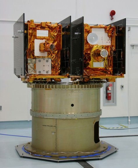
Write an Essay and name these twin Lunar mapping satellites. NASA’s twin GRAIL A & B science probes are now streaking to the Moon and arrive on New Year’s Day 2012. This picture shows how they looked, mounted side by side, during launch preparations prior to blasting off for the Moon on Sept. 10, 2011 from Florida. Credit: Ken Kremer

The GRAIL A and B lunar spaceships are twins – just like those other awe inspiring robots “Spirit” and “Opportunity” , which were named by a 10 year old girl student and quickly became famous worldwide and forever because of their exciting science missions of Exploration and Discovery.They arrive in Lunar Orbit on New Year’s Day 2012.

Blastoff of twin GRAIL A and B lunar gravity mapping spacecraft on a Delta II Heavy rocket on Sept. 10 from Pad 17B Cape Canaveral Air Force Station in Florida at 9:08 a.m. EDT. Credit: Ken Kremer

And there is another way that students can get involved in NASA’s GRAIL mission.

GRAIL A & B are both equipped with four student-run MoonKAM cameras. Students can suggest targets for the cameras. Then the cameras will take close-up views of the lunar surface, taking tens of thousands of images and sending them back to Earth.

“Over 1100 middle schools have signed up to participate in the MoonKAM education and public outreach program to take images and engage in exploration,” said Prof. Maria Zuber of MIT.

Prof. Zuber is the top scientist on the mission and she was very excited to announce the GRAIL Essay Naming contest right after the twin spaceships blasted off to the Moon on Sep 10, 2011 from Cape Canaveral in Florida.

What is the purpose of GRAIL ?

“GRAIL simply put, is a ‘Journey to the Center of the Moon’,” says Dr. Ed Weiler, NASA Associate Administrator of the Science Mission Directorate in Washington, DC.

“It will probe the interior of the moon and map its gravity field by 100 to 1000 times better than ever before. We will learn more about the interior of the moon with GRAIL than all previous lunar missions combined. Precisely knowing what the gravity fields are will be critical in helping to land future human and robotic spacecraft. The moon is not very uniform. So it’s a dicey thing to fly orbits around the moon.”

“There have been many missions that have gone to the moon, orbited the moon, landed on the moon, brought back samples of the moon,” said Zuber. “But the missing piece of the puzzle in trying to understand the moon is what the deep interior is like.”

So, what are you waiting for.

Start thinking and writing. Students – You can be space explorers too !

Read Ken’s continuing features about GRAIL
GRAIL Lunar Blastoff Gallery
GRAIL Twins Awesome Launch Videos – A Journey to the Center of the Moon
NASA launches Twin Lunar Probes to Unravel Moons Core
GRAIL Unveiled for Lunar Science Trek — Launch Reset to Sept. 10
Last Delta II Rocket to Launch Extraordinary Journey to the Center of the Moon on Sept. 8
NASAs Lunar Mapping Duo Encapsulated and Ready for Sept. 8 Liftoff
GRAIL Lunar Twins Mated to Delta Rocket at Launch Pad
GRAIL Twins ready for NASA Science Expedition to the Moon: Photo Gallery

GRAIL Twins Awesome Launch Videos – A Journey to the Center of the Moon

GRAIL A and B Lunar gravity mappers rocket to the moon atop a Delta II Heavy booster on Sept. 10 from Cape Canaveral, Florida. View from Press Site 1. Credit: Alan Walters (awaltersphoto.com)

Video caption: NASA’s twin GRAIL spacecraft blast off atop a Delta II Heavy booster at 9:08 a.m. EDT on Saturday, September 10, 2011 from Cape Canaveral, Florida, on a mission to explore the moon in unprecedented detail.

Be sure to check out these awesome launch videos showing the Delta II Heavy rocket blasting off with NASA’s GRAIL Lunar Gravity Mapper twins on a “Journey to the Center of the Moon” – as shot by NASA and others – on Sept. 10. from Pad 17 B at Cape Canaveral Air Force Station in Florida at 9:08 a.m. EDT.

Thus began a circuitous 3.5 month voyage from the Earth to the Moon culminating in lunar orbit arrival on New Year’s Eve and Day 2012.

[/caption]
Liftoff of the $496 Million Gravity Recovery and Interior Laboratory (GRAIL) duo marked the last currently scheduled launch of a United Launch Alliance Delta II from Florida and also the last launch from Space Launch Complex 17. This was the 356th Delta launch overall since the first one in 1960. It was the 110th and final planned flight of a Delta II from Florida.

Watch the NASA GRAIL Launch Video as the 12 story Delta’s 1st stage liquid and solid engines ignite and the rocket’s explosive exhaust and fiery flames instantaneously and dramatically shoot out from below and are vented safely to the side through specially constructed flame ducts to protect the rocket.

Just after the 1 minute mark, the 6 ground lit solid rocket motors are jettisoned and dramatically tumble away from the first stage. Moment later comes the ignition of the three air-lit solid rocket motors.

This dramatic video was shot by Matt Travis of spacearium -from my viewing location with a hoard of photojournalists at Press Site 1 located inside Cape Canaveral Air Force Station.

Press Site 1 is just 1.5 miles away from Pad 17B. It offers the closest and best view of the mighty Delta II rocket which stands 128 feet tall and generates some 1.3 million pounds of liftoff thrust.

Watch this video for post-launch commentary from NASA’s Delta II Launch manager Tim Dunn from the Mission Director’s Center.

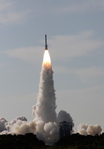
Dawn launch on September 27, 2007 by a Delta II Heavy rocket from Cape Canaveral Air Force Station, Florida. Credit: Ken Kremer

The GRAIL Launch video below was taken from Jetty Park Pier, about 2.9 miles south of Pad 17B and shows a completely different perspective from across the waterway of Port Canaveral.

I watched the unforgettable launch of Dawn five years ago from Jetty Park Pier.

Jetty Park and the beaches along Cape Banaveral and Cocoa Beach have been the best place for the public to view Delta rocket launches.


Thousands of spectators lining the Florida Space Coast were absolutely thrilled to witness the historic launch of GRAIL on the final Delta II booster from Florida on a gorgeous morning.

GRAIL’s primary science objectives during the 82 day mission are to determine the structure of the lunar interior, from crust to core, and to advance understanding of the thermal evolution of the moon and apply that to the other rocky bodies in our solar system.

Check this short NewBlast Video summary of GRAIL’s launch and objectives from Spaceflight Now

Many of NASA’s recent science missions have launched aboard Delta II rockets, including the outstandingly successful Spirit and Opportunity Mars rovers, Dawn Asteroid Orbiter, MESSENGER Mercury orbiter and Stardust and Deep Impact comet spacecraft.

Congratulations to everyone on the GRAIL team for a superb performance !

GRAIL A and B Lunar gravity mappers rocket to the moon atop a Delta II Heavy booster on Sept. 10 from Cape Canaveral, Florida. View to Space Launch Complex 17 gantry from Press Site 1
Credit: Ken Kremer (kenkremer.com)

Read Ken’s continuing features about GRAIL
NASA launches Twin Lunar Probes to Unravel Moons Core
GRAIL Unveiled for Lunar Science Trek — Launch Reset to Sept. 10
Last Delta II Rocket to Launch Extraordinary Journey to the Center of the Moon on Sept. 8
NASAs Lunar Mapping Duo Encapsulated and Ready for Sept. 8 Liftoff
GRAIL Lunar Twins Mated to Delta Rocket at Launch Pad
GRAIL Twins ready for NASA Science Expedition to the Moon: Photo Gallery