Landsat 9’s First Images are Here
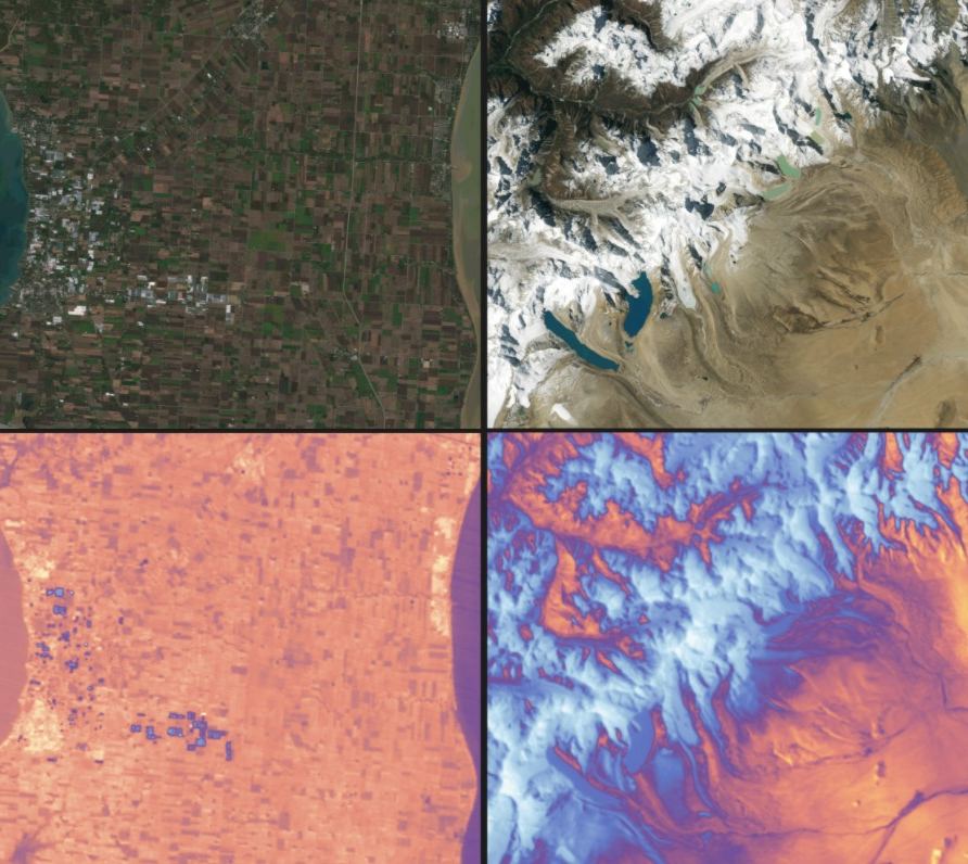
Landsat 9 carries two instruments designed to work together to capture a broad range of wavelengths: the Operational Land Imager 2 and the Thermal Infrared Sensor 2. Data from both instruments are shown in this image. Credits: NASA

The latest satellite in the Landsat family of Earth observation spacecraft has collected its “first light” images of our planet. Landsat 9 launched on September 27, 2021 and it continues the nearly 50-year tradition of making critical observations to help with energy and water management, forest monitoring, human and environmental health, urban planning, disaster recovery and agriculture.

Continue reading “Landsat 9’s First Images are Here”

Landsat 9 Joins a Fleet of Earth Observation Satellites

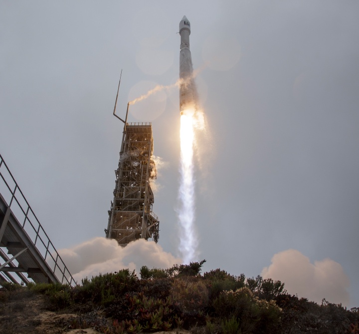
Landsat 9 lifted off from Vandenberg Space Force Base on September 27, 2021 on an an Atlas V 401 rocket. Credit: NASA

Earth has a new eye in orbit to monitor our changing planet.  

Landsat 9 launched on September 27, 2021 continuing the Landsat family of satellite’s nearly 50-year tradition of making critical observations to help with energy and water management, forest monitoring, human and environmental health, urban planning, disaster recovery and agriculture.

Continue reading “Landsat 9 Joins a Fleet of Earth Observation Satellites”

Satellite Images Can Help Predict When Underwater Volcanos are About to Erupt

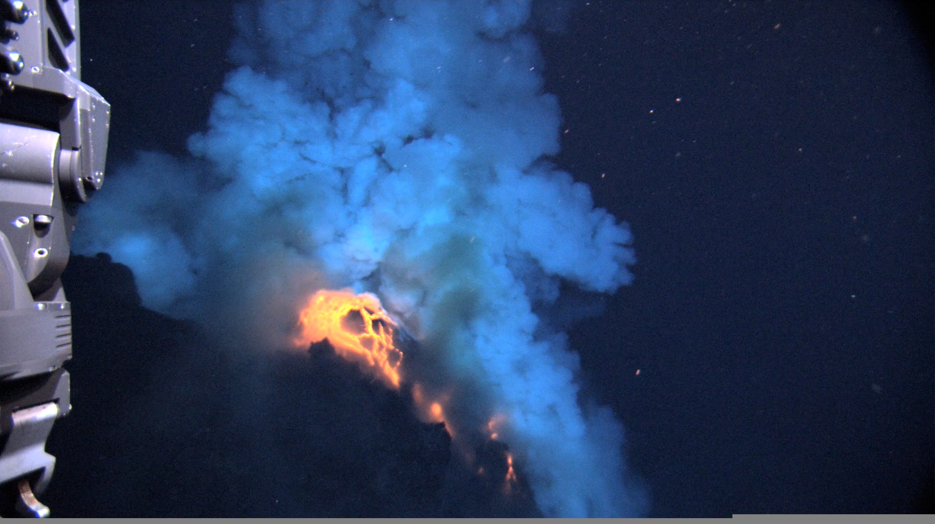
Predicting volcanic eruptions is notoriously tricky. In large part this is because volcanos are unique, each with their own quirks and personalities: the lessons learned from studying one volcano may not apply directly to another. Luckily, researchers are getting better at finding warning signs that they can apply broadly. Some of the most well-known are heightened seismic activity, rising temperatures, expanding magma pools, and the release of gases. New research using satellite imagery now offers a new warning sign for underwater volcanos: a change in the color of the ocean.

Continue reading “Satellite Images Can Help Predict When Underwater Volcanos are About to Erupt”

Teeny Tiny CubeSats Could Have Deployable Mirrors Like James Webb

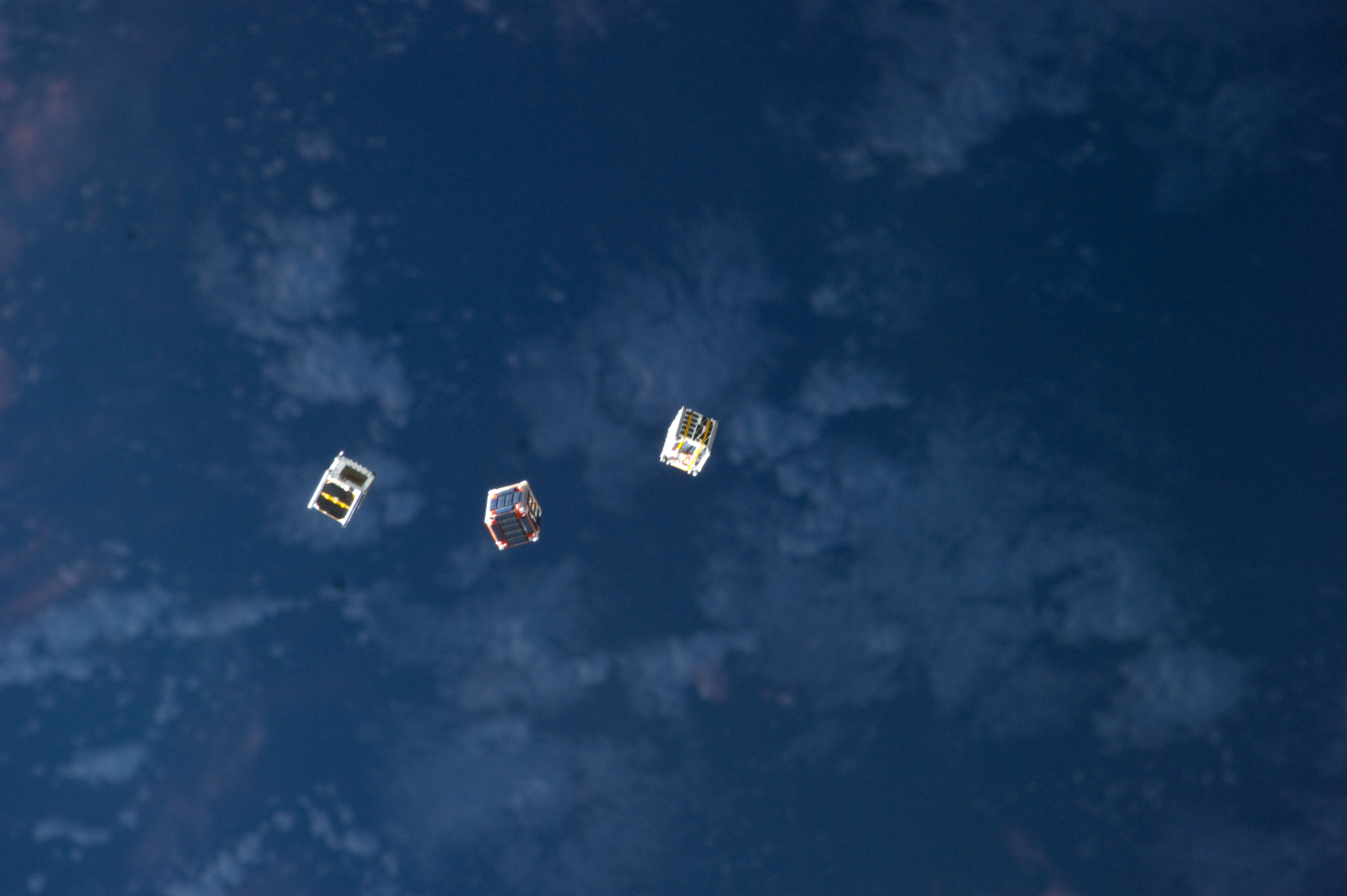
Cubesats being launched from the ISS. Credit: NASA

When you think of a space telescope, you probably think of ones such as the Hubble, which probes deep space using precision optics. But optical space telescopes are also pointed at Earth, giving us detailed views of everything from weather, to traffic patterns, to the movement of military troops. While Earth-focused telescopes are extremely useful, they can also be fairly large and expensive to launch into space. But that could change with a new proposed design for cube satellites.

Continue reading “Teeny Tiny CubeSats Could Have Deployable Mirrors Like James Webb”

This is Currently the World’s Largest Iceberg

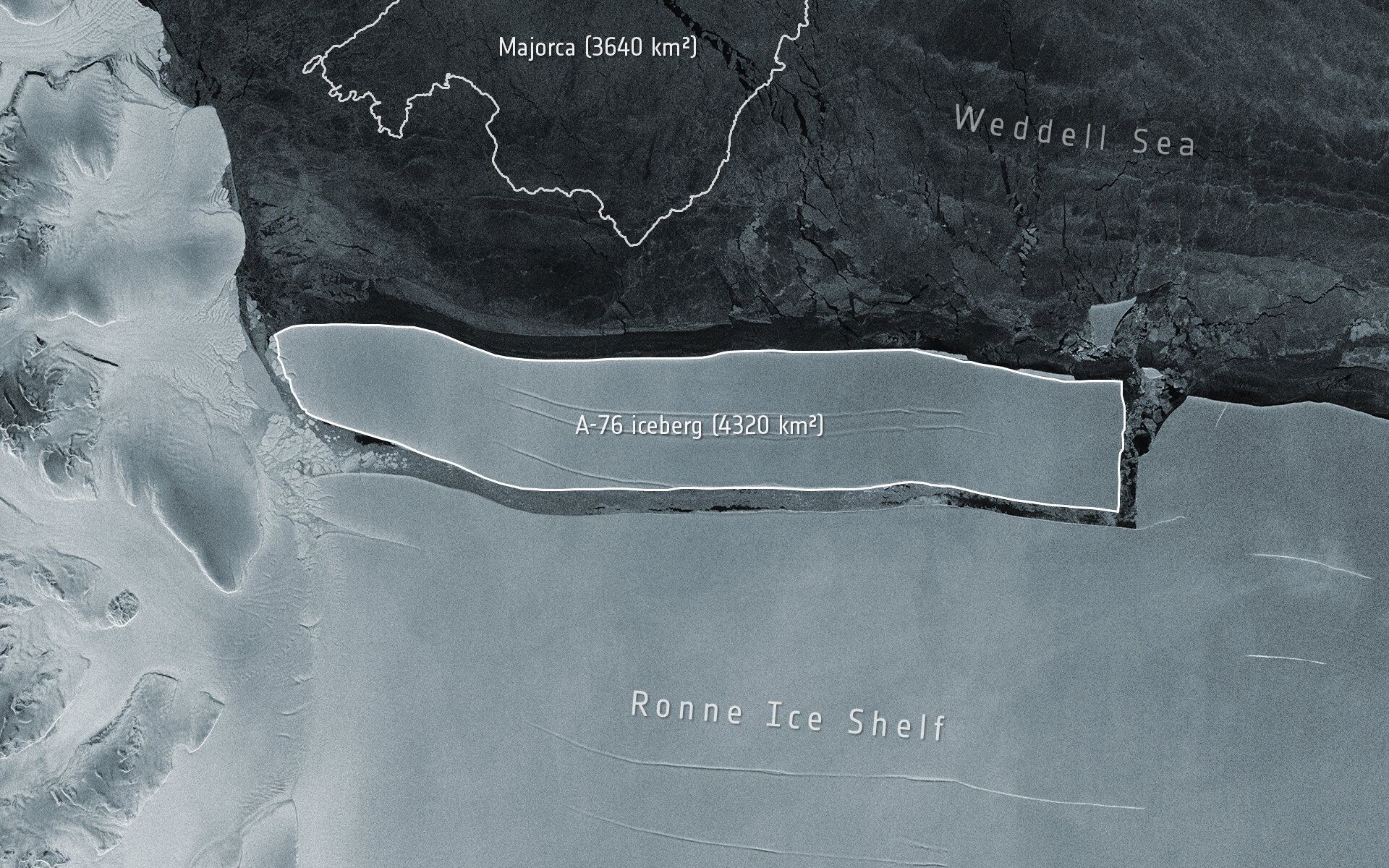
An enormous iceberg has calved from the western side of the Ronne Ice Shelf, lying in the Weddell Sea, in Antarctica. Image by the Copernicus Sentinel-1 mission. Credit: ESA

A gigantic chunk of ice recently broke off from an ice shelf in Antarctica, and is currently the world’s largest iceberg. The iceberg, dubbed A-76, measures around 4,320 square km (1,670 square miles) in size. At 170 km (106 miles) in length and 25 km (15 miles) wide, the iceberg is slightly larger than the Spanish island of Majorca, and bigger than the state of Rhode Island in the US.

A-76 was captured in the above image by ESA’s Copernicus Sentinel-1 satellite. Below is an animation of the iceberg calving off the Ronne Ice Shelf.

Continue reading “This is Currently the World’s Largest Iceberg”

Another Big Iceberg Just Broke off from Antarctica

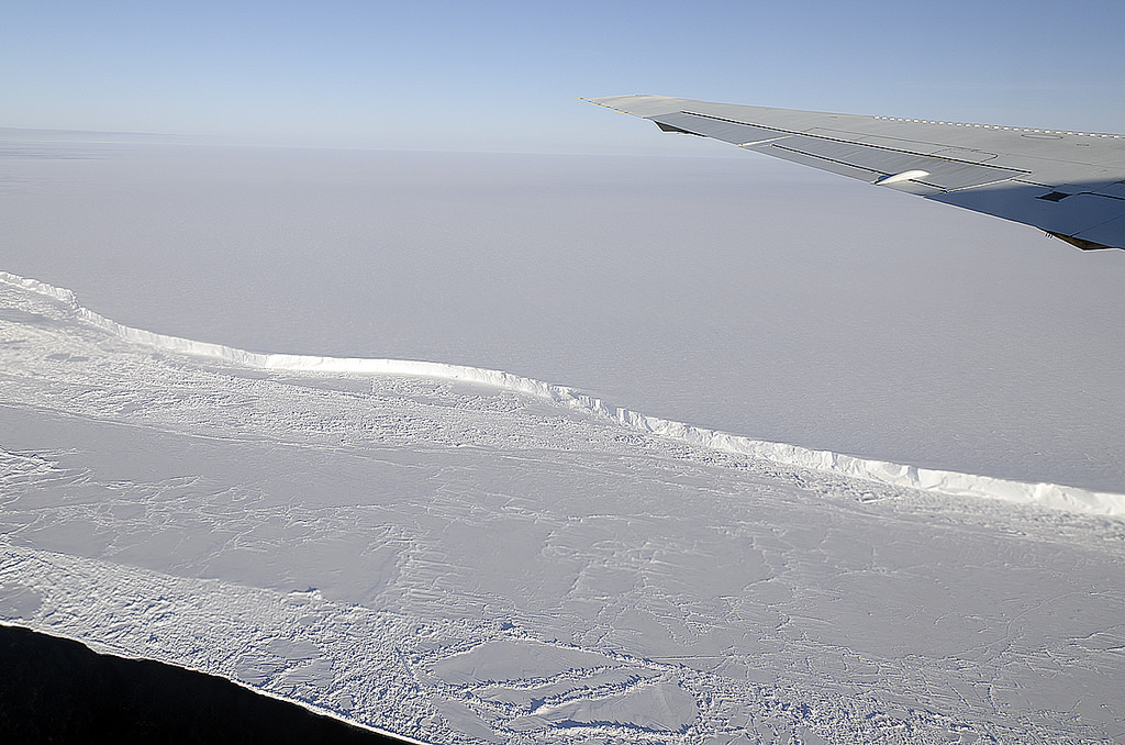
The wing of NASA's DC-8 cuts across the frozen expanse of the Brunt Ice Shelf, with its 100-foot-high cliff face. Credit: Michael Studinger/NASA.

Glaciologists have been closely monitoring ice shelves in Antarctica for signs of cracks and chasms that indicate breakups. The loss of ice around the Earth’s polar regions is one of many consequences of climate change, which is leading to rising ocean levels and various feedback mechanisms. Recently, the ESA’s Copernicus Sentinel-1 satellite witnessed a giant iceberg breaking off from Antarctica’s Brunt Ice Shelf on February 26th.

The Copernicus Sentinel mission consists of two polar-orbiting satellites that rely on C-band synthetic aperture radar imaging to conduct Earth observations in all weather conditions. In recent years, it has been monitoring the Brunt Ice Shelf for signs of cracks and chasms. According to the images it recently captured, an iceberg larger than New York City broke free and began floating out to sea.

Continue reading “Another Big Iceberg Just Broke off from Antarctica”

Three Storms Have Dumped Snow on Mauna Loa and Mauna Kea

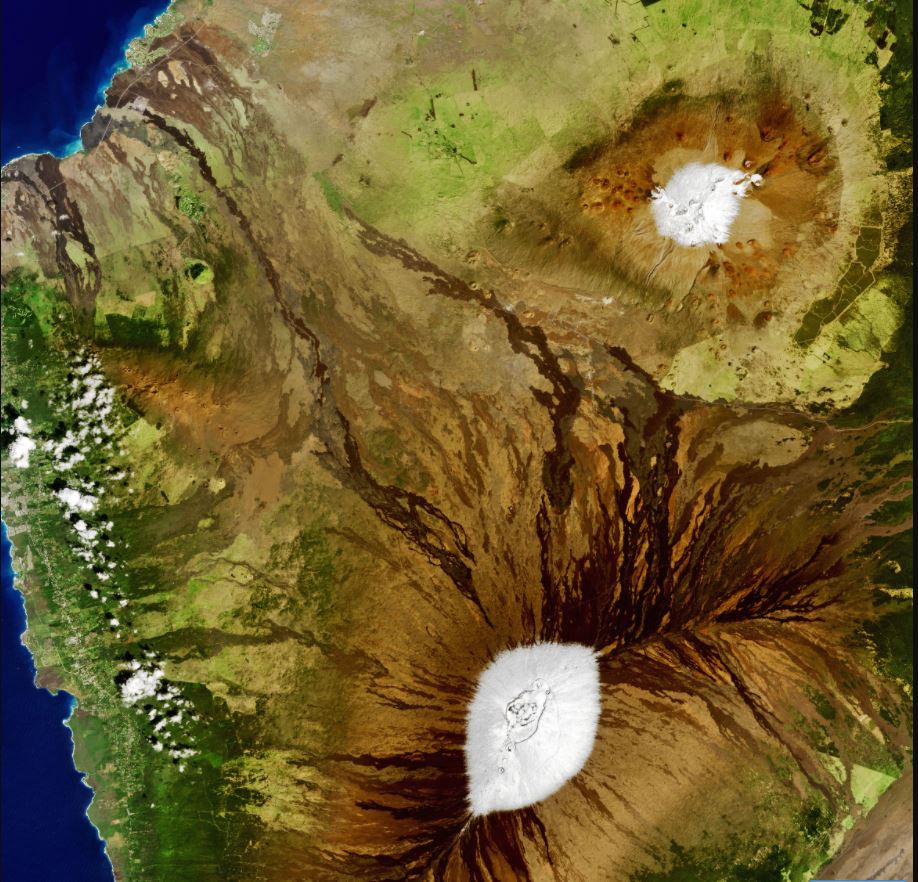
Satellite view of the Big Island of Hawaii on February 6, 2021. Credit: NASA.

The words “snow” and “Hawai’i” are not often mentioned in the same paragraph – or even on the same vacation. But snow does fall in Hawai’i almost every year, and 2021 has seen a deep cold front drop snow on the summits of Mauna Loa and Mauna Kea on the Big Island at least three times in the past few weeks – as well as on Haleakala on Maui. This means there are currently in snowcaps on Hawai’i’s three tallest mountains.

Continue reading “Three Storms Have Dumped Snow on Mauna Loa and Mauna Kea”

This is the View You Get Staring out of the Space Station’s Cupola Module

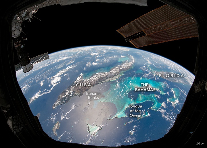
Clouds trace out the islands of the Caribbean Sea in this photo taken by an astronaut from inside the Cupola on the International Space Station. Credit NASA/NASA Earth Observatory.

Those lucky few who have the incredible opportunity to see the Earth from space often report the view gives them a sense of awe, unity and clarity. This perspective-altering experience has come to be known as the Overview Effect, from a book by the same name published 1987 by space philosopher Frank White.

Continue reading “This is the View You Get Staring out of the Space Station’s Cupola Module”

Earth Observation Satellites Could be Flown Much Lower than Current Altitudes and Do Better Science

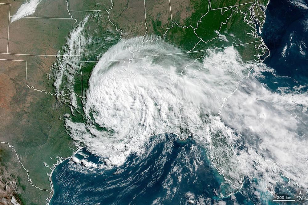
A satellite image of Tropical Depression Cristobal over the US. Image Credit: NASA Earth Observatory.

Satellite engineers know what every photographer knows: get close to your subject to get better pictures. Not just visible light pictures, but all across the spectrum. The lower altitude also improves things like radar, lidar, communications, and gps.

But when your subject is Earth, and Earth is surrounded by an atmosphere, getting closer is a delicate dance with physics. The closer a satellite gets to Earth, the more atmospheric drag it encounters. And that can mean an unscheduled plummet to destruction for Earth-Observing (EO) satellites.

Continue reading “Earth Observation Satellites Could be Flown Much Lower than Current Altitudes and Do Better Science”

Mount Everest, Seen from Space!

Mount Everest, as seen from the International Space Station. Picture taken by cosmonaut Oleg Artemyev.

One under-appreciated space asset is the photography skills of the Russian cosmonauts on board the International Space Station. They are extremely skillful photographers who don’t get the same recognition as their astronaut counterparts in their Earth observation skills. In particular, they have taken some stunning high-oblique shots of objects close to the horizon, with almost an 3-D effect.

Continue reading “Mount Everest, Seen from Space!”