When Will We Find Another Earth?

When Will We Find Another Earth?

We hear about discoveries of exoplanets every day. So how long will it take us to find another planet like Earth?

Back in the olden days, astronomers could only guess if there were planets orbiting other stars.

These were the days when we had to wait at the bank to pay our bills, nobody carried computers in their pockets and those computers gave direct connections to everyone else’s pockets because pocket connectivity is highly important, school was uphill both ways, the number 6 was brand new, we recorded images on thin sheets of transparent plastic, 5 bees were worth a quarter and I had an onion tied to my belt, as was the style at the time.

With the discovery of a mega Jupiter-sized world orbiting the star 51 Pegasi in 1995, the floodgates opened up. In the years that followed, dozens more planets were discovered. Then hundreds, and now, we know about thousands orbiting other stars.

The bad news is we can’t get to any of them. The good news is most of these worlds suck. You don’t want any part of them. For starters their wifi is terrible.

Consider Kepler-70b. This world orbits its star 4 times in a 24 hour period. This means it’s super close, and a great place to really quickly win all the human torch cosplay competitions. The surface temperature is a completely unreasonable 7200 Kelvin, hotter than the surface temperature of the Sun.

There’s the planets orbiting pulsar PSR B1257+12, a millisecond pulsar in the constellation of Virgo. As they whip around their exotic host, they’re bathed in intense radiation. Which is generally considered bad for creatures who need functioning organs.

Perhaps HD 106906 b, orbiting its star 650 times more distantly than we orbit the Sun. You’d spend every second of your short life on that planet inventing new words for cold. And then you’d die. Cold.

Imagine a world that orbits a star like our Sun. A world made of about an Earth’s worth of rocky material that you could stand on, at just the right distance from its star that water can exist as a liquid.

This is what astronomers search for, the tri-wizard cup of extrasolar planetary research. Earth 2? Terra Nova? The Gaia part le deux.

Here’s the exciting part. Astronomers have found each of these characteristics in a planet, but never all together. They’ve found plenty of stars similar to our Sun, with planets orbiting them. In fact, the star HD 10180 is incredibly similar to the Sun, and astronomers have discovered 9 planets orbiting it so far. Which does have a familiar ring to it. No word so far on which ones are about to be demoted to dwarf planets.

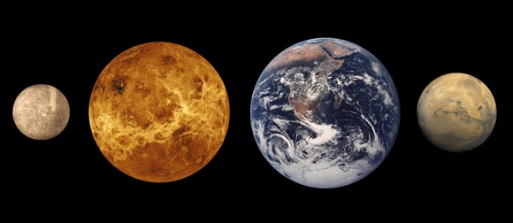
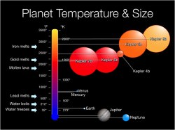
Sizes and temperatures of Kepler discoveries compared to Earth and Jupiter

They’ve found planets roughly the same mass as the Earth. Kepler-89, with 98% the mass of the Earth. So close! Sadly, it’s way too close to its parent hydrogen furnace to be habitable.

They’ve found planets in the habitable zone. Here on Earth, the global average temperature is -18 degrees C. Sounds cold, but the wintery nights in Antarctica absolutely wreck our GPA.

The closest analog discovered is Kepler-22b, with a global average temperature of -11C. So, it should feel downright balmy. Except, it’s about 2.4 times bigger than Earth and orbits a nasty red dwarf star.

Astronomers have even matched up two criteria at the same time. Earth-sized world orbiting around a Sun-like star, but it’s hellishly hot. Wrong flavor star but with the right temperature and size, it’s a veritable tic tac toe board of near wins.

So far, there hasn’t been a single extrasolar planet discovered that meets all three criteria. An Earth-sized world, orbiting a Sun-like star inside the habitable zone where liquid water could be present.

Astronomers were hoping that NASA’s Kepler spacecraft would have been the first to discover Earth 2.0. It had already turned up thousands of planets, including many of the ones I’ve already mentioned.

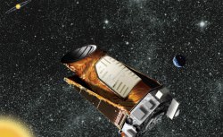
Artist's conception of the Kepler Space Telescope. Credit: NASA/JPL-Caltech
Artist’s conception of the Kepler Space Telescope. Credit: NASA/JPL-Caltech

Sadly, just a few years into the mission, it lost too many reaction wheels, which allow the spacecraft to change direction. It wasn’t able to make enough observations to help confirm a true Earth 2.0. Kepler is still searching for planets, but with a reduced ability to point, it’s only looking at red dwarf stars.

Don’t worry, NASA’s Transiting Exoplanet Survey Satellite will launch in 2017, and will survey a region of the sky 400 times larger than Kepler did. It should turn up thousands of planets, Earth-sized and larger.

Once we actually find New Terra, things get really interesting. Astronomers will search those planets for life. I know it sounds almost impossible to see life from this distance, but astronomers know that if they can analyze the atmosphere of these worlds, they can detect life flourishing there.

They might even be able to detect the pollution from their alien cars and heavy industry, contributing to their CO2 levels, and learn we’re not so different after all. Even if they’re icky bug people.

At the time I’m recording this video, no analog Earth planet has been discovered so far. But it’s just a matter of time. In the next few decades astronomers are going to find that first Earth 2.0, and then dozens, then hundreds, and even figure out which ones have life on them.

It’s a great time to be alive. Place your bets. Predict the date astronomers announce that we’ll find Earth 2.0. Put your guess into the comments below.

Exquisite Views of Earth’s Cities Featured in First Ultra HD Videos from Space Station

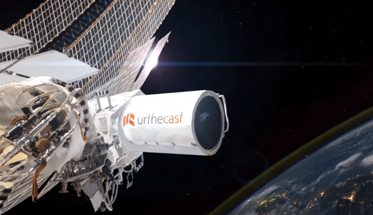
The UrtheCast Corp. Iris camera aboard the International Space Station taking ultra HD video of Earth. Credit: NASA/UrtheCast

https://vimeo.com/130889258

A trio of Earth’s cities come to life like never before with today’s (June 17) publication of the first ever full-color, ultra High Definition full color videos captured by a new commercial camera installed aboard the International Space Station (ISS) that was developed and built by the Canadian-based company UrtheCast Corp.

See Boston, Barcelona and London up close and alive like you’ve never seen them before in the exquisite HD Vimeo videos featured above and below. Indeed the high def videos are “unparalled” says Urthecast.

“These are the the world’s first, full-color HD videos of Earth, filmed from the International Space Station (ISS),” said Urthecast. They have roughly one-meter resolution.

Be sure to click to enlarge the videos to get the full majesty of these cities from space.

Amazingly, you can even watch cars drive along freeways and shipping containers zipping along waterways in the video shot by Iris, UrtheCast’s Ultra HD video camera bolted to the exterior of the massive outpost that’s orbiting Earth at an altitude of some 250 miles (400 kilometers).

“Today, we are continuing our advancement towards democratizing the Earth Observation industry, making timely Earth video and imagery from space accessible to everyone,” explained Scott Larson, UrtheCast Co-founder and Chief Executive Officer, in a statement.

In the lead video of the city of Boston, United States, above you get a glimpse of “fabled Fenway Park in HD” from the Iris camera aboard the ISS.
“Fenway, the oldest ball park in Major League Baseball and the home of the Boston Red Sox, sits aside the Charles River and the beautiful Emerald Necklace — a linear string of parks and rivers,” notes the Urthecast description.

UrtheCast’s goal is to provide “Ultra HD video and still imagery of Earth that will allow for monitoring of the environment, humanitarian relief, social events, agricultural land, etc,” says the company on its website.

The three videos from the Iris full color HD camera cover areas in each of the three cities ranging up to 1.19 x 0.67 miles (1.92 x 1.08 kms) “that is, as of yet, unparalleled.”

Here’s the full color HD video of London, United Kingdom:

https://vimeo.com/130889259

Video caption: London, United Kingdom. Like peering out over the Thames River from your airplane window — see a Tube train depart, the London Eye spin, and cars circle Charing Cross. Captured from the International Space Station at roughly one-meter resolution, UrtheCast’s ‘First Light’ video suite features downtown London, England, showcasing the nucleus of one of Europe‘s most populous cities. Credit: UrtheCast

“With the ultimate goal of connecting the planet and highlighting what unites us all, we’re revealing a perspective of Earth from space that was previously reserved for a small few. By opening up our API to the web development community, we’re providing collaboration tools that will help people monitor, protect, and benefit our world and will lead to the democratization of Earth Observation imagery,” noted Larsen.

Here’s the full color HD video of Barcelona, Spain:

https://vimeo.com/130908246

Barcelona, Spain. Colourful shipping containers zip around the Port of Barcelona in this ‘First Light’ UrtheCast video, captured at roughly one-meter resolution from the International Space Station. To the left of the frame, high atop Montjuïc hill, lies the site of the 1992 Olympics, settled against the shore of the Balearic Sea. Credit: UrtheCast

UrtheCast says it expects Iris to achieve Initial Operation Capability (IOC) status sometime this summer. Their medium-resolution, Theia, achieved IOC status in 2014 “and is actively filling orders for imagery and data.”

Both cameras were flown to the ISS on Russian spacecraft and installed on the exterior of the Russian segment by Russian cosmonauts.

Meanwhile, the human crews aboard the ISS continue to capture breathtaking imagery with hand held cameras.

So be sure to check out my popular story about the dazzling image of the Great Pyramids from the space station taken by NASA astronaut Terry Virts – the commander of Expedition 43. Virts just returned home from the station last week, as detailed in my story here.

Stay tuned here for Ken’s continuing Earth and planetary science and human spaceflight news.

Ken Kremer

What is Lunar Regolith?

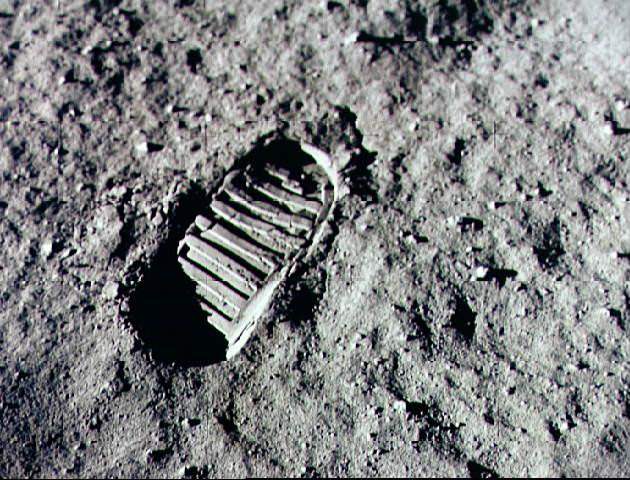
A boot print on the lunar regolith. Credit: NASA.

When you’re walking around on soft ground, do you notice how your feet leave impressions? Perhaps you’ve tracked some of the looser earth in your yard into the house on occasion? If you were to pick up some of these traces – what we refer to as dirt or soil – and examine them beneath a microscope, what would you see?

Essentially, you would be seeing the components of what is known as regolith, which is a collection of particles of dust, soil, broken rock, and other materials found here on Earth. But interestingly enough, this same basic material can be found in other terrestrial environments as well – including the Moon, Mars, other planets, and even asteroids.

Definition:

The term regolith refers to any layer of material covering solid rock, which can come in the form of dust, soil or broken rock. The word is derived from the combination of two Greek words – rhegos (which means “blanket”) and lithos (which means “rock).

Earth:

On Earth, regolith takes the form of dirt, soil, sand, and other components that are formed as a result of natural weathering and biological processes. Due to a combination of erosion, alluvial deposits (i.e. moving water deposing sand), volcanic eruptions, or tectonic activity, the material is slowly ground down and laid out over solid bedrock.

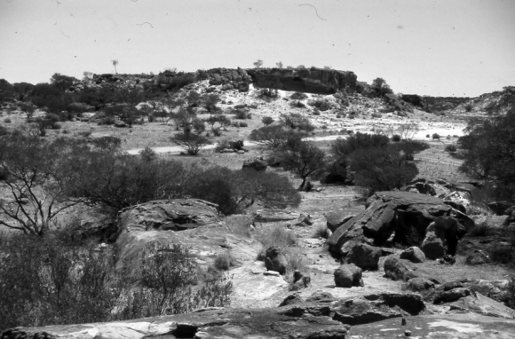
central Yilgarn Craton, Western Australia.
Picture of Mt Magnet in the Central Yilgarn Craton in Western Australia, which dates to the Precambrian Era. Credit: geomorphologie.revues.org

It can be made up of clays, silicates, various minerals, groundwater, and organic molecules. Regolith on Earth can vary from being essentially absent to being hundreds of meters thick. Its can also be very young (in the form of ash, alluvium, or lava rock that was just deposited) to hundreds of millions of years old (regolith dating to the Precambrian age occurs in parts of Australia).

On Earth, the presence of regolith is one of the important factors for most life, since few plants can grow on or within solid rock and animals would be unable to burrow or build shelter without loose material. Regolith is also important for human beings since it has been used since the dawn of civilization (in the form of mud bricks, concrete and ceramics) to build houses, roads, and other civil works.

The difference in terminology between “soil” (aka. dirt, mud, etc.) and “sand” is the presence of organic materials. In the former, it exists in abundance, and is what separates regolith on Earth from most other terrestrial environments in our Solar System.

The Moon:

The surface of the Moon is covered with a fine powdery material that scientists refer to it as “lunar regolith”. Nearly the entire lunar surface is covered with regolith, and bedrock is only visible on the walls of very steep craters.

Earth viewed from the Moon by the Apollo 11 spacecraft. Credit: NASA
Earth viewed from the Moon by the Apollo 11 spacecraft, across a sea of lunar soil. Credit: NASA

The Moon regolith was formed over billions of years by constant meteorite impacts on the surface of the Moon. Scientists estimate that the lunar regolith extends down 4-5 meters in some places, and even as deep as 15 meters in the older highland areas.

When the plans were put together for the Apollo missions, some scientists were concerned that the lunar regolith would be too light and powdery to support the weight of the lunar lander. Instead of landing on the surface, they were worried that the lander would just sink down into it like a snowbank.

However, landings performed by robotic Surveyor spacecraft showed that the lunar soil was firm enough to support a spacecraft, and astronauts later explained that the surface of the Moon felt very firm beneath their feet. During the Apollo landings, the astronauts often found it necessary to use a hammer to drive a core sampling tool into it.

Once astronauts reached the surface, they reported that the fine moon dust stuck to their spacesuits and then dusted the inside of the lunar lander. The astronauts also claimed that it got into their eyes, making them red; and worse, even got into their lungs, giving them coughs. Lunar dust is very abrasive, and has been noted for its ability to wear down spacesuits and electronics.

Alan Bean Takes Lunar Soil Sample
Alan Bean takes a sample of lunar regolith during the Apollo 12 mission. Credit: NASA

The reason for this is because lunar regolith is sharp and jagged. This is due to the fact that the Moon has no atmosphere or flowing water on it, and hence no natural weathering process. When the micro-meteoroids slammed into the surface and created all the particles, there was no process for wearing down its sharp edges.

The term lunar soil is often used interchangeably with “lunar regolith”, but some have argued that the term “soil” is not correct because it is defined as having organic content. However, standard usage among lunar scientists tends to ignore that distinction. “Lunar dust” is also used, but mainly to refer to even finer materials than lunar soil.

As NASA is working on plans to send humans back to the Moon in the coming years, researchers are working to learn the best ways to work with the lunar regolith. Future colonists could mine minerals, water, and even oxygen out of the lunar soil, and use it to manufacture bases with as well.

Mars:

Landers and rovers that have been sent to Mars by NASA, the Russians and the ESA have returned many interesting photographs, showing a landscape that is covered with vast expanses of sand and dust, as well as rocks and boulders.

A successful scoop of Martian regolith (NASA/JPL-Caltech/University of Arizona/Max Planck Institute)
A successful scoop of Martian regolith performed by NASA’s Phoenix lander. Credit: NASA/JPL-Caltech/University of Arizona/Max Planck Institute

Compared to lunar regolith, Mars dust is very fine and enough remains suspended in the atmosphere to give the sky a reddish hue. The dust is occasionally picked up in vast planet-wide dust storms, which are quite slow due to the very low density of the atmosphere.

The reason why Martian regolith is so much finer than that found on the Moon is attributed to the flowing water and river valleys that once covered its surface. Mars researchers are currently studying whether or not martian regolith is still being shaped in the present epoch as well.

It is believed that large quantities of water and carbon dioxide ices remain frozen within the regolith, which would be of use if and when manned missions (and even colonization efforts) take place in the coming decades.

Mars moon of Deimos is also covered by a layer of regolith that is estimated to be 50 meters (160 feet) thick. Images provided by the Viking 2 orbiter confirmed its presence from a height of 30 km (19 miles) above the moon’s surface.

Asteroids and Outer Solar System:

The only other planet in our Solar System that is known to have regolith is Titan, Saturn’s largest moon. The surface is known for its extensive fields of dunes, though the precise origin of them are not known. Some scientists have suggested that they may be small fragments of water ice eroded by Titan’s liquid methane, or possibly particulate organic matter that formed in Titan’s atmosphere and rained down on the surface.

Another possibility is that a series of powerful wind reversals, which occur twice during a single Saturn year (30 Earth years), are responsible for forming these dunes, which measure several hundred meters high and stretch across hundreds of kilometers.  Currently, Earth scientists are still not certain what Titan’s regolith is composed of.

Data returned by the Huygens Probe’s penetrometer indicated that the surface may be clay-like, but long-term analysis of the data has suggested that it may be composed of sand-like ice grains.  The images taken by the probe upon landing on the moon’s surface show a flat plain covered in rounded pebbles, which may be made of water ice, and suggest the action of moving fluids on them.

Asteroids have been observed to have regolith on their surfaces as well. These are the result of meteoriod impacts that have taken place over the course of millions of years, pulverizing their surfaces and creating dust and tiny particles that are carried within the craters.

False color picture of Eros' 5.3-kilometer (3.3-mile) surface crater, showing regolith inside. Credit: NASA/JPL/JHUAPL
False color picture taken by NASA’s NEAR Shoemaker camera of Eros’ 5.3-kilometer (3.3-mile) surface crater, showing the presence of regolith inside. Credit: NASA/JPL/JHUAPL

NASA’s NEAR Shoemaker spacecraft produced evidence of regolith on the surface of the asteroid 433 Eros, which remains the best images of asteroid regolith to date. Additional evidence has been provided by JAXA’s Hayabusa mission, which returned clear images of regolith on an asteroid that was thought to be too small to hold onto it.

Images provided by the Optical, Spectroscopic, and Infrared Remote Imaging System (OSIRIS) cameras on board the Rosetta Spacecraft confirmed that the asteroid 21 Lutetia has a layer of regolith near its north pole, which was seen to flow in major landslides associated with variations in the asteriod’s albedo.

To break it down succinctly, wherever there is rock, there is likely to be regolith. Whether it is the product of wind or flowing water, or the presence of meteors impacting the surface, good old fashioned “dirt” can be found just about anywhere in our Solar System; and most likely, in the universe beyond…

We’ve done several articles about the Moon’s regolith here on Universe Today. Here’s a way astronauts might be able to extract water from lunar regolith with simple kitchen appliances, and an article about NASA’s search for a lunar digger.

Want to buy some lunar regolith simulant? Here’s a site that lets you buy it. Do you want to be a Moon miner? There’s lots of good metal in that lunar regolith.

You can listen to a very interesting podcast about the formation of the Moon from Astronomy Cast, Episode 17: Where Did the Moon Come From?

Reference:
NASA

10 Facts About Planet Earth You May Not Have Known

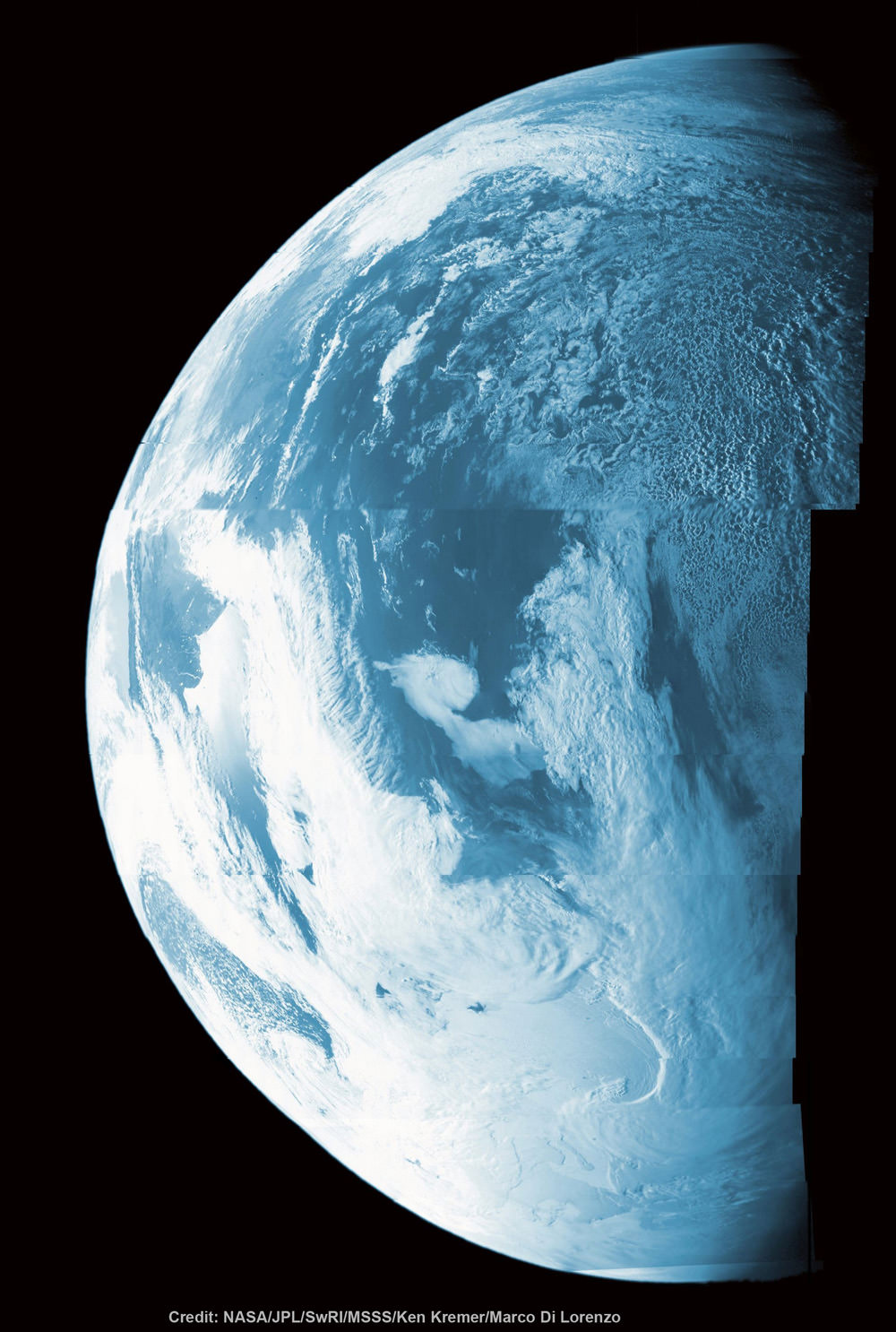
This colorized composite shows more than half of Earth’s disk over the coast of Argentina and the South Atlantic Ocean as the Juno probe slingshotted by on Oct. 9, 2013 for a gravity assisted acceleration to Jupiter. The mosaic was assembled from raw images taken by the Junocam imager. Credit: NASA/JPL/SwRI/MSSS/Ken Kremer/Marco Di Lorenzo

Happy Earth Day! Earth Day is good time to think about the beauty of our home planet and reflect on our stewardship of environmental resources like air and water.

Sometimes, though, our planet can be a bit unpredictable. The folks at HooplaHa have put together this entertaining 2-minute look at a few of our planet’s oddities… and it’s like a combo of “Funniest Home Videos” and “Science Friday.” While our astute readers will likely already know several of these facts, this video will be sure to make you smile.

Again, Happy Earth Day!

Eye of Super Typhoon Maysak Looks “Like a Black Hole” from Space

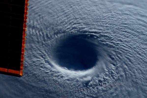
Maysak, a category 4 Super Typhoon, as photographed by astronaut Terry Virts on board the International Space Station. Credit: NASA/Terry Virts.

From his perch on the International Space Station, astronaut Terry Virts has been taking some beautiful photos of Earth and space and sharing them on social media. Today, he shared his views of Super Typhoon Maysak, including this terrifying view looking straight down into the huge eye of the storm. “Looking down into the eye – by far the widest one I’ve seen,” he tweeted. “It seemed like a black hole from a Sci-Fi movie.”

See more of his images, below.

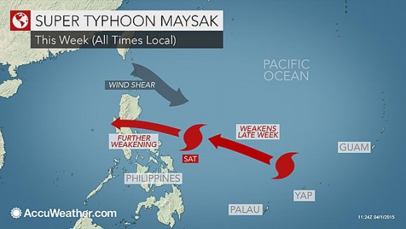
According to AccuWeather.com, Super Typhoon Maysak is one of the strongest cyclones in history during the months of January, February and March. It has slammed several Micronesian islands, killing 5 people, and is now on its way to the Philippines. As of early on April 1, Maysak had sustained winds of 240 kph (150 mph), equivalent of a Category 4 hurricane. Gusts as high as 390 kph (180 mph) are possible with this storm.

The typhoon is expected to weaken, but still poses a threat to the islands in its path:

A graphic showing Typhoon Maysak's projected path. Credit: AccuWeather.com
A graphic showing Typhoon Maysak’s projected path. Credit: AccuWeather.com

No, a Giant Asteroid Isn’t Going to “Skim” Earth on Friday

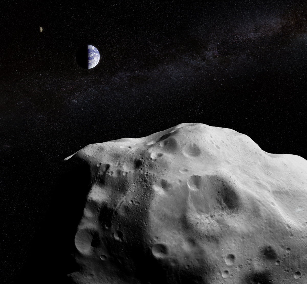
Asteroid 2014 YB35 will safely pass Earth at 4.5 million km on Friday, March 27. (Composite image by J. Major showing asteroid Lutetia imaged by ESA's Rosetta, Earth and Moon imaged by NASA's Galileo, and the Milky Way imaged by ESO and Serge Brunier.)

There are ways to report on occasional close approaches by near-Earth objects (NEOs) that convey the respectful awareness of their presences and the fact that our planet shares its neighborhood with many other objects, large and small… and that sometimes their paths around the Sun bring them unnervingly close to our own.

Then there’s just straight-up over-sensationalism intended to drum up page views by scaring the heck out of people, regardless of facts.

Apparently this is what’s happened regarding the upcoming close approach by NEO 2014 YB35. An asteroid of considerable (but definitely not unprecedented) size – estimated 440-990 meters in diameter, or around a third of a mile across – YB35 will pass by Earth on Friday, March 27, coming as close as 11.7 times the distance between Earth and the Moon at 06:20 UTC.

11.7 lunar distances. That’s 4.5 million kilometers, or almost 2.8 million miles. Cosmically close, sure, but far from “skimming”…and certainly with no danger of an impact or any of the nasty effects that would be a result thereof. None. Zero. Zilch. NASA isn’t concerned, and you shouldn’t be either.

I typically wouldn’t even bother writing up something like this, except that I have been seeing posts shared among acquaintances on Facebook and Twitter that refer to sensationalist articles portraying the event as a frightening near-miss by an apocalyptic object. I won’t link to those articles here but in short they focus heavily on the destructive nature of an object the size of YB35 were it to hit Earth and how it would wipe out “all species” of life on our planet wholesale, and how YB35 is “on course” with Earth’s orbit.

The problem I have is that these statements, although technically not false in themselves, are not being used to demonstrate the potential danger of large-scale cosmic impact events but rather to frighten and alarm people about this particular pass. Which is not any way to responsibly inform the public about impacts, asteroids, and what we can or should be doing to mitigate these dangers.

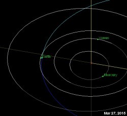
Orbital diagram of 2014 YB35 for March 27, 2015. Via JPL's Small-Body Database.
Orbital diagram of 2014 YB35 for March 27, 2015. Via JPL’s Small-Body Database.

First observed through the Catalina Sky Survey in Dec. 2014, YB35 is a good-sized asteroid. It will come relatively close to Earth on Friday but more than plenty far enough away to not pose any danger or have any physical effects on Earth in any way (similar to the close pass of the smaller asteroid 2014 UR116 in December.) YB35 will actually make slightly closer passes in March 2033 and in 2128, but still at similar distances.

YB35 is, for all intents and purposes, one of the many potentially-hazardous* asteroids that won’t hit us, and NASA is well aware of nearly all of the NEOs in its size range thanks in no small part to space observatories like NEOWISE and various ground-based survey projects around the world. They will observe this event for the increased information on YB35 that can be gathered, but they are not “on alert” and the astronomers certainly aren’t “terrified.”

Should we take this as a reminder that large asteroids are out there and we should be as diligent as we can about identifying them? Yes, certainly. Should we support missions that would help spot and track near-Earth objects as well as those that would provide a way to potentially deflect any large incoming ones? Of course. Should we drop to our knees and cry “why?!” or sleep in our backyard bunkers tonight surrounded by bottled water and cans of beans? Not at all.

So don’t believe the hype, don’t go max out your credit cards, and please don’t sleep in your bunker. Pass it on.

Want to learn more about NEOs and close approaches? Visit JPL’s Near-Earth Object Program page here. Also, watch a fascinating animation showing the discovery rate of asteroids in the Solar System from 1980-2011 by Scott Manley below.

*Note: Potentially-hazardous asteroids (PHAs) are those larger than 150m whose orbits could cross Earth’s in the future, not necessarily that they will or that Earth will be sharing the same place when and if they do.

10 Interesting Facts About Volcanoes

A view of the Villarrica Volcano's Eruption In Chile on March 3, 2-15. Credit: Ariel Marinkovic/EPA /Landov.

Want some volcano facts? Here are 10 interesting facts about volcanoes. Some of these facts you’ll know, and others may surprise you. Whatever the case, volcanoes are amazing features of nature that demand our respect.

1. There are Three Major Kinds of Volcanoes:

Although volcanoes are all made from hot magma reaching the surface of the Earth and erupting, there are different kinds. Shield volcanoes have lava flows with low viscosity that flow dozens of kilometers; this makes them very wide with smoothly sloping flanks.

Stratovolcanoes are made up of different kinds of lava, and eruptions of ash and rock and grow to enormous heights. Cinder cone volcanoes are usually smaller, and come from short-lived eruptions that only make a cone about 400 meters high.

2. Volcanoes Erupt Because of Escaping Magma:

About 30 km beneath your feet is the Earth’s mantle. It’s a region of superhot rock that extends down to the Earth’s core. This region is so hot that molten rock can squeeze out and form giant bubbles of liquid rock called magma chambers. This magma is lighter than the surrounding rock, so it rises up, finding cracks and weakness in the Earth’s crust.

Lava fountain in Hawaii.
Lava fountain in Hawaii. Image Credit: Jim D. Griggs/HVO/USGS

When it finally reaches the surface, it erupts out of the ground as lava, ash, volcanic gasses and rock. It’s called magma when it’s under the ground, and lava when it erupts onto the surface.

3. Volcanoes can be Active, Dormant or Extinct:

An active volcano is one that has had an eruption in historical times (in the last few thousand years). A dormant volcano is one that has erupted in historical times and has the potential to erupt again, it just hasn’t erupted recently. An extinct volcano is one that scientists think probably won’t erupt again. Here’s more information on the active volcanoes in the world.

4. Volcanoes can Grow Quickly:

Although some volcanoes can take thousands of years to form, others can grow overnight. For example, the cinder cone volcano Paricutin appeared in a Mexican cornfield on February 20, 1943. Within a week it was 5 stories tall, and by the end of a year it had grown to more than 336 meters tall. It ended its grown in 1952, at a height of 424 meters. By geology standards, that’s pretty quick.

Detailed View of Ash Plume at Eyjafjallajökull Volcano
Detailed view from space of the ash plume caused by the Eyjafjallajökull volcano in 2010. Credit: NASA

5. There are 20 Volcanoes Erupting Right Now:

Somewhere, around the world, there are likely about 20 active volcanoes erupting as you’re reading this. Some are experiencing new activity, others are ongoing. Between 50-70 volcanoes erupted last year, and 160 were active in the last decade. Geologists estimate that 1,300 erupted in the last 10,000 years.

Three quarters of all eruptions happen underneath the ocean, and most are actively erupting and no geologist knows about it at all. One of the reasons is that volcanoes occur at the mid ocean ridges, where the ocean’s plates are spreading apart. If you add the underwater volcanoes, you get an estimate that there are a total of about 6,000 volcanoes that have erupted in the last 10,000 years.

6. Volcanoes are Dangerous:

But then you knew that. Some of the most deadly volcanoes include Krakatoa, which erupted in 1883, releasing a tsunami that killed 36,000 people. When Vesuvius exploded in AD 79, it buried the towns of Pompeii and Herculaneum, killing 16,000 people.

Image of Mt. Vesuvius, captured in 2000 by the Advanced Spaceborne Thermal Emission and Reflection Radiometer (ASTER). Credit: NASA/EO
Image of Mt. Vesuvius, captured in 2000 by the Advanced Spaceborne Thermal Emission and Reflection Radiometer (ASTER) aboard the Terra satellite. Credit: NASA/EO

Mount Pelee, on the island of Martinique destroyed a town with 30,000 people in 1902. The most dangerous aspect of volcanoes are the deadly pyroclastic flows that blast down the side of a volcano during an eruption. These contain ash, rock and water moving hundreds of kilometers an hour, and hotter than 1,000 degrees C.

7. Supervolcanoes are Really Dangerous:

Geologists measure volcano eruptions using the Volcano Explosivity Index, which measures the amount of material released. A “small” eruption like Mount St. Helens was a 5 out of 8, releasing a cubic kilometer of material. The largest explosion on record was Toba, thought to have erupted 73,000 years ago.

It released more than 1,000 cubic kilometers of material, and created a caldera 100 km long and 30 kilometers wide. The explosion plunged the world into a world wide ice age. Toba was considered an 8 on the VEI.

8. The Tallest Volcano in the Solar System isn’t on Earth:

That’s right, the tallest volcano in the Solar System isn’t on Earth at all, but on Mars. Olympus Mons, on Mars, is a giant shield volcano that rises to an elevation of 27 km, and it measures 550 km across. Scientists think that Olympus Mons was able to get so large because there aren’t any plate tectonics on Mars. A single hotspot was able to bubble away for billions of years, building the volcano up bigger and bigger.

Mauna Kea
Mauna Kea observed from space. Credit: NASA/EO

9. The Tallest and Biggest Volcanoes on Earth are side by side:

The tallest volcano on Earth is Hawaii’s Mauna Kea, with an elevation of 4,207 meters. It’s only a little bigger than the largest volcano on Earth, Mauna Loa with an elevation of only 4,169 meters. Both are shield volcanoes that rise up from the bottom of the ocean. If you could measure Mauna Kea from the base of the ocean to its peak, you’d get a true height of 10,203 meters (and that’s bigger than Mount Everest).

10. The Most Distant Point from the Center of the Earth is a Volcano:

You might think that the peak of Mount Everest is the most distant point from the center of the Earth, but that’s not true. Instead, it’s the volcano Chimborazo in Ecuador. That’s because the Earth is spinning in space and is flattened out. Points at the equator are further from the center of the Earth than the poles. And Chimborazo is very close to the Earth’s equator.

We have written many articles about volcanoes for Universe Today. Here’s an article that tackles about the 10 facts about earth’s core. You might also want to read on the 10 facts about earth. And here’s more: all about volcanoes.

Want more resources on the Earth? Here’s a link to NASA’s Human Spaceflight page, and here’s NASA’s Visible Earth.

We have also recorded an episode of Astronomy Cast about Earth, as part of our tour through the Solar System – Episode 51: Earth.

Reference:
USGS Volcano Hazards Program

Watch the Aurora Shimmer and Dance in Real Time

I for one have never witnessed the northern lights in person, and like many people I experience them vicariously through the photography and videos of more well-traveled (or more polar-bound) individuals. Typically these are either single-shot photos or time-lapses made up of many somewhat long-exposure images. As beautiful as these are, they don’t accurately capture the true motion of this upper atmospheric phenomenon. But here we get a look at the aurora as it looks in real time, captured on camera by Jon Kerr from northern Finland. Check it out above or watch in full screen HD on YouTube.

The video was shot with a full-frame mirrorless Sony a7S. See more of Jon’s aurora videos on YouTube here.

Video credit: Jon Kerr. HT SunViewer on Twitter.

NASA’s Magnetospheric Multiscale (MMS) Spacecraft Set for March Blastoff to study Earth’s Magnetic Reconnection Events

Technicians work on NASA’s 20-foot-tall Magnetospheric Multiscale (MMS) mated quartet of stacked observatories in the cleanroom at NASA's Goddard Space Flight Center in Greenbelt, Md., on May 12, 2014. Credit: Ken Kremer- kenkremer.com

NASA’s first mission dedicated to study the process in nature known as magnetic reconnection undergoing final preparation for launch from Cape Canaveral, Florida in just under two weeks time.

The Magnetospheric Multiscale (MMS) mission is comprised of a quartet of identically instrumented observatories aimed at providing the first three-dimensional views of a fundamental process in nature known as magnetic reconnection.

Magnetic reconnection is the process whereby magnetic fields around Earth connect and disconnect while explosively releasing vast amounts of energy. It occurs throughout the universe.

“Magnetic reconnection is one of the most important drivers of space weather events,” said Jeff Newmark, interim director of the Heliophysics Division at NASA Headquarters in Washington.

“Eruptive solar flares, coronal mass ejections, and geomagnetic storms all involve the release, through reconnection, of energy stored in magnetic fields. Space weather events can affect modern technological systems such as communications networks, GPS navigation, and electrical power grids.”

The four MMS have been stacked on top of one another like pancakes, encapsulated in the payload fairing, transported to the launch pad, hoisted and mated to the top of the 195-foot-tall rocket.

NASA's Magnetospheric Multiscale (MMS) observatories are shown here in the clean room being processed for a March 12, 2015 launch from Space Launch Complex 41 on Cape Canaveral Air Force Station, Florida.  Credit: NASA/Ben Smegelsky
NASA’s Magnetospheric Multiscale (MMS) observatories are shown here in the clean room being processed for a March 12, 2015 launch from Space Launch Complex 41 on Cape Canaveral Air Force Station, Florida. Credit: NASA/Ben Smegelsky

The nighttime launch of MMS on a United Launch Alliance Atlas V rocket should put on a spectacular sky show for local spectators along the Florida space coast as well as more distant located arcing out in all directions.

Liftoff is slated for 10:44 p.m. EDT Thursday March 12 from Space Launch Complex 41 on Cape Canaveral Air Force Station, Florida.

The launch window extends for 30 minutes.

Artist rendition of the four MMS spacecraft in orbit in Earth’s magnetic field. Credit: NASA

After a six month check out phase the probes will start science operation in September.

Unlike previous missions to observe the evidence of magnetic reconnection events, MMS will have sufficient resolution to measure the characteristics of ongoing reconnection events as they occur.

The four probes were built in-house by NASA at the agency’s Goddard Space Flight Center in Greenbelt, Maryland where is visited them during an inspection tour by NASA Administrator Charles Bolden.

I asked Bolden to explain the goals of MMS during a one-on-one interview.

“MMS will help us study the phenomena known as magnetic reconnection and help us understand how energy from the sun – magnetic and otherwise – affects our own life here on Earth,” Bolden told Universe Today.

“MMS will study what effects that process … and how the magnetosphere protects Earth.”

MMS measurements should lead to significant improvements in models for yielding better predictions of space weather and thereby the resulting impacts for life here on Earth as well as for humans aboard the ISS and robotic satellite explorers in orbit and the heavens beyond.

NASA Administrator Charles Bolden poses with the agency’s Magnetospheric Multiscale (MMS) spacecraft, mission personnel, Goddard Center Director Chris Scolese and NASA Associate Administrator John Grunsfeld, during visit to the cleanroom at NASA's Goddard Space Flight Center in Greenbelt, Md., on May 12, 2014.  Credit: Ken Kremer- kenkremer.com
NASA Administrator Charles Bolden poses with the agency’s Magnetospheric Multiscale (MMS) spacecraft, mission personnel, Goddard Center Director Chris Scolese and NASA Associate Administrator John Grunsfeld, during visit to the cleanroom at NASA’s Goddard Space Flight Center in Greenbelt, Md., on May 12, 2014. Credit: Ken Kremer- kenkremer.com

The best place to study magnetic reconnection is ‘in situ’ in Earth’s magnetosphere. This will lead to better predictions of space weather phenomena.

“This is the perfect time for this mission,” said Jim Burch, principal investigator of the MMS instrument suite science team at Southwest Research Institute (SwRI) in San Antonio, Texas.

“MMS is a crucial next step in advancing the science of magnetic reconnection. Studying magnetic reconnection near Earth will unlock the ability to understand how this process works throughout the entire universe.”

Magnetic reconnection is also believed to help trigger the spectacular aurora known as the Northern or Southern lights.

MMS is a Solar Terrestrial Probes Program, or STP, mission within NASA’s Heliophysics Division.

Watch for Ken’s ongoing MMS coverage and he’ll be onsite at the Kennedy Space Center in the days leading up to the launch on March 12.

Stay tuned here for Ken’s continuing MMS, Earth and planetary science and human spaceflight news.

Ken Kremer
………….
Learn more about MMS, Mars rovers, Orion, SpaceX, Antares, NASA missions and more at Ken’s upcoming outreach events:

Mar 6: “MMS Update, Future of NASA Human Spaceflight, Curiosity on Mars,” Delaware Valley Astronomers Assoc (DVAA), Radnor, PA, 7 PM.

Mar 10-12: “MMS, Orion, SpaceX, Antares, Curiosity Explores Mars,” Kennedy Space Center Quality Inn, Titusville, FL, evenings

Incredible “Birdman”-like Tracking-Shot Timelapse of Earth from Space

The Academy Award winning film “Birdman” used what’s called tracking shot to create the sense of a seamless one-shot film. A new timelapse created from imagery captured by astronauts on the International Space Station uses the same technique — which has not been used in previous ISS timelapses — with stunning results. Additionally, the footage is very recent, from January and February 2015. It was compiled by Phil Selmes.

“The footage has been composited and edited to show enhanced camera movement, a day to night transition, and an uninterrupted camera movement which links two timelapse shots seamlessly,” Selmes told Universe Today. “These processes have never been used to present ISS time lapse footage in this way before.”
Continue reading “Incredible “Birdman”-like Tracking-Shot Timelapse of Earth from Space”