Anti-Solar Cells Could Generate Electricity at Night

. Credit: NASA/SolarReserve

It is a foregone conclusion that if humanity intends to survive the so-called “Anthropocene” we need to make the transition away from fossil fuels and other methods that are unsustainable and amplify our impact on the planet. In this respect, a great deal of research and development is being directed towards “renewable energy.” Of the many methods that are being developed, the biggest contender is and always has been solar power.

Unfortunately, solar power suffers from a number of drawbacks, like the fact that it is only available during the day and favorable weather conditions. However, a new study by researchers from the Institute for Research in Electronics and Applied Physics (IREAP) shows how a special kind of photovoltaic cell could generate power at night. These “anti-solar” cells could revolutionize renewable energy and make it far more proficient.

Continue reading “Anti-Solar Cells Could Generate Electricity at Night”

An Upcoming Mission is Going to Assemble and Manufacture a Communications Antenna and Beam in Space

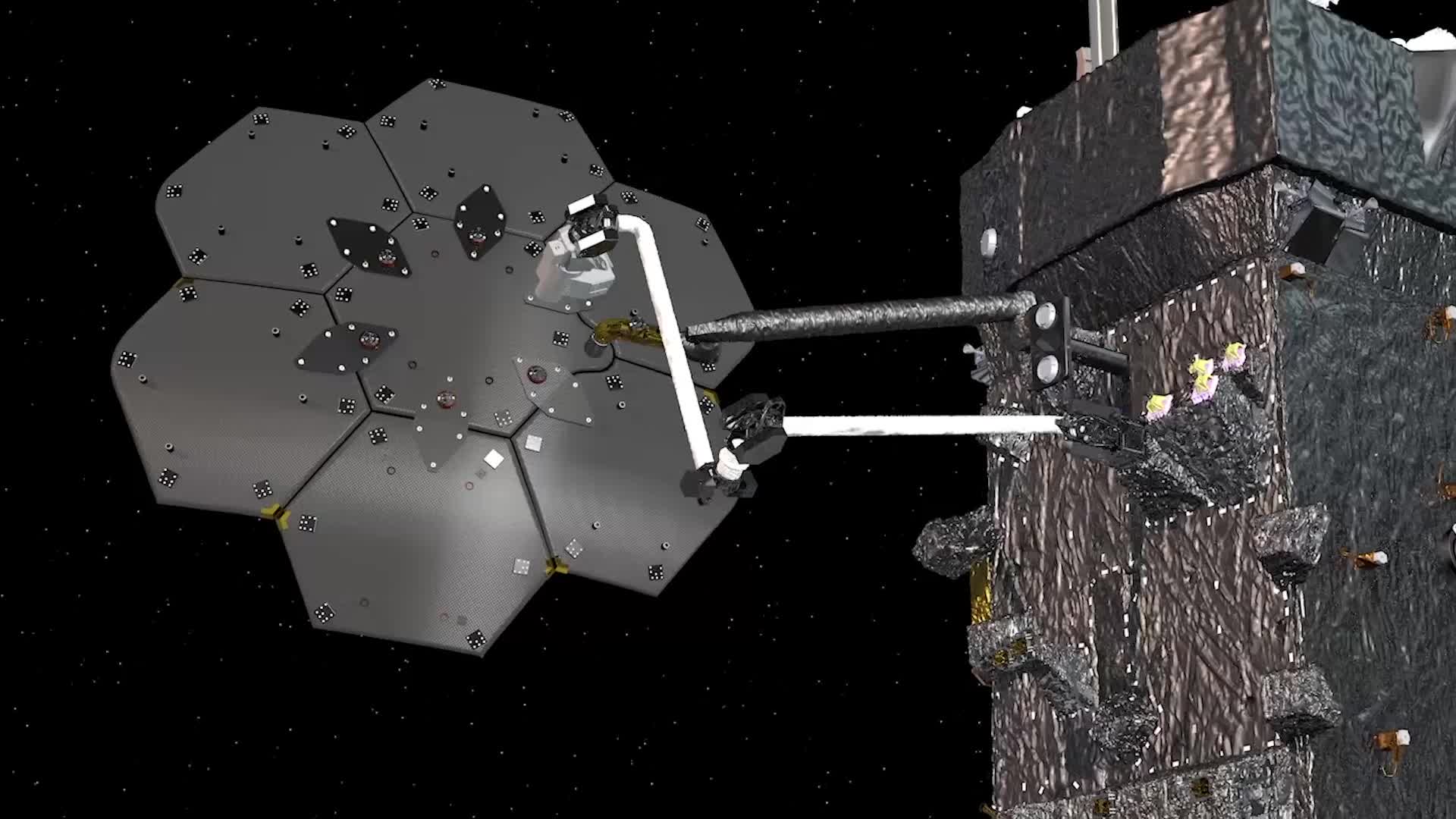
The Space Infrastructure Dexterous Robot (SPIDER) technology demonstration is slated to take place on NASA’s Restore-L spacecraft. The payload will assemble a functional communications antenna and manufacture a spacecraft beam. Credits: Maxar Technologies

It has been suggested that if humanity wants to truly embark on a renewed era of space exploration, one of the key ingredients is the ability to manufacture structures in space. By assembling everything from satellites to spacecraft in orbit, we would eliminate the most costly aspect of going to space. This, simply put, is the sheer expense of escaping Earth’s gravity well, which requires heavy launch vehicles and LOTS of fuel!

This is the idea behind the Space Infrastructure Dexterous Robot (SPIDER), a technology-demonstrator that will be going to space as part of NASA’s Restore-L spacecraft, which is designed to service and refuel a satellite in low-Earth orbit. Once deployed, the SPIDER will assemble a communications antenna and composite beam to demonstrate that space-based construction is possible.

Read more

This is the Spot Where ESA’s Schiaparelli Crashed Into Mars

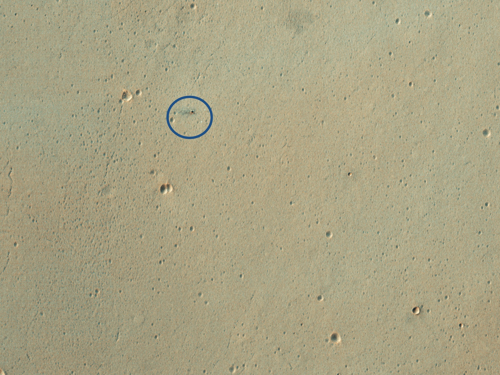
Credit: HiRISE/LPL/University of Arizona

On October 19th, 2016, the NASA/ESA ExoMars mission arrived at the Red Planet to begin its study of the surface and atmosphere. While the Trace Gas Orbiter (TGO) successfully established orbit around Mars, the Schiaparelli Lander crashed on its way to the surface. At the time, the Mars Reconnaissance Orbiter (MRO) acquired images of the crash site using its High Resolution Imaging Science Experiment (HiRISE) camera.

In March and December of 2019, the HiRISE camera captured images of this region once again to see what the crash site looked like roughly three years later. The two images show the impact crater that resulted from the crash, which was partially-obscured by dust clouds created by the recent planet-wide dust storm. This storm lasted throughout the summer of 2019 and coincided with Spring in Mars’ northern hemisphere.

Continue reading “This is the Spot Where ESA’s Schiaparelli Crashed Into Mars”

This is the Highest Resolution Image Ever Taken of the Surface of the Sun

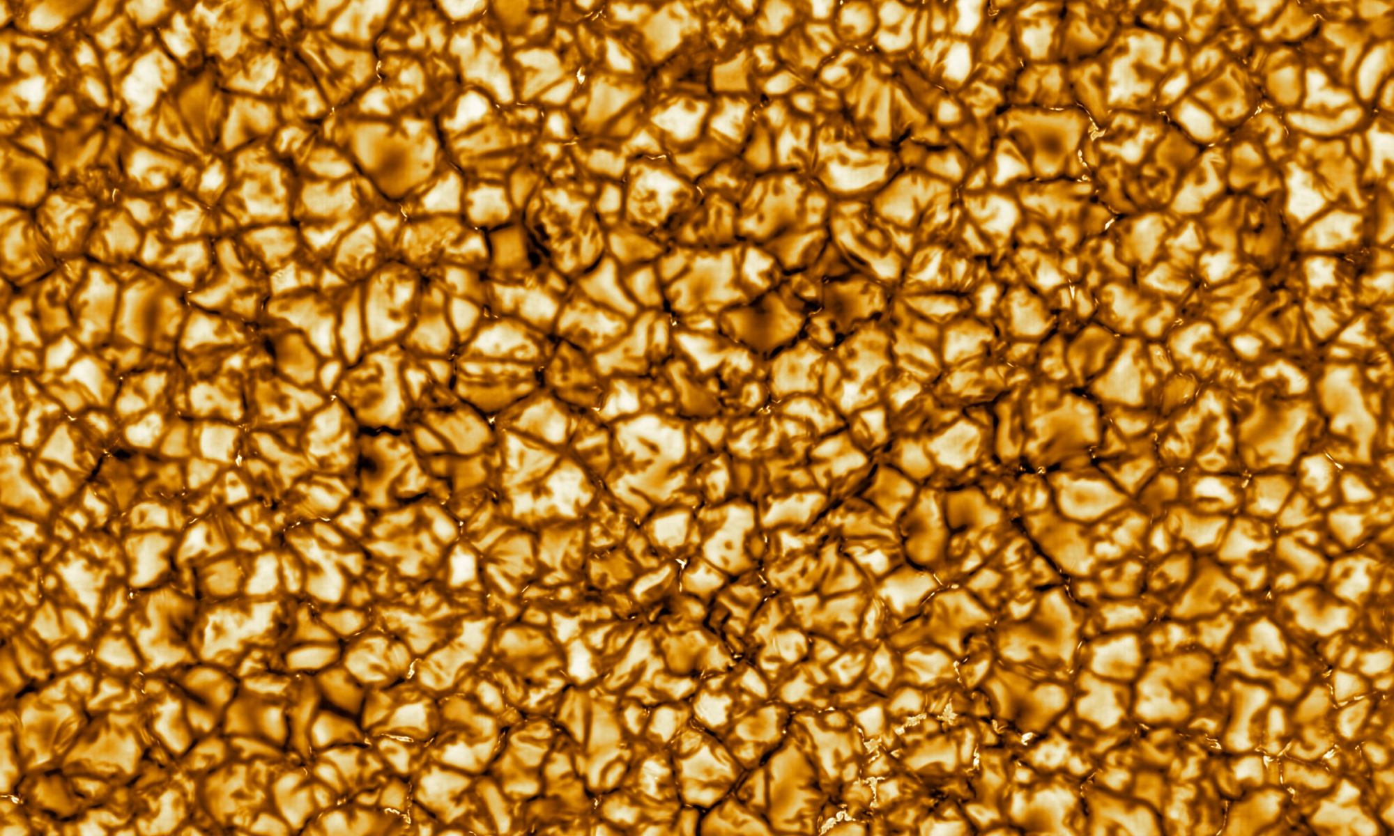
Credit: NSF

The Sun’s activity, known as “space weather”, has a significant effect on Earth and the other planets of the Solar System. Periodic eruptions, also known as solar flares, release considerable amounts of electromagnetic radiation, which can interfere with everything from satellites and air travel to electrical grids. For this reason, astrophysicists are trying to get a better look at the Sun so they can predict its weather patterns.

This is the purpose behind the NSF’s 4-meter (13-ft) Daniel K. Inouye Solar Telescope (DKIST) – formerly known as the Advanced Technology Solar Telescope – which is located at the Haleakala Observatory on the island of Maui, Hawaii. Recently, this facility released its first images of the Sun’s surface, which reveal an unprecedented level of detail and offer a preview of what this telescope will reveal in the coming years.

Continue reading “This is the Highest Resolution Image Ever Taken of the Surface of the Sun”

There’s a 1 in 20 Chance That Two Dead Satellites Might Crash Tonight (Update: No Collision)

Artist's impression of the orbital debris problem. Credit: UC3M

Update. It looks like we didn’t roll a 1 on the d20, and the satellites passed each other without an impact. But this will probably become a more common occurrence as the skies get more crowded.

Over sixty years of space exploration have left their mark in Low Earth Orbit (LEO), where thousands of objects create the risk of collisions. These objects include the spent first stages of rockets, fragments of broken-up spacecraft, and satellites that are no longer operational. As Donald Kessler predicted, the growing presence of “space junk” could result in regular collisions, leading to a cascading effect (aka. Kessler Syndrome).

This evening – on Wednesday, Jan. 29th – such a collision might take place. These satellites are the Infrared Astronomical Satellite (IRAS), an old space telescope launched by NASA, the Netherlands, and the UK; and the GGSE-4 gravitational experiment launched by the US Air Force. These two satellites run the risk of colliding when their orbits cross paths at 06:40 p.m. EST (03:40 p.m. PST) about 900 km (560 mi) above Pittsburgh, Pennsylvania.

Continue reading “There’s a 1 in 20 Chance That Two Dead Satellites Might Crash Tonight (Update: No Collision)”

Here’s What the Climate Might Look Like on Proxima Centauri B

Credit: NASA

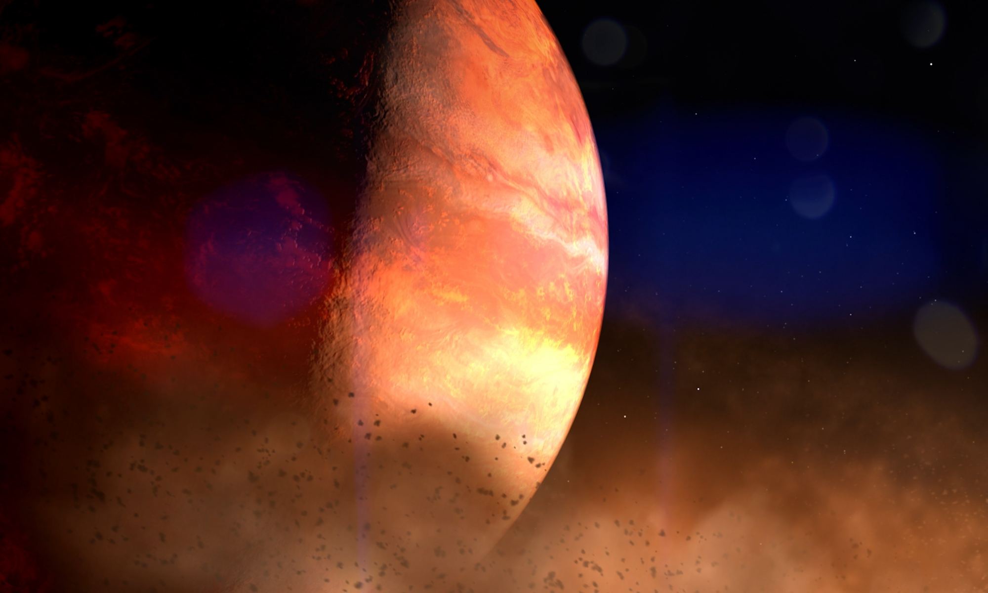
Located at the heart of the NASA Center for Climate Simulation (NCCS) – part of NASA’s Goddard Space Flight Center – is the Discover supercomputer, a 129,000-core cluster of Linux-based processors. This supercomputer, which is capable of conducting 6.8 petaflops (6.8 trillion) operations per second, is tasked with running sophisticated climate models to predict what Earth’s climate will look like in the future.

However, the NCCS has also started to dedicate some of Discover’s supercomputing power to predict what conditions might be like on any of the over 4,000 planets that have been discovered beyond our Solar System. Not only have these simulations shown that many of these planets could be habitable, they are further evidence that our very notions of “habitability” could use a rethink.

Continue reading “Here’s What the Climate Might Look Like on Proxima Centauri B”

A Television Satellite Might be About to Explode

Artist's impression of a satellite exploding. Credit: ESA

On Friday (Jan. 19th), authorities at the Federal Communications Commission (FCC) announced that they had granted permission to cable tv provider DirecTV to begin the process of deorbiting their Spaceway-1 (F1) satellite. This was necessary ever since DirecTV detected a “major anomaly” with the satellite’s batteries which increased the risk of an explosion if its orbit remained unchanged.

Continue reading “A Television Satellite Might be About to Explode”

ESA is Going to Test Two Rovers Working Together to Explore the Moon

Credit: ESA

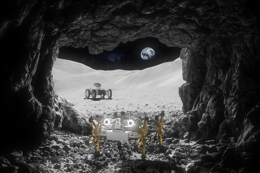
The ESA has spent the past few years working towards the creation of an international lunar base, something that will serve as a spiritual successor to the International Space Station (ISS). To accomplish this, they have enlisted the help of other space agencies and contractors to develop concepts for space habitats and construction methods as well as ways to provide robotic and logistical support.

Recently, the ESA’s Technology Development Element (TDE) signed on with the French technology developer COMEX to create the TRAILER robotic system. This two-year project will test a new mission architecture where two rovers work in tandem (and with the help of astronauts) for the sake of exploring the lunar surface and building a permanent outpost on the Moon.

Continue reading “ESA is Going to Test Two Rovers Working Together to Explore the Moon”

Stalking Starlink’s ‘DarkSat’

Starlink
An artist's conception of Starlink in orbit. Credit: SpaceX

Note: Updates in reflect changes in the new launch time for Starlink-3. We’ll add in updated sighting opportunities as they become available.

By now, you’ve no doubt heard of (or seen) Starlink. SpaceX’s mega-satellite constellation has become a permanent fixture in our skies as of late, with several routine passes on any given week. But have you seen the supposed ‘black sheep’ of the flock, DarkSat?

Continue reading “Stalking Starlink’s ‘DarkSat’”

China Releases New Pictures From the Surface of the Moon

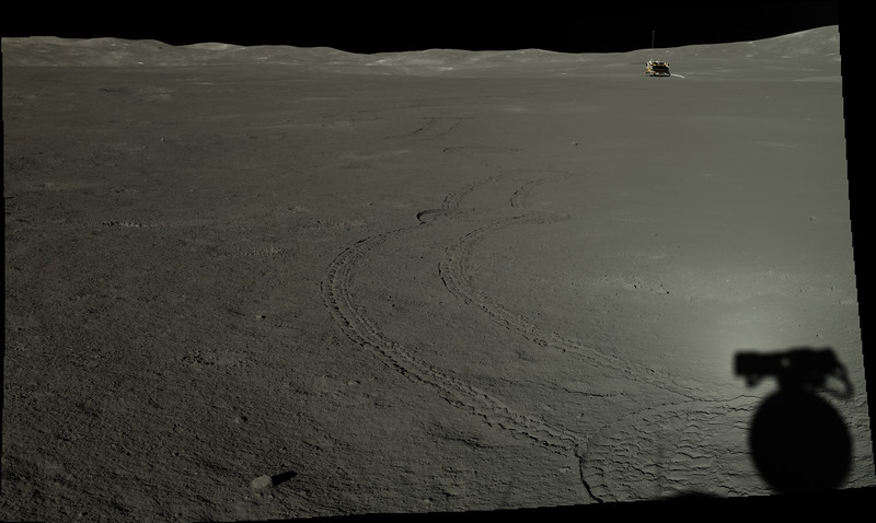
Image of the Chang'e-4 lander, taken by the Yutu 2 rover. Credit: CNSA/GRAS/Doug Ellison

Ever since it made its historic landing on Jan. 3rd, 2019, the Chang’e-4 mission and its Yutu 2 rover have been busy exploring the lunar surface. Just recently, the mission passed its first year of operations and earned the distinction of being the first rover to travel a record 357.695 meters (1,173.5 ft) on the far side of the Moon. And in between all that, the mission has also provided some truly fascinating images of the lunar surface.

Thanks to a data release issued on Monday (Jan. 20th), the public can now peruse through all of the high-resolution images taken by the Chang’e-4 mission. The data, which was released by the Ground Research and Application System (GRAS) of the Chinese Lunar Exploration Project, includes images of the far side of the Moon that were taken with the lander’s terrain camera and the panoramic camera on the Yutu-2 rover.

Continue reading “China Releases New Pictures From the Surface of the Moon”