What are the Earth’s Layers?

The Earth's layers, showing the Inner and Outer Core, the Mantle, and Crust. Credit: discovermagazine.com

There is more to the Earth than what we can see on the surface. In fact, if you were able to hold the Earth in your hand and slice it in half, you’d see that it has multiple layers. But of course, the interior of our world continues to hold some mysteries for us. Even as we intrepidly explore other worlds and deploy satellites into orbit, the inner recesses of our planet remains off limit from us.

However, advances in seismology have allowed us to learn a great deal about the Earth and the many layers that make it up. Each layer has its own properties, composition, and characteristics that affects many of the key processes of our planet. They are, in order from the exterior to the interior – the crust, the mantle, the outer core, and the inner core. Let’s take a look at them and see what they have going on.

Modern Theory:

Like all terrestrial planets, the Earth’s interior is differentiated. This means that its internal structure consists of layers, arranged like the skin of an onion. Peel back one, and you find another, distinguished from the last by its chemical and geological properties, as well as vast differences in temperature and pressure.

Our modern, scientific understanding of the Earth’s interior structure is based on inferences made with the help of seismic monitoring. In essence, this involves measuring sound waves generated by earthquakes, and examining how passing through the different layers of the Earth causes them to slow down. The changes in seismic velocity cause refraction which is calculated (in accordance with Snell’s Law) to determine differences in density.

Model of a flat Earth
Model of a flat Earth, with the continents modeled in a disk-shape and Antarctica as an ice wall. Credit: Wikipedia Commons

These are used, along with measurements of the gravitational and magnetic fields of the Earth and experiments with crystalline solids that simulate pressures and temperatures in the Earth’s deep interior, to determine what Earth’s layers looks like. In addition, it is understood that the differences in temperature and pressure are due to leftover heat from the planet’s initial formation, the decay of radioactive elements, and the freezing of the inner core due to intense pressure.

History of Study:

Since ancient times, human beings have sought to understand the formation and composition of the Earth. The earliest known cases were unscientific in nature – taking the form of creation myths or religious fables involving the gods. However, between classical antiquity and the medieval period, several theories emerged about the origin of the Earth and its proper makeup.

Most of the ancient theories about Earth tended towards the “Flat-Earth” view of our planet’s physical form. This was the view in Mesopotamian culture, where the world was portrayed as a flat disk afloat in an ocean. To the Mayans, the world was flat, and at it corners, four jaguars (known as bacabs) held up the sky. The ancient Persians speculated that the Earth was a seven-layered ziggurat (or cosmic mountain), while the Chinese viewed it as a four-side cube.

By the 6th century BCE, Greek philosophers began to speculate that the Earth was in fact round, and by the 3rd century BCE, the idea of a spherical Earth began to become articulated as a scientific matter. During the same period, the development of a geological view of the Earth also began to emerge, with philosophers understanding that it consisted of minerals, metals, and that it was subject to a very slow process of change.

Edmond Halley's model of a Hallow Earth, one that was made up of concentric spheres.
Illustration of Edmond Halley’s model of a Hallow Earth, one that was made up of concentric spheres. Credit: Wikipedia Commons/Rick Manning

However, it was not until the 16th and 17th centuries that a scientific understanding of planet Earth and its structure truly began to advance. In 1692, Edmond Halley (discoverer of Halley’s Comet) proposed what is now known as the “Hollow-Earth” theory. In a paper submitted to Philosophical Transactions of Royal Society of London, he put forth the idea of Earth consisting of a hollow shell about 800 km thick (~500 miles).

Between this and an inner sphere, he reasoned there was an air gap of the same distance. To avoid collision, he claimed that the inner sphere was held in place by the force of gravity. The model included two inner concentric shells around an innermost core, corresponding to the diameters of the planets Mercury, Venus, and Mars respectively.

Halley’s construct was a method of accounting for the values of the relative density of Earth and the Moon that had been given by Sir Isaac Newton, in his Philosophiæ Naturalis Principia Mathematica (1687) – which were later shown to be inaccurate. However, his work was instrumental to the development of geography and theories about the interior of the Earth during the 17th and 18th centuries.

Another important factor was the debate during the 17th and 18th centuries about the authenticity of the Bible and the Deluge myth. This propelled scientists and theologians to debate the true age of the Earth, and compelled the search for evidence that the Great Flood had in fact happened. Combined with fossil evidence, which was found within the layers of the Earth, a systematic basis for identifying and dating the Earth’s strata began to emerge.
Credit: minerals.usgs.gov
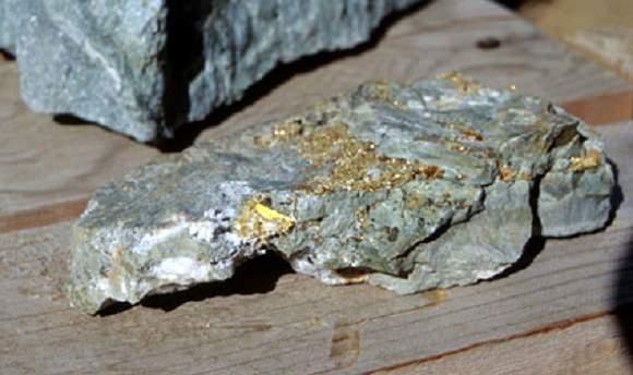
The growing importance of mining in the 17th and 18th centuries, particularly for precious metals, led to further developments in geology and Earth sciences. Credit: minerals.usgs.gov

The development of modern mining techniques and growing attention to the importance of minerals and their natural distribution also helped to spur the development of modern geology. In 1774, German geologist Abraham Gottlob Werner published Von den äusserlichen Kennzeichen der Fossilien (On the External Characters of Minerals) which presented a detailed system for identifying specific minerals based on external characteristics.

In 1741, the National Museum of Natural History in France created the first teaching position designated specifically for geology. This was an important step in further promoting knowledge of geology as a science and in recognizing the value of widely disseminating such knowledge. And by 1751, with the publication of the Encyclopédie by Denis Diderot, the term “geology” became an accepted term.

By the 1770s, chemistry was starting to play a pivotal role in the theoretical foundation of geology, and theories began to emerge about how the Earth’s layers were formed. One popular idea had it that liquid inundation, like the Biblical Deluge, was responsible for creating all the geological strata. Those who accepted this theory became known popularly as the Diluvianists or Neptunists.

Another thesis slowly gained currency from the 1780s forward, which stated that instead of water, strata had been formed through heat (or fire). Those who followed this theory during the early 19th century referred to this view as Plutonism, which held that the Earth formed gradually through the solidification of molten masses at a slow rate. These theories together led to the conclusion that the Earth was immeasurably older than suggested by the Bible.

HMS Beagle in the Galapagos (painted by John Chancellor) - Credit: hmsbeagleproject.otg
HMS Beagle in the Galapagos Islands, painted by John Chancellor. Credit: hmsbeagleproject.otg

In the early 19th century, the mining industry and Industrial Revolution stimulated the rapid development of the concept of the stratigraphic column – that rock formations were arranged according to their order of formation in time. Concurrently, geologists and natural scientists began to understand that the age of fossils could be determined geologically (i.e. that the deeper the layer they were found in was from the surface, the older they were).

During the imperial period of the 19th century, European scientists also had the opportunity to conduct research in distant lands. One such individual was Charles Darwin, who had been recruited by Captain FitzRoy of the HMS Beagle to study the coastal land of South America and give geological advice.

Darwin’s discovery of giant fossils during the voyage helped to establish his reputation as a geologist, and his theorizing about the causes of their extinction led to his theory of evolution by natural selection, published in On the Origin of Species in 1859.

During the 19th century, the governments of several countries including Canada, Australia, Great Britain and the United States began funding geological surveys that would produce geological maps of vast areas of the countries. Thought largely motivated by territorial ambitions and resource exploitation, they did benefit the study of geology.

The Earth's Tectonic Plates. Credit: msnucleus.org
The Earth’s Tectonic Plates. Credit: msnucleus.org

By this time, the scientific consensus established the age of the Earth in terms of millions of years, and the increase in funding and the development of improved methods and technology helped geology to move farther away from dogmatic notions of the Earth’s age and structure.

By the early 20th century, the development of radiometric dating (which is used to determine the age of minerals and rocks), provided the necessary the data to begin getting a sense of the Earth’s true age. By the turn of the century, geologists now believed the Earth to be 2 billion years old, which opened doors for theories of continental movement during this vast amount of time.

In 1912, Alfred Wegener proposed the theory of Continental Drift, which suggested that the continents were joined together at a certain time in the past and formed a single landmass known as Pangaea. In accordance with this theory, the shapes of continents and matching coastline geology between some continents indicated they were once attached together.
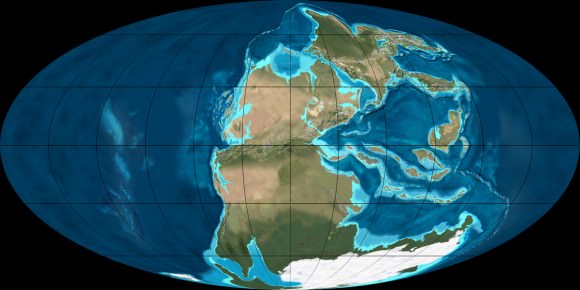
The super-continent Pangea during the Permian period (300 - 250 million years ago). Credit: NAU Geology/Ron Blakey
The super-continent Pangea during the Permian period (300 – 250 million years ago). Credit: NAU Geology/Ron Blakey

Research into the ocean floor also led directly to the theory of Plate Tectonics, which provided the mechanism for Continental Drift. Geophysical evidence suggested lateral motion of continents and that oceanic crust is younger than continental crust. This geophysical evidence also spurred the hypothesis of paleomagnetism, the record of the orientation of the Earth’s magnetic field recorded in magnetic minerals.

Then there was the development of seismology, the study of earthquakes and the propagation of elastic waves through the Earth or through other planet-like bodies, in the early 20th century. By measuring the time of travel of refracted and reflected seismic waves, scientists were able to gradually infer how the Earth was layered and what lay deeper at its core.

For example, in 1910, Harry Fielding Ried put forward the “elastic rebound theory”, based on his studies of the 1906 San Fransisco earthquake. This theory, which stated that earthquakes occur when accumulated energy is released along a fault line, was the first scientific explanation for why earthquakes happen, and remains the foundation for modern tectonic studies.

Earth viewed from the Moon by the Apollo 11 spacecraft. Credit: NASA

Then in 1926, English scientist Harold Jeffreys claimed that below the crust, the core of the Earth is liquid, based on his study of earthquake waves. And then in 1937, Danish seismologist Inge Lehmann went a step further and determined that within the earth’s liquid outer core, there is a solid inner core.

By the latter half of the 20th century, scientists developed a comprehensive theory of the Earth’s structure and dynamics had formed. As the century played out, perspectives shifted to a more integrative approach, where geology and Earth sciences began to include the study of the Earth’s internal structure, atmosphere, biosphere and hydrosphere into one.

This was assisted by the development of space flight, which allowed for Earth’s atmosphere to be studied in detail, as well as photographs taken of Earth from space. In 1972, the Landsat Program, a series of satellite missions jointly managed by NASA and the U.S. Geological Survey, began supplying satellite images that provided geologically detailed maps, and have been used to predict natural disasters and plate shifts.

Earth’s Layers:

The Earth can be divided into one of two ways – mechanically or chemically. Mechanically – or rheologically, meaning the study of liquid states – it can be divided into the lithosphere, asthenosphere, mesospheric mantle, outer core, and the inner core. But chemically, which is the more popular of the two, it can be divided into the crust, the mantle (which can be subdivided into the upper and lower mantle), and the core – which can also be subdivided into the outer core, and inner core.

The inner core is solid, the outer core is liquid, and the mantle is solid/plastic. This is due to the relative melting points of the different layers (nickel–iron core, silicate crust and mantle) and the increase in temperature and pressure as depth increases. At the surface, the nickel-iron alloys and silicates are cool enough to be solid. In the upper mantle, the silicates are generally solid but localized regions of melt exist, leading to limited viscosity.

In contrast, the lower mantle is under tremendous pressure and therefore has a lower viscosity than the upper mantle. The metallic nickel–iron outer core is liquid because of the high temperature. However, the intense pressure, which increases towards the inner core, dramatically changes the melting point of the nickel–iron, making it solid.

The differentiation between these layers is due to processes that took place during the early stages of Earth’s formation (ca. 4.5 billion years ago). At this time, melting would have caused denser substances to sink toward the center while less-dense materials would have migrated to the crust. The core is thus believed to largely be composed of iron, along with nickel and some lighter elements, whereas less dense elements migrated to the surface along with silicate rock.

Earth’s Crust:

The crust is the outermost layer of the planet, the cooled and hardened part of the Earth that ranges in depth from approximately 5-70 km (~3-44 miles). This layer makes up only 1% of the entire volume of the Earth, though it makes up the entire surface (the continents and the ocean floor).
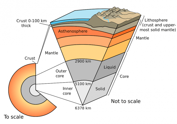
The Earth's layers (strata) shown to scale. Credit: pubs.usgs.gov
The Earth’s layers (strata) shown to scale. Credit: pubs.usgs.gov

The thinner parts are the oceanic crust, which underlies the ocean basins at a depth of 5-10 km (~3-6 miles), while the thicker crust is the continental crust. Whereas the oceanic crust is composed of dense material such as iron magnesium silicate igneous rocks (like basalt), the continental crust is less dense and composed of sodium potassium aluminum silicate rocks, like granite.

The uppermost section of the mantle (see below), together with the crust, constitutes the lithosphere – an irregular layer with a maximum thickness of perhaps 200 km (120 mi). Many rocks now making up Earth’s crust formed less than 100 million (1×10⁸) years ago. However, the oldest known mineral grains are 4.4 billion (4.4×10⁹) years old, indicating that Earth has had a solid crust for at least that long.

Upper Mantle:

The mantle, which makes up about 84% of Earth’s volume, is predominantly solid, but behaves as a very viscous fluid in geological time. The upper mantle, which starts at the “Mohorovicic Discontinuity” (aka. the “Moho” – the base of the crust) extends from a depth of 7 to 35 km (4.3 to 21.7 mi) downwards to a depth of 410 km (250 mi). The uppermost mantle and the overlying crust form the lithosphere, which is relatively rigid at the top but becomes noticeably more plastic beneath.

Compared to other strata, much is known about the upper mantle, thanks to seismic studies and direct investigations using mineralogical and geological surveys. Movement in the mantle (i.e. convection) is expressed at the surface through the motions of tectonic plates. Driven by heat from deeper in the interior, this process is responsible for Continental Drift, earthquakes, the formation of mountain chains, and a number of other geological processes.

Computer simulation of the Earth's field in a period of normal polarity between reversals.[1] The lines represent magnetic field lines, blue when the field points towards the center and yellow when away. The rotation axis of the Earth is centered and vertical. The dense clusters of lines are within the Earth's core
Computer simulation of the Earth’s field in a period of normal polarity between reversals.  Credit: science.nasa.gov
The mantle is also chemically distinct from the crust, in addition to being different in terms of rock types and seismic characteristics. This is due in large part to the fact that the crust is made up of solidified products derived from the mantle, where the mantle material is partially melted and viscous. This causes incompatible elements to separate from the mantle, with less dense material floating upward and solidifying at the surface.

The crystallized melt products near the surface, upon which we live, are typically known to have a lower magnesium to iron ratio and a higher proportion of silicon and aluminum. These changes in mineralogy may influence mantle convection, as they result in density changes and as they may absorb or release latent heat as well.

In the upper mantle, temperatures range between 500 to 900 °C (932 to 1,652 °F). Between the upper and lower mantle, there is also what is known as the transition zone, which ranges in depth from 410-660 km (250-410 miles).

Lower Mantle:

The lower mantle lies between 660-2,891 km (410-1,796 miles) in depth. Temperatures in this region of the planet can reach over 4,000 °C (7,230 °F) at the boundary with the core, vastly exceeding the melting points of mantle rocks. However, due to the enormous pressure exerted on the mantle, viscosity and melting are very limited compared to the upper mantle. Very little is known about the lower mantle apart from that it appears to be relatively seismically homogeneous.

The internal structure of Earth. Credit: Wikipedia Commons/Kelvinsong

Outer Core:

The outer core, which has been confirmed to be liquid (based on seismic investigations), is 2300 km thick, extending to a radius of ~3,400 km. In this region, the density is estimated to be much higher than the mantle or crust, ranging between 9,900 and 12,200 kg/m3. The outer core is believed to be composed of 80% iron, along with nickel and some other lighter elements.

Denser elements, like lead and uranium, are either too rare to be significant or tend to bind to lighter elements and thus remain in the crust. The outer core is not under enough pressure to be solid, so it is liquid even though it has a composition similar to that of the inner core. The temperature of the outer core ranges from 4,300 K (4,030 °C; 7,280 °F) in the outer regions to 6,000 K (5,730 °C; 10,340 °F) closest to the inner core.

Because of its high temperature, the outer core exists in a low viscosity fluid-state that undergoes turbulent convection and rotates faster than the rest of the planet. This causes eddy currents to form in the fluid core, which in turn creates a dynamo effect that is believed to influence Earth’s magnetic field. The average magnetic field strength in Earth’s outer core is estimated to be 25 Gauss (2.5 mT), which is 50 times the strength of the magnetic field measured on Earth’s surface.

Inner Core:

Like the outer core, the inner core is composed primarily of iron and nickel and has a radius of ~1,220 km. Density in the core ranges between 12,600-13,000 kg/m³, which suggests that there must also be a great deal of heavy elements there as well – such as gold, platinum, palladium, silver and tungsten.
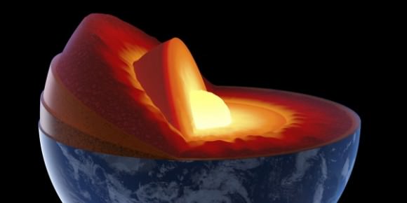
Artist’s illustration of Earht's core via Huff Post Science
Artist’s illustration of Earth’s core, inner core, and inner-inner core. Credit: Huff Post Science

The temperature of the inner core is estimated to be about 5,700 K (~5,400 °C; 9,800 °F). The only reason why iron and other heavy metals can be solid at such high temperatures is because their melting temperatures dramatically increase at the pressures present there, which ranges from about 330 to 360 gigapascals.

Because the inner core is not rigidly connected to the Earth’s solid mantle, the possibility that it rotates slightly faster or slower than the rest of Earth has long been considered. By observing changes in seismic waves as they passed through the core over the course of many decades, scientists estimate that the inner core rotates at a rate of one degree faster than the surface. More recent geophysical estimates place the rate of rotation between 0.3 to 0.5 degrees per year relative to the surface.

Recent discoveries also suggest that the solid inner core itself is composed of layers, separated by a transition zone about 250 to 400 km thick. This new view of the inner core, which contains an inner-inner core, posits that the innermost layer of the core measures 1,180 km (733 miles) in diameter, making it less than half the size of the inner core. It has been further speculated that while the core is composed of iron, it may be in a different crystalline structure that the rest of the inner core.

What’s more, recent studies have led geologists to conjecture that the dynamics of deep interior is driving the Earth’s inner core to expand at the rate of about 1 millimeter a year. This occurs mostly because the inner core cannot dissolve the same amount of light elements as the outer core.

The freezing of liquid iron into crystalline form at the inner core boundary produces residual liquid that contains more light elements than the overlying liquid. This in turn is believed to cause the liquid elements to become buoyant, helping to drive convection in the outer core. This growth is therefore likely to play an important role in the generation of Earth’s magnetic field by dynamo action in the liquid outer core. It also means that the Earth’s inner core, and the processes that drive it, are far more complex than previously thought!

Yes indeed, the Earth is a strange and mysteries place, titanic in scale as well as the amount of heat and energy that went into making it many billions of years ago. And like all bodies in our universe, the Earth is not a finished product, but a dynamic entity that is subject to constant change. And what we know about our world is still subject to theory and guesswork, given that we can’t examine its interior up close.

As the Earth’s tectonic plates continue to drift and collide, its interior continues to undergo convection, and its core continues to grow, who knows what it will look like eons from now? After all, the Earth was here long before we were, and will likely continue to be long after we are gone.

We have written many articles about Earth for Universe Today. Here’s are some Interesting Facts about Earth, and here’s one about the Earth’s inner inner core, and another about how minerals stop transferring heat at the core.

Want more resources on the Earth? Here’s a link to NASA’s Human Spaceflight page, and here’s NASA’s Visible Earth.

If you’d like more info on Earth, check out NASA’s Solar System Exploration Guide on Earth. And here’s a link to NASA’s Earth Observatory.

We’ve also recorded an episode of Astronomy Cast all about Earth. Listen here, Episode 51: Earth.

What is the Pacific “Ring of Fire”?

Sarychev volcano, (located in Russia's Kuril Islands, northeast of Japan) in an early stage of eruption on June 12, 2009. Credit: NASA

What if someone were to tell you that there’s a region in the world where roughly 90% of the world’s earthquakes occur. What if they were to tell you that this region is also home to over 75% of the world’s active and dormant volcanoes, and all but 3 of the world’s 25 largest eruptions in the last 11,700 years took place here.

Chances are, you’d think twice about buying real-estate there. But strangely enough, hundreds of millions of people live in this area, and some of the most densely-packed cities in the world have been built atop its shaky faults. We are talking about the Pacific Ring of Fire, a geologically and volcanically active region that stretches from one side of the Pacific to the other.

Definition:

Also known as the circum-Pacific belt, the “Ring of Fire” is a 40,000 km (25,000 mile) horseshoe-shaped basin that is associated with a nearly continuous series of oceanic trenches, volcanic arcs, and volcanic belts and/or plate movements. This ring accounts for 452 volcanoes (active and dormant), stretching from the southern tip of South America, up along the coast of North America, across the Bering Strait, down through Japan, and into New Zealand – with several active and dormant volcanoes in Antarctica closing the ring.

Tectonic Activity:

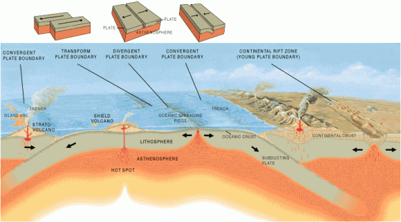
The Ring of Fire is the direct result of plate tectonics and the movement and collisions of lithospheric plates. These plates, which constitute the outer layer of the planet, are constantly in motion atop the mantle. Sometimes they collide, pull apart, or slide alongside each other; resulting in convergent boundaries, divergent boundaries, and transform boundaries.

The Pacific Ring of Fire, a string of volcanic regions extending from the South Pacific to South America. Credit: Public Domain

In the case of the former, subduction zones are often the result, where the heavier plate slips under the lighter plate – forming a deep trench. This subduction changes the dense mantle into buoyant magma, which rises through the crust to the Earth’s surface. Over millions of years, this rising magma creates a series of active volcanoes known as a volcanic arc.

These ocean trenches and volcanic arcs run parallel to one another. For instance, the Aleutian Islands in the U.S. state of Alaska run parallel to the Aleutian Trench. Both geographic features continue to form as the Pacific Plate subducts beneath the North American Plate. Meanwhile, the Andes Mountains of South America run parallel to the Peru-Chile Trench, created as the Nazca Plate subducts beneath the South American Plate.

In the case of divergent boundaries, these are formed when tectonic plates pull apart, forming rift valleys on the seafloor. When this happens, magma wells up in the rift as the old crust pulls itself in opposite directions, where it is cooled by seawater to form new crust. This upward movement and eventual cooling of this magma has created high ridges on the ocean floor over millions of years.

The East Pacific Rise is a site of major seafloor spreading in the Ring of Fire, located on the divergent boundary of the Pacific Plate and the Cocos Plate (west of Central America), the Nazca Plate (west of South America), and the Antarctic Plate. The largest known group of volcanoes on Earth is found underwater along the portion of the East Pacific Rise between the coasts of northern Chile and southern Peru.

Transform Plate Boundary
The different type of tectonic plate boundaries. Credit: oceanexplorer.noaa.gov

A transform boundary is formed when tectonic plates slide horizontally and parts get stuck at points of contact. Stress builds in these areas as the rest of the plates continue to move, which causes the rock to break or slip, suddenly lurching the plates forward and causing earthquakes. These areas of breakage or slippage are called faults, and the majority of Earth’s faults can be found along transform boundaries in the Ring of Fire.

The San Andreas Fault, stretching along the central west coast of North America, is one of the most active faults on the Ring of Fire. It lies on the transform boundary between the North American Plate, which is moving south, and the Pacific Plate, which is moving north. Measuring about 1,287 kilometers (800 miles) long and 16 kilometers (10 miles) deep, the fault cuts through the western part of the U.S. state of California.

Plate Boundaries:

The eastern section of the Ring of Fire is the result of the Nazca Plate and the Cocos Plate being subducted beneath the westward moving South American Plate. Meanwhile, the Cocos Plate is being subducted beneath the Caribbean Plate, in Central America. A portion of the Pacific Plate along with the small Juan de Fuca Plate are being subducted beneath the North American Plate.

Along the northern portion, the northwestward-moving Pacific plate is being subducted beneath the Aleutian Islands arc. Farther west, the Pacific plate is being subducted along the Kamchatka Peninsula arcs on south past Japan.

The Earth's Tectonic Plates. Credit: msnucleus.org
The Earth’s Tectonic Plates. Credit: msnucleus.org

The southern portion is more complex, with a number of smaller tectonic plates in collision with the Pacific plate from the Mariana Islands, the Philippines, Bougainville, Tonga, and New Zealand. This portion excludes Australia, since it lies in the center of its tectonic plate.

Indonesia lies between the Ring of Fire along the northeastern islands adjacent to and including New Guinea and the Alpide belt along the south and west from Sumatra, Java, Bali, Flores, and Timor. The famous and very active San Andreas Fault zone of California is a transform fault which offsets a portion of the East Pacific Rise under southwestern United States and Mexico.

Volcanic Activity:

Most of the active volcanoes on The Ring of Fire are found on its western edge, from the Kamchatka Peninsula in Russia, through the islands of Japan and Southeast Asia, to New Zealand. Mount Ruapehu in New Zealand is one of the more active volcanoes in the Ring of Fire, with yearly minor eruptions, and major eruptions occurring about every 50 years.

Krakatau, perhaps better known as Krakatoa, is an island volcano in Indonesia. Krakatoa erupts less often than Mount Ruapehu, but much more spectacularly. Beneath Krakatoa, the denser Australian Plate is being subducted beneath the Eurasian Plate. An infamous eruption in 1883 destroyed the entire island, sending volcanic gas, volcanic ash, and rocks as high as 80 kilometers (50 miles) in the air. A new island volcano, Anak Krakatau, has been forming with minor eruptions ever since.

Mount Fuji, Japan
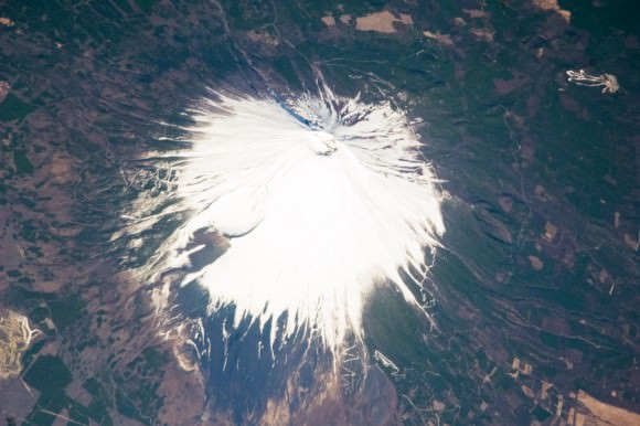
Mount Fuji, Japan, as seen from the ISS. Credit: NASA

Mount Fuji, Japan’s tallest and most famous mountain, is an active volcano in the Ring of Fire. Mount Fuji last erupted in 1707, but recent earthquake activity in eastern Japan may have put the volcano in a “critical state.” Mount Fuji sits at a “triple junction,” where three tectonic plates (the Amur Plate, Okhotsk Plate, and Philippine Plate) interact.

The Ring of Fire’s eastern half also has a number of active volcanic areas, including the Aleutian Islands, the Cascade Mountains in the western U.S., the Trans-Mexican Volcanic Belt, and the Andes Mountains. Mount St. Helens, in the U.S. state of Washington, is an active volcano in the Cascade Mountains.

Below Mount St. Helens, both the Juan de Fuca and Pacific plates are being subducted beneath the North American Plate. Its historic 1980 eruption lasted 9 hours and covered 11 U.S. states with tons of volcanic ash. The eruption caused the deaths of 57 people, over a billion dollars in property damage, and reduced hundreds of square miles to wasteland.

Popocatépetl is one of the most active and dangerous volcanoes in the Ring of Fire, with 15 recorded eruptions since 1519.  The volcano lies on the Trans-Mexican Volcanic Belt, which is the result of the small Cocos Plate subducting beneath the North American Plate. Located close to the urban areas of Mexico City and Puebla, Popocatépetl poses a risk to the more than 20 million people that live close enough to be threatened by a destructive eruption.

Map of the Earth showing fault lines (blue) and zones of volcanic activity (red). Credit: zmescience.com
Map of the Earth showing the relation between fault lines (blue) and zones of volcanic activity (red). Credit: zmescience.com

Earthquakes:

Scientists have known for some time that the majority of the seismic activity occurs along plate boundaries. Hence why roughly 90% of the world’s earthquakes – which is estimated to be around 500,000 a year, one-fifth of which are detectable – occur around the Pacific Rim, where multiple plate boundaries exist.

As a result, earthquakes are a regular occurrence in places like Japan, Indonesia and New Zealand in Asia and the South Pacific; Alaska, British Columbia, California and Mexico in North America; and El Salvador, Guatemala, Peru and Chile in Central and South America. Where fault lines run beneath the ocean, larger earthquakes in these regions also trigger tsunamis.

The most well-known tsumanis to take place in the Ring of Fire include the 2004 Indian Ocean earthquake and tsunami. This was the most devastating tsunami of its kind in modern times, killing around 230,000 people and laying waste to communities throughout Indonesia, Thailand, and Southern Asia.

In 2010, an earthquake triggered a tsunami which caused 4334 confirmed deaths and devastating several coastal towns in south-central Chile, including the port at Talcahuano. The earthquake also generated a blackout that affected 93 percent of the Chilean population.

In 2011, an earthquake off the Pacific coast of Tohoku led to a tsunami that struck Japan and led to 5,891 deaths, 6,152 injuries, and 2,584 people to be declared missing across twenty prefectures. The tsunami also caused meltdowns at three reactors in the Fukushima Daiichi Nuclear Power Plant complex.

The Ring of Fire is a crucial region for many reasons. It serves as one of the main boundary regions for the tectonic plates of over half of the globe. It also affects the lives of millions if not billions of people who live in these regions. For many of the people who live in the Pacific Ring of Fire, the reality of a volcanic eruption or earthquake is commonplace and a challenge they have come to deal with over time.

At the same time, the volcanic activity has also provided many valuable resources, such as rich farmland and the possibility of tapping geothermal activity for heating and electricity. As always, nature gives with one hand and takes with the other!

If you have enjoyed this article there are several others on Universe Today that you will find interesting. Here is one called 10 Interesting Facts About Volcanoes. There is also a great article about plate tectonics.

You can also find some good resources online. There is a companion site for the PBS program Savage Earth that talks about the Ring of Fire. You can also check out the USGS site to see a detailed map of the Pacific Ring of Fire and more detailed information about plate tectonics.

You can also listen to Astronomy Cast. Episode 141 talks about volcanoes.

Moroccan Meteorite May Be a 4.4-Billion-Year-Old Chunk of Dark Martian Crust

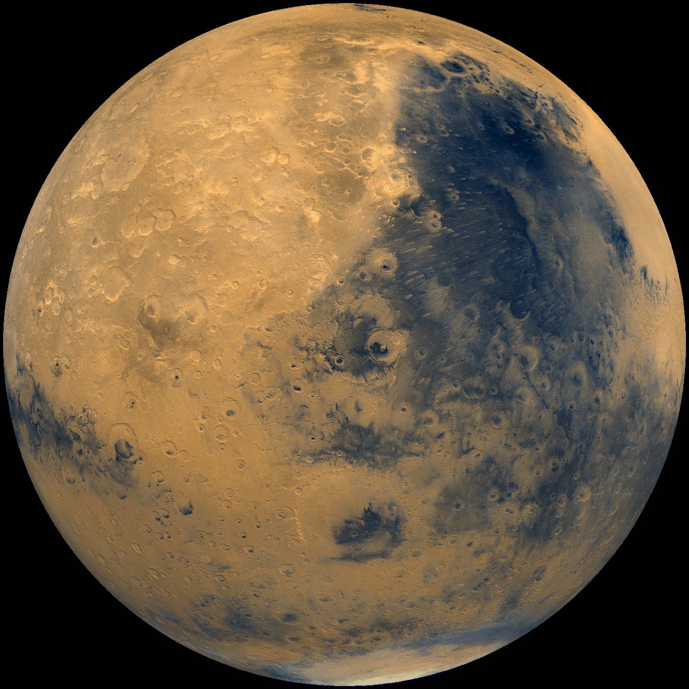
Mars! Martian meteorites make their way to Earth after being ejected from Mars by a meteor impact on the Red Planet. Image: NASA/National Space Science Data Center.

Mars is often referred to as the Red Planet. But its signature color is only skin-deep – or, I should say, dust-deep. Beneath its rusty regolith Mars has many other hues and shades as well, from pale greys like those found inside holes drilled by Curiosity to large dark regions that are the result of ancient lava flows. Now, researchers think we may have an actual piece of one of Mars’ dark plains here on Earth in the form of a meteorite that was found in the Moroccan desert in 2011.

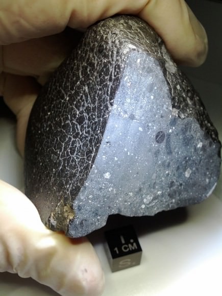
Mars meteorite NWA 7034 (NASA)

Classified as NWA 7034 (for Northwest Africa) the meteorite is a 320-gram (11 oz.) piece of Martian basaltic breccia made up of small fragments cemented together in a dark matrix. Nicknamed “Black Beauty,” NWA 7034 is one of the oldest meteorites ever discovered and is like nothing else ever found on Earth.

According to a new study on a fragment of the meteorite by researchers from Brown University in Providence, Rhode Island and the University of New Mexico, Black Beauty is a 4.4-billion-year-old chunk of Mars’ dark crust – the only known piece of such to have landed on Earth.

While other meteorites originating from Mars have been identified, they are of entirely different types than Black Beauty.

The researchers used a hyperspectral imaging technique to obtain data from across the whole fragment. In doing this, the measurements matched what’s been detected from Mars orbit by NASA’s Mars Reconnaissance Orbiter.

“Other techniques give us measurements of a dime-sized spot,” said Kevin Cannon, a Brown University graduate student and lead author of a new paper published in the journal Icarus. “What we wanted to do was get an average for the entire sample. That overall measurement was what ended up matching the orbital data.”

In addition to indicating a truly ancient piece of another planet, these findings hint at what the surface of many parts of Mars might be like just below the rusty soil… a surface that’s been shattered and reassembled many times by meteorite impacts.

“This is showing that if you went to Mars and picked up a chunk of crust, you’d expect it to be heavily beat up, battered, broken apart and put back together,” Cannon said.

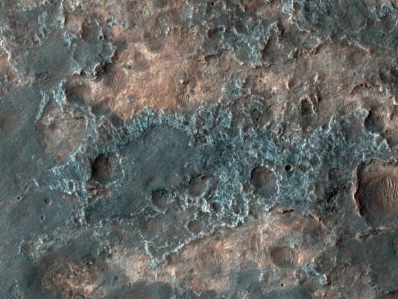
HiRISE image of dark terrain near Ganges Chasma (NASA/JPL/University of Arizona)

Source/read more at Brown University news.

Solar System History: How Was the Earth Formed?

Winter Solstice
Earth as viewed from the cabin of the Apollo 11 spacecraft. Credit: NASA

Just how did the Earth — our home and the place where life as we know it evolved — come to be created in the first place? In some fiery furnace atop a great mountain? On some divine forge with the hammer of the gods shaping it out of pure ether? How about from a great ocean known as Chaos, where something was created out of nothing and then filled with all living creatures?

If any of those accounts sound familiar, they are some of the ancient legends that have been handed down through the years that attempt to describe how our world came to be. And interestingly enough, some of these ancient creation stories contain an element of scientific fact to them.

Continue reading “Solar System History: How Was the Earth Formed?”

Making the Moon: The Practice Crater Fields of Flagstaff, Arizona

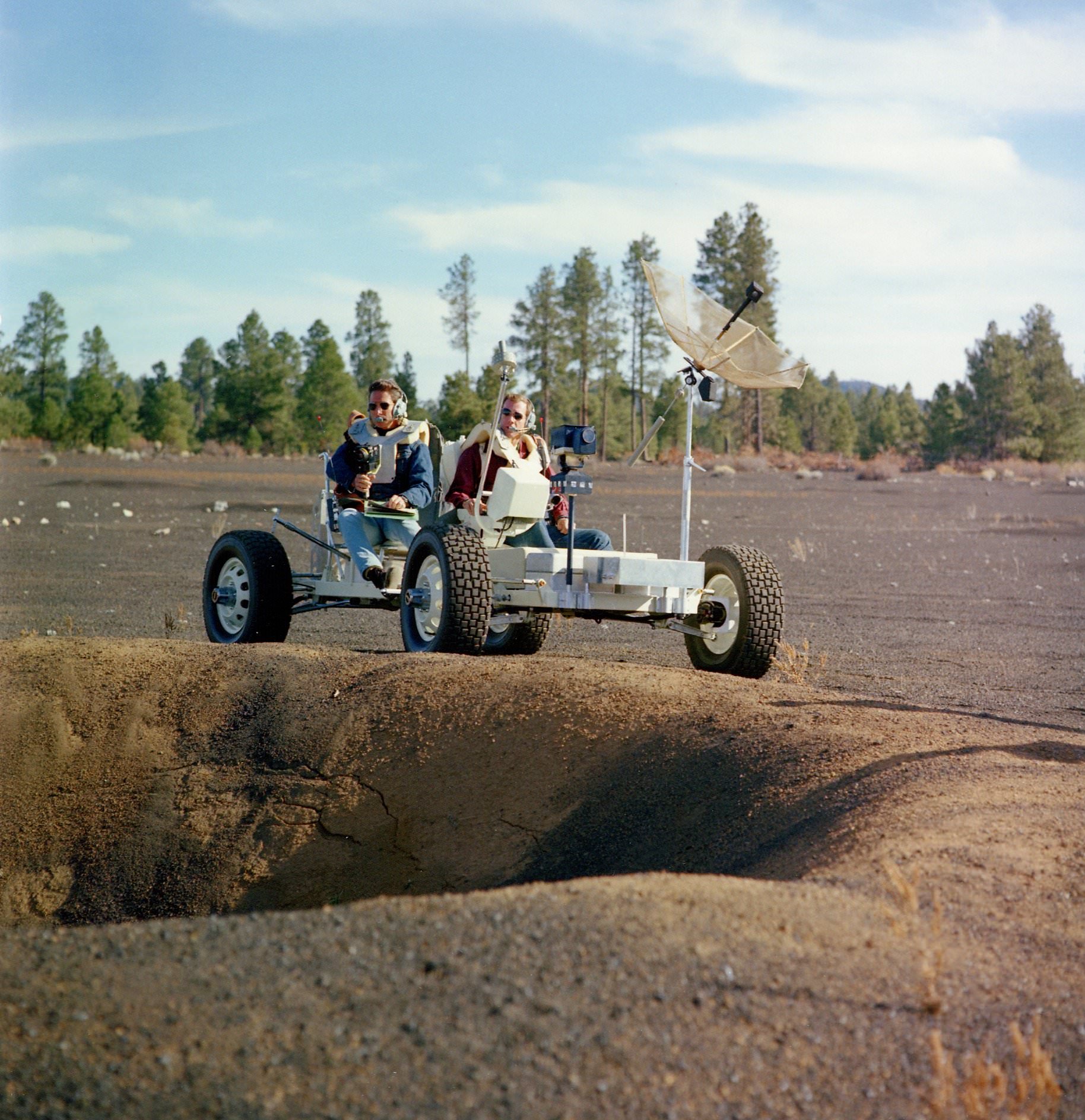
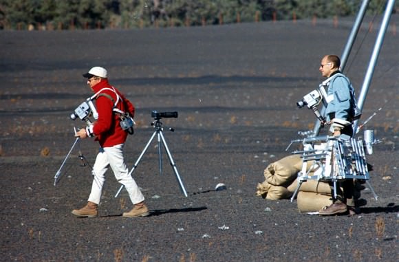
Apollo 15 astronauts David Scott and James Irwin practice LRV operations in Arizona, Nov. 2 1970 (Credit: NASA. Research by J.L. Pickering)

Between the years of 1969 and 1972 the astronauts of the Apollo missions personally explored the alien landscape of the lunar surface, shuffling, bounding, digging, and roving across six sites on the Moon. In order to prepare for their off-world adventures though, they needed to practice extensively here on Earth so they would be ready to execute the long laundry lists of activities they were required to accomplish during their lunar EVAs. But where on Earth could they find the type of landscape that resembles the Moon’s rugged, dusty, and — most importantly — cratered terrain?

Enter the Cinder Lakes Crater Fields of Flagstaff, Arizona.

The Cinder Lakes Crater Fields northeast of Flagstaff, near the famous San Francisco peaks and just south of the Sunset Crater volcano, were used for Apollo-era training because of the inherently lunar-like volcanic landscape. LRV practice as well as hand tool geology and lunar morphology training were performed there, as well as ALSEP – Apollo Lunar Surface Experiment Package – placement and setup practice.

The photo above shows Apollo 15 astronauts Dave Scott and Jim Irwin driving a test LRV nicknamed Grover along the rim of a small “lunar crater.” (This particular exercise was performed on Nov. 2, 1970… 44 years ago today!)

Detonation of a "lunar crater" in 1967 (USGS)
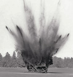
Detonation of a “lunar crater” in 1967 (USGS)

Although the craters might look similar to the ones found on the Moon, they were actually created by the USGS in 1967 by digging holes and filling them with various amounts of explosives, which were detonated to simulate different-sized lunar impact craters. The human-made craters ranged in size from 5-40 feet (1.5-12 meters) in diameter.

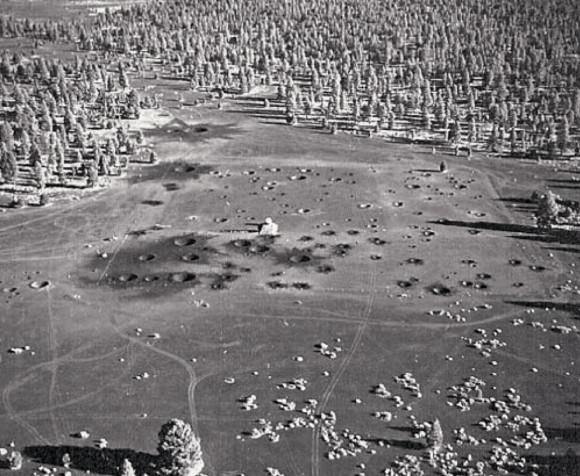
The two crater field sites at Cinder Lakes were chosen because of the specific surface geology: a layer of basaltic cinders covering clay beds, left over from an eruption of the Sunset Crater volcano 950 years ago. After the explosions the excavated lighter clay material spread out from the blast craters and across the fields, like ejecta from actual meteorite impacts. A total of 497 craters were made within two sites comprising 2,000 square feet.

Detonations were done in series to simulate ejected debris from cratering events of different ages. And one of the areas of Cinder Lakes was designed to specifically replicate craters found within a particular region of the Apollo 11 Mare Tranquillitatis landing site.

Watch a contemporary educational film from the USGS showing the crater field detonations here. (HT to spaceflight archivist David S. F. Portree for the link.)

The completed Cinder Lakes Crater Field #1 in October 1967 (USGS)

Today only the largest craters can be distinguished at all in the publicly-accessible Cinder Lakes field, which has become popular with ATV enthusiasts. But a smaller field, fenced off to vehicles, still contains many of the original craters used by Apollo astronauts, softened by time and weather but still visible.

A couple of other areas were used as lunar analogue training fields as well, such as the nearby Merriam Crater and Black Canyon fields — the latter of which is now covered by a housing development. Geology field training exercises by Apollo astronauts were also performed at locations in Texas, New Mexico, Nevada, Oregon, Alaska, Idaho, Iceland, Mexico, the Grand Canyon, and the lava fields of Hawaii. But only in Arizona were actual craters made to specifically simulate the Moon!

Read more about the Cinder Lakes Crater Field in a presentation document (my main article source) by LPI’s Dr. David Kring, and you can find more recent photos of the Crater Lakes sites on this page by LPI’s Jim Scotti.

Top photo research: J.L. Pickering. Source: The Project Apollo Image Archive. 

Apollo 12 astronauts Pete Conrad and Alan Bean during geology training at Cinder Lakes on October 10, 1969 (NASA)

Selling Rocks from Outer Space: an Interview with ‘Meteorite Man’ Geoff Notkin

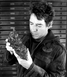
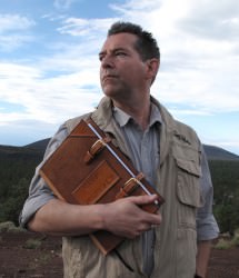
Geoff Notkin at Aerolite Meteorites in Tucson, AZ. (© Geoff Notkin. Used with permission.)

What’s the oldest thing you’ve ever held in your hand? A piece of petrified wood? A fossilized trilobite? A chunk of glacier-carved granite? Those are some pretty old things, sure, but there are even older objects to be found across the world… that came from out of this world. And thanks to “Meteorite Men” co-host, author, and educator Geoff Notkin and his company Aerolite Meteorites, you can own a truly ancient piece of the Solar System that can date back over 4.5 billion years.

Founded in 2005, Aerolite (which is an archaic term for meteorite) offers many different varieties of meteorites for sale, from gorgeous specimens worthy of a world-class museum to smaller fragments that you could proudly — and economically — display on your desk. Recently I had the opportunity to talk in depth with Geoff about Aerolite and his life’s work as a meteorite collector and dealer. Here are some of the fascinating things he had to say…

Geoff holds one of his found meteorites (© Geoff Notkin)
“I promised myself as a kid that one day I would have an actual meteorite.” (© Geoffrey Notkin)

So Geoff, what initially got you interested in meteorites and finding them for yourself?

“It’s been a lifelong passion for me, but I’m lucky in that I can really put my finger on a specific event when I was a kid and that was my mother taking me to the Geological Museum in London when I was six or seven… I was already a rock hound, I loved collecting fossils, and my dad was a very keen amateur astronomer. And so I had this love of astronomy and this fascination with other worlds for as long as I can remember. I’m a very tactile person; I’m very hands-on. I like to know how things work… I want to know all the bits and pieces. I was frustrated a bit, because I wanted to know more about astronomy. I could see all these planets and places through the ‘scope, but I couldn’t touch them. But I could touch rocks and fossils.

“So I’m six or seven years old, and I’m on the second floor of the Museum in the Hall of Rocks and Minerals. And at the back was this small display area that’s very dark. And you walked through an arch, it’s almost like walking into a cave. And it was very low light back there, and that was the meteorite collection.

“There were a couple of large meteorites on stands, and in those days — it was the late 60s — security wasn’t the issue that it is today. So you could touch the big specimens, and so I put my hands on these giant meteorites and I was absolutely enthralled.  And I had this sort of epiphany: meteorites were the locus between my two interests, astronomy and rock-hounding. Because they’re rocks… they’re rock samples from outer space. I promised myself as a kid that one day I would have an actual meteorite.

“By finding or owning meteorites, you are forging a solid and tangible connection with astronomy.”

“Of course at the time there was no meteorite business, no meteorite magazines, there was no network of collectors like there is today. Back in the late 60s when I gave myself this challenge it was like saying I was going to start my own space program! But not only did it come true, it’s become my career.”

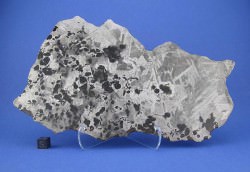
One of the meteorites offered at Aerolite.org (© Geoff Notkin)
One of the meteorites offered at Aerolite.org (© Geoffrey Notkin)

What makes Aerolite such a great place to buy meteorites?

“I think the caring for the subject matter really shows on the website. We have the best photography in the entire meteorite industry. I think we have the largest selection… we certainly spend a great deal of time discussing the history and importance of pieces… every single meteorite on our website has a detailed description and in most cases multiple photographs. My view is if you’re going to do something, you should really do it to the best of your ability. We don’t cut any corners, we don’t sell anything unless we’re one hundred percent sure of what it is and where it came from.

“I want buyers and visitors to look at the website and share my sense of wonder about meteorites. I think meteorites are the most wonderful things in existence, they’re actual visitors from outer space — they’re inanimate aliens that have landed on our planet.”

“We do this because we want to share our passion. We stand by every piece that we sell.”

How can people be sure they are getting actual meteorites (and not just funny-looking rocks?)

“This is something that’s more important to pay attention to now than ever. Are there fakes, are there shady people? Yes and yes. If you go on eBay at any given time you will find numerous pieces that are being offered for sale that are either not meteorites at all or are one thing being passed off as another thing. Sometimes this is malicious, sometimes people just don’t know any better. So the best way to buy a meteorite and know that it’s real is to buy from a respected dealer who has a solid history in the field.

“I’m by no means the only person who does this. There are a number of very well-established dealers around the world, and a good place to start is the International Meteorite Collectors Association (of which Geoff is a member) which is an international group with hundreds of members — collectors and dealers… it’s sort of a watchdog group that tries to maintain high standards of integrity in the field.

“My company has a very strict policy of never offering anything that’s questionable.”

“I see fakes all the time,” Geoff added. “On eBay, on websites, in newspaper ads… you do have to be careful. My company has a very strict policy of never offering anything that’s questionable. And we do get offered questionable things. There are some countries that have strict policies about exporting meteorites — Australia and Canada being two of them — and we work very closely with academia in both countries, and we have legally exported meteorites from those countries. Not only do we abide by international regulations, we actively support them.”

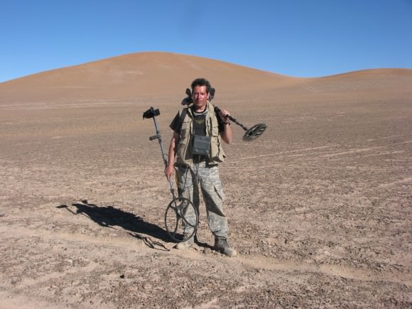
Geoff and some of his 'alien'-hunting gadgets in the  Chilean desert. (© Geoff Notkin)
Geoff and some of his ‘alien’-hunting gadgets in the Chilean desert. (© Geoffrey Notkin)

So you not only offer meteorites for sale to the general public, but you also donate to schools and museums.

“We work very closely with most of the world’s major meteorite institutions. I have provided specimens to the American Museum of Natural History in New York, the British Museum of Natural History in London, the Vienna Museum of Natural  History, the Center for Meteorite Studies… we work with almost everyone. When we find something that is new or different or exciting, we always donate a piece or pieces to our colleagues in academia. It’s just the right thing, it’s the right thing to do if you discover something important to make it available to science.

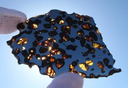
A sample of a beautiful, partially-translucent pallasite meteorite (© Geoff Notkin)
A sample of a beautiful, partially-translucent pallasite meteorite (© Geoffrey Notkin)

“Most universities and museums don’t have acquisitions budgets and can’t afford to buy things that they might like to have. In return they classify the meteorites that we found, and they go into the permanent literature and become more valuable as a result. A meteorite with a history and a name and classification is worth more than a random meteorite that somebody just found in a desert. So everybody benefits, it’s a really good match.”

In other words, you really are making a contribution to science as opposed to just “looting.”

“Exactly. And I have, a very few times, gotten emails from disgruntled viewers who didn’t understand what we were doing, saying ‘what makes you think it’s okay to come to Australia and take our meteorites,’ for example. So I wrote a very courteous email back saying that we were in Australia with the express permission and cooperation of the Australian park services and one of the senior park rangers was there with us. And not only did we follow the proper procedure in having those specimens exported from Australia, I donated rare meteorites to collections just as a ‘thank you’ for working with us. It wasn’t a trade, it was a thank you. So everywhere we go, whatever we do, we try and leave a good impression.”

Geoff added, “I do this out of love… this isn’t the best way to make a living! Being a meteorite hunter is probably not the best capital return on your time but it’s a very exciting and rewarding life in every other way.”

Geoff Notkin is also the host of STEM Journals, an educational show on COX 7 soon entering its third season (© Geoff Notkin)
Geoff Notkin is also the host of STEM Journals, an educational show on COX 7 soon entering its third season (© Geoffrey Notkin)

And thus, by buying meteorites from Aerolite, customers aren’t just helping pay for your expeditions and your work but also supporting research and education too.

“People who purchase from us are really participating in the growth of this science. Also, something very near and dear to my heart is science education for kids. You know that I am the host of an educational series called STEM Journals, which is a very — I think — amusing, entertaining, funny, fast-paced look at science, technology, engineering, and math topics. But you can’t make a living doing television shows like that. This is a labor of love… we do it because we think it’s important. If I didn’t have a commercial meteorite company to help underwrite the costs of educational programming and educational books, we just couldn’t do it. It’s as simple as that.

“So we always try to give back. That’s why I speak at schools and universities and give away meteorites to deserving kids at gem shows… because it was done to me when I was seven years old. The look of wonder you see on a kid’s face when you connect with them and they start to grasp the wonder of science… that’s something they’ll never forget.”

That’s great. And it sounds like you haven’t forgotten it yet either!

“I must say after all these years, I’ve been doing this close to full time for nearly twenty years and you never lose the amazement and the wonder of when a meteorite’s found or uncovered. I never go ‘oh, jeez, it’s just another billion-year-old space rock that fell to Earth!’ So it is a privilege to be in a work field where almost daily something wondrous happens.”

As we here at Universe Today know, when it concerns space that’s a common occurrence!

“Exactly!”

One last thing Geoff… do you think we’ll ever run out of meteorites?

“The meteorite collecting field has grown tremendously in the past ten years, and Meteorite Men is part of that. There is a finite supply of meteorites. Of course there are more landing all the time, but not enough to replenish the demand. Periodically there is a new very large discovery made, such as the Gebil Kamil iron in Egypt a couple of years ago. But what is happening is a significant increase in price and a decrease in selection, so some of the real staples we used to see… you can’t get them anymore.

“Still, people who want a meteorite collection, now is a great time for them to be buying because there are more meteorites available than in the past — but it’s not going to stay that way for very long. It’s like any other collectible that has a finite supply.”

Makes sense… I’ll take that as ‘inside advice’ to place an order soon!

______________

My thanks to Geoff for the chance to talk with him a little bit about his fascinating past, his passion, and his company. And as an added bonus to Universe Today readers, Geoff is extending a special 15% off on orders from Aerolite Meteorites — simply mention the code UNIVERSETODAY when you place an order!* (Trust me — once you browse through the site you’ll find something you want.) Also, if you’re in the Tucson area, Geoff Notkin and Aerolite Meteorites will have a table at the Tucson Gem and Mineral Show starting Jan. 31.

One of several meteorite-hunting books by Geoff, featuring an introduction by Neil Gaiman.

Be sure to check out Geoff’s television show STEM Journals on COX7 — the full first two seasons can be found online here and here, and shooting for the third season will be underway soon.

Want to know how to find “inanimate aliens” for yourself? You can find Geoff’s books on meteorite hunting here, as well as some of the right equipment for the job.

And don’t forget to follow Aerolite Meteorites and Geoff Notkin on Twitter!


*Sorry, the code isn’t valid for items already on sale or for select consignment items.

What Craters on the Moon Teach Us About Earth

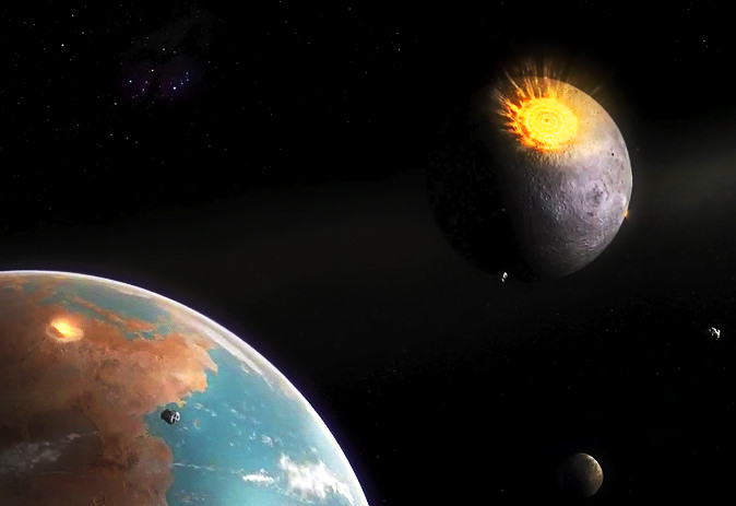
When the Moon was receiving its highest number of impacts, so was Earth. Credit: Dan Durda

Some questions about our own planet are best answered by looking someplace else entirely… in the case of impact craters and when, how and how often they were formed, that someplace can be found shining down on us nearly every night: our own companion in space, the Moon.

By studying lunar impact craters both young and old scientists can piece together the physical processes that took place during the violent moments of their creation, as well as determine how often Earth — a considerably bigger target — was experiencing similar events (and likely in much larger numbers as well.)

With no substantial atmosphere, no weather and no tectonic activity, the surface of the Moon is a veritable time capsule for events taking place in our region of the Solar System. While our constantly-evolving Earth tends to hide its past, the Moon gives up its secrets much more readily… which is why present and future lunar missions are so important to science.

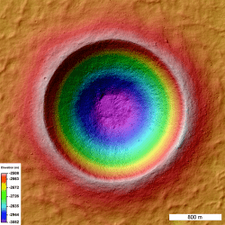
linne_shade_scalebTake the crater Linné, for example. A young, pristine lunar crater, the 2.2-km-wide Linné was formed less than 10 million years ago… much longer than humans have walked the Earth, yes, but very recently on lunar geologic terms.

It was once thought that the circular Linné (as well as other craters) is bowl-shaped, thus setting a precedent for the morphology of craters on the Moon and on Earth. But laser-mapping observations by NASA’s Lunar Reconnaissance Orbiter (at right) determined in early 2012 that that’s not the case; Linné is actually more of a truncated inverted cone, with a flattened interior floor surrounded by sloping walls that rise up over half a kilometer to its rim.

On our planet the erosive processes of wind, water, and earth soon distort the shapes of craters like Linné, wearing them down, filling them in and eventually hiding them from plain sight completely. But in the Moon’s airless environment where the only weathering comes from more impacts they retain their shape for much longer lengths of time, looking brand-new for many millions of years. By studying young craters in greater detail scientists are now able to better figure out just what happens when large objects strike the surface of worlds — events that can and do occur quite regularly in the Solar System, and which may have even allowed life to gain a foothold on Earth.

Most of the craters visible on the Moon today — Linné excluded, of course — are thought to have formed within a narrow period of time between 3.8 and 3.9 billion years ago. This period, called the Late Heavy Bombardment, saw a high rate of impact events throughout the inner Solar System, not only on the Moon but also on Mars, Mercury, presumably Venus and Earth as well. In fact, since at 4 times its diameter the Earth is a much larger target than the Moon, it stands to reason that Earth was impacted many more times than the Moon as well. Such large amounts of impacts introduced material from the outer Solar System to the early Earth as well as melted areas of the surface, releasing compounds like water that had been locked up in the crust… and even creating the sorts of environments where life could have begun to develop and thrive.

(It’s been suggested that there was even a longer period of heavy impact rates nicknamed the “late late heavy bombardment” that lingered up until about 2.5 billion years ago. Read more here.)

In the video below lunar geologist David Kring discusses the importance of impacts on the evolution of the Moon, Earth and eventually life as we know it today:

“Impact cratering in Earth’s past has affected not only the geologic but the biologic evolution of our planet, and we were able to deduce that in part by the lessons we learned by studying the Moon… and you just have to wonder what other things we can learn by going back to the Moon and studying that planetary body further.”

– David Kring

David is a senior staff scientist at the Lunar and Planetary Institute in Houston, TX.

It’s these sorts of connections that make lunar exploration so valuable. Keys to our planet’s past are literally sitting on the surface of the Moon, a mere 385,000 km away, waiting for us to just scoop them up and bring them back. While the hunt for a biological history on Mars or resource-mining an asteroid are definitely important goals in their own right, only the Moon holds such direct references to Earth. It’s like an orbiting index to the ongoing story of our planet — all we have to do is make the connections.


Learn more about lunar research at the LPI site here, and see the latest news and images from LRO here.

Scientists Suggest Evidence of Recent Lunar Volcanism

There may be a volcanic vent on the central peak of Tycho crater, according to an Indian research team. (Image: NASA Goddard/Arizona State University)

[/caption]

A team of researchers at India’s Physical Research Laboratory (PRL) claims it has found evidence of relatively recent volcanic activity on the Moon, using data from NASA’s Lunar Reconnaissance Orbiter and the Chadrayaan-1 spacecraft. According to the findings the central peak of Tycho crater contains features that are volcanic in origin, indicating that the Moon was geologically active during the crater’s formation 110 million years ago.

In an article by the Deccan Herald, a Bangalore-based  publication, the PRL researchers claim that vents, lava channels and solidified flows of inner crustal material found within Tycho were made as recently as 100 million years ago — after the creation of the crater.

This could indicate that there was pre-existing volcanic activity within the Moon at the site of the Tycho impact, lending credence to the idea that the Moon was recently geologically active.

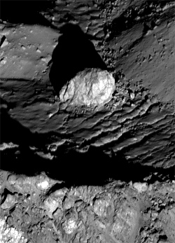
In addition, large boulders ranging in size from 33 meters to hundreds of yards across have been spotted on Tycho’s central peaks by LRO, including one 400-foot (120-meter) -wide specimen nestled atop the highest summit. How did such large boulders get there and what are they made of?

A 400-foot-wide boulder within the central peak of Tycho. (NASA/GSFC/LROC)

The researchers hint that they may also be volcanic in origin.

“A surprise findings revealed the  presence of large boulders–about 100 meter in size –on top of the peak. Nobody knew how did they reach the top,” said Prakash Chauhan, a PRL scientist.

Without further studies it’s difficult to determine the exact origin and ages of these lunar formations. The team awaits future research by Chandrayaan-II, which will examine the Moon from orbit as well as land a rover onto the lunar surface. Chandrayaan-II is expected to launch in early 2014.

The PRL team’s findings were published in the April 10 issue of Current Science.

Read the article in the Deccan Herald here.

A Peek at a Pitch-Black Pit

A rimless pit crater within the crater Tolstoj

[/caption]

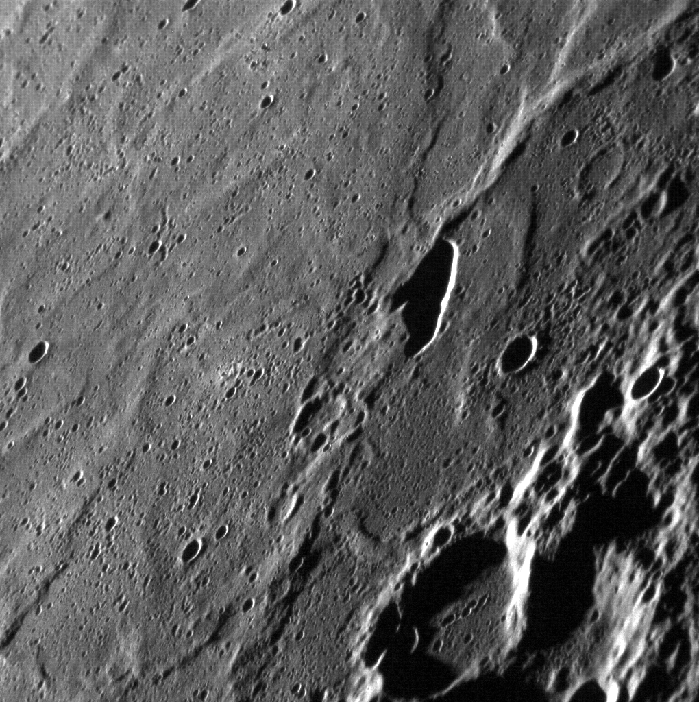
MESSENGER captured this high-resolution image of an elongated pit crater within the floor of the 355-km (220-mile) -wide crater Tolstoj on Mercury on Jan. 11, 2012. The low angle of sun illumination puts the interior of the pit crater into deep shadow, making it appear bottomless.

Pit craters are not caused by impacts, but rather by the collapse of the roof of an underground magma chamber. They are characterized by the lack of a rim or surrounding ejecta blankets, and are often not circular in shape.

Since the floor of Tolstoj crater is thought to have once been flooded by lava, a pit crater is not out of place here.

The presence of such craters on Mercury indicates past volcanic activity on Mercury contributing to the planet’s evolution.

Read more on the MESSENGER mission website here.

Image credit: : NASA/Johns Hopkins University Applied Physics Laboratory/Carnegie Institution of Washington