This is the Spot Where ESA’s Schiaparelli Crashed Into Mars

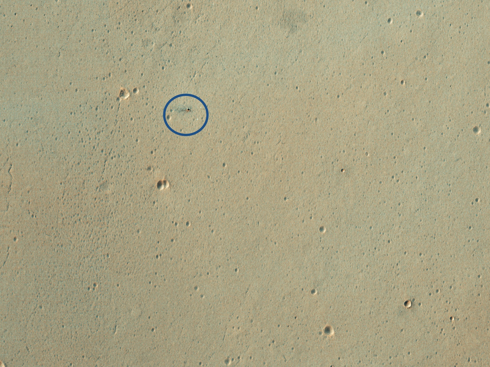
Credit: HiRISE/LPL/University of Arizona

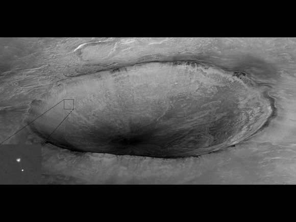
On October 19th, 2016, the NASA/ESA ExoMars mission arrived at the Red Planet to begin its study of the surface and atmosphere. While the Trace Gas Orbiter (TGO) successfully established orbit around Mars, the Schiaparelli Lander crashed on its way to the surface. At the time, the Mars Reconnaissance Orbiter (MRO) acquired images of the crash site using its High Resolution Imaging Science Experiment (HiRISE) camera.

In March and December of 2019, the HiRISE camera captured images of this region once again to see what the crash site looked like roughly three years later. The two images show the impact crater that resulted from the crash, which was partially-obscured by dust clouds created by the recent planet-wide dust storm. This storm lasted throughout the summer of 2019 and coincided with Spring in Mars’ northern hemisphere.

Continue reading “This is the Spot Where ESA’s Schiaparelli Crashed Into Mars”

There’s the Curiosity Rover, On the Move, Seen from Space

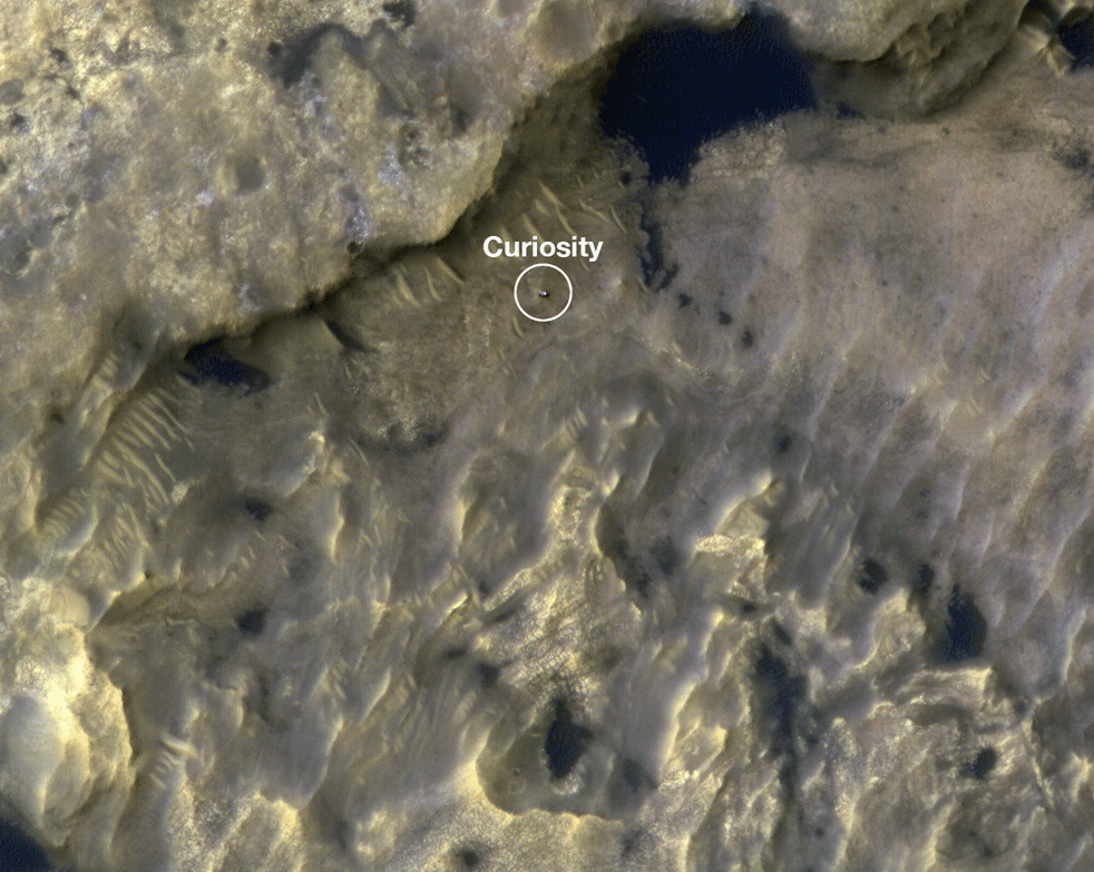
MSL Curiosity as imaged by the Mars Reconnaissance Orbiter. Image Credit: NASA/CalTech-JPL

If the Curiosity rover was paranoid, would it feel like it was being watched? Well, it is being watched, by its brother in orbit, the Mars Reconnaissance Orbiter. The MRO watched Curiosity as it travelled through the ‘Clay-Bearing Unit‘ in Gale Crater, during June and July, 2019.

Continue reading “There’s the Curiosity Rover, On the Move, Seen from Space”

This is a Dust Devil… on Mars

Dust Devil on Mars. Image: NASA/JPL/University of Arizona

We live in a time when our spacecraft orbiting Mars at an altitude of about 300 km. can snap photos of a dust devil and transmit them back to us so we can share them on the internet. Not only that, but we have rovers wandering around on the surface taking pictures of the dust storms, too. Big deal, you say? So what, you say?

You’re dead inside.

Continue reading “This is a Dust Devil… on Mars”

Curiosity Captured from Orbit Crossing Landing Ellipse Boundary – Martian Scenery from Above and Below

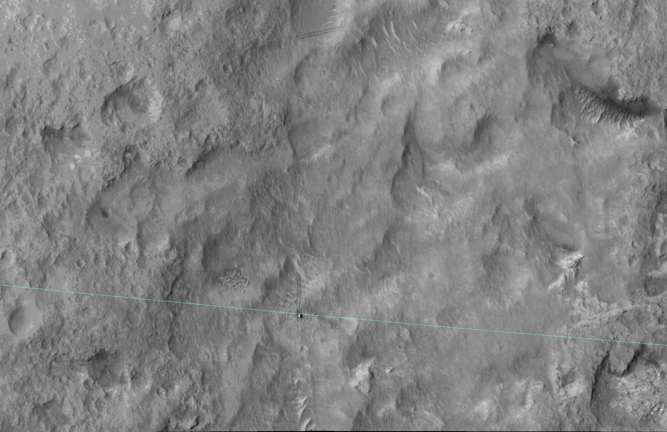
This June 27, 2014, image from the HiRISE camera on NASA's Mars Reconnaissance Orbiter shows NASA's Curiosity Mars rover on the rover's landing-ellipse boundary, which is superimposed on the image. The 12-mile-wide ellipse was mapped as safe terrain for its 2012 landing inside Gale Crater. Image Credit: NASA/JPL-Caltech/Univ. of Arizona

NASA has now released a breathtaking high resolution image of the rover Curiosity captured from Mars orbit coincidentally coinciding with her crossing the targeted landing ellipse just days after she marked ‘1 Martian Year’ on the Red Planet in search of the chemical ingredients necessary to support alien microbial life forms.

The orbital image was taken on June 27 (Sol 672) by the High Resolution Imaging Science Experiment (HiRISE) camera on NASA’s Mars Reconnaissance Orbiter (MRO) and clearly shows the rover and wheel tracks at the end of the drive that Sol, or Martian day.

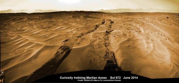
You can simultaneously experience the Martian eye view of Curiosity from above and below by checking out our Sol 672 ground level photo mosaic – below. It’s assembled from raw images taken by the mast mounted navigation camera (Navcam) showing the rovers wheel tracks and distant rim of the Gale Crater landing site.

Curiosity treks across Martian dunes and drives outside landing ellipse here, in this photo mosaic view captured on Sol 672, June 27, 2014.    Navcam camera raw images stitched and colorized.   Credit: NASA/JPL-Caltech/Marco Di Lorenzo/Ken Kremer – kenkremer.com
Curiosity treks across Martian dunes and drives outside landing ellipse here, in this photo mosaic view captured on Sol 672, June 27, 2014. Navcam camera raw images stitched and colorized. Credit: NASA/JPL-Caltech/Marco Di Lorenzo/Ken Kremer – kenkremer.com

The six wheeled robot drove about 269 feet (82 meters) on June 27 traversing to the boundary of her targeted landing ellipse in safe terrain – approximately 4 miles wide and 12 miles long (7 kilometers by 20 kilometers) – for the first time since touchdown on Mars nearly two years ago on August 5, 2012 inside Gale Crater.

Curiosity celebrated another Martian milestone anniversary on June 24 (Sol 669) – 1 Martian Year on Mars!

A Martian year is equivalent to 687 Earth days, or nearly two Earth years.

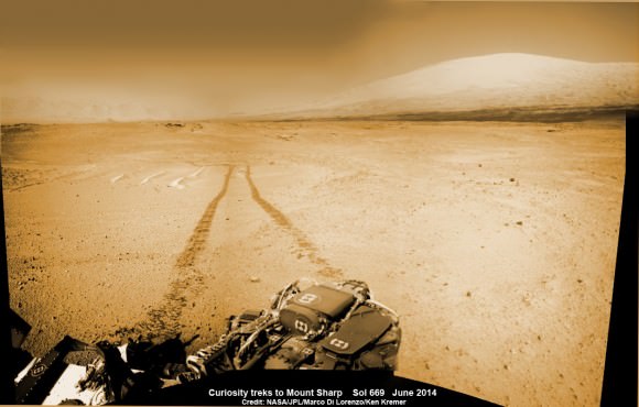
1 Martian Year on Mars!  Curiosity treks to Mount Sharp in this photo mosaic view captured on Sol 669, June 24, 2014.    Navcam camera raw images stitched and colorized.   Credit: NASA/JPL-Caltech/Marco Di Lorenzo/Ken Kremer – kenkremer.com
1 Martian Year on Mars!
Curiosity treks to Mount Sharp in this photo mosaic view captured on Sol 669, June 24, 2014. Navcam camera raw images stitched and colorized. Credit: NASA/JPL-Caltech/Marco Di Lorenzo/Ken Kremer – kenkremer.com

The SUZ sized rover is driving as swiftly as possible to the base of Mount Sharp which dominates the center of Gale Crater and reaches 3.4 miles (5.5 km) into the Martian sky – taller than Mount Rainier.

During Year 1 on Mars, Earth’s emissary has already accomplished her primary objective of discovering a habitable zone on the Red Planet that contains the minerals necessary to support microbial life in the ancient past when Mars was far wetter and warmer billions of years ago.

To date, Curiosity’s odometer totals over 5.1 miles (8.4 kilometers) since landing inside Gale Crater on Mars in August 2012. She has taken over 165,000 images.

Curiosity still has about another 2.4 miles (3.9 kilometers) to go to reach the entry way at a gap in the treacherous sand dunes at the foothills of Mount Sharp sometime later this year.

Stay tuned here for Ken’s continuing Curiosity, Opportunity, Orion, SpaceX, Boeing, Orbital Sciences, commercial space, MAVEN, MOM, Mars and more planetary and human spaceflight news.

Ken Kremer

Amazing Sharper View of MSL Hanging by its Parachute

I have to steal a phrase from Phil Plait, the Bad Astronomer, who earlier this week said something like, “Things just can’t keep getting more cool all the time, right?”

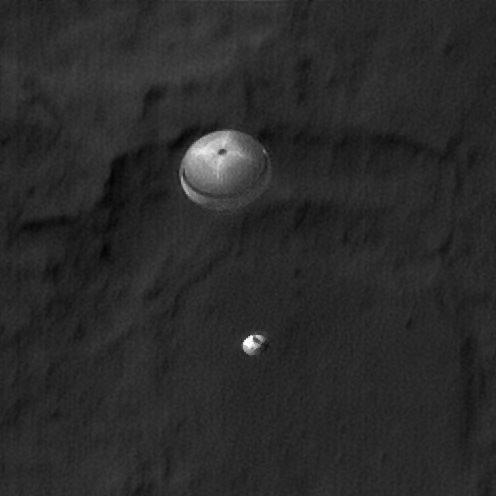
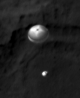
Well, apparently they can. Here’s a sharpened view from HiRISE of the Mars Science Laboratory descending to Mars on a parachute. It shows greater detail of the parachute and even MSL itself.

Just wow.

The original image cropped image:

The HiRISE team describes how they sharpened the image: “This image was given special processing by members of the HiRISE Team, that included removing detector noise and optical blur. The sharpening was achieved by converting the image to its frequency components, correcting for the minor blur that was characterized by pre-flight laboratory measurements, and converting back.”

All I know is that it’s awesome.

See our article on the original image and how the team captured it.

See more details at the HiRISE website.

HiRISE Camera to Attempt Imaging Curiosity’s Descent to Mars

Mars Reconnaissance Orbiter's High Resolution Imaging Science Experiment (HiRISE) camera captured this image of Phoenix hanging from its parachute as it descended to the Martian surface. Credit: NASA/JPL/University of Arizona.

[/caption]

Note: This article was updated on Aug. 3 with additional information.

The HiRISE camera crew on the Mars Reconnaissance Orbiter will attempt an audacious repeat performance of the image above, where the team was able to capture an amazing shot of the Phoenix lander descending on a parachute to land on Mars’ north polar region. Only this time it will try to focus on the Mars Science Laboratory’s Curiosity rover descending to touch down in Gale Crater. It will be all or nothing for the HiRISE team, as they get only one shot at taking what would likely be one of the most memorable images of the entire mission for MRO.

“We’re only making one attempt on MSL here,” Christian Schaller of the HiRISE team told Universe Today. “The EDL (Entry, Descent and Landing) image is set up so that as MSL is descending, MRO will be slewing the HiRISE field of view across the expected descent path. The plan is to capture MSL during the parachute phase of descent.”

Schaller is the software developer responsible for the primary planning tools the MRO and HiRISE targeting specialists and science team members use to plan their images.

Last December, when Universe Today learned of this probable imaging attempt, HiRISE Principal Investigator Alfred McEwen confirmed for us that, indeed, the team was working to make it happen. The preferred shot would be to “capture the rover hanging from the skycrane, but the timing may be difficult,” McEwen said.

It would take an impeccable – and fortuitous – sense of timing to get that shot, but since MSL’s EDL won’t happen on a precisely exact timetable, the HiRISE team will take their one shot and see what happens.

“We’ve been gradually updating the exact timing of the sequence over the past couple of weeks as the MSL navigation team, the MRO navigation team and the MRO flight engineering team refines that descent path and MRO slew,” Schaller said via email, “and we think we’ve pretty much got it nailed down at this point. I think it’s a real testament to NASA and its partners that we can even think about doing this.”

HiRISE will actually be taking two images, but the first is a “throwaway” warmup image taken about 50 minutes prior to MSL’s descent, designed to heat the camera’s electronics up to the preferred temperature for getting good image data.

“The warmup image we’re taking is a long-exposure throwaway that we’re taking on the night side of Mars,” Schaller explained. “It’s a 5,000 microsecond per line exposure, compared to a more typical 100 microsecond per line exposure during normal surface imaging. These warmup data will be useless, and we don’t even bother sending them back to Earth; we just dump them from the MRO filesystem once the exposure is complete.”

Schaller said the warmup image starts executing at 04:17 UTC/9:17 PM PDT. The real image starts executing at 05:09 UTC/10:09 PM PDT, centered on 10:16 PM as the time MSL and MRO navigation teams have determined MSL will pass through HiRISE’s field of view.

This image will be an approximately 500 microseconds per line exposure, to match the MRO’s slew rate.
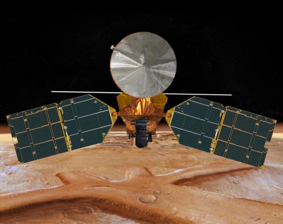

Caption: Artist impression of MRO orbiting Mars. Credit: NASA

UPDATE (Aug. 3): In checking with McEwen, he said that Mars Express and Odyssey are NOT planning to image the descent, but they are supporting EDL via UHF relay, and the plans to use CTX has been dropped.

“HiRISE plans are to definitely attempt the image, unless there is a late upset to the MRO spacecraft,” McEwen said via email on August 3. “The engineers estimate we have a 60% chance of capturing MSL in our image.”

MRO’s Context Camera (CTX) will also be attempting to image Curiosity’s descent, as will NASA’s Mars Odyssey and ESA’s Mars Express and all the spacecraft have been performing special maneuvers to be aligned in just the right place – nearby to MSL’s point of entry into Mars’ atmosphere.

While Odyssey and Mars Express’ cameras may not have the resolving power to capture MSL itself, the powerful HiRISE camera does. However, it has a narrower field of view, so as much skill and planning as this requires, the team will need a little luck, too. But there’s also the CTX.

“CTX has a much larger field of view and will likely capture it,” McEwen said, “but at 20X lower resolution than HiRISE, which should still be good enough to detect the parachute.”

For those concerned about the fuel required for all these orbiters to reposition themselves just to take a few pictures, the expenditure is nothing that isn’t required anyway. All the spacecraft need to be in position to support MSL during the critical EDL event, and the images are pure extra-benefit, if not an incredible exercise for the imaging teams.

So while we’ll all be crossing our fingers for a successful landing for Curiosity, I’m on my way to find a rabbit’s foot or 4-leaf clover for HiRISE.