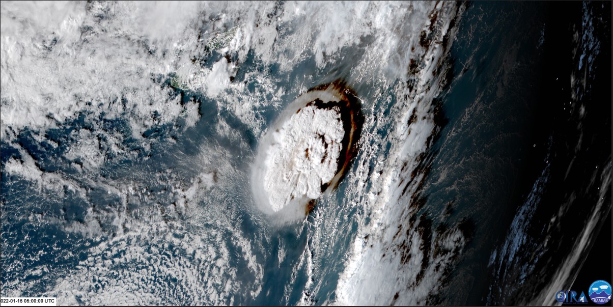
Volcanoes are not restricted to the land, there are many undersea versions. One such undersea volcano known as Hunga Tonga-Hunga Ha’apai off the coast of Tonga. On 15th January 2022, it underwent an eruption which was one of the most powerful in recent memory. A recent paper shows that seismic waves were released 15 minutes before the eruption and before any visible disruption at the surface. The waves had been detected by a seismic station 750km away. This is the first time a precursor signal has been detected.
Continue reading “There Was a 15 Minute Warning Before Tonga Volcano Exploded”The Most Intense Lightning Ever Seen Came From Last Year's Tonga Volcano Eruption
The enormous undersea volcano that erupted in Tonga last year was record-breaking in many regards. It generated the highest-ever recorded volcanic plume, it triggered a sonic boom that circled the globe twice, and was the most powerful natural explosion in more than a century.
Now, scientists studying the eruption say the volcanic plume created record-breaking amounts of volcanic lightning, the most intense lightning rates ever documented in Earth’s atmosphere. While the ash obscured the view, satellites and ground-based radio antennas with specialized instrument could peer through the ash and see every stage of the unfolding eruption. Over 200,000 lightning flashes were detected in the volcanic plume, more than 2,600 flashes every minute.
Continue reading “The Most Intense Lightning Ever Seen Came From Last Year's Tonga Volcano Eruption”Tonga’s Incredible Underwater Volcano Eruption Seen From Space
An undersea volcano erupted near the Pacific island of Tonga, and several satellites caught the incredible explosion in action. The blast of the Hunga Tonga Hunga Ha’apai volcano created a plume of ash, steam and gas mushrooming above the Pacific Ocean, with a quickly expanding shockwave visible from orbit. Japan’s Himawari-8 weather satellite recorded this dramatic video:
Continue reading “Tonga’s Incredible Underwater Volcano Eruption Seen From Space”

