[/caption]
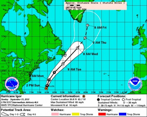
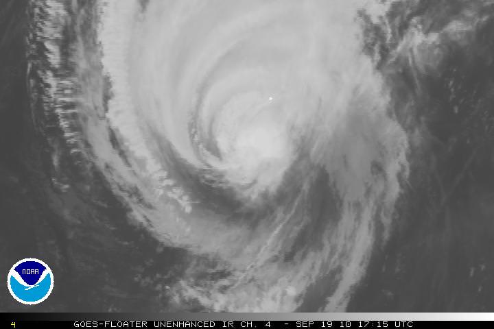
The massive Hurricane Igor is now a Category One storm, with maximum sustained wind speeds of 140 km per hour, (85 miles per hour). As of this writing at 2:30 EDT, it looks as if it is on a direct collision course with Bermuda and is about 220 km (135 miles) southwest of Bermuda. The intensity of the storm has decreased over the past few days, but the size and rotation of the Igor means that Bermuda will be hit repeatedly as the arms of the hurricane spin over the 54 square kilometer (21 sq mi) island nation. In the satellite image above, Bermuda is the small white dot near the center of the image.

Damaging sustained winds of hurricane force will reach the Bermuda late Sunday afternoon, and they will continue into early Monday morning. Wind gusts are predicted to be near or just over 160 km/hour (100 mph) as Igor makes its closest approach to Bermuda. Here’s a link to even more hurricane images.
The hurricane threatens to leave widespread tree damage and power outages in its wake. Some structures will also sustain damage; but fortunately, many buildings on Bermuda are made of stone with foundations into bedrock.
Flooding is also a serious concern across Bermuda. Igor will not only drop 4 to 8 inches of rain but will also trigger a 6- to 10-foot storm surge. Worsening the situation is the fact that waves pounding Bermuda will rise to heights in excess of 40 feet into this evening.
The massive size of Igor will cause the hurricane to keep battering the island well into Monday afternoon.

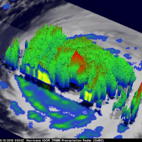
This 3-D image of Igor’s cloud heights and rainfall from NASA TRMM data shows a large area of heavy rainfall (falling at about 2 inches per hour) shown here in red on Sept. 15 at 0353 UTC. The yellow and green areas indicate moderate rainfall between .78 to 1.57 inches per hour. The image reveals that Igor’s eye was still very distinct but the southwestern portion of the eye wall had eroded.
Sources: NOAA, AccuWeather, JPL

