An Iceberg the Size of South Georgia Island is on a Collision Course with… South Georgia Island

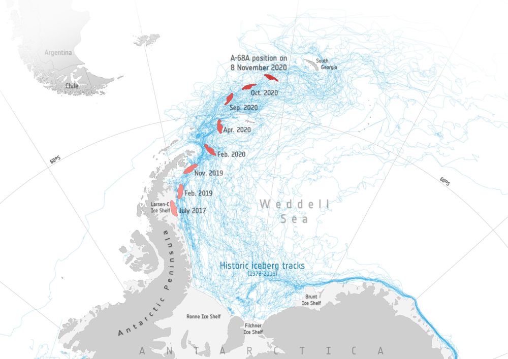
An iceberg the size of South Georgia Island is on a collision course with... South Georgia Island. Image Credit: contains modified Copernicus Sentinel data (2017–20), processed by ESA; Antarctic Iceberg Tracking Database

Back in July 2017, satellites watched as an enormous iceberg broke free from Antarctica’s Larsen C ice shelf on the Antarctic Peninsula. The trillion-ton behemoth has been drifting for over three years now. While it stayed close to its parent ice shelf for the first couple of years, it’s now heading directly for a collision with South Georgia Island.

It could be a slow-motion collision, but a collision nonetheless. If it does collide with the island and its shallow sea-floor, it won’t be the first iceberg to do so. And if the first one was any indication, wildlife could suffer.

Continue reading “An Iceberg the Size of South Georgia Island is on a Collision Course with… South Georgia Island”

That Rectangular Iceberg Took a Long, Hazardous Journey

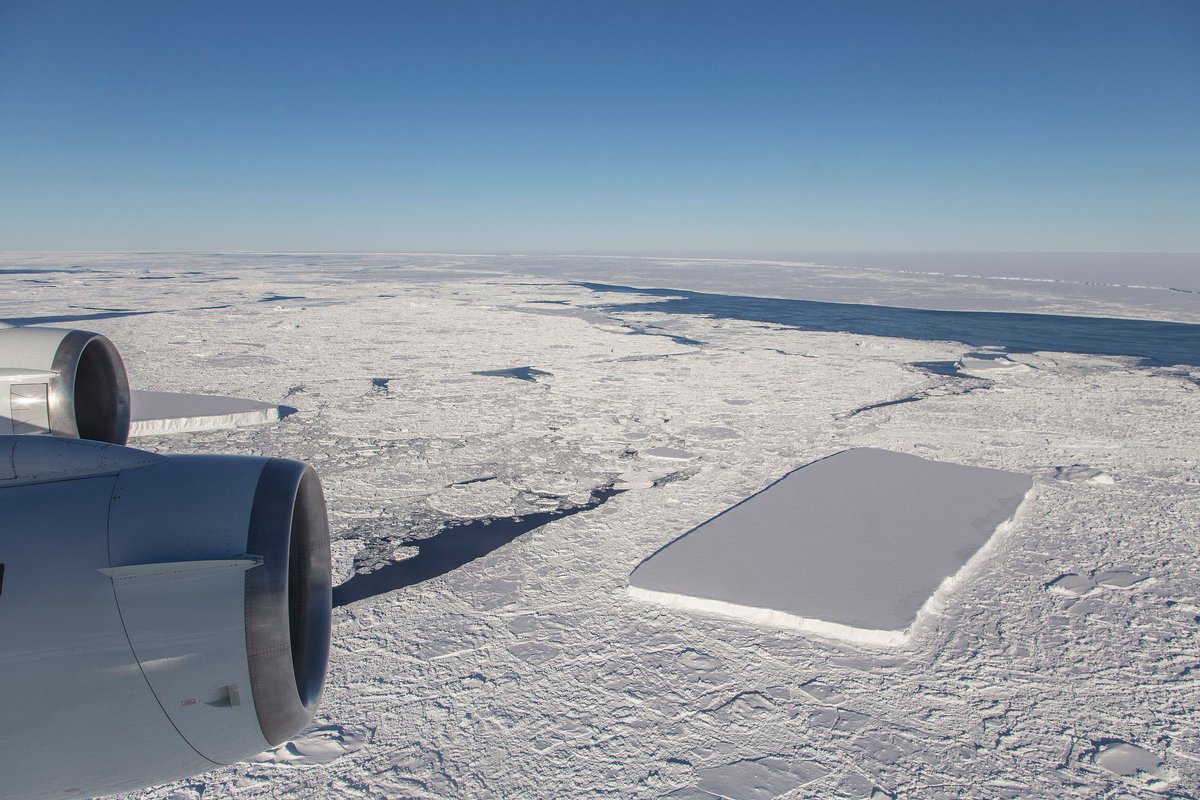
The rectangular iceberg spotted in mid-October had a much longer and more perilous journey than we thought. Image Credit: NASA/Jeremy Harbeck

That stunning rectangular iceberg that was photographed in mid-October by NASA scientist Jeremy Harbeck had a much more harrowing journey than we thought. Scientists looked back through satellite images to retrace the ‘berg’s journey. They found that it calved from the Larsen C Ice Shelf in November 2017.

Continue reading “That Rectangular Iceberg Took a Long, Hazardous Journey”

Antarctica Gives NASA Satellite The Ol’ Frazil Dazzle

Tendrils of ice particles, called frazil, extend out into Antarctica's Mackenzie Bay. (NASA/EO-1 - ALI)

[/caption]

Ghostly green tendrils drift out into Mackenzie Bay off the coast of eastern Antarctica in this image, acquired by NASA’s Earth-Observing (EO-1) satellite on Feb. 12, 2012.

The tendrils are made of fine particles of ice called frazil, the result of upwelling cold water from deep beneath the Amery ice shelf.

Sea water flowing in currents under the Amery ice shelf gets cooled to temperatures below freezing, the result of greater water pressures existing at depth. As some of the water rises and flows along the underside of the shelf toward the open ocean, it gradually encounters less pressure since the ice thickness decreases the further away from shore it extends.

When the supercold water approaches the surface where pressure is lowest, it instantly freezes, forming needle-like ice particles called frazil.

Only 3 -4 millimeters wide, the frazil crystals can still be concentrated enough to be visible from orbit as it drifts into the bay, flowing around icebergs as it is carried along by wind and currents. (The largest iceberg in the image is a little over 4 km/2.5 miles long.)

Eventually the warmer surface water that surrounds the southern continent melts the frazil, and the tendrils fade away.

Scheduled to fly for a year and only designed to last a year and a half, EO-1 celebrated its eleventh anniversary on November 21, 2011. During its time in orbit the satellite has accomplished far more than anyone dreamed, and its Earth-observing mission continues on. Read more on the EO-1 site here.