Want to Live on Mars? Here's Where the Water is

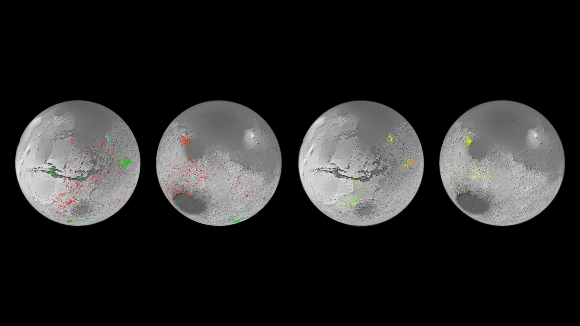
Mineral map of Mars showing the presence of patches that formed in the presence of water. Credit: ESA

When crewed missions begin to travel to Mars for the first time, they will need to be as self-sufficient as possible. Even when Mars and Earth are at the closest points in their orbits to each other every 26 months (known as “Opposition“), it can take six to nine months for a spacecraft to travel there. This makes resupply missions painfully impractical and means astronauts must pack plenty of supplies for the journey. They will also need to grow some of their food and leverage local resources to meet their needs, a process known as In-Situ Resource Utilization (ISRU).

In particular, astronauts will need to know where to find water on the Red Planet, which is no small challenge. Luckily, the European Space Agency (ESA) has created a mineral map showing the locations of aqueous minerals (rocks that have been chemically altered by water). This map was created by the Mars Orbital Catalog of Aqueous Alteration Signatures (MOCAAS) project and took over ten years to complete. When it comes time to select landing sites for crewed missions to Mars (in the next decade and beyond), maps like this will come in mighty handy!

Continue reading “Want to Live on Mars? Here's Where the Water is”

The Deepest Known Canyon in the Solar System, Seen From Space

valles marineris canyon

Solar system worlds beyond Earth have amazing surface features. Thanks to planetary science missions, we see images of canyons, craters, and cliffs across a variety of worlds. Someday, those places will give mountain climbers and hikers new challenges. In particular, Mars will be a favored destination. Future hikers and mountain climbers will be spoiled for choice, even if they must wear space suits to get their thrill on.

For example, there’s the Valles Marineris canyon region. It’s the largest known such feature in the solar system, many times larger than the Grand Canyon here on Earth. The European Space Agency’s Mars Express orbiter just returned breathtaking images of this rift canyon.

Continue reading “The Deepest Known Canyon in the Solar System, Seen From Space”

The Scientific Debate Rages on: Is there Water Under Mars’ South Pole?

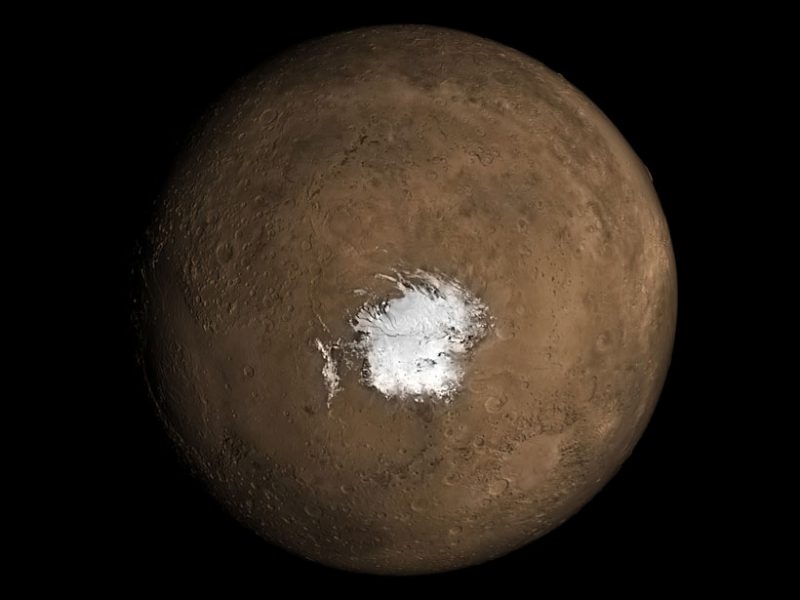
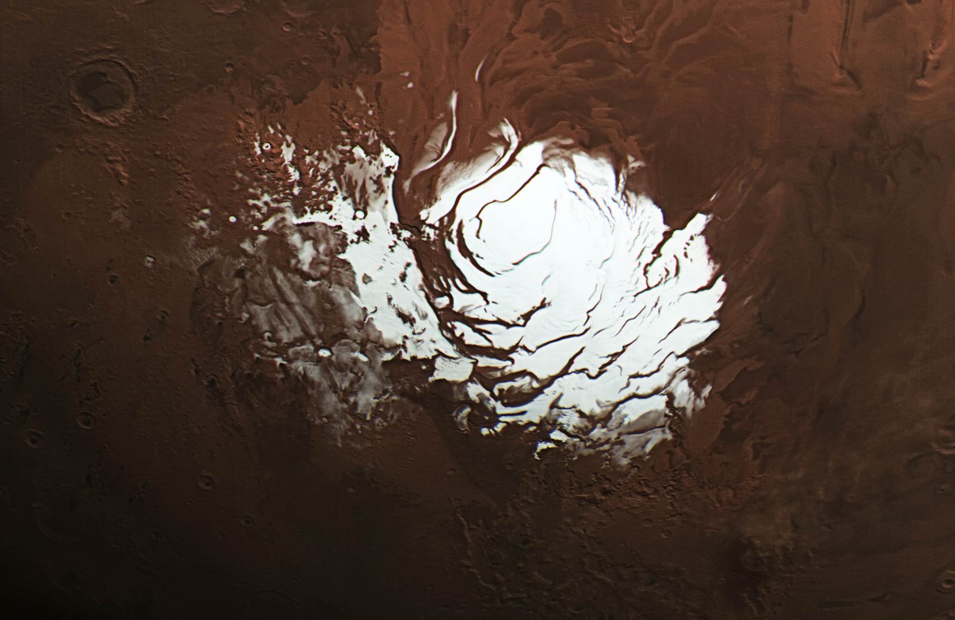
The South Pole on Mars. Image: NASA.

There’s no surface water on Mars now, but there was a long time ago. If you ask most people interested in Mars, what’s left of it is underground and probably frozen.

But some previous evidence shows there’s a lake of liquid water under the planet’s South Pole Layered Deposits (SPLD). Other evidence refutes it. So what’s going on?

Science, that’s what.

Continue reading “The Scientific Debate Rages on: Is there Water Under Mars’ South Pole?”

Bad News. Those Underground Lakes on Mars? They’re Probably Just Frozen Clay

Context map: NASA/Viking; THEMIS background: NASA/JPL-Caltech/Arizona State University; MARSIS data: ESA/NASA/JPL/ASI/Univ. Rome; R. Orosei et al 2018

If you were planning an ice-fishing trip to the Martian south pole and its sub-surface lakes observed by radar in 2018, don’t pack your parka or ice auger just yet. In a research letter published earlier this month in Geophysical Research Letters by I.B. Smith et al., it seems that the Martian lakes may be nothing more smectite, that is, a kind of clay. Should the findings of the paper, titled A Solid Interpretation of Bright Radar Reflectors Under the Mars South Polar Ice (a solid title if you ask me), turn out to be correct, it would be a significant setback for those hoping to find life on the red planet. So why were these supposed lakes so critical for the search for life on Mars? How were they discovered in the first place? Why have our dreams of Martian ice-fishing turned to dust (or, more correctly, clay)?

Continue reading “Bad News. Those Underground Lakes on Mars? They’re Probably Just Frozen Clay”

Potentially More Subsurface Lakes Found on Mars

One of the hardest things to reconcile in science is when new data either complicates or refutes previously findings.  It’s even more difficult when those findings were widely publicized and heralded around the community.  But that is how science works – the theories must fit the data.  So when a team from JPL analyzed data from Mars Express about the Martian South Pole, they realized the findings announced in 2018 about subsurface lakes on Mars might have been more fraught than they had originally thought.

Continue reading “Potentially More Subsurface Lakes Found on Mars”

Unfortunately, There are Other Viable Explanations for the Subsurface Lakes on Mars

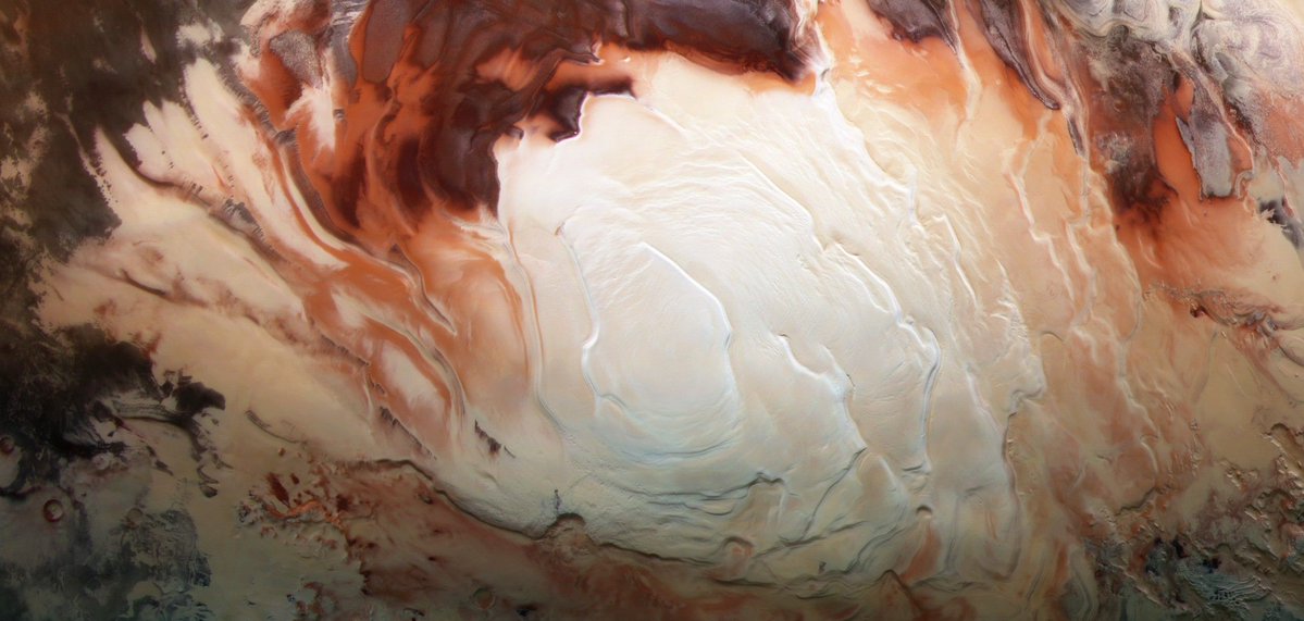
Mars’ south polar ice cap. Credit: ESA / DLR / FU Berlin /

Ever since 1971, when the Mariner 9 probe surveyed the surface of Mars, scientists have theorized that there might be subsurface ice beneath the southern polar ice cap on Mars. In 2004, the ESA’s Mars Express orbiter further confirmed this theory when its Mars Advanced Radar for Subsurface and Ionosphere Sounding (MARSIS) instrument detected what looked like water ice at a depth of 3.7 km (2.3 mi) beneath the surface.

These findings were very encouraging since they indicated that there could still be sources of liquid water on Mars where life could survive. Unfortunately, after reviewing the MARSIS data, a team of researchers led from Arizona State University (ASU) has proposed an alternative explanation. As they indicated in a recent study, the radar reflections could be the result of clays, metal-bearing minerals, or saline ice beneath the surface.

Continue reading “Unfortunately, There are Other Viable Explanations for the Subsurface Lakes on Mars”

Mars Express Finds Even More Ponds of Water Under the Ground on Mars

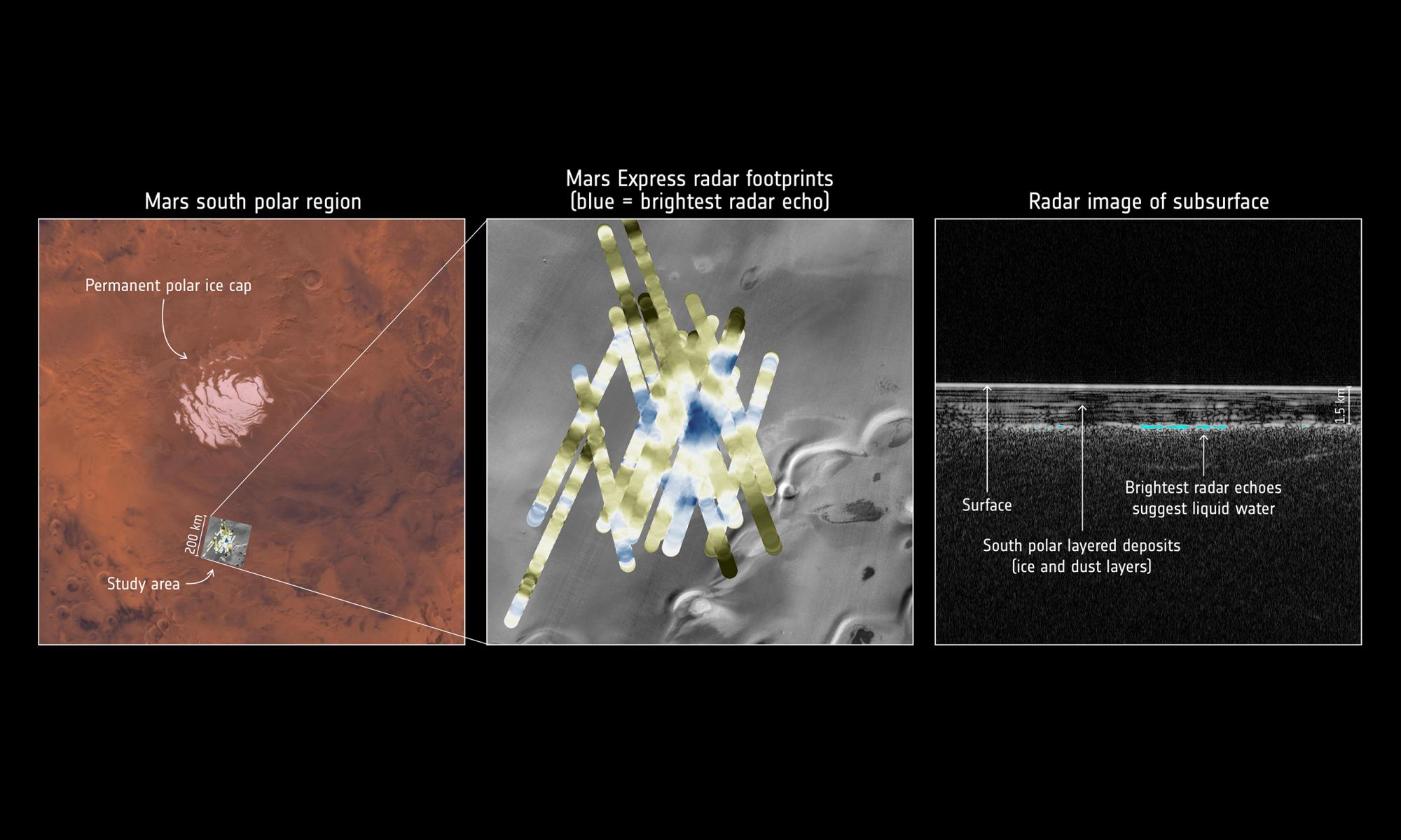
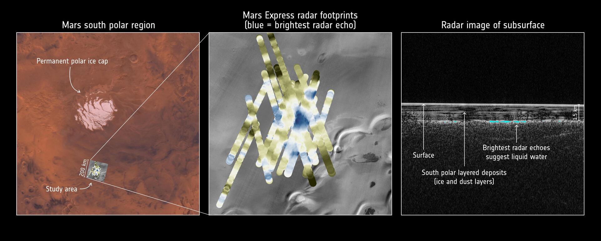
Radar data collected by ESA’s Mars Express point to a pond of liquid water buried under layers of ice and dust in the south polar region of Mars. Credit: ESA

Evidence of Mars’ watery past is written all over the surface of the planet. Between dried-up river valleys, outflow channels, and sedimentary deposits, it is clear that Mars was once a much different place. But until recently, the mystery of where this water went has remained unsolved. This changed in 2018 when data obtained by the ESA’s Mars Express probe indicated the existence of water beneath the south pole of the planet.

According to the Mars Express probe’s Mars Advanced Radar for Subsurface and Ionosphere Sounding (MARSIS), this body of water is in a 20 km (~12.5 mi) wide area about 1.5 km (~1 mi) beneath the surface. And now, further analysis of the data by a team led by the Roma Tre University has revealed the existence of three new ponds, the largest of which measures about 20 x 30 km (~12.5 x 18.5 mi) and is surrounded by many smaller ponds.

Continue reading “Mars Express Finds Even More Ponds of Water Under the Ground on Mars”

There’s One Cloud on Mars That’s Over 1800 km Long

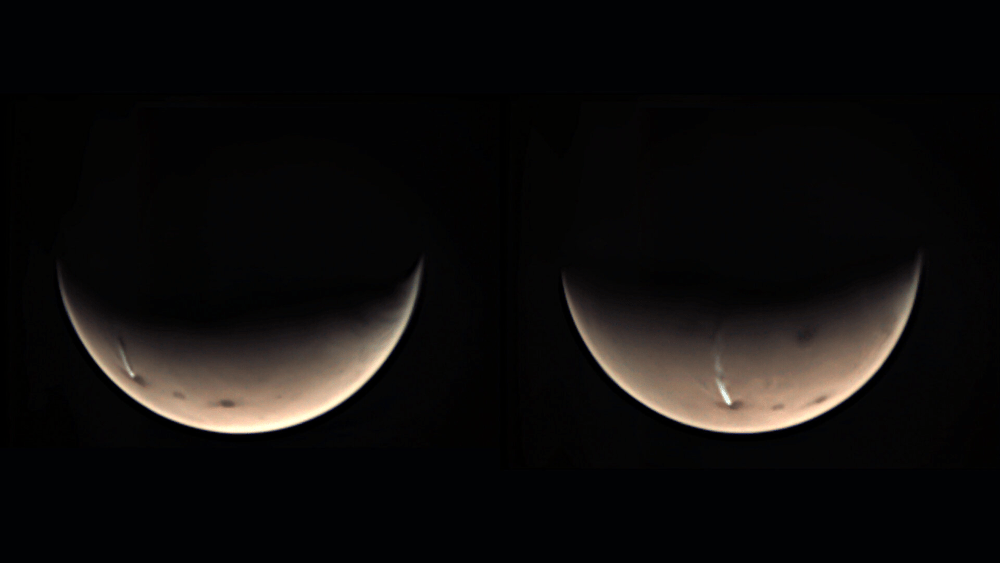
A mysteriously long, thin cloud has again appeared over the 20-km high Arsia Mons volcano on Mars. Image Credit: ESA/GCP/UPV/EHU Bilbao

Mars’ massive cloud is back.

Every year during Mars’ summer solstice, a cloud of water ice forms on the leeward side of Arsia Mons, one of Mars’ largest extinct volcanoes. The cloud can grow to be up to 1800 km (1120 miles) long. It forms each morning, then disappears the same day, only to reappear the next morning. Researchers have named it the Arsia Mons Elongated Cloud (AMEC).

Continue reading “There’s One Cloud on Mars That’s Over 1800 km Long”

Take a Flight Over Korolev Crater on Mars

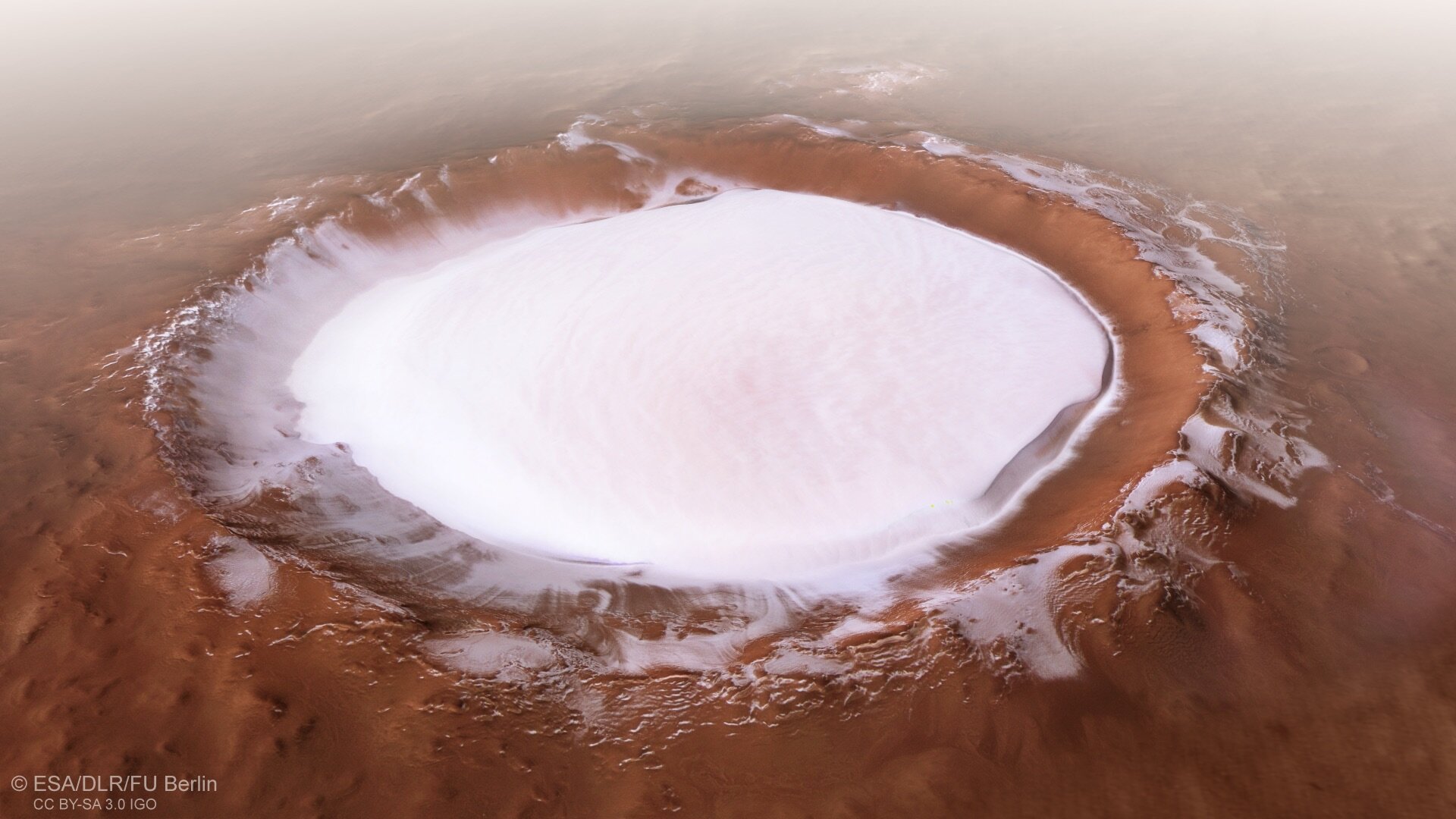
Perspective view of Korolev Crater on Mars, as seen by the European Space Agency's Mars Express. Credit: ESA/DLR/FU Berlin.

We love flyover videos from other worlds. These stunning videos, created from imagery gathered by orbiting spacecraft, can give us a sense of what it would be like to fly in an airplane on another planet. This latest flyover video from the European Space Agency’s Mars Express spacecraft, provides a stunning view of one of Mars’ most eye-popping craters.

Continue reading “Take a Flight Over Korolev Crater on Mars”

Planet Mars, From Pole to Pole

Mars from pole to pole as imaged by the Mars Express orbiter. Image Credit: ESA/DLR/FU Berlin, CC BY-SA 3.0 IGO

A new image from the ESA’s Mars Express Orbiter shows exactly how different regions in Mars are from one another. From the cloudy northern polar region all the way to the Helles Planitia down in the south, Mars is a puzzle of different terrain types. At the heart of it all is what’s known as the Martian dichotomy.

Continue reading “Planet Mars, From Pole to Pole”