Dang, These Features on Mars are Groovy!

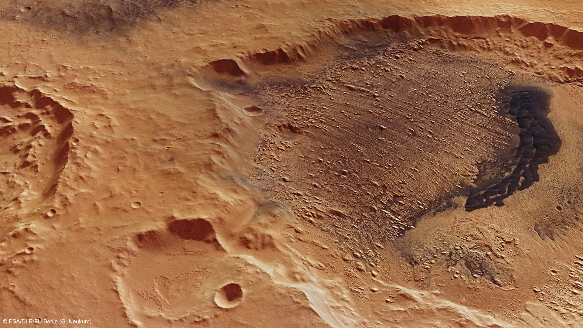
This computer-generated view of the yardangs in Danielson Crater on Mars was created using data obtained from the High- Resolution Stereo Camera (HRSC) on ESA’s Mars Express. Credit: ESA/DLR/FU Berlin (G. Neukum)

[/caption]

The term ‘yardangs’ almost sounds like a fictional word from a Barsoomian tale of creatures living on Mars. However, this is a real word, a geologists’ term for narrow, wind-eroded ridges. These are common land features in the desert regions of Earth, eolian features created by wind and dust. With Mars’ dusty soil and frequent winds, these landforms are common on the Red Planet, too. The abrasive dust is blown by wind, impacting on the bedrock, slowly removing parts of the surface, like a sand-blaster. If the winds blow in the same direction for a long enough period, ‘wind-lanes’ are made. These features are called yardangs.

These latest images from the Mars Express mission show yardangs on the floor of Danielson crater, and scientists think this crater may provide evidence that the planet underwent significant periodic fluctuations in its climate due to changes in its rotation axis.

On June 19, 2011, Mars Express took a look at the region pictured here — Arabia Terra region of Mars — imaging Danielson and the smaller Kalocsa crater with its high-resolution stereo camera.

In the case of Danielson crater, scientists think the sediments were cemented in by water, possibly from an ancient deep groundwater reservoir, before being eroded by the wind.

Danielson and Kalocsa craters as seen by Mars Express. Credit: ESA/DLR/FU Berlin (G. Neukum)

The orientation of the yardangs leads scientists to theorize that strong north–northeasterly winds (from the lower right in the image) both deposited the original sediments and then caused their subsequent erosion in a later drier period of Martian history.

A 30 km-long field of darker dunes can be seen bisecting the yardangs and is thought to have formed at a later epoch.

Some scientists believe that this indicates periodic fluctuations in the climate of Mars, triggered by regular changes in the planet’s axis of rotation. The different layers would have been laid down during different epochs.

But Kalocsa crater shows a completely different topography, with no layered sediments. This is thought to be due to the higher altitude of its floor, with the crater not tapping in to the suspected underlying ancient water reservoir.

However, another hypothesis is that this crater is younger than its neighbor, created when water was not present anymore.

Dang.

Source: ESA

More Evidence of Mars’ Watery Past

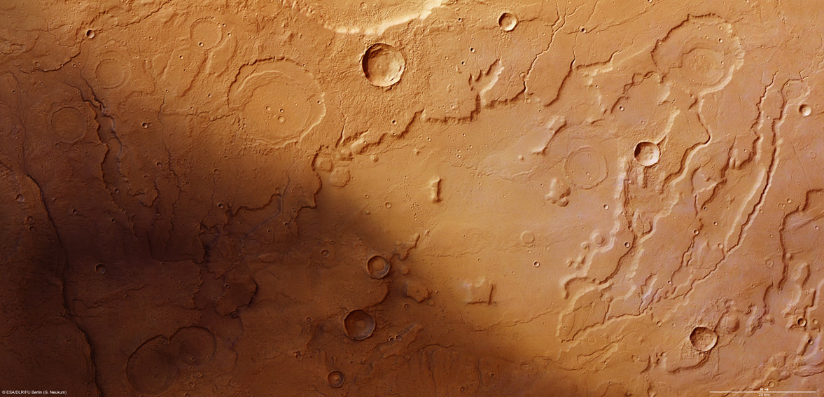
The transition between Acidalia Planitia and Tempe Terra from the Mars Express High-Resolution Stereo Camera (HRSC). Credit ESA/DLR/FU Berlin (G. Neukum)

[/caption]

ESA’s Mars Express orbiter has sent back images revealing terrain that seems to have been sculpted by flowing water, lending further support to the hypothesis that Mars had liquid water on its surface at some point.

The region seen above in a HRSC image is along the border of the Acidalia Planitia region, a vast, dark swath of Mars’ northern hemisphere so large that it’s visible from Earth.

In 1877 the Italian astronomer Giovanni Schiaparelli named the region after a mythical fountain, where the three Graces of Greek mythology were said to have bathed.

Although there may not be any fountains or ancient Immortals within Acidalia Planitia, there may have been water — enough to carve serpentine channels and steep scallops along the edges of wide valleys, much in the same way that the Grand Canyon was carved by the Colorado River.

In the HRSC image some of the etched valleys extend outwards from craters, implying that they were created by water emptying out from within the craters. In addition, sediments present within older craters indicate that they were once filled with water, likely for an extended time.

Acidalia Planitia in a broader context. (NASA MGS MOLA Science Team)

With images like these, so reminiscent of similar features found here on Earth, it’s hard to discount that Mars once had liquid water upon its surface; perhaps some of it still remains today in pockets beneath the ground!

Read more on the ESA site here.

Could There Be Life In Them Thar Pits?

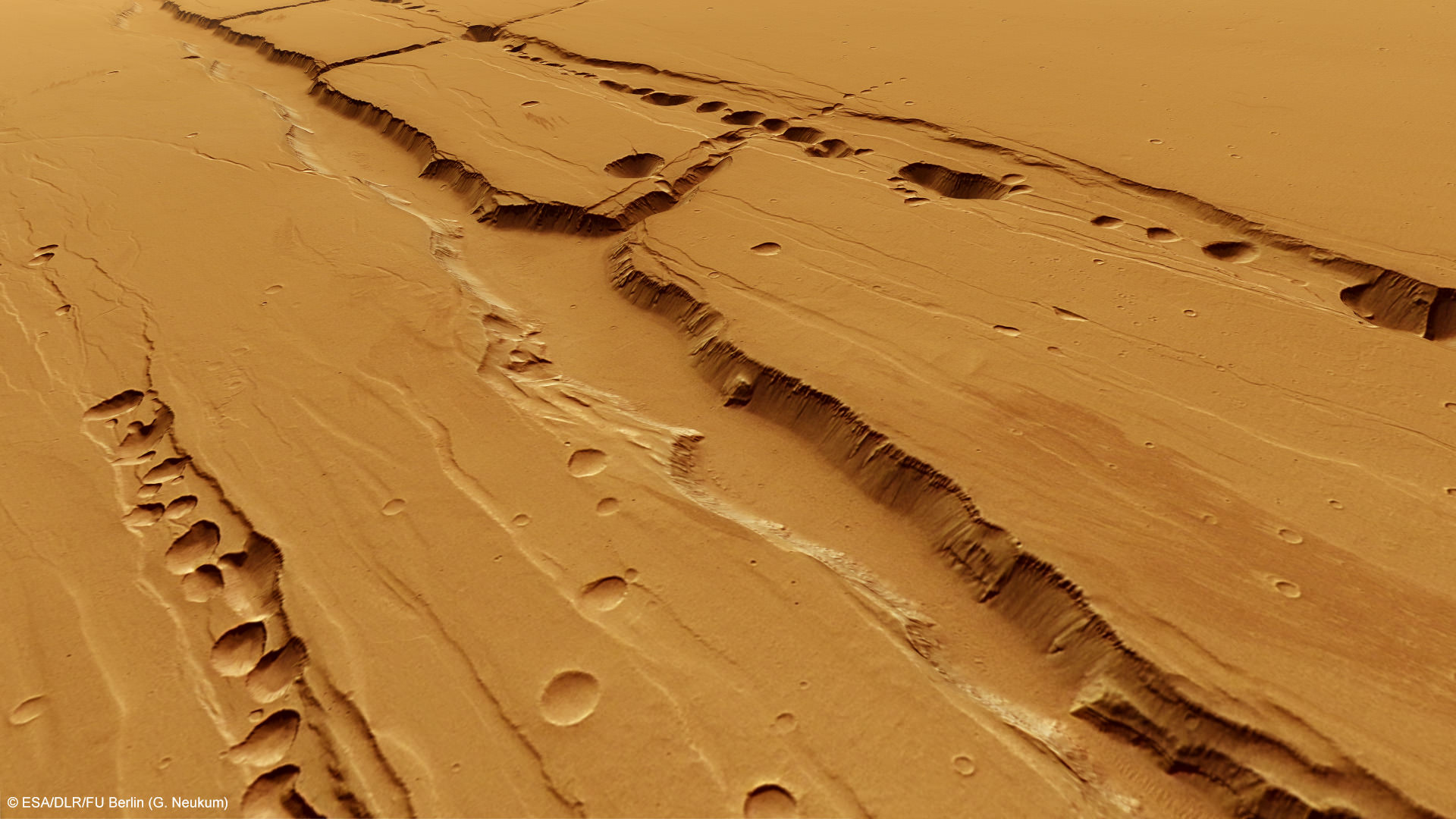
Computer-generated perspective of the Tractus Catene pit chains. Credit: ESA/DLR/FU Berlin (G. Neukum)

[/caption]

Recent images from ESA’s Mars Express spacecraft reveal long rows of crater-like depressions lining the flanks of ancient Martian volcanoes located in the planet’s vast Tharsis region. Rather than being the result of impact events, these “pit chains” were likely caused by underground lava flows — and could be a prime location for look for life.

Like similar features found on Earth, lava tubes on Mars are the result of rivers of magma that carved channels beneath the surface. When these channels empty out, a hollow tube is left. If the roof of a particularly large tube is near the surface the roof can eventually collapse, creating a surface depression… or, in some cases, opening up to the surface entirely.

Even though volcanism on Mars isn’t currently active — the last eruptions probably took place at least over a million years ago — the features left by volcanic activity are still very much present today and likely well-preserved beneath the Martian surface.

Shielded from harsh solar and cosmic radiation, the interior of such lava tubes could provide a safe haven for microbial life — especially if groundwater had found its way inside at some point.

Even though the surface of Mars can receive 250 times the radiation levels found on Earth, the layers of soil and rock surrounding the tubes can provide adequate protection for life, whether it be ancient Martian microbes or future explorers from Earth.

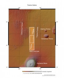
A wider image of the Tractus Catena region showing the large shield volcano Ascraeus Mons. Credits: ESA/DLR/FU Berlin (G. Neukum)

Of course, water and protection from radiation aren’t the only factors necessary for life. There also needs to be some source of heat. Fortunately, the pit chains imaged by Mars Express happen to be within one of the most volcano-laden areas of the Red Planet, a region called the Arcadia quadrangle. Within this area exist some of the largest volcanoes on Mars — and the Tractus Catena pits are located right in the middle of them.

If a heat source were ever to have been beneath the surface of Mars, there would be a good chance it would have been here.

And if our own planet is any measure of such things, where there’s heat and water there is often some form of life — however extreme the conditions may be.

“I’d like to see us land ON a volcano,” Dr. Tracy Gregg, a volcanologist with the University of Buffalo, had once told Universe Today back in 2004. “Right on the flanks. Often the best place to look for evidence of life on any planet is near volcanoes.”

“That may sound counterintuitive, but think about Yellowstone National Park , which really is nothing but a huge volcano,” Gregg elaborated. “Even when the weather in Wyoming is 20 below zero, all the geysers, which are fed by volcanic heat, are swarming with bacteria and all kinds of happy little things cruising around in the water. So, since we think that the necessary ingredients for life on Earth were water and heat, we are looking for the same things on Mars.”

As far as any remaining geothermal activity still happening beneath the Martian surface?

“I strongly suspect there are still molten (or at least mushy) magma bodies beneath the huge Tharsis volcanoes,” Gregg had said. (Read the full article here.)

On Earth, lava tubes, caves and underground spaces of all kinds harbor life, often specialized forms that are found no place else. Could this be (or have once been) the case on Mars as well? Only future exploration will tell. Until then, places like Tractus Catena will remain on scientists’ short list of places to look.

Read more on the ESA website here.

New Analysis of Clay Deposits in Ancient Martian Lakes

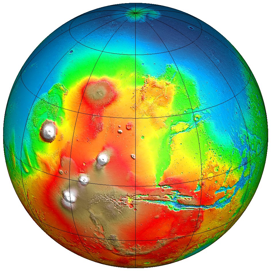
Map of 226 ancient lakes on Mars. Credit: Goudge, T.A., Head, J.W., Mustard, J.F. and Fassett, C.I./MOLA/NASA

[/caption]

Mars was once a much wetter world than it is now, with hot springs, rivers, lakes and perhaps even oceans. Just how wet exactly, and for how long, is still a subject of considerable debate. One vital clue comes from clay mineral deposits and sediments left over after the water disappeared, but still visible now. They provide a valuable insight into what Mars used to be like, and why it is the cold, dry place we see today.

A team of scientists from Brown University has just completed a new study of ancient lake beds on Mars, specifically looking at the clay deposits within them, to try to determine how many of these lakes still contain such deposits and their composition. So what do they tell us about conditions on early Mars? How does this affect the search for evidence of life?

As it turns out, about a third of the lake beds examined still show evidence for clay deposits. A total of 79 lake beds out of 226 studied to be exact, indicating that they are less common on Mars than on Earth. The reason for this may be that the chemistry of the water was not ideal for preserving clays or that the lakes were relatively short-lived.
The paper was just published in Icarus on March 2, 2012.

From the abstract:

“These results indicate that hydrated and evaporite minerals are not as commonly associated with lacustrine deposits on Mars as they are on Earth. This suggests in situ alteration and mineral precipitation, a common source of such minerals in terrestrial lakes, was not a major process occurring in these paleolacustrine systems, and that the observed minerals are likely to be present as transported material within the lacustrine deposits. The lack of widespread in situ alteration also suggests that either the water chemistry in these paleolake systems was not conducive to aqueous alteration and mineral precipitation, or that the open-basin lake systems were relatively short-lived.”

Images for the study came from the Mars Reconnaissance Orbiter, Mars Odyssey and Mars Express spacecraft.

Clay deposits have become a primary focus of study by orbiters and rovers, as they could preserve fossil traces of early life, just as they do on Earth. Even if they are less common on Mars, the fact that they do exist there is exciting, and there is now much interest in exploring them further. Apart from underground, they are the best places to look for such evidence of life. It is also possible that additional deposits have been buried underground, waiting to be discovered.

The Opportunity rover is currently very close to a treasure trove of clays in Endeavour crater, and it is expected to head straight for them after its winter “hibernation” is over in the next few months. The Curiosity rover, en route to Mars right now, will land in Gale crater next July, where there are also clay deposits near the base of a mountainous peak within the crater. Gale crater is thought to be another site of a former Martian lake.

The abstract is available here (with full paper available for purchase).

‘Oceanus Borealis’ – Mars Express Finds New Evidence for Ancient Ocean on Mars

Topographic map from Mars Global Surveyor showing colour-coded altitudes; the blue areas are the lowest and correspond to the possible ancient ocean in the northern hemisphere. Credit: NASA/JPL

[/caption]

For a long time now, evidence has continued to indicate that Mars was once a water world – near-surface groundwater, lakes, rivers, hot springs and, according to some planetary models, even an ancient ocean in the northern hemisphere. That last one in particular has been a subject of intense debate; some scientists see evidence for it while others do not. Even if it was there, it may have been a warm ocean or it may have been colder, like the polar seas here on Earth. The prospect of an ocean of any kind on early Mars is an exciting one, regarding the question of possible life way back then. The argument has swung both ways over the years, but now another new report has been published which comes down on the “yes” side.

The results come from the Mars Express Orbiter – specifically its ground-penetrating radar (MARSIS) and they have just been published in Geophysical Research Letters by Jérémie Mouginot from the University of California. The findings reinforce the idea of a large ocean which occupied much of the northern hemisphere, also known as Oceanus Borealis.

The radar has mapped the sedimentary deposits within the region, known as the Vastitas Borealis Formation, which are about 100 metres (328 feet) thick and overlie deeper volcanic deposits. Significantly, the mapping of the dielectric constant showed that the sedimentary deposits left over from the putative ocean differ from volcanic rock – they have a value of about 4-5, while volcanic deposits have a value of 9, 10 or even higher. Pure ice has a value of 3.1.

According to the research team, “Although much is still unknown about the evolution and environmental context of a Late Hesperian ocean, our observations provide persuasive evidence of its existence by the measurement of a dielectric constant of the Vastitas Borealis Formation that is sufficiently low that it can only be explained by the widespread deposition of (now desiccated) aqueous sediments or sediments mixed with massive ice.”

The big question has always been, if there was an ocean, where did all the water go? Additional radar mapping from Mars Express has shown that there are massive amounts of water ice buried beneath the surface, notably at the poles as well as within the speculative shorelines of the old ocean and even closer to the equator than was previously thought. It might seem reasonable to conclude then that much of the water from the ocean, and perhaps other seas or lakes as well, is still there, but now frozen solid.

It’s interesting to note also that the Phoenix lander, which landed within the Vastitas Borealis Formation in 2008, found water ice deposits only a few centimetres below the surface.

“As such, the formation represents the best geologic evidence to date for the existence of an ocean in the Late Hesperian, about 3 billion years ago,” the researchers said.

From the abstract:

A number of observations suggest that an extended ocean once covered a significant part of the Martian northern hemisphere. By probing the physical properties of the subsurface to unprecedented depth, the MARSIS/Mars Express provides new geophysical evidences for the former existence of a Late Hesperian ocean. The Vastitas Borealis formation, located inside a putative shoreline of the ancient ocean, has a low dielectric constant compared with that of typical volcanic materials. We show that the measured value is only consistent with low-density sedimentary deposits, massive deposits of ground-ice, or a combination of the two. In contrast, radar observations indicate a distribution of shallow ground ice in equilibrium with the atmosphere in the south polar region. We conclude that the northern plains are filled with remnants of a late Hesperian ocean, fed by water and sediments from the outflow channels about 3 Gy ago.

The full article can be purchased here ($25.00 U.S.).

Mars Orbiters Will Attempt to Take Pictures of the Curiosity Rover as It Lands

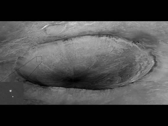
Mars Reconnaissance Orbiter's High Resolution Imaging Science Experiment (HiRISE) camera captured this image of Phoenix hanging from its parachute as it descended to the Martian surface. Credit: NASA/JPL/University of Arizona.

[/caption]

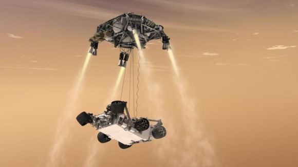
Remember this amazing image from 2008? The HiRISE (High Resolution Imaging Science Experiment) camera on the Mars Reconnaissance Orbiter captured the Phoenix lander descending on a parachute to land on Mars’ north polar region. MRO will attempt a repeat performance in August of 2012 when the Mars Science Laboratory rover “Curiosity” will be landing in Gale Crater on Mars. Capturing this event would be epic, especially with MSL’s unique “skycrane” landing system.

“Yes, MRO is planning to image the descent of MSL with both HiRISE and CTX (Context Camera),” Alfred McEwen, HiRISE principal investigator told Universe Today. “For Phoenix we got a bit lucky with HiRISE in terms of the geometry, giving us a high probability of success. It may not work out so well for MSL. What I’d really like is to capture the rover hanging from the skycrane, but the timing may be difficult.”

Again, the word here is epic.

So, how challenging is it for a spacecraft orbiting Mars to try and track another spacecraft coming in?

“If we were not to do anything, the Mars’ orbiting spacecraft may be on the other side of the planet,” said MSL navigation team chief Tomas Martin-Mur, during an interview with UT. “So as soon as we launch, we tell the other spacecraft where we are going to be by the time of entry so they can change their orbits over time, so they will be flying overhead as MSL approaches the planet.”

The orbiters – which also includes NASA’s Mars Odyssey and ESA’s Mars Express – will have to do special maneuvers to be aligned in just the right place – nearby to MSL’s point of entry into Mars’ atmosphere — and they may even have to change the plane of their orbit.

This artist's concept shows the sky crane maneuver during the descent of NASA's Curiosity rover to the Martian surface. Credit: NASA/JPL-Caltech.

“The other thing that we’ll need them to do is to point their UHF antennas towards MSL,” Martin-Mur said. “Normally their antennas will be pointed to take pictures, but they will have to go to a special attitude to point to MSL. This will enable them to try — like they did with Phoenix — to take a picture of the spacecraft as it is coming down to the planet. We are hoping to see the parachute deployed and maybe more.”

“That was a great picture for Phoenix, and we will attempt to repeat that,” Martin-Mur added.

While Odyssey and Mars Express’ cameras may not have the resolving power to capture such an image, MRO’s powerful HiRISE camera does. However it has a narrower field of view, so as much skill and planning as this requires, the team will need a little luck, too. But there’s also the CTX.

“CTX has a much larger field of view and will likely capture it,” McEwen said, “but at 20X lower resolution than HiRISE, which should still be good enough to detect the parachute.”

Here’s a preview of what MSL will be going through during the perilous entry descent and landing:

Learn more about the navigation for MSL, currently traveling on its way to Mars, in our previous interview with Tomas Martin-Mur.

Mars Express Experiences Multiple ‘Safe Mode’ Events

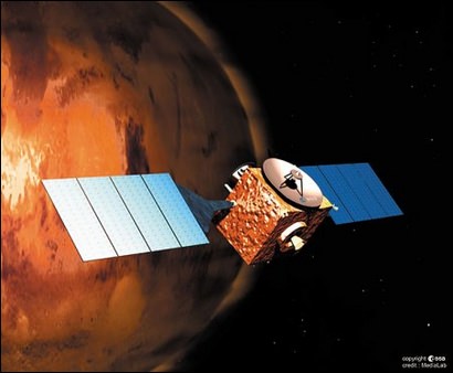
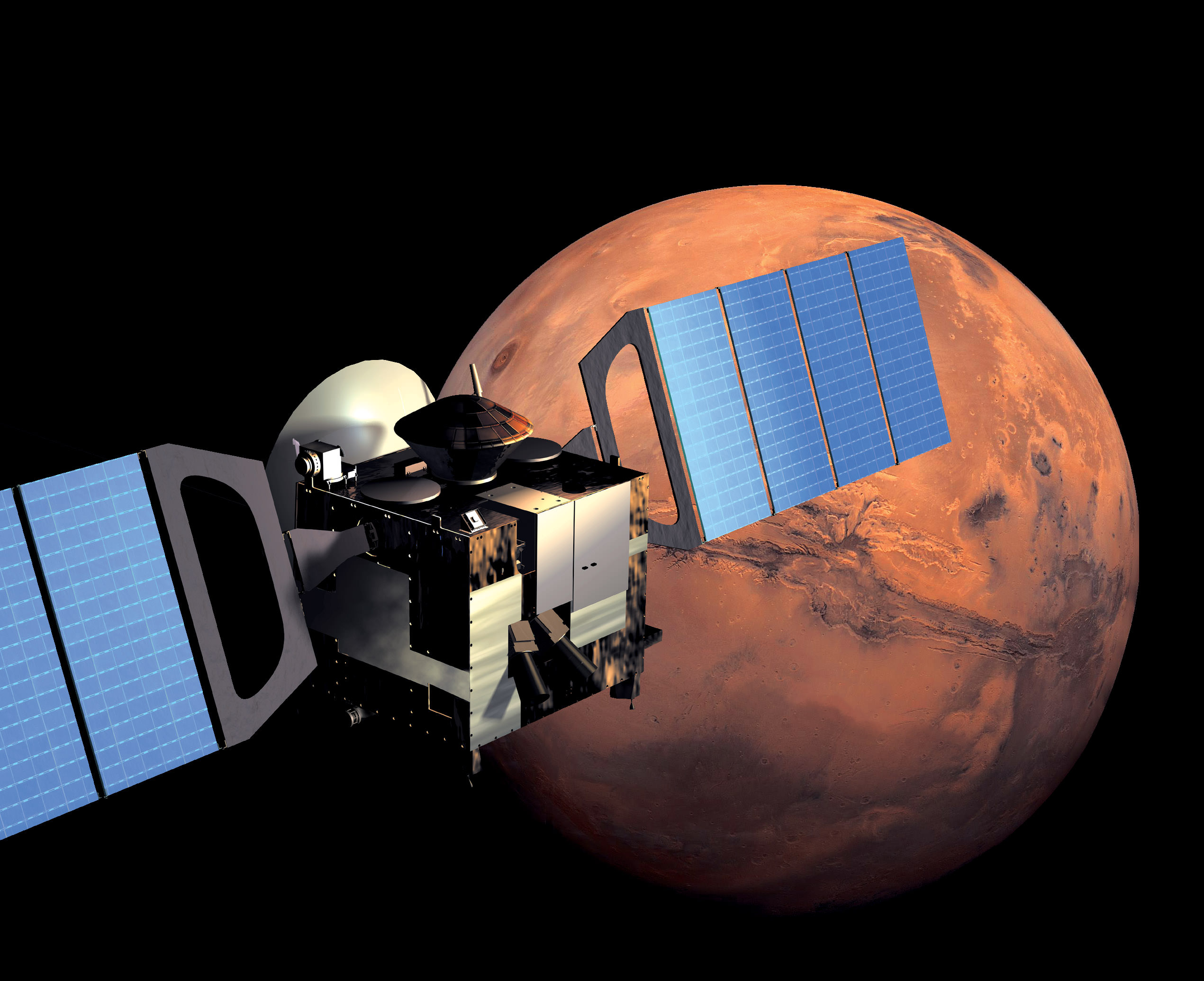
An illustration showing the ESA's Mars Express mission. Credit: ESA/Medialab)

[/caption]

Mars Express has been a fixture in orbit around the Red Planet for almost eight years, but problems with the spacecraft’s computer memory has put the orbiter into safe mode and science observations have been halted for the time being. The spacecraft has gone into safe mode three times since mid-August, twice being recovered successfully. It has also had additional problems with its memory during this time. ESA says a technical work-around is being investigated that will enable the resumption of a number of observations, which will hopefully evolve into a long-term solution.

Safe mode is operational mode designed to safeguard both the spacecraft itself and its instrument payload in the event of faults or errors.

The portion of Mars Express’s computer the Solid-State Mass Memory (SSMM) system, which stores data before sending it on to Earth was not able to either write new data or read the previous data already in memory. The SSMM is a critical subsystem, central to all spacecraft and instrument operations.

Timeline of recent safe mode and anamolous events for Mars Express. Credit: ESA

This is not the first time the spacecraft has gone into safe mode. Three years ago a similar event took place, but now this multiple occurrence of problems has the Mars Express team looking for inventive solutions. The memory system has been switched to the “B” side or redundant computer, but the same fault took place, putting the spacecraft back in safe mode.

Another issue with the spacecraft going into safe mode is that is uses a lot of reserve fuel – as much as is required for six months of normal operations — so the frequent instances of this mode has engineers looking for a long-term solution. Most of the fuel consumption when entering safe mode is the ‘Sun acquisition’ process for letting the spacecraft know where it is in space, which requires a significant amount of spacecraft maneuvering.

ESA says they are making good progress with finding an alternative approach to commanding Mars Express, and will test it soon, and work continues on the finding a full solution to the memory problems.

Source: ESA

Daring Russian Sample Return mission to Martian Moon Phobos aims for November Liftoff

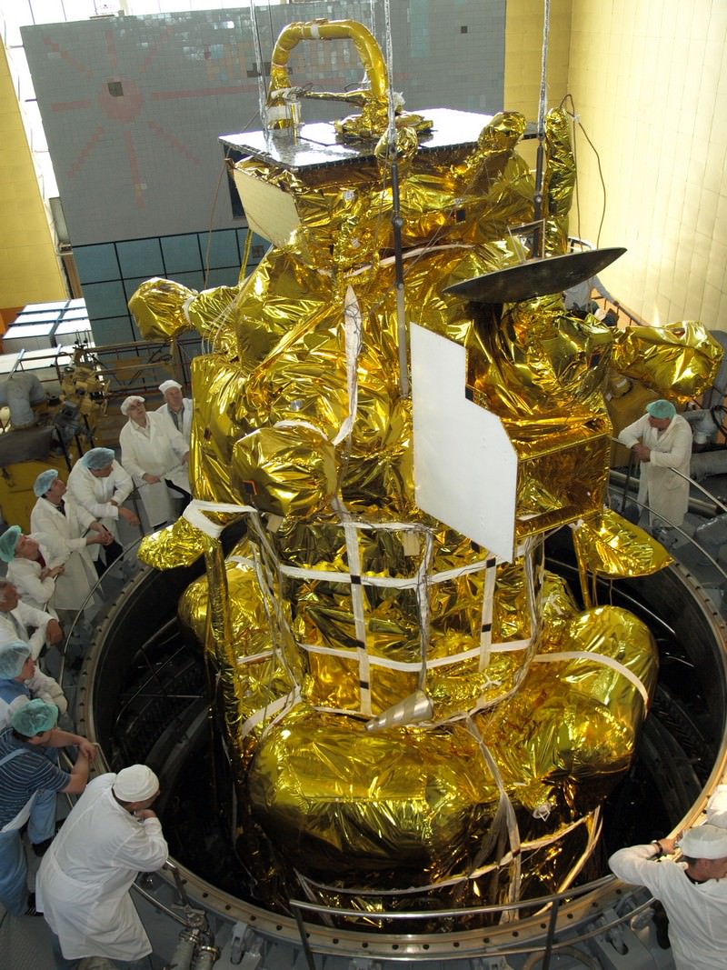
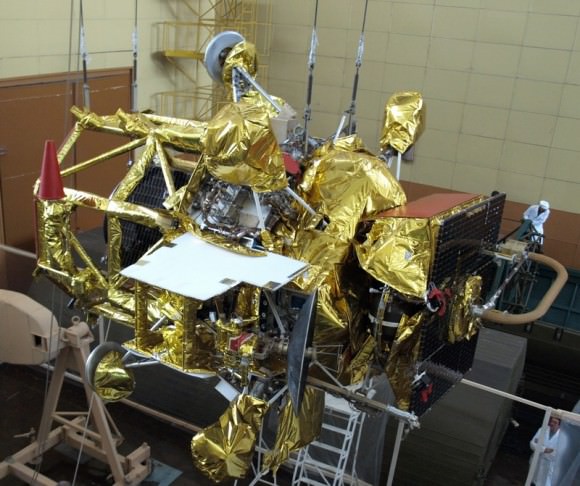
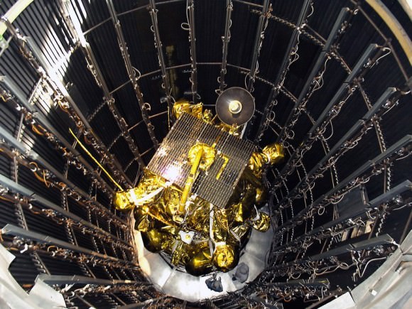
Russian Phobos-Grunt spacecraft set to Launch in November 2011.The flight version of the Phobos-Grunt spacecraft minus its main solar panels is being lowered into a vacuum chamber at NITs RKP test facility in Peresvet, north of Moscow, for thermal, vacuum and electric tests around beginning of June 2011. Credit: NPO Lavochkin

[/caption]

In just over 3 weeks’ time, Russia plans to launch a bold mission to Mars whose objective, if successful , is to land on the Martian Moon Phobos and return a cargo of precious soil samples back to Earth about three years later.

The purpose is to determine the origin and evolution of Phobos and how that relates to Mars and the evolution of the solar system.

Liftoff of the Phobos-Grunt space probe will end a nearly two decade long hiatus in Russia’s exploration of the Red Planet following the failed Mars 96 mission and is currently scheduled to head to space just weeks prior to this year’s other Mars mission – namely NASA’s next Mars rover, the Curiosity Mars Science Laboratory (MSL).

Blastoff of Phobos-Grunt may come as early as around Nov. 5 to Nov. 8 atop a Russian Zenit 3-F rocket from the Baikonur Cosmodrome in Kazakhstan. The launch window extends until about Nov. 25. Elements of the spacecraft are undergoing final prelaunch testing at Baikonur.

Flight version of the Phobos-Grunt spacecraft during assembly in preparation for critical testing in thermal and vacuum chamber at NITs RKP facility closely imitating harsh conditions of the real space flight. Credit: NPO Lovochkin

Baikonur is the same location from which Russian manned Soyuz rockets lift off for the International Space Station. Just like NASA’s Curiosity Mars rover, the mission was originally intended for a 2009 launch but was prudently delayed to fix a number of technical problems.

“November will see the launch of the Phobos-Grunt interplanetary automatic research station aimed at delivering samples of the Martian natural satellite’s soil to Earth’” said Vladimir Popovkin, head of the Russian Federal Space Agency, speaking recently at a session of the State Duma according to the Voice of Russia, a Russian government news agency.

Phobos-Grunt spacecraft

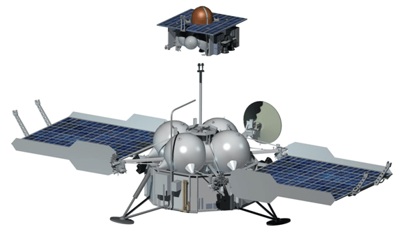
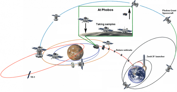
The spacecraft will reach the vicinity of Mars after an 11 month interplanetary cruise around October 2012. Following several months of orbital science investigations of Mars and its two moons and searching for a safe landing site, Phobos-Grunt will attempt history’s first ever touchdown on Phobos. It will conduct a comprehensive analysis of the surface of the tiny moon and collect up to 200 grams of soil and rocks with a robotic arm and drill.

Russian Phobos-Grunt spacecraft prepares for testing inside the vacuum chamber. Credit: NPO Lavochkin

After about a year of surface operations, the loaded return vehicle will blast off from Phobos and arrive back at Earth around August 2014. These would be the first macroscopic samples returned from another body in the solar system since Russia’s Luna 24 in 1976.

“The way back will take between nine and 11 months, after which the return capsule will enter Earth’s atmosphere at a speed of 12 kilometers per second. The capsule has neither parachute nor radio communication and will break its speed thanks to its conical shape,” said chief spacecraft constructor Maksim Martynov according to a report from the Russia Today news agency. He added that there are two soil collection manipulators on the lander because of uncertainties in the characteristics of Phobos soil.

Phobos-Grunt was built by NPO Lavochkin and consists of a cruise stage, orbiter/lander, ascent vehicle, and Earth return vehicle.

The spacecraft weighs nearly 12,000 kg and is equipped with a sophisticated 50 kg international science payload, in particular from France and CNES, the French Space Agency.

Also tucked aboard is the Yinghou-1 microsatellite supplied by China. The 110 kg Yinghou-1 is China’s first probe to launch to Mars and will study the Red Planet’s magnetic and gravity fields and surface environment from orbit for about 1 year.

“It will be the first time such research [at Mars] will be done by two spacecraft simultaneously. The research will help understand how the erosion of Mars’ atmosphere happens,” said Professor Lev Zelyony from the Space Research Institute of the Russian Academy of Science, according to Russia Today.

Phobos-Grunt mission scenario. Credit: CNES
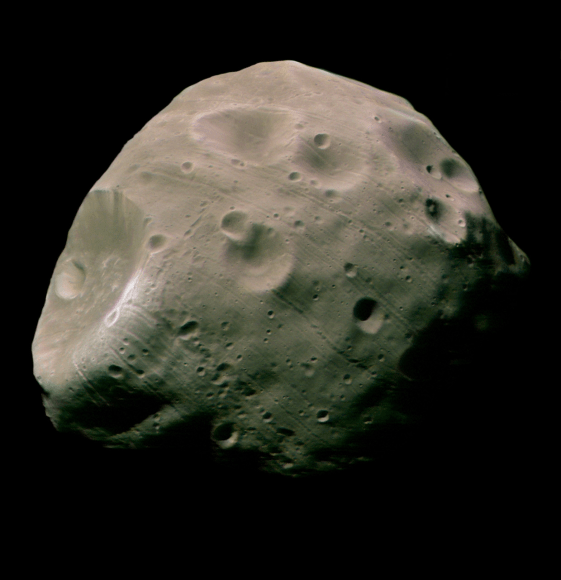
Phobos seen by Mars Express. Credit: ESA

Read Ken’s continuing features about Phobos-Grunt, Curiosity and Opportunity starting here:
Assembling Curiosity’s Rocket to Mars
Encapsulating Curiosity for Martian Flight Test
Dramatic New NASA Animation Depicts Next Mars Rover in Action
Opportunity spotted Exploring vast Endeavour Crater from Mars Orbit
Twin Towers 9/11 Tribute by Opportunity Mars Rover
NASA Robot arrives at ‘New’ Landing Site holding Clues to Ancient Water Flow on Mars
Opportunity Arrives at Huge Martian Crater with Superb Science and Scenic Outlook
Opportunity Snaps Gorgeous Vistas nearing the Foothills of Giant Endeavour Crater
Opportunity Rover Heads for Spirit Point to Honor Dead Martian Sister; Science Team Tributes

Martian Atmosphere Supersaturated with Water?

Artist's impression of the Mars Express spacecraft in orbit. Image Credit: ESA/Medialab

[/caption]

Last week, scientists announced findings based on data from the SPICAM spectrometer onboard ESA’s Mars Express spacecraft. The findings reported in Science by Maltagliati et al (2011), reveal that the Martian atmosphere is supersaturated with water vapor. According to the research team, the discovery provides new information which will help scientists better understand the water cycle and atmospheric history of Mars.

What processes are at work to allow large amounts of water vapor in the Martian atmosphere?

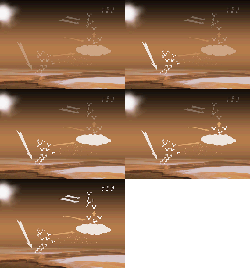
The animated sequence to the left shows the water cycle of the Martian atmosphere in action:
When the polar caps of Mars (which contain frozen Water and CO2) are warmed by the Sun during spring and summer, the water sublimates and is released into the atmosphere.

Atmospheric winds transport the water vapor molecules to higher altitudes. When the water molecules combine with dust molecules, clouds are formed. If there isn’t much dust in the atmosphere, the rate of condensation is reduced, which leaves water vapor in the atmosphere, creating a supersaturated state.

Water vapor may also be transported by wind to the southern hemisphere or may be carried high in the atmosphere.In the upper atmosphere the water vapor can be affected by photodissociation in which solar radiation (white arrows) splits the water molecules into hydrogen and oxygen atoms, which then escape into space.

Scientists had generally assumed that supersaturation cannot exist in the cold Martian atmosphere, believing that any water vapor in excess of saturation instantly froze. Data from SPICAM revealed that supersaturation takes place at altitudes of up to 50 km above the surface when Mars is at its farthest point from the Sun.

Based on the SPICAM data, scientists have learned that there is more water vapor in the Martian atmosphere than previously believed. While the amount of water in Mars’ atmosphere is about 10,000 times less water vapor than that of Earth, previous models have underestimated the amount of water in the Martian atmosphere at altitudes of 20-50km, as the data suggests 10 to 100 times more water than expected at said altitudes.

“The vertical distribution of water vapour is a key factor in the study of Mars’ hydrological cycle, and the old paradigm that it is mainly controlled by saturation physics now needs to be revised,” said Luca Maltagliati, one of the authors of the paper. “Our finding has major implications for understanding the planet’s global climate and the transport of water from one hemisphere to the other.”

“The data suggest that much more water vapour is being carried high enough in the atmosphere to be affected by photodissociation,” added Franck Montmessin, Principal Investigator for SPICAM and co-author of the paper.

“Solar radiation can split the water molecules into oxygen and hydrogen atoms, which can then escape into space. This has implications for the rate at which water has been lost from the planet and for the long-term evolution of the Martian surface and atmosphere.”

However, water vapour is a very dynamic trace gas, and one of the most seasonally variable atmospheric constituents on Mars.

Source: ESA/Mars Express Mission Updates

Worlds Apart: Planet and Moon Align

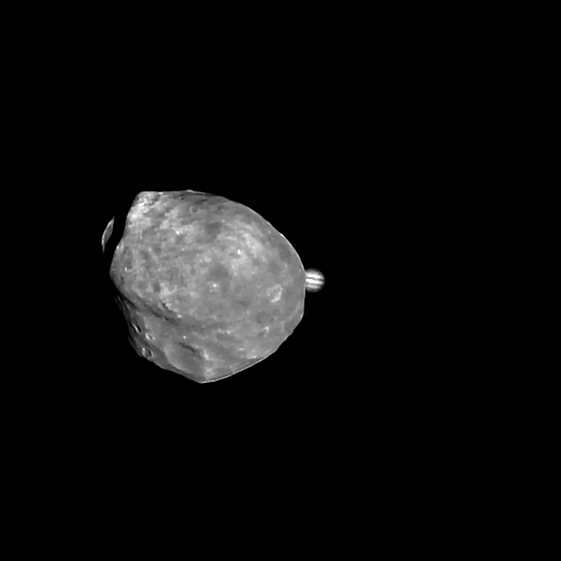
Conjunction of Jupiter and Phobos from Mars Express (rotated so north is up.)

Here’s a cool animation showing Mars’ little moon Phobos passing in front of distant Jupiter from the viewpoint of ESA’s Mars Express orbiter:

The conjunction event occurred on June 1.

[/caption]

Only 21 km (13 miles) across at the widest, the irregularly-shaped Phobos may have been created by a large impact on Mars in its distant past, a chunk of the planet’s crust thrown into orbit. Mars Express most recently performed a close flyby of Phobos back on January 9, passing it at a distance of only 100 km (62 miles).

What’s really amazing to think about is the distances between these two worlds – about 529 million km! But those kinds of distances are no hindrance to vision out in space, especially when the farther object is a giant planet like Jupiter.

The images were taken with Mars Express’ High Resolution Stereo Camera (HRSC), which was kept centered on Jupiter during the conjunction. A total of 104 images were taken over a span of 68 seconds to create the animation.

“By knowing the exact moment when Jupiter passed behind Phobos, the observation will help to verify and even improve our knowledge of the orbital position of the martian moon.”

– ESA

Read the news release on the ESA Space Science site here.

All images shown here were processed at the Department of Planetary Sciences and Remote Sensing at the Institute of Geological Sciences of the Freie Universität Berlin. Credit: ESA/DLR/FU Berlin (G. Neukum)