A Global Color Map of Mars, Courtesy of China’s Tianwen-1 Mission

China’s first Mars global color image map. Credit and ©: Science China Press

In July 2020, China’s Tianwen-1 mission arrived in orbit around Mars, consisting of six robotic elements: an orbiter, a lander, two deployable cameras, a remote camera, and the Zhurong rover. As the first in a series of interplanetary missions by the China National Space Administration (CNSA), the mission’s purpose is to investigate Mars’s geology and internal structure, characterize its atmosphere, and search for indications of water on Mars. Like the many orbiters, landers, and rovers currently exploring Mars, Tianwen-1 is also searching for possible evidence of life on Mars (past and present).

In the almost 1298 days that the Tianwen-1 mission has explored Mars, its orbiter has acquired countless remote-sensing images of the Martian surface. Thanks to a team of researchers from the Chinese Academy of Sciences (CAS), these images have been combined to create the first high-resolution global color-image map of Mars with spatial resolutions greater than 1 km (0.62 mi). This is currently the highest-resolution map of Mars and could serve as a global base map that will support crewed missions someday.

Continue reading “A Global Color Map of Mars, Courtesy of China’s Tianwen-1 Mission”

Navigate a Global Image of Mars (If Your Computer Can Handle It)

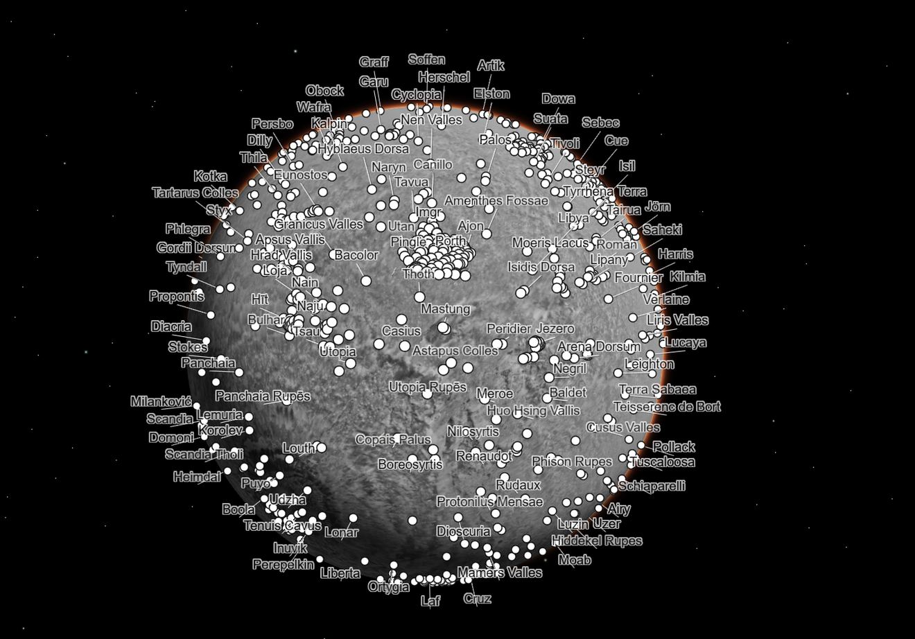
The Global CTX Mosaic of Mars allows scientists and the public to explore the planet like never before. It includes different layers of data that can be turned on or off, like these labels for named geographic features on the planet. Credits: NASA/JPL-Caltech/MSSS,

Using data from the Mars Reconnaissance Orbiter (MRO), planetary scientists have created one of the most unique and detailed maps of Mars ever. But fair warning, the biggest version of this is a could overload your computer.  

Global CTX Mosaic of Mars is the highest-resolution global image of the Red Planet ever created and it even allows you see Mars in 3D.

Continue reading “Navigate a Global Image of Mars (If Your Computer Can Handle It)”

Want to Live on Mars? Here's Where the Water is

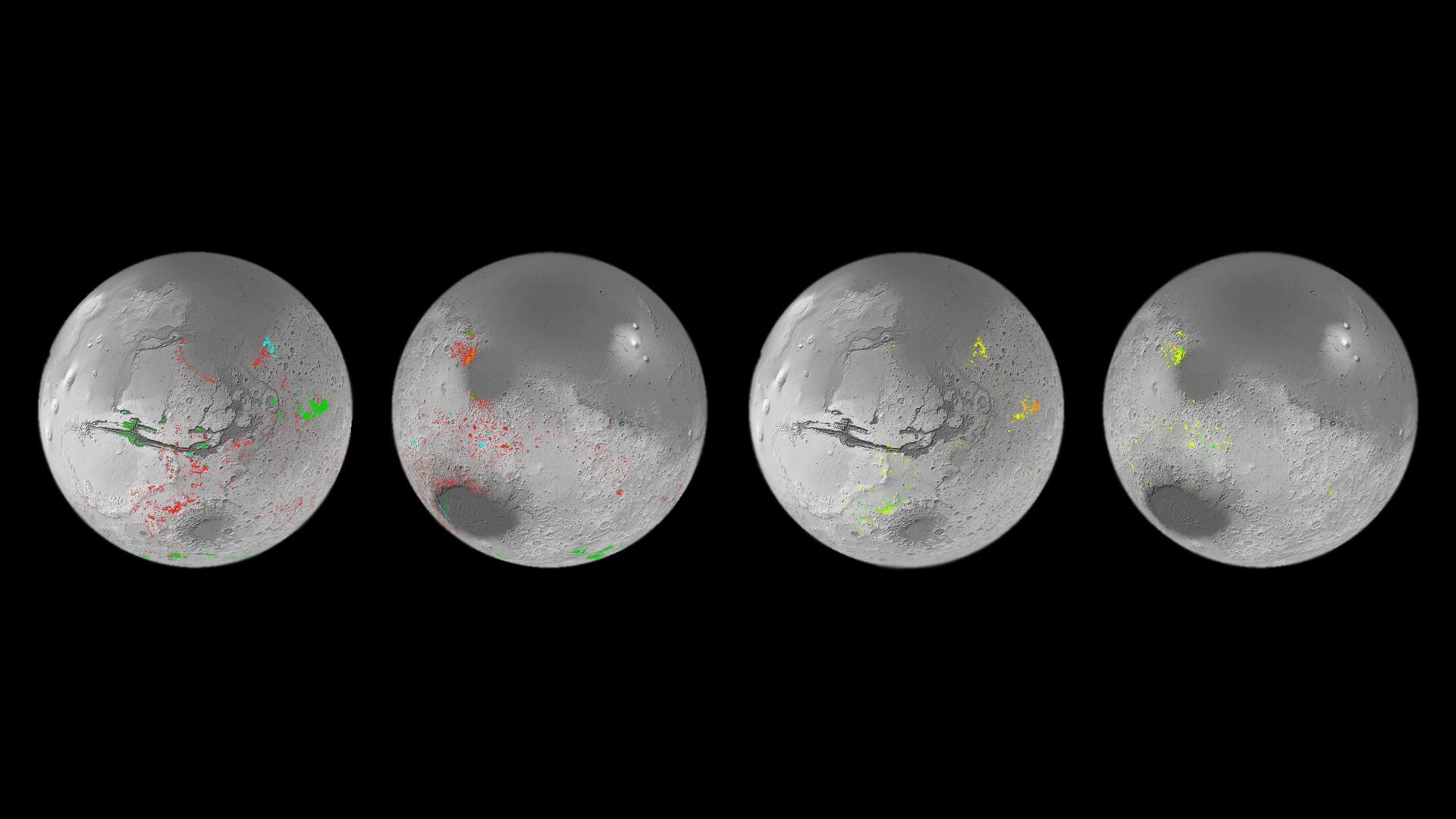
Mineral map of Mars showing the presence of patches that formed in the presence of water. Credit: ESA

When crewed missions begin to travel to Mars for the first time, they will need to be as self-sufficient as possible. Even when Mars and Earth are at the closest points in their orbits to each other every 26 months (known as “Opposition“), it can take six to nine months for a spacecraft to travel there. This makes resupply missions painfully impractical and means astronauts must pack plenty of supplies for the journey. They will also need to grow some of their food and leverage local resources to meet their needs, a process known as In-Situ Resource Utilization (ISRU).

In particular, astronauts will need to know where to find water on the Red Planet, which is no small challenge. Luckily, the European Space Agency (ESA) has created a mineral map showing the locations of aqueous minerals (rocks that have been chemically altered by water). This map was created by the Mars Orbital Catalog of Aqueous Alteration Signatures (MOCAAS) project and took over ten years to complete. When it comes time to select landing sites for crewed missions to Mars (in the next decade and beyond), maps like this will come in mighty handy!

Continue reading “Want to Live on Mars? Here's Where the Water is”