Spectacular ‘Sideways Glance’ of Mt. Sharp in Gale Crater

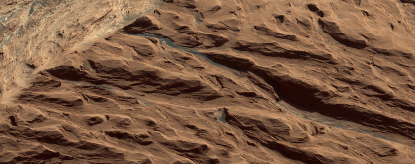
Yep, you really want to click on this link to see the full color version of this great oblique view of Mt. Sharp (a.k.a. Aeolis Mons) in Gale Crater, taken by the HiRISE camera on the Mars Reconnaissance Orbiter. Or you can click here to see the full “raw” strip from the spacecraft.

“The viewing angle is 45 degrees, like looking out an airplane window,” wrote HiRISE Principal Investigator Alfred McEwen on the HiRISE website. McEwen noted that this color version doesn’t show the Curiosity rover or the hardware left over from the landing on Mars, but it does provide a great view of Gale Crater’s central mound.

So how “true” is the color in this image?

“It may be close, but not true,” Christian Schaller from the HiRISE team told Universe Today. Schaller pointed out the description (pdf) of color in HiRISE images from the HiRISE team:

It isn’t natural color, as seen by normal human eyes, because the IR, RED, and BG channels are displayed in red, green, and blue colors. For the Extras products, each color band is individually stretched to maximize contrast, so the colors are enhanced differently for each image based on the color and brightness of each scene. Scenes with dark shadows and bright sunlit slopes or with both bright and dark materials are stretched less, so the colors are less enhanced than is the case over bland scenes.

Jim Bell, the lead scientist for the Pancam color imaging system on the Mars Exploration Rovers, said he likes to use the term “approximate true color” because the MER panoramic camera images are estimates of what humans would see if they were on Mars. Other colleagues, Bell said, use “natural color.”

“We actually try to avoid the term ‘true color’ because nobody really knows precisely what the ‘truth’ is on Mars,” Bell told Universe Today in 2007 for an article about the art of extraterrestrial photography. In fact, Bell pointed out, on Mars, as well as Earth, color changes all the time: whether it’s cloudy or clear, the Sun is high or low, or if there are variations in how much dust is in the atmosphere. “Colors change from moment to moment. It’s a dynamic thing. We try not to draw the line that hard by saying ‘this is the truth!’”

For more great shots from HiRISE, check out their website.

Source: HiRISE

Which Planet is This? A Gale Crater Doppelganger

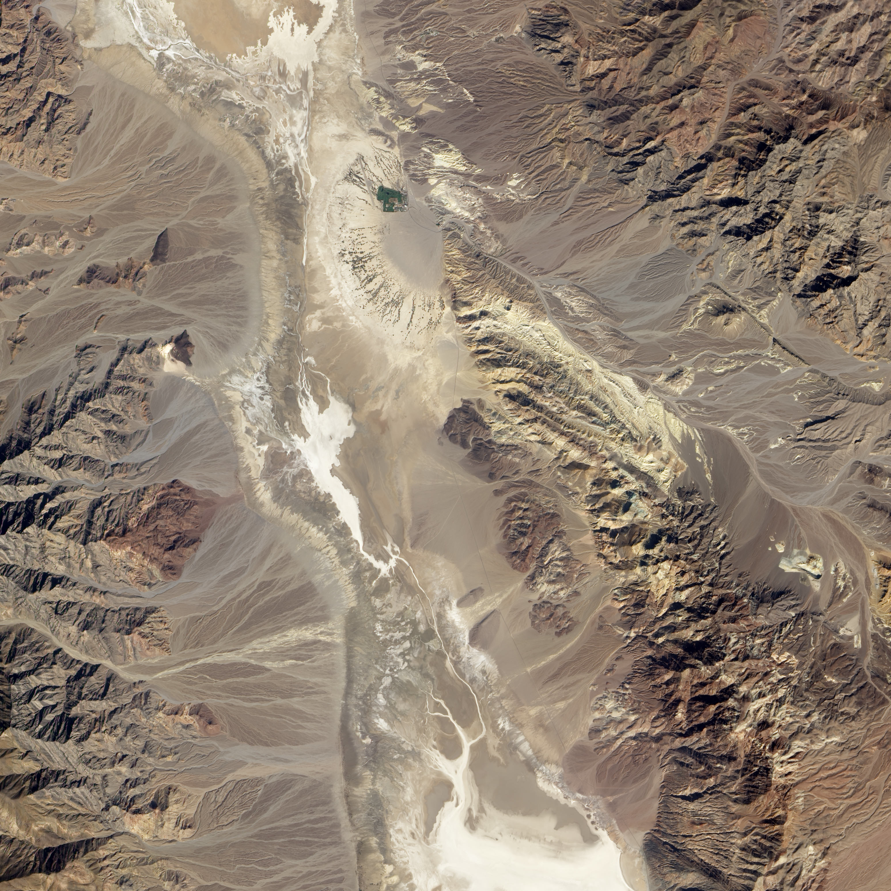
The Badwater Basin region of California’s Death Valley acquired by NASA’s Earth Observing-1 satellite (EO-1) on October 23, 2002. Alluvial fans in the image are remarkably similar to the terrain that the Curiosity rover will explore on Mars. Image and annotations from NASA Earth Observatory

Leave it to NASA’s Earth Observtory folks to come up with a terrestrial image that captures the familiar terrain the car-sized rover Curiosity will explore on Mars.

“You would really be forgiven for thinking that NASA was trying to pull a fast one on you, and we actually put a rover out in the Mojave Desert and took a picture,” said project scientist John Grotzinger during a recent press conference.

Curiosity set down along a fan-shaped apron of dirt and debris known as an alluvial fan. The landform likely formed when liquid water flowed down the side of Gale Crater through a network of stream channels and valleys onto the crater floor. Although no liquid water seems to exist on the surface of Mars, the tell-tale traces of liquid water’s flow is abundant.

Gaze down onto the Badwater Basin area of California’s Death Valley National Park in this image from NASA’s Earth Observing-1 Satellite (EO-1). Take a peek at the earthimagified version. Alluvial fans are abundant in this image. Occasional storms send flash floods rushing down canyons in this arid landscape. The water transports sediment from the mountains and deposits them in the fan-shaped patterns we see in the image. The white region to the left of the image is a salt flat; the remains of a dried up lake. Scientists note that Gale Crater is also a basin with no outlets so water that pooled in the crater may leave behind similar salts and deposits.

The NASA site also points out that many features, including wind, volcanism, and alternating wet and dry conditions, make this area a perfect laboratory for planning missions to Mars. In fact, a dark patch just north of the large alluvial fan to the left of the image is called Mars Hill due to its similarity to features seen at the Viking 1 landing site. Viking 1 landed on Mars July 20, 1976.

There is a primary difference between the landscapes and features of Gale Crater and Badwater Basin and that is age. The features of Death Valley are billions of years younger than those found on Mars and the site continues to be shaped by water. Scientists believe water stopped flowing on Mars billions of years ago; the sediments deposited by ancient rivers on Mars buried by eons of wind-driven erosion.

John Williams is a science writer and owner of TerraZoom, a Colorado-based web development shop specializing in web mapping and online image zooms. He also writes the award-winning blog, StarryCritters, an interactive site devoted to looking at images from NASA’s Great Observatories and other sources in a different way. A former contributing editor for Final Frontier, his work has appeared in the Planetary Society Blog, Air & Space Smithsonian, Astronomy, Earth, MX Developer’s Journal, The Kansas City Star and many other newspapers and magazines.

Curiosity Wheels Initial Rove in a Week on Heels of Science and Surgery Success

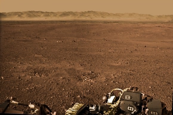
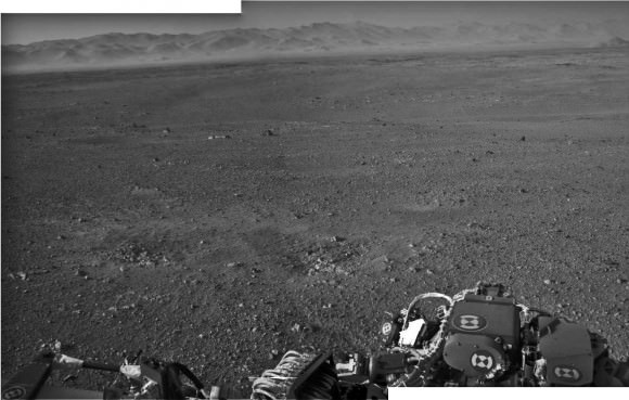
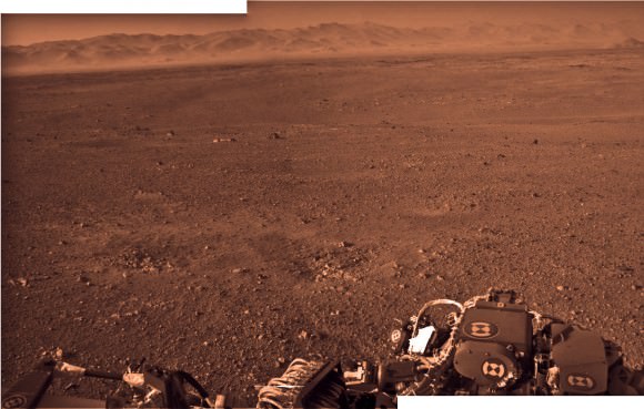
Image Caption: Curiosity’s Wheels Set to Rove soon Mars inside Gale Crater after ‘brain transplant’. This colorized mosaic shows Curiosity wheels, nuclear power source and pointy low gain antennea (LGA) in the foreground looking to the eroded northern rim of Gale Crater in the background. The mosaic was assembled from full resolution Navcam images snapped by Curiosity on Sol 2 on Aug. 8. Image stitching and processing by Ken Kremer and Marco Di Lorenzo. see black & white version below. Credit: NASA/JPL-Caltech/Ken Kremer/Marco Di Lorenzo

Curiosity’s weekend “Brain transplant” proceeded perfectly and she’ll be ready to drive across the floor of Gale Crater in about a week, said the projects mission managers at a NASA news briefing on Tuesday, Aug. 14. And the team can’t wait to get Curiosity’s 6 wheels mobile on the heels of a plethora of science successes after just a week on Mars.

Over the past 4 sols, or Martian days, engineers at NASA’s Jet Propulsion Lab (JPL) successfully uploaded the new “R10” flight software that is required to carry out science operations on the Red Planet’s surface and transform the car-sized Curiosity from a landing vehicle into a fully fledged rover.

The step by step flight software transition onto both the primary and backup computers “went off without a hitch”, said mission manager Mike Watkins of JPL at the news briefing. “We are ‘Go’ to continue our checkout activities on Sol 9 (today).”
Watkins added that the electronic checkouts of all the additional science instruments tested so far, including the APXS, DAN and Chemin, has gone well. Actual use tests are still upcoming.

“With the new flight software, we’re now going to test the steering actuators on Sol 13, and then we are going to take it out for a test drive here probably around Sol 15,” said Watkins . “We’re going to do a short drive of a couple of meters and then maybe turn and back up.”

See our rover wheel mosaic above, backdropped by the rim of Gale Crater some 15 miles away.

Image Caption: Curiosity landed within Gale Crater near the center of the landing ellipse. The crater is approximately the size of Connecticut and Rhode Island combined. This oblique view of Gale, and Mount Sharp in the center, is derived from a combination of elevation and imaging data from three Mars orbiters. The view is looking toward the southeast. Mount Sharp rises about 3.4 miles (5.5 kilometers) above the floor of Gale Crater. Credit: NASA/JPL-Caltech/ESA/DLR/FU Berlin/MSSS

Curiosity made an unprecedented pinpoint landing inside Gale Crater using the rocket powered “Sky Crane” descent stage just a week ago on Aug. 5/6 and the team is now eager to get the huge rover rolling across the Martian plains towards the foothills of Mount Sharp, about 6 miles (10 km) away as the Martian crow flies.

“We have a fully healthy rover and payload,” said Ashwin Vasavada, Mars Science Laboratory (MSL) deputy project scientist. “We couldn’t be happier with the success of the mission so far. We’ve never had a vista like this on another planet before.”

“In just a week we’ve done a lot. We’ve taken our 1st stunning panorama of Gale crater with focusable cameras, 1st ever high energy radiation measurement from the surface, the 1st ever movie of a spacecraft landing on another planet and the 1st ground images of an ancient Martian river channel.”

A high priority is to snap high resolution images of all of Mount Sharp, beyond just the base of the 3.4 mile (5.5 km) tall mountain photographed so far and to decide on the best traverse route to get there.

“We will target Mount Sharp directly with the mastcam cameras in the next few days,” said Watkins.

Climbing the layered mountain and exploring the embedded water related clays and sulfate minerals is the ultimate goal of Curiosity’s mission. Scientists are searching for evidence of habitats that could have supported microbial life.

Curiosity will search for the signs of life in the form of organic molecules by scooping up soil and rock samples and sifting them into analytical chemistry labs on the mobile rovers’ deck.

Vasavada said the team is exhaustively discussing which terrain to visit and analyze along the way that will deliver key science results. He expects it will take about a year or so before Curiosity arrives at the base of Mount Sharp and begins the ascent in between the breathtaking mesas and buttes lining the path upwards to the sedimentary materials.

Watkins and Vasavada told me they are confident they will find a safe path though the dunes and multistory tall buttes and mesas that line the approach to and base of Mount Sharp.

“Curiosity can traverse slopes of 20 degrees and drive over 1 meter sized rocks. The team has already mapped out 6 potential paths uphill from orbital imagery.”

“The science team and our rover drivers and really everybody are kind of itching to move at this point,” said Vasavada. “The science and operations teams are working together to evaluate a few different routes that will take us eventually to Mount Sharp, maybe with a few waypoints in between to look at some of this diversity that we see in these images. We’ll take 2 or 3 samples along the way. That’s a few weeks work each time.”
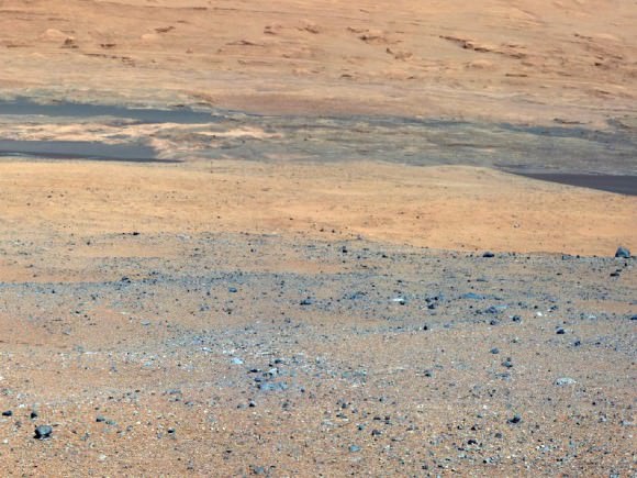
Caption: Destination Mount Sharp. This image from NASA’s Curiosity rover looks south of the rover’s landing site on Mars towards Mount Sharp. Colors have been modified as if the scene were transported to Earth and illuminated by terrestrial sunlight. This processing, called “white balancing,” is useful for scientists to be able to recognize and distinguish rocks by color in more familiar lighting. Credit: NASA/JPL-Caltech/MSSS

“We estimate we can drive something like a football field a day once we get going and test out all our driving capabilities. And if we’re talking about a hundred football fields away, in terms of 10 kilometers or so, to those lower slopes of Mount Sharp, that already is a hundred days plus.”

“It’s going to take a good part of a year to finally make it to these sediments on Mount Sharp and do science along the way,” Vasavada estimated.

The 1 ton mega rover Curiosity is the biggest and most complex robot ever dispatched to the surface of another planet and is outfitted with a payload of 10 state of the art science instruments weighing 15 times more than any prior roving vehicle.

Ken Kremer
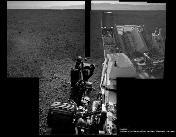
Image Caption: Curiosity’s Wheels Set to Rove soon Mars inside Gale Crater. This mosaic shows Curiosity wheels, nuclear power source and pointy low gain antennea (LGA) in the foreground looking to the eroded northern rim of Gale Crater in the background. The mosaic was assembled from full resolution Navcam images snapped by Curiosity on Sol 2 on Aug. 8. Image stitching and processing by Ken Kremer and Marco Di Lorenzo. Credit: NASA/JPL-Caltech/Ken Kremer/Marco Di Lorenzo – www.kenkremer.com
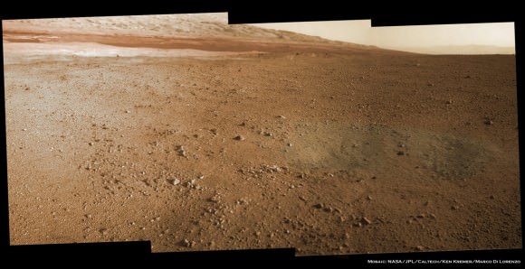
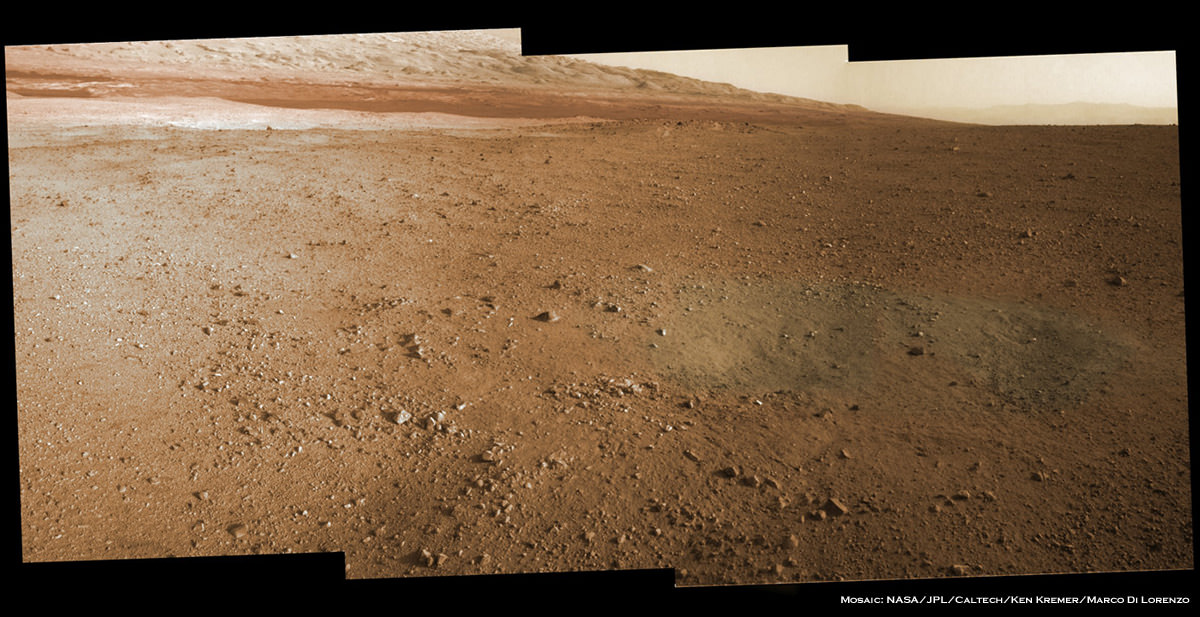
Image Caption: Mosaic of Mount Sharp inside Curiosity’s Gale Crater landing site. Gravelly rocks are strewn in the foreground, dark dune field lies beyond and then the first detailed view of the layered buttes and mesas of the sedimentary rock of Mount Sharp. Topsoil at right was excavated by the ‘sky crane’ landing thrusters. Gale Crater in the hazy distance. This mosaic was stitched from three full resolution Navcam images returned by Curiosity on Sol 2 (Aug 8) and colorized based on Mastcam images from the 34 millimeter camera. Processing by Ken Kremer and Marco Di Lorenzo. Credit: NASA/JPL-Caltech/Ken Kremer/Marco Di Lorenzo

Curiosity Getting Ready to Rove

Here’s a look at what the Curiosity team has planned for the rover this week. Team member Jessica Samuels provides an update on developments and status of the mission now that it’s preparing to explore Gale Crater. Curiosity carries 10 science instruments with a total mass 15 times as large as the science payloads on NASA’s Mars rovers Spirit and Opportunity. Some of the tools, such as a laser-firing instrument for checking rocks’ elemental composition from a distance, are the first of their kind on Mars. Curiosity will use a drill and scoop, which are located at the end of its robotic arm, to gather soil and powdered samples of rock interiors, then sieve and parcel out these samples into the rover’s analytical laboratory instruments.
Continue reading “Curiosity Getting Ready to Rove”

Curiosity sees Mount Sharp Up Close and gets ‘Brain Transplant’

Image Caption: Mosaic of Mount Sharp inside Curiosity’s Gale Crater landing site. Gravelly rocks are strewn in the foreground, dark dune field lies beyond and then the first detailed view of the layered buttes and mesas of the sedimentary rock of Mount Sharp. Topsoil at right was excavated by the ‘sky crane’ landing thrusters. Gale Crater in the hazy distance. This mosaic was stitched from three full resolution Navcam images returned by Curiosity on Sol 2 (Aug 8) and colorized based on Mastcam images from the 34 millimeter camera. Processing by Ken Kremer and Marco Di Lorenzo. Credit: NASA/JPL-Caltech/Ken Kremer/Marco Di Lorenzo
The Curiosity rover has beamed back the first detailed images of Mount Sharp, offering a stupendous initial view of her ultimate driving goal, and is now in the midst of a crucial “brain transplant” this weekend that will transform her into a fully operational rover.

The science team will direct the six-wheeled Curiosity to begin climbing Mount Sharp at some later date during the rovers’ two year primary mission after traversing and extensively investigating the floor of her landing site inside Gale Crater.

See our mosaic focusing on the base of Mount Sharp using three full resolution images snapped by the Navcam navigation camera located on the newly erected camera and instrument mast with colorization based on the 34 millimeter Mastcam color camera.

Curiosity came to rest almost flat on the martian surface, but with a slight 3 degree tilt down in the front and the images thus far are taken from that preprogrammed viewpoint, roughly some six miles or so from the base of Mount Sharp.

The terrain is strewn with small pebbles that may stem from a nearby alluvial fan through which liquid water flowed long ago, scientist think. Observations from orbit with NASA’s Mars Reconnaissance Orbiter have identified clay and sulfate minerals in the lower layers of Mount Sharp, indicating a wet history. At higher elevations, scientists hope to discover a boundary layer and indications of what led to the “Great Dessication Event” and loss of liquid water on the ancient Martian surface.

This weekend Curiosity has also begun transmitting spectacular hi res Mastcam images that will far exceed anything else thus far. Here is the Mastcam 360 pano as assembled by NASA so far:

Image Caption: First Hi-Res Color Mosaic of Curiosity’s Mastcam Images. NASA/JPL-Caltech/MSSS

But before the car-sized robot can actually rove around, reach out with her 7 foot (2 meter) long instrument loaded arm and scoop up samples for analysis by the on board chemistry labs she needs the software smarts to accomplish the science tasks.

With all the initial post landing objectives accomplished, engineers at NASA’s Jet Propulsion Lab in Pasadena, Calif., are spending 4 Sols, or Martian days, bracketing this weekend to upload a new software package named “R10” that is optimized for surface operations and will replace the current “R9” package.

“We designed the mission from the start to be able to upgrade the software as needed for different phases of the mission,” said Ben Cichy of NASA’s Jet Propulsion Laboratory in Pasadena, Calif., chief software engineer for the Mars Science Laboratory mission. “The flight software version Curiosity currently is using [R9] was really focused on landing the vehicle. It includes many capabilities we just don’t need any more. It gives us basic capabilities for operating the rover on the surface, but we have planned all along to switch over after landing to a version of flight software that is really optimized for surface operations.”

Software on both the primary and backup computers is being carefully upgraded in step by step stages. He said an initial “toe dip” on Friday to test the upgrade was the first step.

“R10 is optimized for surface operations and has what the science team wants. It’s being downloaded over the next four Sols to enable this fantastic mission,” Cichy said at a JPL news briefing on August 10. They will stand down on science for the next four Sols during the installation.

“Right now, we have the capability in our basic surface software to check out the health of the instruments, but we don’t really have the capability to go and make the full use of all this great hardware we shipped to Mars.”

“So the R10 software gives us the capability to use the robotic arm fully, to use the drill, to use the dust removal tool, to use the whole sampling chain and injest the samples and analyze them, all this exciting stuff this mission will do.”

“Curiosity is a Martian mega rover and born to drive ! R10 gives us the ability to drive autonomously and use images to detect hazards and drive safely.”

So far, the software upgrade is going as planned this weekend.

Curiosity made an unprecedented pinpoint landing inside Gale Crater on Aug. 5/6 using the rocket powered “Sky Crane” descent stage that lowered Curiosity by cables onto the Red Planet’s surface exactly as planned on the plains astride Mount Sharp just a few miles from the base of the gigantic mountain.

Mount Sharp covers much of the interior of the 96 mile wide (154 km) Gale Crater. The peak of the 3.4 mile (5.5 km) high layered mountain is taller than Mount Whitney in California.

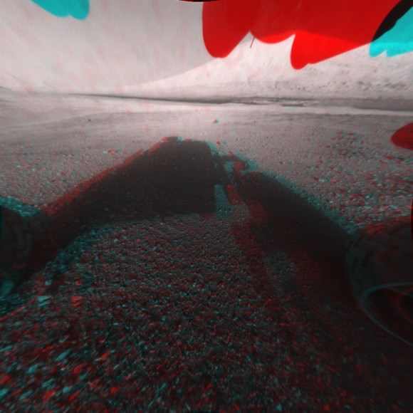
For comparison, see Curiosity’s initial wider field post-landing shots of Mount Sharp in 2 D and 3 D from the lower resolution fish-eye Hazcam cameras, here

NASA’s 1 ton mega rover Curiosity is the biggest and most complex robot ever sent to the surface of another planet, sporting a payload of 10 state of the art science instruments weighing 15 times more than any prior roving vehicle. Curiosity’s goal is to determine if Mars was ever capable of supporting microbial life, past or present and to search for the signs of life in the form of organic molecules.

Ken Kremer

Curiosity and the Mojave Desert of Mars – Panorama from Gale Crater

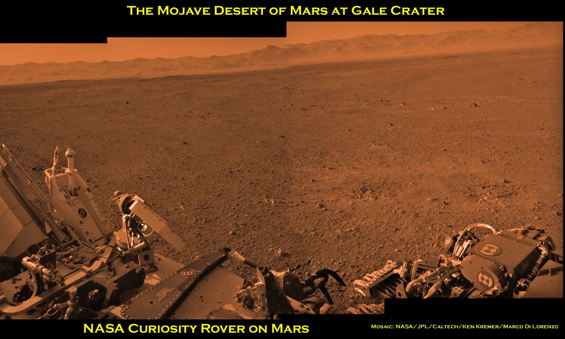
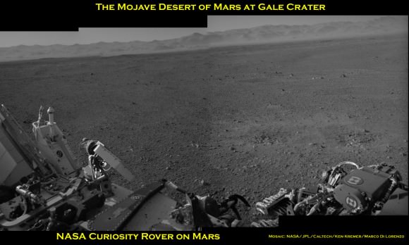
Image Caption: Curiosity and the Mojave Desert of Mars at Gale Crater North Rim, False Color Mosaic. This false color panoramic mosaic shows Curiosity in the foreground looking to the eroded rim of Gale Crater in the background. Visible at left is a portion of the RTG nuclear power source, low gain antenna pointing up, then the deployed High Gain antenna and other components of the rover deck. This mosaic was assembled from the three new full resolution Navcam images returned by Curiosity overnight and snapped on Sol 2 on Aug. 8. Image stitching by Ken Kremer and Marco Di Lorenzo. Topsoil at right foreground has been excavated by the descent landing thrusters to expose what the team believes is bedrock. See black and white version below. Credit: NASA/JPL-Caltech/Ken Kremer/Marco Di Lorenzo
Curiosity lead scientist John Grotzinger calls this place “The Mojave Desert” of Mars– that’s the sweet spot where NASA’s huge new Curiosity rover landed only 3 Sols, or days ago, and looks so “Earth-like”.

See above and below our new 3 frame panoramic mosaic showing Curiosity with a dramatic “Mojave Desert” backdrop – in false color and black and white – assembled from new pictures received overnight at JPL.

With her camera mast erected, Curiosity is beginning to beam back a flood of spectacular images and giving us the first detailed view of her new surroundings from her touchdown point inside Gale Crater on Mars beside a 3.4 mile (5.5 km) high layered mountain nicknamed Mount Sharp.

Overnight, Curiosity sent back many more full frame pictures from her Navcam navigation camera, including exquisite high resolution views of herself with the eroded rim of Gale Crater over her shoulder.

At Wednesday’s briefing, Grotzinger has ecstatic with the initial set of high resolution images showing Gale crater in the distance, saying;

“The thing that really struck the science team about this image, you would really be forgiven for thinking that NASA was trying to pull a fast one on you and we actually put a rover out in the Mojave Desert and took a picture.

“That’s the part of the rim that’s lowest in elevation, facing the northern lowlands of Mars.”

“The thing that’s amazing about this is to a certain extent the first impression you get is how earth-like this seems, looking at that landscape.”

The terrain is strewn with small pebbles that the team hypothesizes may stem from a nearby alluvial fan through which liquid water flowed long ago and is exactly why they chose Gale Crater as Curiosity’s landing site.

“The sedimentary materials, all those materials are derived from erosion of those mountains there, that’s the source region for this material,” Grotzinger said. “It’s really kind of fantastic.”

The first 360 color panorama from the Mastcam cameras are expected soon.

Ken Kremer

Image Caption: Curiosity and the Mojave Desert of Mars at Gale Crater North Rim. This false color panoramic mosaic shows Curiosity in the foreground looking to the eroded rim of Gale Crater in the background. Visible at left is a portion of the RTG nuclear power source, low gain antenna pointing up, then the deployed High Gain antenna and other components of the rover deck. This mosaic was assembled from the three new full resolution Navcam images returned by Curiosity overnight. Processing by Ken Kremer and Marco Di Lorenzo. Topsoil at right foreground has been excavated by the descent landing thrusters to expose what the team believes is bedrock. Credit: NASA/JPL-Caltech/Ken Kremer/Marco Di Lorenzo
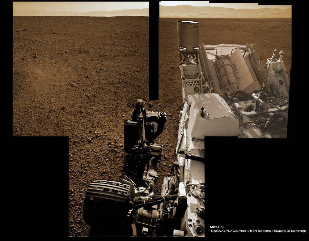
Image Caption: Looking to Martian bedrock and Gale Crater North Rim, False Color- This two frame mosaic was assembled from the first two full resolution Navcam images returned by Curiosity on Sol 2 (Aug 8) and enhanced and colorized to bring out further details. Image sticthing and processing by Ken Kremer and Marco Di Lorenzo. Topsoil in the foreground has been excavated by the Sky crane descent landing thrusters to expose what the team believes is bedrock. Credit: NASA/JPL-Caltech/Ken Kremer/Marco Di Lorenzo – www.kenkremer.com

Curiosity raises Mast and snaps 1st Self Portrait and 1st 360 Panorama

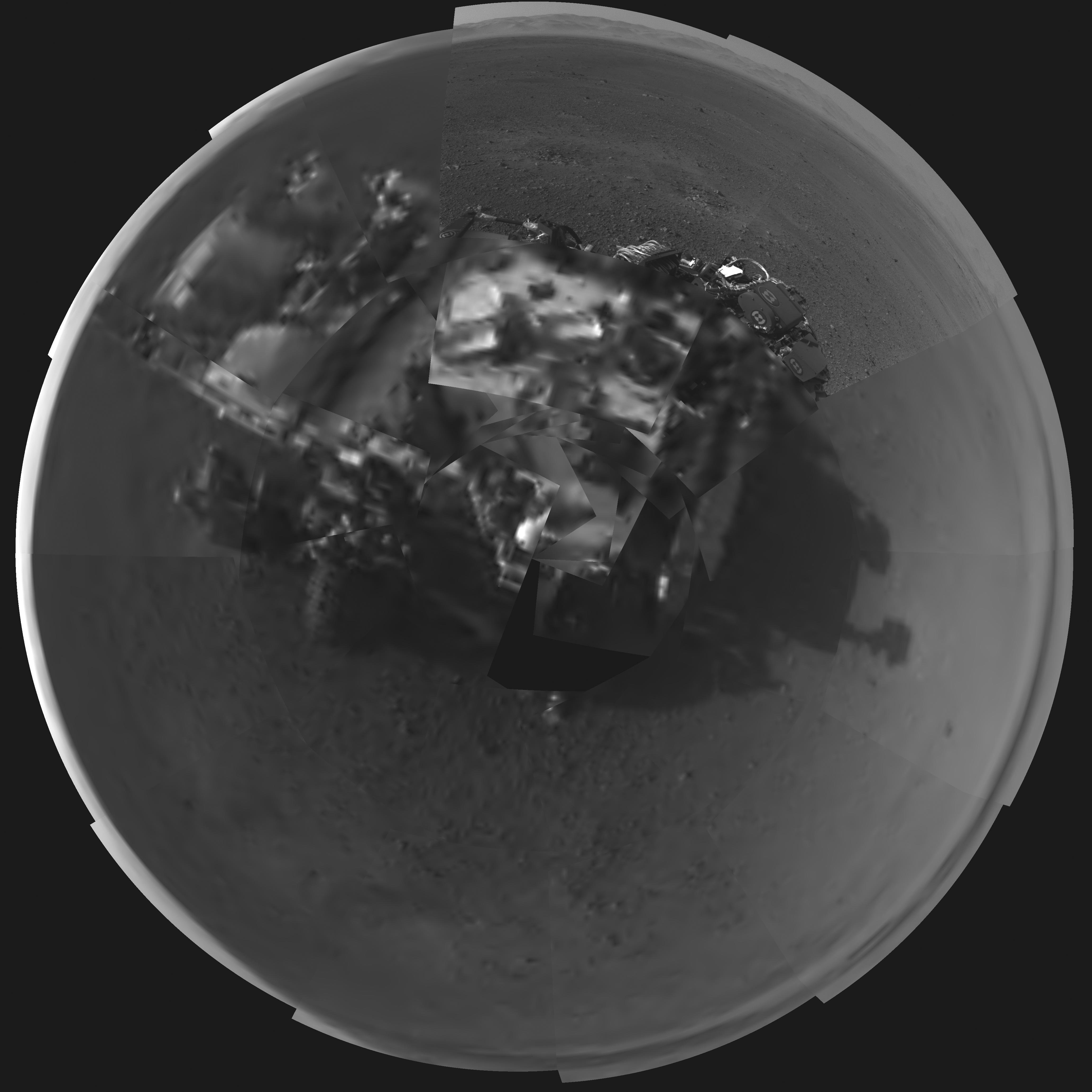
Image Caption: Rover’s Self Portrait -This Picasso-like self portrait of NASA’s Curiosity rover was taken by its Navigation cameras, located on the now-upright mast. The camera snapped pictures 360-degrees around the rover, while pointing down at the rover deck, up and straight ahead. Those images are shown here in a polar projection. Most of the tiles are thumbnails, or small copies of the full-resolution images that have not been sent back to Earth yet. Two of the tiles are full-resolution. Credit: NASA/JPL-Caltech.
See below the 1st 360 degree panorama from Curiosity and an enhanced Sol 2 mosaic of the full resolution view of the north rim of Gale Crater by this author

The rover Curiosity continues her marathon run of milestone achievements – snapping her 1st self portrait and 1st 360 degree panorama since touchdown inside Gale Crater barely over 2 sols, or Martian days ago.

To take all these new images, Curiosity used a new camera, the just-activated higher resolution navigation cameras (Navcam) positioned on the mast. Several of the new images provide the best taste yet of the stupendous vistas coming soon. See our enhanced Sol 2 mosaic below.

The 3.6 foot-tall (1.1 meter) camera mast on the rover deck was just raised and activated earlier today, Wednesday, Aug. 8.

The mast deployment is absolutely crucial to Curiosity’s science mission. It is also loaded with the high resolution MastCam cameras and the ChemCam instrument with the laser rock zapper.

Most of the images Navcam images beamed back today were lower-resolution thumbnails. But 2 high-resolution Navcams from the panorama and the self portrait were also downlinked and provide the clearest view yet of the breathtaking terrain surrounding Curiosity in every direction.

“The full frame navcams show the north rim of Gale Crater,” said Justin Maki, MSL navcam lead, at a briefing today at JPL. “The Navcam’s are identical to the MER Navcam’s.”

The hi res images also show how the descent thruster excavated the topsoil like Phoenix.

Image Caption: Curiosity Looks Away from the Sun – This is the first 360-degree panoramic view from NASA’s Curiosity rover, taken with the Navigation cameras. Most of the tiles are thumbnails, or small copies of the full-resolution images that have not been sent back to Earth yet. Two of the tiles near the center are full-resolution. Mount Sharp is to the right, and the north Gale Crater rim can be seen at center. The rover’s body is in the foreground, with the shadow of its head, or mast, poking up to the right. These images were acquired at 3:30 pm on Mars, or the night of Aug. 7 PDT (early morning Aug. 8 EDT). Thumbnails are 64 by 64 pixels in size; and full-resolution images are 1024 by 1024 pixels. Credit: NASA/JPL-Caltech

Image Caption: Looking to Martian bedrock and Gale Carter North Rim, Enhanced Mosaic- This mosaic was assembled from the first two full resolution Navcam images returned by Curiosity on Sol 2 (Aug 8) and enhanced to bring out further details. Processing by Ken Kremer and Marco Di Lorenzo. Topsoil in the foreground has been excavated by the descent landing thrusters to expose what the team believes is bedrock. Credit: NASA/JPL-Caltech/Ken Kremer/Marco di Lorenzo

“These Navcam images indicate that our powered descent stage did more than give us a great ride, it gave our science team an amazing freebie,” said John Grotzinger, project scientist for the mission from the California Institute of Technology in Pasadena. “The thrust from the rockets actually dug a one-and-a-half-foot-long [0.5-meter] trench in the surface. It appears we can see Martian bedrock on the bottom. Its depth below the surface is valuable data we can use going forward.”

Gale Crater is unlike anything we’ve seen before on Mars.

It also distinctly reminded Grotzinger of Earth and looked to him like the rover set down in the Mojave desert. “The thing that’s amazing about this is to a certain extent the first impression you get is how earth-like this seems, looking at that landscape.”

Curiosity carries 10 science instruments with a total mass 15 times as large as the science payloads on NASA’s Mars rovers Spirit and Opportunity. Some of the tools, such as a laser-firing instrument for checking rocks’ elemental composition from a distance, are the first of their kind on Mars. Curiosity will use a drill and scoop, which are located at the end of its robotic arm, to gather soil and powdered samples of rock interiors, then sieve and parcel out these samples into the rover’s analytical laboratory instruments.

So far everything is going very well with Curiosity’s mechanical and instrument checkout. And there is even more power than expected from the RTG nuclear power source.

“We have more power than we expected and that’s going to be fantastic for being able to keep the rover awake longer,” said Mission manager Jennifer Trosper of JPL.

Ken Kremer

Looking to Martian bedrock and Gale Carter North Rim, Enhanced Mosaic with False Color- This mosaic was assembled from the first two full resolution Navcam images returned by Curiosity on Sol 2 (Aug 8) and enhanced and colorized to bring out further details. Processing by Ken Kremer and Marco Di Lorenzo. Topsoil in the foreground has been excavated by the descent landing thrusters to expose what the team believes is bedrock. Credit: NASA/JPL-Caltech/Ken Kremer/Marco di Lorenzo

Mount Sharp on Mars: 1st 2-D and 3-D Views of Curiosity’s Ultimate Mountain Goal

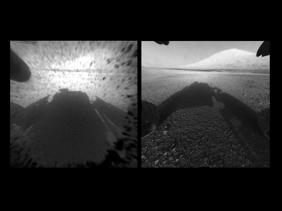
Image Caption: Clear View on Mars – This image comparison shows a view through a Hazard-Avoidance camera on NASA’s Curiosity rover before and after the clear dust cover was removed. Both images were taken by a camera at the front of the rover. Mount Sharp, the mission’s ultimate destination, looms ahead. See the first 3 D and 2 D full res images with no dust cover, below. Image credit: NASA/JPL-Caltech

Curiosity, NASA’s new car sized rover on Mars has sent back her first breathtaking views of Mount Sharp, the huge nearby mountain that enticed scientists to set Gale Crater as her touchdown goal.

And already within the first 2 Sols, or martian days, the rover has beamed back magnificent 2D and 3 D vistas of the landscape surrounding her.

The unprecedented rocket powered “Sky Crane” descent maneuver that lowered Curiosity by cables upon the Red Planet’s surface rover with pinpoint accuracy, set her down in a position inside Gale Crater that fortuitously pointed her front Hazard Avoidance (Hazcam) cameras towards a stupendous panoramic view of Mount Sharp.

The terrain is strewn with small pebbles that may stem from a nearby alluvial fan through which liquid water flowed long ago, scientist think.

The top image set shows the spectacular side by side views of Mount Sharp before and after the protective dust covers were popped off.

Mount Sharp is taller than Mount Ranier, the tallest mountain in the US in the lower 48 states. It’s about 3.5 miles (5.5 km) high.

Curiosity is roughly 6 km distant from Mount Sharp, as the martian crow flies.

The image below is the first full resolution Hazcam version of Mount Sharp.

Curiosity’s Early Views of Mars. This full-resolution image shows one of the first views from NASA’s Curiosity rover, which landed on Mars the evening of Aug. 5 PDT (early morning hours Aug. 6 EDT). It was taken through a “fisheye” wide-angle lens on one of the rover’s front Hazard-Avoidance cameras. These engineering cameras are located at the rover’s base. Image credit: NASA/JPL-Caltech

Here’s the first 3D version of Mount Sharp assembled from both front cameras.

Image Caption: 3-D View from the Front of Curiosity. This image is a 3-D view in front of NASA’s Curiosity rover, which landed on Mars on Aug. 5 PDT (Aug. 6 EDT). The anaglyph was made from a stereo pair of Hazard-Avoidance Cameras on the front of the rover. Mount Sharp, a peak that is about 5.5 kilometers (3.4 miles) high, is visible rising above the terrain, though in one “eye” a box on the rover holding the drill bits obscures the view. This image was captured by Hazard-Avoidance cameras on the front of the rover at full resolution shortly after the rover landed. It has been linearized to remove the distorted appearance that results from its fisheye lens. Credit: NASA/JPL-Caltech

Ken Kremer

Rover, Sky Crane, Heat Shield and Parachute Located from Orbit by HiRISE

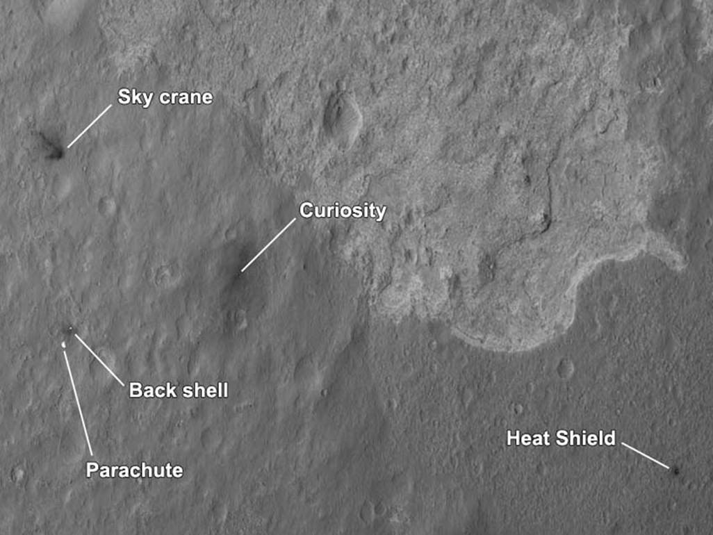
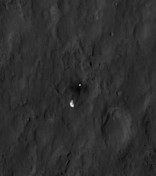
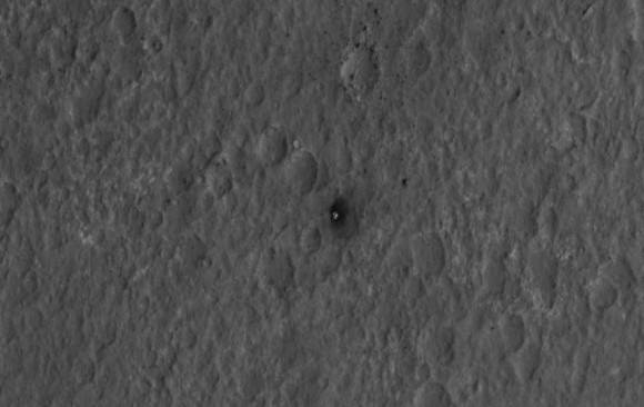
More awesomeness from HiRISE! A new orbital image shows the Curiosity rover sitting on Mars’ surface, along with all the accoutrements needed to get it there safely: the heat shield, backshell, parachute, and the Sky Crane. The High-Resolution Imaging Science Experiment (HiRISE) camera captured this image just 24 hours after MSL’s landing.

“This is like the crime scene photo here,” HiRISE team member Sarah Milkovich said during a press conference on Aug. 7.

Of course, yesterday the HiRISE team revealed they had captured MSL in the act of landing.

In re-inacting the scene of the crime, er… incredible landing, the heat shield, lower right, was the first piece to hit the ground, followed by the back shell attached to the parachute, then the rover itself touched down. Then, and finally, after cables were cut, the sky crane flew away to the northwest and crashed.
The heat shield is about 1,220 meters (4,000 feet) from Curiosity, the backshell and parachute are about 610 meters (2,000 feet) away from the rover, and the Sky Crane is about 620 meters (2,100 feet) away.

The relatively dark areas in all four spots are from disturbances of the bright surface dust, revealing darker soil underneath. If you look closely, even visible are the black streaks where the sky crane thrusters kicked up dust. Malkovich said scientists have looked at the streak patterns to verify Curiosity’s orientation — which confirms the information from the rover’s first pictures from surface.


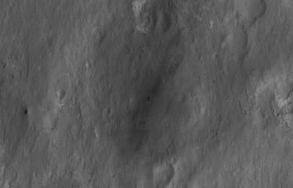
Close-up of Curiosity sitting on Mars’ surface. Credit: NASA/JPL/University of Arizona

The darkened radial jets from the sky crane are downrange from the point of oblique impact, much like the oblique impacts of asteroids. In fact, NASA said, they make an arrow pointing to Curiosity.


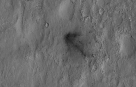
Close-up of the Sky Crane. Credit: NASA/JPL/University of Arizona

HiRISE’s image of MSL’s landing site shows the rover and the hardware doing their jobs exactly as they were designed to do.

The image was acquired from a special 41-degree roll of MRO, larger than the normal 30-degree limit. It rolled towards the west and towards the Sun, which increases visible scattering by atmospheric dust as well as the amount of atmosphere the orbiter has to look through, thereby reducing the contrast of surface features. Malkovich said that future images taken from a higher angle will show the hardware in greater detail.


Close-up of the parachute and backshell. Credit: NASA/JPL/University of Arizona


Close-up of the heat shield. Credit: NASA/JPL/University of Arizona

See larger versions and additional info at the HiRISE website.

Curiosity Beams 1st Color Image from Mars

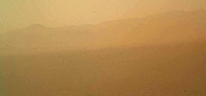
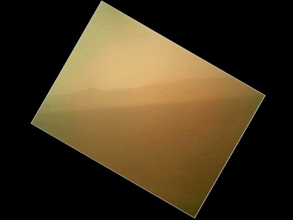
Image caption: This murky view from Curiosity shows the martian landscape looking north to the rim from inside the Gale Crater landing site and is her first color image beamed back to Earth. It’s murky because the dust cover is still attached. See full MAHLI image below. Also see below full res Hazcam image of crater rim. Credit: NASA/JPL-Caltech/Malin Space Science Systems

NASA’s Curiosity Mars rover has beamed back her first color view since touchdown, showing a view of the alien landscape pointing northward towards the eroded rim of Gale crater.

The picture was snapped by the rovers Mars Hand Lens Imager (MAHLI) camera on the afternoon of the first day after the pinpoint landing – signified as Sol 1 on Aug. 6, 2012.

The MAHLI image looks murky because the protective dust cover is still in place and is coated with a film of martian dust sprayed up by the descent retrorockets during the terminal phase of the hair-raising landing on Aug 5/6.

The camera’s dust cover is intentionally transparent so that initial images can still be snapped through the cover before it’s popped off in about a week.

MAHLI is located on the turret at the end of the rover’s 8 foot long robot arm which has been stowed in place on the front left side of Curiosity since long before the Nov. 26 liftoff from Cape Canaveral, Florida.

In the stowed position, MAHLI is rotated about 30 degrees as seen in the image below. The top image has been rotated to correct for the tilt and shows the sky “up” as Curiosity is actually sitting on the Martian surface.


Image caption: This full frame view from Curiosity shows the martian landscape looking north to the rim from inside the Gale Crater landing site and is her first color image beamed back to Earth. It’s murky because the dust cover is still attached. The image is from the MAHLI camera on the robot arm and currently in the stowed position. It has been rotated 30 degress. Credit: NASA/JPL-Caltech/Malin Space Science Systems

During her 2 year prime mission, Curiosity’s goal is to determine if Mars was ever capable of supporting microbial life, past or present and to search for the signs of life in the form of organic molecules with a payload of 10 science instruments weighing 15 times more than any prior roving vehicle.

Curiosity is the 3rd generation of NASA rover’s delivered to the Red Planet

Ken Kremer

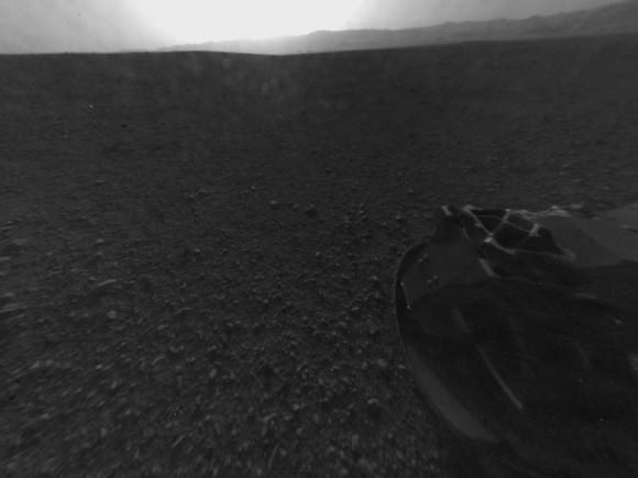
Image Caption: Looking Back at the Crater Rim – This is the full-resolution version of one of the first images taken by a rear Hazard-Avoidance camera on NASA’s Curiosity rover, which landed on Mars the evening of Aug. 5 PDT (morning of Aug. 6 EDT). The image was originally taken through the “fisheye” wide-angle lens, but has been “linearized” so that the horizon looks flat rather than curved. The image has also been cropped. A Hazard-avoidance camera on the rear-left side of Curiosity obtained this image. Part of the rim of Gale Crater, which is a feature the size of Connecticut and Rhode Island combined, stretches from the top middle to the top right of the image. One of the rover’s 20 inch wide wheels can be seen at bottom right. Image credit: NASA/JPL-Caltech