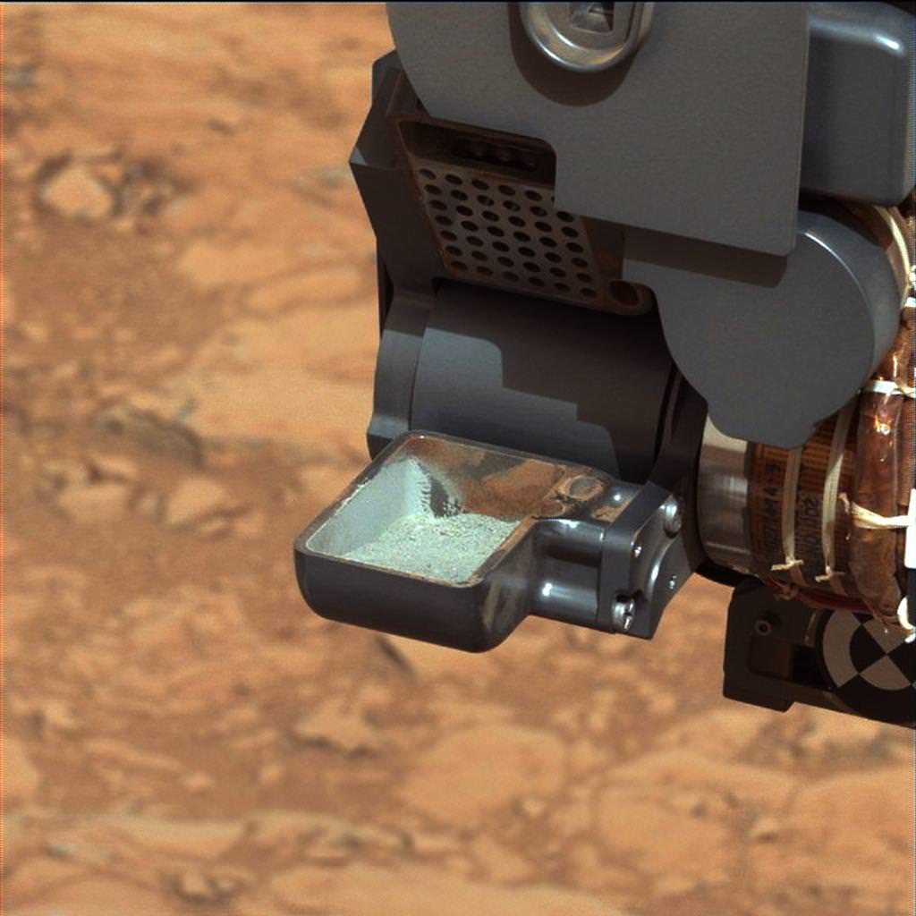
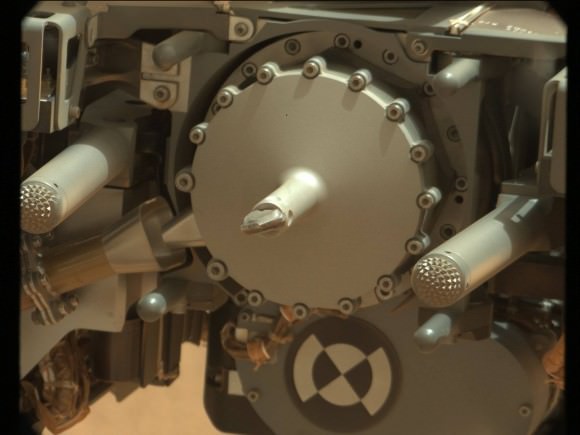
Newly received images from the surface of Mars confirm that NASA’s Curiosity rover successfully extracted the 1st ever samples collected by drilling down inside a rock on another planet and transferred the pulverized alien powder to the robots processing scoop, thrilled mission scientists announced just hours after seeing visual corroboration.
Collecting the 1st particles bored from the interior of a rock on a planet beyond Earth marks a historic feat in humankind’s exploration of the cosmos – and is crucial for achieving Curiosity’s goal to determine whether Mars ever could have supported microbial life, past or present.
The essential next step is to feed carefully sieved portions of the precious gray colored material into the high powered duo of miniaturized analytical chemistry labs (CheMin & SAM) inside the rover, for thorough analysis and scrutiny of their mineral content and to search for signatures of organic molecules – the building blocks of life as we know it.
Curiosity is drilling into ancient bedrock and hunting for clues to the planet’s habitability over the eons and that preserve the historical record – perhaps including organics.
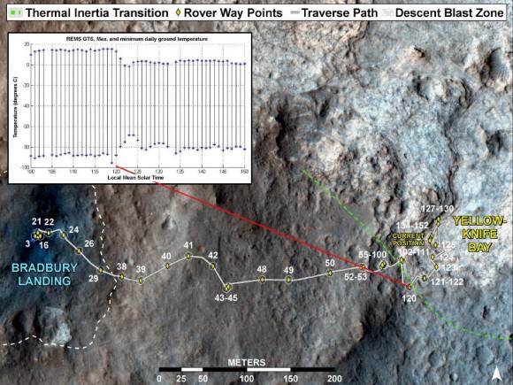
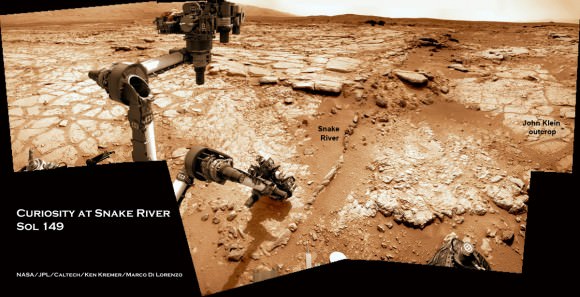
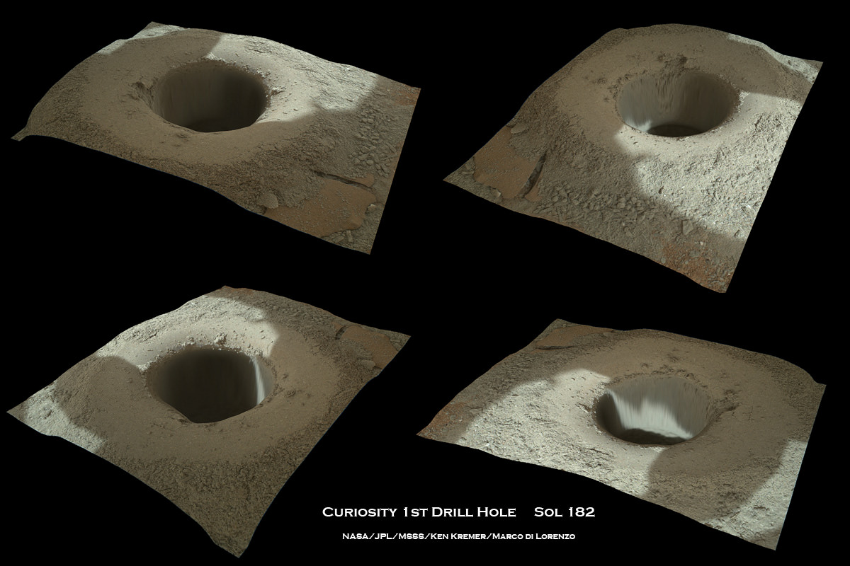
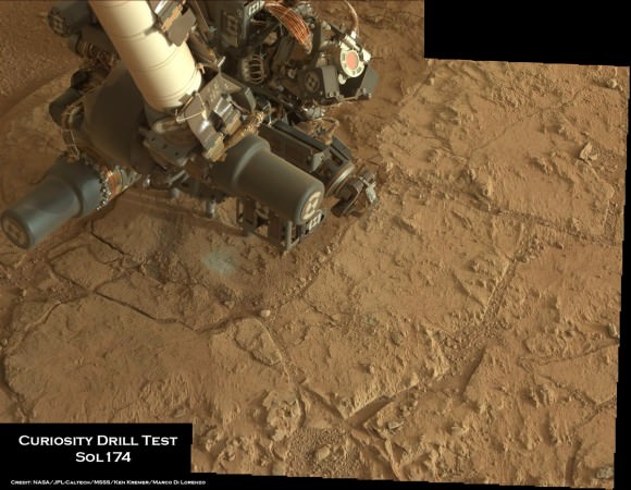
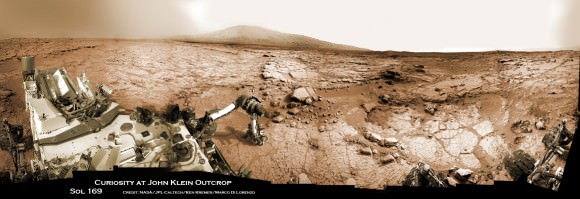
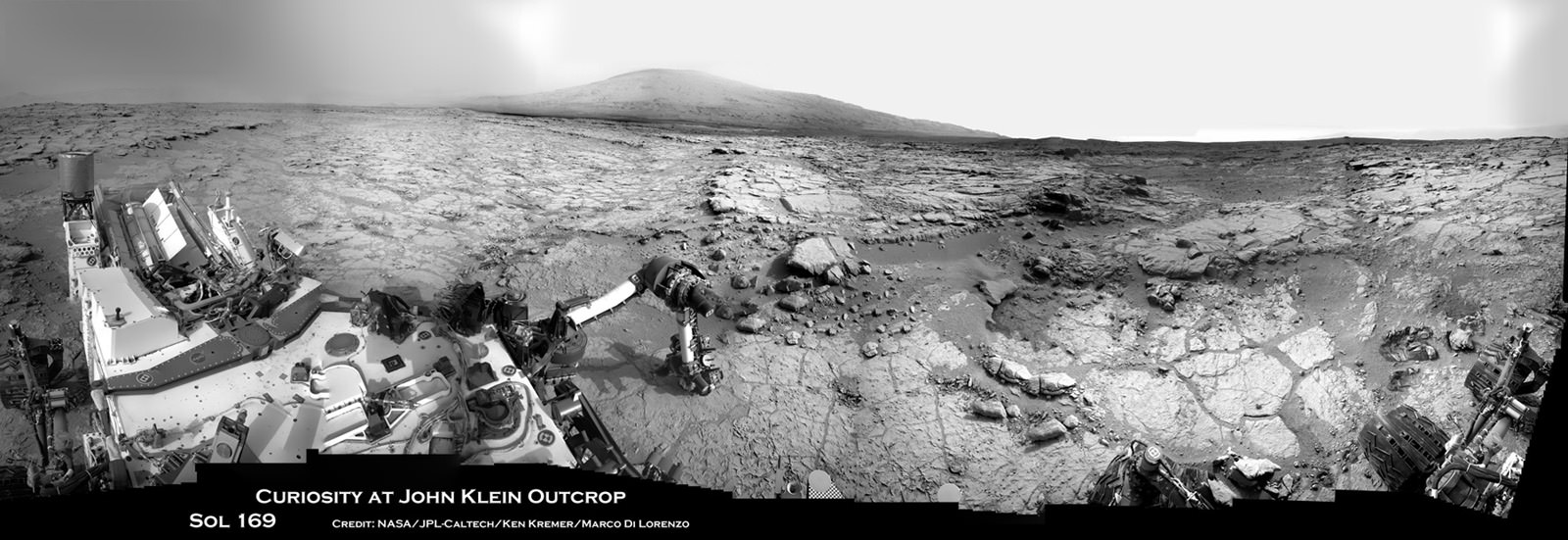
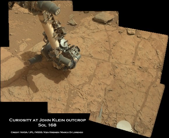
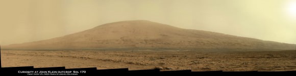
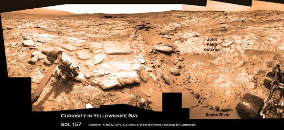
The rover team believes that this work area inside Gale Crater called Yellowknife Bay, experienced repeated percolation of flowing liquid water long ago when Mars was warmer and wetter – and therefore was potentially more hospitable to the possible evolution of life. See our Yellowknife Bay worksite and drill hole photo mosaics below by Ken Kremer & Marco Di Lorenzo, created from rover raw images.

“We collected about a tablespoon of powder, which meets our expectations and is a great result,” said JPL’s Scott McCloskey, drill systems engineer for Curiosity, at a NASA media briefing on Feb. 20. “We are all very happy and relieved that the drilling was a complete success.”
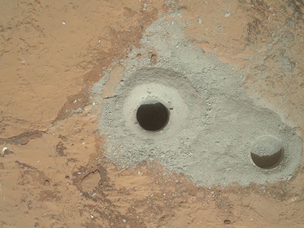
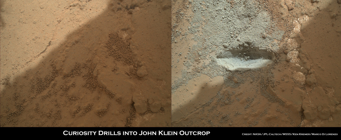
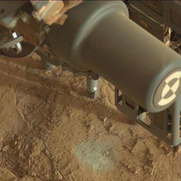
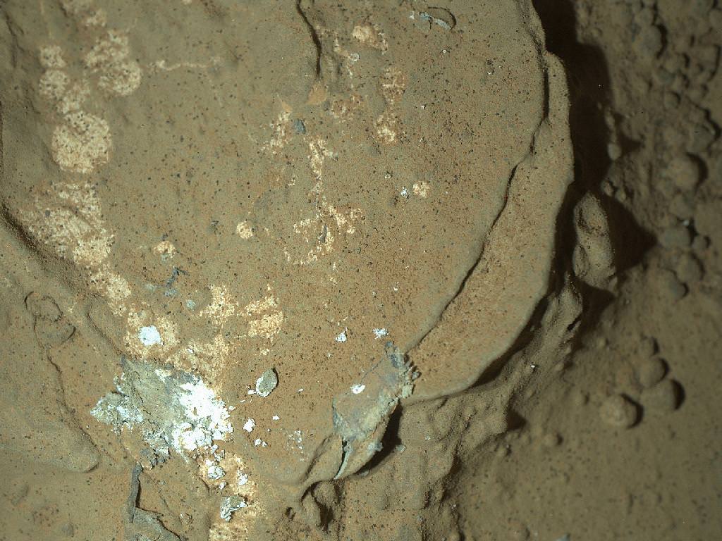
The gray colored tailings from the rocky interior offer a startlingly fresh sight of Mars compared to the red-orangey veneer of rusty, oxidized dust we are so accustomed to seeing globally across what we humans have referred to for centuries as the “Red Planet”.
“For the first time we are examining ancient rocks that have not been exposed to the Martian surface environment, and weathering, and preserve the environment in which they formed,” said Joel Hurowitz, Curiosity sampling system scientist of JPL.
This is a key point because subsequent oxidation reactions can destroy organic molecules and thereby potential signs of habitability and life.
“The tailings are gray. All things being equal it’s better to have a gray color than red because oxidation is something that can destroy organic compounds,” said John Grotzinger, the Curiosity mission’s chief scientist of the California Institute of Technology.
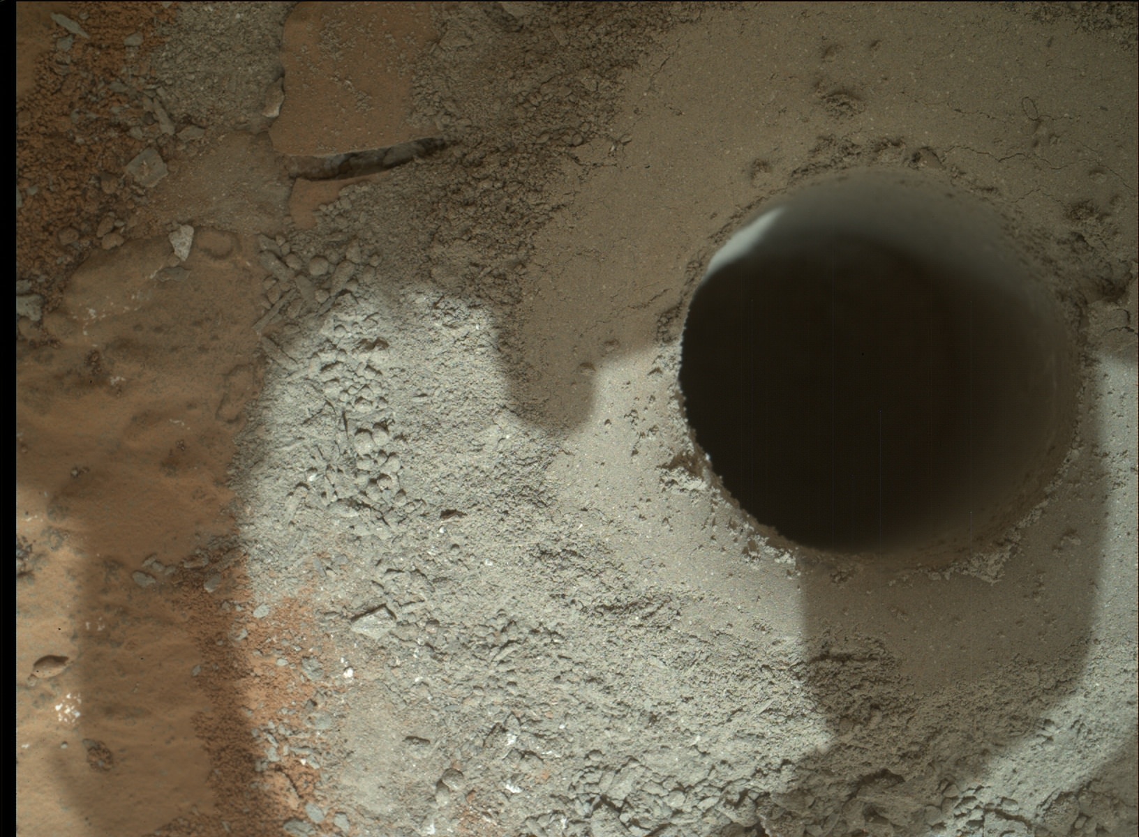
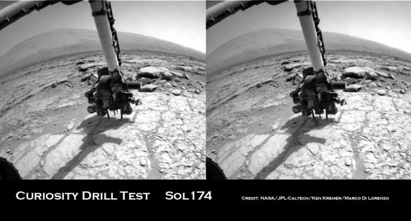
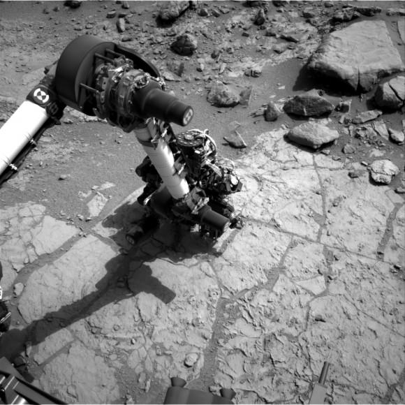
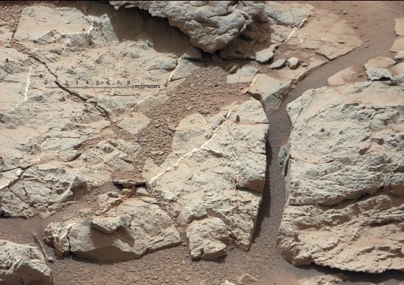
On Feb. 8, 2013 (mission Sol 182), Curiosity used the rotary-percussion drill mounted on the tool turret at the end of the 7 foot (2.1 meter) long robotic arm to bore a circular hole about 0.63 inch (16 mm) wide and about 2.5 inches (64 mm) deep into a red colored slab of flat, fine-grained, veiny sedimentary bedrock named “John Klein” that formed in water.
“Curiosity’s first drill hole at the John Klein site is a historic moment for the MSL mission, JPL, NASA and the United States. This is the first time any robot, fixed or mobile, has drilled into a rock to collect a sample on Mars,” said Louise Jandura, Curiosity’s chief engineer for the sampling system.
“In fact, this is the first time any rover has drilled into a rock to collect a sample anywhere but on Earth. In the five decade history of the space age this is indeed a rare event.”
“The rock drilling capability is a significant advancement. It allows us to go beyond the surface layer of the rock, unlocking a time capsule of evidence about the state of Mars going back 3 or 4 Billion years.”
“Using our roving geologist Curiosity, the scientists can choose the rock, get inside the rock and deliver the powdered sample to instruments on the rover for analysis.”
“We couldn’t all be happier as Curiosity drilled her first hole on Mars,” said Jandura.
Over the next few days, the powdery gray scoop material will be shaken and moved through Curiosity’s sample processing device known as CHIMRA, or Collection and Handling for In-Situ Martian Rock Analysis and sieved through ultra fine screens that filter out particles larger than 150 microns (0.006 inch) across – about the width of a human strand of hair.
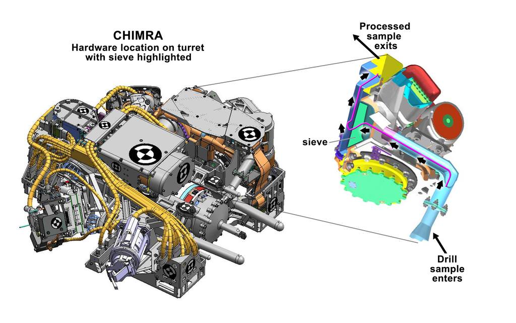
Drilling goes to the heart of the mission. It is absolutely indispensable for collecting and conveying pristine portions of Martian rocks and soil to a trio of inlet ports on top of the rover deck leading into the Chemistry and Mineralogy (CheMin) instrument and Sample Analysis at Mars (SAM) instrument .
The sieving process is designed to prevent clogging downstream into the chemistry labs.
The pair of state-of-the-art instruments will then test the gray rocky powder for a variety of inorganic minerals as well as both simple and complex organic molecules.
Samples will be dropped off first to CheMin and then SAM over the next few days. Results are expected soon.
The data so far indicate the drilled rock is either siltstone or mudstone with a basaltic bulk composition, said Hurowitz. The CheMin and SAM testing will be revealing.
The high powered drill was the last of Curiosity 10 instruments still to be checked out and put into full operation and completes the robots commissioning phase.
“This is a real big turning point for us as we had a passing of the key for the rover [from the engineering team] to the science team,” said Grotzinger.
Curiosity has discovered that Yellowknife Bay is loaded with hydrated mineral veins of calcium sulfate that precipitated from interaction with aqueous environments.
I asked how was the drill target hole selected?
“We wanted to be well centered in a large plate of bedrock where we knew we could place the drill into a stable location on an interesting rock,” Hurowitz told Universe Today.
“The drill did not specifically target the veins or nodular features visible in this rock. But these rocks are so shot through with these features that it’s hard to imagine that we would have been missed them somewhere along the travel of the drill.”
“We will find out what’s in the material once we get the materials analyzed by SAM and CheMin.
“We will consider additional drill targets if we think we missed a component of the rock.”
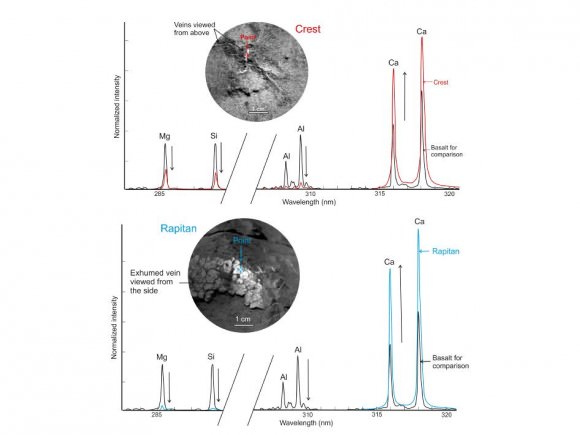
“We believe the white vein material is calcium sulfate based on data from ChemCam and APXS but we don’t yet know the hydration state.” Hurowitz told me.
Regarding the prospects for conducting additional sample drilling and soil scooping at Yellowknife Bay, Grotzinger told me, “We have to take it one step at a time.”
“We have to see what we find in the first sample. We are discovery driven and that will determine what we do next here,” Grotzinger said. “We have no quotas.”
The long term mission goal remains to drive to the lower reaches of Mount Sharp some 6 miles away and look for habitable environments in the sedimentary layers.
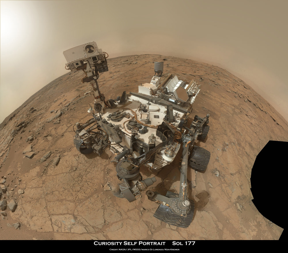
Curiosity executed a flawless and unprecedented nail-biting, pinpoint touchdown on Aug. 5, 2012 to begin her 2 year long primary mission inside Gale Crater. So far she has snapped over 45,000 images, traveled nearly 0.5 miles, conducted 25 analysis with the APXS spectrometer and fired over 12,000 laser shots with the ChemCam instrument.


![HRI_937_1[1]](https://www.universetoday.com/wp-content/uploads/2013/02/HRI_937_11-580x580.jpg)
![PIA16716_ip[1]](https://www.universetoday.com/wp-content/uploads/2013/01/PIA16716_ip1-580x580.jpg)
![8403941024_d82bee7a00_b[1]](https://www.universetoday.com/wp-content/uploads/2013/01/8403941024_d82bee7a00_b1-580x360.jpg)


![pia16567-43[1]](https://www.universetoday.com/wp-content/uploads/2013/01/pia16567-431-580x435.jpg)