A Memorial to 9/11… on Mars

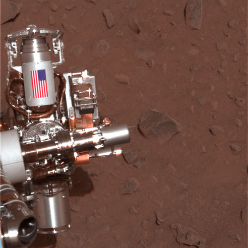
Today, on the 11th anniversary of the World Trade Center attack, countless hearts and minds will be reflecting upon a day that changed our world forever and remembering those who lost their lives in the tragic collapse of the twin towers. Memorial events will be held in many locations around the planet… and even, in a small yet poignant way, on another planet. For, unknown to many, two pieces of the World Trade Center are currently on the surface of Mars: one affixed to the rover Spirit, now sitting silently next to a small rise dubbed “Home Plate”, and the other on its sister rover Opportunity, still actively exploring the rim of Endeavour crater.

Even more than scientific exploration tools, these rovers are also interplanetary memorials to all the victims of 9/11.

(The following is a repost of an article first featured on Universe Today in 2011, on the 10th anniversary of 9/11.)

In September of 2001 workers at Honeybee Robotics in lower Manhattan were busy preparing the Rock Abrasion Tools that the twin rovers Spirit and Opportunity would each be equipped with, specialized instruments that would allow scientists to study the interiors of Martian rocks. After the World Trade Center attacks occurred, the company wanted a way to memorialize those who had lost their lives.

Through what was undoubtedly some incredibly skillful use of contacts, Honeybee founder and MER science team member Stephen Gorevan – on a suggestion by JPL engineer Steve Kondos and with help from the NYC mayor’s office and rover mission leader Steve Squyres – was able to procure two pieces of aluminum from the tower debris. These were fashioned into cylindrical cable shields by a contracted metal shop in Round Rock, Texas, and had American flags adhered to each by Honeybee engineer Tom Myrick.
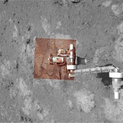
The image above, taken in 2004, shows the cable shield with American flag on the Rock Abrasion Tool attached to Spirit. At right is an image of the flag shield on Opportunity, acquired on September 11, 2011.

The rovers were launched in the summer of 2003 and have both successfully operated on Mars many years past their planned initial mission timelines. Spirit currently sits silent, having ceased communication in March 2010, but Opportunity is still going strong in its exploration of the Martian surface.

“It’s gratifying knowing that a piece of the World Trade Center is up there on Mars. That shield on Mars, to me, contrasts the destructive nature of the attackers with the ingenuity and hopeful attitude of Americans.”

– Stephen Gorevan, Honeybee Robotics founder and chairman

These memorials will remain on Mars long after both rovers have ceased to run, subtle memorials to thousands of lives and testaments to our ability to forge ahead in the name of hopefulness and discovery.

Original source: OnOrbit.com

Image credit: NASA / JPL-Caltech

Photo of Manhattan taken from orbit on September 11, 2001. (NASA)

Could Dust Devils Create Methane in Mars’ Atmosphere?

[/caption]

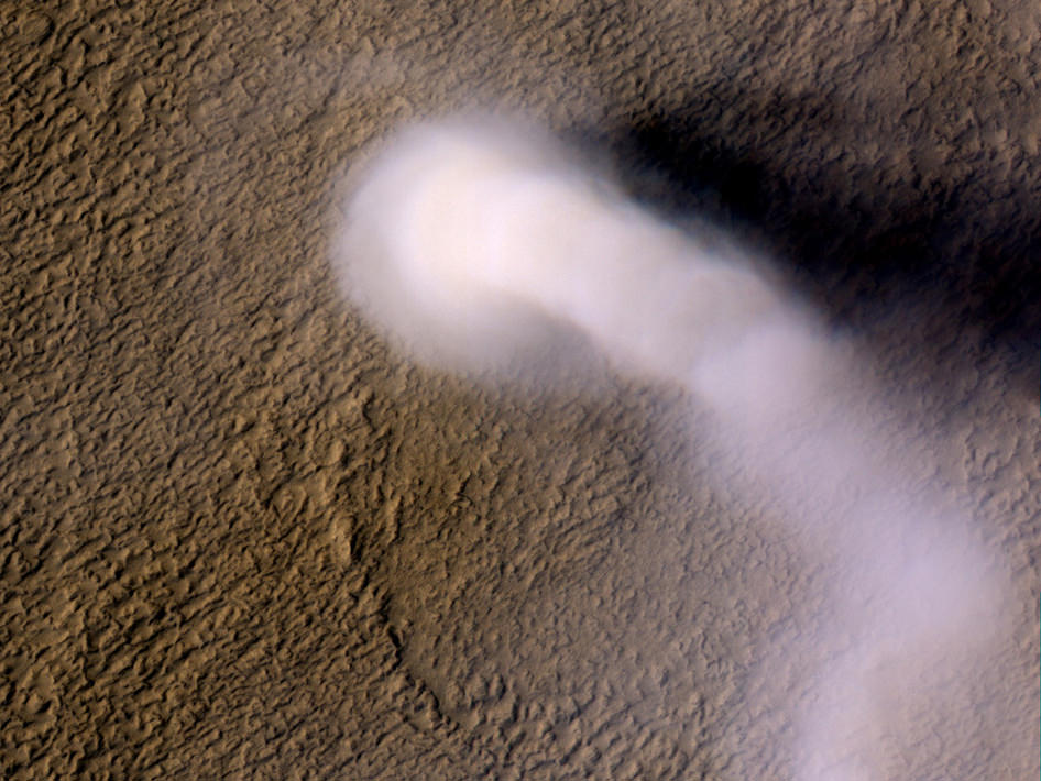
Methane on Mars has long perplexed scientists; the short-lived gas has been measured in surprising quantities in Mars’ atmosphere over several seasons, sometimes in fairly large plumes. Scientists have taken this to be evidence of Mars being an ‘active’ planet, either geologically or biologically. But a group of researchers from Mexico have come up with a different – and rather unexpected – source of methane: dust storms and dust devils.

“We propose a new production mechanism for methane based on the effect of electrical discharges over iced surfaces,” reports a paper published in Geophysical Research letters, written by a team led by Arturo Robledo-Martinez from the Universidad Autónoma Metropolitana, Azcapotzalco, Mexico.

“The discharges, caused by electrification of dust devils and sand storms, ionize gaseous CO2 and water molecules and their byproducts recombine to produce methane.”

Graph from the paper Electrical discharges as a possible source of methane on Mars: Lab simulation, Geophys. Res. Lett., 39, L17202, doi:10.1029/2012GL053255.

In a laboratory simulation, they showed that that pulsed electrical discharges over ice samples in a synthetic Martian atmosphere produced about 1.41×10¹⁶ molecules of methane per joule of applied energy. The results of the electrical discharge experiment were compared with photolysis induced with UV laser radiation and it was found that both produce methane, although the efficiency of photolysis is one-third of that of the discharge.

The scientists don’t rule out that methane may indeed come from other sources as well, but the way that dust devils and storms can quickly form means they can also quickly generate methane. “The present mechanism may be acting in parallel with other proposed sources but its main advantage is that it can generate methane very quickly and thus explain the generation of plumes,” the team writes.

Methane has been observed in Mars’ atmosphere since 1999, but in 2009, scientists studying the atmosphere of Mars over several Martian years with telescopes here on Earth announced they had found three regions of active release of methane over areas that had evidence of ancient ground ice or flowing water.

They observed and mapped multiple plumes of methane on Mars, one of which released about 19,000 metric tons of methane. The plumes were emitted during the warmer seasons — spring and summer — which is also when dust devils tend to form.

Methane on Mars is enticing because it only lasts a few hundred years in Mars’ atmosphere, meaning it has to be continually replaced. And in the back of everyone’s minds has been the possibility of some sort of Martian life producing it.

“Methane is quickly destroyed in the Martian atmosphere in a variety of ways, so our discovery of substantial plumes of methane … indicates some ongoing process is releasing the gas,” said Dr. Michael Mumma of NASA’s Goddard Space Flight Center in Greenbelt, Md in 2009. “At northern mid-summer, methane is released at a rate comparable to that of the massive hydrocarbon seep at Coal Oil Point in Santa Barbara, Calif.”

The researchers in 2009 thought that the methane was being released from Mars’ interior, perhaps because the permafrost blocking cracks and fissures vaporized, allowing methane to seep into the Martian air.

The unknown has been where the methane has been coming from; if it is being released from the interior, it could be produced by either geologic processes such as serpentinization, a simple water/rock reaction or biologic processes of microbes (or something bigger) releasing methane as a waste product.

But if dust devils and dust storms can also produce methane, the mystery becomes a little more mundane.

The new research by the team from Mexico also mentioned fissures in the surface, but for a different reason, saying that the electric field of dust devils is amplified by the topology of the soil: “The electrical field produced by a dust devil can not only overcome the weak dielectric strength of the Martian atmosphere, but also penetrate into cracks on the soil and so reach the ice lying at the bottom, with added strength, due to the topography of the terrain,” the team wrote.

At a concentration of about 10 to 50 parts per billion by volume, methane is still a trace element in the Martian atmosphere, and indeed the sharp variations in its concentration that have been observed have been difficult to explain. Hopefully the research teams can coordinate follow-up observations of methane production during the dust devil and dust storm seasons on Mars.

Read the team’s abstract.

Read our article from 2009 about Mars Methane.

Clay Deposits Don’t Prove Existence of Ancient Martian Lakes

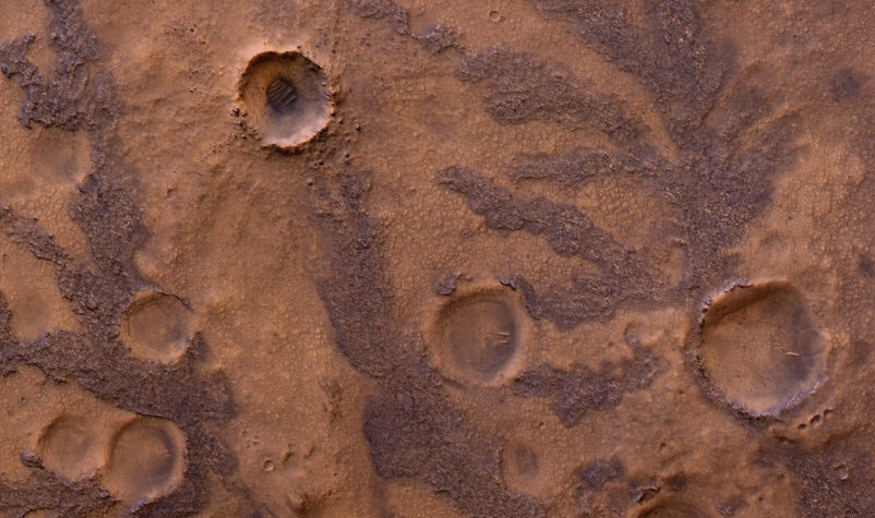
HiRISE image of branching features in the floor of Antoniadi Crater thought to contain clay material. (NASA/JPL/University of Arizona)

In the hunt for evidence of a warmer, wetter past on Mars, clay deposits have been viewed as good indications that stable liquid water existed on its surface for some time — perhaps even long enough to allow life to develop. But new research conducted here on Earth shows that some clays don’t necessarily need lakes of liquid water to form. Instead they can be the result of volcanic activity, which is not nearly so hospitable to life.

A research team led by Alain Meunier of the Université de Poitiers in France studied lavas containing iron and magnesium — similar to ancient clays identified on the surface of Mars — in the French Polynesian atoll of Moruroa. The team’s findings show that the same types of clay outcrops can be caused by the solidifying of water-rich magma in a volcanic environment, and don’t require Earthlike aquatic conditions at all.

The results also correlate to the deuterium-to-hydrogen (D/H) ratio within clays found in Martian meteorites.

Read: Life from Mars Could Have Polluted Earth

“To crystallize, clays need water but not necessarily liquid water,” said Alain Meunier to the Agençe France-Presse (AFP). “Consequently, they cannot be used to prove that the planet was habitable or not during its early history.”

Additionally, the clay deposits found on Mars can be several hundred meters thick, which seems to be more indicative of upwelling magma than interactions with water.

“[This] new hypothesis proposes that the minerals instead formed during brief periods of magmatic degassing, diminishing the prospects for signs of life in these settings,” wrote Brian Hynek from the Department of Geological Sciences at the University of Colorado, in response to the paper by Meunier et al. which was published in the September 9 edition of the journal Nature Geoscience.

This does not necessarily mean that all Martian clays weren’t formed in the presence of water, however. Gale Crater — where NASA’s Curiosity rover is now exploring — could very well have been the site of a Martian lake, billions of years in the past. Clays found there could have been created by water.

Read: Take a Trip to Explore Gale Crater

According to Bethany Ehlmann of the California Institute of Technology, co-author of the study, “there are particular characteristics of texture” to clays formed under different conditions, and “Gale is a different flavor of Mars.”

Perhaps Curiosity will yet discover if Gale’s original flavor was more cool and wet than hot and spicy.

Read more on New Scientist and Cosmos Magazine.

Inset image: Moruroa Atoll (NASA) 

Curiosity Snaps Evocative Self Portrait

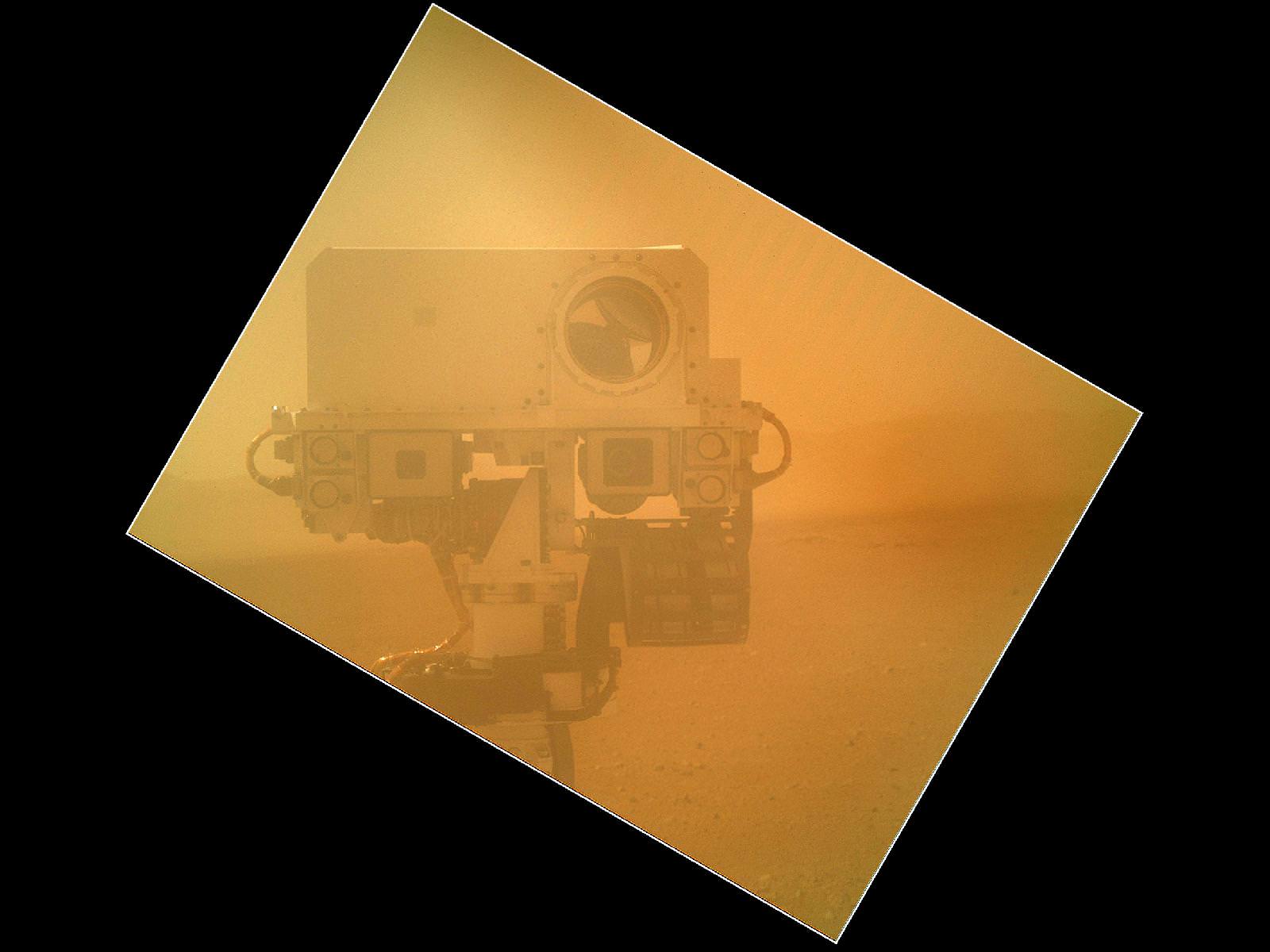
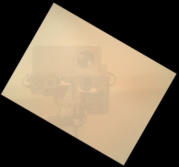
Image Cation: Curiosity takes Self Portrait on Sol 32 with the Mars Hand Lens Imager (MAHLI). Image has been rotated up and enhanced by JPL. Credit: NASA/JPL-Caltech/Malin Space Science Systems

Curiosity has snapped an evocative new color self-portrait – and it’s totally unique, being the 1st head shot pose, showing the top of the Remote Sensing Mast (RSM).

You’ll notice it’s a bit dusty ! That’s because it was acquired through the transparent dust cover protecting the high resolution Mars Hand Lens Imager (MAHLI) camera positioned on the turret at the end of Curiosity’s 7 foot (2.1 meter) long robotic arm.

The gorgeous new image was taken on Sol 32 (Sept. 7, 2012) with the dust cover closed over the camera lens and thus provides a taste of even more spectacular views yet to come. The picture beautifully shows the Mastcam, Chemcam and Navcam cameras with the rim of Gale Crater in the background.

The MAHLI image above has been enhanced and rotated – to right side up. See the MAHLI raw image below.

The image was taken as JPL engineers were inspecting and moving the arm turret holding MAHLI and the other science instruments and tools and looking back to image them in turn using the Mast’s cameras.

NASA’s mega Martian rover is pausing for about a week or two at this location reached after driving on Sol 29 (Sept. 2) and will thoroughly check out the robotic arm and several science instruments.

So far Curiosity has driven about 358 feet (109 meters) and is sitting roughly 270 feet from the “Bradbury Landing” touchdown spot as the Martian crow flies.

The car sized robot is about a quarter of the way to Glenelg, the destination of her first lengthy science stop where three different types of geologic terrain intersect and are easily accessible for a detailed science survey using all 10 state of the art instruments including the rock drill and soil sampling mechanisms.

Ken Kremer

Curiosity on the Move! HiRISE Spies Rover Tracks on Mars

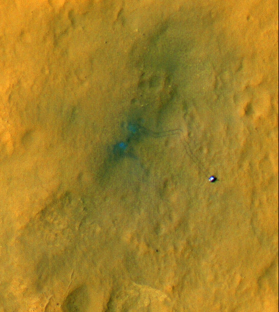
The beginning of Curiosity’s journeys. Credit: NASA/JPL-Caltech/Univ. of Arizona

Yes, the Curiosity rover is on the move, evidenced by the rover tracks seen from above by the outstanding HiRISE camera on board the Mars Reconnaissance Orbiter. If you look closely, visible are the rover’s wheels and even the camera mast. While this image’s color has been enhanced to show the surface details better, this is still an amazing view of Curiosity’s activities, displaying the incredible resolving power of the High-Resolution Imaging Science Experiment.

“These are great pictures that help us see context,” said Curiosity mission manager Mike Watkins at a press conference today. “Plus they’re just amazing photos.”

The two “blue” marks (blue is, of course, false color) seen near the site where the rover landed were formed when reddish surface dust was blown away by the rover’s descent stage, revealing darker basaltic sands underneath. Similarly, the tracks appear darker where the rover’s wheels disturbed the top layer of dust.

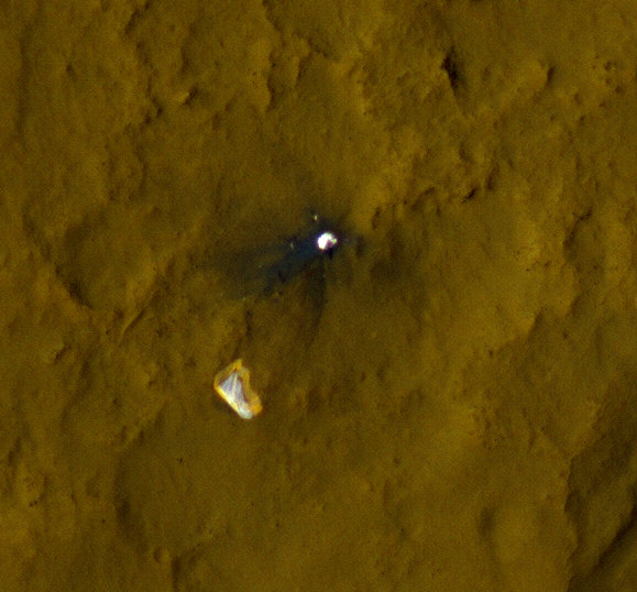
Below is another great view showing Curiosity’s parachute and backshell in color, highlighting the color variations in the parachute, along with a map of where Curiosity has been and will be going.

Curiosity’s parachute and backshell in color. Credit: NASA/JPL-Caltech/Univ. of Arizona

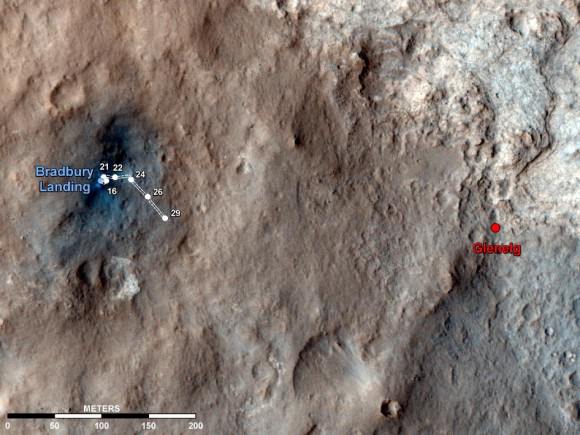
Map of Curiosity’s travels so far. Credit: NASA/JPL-Caltech/Univ. of Arizona.

This map shows the route driven by NASA’s Mars rover Curiosity overlaid on the HiRISE image, showing where Curiosity has driving through the 29th Martian day, or sol, of the rover’s mission on Mars, which equals Sept. 4, 2012 here on Earth.

The route starts at Bradbury Landing, Curiosity’s landing site. Numbering of the dots along the line indicate the sol numbers of each drive. North is up. The scale bar is 200 meters (656 feet).

By Sol 29, Curiosity had driven at total of 358 feet (109 meters). While scientists say the rover can travel up to a hundred meters a day, the team has been putting the rover through tests of the robotic arms and other instruments.

The first area of real interest that the team wants to study is the Glenelg area, farther east. The science team said the Glenelg region should provide a good target for Curiosity’s first analysis of powder collected by drilling into a rock.

How long will it take to get to Glenelg? It is about 400 meters away, and the rover is about a quarter of the way there so far.

“If you drove every day and didn’t do the context science it would take a couple of weeks to drive to Glenelg, at 30-40 meters a day,” said Matt Robinson, lead engineer for Curiosity’s robotic arm testing and operations. “But I think we will stop and do the context science. My guess is it will be a few weeks before we get to Glenelg.

The drive to Mt. Sharp, which is about 8 km away, will take much longer, months, maybe even a year.

“If we use our full driving mode and do up to one hundred meters a day, and not stop, it would take about 3 months,” said Robinson, “but we might only be driving for one-half to one-third of the time, it depends on how interesting the terrain is along the way.”

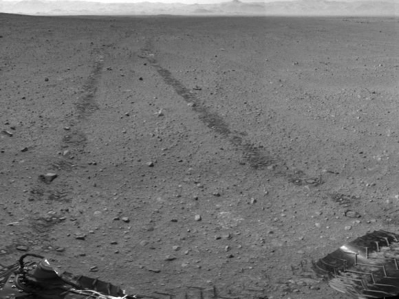
This scene shows the surroundings of the location where NASA Mars rover Curiosity arrived on the 29th Martian day, or sol, of the rover’s mission on Mars (Sept. 4, 2012). It is a mosaic of images taken by Curiosity’s Navigation Camera (Navcam) following the Sol 29 drive of 100 feet (30.5 meters). Tracks from the drive are visible in the image. For scale, Curiosity leaves parallel tracks about 9 feet (2.7 meters) apart. At this location on Sol 30, Curiosity began a series of activities to test and characterize the rover’s robotic arm and the tools on the arm.

The panorama is centered to the north-northeast, with south-southwest at both ends.

Image credit: NASA/JPL-Caltech

The view of Curiosity’s surroundings is fascinating to both Mars enthusiasts and the scienctists.
Joy Crisp, the deputy project scientist for the mission said two main things have intrigued her. “One is the Mastcam imaging of Mt. Sharp, seeing structures and layers. The other is the amazing rock textures. Some rocks have light-toned grains mixed in a dark matrix. We need to examine rocks like those more thoroughly.”

“That’s what’s been exciting, to see things we haven’t seen before on Mars,” Crisp added.

See more info and larger versions of these images at this NASA webpage.

Bradbury Landing on Mars Chronicled in 3-D

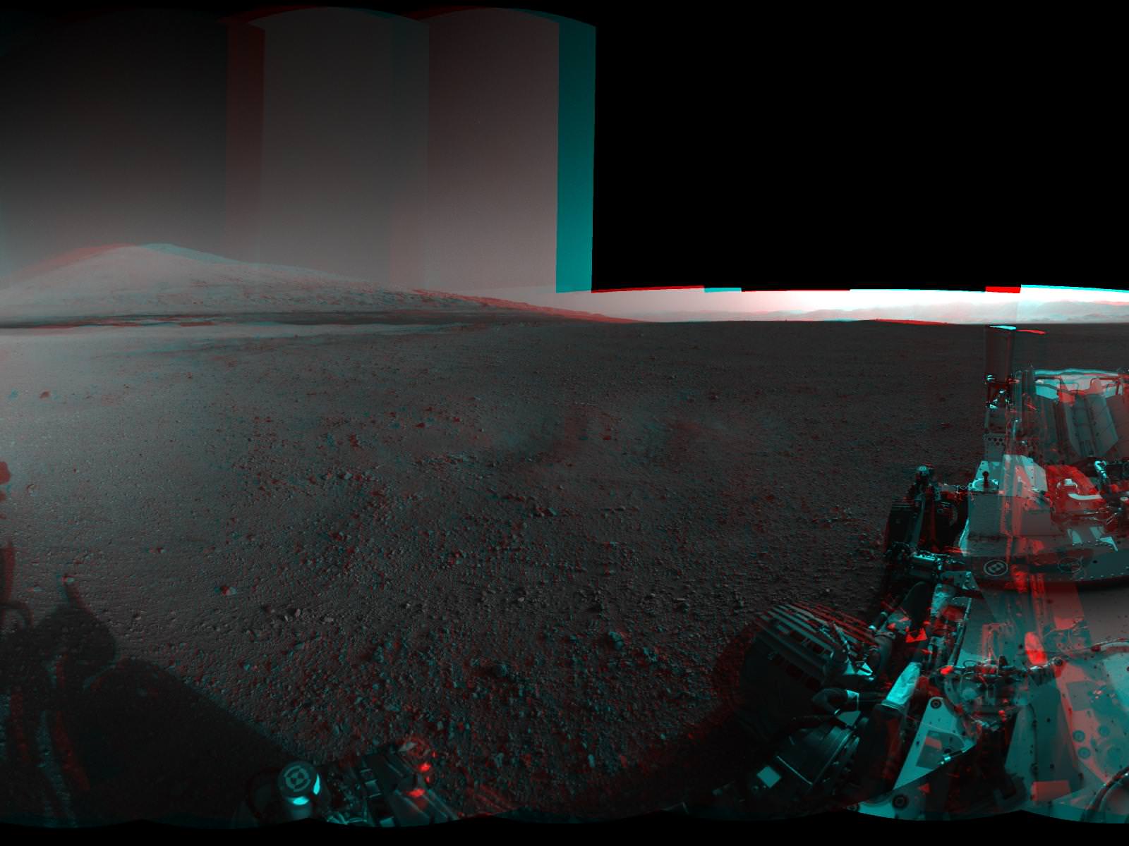
Image Caption:3-D View from Bradbury Landing- from Navcam cameras.. See the full panorama below. Credit: NASA/JPL-Caltech

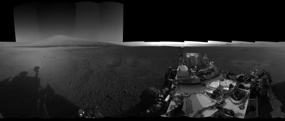
Now you can enjoy the thrills of Curiosity’s touchdown site at Bradbury Landing as if you there – chronicled in stunning 3 D !! Check out this glorious 360-degree stereo panorama just released by JPL.

The pano was assembled by JPL from individual right and left eye images snapped by the rover’s mast mounted navigation cameras on sols 2 and 12 of the mission – Aug. 8 and 18, 2012.

So whip out your handy-dandy, red-blue (cyan) anaglyph glasses and start exploring the magnificent home of NASA’s newest Mars rover inside Gale Crater.

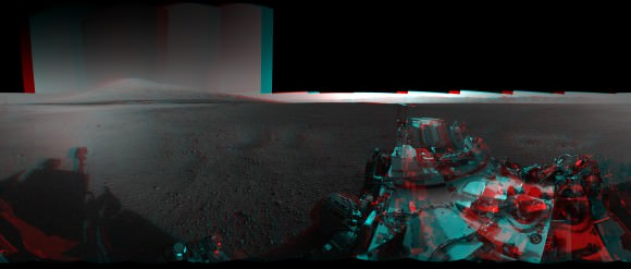
Image Caption: Complete 360 degree Panoramic 3-D View from Bradbury Landing by NASA’s Curiosity Mars rover. Credit: NASA/JPL-Caltech

The mosaic shows Curiosity’s eventual mountain destination – Mount Sharp – to its visible peak at the right, as well as the eroded rim of Gale Crater and a rover partial self portrait. Curiosity cannot see the actual summit from the floor of Gale Crater at Bradbury landing.

In about a year, the 1 ton behemoth will begin climbing up the side of Mount Sharp – a layered mountain some 3.4 miles (5.5 kilometers) high that contains deposits of hydrated minerals.

Curiosity will investigate and sample soils and rocks with her powerful suite of 10 state of the art science instruments.

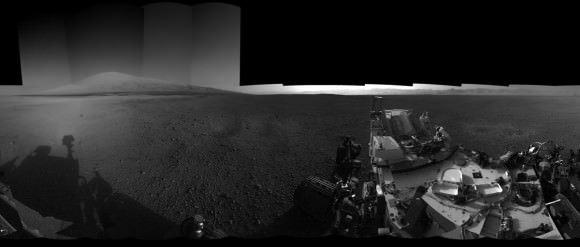
See below JPL’s individual right and left eye pano’s from which the 3-D mosaic was created.

Image Caption: Complete 360 degree Panoramic left eye View from Bradbury Landing by NASA’s Curiosity Mars rover – from Navcam cameras. Credit: NASA/JPL-Caltech

Image Caption: Complete 360 degree Panoramic right eye View from Bradbury Landing by NASA’s Curiosity Mars rover- from Navcam cameras. Credit: NASA/JPL-Caltech

The rover has now departed Bradbury landing and begun her long Martian Trek on an easterly path to Glenelg – her first stop designated for a lengthy science investigation.

Glenelg lies at the intersection of three distinct types of geologic terrain.

So far Curiosity has driven 358 feet (109 meters) and is in excellent health.

Ken Kremer

Life from Mars could have ‘polluted’ Earth: Krauss

Unless you’ve been living under a rock — Earth or Martian — in the past month, surely you have heard about the Curiosity rover’s landing and early adventures on Mars.

The prospects for what the rover could find has many in the space community very excited, even though Curiosity is supposed to look for habitable environments, not life itself.

However, a couple of weeks ago, noted theoretical physicist Lawrence Krauss said he wouldn’t be surprised if we do find evidence of life on Mars.

In an interview with CNN, Krauss said it’s possible Martian life could have “polluted” Earth early in our planet’s history, giving rise to life as we know it today.

The big surprise (in finding life) would be if it weren’t our cousins. Because what we’ve learned is that material goes back and forth between the planets all the time. We have discovered Martian meteorites in Antarctica, for example, and it goes the other way around, and microbes certainly (can) survive the the eight-month voyage in a rock.

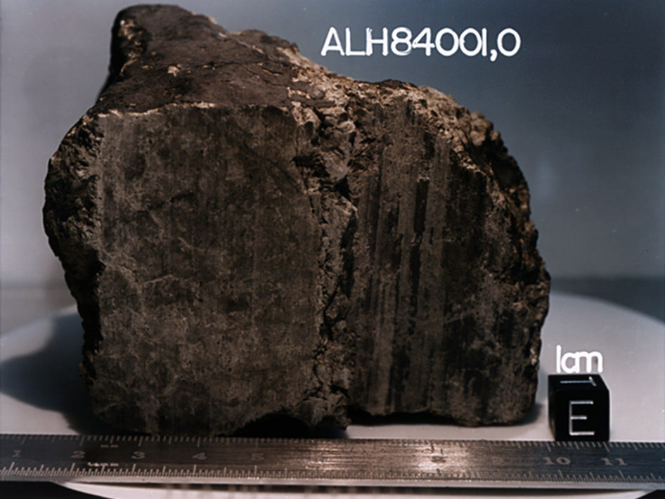
Though Krauss did not specify which meteorites in Antarctica he was referring to, he is most likely talking about ALH84001, which was found in 1984.

The meteorite shot to international prominence in 1996 when scientists, led by NASA’s David McKay, published an article in the journal Science saying there was evidence the meteorite showed “primitive bacterial life” from Mars. In particular, they used a high-power electron microscope and found formations that they said are consistent with those caused by bacterial life.

The team’s proclamation met with scientific skepticism. The Lunar and Planetary Institute’s Allan Treiman said even if it did show evidence of life, the rocks could have been contaminated by Antarctic life or by handling of the meteorite after it was found.

John Bradley, an adjunct professor at the Georgia Institute of Technology, took his skepticism a step further: “Unfortunately, there are many signatures in the fossil record here on Earth, and probably on Mars, that look very similar to bacterial signatures. But they are not unique to bacterial processes,” he said in an undated NASA page (most likely from 2001, since it references a meeting from that time) that was reportedly based on a SPACE.com story.

NASA revisited the sample in 2009 with more advanced equipment and argued that life was the most plausible explanation for the formations. In a paper published in Geochimica et Cosmochimica Acta, the authors rejected the alternate hypotheses of shock or heating affecting the meteorite based on their experiments.

That said, the 1996 announcement is still a long way from confirmation. Krauss’ interview is below. What do you think of his views of Martian life?

Lead image courtesy of NASA.

Elizabeth Howell (M.Sc. Space Studies ’12) is a contributing editor for SpaceRef and award-winning space freelance journalist living in Ottawa, Canada. Her work has appeared in publications such as SPACE.com, Air & Space Smithsonian, Physics Today, the Globe and Mail, the Canadian Broadcasting Corp.,  CTV and the Ottawa Business Journal.

Opportunity Rover Tops 35 Kilometers of Driving

The Opportunity Mars rover looks back at the tracks left along the rim of Endeavour Crater. Credit: NASA/JPL-Caltech

Meanwhile, back in Meridiani Planum … the Opportunity rover keeps on trucking, and has now exceeded over 35 kilometers (21.75 miles) of driving on its odometer! Quite an accomplishment for the Energizer Bunny of Mars rovers, now operating for 3,057 Martian sols. As the MER team says, “Not bad for a vehicle designed for only about 1 kilometer (.6 miles) of distance and 90 sols (days) of lifetime.”

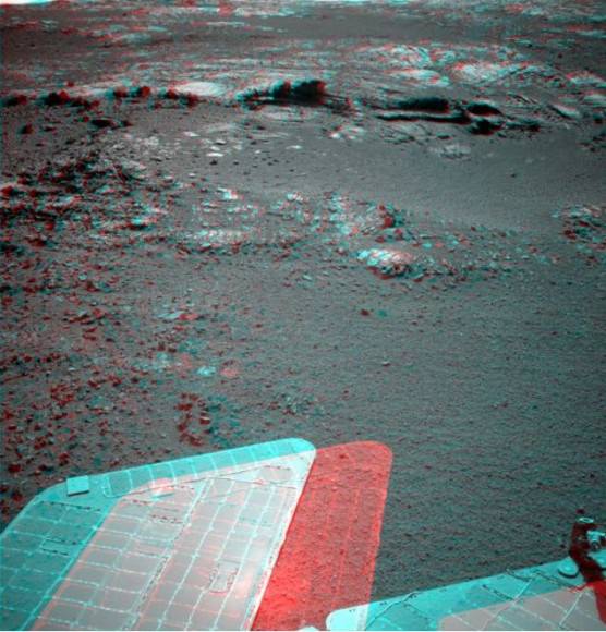
Oppy is now moving south along the inboard edge of Cape York on the rim of Endeavour Crater surveying exposed outcrop in search of phyllosilicate clay minerals that have been detected from orbit. These outcrops are quite interesting and attention-grabbing; here’s a look in color from Stuart Atkinson:

and in 3-D:

Wow!

As Stu writes in his Road to Endeavour blog, “What are those rocks made of? How did this feature form? What do the diferent colours and textures mean? These are all questions which the MER team will be hoping to answer over the next few days, I’m sure. I think we’ll see Oppy driving closer to this outcrop and studying it in a lot of detail.”

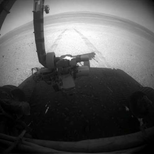
The MER team reports that on Sol 3055 (Aug. 27, 2012), the Rock Abrasion Tool (RAT) on the end of the robotic arm was imaged (top image) to re-confirm the available bit for future grinding and the Alpha Particle X-ray Spectrometer (APXS) collected a measurement of atmospheric argon.

Opportunity’s solar array energy production is good, producing about 568 watt-hours.

So, even though the Curiosity rover is grabbing the headlines, don’t forget that Opportunity is still keepin’ on, working hard on Mars.

Sources: NASA/JPL, Road to Endeavour

Researchers Send Mars Some Radar Love

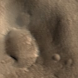
A radar map of Mars’ major volcanic regions created by the Arecibo Observatory in Puerto Rico (John Harmon et al., NAIC)

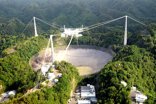
Even though we currently have several missions exploring Mars both from orbit and on the ground, there’s no reason that robots should be having all the fun; recently a team of radio astronomers aimed the enormous 305-meter dish at Puerto Rico’s Arecibo Observatory at Mars, creating radar maps of the Red Planet’s volcanic regions and capturing a surprising level of detail for Earth-based observations.

The team, led by John Harmon of the National Astronomy and Ionosphere Center, bounced radar waves off Mars from Arecibo’s incredibly-sensitive dish, targeting the volcanic Tharsis, Elysium, and Amazonis regions. Depolarized radar imagery best reveals surface textures; the rougher and less uniform a surface is, the brighter it appears to radar while smooth, flat surfaces appear dark.

What the radar maps portray are very bright — and therefore rough — areas on most of the major volcanoes, although some regions do appear dark, such as the summit of Pavonis Mons.

This likely indicates a covering by smoother, softer material, such as dust or soil. This is actually in line with previous observations of the summit of Pavonis Mons made with the HiRISE camera aboard NASA’s Mars Reconnaissance Orbiter, which showed the summit to appear curiously soft-edged and “out-of-focus”, creating a blurry optical illusion of sorts.

It’s thought that the effect is the result of the build-up of dust over millennia, carried across the planet by dust storms but remaining in place once settled because the Martian wind is just so extremely thin — especially at higher altitudes.

The team also found bright areas located away from the volcanoes, indicating rough flows elsewhere, while some smaller volcanoes appeared entirely dark — again, indicating a possible coating of smooth material like dust or solidified lava flows.

The resolution of the radar maps corresponds to the wavelength of the signals emitted from Arecibo; the 12.6 centimeter signal allows for surface resolution of Mars of about 3 km.

The team’s paper was published in the journal Icarus on July 25. Read more on the Red Planet Report here.

The iconic 305-meter radar telescope at Arecibo Observatory in Puerto Rico


Curiosity’s Laser Leaves Its Mark

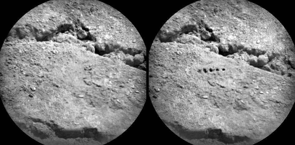
Before-and-after images from Curiosity’s ChemCam  micro-imager show holes left by its million-watt laser (NASA/JPL-Caltech/LANL/CNES/IRAP/LPGN/CNRS)

PEWPEWPEWPEWPEW! Curiosity’s head-mounted ChemCam did a little target practice on August 25, blasting millimeter-sized holes in a soil sample named “Beechey” in order to acquire spectrographic data from the resulting plasma glow. The neat line of holes is called a five-by-one raster, and was made from a distance of about 11.5 feet (3.5 meters).

Sorry Obi-Wan, but Curiosity’s blaster is neither clumsy nor random!

Mounted to Curiosity’s “head”, just above its Mastcam camera “eyes”, ChemCam combines a powerful laser with a telescope and spectrometer that can analyze the light emitted by zapped materials, thereby determining with unprecedented precision what Mars is really made of.

Read: Take a Look Through Curiosity’s ChemCam

For five billionths of a second the laser focuses a million watts of energy onto a specific point. Each of the 5 holes seen on Beechey are the result of 50 laser hits. 2 to 4 millimeters in diameter, the holes are much larger than the laser point itself, which is only .43 millimeters wide at that distance.

ChemCam’s laser allows Curiosity to zap and examine targets up to 23 feet (7 meters) away. Credit: J-L. Lacour/CEA/French Space Agency (CNES)

“ChemCam is designed to look for lighter elements such as carbon, nitrogen, and oxygen, all of which are crucial for life,” said Roger Wiens, principal investigator of the ChemCam team. “The system can provide immediate, unambiguous detection of water from frost or other sources on the surface as well as carbon – a basic building block of life as well as a possible byproduct of life. This makes the ChemCam a vital component of Curiosity’s mission.”

Visit the official ChemCam site for more information.