Ancient Hydrothermal Vents Found on Mars, Could Have Been a Cradle for Life

MOLA topographic data, colorized to show the maximum (1,100?m) and minimum (700?m) level of an ancient sea. Credit: NASA/Joseph R. Michalski (et al.)/Nature Communications

It is now a well-understood fact that Mars once had quite a bit of liquid water on its surface. In fact, according to a recent estimate, a large sea in Mars’ southern hemisphere once held almost 10 times as much water as all of North America’s Great Lakes combined. This sea existed roughly 3.7 billion years ago, and was located in the region known today as the Eridania basin.

However, a new study based on data from NASA’s Mars Reconnaissance Orbiter (MRO) detected vast mineral deposits at the bottom of this basin, which could be seen as evidence of ancient hot springs. Since this type of hydrothermal activity is believed to be responsible for the emergence of life on Earth, these results could indicate that this basin once hosted life as well.

The study, titled “Ancient Hydrothermal Seafloor Deposits in Eridania Basin on Mars“, recently appeared in the scientific journal Nature Communications. The study was led by Joseph Michalski of the Department of Earth Sciences and Laboratory for Space Research at the University of Hong Kong, along with researchers from the Planetary Science Institute, the Natural History Museum in London, and NASA’s Johnson Space Center.


The Eridania basin of southern Mars is believed to have held a sea about 3.7 billion years ago, with seafloor deposits likely resulting from underwater hydrothermal activity. Credit: NASA

Together, this international team used data obtained by the MRO’s Compact Reconnaissance Spectrometer for Mars (CRISM). Since the MRO reached Mars in 2006, this instrument has been used extensively to search for evidence of mineral residues that form in the presence of water. In this respect, CRISM was essential for documenting how lakes, ponds and rivers once existed on the surface of Mars.

In this case, it identified massive mineral deposits within Mars’ Eridania basin, which lies in a region that has some of the Red Planet’s most ancient exposed crust. The discovery is expected to be a major focal point for scientists seeking to characterize Mars’ once-warm and wet environment. As Paul Niles of NASA’s Johnson Space Center said in a recent NASA press statement:

“Even if we never find evidence that there’s been life on Mars, this site can tell us about the type of environment where life may have begun on Earth. Volcanic activity combined with standing water provided conditions that were likely similar to conditions that existed on Earth at about the same time — when early life was evolving here.”

Today, Mars is a cold, dry place that experiences no volcanic activity. But roughly 3.7 billion years ago, the situation was vastly different. At that time, Mars boasted both flowing and standing bodies of water, which are evidenced by vast fluvial deposits and sedimentary basins. The Gale Crater is a perfect example of this since it was once a major lake bed, which is why it was selected as the landing sight for the Curiosity rover in 2012.

Illustrates showing the origin of some deposits in the Eridania basin of southern Mars resulting from seafloor hydrothermal activity more than 3 billion years ago. Credit: NASA

Since Mars had both surface water and volcanic activity during this time, it would have also experienced hydrothermal activity. This occurs when volcanic vents open into standing bodies of water, filling them with hydrated minerals and heat. On Earth, which still has an active crust, evidence of past hydrothermal activity cannot be preserved. But on Mars, where the crust is solid and erosion is minimal, the evidence has been preserved.

“This site gives us a compelling story for a deep, long-lived sea and a deep-sea hydrothermal environment,” Niles said. “It is evocative of the deep-sea hydrothermal environments on Earth, similar to environments where life might be found on other worlds — life that doesn’t need a nice atmosphere or temperate surface, but just rocks, heat and water.”

Based on their study, the researchers estimate that the Eridania basin once held about 210,000 cubic km (50,000 cubic mi) of water. Not only is this nine times more water than all of the Great Lakes combined, it is as much as all the other lakes and seas on ancient Mars combined. In addition, the region also experienced lava flows that existed  after the sea is believed to have disappeared.

From the CRISM’s spectrometer data, the team identified deposits of serpentine, talc and carbonate. Combined with the shape and texture of the bedrock layers, they concluded that the sea floor was open to volcanic fissures. Beyond indicating that this region could have once hosted life, this study also adds to the diversity of the wet environments which are once believed to have existed on Mars.

A scale model compares the volume of water contained in lakes and seas on the Earth and Mars to the estimated volume of water contained in an ancient Eridania sea. Credit: JJoseph R. Michalski (et al.)/Nature Communications

Between evidence of ancient lakes, rivers, groundwater, deltas, seas, and volcanic eruptions beneath ice, scientists now have evidence of volcanic activity that occurred beneath a standing body of water (aka. hot springs) on Mars. This also represents a new category for astrobiological research, and a possible destination for future missions to the Martian surface.

The study of hydrothermal activity is also significant as far as finding sources of extra-terrestrial, like on the moons of Europa, Enceladus, Titan, and elsewhere. In the future, robotic missions are expected to travel to these worlds in order to peak beneath their icy surfaces, investigate their plumes, or venture into their seas (in Titan’s case) to look for the telltale traces of basic life forms.

The study also has significance beyond Mars and could aid in the study of how life began here on Earth. At present, the earliest evidence of terrestrial life comes from seafloor deposits that are similar in origin and age to those found in the Eridania basin. But since the geological record of this period on Earth is poorly preserved, it has been impossible to determine exactly what conditions were like at this time.

Given Mars’ similarities with Earth, and the fact that its geological record has been well-preserved over the past 3 billion years, scientists can look to mineral deposits and other evidence to gauge how natural processes here on Earth allowed for life to form and evolve over time. It could also advance our understanding of how all the terrestrial planets of the Solar System evolved over billions of years.

Further Reading: NASA

This Meteorite Came From a Volcano on Mars

A sample of nakhlite, a type of volcanic terrain that came to Earth as a Martian meteorite. Credit: University of Glasgow

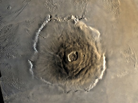
Today, it is well understood that Mars is a cold, dry, and geologically dead planet. However, billions of years ago when it was still young, the planet boasted a denser atmosphere and had liquid water on its surface. Millions of years ago, it also experienced a significant amount of volcanic activity, which resulted in the formation of it’s massive features – like Olympus Mons, the largest volcano in the Solar System.

Until recently, scientists have understood that Martian volcanic activity has been driven by sources other than tectonic movement, which the planet has been devoid of for billions of years. However, after conducting a study of Martian rock samples, a team of researchers from the UK and United States concluded that eons ago, Mars was more volcanically active than previously thought.

Their study, titled “Taking the Pulse of Mars via Dating of a Plume-fed Volcano“, recently appeared in the scientific journal Nature Communications. Led by Benjamin Cohen, a researcher with the Scottish Universities Environmental Research Center (SUERC) and the School of Geographical and Earth Sciences at the University of Glasgow, the team conducted an analysis of Mars’ volcanic past using samples of Martian meteorites.

Asteroid impacts on Mars have sent samples of Martian rock to Earth in the form of meteorites. Credit: geol.umd.edu

On Earth, the majority of volcanism occurs as a result of plate tectonics, which are driven by convection in the Earth’s mantle. But on Mars, the majority of volcanic activity is the result of mantle plumes, which are highly-localized upwellings of magma that rise from deep within the mantle. This is due to the fact that Mars’ surface has remained static and cool for the past few billion years.

Because of this, Martian volcanoes (though similar in morophology to shield volcanoes on Earth), grow to much larger sizes than those on Earth. Olympus Mons, for example, is not only the largest shield volcano on Mars, but the largest in the Solar System. Whereas the tallest mountain on Earth – Mt. Everest – is 8,848 m (29,029 ft) in height, Olympus Mons stands some 22 km (13.6 mi or 72,000 ft) tall.

For the sake of their study, Dr. Cohen and his colleagues used radioscopic dating techniques, which are commonly used to determine the age and eruption rate of volcanoes on Earth. However, such techniques have not been previously used for shield volcanoes on Mars. As a result, the team’s study of Martian meteorite samples was the first detailed analysis of growth rates in Martian volcanoes.

The six samples they examined are known as nakhlites, a class of Martian meteorite that formed from basaltic magma roughly 1.3 billion years ago. These came to Earth roughly 11 million years ago after being were blasted from the face of Mars by an impact event. By conducting an analysis of Martian meteorites, the team was able to uncover about 90 million years’ worth of new information about Mars’ volcanic past.

Color Mosaic of Olympus Mons on Mars
Color mosaic of Mars’ greatest mountain, Olympus Mons, viewed from orbit. Credit NASA/JPL

As Dr. Cohen explained in a University of Glasgow press release:

“We know from previous studies that the nakhlite meteorites are volcanic rocks, and the development of age-dating techniques in recent years made the nakhlites perfect candidates to help us learn more about volcanoes on Mars.”

The first step was to demonstrate that the rock samples were indeed Martian in origin, which the team confirmed by measuring their exposure to cosmogenic radiation. From this, they determined that the rocks were expelled from the Martian surface 11 million years ago, most likely as a result of an impact event on the Martian surface. They then applied a high-precision radioscopic technique known as 40Ar/39Ar dating.

This consisted of using a noble gas mass spectromomer to measure the amount of argon built up in the samples, which is the result of the natural radioactive decay of potassium. From this, they were able to obtain 90 million years’ worth of new information about the Martian surface. The results of their analysis indicated that there are significant differences in volcanic history between the Earth and Mars. As Dr. Cohen explained:

“We found that the nakhlites formed from at least four eruptions over the course of 90 million years. This is a very long time for a volcano, and much longer than the duration of terrestrial volcanoes, which are typically only active for a few million years. And this is only scratching the surface of the volcano, as only a very small amount of rock would have been ejected by the impact crater – so the volcano must have been active for much longer.”

A triple crater in Elysium Planitia on Mars. Credit: NASA/JPL/University of Arizona

In addition, the team was also able to narrow down which volcanoes their rock samples came from. Previous studies conducted by NASA revealed several candidates for the possible nakhlite source crater. However, only one of the locations matched their results in terms of the age of the volcanic eruptions and the impact that would have ejected the samples into space.

This particular crater (which is currently unnamed) is located in the volcanic plains known as Elysium Planitia, roughly 900 km (560 mi) away from summit of the Elysium Mons volcano  – which stands 12.6 km (7.8 mi) tall. It is also located about 2000 km (1243 mi) north of where the NASA Curiosity rover currently is. As Cohen explained, NASA has some wonderfully detailed satellite images of this particular crater.

“It is 6.5 km wide, and has preserved ejecta rays of debris,” he said. “And we were able to see multiple horizontal bands on the crater walls – which indicating the rocks form layers, with each layer interpreted as a separate lava flow. This study has been able to provide a clearer picture into the history of the nakhlite meteorites, and in turn the largest volcanoes in the solar system.”

In the future, sample return and crewed missions to Mars are sure to clear up this picture even further. Given that Mars, like Earth, is a terrestrial planet, knowing all we can about its geological history will ultimately improve our understanding of how the rocky planets of the Solar System formed. In short, the more we know about Mars’ volcanic history, the most we will be able to learn about the Solar System’s formation and evolution.

Further Reading: University of Glasgow, Nature Communications


Lockheed Martin Unveils Details of their Proposed Base Camp for Mars

Artist's impression of the Mars Base Camp in orbit around Mars. When missions to Mars begin, one of the greatest risks will be that posed by space radiation. Credit: Lockheed Martin

Before NASA can mount its proposed “Journey to Mars“, which will see astronauts set foot on the Red Planet for the first time in history, a number of logistical and technical issues need to be addressed first. In addition to a launch vehicle (the Space Launch System), a crew capsule (the Orion Multi-Purpose Crew Vehicle), and a space station beyond the Moon (the Deep Space Gateway), the astronauts will also need a space habitat in orbit of Mars.

To build this habitat, NASA has reached out to its long-time contractor, Lockheed Martin. And on Saturday, September 28th, at the International Astronautical Congress (IAC) in Adelaide, Australia, the aerospace company revealed new details about its Mars Base Camp. When NASA’s proposed crewed mission to Mars takes place in the 2030s, this base will be the outpost from which crews will conduct research on the Martian surface.

The details revealed at the conference included how their proposed base camp aligns with other key components of NASA’s Mars mission, which Lockheed Martin is also working with NASA to develop. These include the Deep Space Gateway positioned in cislunar orbit, and a Mars surface lander – a reusable, single-stage craft capable of descending to the Martian surface from orbit.

Diagram of Lockheed Martin’s Mars Base Camp. Credit: Lockheed Martin

Along with NASA’s SLS and Orion spacecraft, these vital pieces of infrastructure will allow for not just one, but repeated crewed mission to Mars. As Lisa Callahan – the vice president and general manager of Commercial Civil Space at Lockheed Martin – said in the course of the company’s presentation at the IAC:

“Sending humans to Mars has always been a part of science fiction, but today we have the capability to make it a reality. Partnered with NASA, our vision leverages hardware currently in development and production. We’re proud to have Orion powered-on and completing testing in preparation for its Exploration Mission-1 flight and eventually its journey to Mars.”

Overall, the purpose of the Mars Base Camp is very simple. Basically, it consists of an orbital outpost where scientist-astronauts will be transported to after leaving Earth and flying from the Deep Space Gateway into orbit around Mars. From this base, crews will be able to conduct real-time scientific exploration of the Martian atmosphere, followed by missions to the surface.

As Lockheed Martin’s indicates on their website, the major components of their base camp will be launched separately. Some will be pre-positioned in orbit around Mars ahead of time while others will be assembled in cis-lunar space for the journey to Mars. In the end, six astronauts will launch on an Orion spacecraft – which serves as the heart of the Mars Base Camp interplanetary ship – and assemble all the component in orbit around Mars.

Artist’s impression of Lockheed Martin’s proposed Mars Lander. Credit: Lockheed Martin

This is also consistent with Phase II and Phase III of NASA’s “Journey to Mars”, which are known as the “Proving Ground” and “Earth Independent” phases, respectively. Phase II calls for a series of missions to test the capabilities of the Space Launch System (SLS), Orion spacecraft, and deep space habitats, as well as multiple crewed missions and spacewalks in cislunar space.

Phase III will then consist of the refinement and testing of entry, descent, and landing techniques, as well as in-situ resource utilization. Once these are complete, Phase III will culminate with crewed missions to Martian orbit, followed by landed missions to the Martian surface. The first mission involving the Mars Base Camp are intended to be an extended stay in orbit around the Red Planet.

This will allow astronauts to gain vital experience with extended operations far from Earth and its protective magnetic field. This will be followed by the arrival of the surface lander, which would allow the astronauts to land and conduct missions on the surface. The lander would be mated to the base camp between missions and descend to the surface using supersonic retro-propulsion.

The lander also relies on Orion avionics and systems as its command deck, and is powered by engines that use a liquid-hydrogen/liquid-oxygen propellant. Each mission to the surface would likely last two weeks at a time and consist of four astronauts conducting research and collecting samples for return to the base camp. The crews would then take off in the Lander and return it the station, where it would refuel and restock for future missions.

Artist illustration of Habitation Module. Credit: Lockheed Martin

Since the lander’s fuel can be manufactured from water, it is likely that a source of subsurface water ice will also come into play during these surface missions. If the necessary infrastructure is brought to the surface, it could even be used for the in-situ manufacture of rocket fuel. As such, it is understandable by locating a source of subsurface water ice is a major focal point of future NASA and SpaceX missions.

As noted, the Mars Base Camp is aligned with other mission components, which include the Deep Space Gateway. Here too, NASA has contracted Lockheed Martin to develop the concept’s architecture. This past summer, the company was awarded a Phase II contract by NASA to create designs for this space habitat, which is intended to build on the lessons learned from the International Space Station (ISS).

The contract was awarded as part of the Next Space Technologies for Exploration Partnership (NextSTEP) program, which NASA launched in 2014. In April of 2016, during the second NextSTEP Broad Agency Announcement (NextSTEP-2), NASA selected six U.S. companies to begin building full-sized ground prototypes and concepts for this deep space habitat.

In the end, the Deep Space Gateway and the Mars Base Camp will allow for the development and testing of other space systems in cis-lunar space before sending them on to Mars. The Gateway will also allow astronauts to conduct lunar research and live and work in orbit around the Moon for months at a time. This will come in handy once they begin making transits to and from Mars.

NASA’s Journey to Mars. NASA is developing the capabilities needed to send humans to an asteroid by 2025 and Mars in the 2030s. Credit: NASA/JPL

Ever since NASA first announced its proposal for a “Journey to Mars” in 2010, scientists, space enthusiasts and the general public ave eagerly awaited the release of key details. Given that such a mission comes with major technical and logistical challenges, how they intend to address them has been a major point of interest. Other points of interest have included timelines as well as the vehicles, systems and technologies that would be involved.

This latest announcement is just one of many to be made by NASA and its partners in recent months. As the “Journey to Mars” slowly approaches, more and more details have become available, and what this mission will look like has slowly taken form. As Lockheed Martin states on their website:

Since the first Viking lander touched down on Mars 40 years ago, humanity has been fascinated with the Red Planet. Lockheed Martin built NASA’s first Mars lander and has been a part of every NASA Mars mission since. We’re ready to deliver the future, faster. Mars is closer than you think. We’re ready to accelerate the journey.”

And be sure to check out this promotional video about the Mars Base Camp, courtesy of Lockheed Martin:

Further Reading: Lockheed Martin, LM – Mars Base Camp

Old Mars Odyssey Data Indicates Presence of Ice Around Martian Equator

A new paper suggests hydrogen-possibly water ice-in the Medusa Fossae area of Mars, which is in an equatorial region of the planet to the lower left in this view. Image Credit: Steve Lee (University of Colorado), Jim Bell (Cornell University), Mike Wolff (Space Science Institute), and NASA

Finding a source of Martian water – one that is not confined to Mars’ frozen polar regions – has been an ongoing challenge for space agencies and astronomers alike. Between NASA, SpaceX, and every other public and private space venture hoping to conduct crewed mission to Mars in the future, an accessible source of ice would mean the ability to manufacture rocket fuel on sight and provide drinking water for an outpost.

So far, attempt to locate an equatorial source of water ice have failed. But after consulting old data from the longest-running mission to Mars in history – NASA’s Mars Odyssey spacecraft – a team of researchers from the John Hopkins University Applied Physics Laboratory (JHUAPL) announced that they may have found evidence of a source of water ice in the Medusae Fossae region of Mars.

This region of Mars, which is located in the equatorial region, is situated between the highland-lowland boundary near the Tharsis and Elysium volcanic areas. This area is known for its formation of the same name, which is a soft deposit of easily-erodible material that extends for about 5000 km (3,109 mi) along the equator of Mars. Until now, it was believed to be impossible for water ice to exist there.

Artist’s conception of the Mars Odyssey spacecraft. Credit: NASA/JPL

However, a team led by Jack Wilson – a post-doctoral researcher at the JHUAPL – recently reprocessed data from the Mars Odyssey spacecraft that showed unexpected signals. This data was collected between 2002 and 2009 by the mission’s neutron spectrometer instrument. After reprocessing the lower-resolution compositional data to bring it into sharper focus, the team found that it contained unexpectedly high signals of hydrogen.

To bring the information into higher-resolution, Wilson and his team applied image-reconstruction techniques that are typically used to reduce blurring and remove noise from medical and spacecraft imaging data. In so doing, the team was able to improve the data’s spatial resolution from about 520 km (320 mi) to 290 km (180 mi). Ordinarily, this kind of improvement could only be achieved by getting the spacecraft much closer to the surface.

“It was as if we’d cut the spacecraft’s orbital altitude in half,” said Wilson, “and it gave us a much better view of what’s happening on the surface.” And while the neutron spectrometer did not detect water directly, the high abundance of neutrons detected by the spectrometer allowed the research team to calculate the abundance of hydrogen. At high latitudes on Mars, this is considered to be a telltale sign of water ice.

The first time the Mars Odyssey spacecraft detected abundant hydrogen was in 2002, which appeared to be coming from subsurface deposits at high latitudes around Mars. These findings were confirmed in 2008, when NASA’s Phoenix Lander confirmed that the hydrogen took the form of water ice. However, scientists have been operating under the assumption that at lower latitudes, temperatures are too high for water ice to exist.

This artist’s concept of the Mars Reconnaissance Orbiter highlights the spacecraft’s radar capability. Credit: NASA/JPL

In the past, the detection of hydrogen in the equatorial region was thought to be due to the presence of hydrated minerals (i.e. past water). In addition, the Mars Reconnaissance Orbiter (MRO) and the ESA’s Mars Express orbiter have both conducted radar-sounding scans of the area, using their Shallow Subsurface Radar (SHARAD) and Mars Advanced Radar for Subsurface and Ionospheric Sounding (MARSIS) instruments, respectively.

These scans have suggested that there was either low-density volcanic deposits or water ice below the surface, though the results seemed more consistent with their being no water ice to speak of. As Wilson indicated, their results lend themselves to more than one possible explanation, but seem to indicate that water ice could part of the subsurface’s makeup:

“[I]f the detected hydrogen were buried ice within the top meter of the surface. there would be more than would fit into pore space in soil… Perhaps the signature could be explained in terms of extensive deposits of hydrated salts, but how these hydrated salts came to be in the formation is also difficult to explain. So for now, the signature remains a mystery worthy of further study, and Mars continues to surprise us.”

Given Mars’ thin atmosphere and the temperature ranges that are common around the equator – which get as high as 308 K (35 °C; 95 °F) by midday during the summer – it is a mystery how water ice could be preserved there. The leading theory though is that a mixture of ice and dust was deposited from the polar regions in the past. This could have happened back when Mars’ axial tilt was greater than it is today.

The MARSIS instrument on the Mars Express is a ground penetrating radar sounder used to look for subsurface water and ice. Credit: ESA

However, those conditions have not been present on Mars for hundreds of thousands or even millions of years. As such, any subsurface ice that was deposited there should be long gone by now. There is also the possibility that subsurface ice could be shielded by layers of hardened dust, but this too is insufficient to explain how water ice could have survived on the timescales involved.

In the end, the presence of abundant hydrogen in the Medusae Fossae region is just another mystery that will require further investigation. The same is true for deposits of water ice in general around the equatorial region of Mars. Such deposits mean that future missions would have a source of water for manufacturing rocket fuel.

This would shave billions of dollars of the costs of individual mission since spacecraft would not need to carry enough fuel for a return trip with them. As such, interplanetary spacecraft could be manufactured that would be smaller, lighter and faster. The presence of equatorial water ice could also be used to provide a steady supply of water for a future base on Mars.

Crews could be rotated in and out of this base once every two years – in a way that is similar to what we currently do with the International Space Station. Or – dare I say it? – a local source of water could be used to supply drinking, sanitation and irrigation water to eventual colonists! No matter how you slice it, finding an accessible source of Martian water is critical to the future of space exploration as we know it!

Further Reading: NASA

New Study Sheds Light on How Earth and Mars Formed

Snapshot of a computer simulation of two (relatively small) planets colliding with each other. The colors show how the rock of the impacting body (dark grey, in center of impact area) accretes to the target body (rock; light grey), while some of the rock in the impact area is molten (yellow to white) or vaporised (red). Credit: Philip J. Carter

In accordance with the Nebular Hypothesis, the Solar System is believed to have formed through the process of accretion. Essentially, this began when a massive cloud of dust and gas (aka. the Solar Nebula) experienced a gravitational collapse at its center, giving birth to the Sun. The remaining dust and gas then formed into a protoplanetary disc around the Sun, which gradually coalesced to form the planets.

However, much about the process of how planets evolved to become distinct in their compositions has remained a mystery. Luckily, a new study by a team of researchers from the University of Bristol has approached the subject with a fresh perspective. By examining a combination of Earth samples and meteorites, they have shed new light on how planets like Earth and Mars formed and evolved.

The study, titled “Magnesium Isotope Evidence that Accretional Vapour Loss Shapes Planetary Compositions“, recently appeared in the scientific journal Nature. Led by Remco C. Hin, a senior research associate from the School of Earth Sciences at the University of Bristol, the team compared samples of rock from Earth, Mars, and the Asteroid Vesta to compare the levels of magnesium isotopes within them.

Artist’s impression of the early Solar System, where collision between particles in an accretion disc led to the formation of planetesimals and eventually planets. Credit: NASA/JPL-Caltech

Their study attempted answering what has been a lingering question in the scientific community – i.e. did the planets form the way they are today, or did they acquire their distinctive compositions over time? As Dr. Remco Hin explained in a University of Bristol press release:

“We have provided evidence that such a sequence of events occurred in the formation of the Earth and Mars, using high precision measurements of their magnesium isotope compositions. Magnesium isotope ratios change as a result of silicate vapour loss, which preferentially contains the lighter isotopes. In this way, we estimated that more than 40 per cent of the Earth’s mass was lost during its construction. This cowboy building job, as one of my co-authors described it, was also responsible for creating the Earth’s unique composition.

To break it down, accretion consists of clumps of material colliding with neighboring clumps to form larger objects. This process is very chaotic, and material is often lost as well as accumulated due to the extreme heat generated by these high-speed collisions. This heat is also believed to have created oceans of magma on the planets as they formed, not to mention temporary atmospheres of vaporized rock.

Until planets become about the same size as Mars, their force of gravitational attraction was too weak to hold onto these atmospheres. And as more collisions took place, the composition of these atmosphere and of the planets themselves would have changes substantially. How exactly the terrestrial planets – Mercury, Venus, Earth and Mars – obtained their current, volatile-poor compositions over time is what scientists have hoped to address.

Artist impression of the Late Heavy Bombardment period. Credit: NASA

For example, some believe that the planets current compositions are the result of particular combinations of gas and dust during the earliest periods of planet formation – where terrestrial planets are silicate/metal rich, but volatile poor, because of which elements were most abundant closest to the Sun. Others have suggested that their current composition is a consequence of their violent growth and collisions with other bodies.

To shed light on this, Dr. Hin and his associates analyzed samples of Earth, along with meteorites from Mars and the asteroid Vesta using a new analytical approach. This technique is capable of obtaining more accurate measurements of magnesium isotope rations than any previous method. This method also showed that all differentiated bodies – like Earth, Mars and Vesta – have isotopically heavier magnesium compositions than chondritic meteorites.

From this, they were able to draw three conclusions. For one, they found that Earth, Mars and Vesta have distinct magnesium isotope rations that could not be explained by condensation from the Solar Nebula. Second, they noted that the study of heavy magnesium isotopes revealed that in all cases, the planets lost about 40% percent of their mass during their formation period, following repeated episodes of vaporization.

Last, they determined that the accretion process results in other chemical changes that generate the unique chemical characteristics of Earth. In short, their study showed that Earth, Mars and Vesta all experiences significant losses of material after formation, which means that their peculiar compositions were likely the result of collisions over time. As Dr Hin added:

“Our work changes our views on how planets attain their physical and chemical characteristics. While it was previously known that building planets is a violent process and that the compositions of planets such as Earth are distinct, it was not clear that these features were linked. We now show that vapour loss during the high energy collisions of planetary accretion has a profound effect on a planet’s composition.”

Their study also indicated that this violent formation process could be characteristic of planets in general. These findings are not only significant when it comes to the formation of the Solar System, but of extra-solar planets as well. When it comes time to explore distant star systems, the distinctive compositions of their planets will tell us much about the conditions from which they formed, and how they came to be.

Further Reading: University of Bristol, Nature

New Study Could Help Locate Subsurface Deposits of Water Ice on Mars

Mars Express' view of Meridiani Planum. Credits: ESA/DLR/FU Berlin (G. Neukum)

It is a well-known fact that today, Mars is a very cold and dry place. Whereas the planet once had a thicker atmosphere that allowed for warmer temperatures and liquid water on its surface, the vast majority of water there today consists of ice that is located in the polar regions. But for some time, scientists have speculated that there may be plenty of water in subsurface ice deposits.

If true, this water could be accessed by future crewed missions and even colonization efforts, serving as a source of rocket fuel and drinking water. Unfortunately, a new study led by scientists from the Smithsonian Institution indicates that the subsurface region beneath Meridiani Planum could be ice-free. Though this may seem like bad news, the study could help point the way towards accessible areas of water ice on Mars.

This study, titled “Radar Sounder Evidence of Thick, Porous Sediments in Meridiani Planum and Implications for Ice-Filled Deposits on Mars“, recently appeared in the Geophysical Research Letters. Led by Dr. Thomas R. Watters, the Senior Scientist with the Center for Earth and Planetary Studies at the Smithsonian Institution, the team examined data collected by the ESA’s Mars Express mission in the Meridiani Planum region.

Artist’s impression of a global view of Mars, centered on the Meridiani Planum region. Credit: Air and Space Museum/Smithsonian Institution

Despite being one of the most intensely explored regions on Mars, particularly by missions like the Opportunity rover, the subsurface structure of Meridiani Planum has remained largely unknown. To remedy this, the science team led by Dr. Watters examined data that had been collected by the Mars Advanced Radar for Subsurface and Ionospheric Sounding (MARSIS) instrument aboard the ESA’s Mars Express orbiter.

Developed by researchers at the University of Rome in partnership with NASA’s Jet Propulsion Laboratory (and with the help of private contractors), this device used low-frequency radio pulses to study Mars’ ionosphere, atmosphere, surface, and interior structure. The way these pulses penetrated into certain materials and were reflected back to the orbiter was then used to determine the bulk density and compositions of those materials.

After examining the Meridiani Planum region, the Mars Express probe obtained readings that indicated that the subsurface area had a relatively low dielectric constant. In the past, these kinds of readings have been interpreted as being due to the presence of pure water ice. And in this case, the readings seemed to indicate that the subsurface was made up of porous rock that was filled with water ice.

However, with the help of newly-derived compaction models for Mars, the team concluded that these signals could be the result of ice-free, porous, windblown sand (aka. eolian sands). They further theorized that the Meridiani Planum region, which is characterized by some rather unique physiographic and hydrologic features, could have provided an ideal sediment trap for these kinds of sands.

Artist’s impression of the Mars Express rover, showing radar returns from its MARSIS instrument. Credit: ESA/NASA/JPL/KU/Smithsonian

“The relatively low gravity and the cold, dry climate that has dominated Mars for billions of years may have allowed thick eolian sand deposits to remain porous and only weakly indurated,” they concluded. “Minimally compacted sedimentary deposits may offer a possible explanation for other nonpolar region units with low apparent bulk dielectric constants.”

As Watters also indicated in a Smithsonian press statement:

“It’s very revealing that the low dielectric constant of the Meridiani Planum deposits can be explained without invoking pore-filling ice. Our results suggest that caution should be exercised in attributing non-polar deposits on Mars with low dielectric constants to the presence of water ice.”

On its face, this would seem like bad news to those who were hoping that the equatorial regions on Mars might contain vast deposits of accessible water ice. It has been argued that when crewed missions to Mars begin, this ice could be accessed in order to supply water for surface habitats. In addition, ice that didn’t need to come from there could also be used to manufacture hydrazine fuel for return missions.

This would reduce travel times and the cost of mounting missions to Mars considerably since the spacecraft would not need to carry enough fuel for the entire journey, and would therefore be smaller and faster. In the event that human beings establish a colony on Mars someday, these same subsurface deposits could also used for drinking, sanitation, and irrigation water.

A subsurface view of Miyamoto crater in Meridiani Planum from the MARSIS radar sounder. . Credit: ESA/NASA/JPL/KU/Smithsonian

As such, this study – which indicates that low dielectric constants could be due to something other than the presence of water ice – places a bit of a damper on these plans. However, understood in context, it provides scientists with a means of locating subsurface ice. Rather than ruling out the presence of subsurface ice away from the polar regions entirely, it could actually help point the way to much-needed deposits.

One can only hope that these regions are not confined to the polar regions of the planet, which would be far more difficult to access. If future missions and (fingers crossed!) permanent outposts are forced to pump in their water, it would be far more economical to do from underground sources, rather than bringing it in all the way from the polar ice caps.

Further Reading: Smithsonian NASM, Geophysical Research Letters

Rare Element Could Point the Way to Past Life on Mars

Future missions could determine the presence of past life on Mars by looking for signs of extreme metal-metabolizing bacteria. Credit: NASA.

Over the past few decades, our ongoing studies of Mars have revealed some very fascinating things about the planet. In the 1960s and early 70s, the Mariner probes revealed that Mars was a dry, frigid planet that was most likely devoid of life. But as our understanding of the planet has deepened, it has come to be known that Mars once had a warmer, wetter environment that could have supported life.

This in turn has inspired multiple missions whose purpose it has been to find evidence of this past life. The key questions in this search, however, are where to look and what to look for? In a new study led by researchers from the University of Kansas, a team of international scientists recommended that future missions should look for vanadium. This rare element, they claim, could point the way towards fossilized evidence of life.

Their study, titled “Imaging of Vanadium in Microfossils: A New Potential Biosignature“, recently appeared in the scientific journal Astrobiology. Led by Craig P. Marshall, an associate professor of geology at the University of Kansas, the international team included members from the Argonne National Laboratory, the Geological Technical Services Division of Saudi Aramco, the University of Liege, and the University of Sydney.

The microphone for the upcoming Mars mission will be attached to the SuperCam, seen here in this illustration zapping a rock with its laser. Credit: NASA/JPL-Caltech

To be clear, finding signs of life on a planet like Mars is no easy task. As Craig Marshall indicated in a University of Kansas press release:

“You’ve got your work cut out if you’re looking at ancient sedimentary rock for microfossils here on Earth – and even more so on Mars. On Earth, the rocks have been here for 3.5 billion years, and tectonic collisions and realignments have put a lot of stress and pressure on rocks. Also, these rocks can get buried, and temperature increases with depth.”

In their paper, Marshall and his colleagues recommend that missions like NASA’s Mars 2020 rover, the ESA’s ExoMars 2020 rover, and other proposed surface missions could combine Raman spectroscopy with the search for vanadium to find evidence of fossilized life. On Earth, this element has been found in crude oils, asphalts, and black shales that have been formed by the slow decay of biological organic material.

In addition, paleontologists and astrobiologists have used Raman spectroscopy – a technique that reveals the cellular compositions of samples –  on Mars for some time to search for signs of life. In this respect, the addition of vanadium would provide material that would act as a biosignature to confirm the existence of organic life in samples under study. As Marshall explained:

“People say, ‘If it looks like life and has a Raman signal of carbon, then we have life. But, of course, we know there can be carbonaceous materials made in other processes — like in hydrothermal vents — consistent with looking like microfossils that also have some carbon signal. People also make wonderful carbon structures artificially that look like microfossils — exactly the same. So, we’re at a juncture now where it’s really hard to tell if there’s life only based on morphology and Raman spectroscopy.”

Artist’s impression of the Mars 2020 with its sky crane landing system deployed. Credit: NASA/JPL

This is not the first time that Marshall and his co-authors have advocated using vanadium to search for signs of life. Such was the subject of a presentation they made at the Astrobiology Science Conference in 2015. What’s more, Marshall and his team emphasize that it would be possible to perform this technique using instruments that are already part of NASA’s Mars 2020 mission.

Their proposed method also involves new technique known as X-ray fluorescence microscopy, which looks at elemental composition. To test this technique, the team examined thermally altered organic-walled microfossils which were once organic materials )called acritarchs). From their data, they confirmed that traces of vanadium are present within microfossils that were indisputably organic in origin.

“We tested acritarchs to do a proof-of-concept on a microfossil where there’s no shadow of a doubt that we’re looking at preserved ancient biology,” Marshall said. “The age of this microfossil we think is Devonian. These guys are aquatic microorganisms — they’re thought to be microalgae, a eukaryotic cell, more advanced than bacterial. We found the vanadium content you’d expect in cyanobacterial material.”

These microfossilized bit of life, they argue, are probably not very distinct from the kinds of life that could have existed on Mars billions of years ago. Other scientific research has also indicated that vanadium is the result of organic compounds (like chlorophyll) from living organisms undergoing a transformation process caused by heat and pressure (i.e. diagenetic alteration).

Artist’s impression of ESA’s ExoMars rover (foreground) and Russia’s stationary surface science platform (background) on the surface of Mars. Credit: ESA/ATG medialab

In other words, after living creatures die and become buried in sediment, vanadium forms in their remains as a result of being buried under more and more layers of rock – i.e. fossilization. Or, as Marshall explained it:

“Vanadium gets complexed in the chlorophyll molecule. Chlorophylls typically have magnesium at the center — under burial, vanadium replaces the magnesium. The chlorophyll molecule gets entangled within the carbonaceous material, thus preserving the vanadium. It’s like if you have a rope stored in your garage and before you put it away you wrap it so you can unravel it the next time you need it. But over time on the garage floor it becomes tangled, things get caught in it. Even when you shake that rope hard, things don’t come out. It’s a tangled mess. Similarly, if you look at carbonaceous material there’s a tangled mess of sheets of carbon and you’ve got the vanadium mixed in.”

The work was supported by an ARC International Research Grant (IREX) – which sponsors research that seeks to find biosignatures for extracellular life – with additional support from the Australian Synchrotron and the Advanced Photon Source at the Argonne National Laboratory. Looking forward, Marshall and his colleagues hope to conduct further research that will involve using Raman spectroscopy to study carbonaceous materials.

At present, their research appears to have attracted the interesting of the European Space Agency. Howell Edwards, who also conducts research using Raman spectroscopy (and who’s work has been supported by an ARC grant), is part of the ESA’s Mars Explorer team, where he is responsible for instrumentation on the ExoMars 2020 rover. But, as Marshall indicated, the team also hopes that NASA will consider their study:

“Hopefully someone at NASA reads the paper. Interestingly enough, the scientist who is lead primary investigator for the X-ray spectrometer for the space probe, they call it the PIXL, was his first graduate student from Macquarie University, before his KU times. I think I’ll email her the paper and say, ‘This might be of interest.’” 

The next decade is expected to be a very auspicious time for exploration missions to Mars. Multiple rovers will be exploring the surface, hoping to find the elusive evidence of life. These missions will also help pave the way for NASA’s crewed mission to Mars by the 2030s, which will see astronauts landing on the surface of the Red Planet for the first time in history.

If, in fact, these missions find evidence of life, it will have a profound effect on all future mission to Mars. It will also have an immeasurable impact on humanity’s perception of itself, knowing at long last that billions of years ago, life did not emerge on Earth alone!

Further Reading: University of Kansas, Astrobiology

New Study Says Primordial Asteroid Belt was Empty

Artist concept of the asteroid belt. Credit: NASA

Between the orbits of Mars and Jupiter lies a disk of rocks, small bodies and planetoids known as the Main Asteroid Belt. The existence of this Belt was first theorized in the 18th century, based on observations that indicated a regular pattern in the orbits of Solar planets. By the following century, regular discoveries began to be made in the space between Mars and Jupiter, prompting astronomers to theorize where the Belt came from.

For a long time, scientists debated whether the Belt was the remains of a planet that broke up, or remnants left over from the early system that failed to become a planet. But a new study by a pair of astronomers from the University of Bordeaux has offered a different take. According to their theory, the Asteroid Belt began as an empty space which was gradually filled by rocks and debris over time.

For the sake of their study – which recently appeared in the journal Science Advances under the title “The Empty Primordial Asteroid Belt” – astronomers Sean N. Raymond and Andre Izidoro of the University of Bordeaux considered the current scientific consensus, which is that the Main Belt was once much more densely packed and became depleted of mass over time.

Artist’s impression of how the Asteroid Belt could have become filled with C-type and S-type asteroids over time. Credit: Sean Raymond/planetplanet.net

As Dr. Raymond explained to Universe Today via email:

“The standard picture is that the building blocks of the Solar System — what we call planetesimals, generally thought of as 10-100 km-scale bodies — started off in a smooth distribution across the Sun’s planet-forming disk. The problem is, that puts a couple of times Earth’s mass in the asteroid belt, where there is now less than a thousandth of an Earth mass. The challenge in this picture is therefore to understand how the belt lost 99.9% of its mass (but not 100%).”

To this, Dr. Raymond and Dr. Izodoro considered the alternate possibility that perhaps the primordial belt started as an empty space. In accordance with this theory, there were no planetesimals – i.e. Ceres, Vesta, Palla, and Hygeia – orbiting between Mars and Jupiter as there are today. This began as a thought experiment which, as Dr. Raymond admits, sounded a bit crazy at first.

However, he and Dr. Izodoro soon realized that several protoplanetary disks like the one they were envisioning had already been discovered in other star systems. For example, in 2014, the Atacama Large Millimeter/submillimeter Array in Chile photographed a planet-forming disk of dust and gas (aka, a protoplanetary disk) in the HL Tauri system, a very young star located about 450 light years away in the Taurus constellation.

As the image (shown below) revealed, the dust in this disk is not smooth, but consists of several broad regions and less dense regions. “The exact explanation for the structure in this disk is still debated but pretty much all models invoke drifting dust,” said Raymond. “And planetesimals form when drifting dust piles up into sufficiently-dense rings. So, dust rings should (we think) produce rings of planetesimals.”

Image of the HL Tau planet-forming disk taken with the Atacama Large Millimeter Array. Credit: ALMA (ESO/NAOJ/NRAO)

To test this hypothesis, they constructed a model of the early Solar System which included an empty Main Belt region. As they moved the simulation forward, they found that the formation of the disk was related to the formation of the rocky planets, and would gradually become what we see today. As Raymond indicated:

“What we found is that the growth of the rocky planets is not 100% efficient. A fraction of planetesimals is gravitationally kicked outward and stranded in the asteroid belt. The orbits of captured bodies matches closely those of S-type asteroids. The efficiency of implanting S-types in the belt is quite low, only about 1 in 1000.  However, recall that the belt is almost empty.  There is a total of about 4 hundred-thousandths of an Earth-mass in S-types in the present-day belt.  Our simulations typically implanted a few times that amount. Given that some are lost during later evolution of the Solar System, this matches both the distribution and amount of S-type asteroids in the belt.

They then combined this model with previous work which looked at the growth of Jupiter and Saturn and how this would effect the Solar System. In this study, they showed the C-type asteroids would be deposited in the Belt over time, and that these asteroids would also be responsible for delivering water to Earth. When they combined the distribution of implanted C-type and S-type asteroids with their current work, they found that it matched the present-day distribution of asteroids.

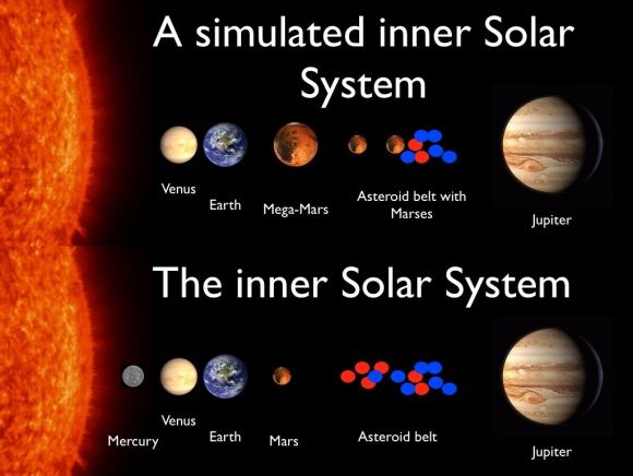
Interestingly enough, this is not the first theory Raymond and Izodoro have come up with to address the Asteroid Belt’s missing mass. Back in 2011, Raymond was a co-author on the study that proposed the Grand Tack model, in which he and his colleagues proposed that Jupiter migrated from its original orbit after it formed. At first, the planet moved closer to Mars’ current orbit, then back out towards where it is today.

Diagram comparing two possible explanations for how the Asteroid Belt formed. Credit: Sean Raymond/planetplanet.net

In the process, the asteroid belt would have been cleared, and Mars would have been deprived of mass, thus leading to its diminutive size – relative to Earth and Venus. This resolved a key problem with classical theories of Asteroid Belt formation, which was known as the “small Mars problem”. In short, all previous simulations of Solar planet formation tended to produce Mars analogs that were far more massive than Mars is today.

However, the Grand Tack hypothesis still contained theoretical uncertainties, which prompted Raymond and Izodoro to consider the the Empty Primordial Belt theory. “Our new result lends credence to an alternate model in which planetesimals never formed in the asteroid belt at all,” he said. “Different pieces of this new alternative model have been developed in recent years, and I think they add up to make a solid alternative to the Grand Tack model.”

Looking ahead, Raymond says that he and Izodoro hope to conduct further studies and simulations to see if either theory can be confirmed or falsified. “That’s the next step,” he said. “Until the next (seemingly-)crazy idea!”

Further Reading: Science Advances, PlanetPlanet

Study of Martian Sedimentary Layers Reveals More About the Planet’s Past

An artist’s impression of what Mars might have looked like with water. Credit: ESO/M. Kornmesser

As of 2016, Mars became the permanent residence of no less than eight robotic missions, a combination of orbiters, rovers and landers. Between extensive studies of the Martian atmosphere and surface, scientists have learned a great deal about the planet’s history and evolution. In particular, they have uncovered voluminous amounts of evidence that Mars once had flowing water on its surface.

The most recent evidence to this effect from the University of Texas at Austin, where researchers have produced a study detailing how water deposited sediment in Mars’ Aeolis Dorsa region. According to their research, this area contains extensive sedimentary deposits that act as a historical record of Mars, cataloguing the influence played by water-based erosion over time.

The study, titled “Fluvial Stratigraphy of Valley Fills at Aeolis Dorsa, Mars: Evidence for Base-Level Fluctuations Controlled by a Downstream Water Body“, recently appeared in the scientific journal GeoScienceWorld. Led by Benjamin D. Cardenas – a geologist with the Jackson School of Geosciences at the University of Texas at Austin – the team examined satellite data of the Aeolis Dorsa region to study the structure of sedimentary deposits.

MOLA Topographic Map of Aeolis Quadrangle (MC-23) on the planet Mars. Credit: USGS

For years, Aeolis Dorsa has been of interest to scientists since it contains some of the most densely-packed sedimentary layers on Mars, which were deposited by flowing water (aka. fluvial deposits). These deposits are visible from orbit because of the way they have undergone a process known as “topographic inversion” – which consists of deposits filling low river channels, then being exhumed to create incised valleys.

By definition, incised valleys are topographic lows produced by “riverine” erosion – i.e. relating to a river or riverbank. On Earth, these valleys are commonly created by rising sea levels, and then filled with sediment as a result of falling sea levels. As sea levels rise, the valleys are cut from the landscape as the waters move inland; and as the sea levels drop, retreating waters deposit sediment within them.

According to the study, this process has created an opportunity for geophysicists and planetary scientist to observe Mars’ geological record in three dimensions and across significant distances. As Cardenas told Universe Today via email:

“Sedimentary rocks in general record information about the environments under which they were deposited. Fluvial (river) deposits specifically record information about the way rivers migrated laterally, the way they aggraded vertically, and how these things changed over time.”
The dotted white arrow points to curved strata recording point bar growth and river migration while the black arrow shows topographically inverted river deposits outcropping as ridges (e.g., black arrow). Credit: hou.usra.edu

Here on Earth, the statigraphy (i.e. the order and position of sedimentary layers) of sedimentary rocks has been used by geologists for generations to place constraints on what conditions were like on our planet billions of years ago. It has only been in recent history that the study of sedimentary layers has been used to place constraints on what environmental conditions were like on other planetary bodies (like Mars) billions of years ago.

However, most of these studies have produced data that has been unable to resolve sedimentary packaging at the sub-meter scale. Instead, satellite images have been used to define large-scale stratigraphic relationships, such as deposition patterns along past water channels. In other words, the studies have focused on cataloging the existence of past water flows on Mars more than what has happened since then.

As Cardenas indicated, he and his team took a different approach, one which considered that Mars has experienced changes over the past 3.5 billion years. As he explained:

“In general, there has been the assumption that a lot of the martian surface is not particularly different than it was 3.5 billion years ago. We make an effort to demonstrate that the modern surface at our study area, Aeolis Dorsa, is the result of burial, exhumation, and un-equal erosion, and it can’t be assumed that the modern surface represents the ancient surface at all. We really try to show that what we see today, the features we can measure today, are sedimentary deposits of rivers, and not actual rivers. This is incredibly important to realize when you start making interpretations of your observations, and it is frequently a missed point.”
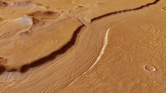
Perspective view of Reull Vallis based on images taken by the ESA’s Mars Express. Reull Vallis, a river-like structure, is believed to have formed when running water flowed in the distant martian past. Credit and Copyright: ESA/DLR/FU Berlin (G. Neukum)

For the sake of their research, Cardenas and his team used stereo pairs of high-resolution images and topographic data taken by the Context Camera (CTX) and the High Resolution Imaging Science Experiment (HiRISE) aboard the Mars Reconnaissance Orbiter (MRO). This data was then combined with the Integrated Software for Imagers and Spectrometers (ISIS) –  a digital image-processing package used by the U.S. Geological Survey (USGS) – and NASA’s Ames Stereo Pipeline.

These processed the paired images into high-resolution topographic data and digital elevation models (DEMs) which were then compared to data from the Mars Orbiting Laser Altimeter (MOLA) instrument aboard the Mars Global Surveyor (MSG). The final result was a series of DEMs that were orders of magnitude higher in terms of resolution than anything previously produced.

For all of this, Cardenas and his colleagues were able to identify stacking patterns in the fluvial deposits, noted changes in sedimentation styles, and suggested mechanisms for their creation. In addition, the team introduced a brand new method to measure the flow direction of the rivers that left these deposits, which allowed them to see how the landscape has changed over the past few billion years.

“The study shows there was a large body of water on Mars ~3.5 billion years ago, and that this body of water increased and decreased in volume slowly enough that river sedimentation had time to adjust styles,” said Cardenas. “This is more in line with slower climatic changes, and less in line with catastrophic hydrologic events. Aeolis Dorsa is positioned along hypothesized coastlines of an ancient northern ocean on Mars. It’s interesting to find coastal river deposits at Aeolis Dorsa, but it doesn’t help us constrain the size of the water body (lake, ocean, etc.)”

Nanedi Valles, a roughly 800-kilometre valley believed to be caused by ground-water outflow. Copyright ESA/DLR/FU Berlin (G. Neukum)

In essence, Cardenas and his colleagues concluded that – similar to Earth – falling and rising water levels in a large water body forced the formation of the paleo-valleys in their study area. And in a way that is similar to what is happening on Earth today, rivers that formed in coastal regions were strongly influenced by changes in water levels of a large, downstream water body.

For some time, it has been something of a foregone conclusion that the surface of Mars is dead, its features frozen in time. But as this study demonstrated, the landscape has undergone significant changes since it lost its atmosphere and surface water. These findings will no doubt be the subject of interest as we get closer to mounting a crewed mission to the Martian surface.

Further Reading: GSA, GeoScienceWorld

Detection of Mineral on Mars Bolsters Argument that Mars was Once Habitable

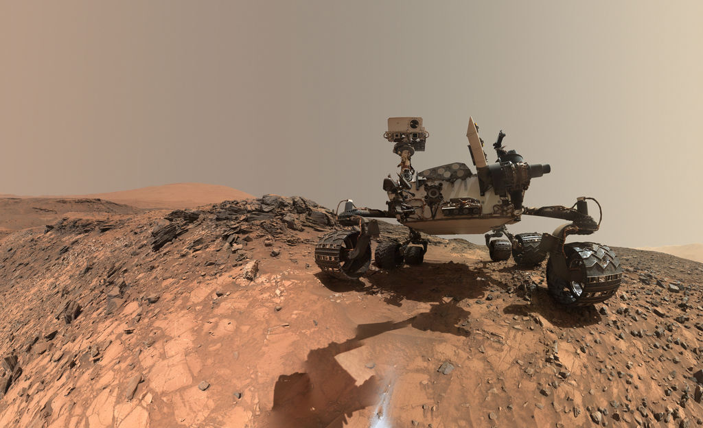
Mosaic image of the Curiosity rover on Mars, which recently turned up more evidence that supports the idea that the planet was once habitability. Credit: NASA/JPL-Caltech/MSSS.

It has become a well-known scientific fact that billions of years ago, Mars once had a thicker atmosphere and liquid water on its surface. Scientists have also discovered that it was the gradual loss of this atmosphere, between 4.2 and 3.7 billion years ago, that caused Mars to go from being a warmer, wetter environment to the dry, freezing environment it is today.

Despite the existence of both a thicker atmosphere and water, questions remain as to whether or not Mars was truly habitable in the past. According to a new study from a team of researchers from the Los Alamos National Laboratory (LANL), the discovery of a specific mineral (boron) has added weight to the argument that Mars was once a potentially life-bearing world.

The study, titled “In situ detection of boron by ChemCam on Mars“, was recently published in the scientific journal Geophysical Research Letters. For the sake of this study, the LANL research team consulted data collected by the  Chemistry and Camera (ChemCam) instrument aboard the Curiosity rover, which showed evidence of boron on the surface of Mars.

Mars, as it may have looked 4.2 billion years ago (left) and today (right). Credit: Kevin Gill

Boron, an element which is created by cosmic rays and is relatively rare in the Solar System, is necessary for the creation of ribonucleic acid – which is present in all forms of modern life. Essentially, RNA requires a key ingredient to form, which is a sugar called ribose. Like all sugars, ribose is highly unstable and decomposes quickly in water. As such, it needs another element to stabilize it, which is where boron comes into play.

As Patrick Gasda, a postdoctoral researcher at the Los Alamos National Laboratory and lead author on the paper, explained in a LANL press statement:

“Because borates may play an important role in making RNA – one of the building blocks of life – finding boron on Mars further opens the possibility that life could have once arisen on the planet. Borates are one possible bridge from simple organic molecules to RNA. Without RNA, you have no life. The presence of boron tells us that, if organics were present on Mars, these chemical reactions could have occurred.”

When boron is dissolved in water (which, as noted, Mars once had in abundance) it becomes borate. This compound (when combined with ribose) would act as a stabilizing agent, keeping the sugar together long enough so that RNA can form. As Gasda explained, “We detected borates in a crater on Mars that’s 3.8 billion years old, younger than the likely formation of life on Earth.”

Artist rendition of how the “lake” at Gale Crater on Mars may have looked millions of years ago. Credit and copyright: Kevin Gill.

The boron was detected by Curiosity’s laser-shooting ChemCam instrument, which was developed by the LANL in conjunction with France’s space agency, the National Center of Space Studies (CNES). It detected the element in veins of calcium sulfate minerals located in the Gale Crater, which means that boron was present in Mars’ groundwater and was preserved with other minerals when the water dissolved, leaving behind rich mineral veins.

This provides further evidence that the lake that is now known to have once filled the Gale Crater could have had life in it. During the time period in question, this lake would have experienced temperatures ranging from from 0 to 60 ° C (32 to 140 °F) and had a pH level that would have been neutral-to-alkaline. It also means that on ancient Mars, the conditions necessary for life would have existed, and independent of Earth to boot.

This is just one of many findings Curiosity has made related to the composition of Martian rocks. Since it touched down in the Gale Crater in 2012, the rover has been gathering chemical evidence of the ancient lake that once existed there, as well as geological evidence that has been preserved by sedimentary deposits. As the rover began to scale the slope of Mount Sharp, the composition of the surface began to change.

Whereas samples taken from the crater floor tended to contain more in the way of clays, samples collected higher up Mount Sharp contained more boron. These and other chemical traces are indications of how conditions under which sediments were deposited changed over time. Analysis conducted of the mountain’s layers has also showed how the movement of groundwater through these layers of sediment altered and transported elements (like boron).

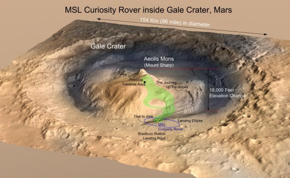
MRO image of Gale Crater illustrating the landing location and trek of the Rover Curiosity. Credits: NASA/JPL, illustration, T.Reyes

All of this is providing a picture of how Mars’ environment changed over the course of billions of years and affected the planet’s potential favorability for microbial life. And while scientists have a general picture of how Mars underwent a very significant transition billions of years ago, whether or not Martian life ever existed remains unknown.

The main goal of the Curiosity mission was to determine whether the area ever offered a habitable environment. Thanks to evidence of past water and the discovery of minerals like boron, this has been confirmed. In the coming years, the deployment of the Mars 2020 rover is expected to follow-up on these findings and shed more light on Mars’ case for past habitability.

Once it reaches the surface, the Mars 2020 rover – which relies on much of the same technology as Curiosity – will use an instrument called the Scanning Habitable Environments with Raman & Luminescence for Organics & Chemicals (SHERLOC). Also developed by the LANL, this “SuperCam” instrument will use spectrometers, a laser and a camera to search for organics and minerals that could indicate the existence of past microbial life.

If there is still preserved evidence of life to be found on Mars or – fingers crossed! – microbial life still exists there today, we can expect to find it before long. If that should be the case, human beings will finally know with certainty that life evolved on a planet other than Earth, and perhaps independent of it!

Further Reading: LANL, Geophysical Research Letters