New Study Says Primordial Asteroid Belt was Empty

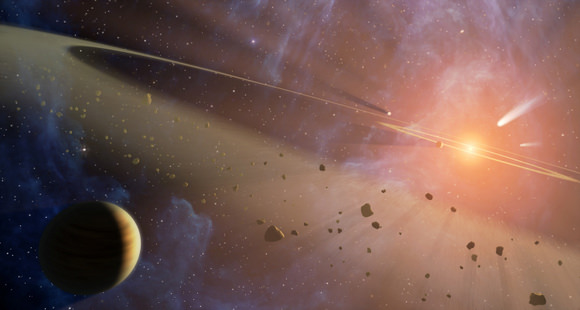
Artist concept of the asteroid belt. Credit: NASA

Between the orbits of Mars and Jupiter lies a disk of rocks, small bodies and planetoids known as the Main Asteroid Belt. The existence of this Belt was first theorized in the 18th century, based on observations that indicated a regular pattern in the orbits of Solar planets. By the following century, regular discoveries began to be made in the space between Mars and Jupiter, prompting astronomers to theorize where the Belt came from.

For a long time, scientists debated whether the Belt was the remains of a planet that broke up, or remnants left over from the early system that failed to become a planet. But a new study by a pair of astronomers from the University of Bordeaux has offered a different take. According to their theory, the Asteroid Belt began as an empty space which was gradually filled by rocks and debris over time.

For the sake of their study – which recently appeared in the journal Science Advances under the title “The Empty Primordial Asteroid Belt” – astronomers Sean N. Raymond and Andre Izidoro of the University of Bordeaux considered the current scientific consensus, which is that the Main Belt was once much more densely packed and became depleted of mass over time.

Artist’s impression of how the Asteroid Belt could have become filled with C-type and S-type asteroids over time. Credit: Sean Raymond/planetplanet.net

As Dr. Raymond explained to Universe Today via email:

“The standard picture is that the building blocks of the Solar System — what we call planetesimals, generally thought of as 10-100 km-scale bodies — started off in a smooth distribution across the Sun’s planet-forming disk. The problem is, that puts a couple of times Earth’s mass in the asteroid belt, where there is now less than a thousandth of an Earth mass. The challenge in this picture is therefore to understand how the belt lost 99.9% of its mass (but not 100%).”

To this, Dr. Raymond and Dr. Izodoro considered the alternate possibility that perhaps the primordial belt started as an empty space. In accordance with this theory, there were no planetesimals – i.e. Ceres, Vesta, Palla, and Hygeia – orbiting between Mars and Jupiter as there are today. This began as a thought experiment which, as Dr. Raymond admits, sounded a bit crazy at first.

However, he and Dr. Izodoro soon realized that several protoplanetary disks like the one they were envisioning had already been discovered in other star systems. For example, in 2014, the Atacama Large Millimeter/submillimeter Array in Chile photographed a planet-forming disk of dust and gas (aka, a protoplanetary disk) in the HL Tauri system, a very young star located about 450 light years away in the Taurus constellation.

As the image (shown below) revealed, the dust in this disk is not smooth, but consists of several broad regions and less dense regions. “The exact explanation for the structure in this disk is still debated but pretty much all models invoke drifting dust,” said Raymond. “And planetesimals form when drifting dust piles up into sufficiently-dense rings. So, dust rings should (we think) produce rings of planetesimals.”

Image of the HL Tau planet-forming disk taken with the Atacama Large Millimeter Array. Credit: ALMA (ESO/NAOJ/NRAO)

To test this hypothesis, they constructed a model of the early Solar System which included an empty Main Belt region. As they moved the simulation forward, they found that the formation of the disk was related to the formation of the rocky planets, and would gradually become what we see today. As Raymond indicated:

“What we found is that the growth of the rocky planets is not 100% efficient. A fraction of planetesimals is gravitationally kicked outward and stranded in the asteroid belt. The orbits of captured bodies matches closely those of S-type asteroids. The efficiency of implanting S-types in the belt is quite low, only about 1 in 1000.  However, recall that the belt is almost empty.  There is a total of about 4 hundred-thousandths of an Earth-mass in S-types in the present-day belt.  Our simulations typically implanted a few times that amount. Given that some are lost during later evolution of the Solar System, this matches both the distribution and amount of S-type asteroids in the belt.

They then combined this model with previous work which looked at the growth of Jupiter and Saturn and how this would effect the Solar System. In this study, they showed the C-type asteroids would be deposited in the Belt over time, and that these asteroids would also be responsible for delivering water to Earth. When they combined the distribution of implanted C-type and S-type asteroids with their current work, they found that it matched the present-day distribution of asteroids.

Interestingly enough, this is not the first theory Raymond and Izodoro have come up with to address the Asteroid Belt’s missing mass. Back in 2011, Raymond was a co-author on the study that proposed the Grand Tack model, in which he and his colleagues proposed that Jupiter migrated from its original orbit after it formed. At first, the planet moved closer to Mars’ current orbit, then back out towards where it is today.

Diagram comparing two possible explanations for how the Asteroid Belt formed. Credit: Sean Raymond/planetplanet.net

In the process, the asteroid belt would have been cleared, and Mars would have been deprived of mass, thus leading to its diminutive size – relative to Earth and Venus. This resolved a key problem with classical theories of Asteroid Belt formation, which was known as the “small Mars problem”. In short, all previous simulations of Solar planet formation tended to produce Mars analogs that were far more massive than Mars is today.

However, the Grand Tack hypothesis still contained theoretical uncertainties, which prompted Raymond and Izodoro to consider the the Empty Primordial Belt theory. “Our new result lends credence to an alternate model in which planetesimals never formed in the asteroid belt at all,” he said. “Different pieces of this new alternative model have been developed in recent years, and I think they add up to make a solid alternative to the Grand Tack model.”

Looking ahead, Raymond says that he and Izodoro hope to conduct further studies and simulations to see if either theory can be confirmed or falsified. “That’s the next step,” he said. “Until the next (seemingly-)crazy idea!”

Further Reading: Science Advances, PlanetPlanet

Study of Martian Sedimentary Layers Reveals More About the Planet’s Past

An artist’s impression of what Mars might have looked like with water. Credit: ESO/M. Kornmesser

As of 2016, Mars became the permanent residence of no less than eight robotic missions, a combination of orbiters, rovers and landers. Between extensive studies of the Martian atmosphere and surface, scientists have learned a great deal about the planet’s history and evolution. In particular, they have uncovered voluminous amounts of evidence that Mars once had flowing water on its surface.

The most recent evidence to this effect from the University of Texas at Austin, where researchers have produced a study detailing how water deposited sediment in Mars’ Aeolis Dorsa region. According to their research, this area contains extensive sedimentary deposits that act as a historical record of Mars, cataloguing the influence played by water-based erosion over time.

The study, titled “Fluvial Stratigraphy of Valley Fills at Aeolis Dorsa, Mars: Evidence for Base-Level Fluctuations Controlled by a Downstream Water Body“, recently appeared in the scientific journal GeoScienceWorld. Led by Benjamin D. Cardenas – a geologist with the Jackson School of Geosciences at the University of Texas at Austin – the team examined satellite data of the Aeolis Dorsa region to study the structure of sedimentary deposits.

MOLA Topographic Map of Aeolis Quadrangle (MC-23) on the planet Mars. Credit: USGS

For years, Aeolis Dorsa has been of interest to scientists since it contains some of the most densely-packed sedimentary layers on Mars, which were deposited by flowing water (aka. fluvial deposits). These deposits are visible from orbit because of the way they have undergone a process known as “topographic inversion” – which consists of deposits filling low river channels, then being exhumed to create incised valleys.

By definition, incised valleys are topographic lows produced by “riverine” erosion – i.e. relating to a river or riverbank. On Earth, these valleys are commonly created by rising sea levels, and then filled with sediment as a result of falling sea levels. As sea levels rise, the valleys are cut from the landscape as the waters move inland; and as the sea levels drop, retreating waters deposit sediment within them.

According to the study, this process has created an opportunity for geophysicists and planetary scientist to observe Mars’ geological record in three dimensions and across significant distances. As Cardenas told Universe Today via email:

“Sedimentary rocks in general record information about the environments under which they were deposited. Fluvial (river) deposits specifically record information about the way rivers migrated laterally, the way they aggraded vertically, and how these things changed over time.”
The dotted white arrow points to curved strata recording point bar growth and river migration while the black arrow shows topographically inverted river deposits outcropping as ridges (e.g., black arrow). Credit: hou.usra.edu

Here on Earth, the statigraphy (i.e. the order and position of sedimentary layers) of sedimentary rocks has been used by geologists for generations to place constraints on what conditions were like on our planet billions of years ago. It has only been in recent history that the study of sedimentary layers has been used to place constraints on what environmental conditions were like on other planetary bodies (like Mars) billions of years ago.

However, most of these studies have produced data that has been unable to resolve sedimentary packaging at the sub-meter scale. Instead, satellite images have been used to define large-scale stratigraphic relationships, such as deposition patterns along past water channels. In other words, the studies have focused on cataloging the existence of past water flows on Mars more than what has happened since then.

As Cardenas indicated, he and his team took a different approach, one which considered that Mars has experienced changes over the past 3.5 billion years. As he explained:

“In general, there has been the assumption that a lot of the martian surface is not particularly different than it was 3.5 billion years ago. We make an effort to demonstrate that the modern surface at our study area, Aeolis Dorsa, is the result of burial, exhumation, and un-equal erosion, and it can’t be assumed that the modern surface represents the ancient surface at all. We really try to show that what we see today, the features we can measure today, are sedimentary deposits of rivers, and not actual rivers. This is incredibly important to realize when you start making interpretations of your observations, and it is frequently a missed point.”
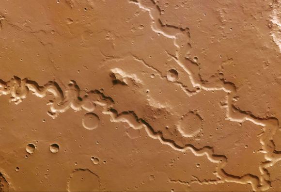
Perspective view of Reull Vallis based on images taken by the ESA’s Mars Express. Reull Vallis, a river-like structure, is believed to have formed when running water flowed in the distant martian past. Credit and Copyright: ESA/DLR/FU Berlin (G. Neukum)

For the sake of their research, Cardenas and his team used stereo pairs of high-resolution images and topographic data taken by the Context Camera (CTX) and the High Resolution Imaging Science Experiment (HiRISE) aboard the Mars Reconnaissance Orbiter (MRO). This data was then combined with the Integrated Software for Imagers and Spectrometers (ISIS) –  a digital image-processing package used by the U.S. Geological Survey (USGS) – and NASA’s Ames Stereo Pipeline.

These processed the paired images into high-resolution topographic data and digital elevation models (DEMs) which were then compared to data from the Mars Orbiting Laser Altimeter (MOLA) instrument aboard the Mars Global Surveyor (MSG). The final result was a series of DEMs that were orders of magnitude higher in terms of resolution than anything previously produced.

For all of this, Cardenas and his colleagues were able to identify stacking patterns in the fluvial deposits, noted changes in sedimentation styles, and suggested mechanisms for their creation. In addition, the team introduced a brand new method to measure the flow direction of the rivers that left these deposits, which allowed them to see how the landscape has changed over the past few billion years.

“The study shows there was a large body of water on Mars ~3.5 billion years ago, and that this body of water increased and decreased in volume slowly enough that river sedimentation had time to adjust styles,” said Cardenas. “This is more in line with slower climatic changes, and less in line with catastrophic hydrologic events. Aeolis Dorsa is positioned along hypothesized coastlines of an ancient northern ocean on Mars. It’s interesting to find coastal river deposits at Aeolis Dorsa, but it doesn’t help us constrain the size of the water body (lake, ocean, etc.)”

Nanedi Valles, a roughly 800-kilometre valley believed to be caused by ground-water outflow. Copyright ESA/DLR/FU Berlin (G. Neukum)

In essence, Cardenas and his colleagues concluded that – similar to Earth – falling and rising water levels in a large water body forced the formation of the paleo-valleys in their study area. And in a way that is similar to what is happening on Earth today, rivers that formed in coastal regions were strongly influenced by changes in water levels of a large, downstream water body.

For some time, it has been something of a foregone conclusion that the surface of Mars is dead, its features frozen in time. But as this study demonstrated, the landscape has undergone significant changes since it lost its atmosphere and surface water. These findings will no doubt be the subject of interest as we get closer to mounting a crewed mission to the Martian surface.

Further Reading: GSA, GeoScienceWorld

Detection of Mineral on Mars Bolsters Argument that Mars was Once Habitable

Mosaic image of the Curiosity rover on Mars, which recently turned up more evidence that supports the idea that the planet was once habitability. Credit: NASA/JPL-Caltech/MSSS.

It has become a well-known scientific fact that billions of years ago, Mars once had a thicker atmosphere and liquid water on its surface. Scientists have also discovered that it was the gradual loss of this atmosphere, between 4.2 and 3.7 billion years ago, that caused Mars to go from being a warmer, wetter environment to the dry, freezing environment it is today.

Despite the existence of both a thicker atmosphere and water, questions remain as to whether or not Mars was truly habitable in the past. According to a new study from a team of researchers from the Los Alamos National Laboratory (LANL), the discovery of a specific mineral (boron) has added weight to the argument that Mars was once a potentially life-bearing world.

The study, titled “In situ detection of boron by ChemCam on Mars“, was recently published in the scientific journal Geophysical Research Letters. For the sake of this study, the LANL research team consulted data collected by the  Chemistry and Camera (ChemCam) instrument aboard the Curiosity rover, which showed evidence of boron on the surface of Mars.

Mars, as it may have looked 4.2 billion years ago (left) and today (right). Credit: Kevin Gill

Boron, an element which is created by cosmic rays and is relatively rare in the Solar System, is necessary for the creation of ribonucleic acid – which is present in all forms of modern life. Essentially, RNA requires a key ingredient to form, which is a sugar called ribose. Like all sugars, ribose is highly unstable and decomposes quickly in water. As such, it needs another element to stabilize it, which is where boron comes into play.

As Patrick Gasda, a postdoctoral researcher at the Los Alamos National Laboratory and lead author on the paper, explained in a LANL press statement:

“Because borates may play an important role in making RNA – one of the building blocks of life – finding boron on Mars further opens the possibility that life could have once arisen on the planet. Borates are one possible bridge from simple organic molecules to RNA. Without RNA, you have no life. The presence of boron tells us that, if organics were present on Mars, these chemical reactions could have occurred.”

When boron is dissolved in water (which, as noted, Mars once had in abundance) it becomes borate. This compound (when combined with ribose) would act as a stabilizing agent, keeping the sugar together long enough so that RNA can form. As Gasda explained, “We detected borates in a crater on Mars that’s 3.8 billion years old, younger than the likely formation of life on Earth.”

Artist rendition of how the “lake” at Gale Crater on Mars may have looked millions of years ago. Credit and copyright: Kevin Gill.

The boron was detected by Curiosity’s laser-shooting ChemCam instrument, which was developed by the LANL in conjunction with France’s space agency, the National Center of Space Studies (CNES). It detected the element in veins of calcium sulfate minerals located in the Gale Crater, which means that boron was present in Mars’ groundwater and was preserved with other minerals when the water dissolved, leaving behind rich mineral veins.

This provides further evidence that the lake that is now known to have once filled the Gale Crater could have had life in it. During the time period in question, this lake would have experienced temperatures ranging from from 0 to 60 ° C (32 to 140 °F) and had a pH level that would have been neutral-to-alkaline. It also means that on ancient Mars, the conditions necessary for life would have existed, and independent of Earth to boot.

This is just one of many findings Curiosity has made related to the composition of Martian rocks. Since it touched down in the Gale Crater in 2012, the rover has been gathering chemical evidence of the ancient lake that once existed there, as well as geological evidence that has been preserved by sedimentary deposits. As the rover began to scale the slope of Mount Sharp, the composition of the surface began to change.

Whereas samples taken from the crater floor tended to contain more in the way of clays, samples collected higher up Mount Sharp contained more boron. These and other chemical traces are indications of how conditions under which sediments were deposited changed over time. Analysis conducted of the mountain’s layers has also showed how the movement of groundwater through these layers of sediment altered and transported elements (like boron).

MRO image of Gale Crater illustrating the landing location and trek of the Rover Curiosity. Credits: NASA/JPL, illustration, T.Reyes

All of this is providing a picture of how Mars’ environment changed over the course of billions of years and affected the planet’s potential favorability for microbial life. And while scientists have a general picture of how Mars underwent a very significant transition billions of years ago, whether or not Martian life ever existed remains unknown.

The main goal of the Curiosity mission was to determine whether the area ever offered a habitable environment. Thanks to evidence of past water and the discovery of minerals like boron, this has been confirmed. In the coming years, the deployment of the Mars 2020 rover is expected to follow-up on these findings and shed more light on Mars’ case for past habitability.

Once it reaches the surface, the Mars 2020 rover – which relies on much of the same technology as Curiosity – will use an instrument called the Scanning Habitable Environments with Raman & Luminescence for Organics & Chemicals (SHERLOC). Also developed by the LANL, this “SuperCam” instrument will use spectrometers, a laser and a camera to search for organics and minerals that could indicate the existence of past microbial life.

If there is still preserved evidence of life to be found on Mars or – fingers crossed! – microbial life still exists there today, we can expect to find it before long. If that should be the case, human beings will finally know with certainty that life evolved on a planet other than Earth, and perhaps independent of it!

Further Reading: LANL, Geophysical Research Letters

Preparations for Deployment of InSight Lander to Mars are Ramping Up!

Artist's conception of the NASA InSight Mars lander. Credit: NASA/JPL-Caltech

This summer has been a busy time for NASA. At present, the agency is making the final preparations for the Cassini mission‘s plunge into Saturn’s atmosphere, monitoring the large Near-Earth Asteroid that recently made a flyby of Earth, marking the 40th anniversary of the historic Voyager missions, and hosting the Summer of Mars at the Kennedy Space Center.

In addition to all that, engineers at the Jet Propulsion Laboratory in Pasadena, California, are busy preparing the Interior Exploration using Seismic Investigations, Geodesy and Heat Transport (InSight) Lander for its scheduled launch in 2018. Once deployed to Mars, the lander will reveal things about Mars’ interior geology and composition, shedding new light on the history of the Red Planet’s formation and evolution.

Originally scheduled for launch in 2016, the lander’s deployment was delayed due to the failure of a key component – a chamber that housed the Seismic Experiment for Interior Structure (SEIS). Having finished work on a new vacuum enclosure for this instrument, the technicians at Lockheed Martin Space Systems are back at work, assembling and testing the spacecraft in a clean room facility outside of Denver, Colorado.

This artist’s concept from August 2015 depicts NASA’s InSight Mars lander fully deployed for studying the deep interior of Mars. Credit: NASA/JPL-Caltech

As Stu Spath, the spacecraft program manager at Lockheed Martin, said in a NASA press statement:

“Our team resumed system-level integration and test activities last month. The lander is completed and instruments have been integrated onto it so that we can complete the final spacecraft testing including acoustics, instrument deployments and thermal balance tests.”

Beyond the exploration of Mars, the InSight mission is also expected to reveal information about how all terrestrial (i.e. rocky) planets in the Solar System formed over four billion years ago. Mars is an especially opportune target for this type of research since it has been relatively inactive for the past three billion years. However, when the planet was still young, it underwent geological processes that were analogous to Earth’s.

In other words, because the interior of Mars has been subject to less convection over the past three billion years, it has likely preserved evidence about its early geological history better than Earth has. InSight will study this preserved history through a series of instruments that will measure the planet’s seismology, heat loss, and the state and nature of its core.

Once it reaches Mars, the stationary lander will set down near Mars’ equator and deploy its two fold-out solar cells, which kind of resemble large fans. Within a few weeks of making its landing, it will use a robotic arm to place its two main instruments onto the Martian surface – the aforementioned Seismic Experiment for Interior Structure (SEIS) and the Heat Flow and Physical Properties Probe (HP³).

Artist’s impression of the interior of Mars. Credit: NASA/JPL

The SEIS instrument – which was developed by France’s National Center for Space Studies (CNES) in collaboration with NASA and several European scientific institutions – has a sensitivity comparable to the best research seismometers here on Earth. This instrument will record seismic waves from “marsquakes” and meteor impacts, which will reveal things about the planet’s interior layers.

The HP³ probe, supplied by the German Aerospace Center (DLR), will use a Polish-made self-hammering mechanism to bury itself to a depth of 3 meters (10 feet) or more. As it descends, the probe will extend a tether that contains temperature sensors every ~10 cm, which measure the temperature profile of the subsurface. Combined with surface measurements, the instrument will determine the amount of heat escaping from the planet’s interior.

A third experiment, known as Rotation and Interior Structure Experiment (RISE), will also come into play. This instrument will use the lander’s X-band radio link to conduct Doppler tracking of the lander’s location, which will also allow it to measure variations in Mars’ rotation axis. Since these variations are primarily related to the size and state of Mars’ core, this experiment will shed light on one of Mars’ greatest mysteries.

Thanks to multiple missions that have studies Mars’ surface and atmosphere, scientists now know that roughly 4.2 billions of years ago, Mars lost its magnetic field. Because of this, Mars’ atmosphere was stripped away by solar wind during the next 500 million years. It is believed that it was this process that allowed the planet to go from being a warmer, wetter environment in the past to the cold, desiccated and irradiated place it is today.

NASA’s InSight Mars lander spacecraft in a Lockheed Martin clean room near Denver. Credit: NASA/JPL-Caltech/Lockheed Martin

As such, determining the state of Mars’ core – i.e. whether it is solid or liquid, or differentiated between a solid outer core and liquid inner core – will allow scientists to gain a more comprehensive understanding of the planet’s geological history. It will also allow them to answer with a fair degree of certainty how and when Mars lost its magnetic field (and hence, its denser, warmer atmosphere).

The spacecraft’s science payload is also on track for next year’s launch. At present, the mission is scheduled to launch on May 5th, 2018, though this window could be moved to anytime within a five-week period. Regardless of what day it launches, mission planners indicate that the flight will reach Mars on November 26th, 2018 (the Monday after Thanksgiving).

As noted, the mission was originally planned to launch in March of 2016, but was canceled due to the presence of a leak in the special metal container designed to maintain near-vacuum conditions around the SEIS’s main sensors. Now that a redesigned vacuum vessel has been built and tested (and integrated with the SEIS) the spacecraft is ready for its new launch date.

Back in 2010, the InSight mission was selected from a total of 28 proposals, which were made as part of the twelfth round of selections for NASA’s Discovery Program. In contrast to New Frontiers or Flagship programs, Discovery missions are small-budget enterprises that aid in larger scientific pursuits. Along with two other finalists – the Titan Mare Explorer (TiME) and the Comet Hopper (CHopper) – InSight was awarded funding for further development.

Bruce Banerdt of NASA’s Jet Propulsion Laboratory is the Principle Investigator (PI) for the InSight mission.

Be sure to check out this video of the InSight mission (courtesy of NASA JPL) as well:

Further Reading: NASA JPL

Mars Express Captures Mars’ Moving Bow Shock

Artist's impression of the moving Martian bow shock. Credit: ESA/ATG medialab

Every planet in our Solar System interacts with the stream of energetic particles coming from our Sun. Often referred to as “solar wind”, these particles consist mainly of electrons, protons and alpha particles that are constantly making their way towards interstellar space. Where this stream comes into contact with a planet’s magnetosphere or atmosphere, it forms a region around them known as a “bow shock”.

These regions form in front of the planet, slowing and diverting solar wind as it moves past – much like how water is diverted around a boat. In the case of Mars, it is the planet’s ionosphere that provides the conductive environment necessary for a bow shock to form. And according to a new study by a team of European scientists, Mars’ bow shock shifts as a result of changes in the planet’s atmosphere.

The study, titled “Annual Variations in the Martian Bow Shock Location as Observed by the Mars Express Mission“, appeared in the Journal of Geophysical Letters: Space Physics. Using data from the Mars Express orbiter, the science team sought to investigate how and why the bow shock’s location varies during the course of several Martian years, and what factors are chiefly be responsible.

Diagram of Mars’ orbit and changes to its bow shock between perihelion and aphelion. Credit: ESA/ATG medialab

For many decades, astronomers have been aware that bow shocks form upstream of a planet, where interaction between solar wind and the planet causes energetic particles to slow down and gradually be diverted. Where the solar wind meets the planet’s magnetosphere or atmosphere, a sharp boundary line is formed, which them extends around the planet in a widening arc.

This is where the term bow shock comes from, owing to its distinctive shape. In the case of Mars, which does not have a global magnetic field and a rather thin atmosphere to boot (less than 1% of Earth’s atmospheric pressure at sea level), it is the electrically-charged region of the upper atmosphere (the ionosphere) that is responsible for creating the bow shock around the planet.

At the same time, Mars relatively small size, mass and gravity allows for the formation of an extended atmosphere (i.e. an exosphere). In this portion of Mars’ atmosphere, gaseous atoms and molecules escape into space and interact directly with solar wind. Over the years, this extended atmosphere and Mars’ bow shock have been observed by multiple orbiter missions, which have detected variations in the latter’s boundary.

This is believed to be caused by multiple factors, not the least of which is distance. Because Mars has an relatively eccentric orbit (0.0934 compared to Earth’s 0.0167), its distance from the Sun varies quite a bit – going from 206.7 million km (128.437 million mi; 1.3814 AU) at perihelion to 249.2 million km (154.8457 million mi; 1.666 AU) at aphelion.

Illustration showing how Mars and Earth interact with solar wind. Credit: NASA

When the planet is closer, the dynamic pressure of the solar wind against its atmosphere increases. However, this change in distance also coincides with increases in the amount of incoming extreme ultraviolet (EUV) solar radiation. As a result, the rate at which ions and electrons (aka. plasma) are produced in the upper atmosphere increases, causing increased thermal pressure that counteracts the incoming solar wind.

Newly-created ions within the extended atmosphere are also picked up and accelerated by the electromagnetic fields being carried by the solar wind. This has the effect of slowing it down and causing Mars’ bowshock to shift its position. All of this has been known to happen over the course of a single Martian year – which is equivalent to 686.971 Earth days or 668.5991 Martian days (sols).

However, how it behaves over longer periods of time is a question that was previously unanswered. As such, the team of European scientists consulted data obtained by the Mars Express mission over a five year period. This data was taken by the Analyser of Space Plasma and EneRgetic Atoms (ASPERA-3) Electron Spectrometer (ELS), which the team used to examine a total of 11,861 bow shock crossings.

What they found was that, on average, the bow shock is closer to Mars when it is near aphelion (8102 km), and further away at perihelion (8984 km). This works out to a variation of about 11% during the Martian year, which is pretty consistent with its eccentricity. However, the team wanted to see which (if any) of the previously-studied mechanisms was chiefly responsible for this change.

The moving Martian bow shock. Credit: ESA/ATG medialab

Towards this end, the team considered variations in solar wind density, the strength of the interplanetary magnetic field, and solar irradiation as primary causes – are all of which decline as the planet gets farther away from the Sun. However, what they found was that the bow shock’s location appeared more sensitive to variations in the Sun’s output of extreme UV radiation rather than to variations in solar wind itself.

The variations in bow shock distance also appeared to be related to the amount of dust in the Martian atmosphere. This increases as Mars approaches perihelion, causing the atmosphere to absorb more solar radiation and heat up. Much like how increased levels of EUV leads to an increased amount of plasma in the ionosphere and exosphere, increased amounts of dust appear to act as a buffer against solar wind.

As Benjamin Hall, a researcher at Lancaster University in the UK and the lead author of the paper, said in an ESA press release:

“Dust storms have been previously shown to interact with the upper atmosphere and ionosphere of Mars, so there may be an indirect coupling between the dust storms and bow shock location… However, we do not draw any further conclusions on how the dust storms could directly impact the location of the Martian bow shock and leave such an investigation to a future study.”

In the end, Hall and his team could not single out any one factor when addressing why Mars’ bow shock shifts over longer periods of time. “It seems likely that no single mechanism can explain our observations, but rather a combined effect of all of them,” he said. “At this point none of them can be excluded.”

Looking ahead, Hall and his colleagues hope that future missions will help shed additional light on the mechanisms behind Mars shifting bowshock. As Hall indicated, this will likely involve “”joint investigations by ESA’s Mars Express and Trace Gas Orbiter, and NASA’s MAVEN mission. Early data from MAVEN seems to confirm the trends that we discovered.”

While this is not the first analysis that sought to understand how Mars’ atmosphere interacts with solar wind, this particular analysis was based on data obtained over a much longer period of time than any previously study. In the end, the multiple missions that are currently studying Mars are revealing much about the atmospheric dynamics of this planet. A planet which, unlike Earth, has a very weak magnetic field.

What we learn in the process will go a long way towards ensuring that future exploration missions to Mars and other planets that have weak magnetic fields (like Venus and Mercury) are safe and effective. It might even assist us with the creation of permanent bases on these worlds someday!

Further Reading: ESA, Journal of Geophysical Research: Space Physics

New Study Says that Martian Weather May Get Snowy Overnight

Mars’ south polar ice cap. Credit: ESA / DLR / FU Berlin /

For decades, scientists have tried to crack the mystery of Mars’ weather patterns. While the planet’s atmosphere is much thinner than our own – with less than 1% of the air pressure that exists on Earth at sea level – clouds have been seen periodically in the skies above the surface. In addition, periodic snowfalls has been spotted over the years, mainly in the form of carbon dioxide snow (i.e. dry ice).

However, according to a new study by a team of French and American astronomers, Mars experiences snowfalls in the form of water-ice particles. These snowfalls occur only at night, coinciding with drops in global temperature. The presence of these storms, and the speed at which they reach the surface, is forcing scientists to rethink Mars’ weather patterns.

The study, titled “Snow Precipitation on Mars Driven by Cloud-Induced Night-Time Convection“, recently appeared in the journal Nature Geosciences. Led by Aymeric Spiga, a tenured lecturer at the Université Pierre et Marie Curie and a researcher at Laboratoire de Météorologie Dynamique in Paris, the team conducted numerical simulations of Mars’ cloudy regions to demonstrate that localized convective snowstorms can occur there.

Mars’ north polar ice cap, captured by NASA’s Mars Global Surveyor. Credit: NASA/JPL-Caltech/MSSS

For decades, scientists believed that Mars experienced snowfall in the form of frozen carbon dioxide (aka. dry ice), particularly around the south pole. But it has only been in recent years that direct evidence has been obtained. For instance, on September 29th, 2008, the Phoenix lander took pictures of snow falling from clouds that were 4 km (2.5 mi) above its landing site near the Heimdal Crater.

In 2012, the Mars Reconnaissance Orbiter revealed additional evidence of carbon-dioxide snowfalls on Mars. And there has also been evidence in recent years of low-falling snows, which appear to have helped shape the Martian landscape. These include a relatively young gully fan system in the Promethei Terra region of Mars, which researchers at Brown University determined were shaped by melting snow.

Further, in 2014, data obtained by the ESA’s Mars Express probe showed how the Hellas Basin (a massive crater) was also weathered by melting snows. And in 2015, the Curiosity rover confirmed that the Gale Crater (where it landed in 2012) was once filled by a standing body of water. According to the science team’s findings, this ancient lake received runoff from snow melting on the crater’s northern rim.

All of these findings were rather perlexing to scientists, as Mars was thought to not have a dense enough atmosphere to support this level of condensation. To investigate these meteorological phenomena, Dr. Spiga and his colleagues combined data provided by various Martian lander and orbiter missions to create a new atmospheric model that simulated weather on Mars.

Simulated view of the Gale Crater Lake on Mars. Credit: NASA/JPL-Caltech/ESA/DLR/FU Berlin/MSSS

What they found was that during the nights when Mars’ atmosphere became cold enough, water-ice particles could form clouds. These clouds would become unstable and release water-ice precipitation, which fall rapidly to the surface. The team then compared these results to localized weather phenomena on Earth, where cold dense air results in rains or snow falling rapidly from clouds (aka. “microbursts”).

As they state in their study, this information was consistent with data provided by Martian lander and orbiter missions:

“In our simulations, convective snowstorms occur only during the Martian night, and result from atmospheric instability due to radiative cooling of water-ice cloud particles. This triggers strong convective plumes within and below clouds, with fast snow precipitation resulting from the vigorous descending currents.”

The results also contradicted the long-held belief that low-lying clouds would only deposit snow on the surface slowly and gently. This was believed to be the case based on the fact that Mars has a thin atmosphere, and therefore lacks violent winds. But as their simulations showed, water-ice particles that lead to microburst snowstorms would reach the ground within minutes, rather than hours.

The Phoenix Mars Lander used a lidar device built by Teledyne Optech to detect snow in the Martian atmosphere in 2008. Credits: NASA

These findings indicate that Martian snowstorms also have a profound influence on the global transport of water vapor and seasonal variations of ice deposits. As they state further:

“Night-time convection in Martian water-ice clouds and the associated snow precipitation lead to transport of water both above and below the mixing layers, and thus would affect Mars’ water cycle past and present, especially under the high-obliquity conditions associated with a more intense water cycle.”

As Aymeric Spiga explained in an interview with the AFP, these snows are not quite what we are used to here on Earth. “It’s not as if you could make a snowman or ski,” he said. “Standing on the surface of Mars you wouldn’t see a thick blanket of snow—more like a generous layer of frost.” Nevertheless, these findings do point towards their being some similarities between the meteorlogical phenomena of Earth and Mars.

With crewed missions to Mars planned for the coming decades – particularly NASA’s “Journey to Mars“, scheduled for the 2030s – it helps to know precisely what kinds of meteorological phenomena our astronauts will encounter. While snowshoes or skis might be out of the question, astronauts could at least look forward to the possibility of seeing fresh snow when they wake up in their habitats!

Further Reading: AFP, Nature Geoscience

Opportunity Starts Historic Descent of Tantalizing Martian Gully to Find Out How Was It Carved

Historic 1st descent down Martian gully. Panoramic view looking down Perseverance Valley after entry at top was acquired by NASA’s Opportunity rover scanning from north to south. It shows numerous wheel tracks at left, center and right as rover conducted walkabout tour prior to starting historic first decent down a Martian gully - possibly carved by water - and looks into the interior of Endeavour crater. Perseverance Valley terminates down near the crater floor in the center of the panorama. The far rim of Endeavour crater is seen in the distance, beyond the dark floor. Rover mast shadow at center and deck at left. This navcam camera photo mosaic was assembled by Ken Kremer and Marco Di Lorenzo from raw images taken on Sol 4780 (5 July 2017) and colorized. Credit: NASA/JPL/Cornell/Ken Kremer/kenkremer.com/Marco Di Lorenzo
Historic 1st descent down Martian gully. Panoramic view looking down Perseverance Valley after entry at top was acquired by NASA’s Opportunity rover scanning from north to south. It shows numerous wheel tracks at left, center and right as rover conducted walkabout tour prior to starting historic first decent down a Martian gully – possibly carved by water – and looks into the interior of Endeavour crater. Perseverance Valley terminates down near the crater floor in the center of the panorama. The far rim of Endeavour crater is seen in the distance, beyond the dark floor. Rover mast shadow at center and deck at left. This navcam camera photo mosaic was assembled by Ken Kremer and Marco Di Lorenzo from raw images taken on Sol 4780 (5 July 2017) and colorized. Credit: NASA/JPL/Cornell/Ken Kremer/kenkremer.com/Marco Di Lorenzo

From the precipice of “Perseverance Valley” NASA’s teenaged Red Planet robot Opportunity has begun the historic first ever descent of an ancient Martian gully – that’s simultaneously visually and scientifically “tantalizing” – on an expedition to discern ‘How was it carved?’; by water or other means, Jim Green, NASA’s Planetary Sciences Chief tells Universe Today.

Since water is an indispensable ingredient for life as we know it, the ‘opportunity’ for Opportunity to study a “possibly water-cut” gully on Mars for the first time since they were discovered over four decades ago by NASA orbiters offers a potential scientific bonanza.

“Gullies on Mars have always been of intense interest since first observed by our orbiters,” Jim Green, NASA’s Planetary Sciences Chief explained to Universe Today.

“How were they carved? muses Green. “Water is a natural explanation but this is another planet. Now we have a chance to find out for real!”

Their origin and nature has been intensely debated by researchers for decades. But until now the ability to gather real ‘ground truth’ science by robotic or human explorers has remained elusive.

“This will be the first time we will acquire ground truth on a gully system that just might be formed by fluvial processes,” Ray Arvidson, Opportunity Deputy Principal Investigator of Washington University in St. Louis, told Universe Today.

“Perseverance Valley” is located along the eroded western rim of gigantic Endeavour crater – as illustrated by our exclusive photo mosaics herein created by the imaging team of Ken Kremer and Marco Di Lorenzo.

After arriving at the upper entryway to “Perseverance Valley” the six wheeled rover drove back and forth to gather high resolution imagery of the inner slope for engineers to create a 3D elevation map and plot a safe driving path down – as illustrated in our lead mosaic showing the valley and extensive wheel tracks at left, center and right.

Having just this week notched an astounding 4800 Sols roving the Red Planet, NASA’s resilient Opportunity rover has started driving down from the top of “Perseverance Valley” from the spillway overlooking the upper end of the ancient fluid-carved Martian valley into the unimaginably vast eeriness of alien Endeavour crater.

Water, ice or wind may have flowed over the crater rim and into the crater from the spillway.

“It is a tantalizing scene,” said Opportunity Deputy Principal Investigator Ray Arvidson of Washington University in St. Louis, in a statement. “You can see what appear to be channels lined by boulders, and the putative spillway at the top of Perseverance Valley. We have not ruled out any of the possibilities of water, ice or wind being responsible.”

Toward the right side of this scene is a broad notch in the crest of the western rim of Endeavour Crater. Wheel tracks in that area were left by NASA’s Mars Exploration Rover Opportunity as it observed “Perseverance Valley” from above in the spring of 2017. The valley is a major destination for the rover’s extended mission. It descends out of sight on the inner slope of the rim, extending down and eastward from that notch. The component pancam images for this view from a position outside the crater were taken during the span of June 7 to June 19, 2017, sols 4753 to 4765. Credit: NASA/JPL-Caltech/Cornell/Arizona State Univ.

“With the latest drive on sol 4782, Opportunity began the long drive down the floor of Perseverance Valley here on Endeavour crater, says Larry Crumpler, a rover science team member from the New Mexico Museum of Natural History & Science.

“This is rather historic in that it represents the first time that a rover has driven down an apparent water-cut valley on Mars. Over the next few months Opportunity will explore the floor and sides of the valley for evidence of the scale and timing of the fluvial activity, if that is what is represents.”

This mosaic view looks down from inside the upper end of “Perseverance Valley” on the inner slope of Endeavour Crater’s western rim after Opportunity started driving down the Martian gully. The scene behind the shadow of the rover’s mast shows Perseverance Valley descending to the floor of Endeavour Crater. This navcam camera photo mosaic was assembled from raw images taken on Sol 4782 (7 July 2017) and colorized. Credit: NASA/JPL/Cornell/Marco Di Lorenzo/Ken Kremer/kenkremer.com

NASA’s unbelievably long lived Martian robot reached a “spillway” at the top of “Perseverance Valley” in May after driving southwards for weeks from the prior science campaign at a crater rim segment called “Cape Tribulation.”

“Investigations in the coming weeks will “endeavor” to determine whether this valley was eroded by water or some other dry process like debris flows,” explains Crumpler.

“It certainly looks like a water cut valley. But looks aren’t good enough. We need additional evidence to test that idea.”

NASA’s Opportunity rover acquired this Martian panoramic view from a promontory that overlooks Perseverance Valley below – scanning from north to south. It is centered on due East and into the interior of Endeavour crater. Perseverance Valley descends from the right and terminates down near the crater floor in the center of the panorama. The far rim of Endeavour crater is seen in the distance, beyond the dark floor. Rover deck and wheel tracks at right. This navcam camera photo mosaic was assembled from raw images taken on Sol 4730 (14 May 2017) and colorized. Credit: NASA/JPL/Cornell/Ken Kremer/kenkremer.com/Marco Di Lorenzo

The valley slices downward from the crest line through the rim from west to east at a breathtaking slope of about 15 to 17 degrees – and measures about two football fields in length!

Huge Endeavour crater spans some 22 kilometers (14 miles) in diameter on the Red Planet. Perseverance Valley slices eastwards at approximately the 8 o’clock position of the circular shaped crater. It sits just north of a rim segment called “Cape Byron.”

Why go and explore the gully at Perseverance Valley?

“Opportunity will traverse to the head of the gully system [at Perseverance] and head downhill into one or more of the gullies to characterize the morphology and search for evidence of deposits,” Arvidson elaborated to Universe Today.

“Hopefully test among dry mass movements, debris flow, and fluvial processes for gully formation. The importance is that this will be the first time we will acquire ground truth on a gully system that just might be formed by fluvial processes. Will search for cross bedding, gravel beds, fining or coarsening upward sequences, etc., to test among hypotheses.”

Exploring the ancient valley is the main science destination of the current two-year extended mission (EM #10) for the teenaged robot, that officially began Oct. 1, 2016. It’s just the latest in a series of extensions going back to the end of Opportunity’s prime mission in April 2004.

Before starting the gully descent, Opportunity conducted a walkabout at the top of the Perseverance Valley in the spillway to learn more about the region before driving down.

“The walkabout is designed to look at what’s just above Perseverance Valley,” said Opportunity Deputy Principal Investigator Ray Arvidson of Washington University in St. Louis, in a statwemwent. “We see a pattern of striations running east-west outside the crest of the rim.”

“We want to determine whether these are in-place rocks or transported rocks,” Arvidson said. “One possibility is that this site was the end of a catchment where a lake was perched against the outside of the crater rim. A flood might have brought in the rocks, breached the rim and overflowed into the crater, carving the valley down the inner side of the rim. Another possibility is that the area was fractured by the impact that created Endeavour Crater, then rock dikes filled the fractures, and we’re seeing effects of wind erosion on those filled fractures.”

Opportunity rover looks south from the top of Perseverance Valley along the rim of Endeavour Crater on Mars in this partial self portrait including the rover deck and solar panels. Perseverance Valley descends from the right and terminates down near the crater floor. This navcam camera photo mosaic was assembled from raw images taken on Sol 4736 (20 May 2017) and colorized. Credit: NASA/JPL/Cornell/Marco Di Lorenzo/Ken Kremer/kenkremer.com

Having begun the long awaited gully descent, further movements are temporarily on hold since the start of the solar conjunction period which blocks communications between Mars and Earth for about the next two weeks, since Mars is directly behind the sun.

In the meantime, Opportunity will still collect very useful panoramic images and science data while standing still.

The solar conjunction moratorium on commanding extends from July 22 to Aug. 1, 2017.

As of today, July 27, 2017, long lived Opportunity has survived over 4800 Sols (or Martian days) roving the harsh environment of the Red Planet.

Opportunity has taken over 221,625 images and traversed over 27.95 miles (44.97 kilometers.- more than a marathon.

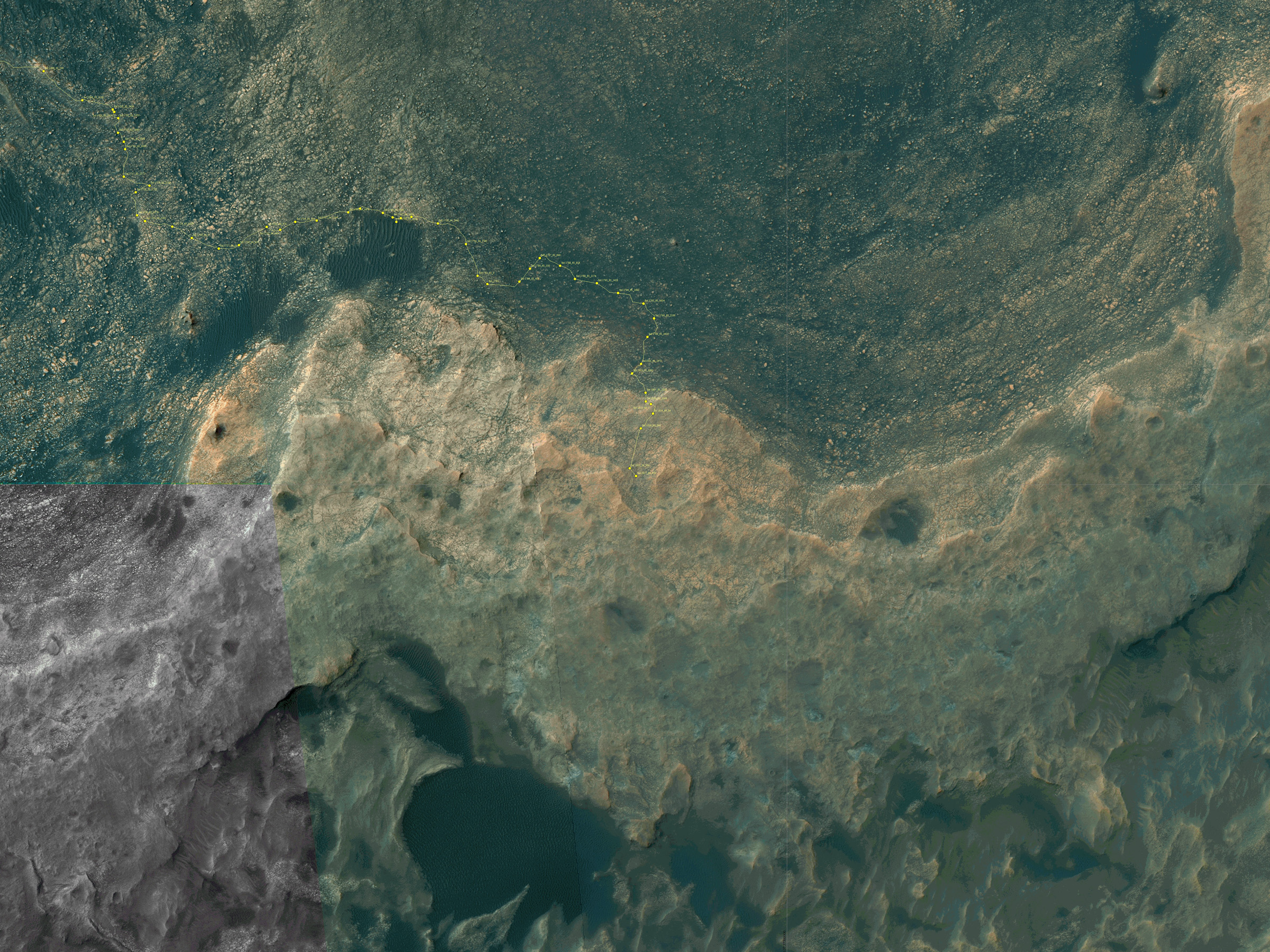
See our updated route map below. It shows the context of the rovers over 13 year long traverse spanning more than the 26 mile distance of a Marathon runners race.

The rover surpassed the 27 mile mark milestone on November 6, 2016 (Sol 4546) and will soon surpass the 28 mile mark.

As of Sol 4793 (July 18, 2017) the power output from solar array energy production is currently 332 watt-hours with an atmospheric opacity (Tau) of 0.774 and a solar array dust factor of 0.534, before heading into another southern hemisphere Martian winter later in 2017. It will count as Opportunity’s 8th winter on Mars.

Meanwhile Opportunity’s younger sister rover Curiosity traverses up the lower sedimentary layers at the base of Mount Sharp.

And NASA continues building the next two robotic missions due to touch down in 2018 and 2020.

NASA as well is focusing its human spaceflight efforts on sending humans on a ‘Journey to Mars’ in the 2030s with the Space Launch System (SLS) mega rocket and Orion deep space crew capsule.

Stay tuned here for Ken’s continuing Earth and planetary science and human spaceflight news.
Ken Kremer

13 Year Traverse Map for NASA’s Opportunity rover from 2004 to 2017. This map shows the entire 43 kilometer (27 mi) path the rover has driven on the Red Planet during over 13 years and more than a marathon runners distance for over 4782 Sols, or Martian days, since landing inside Eagle Crater on Jan 24, 2004 – to current location at the western rim of Endeavour Crater. After studying Spirit Mound and ascending back uphill the rover has reached her next destination in May 2017- the Martian water carved gully at Perseverance Valley near Orion crater. Rover surpassed Marathon distance on Sol 3968 after reaching 11th Martian anniversary on Sol 3911. Opportunity discovered clay minerals at Esperance – indicative of a habitable zone – and searched for more at Marathon Valley. Credit: NASA/JPL/Cornell/ASU/Marco Di Lorenzo/Ken Kremer/kenkremer.com

Hubble Sees Tiny Phobos Orbiting Mars

While photographing Mars, NASA’s Hubble Space Telescope captured a cameo appearance of the tiny moon Phobos on its trek around the Red Planet. Credit: NASA/Hubble/Goddard

Mars’ moon Phobos is a pretty fascinating customer! Compared to Mars’ other moon Deimos, Phobos (named after the Greek personification of fear) is the larger and innermost satellite of the Red Planet. Due to its rapid orbital speed, the irregularly-shaped moon orbits Mars once every 7 hours, 39 minutes, and 12 seconds. In other words, it completes over three orbits of Mar within a single Earth day.

It’s not too surprising then that during a recent observation of Mars with the Hubble space telescope,  Phobos chose to photobomb the picture! It all took place in May of 2016, when while Mars was near opposition and Hubble was trained on the Red Planet to take advantage of it making its closest pass to Earth in over a decade. The well-timed sighting also led to the creation of a time-lapse video that shows the moon’s orbital path.

Continue reading “Hubble Sees Tiny Phobos Orbiting Mars”

Ancient Volcanoes on Mars Could Have Been the Place for Life

The valleys of Coprates Chasma in the east of Valles Marineris. This perspective view was created using stereo image data from DLR’s HRSC (High Resolution Stereo Camera) camera on board ESA’s Mars Express spacecraft Credit: ESA/DLR/FU Berlin

For decades, Mars has been the focal point of intense research. Beginning in the 1960s, literally dozens of robotic spacecraft, orbiters and rovers have explored Mars’ atmosphere and surface, looking for clues to the planet’s past. From this, scientists now know that billions of years ago, Mars was a warmer, wetter place. Not only did liquid water exist on its surface, but it is possible life existed there in some form as well.

Granted, some recent findings have cast some doubt in this, indicating that Mars’ surface may have been hostile to microbes. But a new study from an international team of scientists indicates that evidence life could be found in volcanic deposits. Specifically, they argue that within the massive geological structure known as Valles Marineris, there may be ancient volcanoes that have preserved ancient microbes.

The study, titled “Amazonian Volcanism Inside Valles Marineris on Mars“, recently appeared in the journal Earth and Planetary Science Letters. Led by Petr Brož of the Institute of Geophysics at the Czech Academy of Sciences (AVCR), the team examined Mars’ famous Valles Marineris region – a canyon system stretching for 4000 km (2485.5 mi) – for signs of recent geological activity, which opens up the possibility of there also being fossilized life there.

Valles Marineris, part of NASA World Wind map of Mars. Credit: NASA

The team began by examining the Coprates Chasma canyon, one of the lowest points in Valles Marineris, which is home to over 130 volcanoes and solidified lava flows. This consisted of analyzing high-resolution images of the region that were taken by NASA’s Mars Reconnaissance Orbiter (MRO), which revealed cones of basaltic lava (aka. scoria) and ash that measured around 400-meters (1300 ft) high.

After examining the cones’ surface patterns and morphological details, they confirmed that these were indeed the remains of lava volcanoes (and not mud volcanoes, which was another possibility). In addition, they also noted similarities between these cone and others on Mars where mud volcanism is not possible – as well as similarities with volcanic cones here on Earth.

As Ernst Hauber, a researcher from the Institute of Planetary Research at the German Aerospace Center (DLR) and a co-author on the study, explained in a AVCR press release:

“The spatial distribution of the cones also suggests their volcanic origin. They appear to occur more frequently along tectonic fractures that formed the trough in the surface and whose fracture interfaces continue into the subsurface, creating pathways for the magma to ascend.”

Even more surprising was the apparent age of the volcanoes, which was very young. On Mars, the main period of volcanic activity ended during Mars’ Hesperian Period – which ran from 3.7 to approximately 3.0 billion years ago. And while images acquired by the Mars Express mission have shown indications of younger volcanoes (occurring 500 million years ago), these tend to be located in volcanic provinces.

A colorized image of the surface of Mars taken by the Mars Reconnaissance Orbiter. The line of three volcanoes is the Tharsis Montes, with Olympus Mons to the northwest. Valles Marineris is to the east. Image: NASA/JPL-Caltech/ Arizona State University

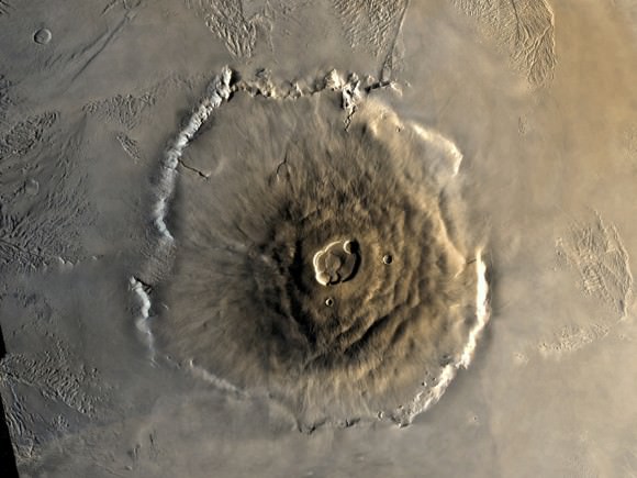
A good example of this is the Tharsis Bulge, which is located several thousand km from the Coprates Chasma canyon. It is here that the Tharses Montes mountain chain is located, which consists of the shield volcanoes of Ascraeus Mons, Pavonis Mons and Arsia Mons. Olympus Mons, the tallest mountain in the Solar System (with an elevation of 22 km or 13.6 mi), is located at the edge of this region.

In contrast, the volcanic cones spotted in the Coprates Chasma canyon were estimates to be between 200 and 400 million years of age, placing them in the most recent geological period known as the Amazonian (3.0 billion years ago to the present day). This effectively demonstrates that these volcanoes formed late in Mars’ history and far away from volcanic areas like Tharsis and Elysium.

It also demonstrates that these volcanoes were not part of the original formation of Valles Marineris, which is believed to be related to the formation of the Tharsis Bulge. This all took place between the Noachian to Late Hesperian periods of Mars (ca. 3.5 billion years ago), which was the last time Mars experienced widespread geological activity.

Last, but not least, the team used the Compact Reconnaissance Imaging Spectrometer (CRISM) aboard the MRO to learn more about the mineral compositions of the region’s lava and volcanic cones. Once again, their findings proved to be surprising, and could indicate that the Coprates Chasma region is a suitable location to search for evidence of ancient life on Mars.

Image of young volcanoes at the base of Coprates Chasma on Mars, obtained by the Mars Reconnaissance Orbiter. Credit: NASA/JPL/University of Arizona

Essentially, the CRISM data indicated the presence of high-silica content minerals in the volcanic rock, which included opaline-like substances at one of the peaks. Opaline silicates, it should be noted, are water-bearing materials that are often produced by hydrothermal processes – where silicate structures form from supersaturated, hot solutions of minerals that cool to become solid.

On Earth, microorganisms are often found within opal deposits since they form in energy and mineral-rich environments, where microbial lifeforms thrive. The presence of these minerals in the Coprates Chasma region could therefore mean that ancient microorganisms once thrived there. Moreover, such organisms could also be fossilized within the mineral-rich lava rock, making it a tempting target for future research.

As Hauber indicated, the appeal of Coprates Chasma doesn’t end there, and future mission will surely want to make exploring this region a priority:

“Coprates Chasma is not just interesting with regard to the question of previous life on Mars. The region would also be an excellent landing site for future Mars Rovers. Here we could investigate many scientifically important and interesting topics. Analyzing samples for their elemental isotopic fractions would allow us to determine with far greater precision when the volcanoes were actually active.

“On the towering, steep walls, the geologic evolution of the Valles Marineris is presented to us almost like a history book – gypsum strata and layers of old, crustal rocks can be observed, as well as indications for liquid water trickling down the slopes even today during the warm season. That is as much Mars geology as you can get!”

Scientists were able to gauge the rate of water loss on Mars by measuring the ratio of water and HDO from today and 4.3 billion years ago. Credit: Kevin Gill

In other words, this low-lying region could be central to future studies that attempt to unlock the history and geological evolution of the Red Planet. The payoffs of studying this region not only include determining if Mars had life in the past, but when and how it went from being a warmer, wetter environment to the cold, dessicated landscape we know today.

In the future, NASA, the ESA, the China National Space Agency (CNSA) and Roscosmos all hope to mount additional robotic missions to Mars. In addition, NASA and even SpaceX hope to send crewed missions to the planet in the hopes of learning more about its past – and possibly future – habitability. Between its geological history, greater atmospheric pressure, and the possibility of fossilized life, one or more of these missions may be headed to Valles Marineris to have a look around.

Further Reading: The Czech Academy of Science, Earth and Planetary Science Letters

Turns Out, Mars Sucks Even Worse Than We Knew

Image taken by the Viking 1 orbiter in June 1976, showing Mars thin atmosphere and dusty, red surface. Credits: NASA/Viking 1

One of the most significant finds to come from our ongoing exploration and research efforts of Mars is the fact that the planet once had a warmer, wetter environment. Between 4.2 and 3.7 billion years ago, the planet had a thicker atmosphere and was able to maintain liquid water on its surface. As such, it has been ventured that life could have once existed there, and might still exist there in some form.

However, according to some recent lab tests by a pair of researchers from the UK Center for Astrobiology at the University of Edinburgh, Mars may be more hostile to life than previously thought. Not only does this not bode well for those currently engaged in the hunt for life on Mars (sorry Curiosity!), it could also be bad news for anyone hoping to one day grow things on the surface (sorry Mark Watney!).

Their study, titled “Perchlorates on Mars Enhance the Bacteriocidal Effects of UV Light“, was recently published in the journal Science Reports. Performed by Jennifer Wadsworth and Charles Cockell – a postgraduate student and a professor of astrobiology at the UK Center for Astrobiology, respectively – the purpose of this study was to see how perchlorates (a chemical compound that is common to Mars) behaved under Mars-like conditions.

An artist’s impression of what Mars might have looked like with water, when any potential Martian microbes would have evolved. Credit: ESO/M. Kornmesser

Basically, perchlorates are a negative ion of chlorine and oxygen that are found on Earth. When the Pheonix lander touched down on Mars in 2008, it found that this chemical was also found on the Red Planet. While stable at room temperature, perchlorates become active when exposed to high levels of heat energy. And under the kinds of conditions associated with Mars, they become rather toxic.

Interestingly enough, the presence of perchlorates on the surface of Mars was presented in 2015 as evidence of there being liquid water there in the past. This was due to the fact that these compounds were found both in-situ and as part of what are known as “brine sweeps”. In other words, some of the discovered perchlorates took the form of streaky lines that were thought to have been the result of water evaporating.

Water, as we all know, is also an essential ingredient to life as we know it, and it’s discovery of Mars was seen as evidence that life could have once existed there. Hence, as Jennifer Wadsworth (the study’s lead author) told Universe Today via email, she and Dr. Cockell were interested to see how such compounds would behave under conditions that are particular to Mars:

“There is a relatively large amount of perchlorate on Mars (0.6 weight percent) and it was confirmed to be a component of a Martian brine by NASA in 2015. It has been speculated that these brines may be habitable. There has been previous work done showing that perchlorates can be ‘activated’ by ionizing radiation which leads them to chlorinate amino acids and degrade organics. We wanted to test whether perchlorate could be activated by UV under Martian environmental conditions to directly kill bacteria. We thought it would be interesting to investigate in light of the discussions of brine habitability.”

Scientists were able to gauge the rate of water loss on Mars by measuring the ratio of water

After recreating the temperature conditions that are common to the Martian surface, Wadsworth and Cockell began exposing the samples to ultra-violet light – which the surface of Mars gets plenty of exposure to. What they found was that under cold conditions, the samples became activated when exposed to UV radiation. And As Wadsworth explained, the results were less than encouraging:

“The main results were that perchlorate, that is usually only activated at high temperatures, can be activated by only using UV light. This is interesting because this compound is abundant on Mars (where it’s very cold), so we might have previously thought it wouldn’t be possible to activate it under Martian conditions. We also found the bactericidal effect increased when bacteria were irradiated with perchlorate and other Martian compounds (iron oxide and hydrogen peroxide). This is important because it is lethal to bacteria when activated. So, if we want to find life on Mars, we have to take this into consideration.”

Iron oxide – aka. rust – and hydrogen peroxide are two compounds that are also found in abundance on the surface of Mars. In fact, it is the prevalence of iron oxide in the soil that gives Mars its distinct, reddish appearance. When Wadsworth and Cockell added these compounds to the perchlorates, the result was nothing less than a 10.8-fold increase in the death of bacterial cells, when compared to perchlorates alone.

While the surface of Mars has long been suspected of having toxic effects, this study shows that it could actually be very hostile to living cells. Thanks to the toxic combination that is created when these three chemical compounds come together and are activated by UV light, the most basic of life forms may be unable to survive there. For those researchers attempting to determine if Mars could in fact be habitable, this is not good news!

Sorry, Mark Watney. Turns out, your potatoes are growing in dirt that is toxic to lifeforms. Credit: Twentieth Century Fox Film Corporation

It is also bad news as far as the existence of liquid water is concerned. While the presence of liquid water in Mars’ past was seen as compelling evidence for past habitability, this water would not have been particularly supportive for life as we know it. Not if these compounds were present in Mars’ surface water, which this study would seem to suggest. Luckily, this research does present a few silver linings.

On the one hand, the fact that perchlorates became hostile to B. subtilis in the presence of UV does not necessarily mean that the Martian surface is hostile to all life. Second, the presence of these bacteria-killing compounds means that contaminants left behind by robotic explorers are not likely to survive long. So the risk of contaminating Mars’ environment (always a going concern for any mission) is very low.

As Wadsworth explained, there are unanswered questions, and more research is necessary:

“We don’t know exactly how far reaching the effect of UV and perchlorate would penetrate the surface layers, as the precise mechanism isn’t understood. If it’s the case of altered forms of perchlorate (such as chlorite or hypochlorite) diffusing through the environment, that might extend the uninhabitable zone. If you’re looking for life you have to additionally keep the ionizing radiation in mind that can penetrate the top layers of soil, so I’d suggest digging at least a few meters into the ground to ensure the levels of radiation would be relatively low. At those depths, it’s possible Martian life may survive.”

As for all the potential Mark Watney’s out there (the protoganist from The Martian), there might be some good news as well. “Perchlorate can be dangerous to humans so we’d just have to make sure we keep it out of the austronauts’ living quarters,” said Wadsworth. “We could potentially use it in sterilization processes. I think the more immediate threat to Martian colonies would be the amount of radiation reaching the surface.”

So maybe we don’t need to cancel our tickets to Mars just yet! However, as the day draws nearer to where people like Elon Musk and Bas Lansdorp are able to make commercial trips to the Red Planet a reality, we will need to know precisely how terrestrial organisms will fare on the planet – and that includes us! And if the prospects don’t look good, we better make certain we have some decent counter-measures in place.

Further Reading: Nature, University of Edinburgh