The Progress 65 cargo spaceship launched on time Thursday morning, Dec. 1, 2016 from the Baikonur Cosmodrome in Kazakhstan. Credit: NASA TV
The Progress 65 cargo spaceship launched on time Thursday morning, Dec. 1, 2016 from the Baikonur Cosmodrome in Kazakhstan but failed to reach orbit minutes later. Credit: NASA TV
KENNEDY SPACE CENTER, FL – An unmanned Russian Progress resupply ship bound for the International Space Station (ISS) was lost shortly after launch from the Baikonur Cosmodrome in Kazakhstan on Thursday when its Soyuz booster suffered a catastrophic anomaly in the third stage, and the craft and its contents were totally destroyed.
The Russian launch failure deals somewhat of a setback to the ever ongoing efforts by all the space station partners to keep the orbiting outpost well stocked with critical supplies of food and provisions for the multinational six person crew and science experiments to carry out the research activities for which the station was assembled.
The three stage Soyuz-U rocket failed in flight around six and a half minutes after what had been an otherwise flawless nighttime liftoff from the Baikonur Cosmodrome at 9:51 a.m. EST (8:51 p.m. Baikonur time), Thursday, Dec. 1.
Telemetry from the Progress 65 vehicle, also known as Progress MS-04, stopped after 382 seconds of flight while soaring about 190 km over the southern Russian Republic of Tyva.
“The Russian space agency Roscosmos has confirmed a Progress cargo resupply spacecraft bound for the International Space Station and her six person crew has lost shortly after launch,” said NASA.
“According to preliminary information, the contingency took place at an altitude of about 190 km over remote and unpopulated mountainous area of the Republic of Tyva,” said Roscosmos in a statement.
The Progress vehicle burned up during the resulting and unplanned fiery plummet through the Earth’s atmosphere.
Per protocol, the Russian space agency Roscosmos has formed a state commission to investigate the accident, seek out the root cause and implement measures to prevent such failures in the future.
“The first few minutes of flight were normal, but Russian flight controllers reported telemetry data indicating a problem during third stage operation. The Russians have formed a State Commission and are the source for details on the specific failure cause,” NASA said.
Crew launches on a different version of the Soyuz rocket were delayed and put on hold several months following last year’s Progress 59 failure and accident investigation.
Despite the failure there was no immediate impact on the current Expedition 50 crew and life goes on.
“The loss of the cargo ship will not affect the normal operations of the ISS and the life of the station crew,” said Roscosmos.
“The spacecraft was not carrying any supplies critical for the United States Operating Segment (USOS) of the station,” NASA reported.
Currently there is a satisfactory level of supplies.
“Six crew members living aboard the space station are safe and have been informed of the mission’s status. Both the Russian and U.S. segments of the station continue to operate normally with onboard supplies at good levels.”
However the continued useful utilization of the million pound station is totally dependent on receiving a steady train of supplies from Earth – comprising Russian, US and Japanese cargo freighters launching multiple times per year.
The Progress 65 cargo freighter was jam packed with 2.6 tons of food, fuel, and supplies for the space station crew, including approximately 1,400 pounds of propellant, 112 pounds of oxygen, 925 pounds of water, and 2,750 pounds of spare parts, supplies and scientific experiment hardware.
The Russian Progress 62 spacecraft approaches the International Space Station on July 1, 2016. Credits: NASA
The Progress was carrying a few items from NASA but they are all replaceable, says NASA. The US items packed on board included spare parts for the station’s environmental control and life support system, research hardware, crew supplies and crew clothing.
Had all gone well, Progress 65 would have docked to the rear port of the space station’s Russian Zvezda Service Module at 11:43 a.m. Saturday, Dec. 3.
Japan is all set to launch the next cargo flight to the ISS on Friday, Dec. 9 when the Japan Aerospace Exploration Agency (JAXA) HTV-6 resupply ship will blast off atop the H-II rocket.
The Orbital ATK Antares rocket topped with the Cygnus cargo spacecraft launches from Pad-0A, Monday, Oct. 17, 2016 at NASA’s Wallops Flight Facility in Virginia. Orbital ATK’s sixth contracted cargo resupply mission with NASA to the International Space Station. Credit: Ken Kremer/kenkremer
The next US cargo launch could be either an Orbital ATK Cygnus launch atop a ULA Atlas V in March 2017 or a SpaceX Dragon launch perhaps in Jan 2017.
The US has also suffered ISS cargo launch failures from both of the commercial resupply providers; SpaceX on the Dragon CRS-7 mission in Jun 2015 and Orbital ATK on the Cygnus Orb-3 mission in October 2014.
First stage propulsion system at base of Orbital Sciences Antares rocket appears to explode moments after blastoff from NASA’s Wallops Flight Facility, VA, on Oct. 28, 2014, at 6:22 p.m. Credit: Ken Kremer – kenkremer.com
The cargo ships function as a railroad to space and function as the lifeline to keep the station continuously crewed and functioning. Without periodic resupply by visiting vehicles from the partner nations the ISS cannot continue to operate.
Stay tuned here for Ken’s continuing Earth and Planetary science and human spaceflight news.
Portrait of Giovanni Domenico Cassini, with the Paris Observatory in the background. Credit: Wikipedia Commons
During the Scientific Revolution, which took place between the 15th and 18th centuries, numerous inventions and discoveries were made that forever changed the way humanity viewed the Universe. And while this explosion in learning owed its existence to countless individuals, a few stand out as being especially worthy of praise and remembrance.
One such individual is Gionvanni Domenico Cassini, also known by his French name Jean-Dominique Cassini. An Italian astronomer, engineer, and astrologer, Cassini made many valuable contributions to modern science. However, it was his discovery of the gaps in Saturn’s rings and four of its largest moons for which he is most remembered, and the reason why the Cassini spacecraft bears his name.
Early Life and Education:
Giovanni Domenico Cassini was born on June 8th, 1625, in the small town of Perinaldo (near Nice, France) to Jacopo Cassini and Julia Crovesi. Educating by Jesuit scientists, he showed an aptitude for mathematics and astronomy from an early age. In 1648, he accepted a position at the observatory at Panzano, near Bologna, where he was employed by a rich amateur astronomer named Marquis Cornelio Malvasia.
During his time at the Panzano Observatory, Cassini was able to complete his education and went on to become the principal chair of astronomy at the University of Bologna by 1650. While there, he made several scientific contributions that would have a lasting mark.
La Meridiana, the meridian line calculated by Cassini while living in Bologna. Credit: Wikipedia Commons/Ilario/Cassinam
This included the calculation of an important meridian line, which runs along the left aisle of the San Petronio Basilica in Bologna. At 66.8 meters (219 ft) in length, it is one of the largest astronomical instruments in the worl and allowed for measurements that were (at the time) uniquely precise. This meridian also helped to settle the debate about whether or not the Universe was geocentric or heliocentric.
During his time in Italy, Cassini determined the obliquity of the Earth’s ecliptic – aka. it’s axial tilt, which he calculated to be 23° and 29′ at the time. He also studied the effects of refraction and the Solar parallax, worked on planetary theory, and observed the comets of 1664 and 1668.
In recognition of his engineering skills, Pope Clement IX employed Cassini with regard to fortifications, river management and flooding along the Po River in northern Italy. In 1663, Cassini was named superintendent of fortifications and oversaw the fortifying of Urbino. And in 1665, he was named the inspector for the town of Perugia in central Italy.
Paris Observatory:
In 1669, Cassini received an invitation by Louis XIV of France to move to Paris and help establish the Paris Observatory. Upon his arrival, he joined the newly-founded Academie Royale des Sciences (Royal Academy of Sciences), and became the first director of the Paris Observatory, which opened in 1671. He would remain the director of the observatory until his death in 1712.
An engraving of the Paris Observatory during Cassini’s time. Credit: Public Domain
In 1673, Cassini obtained his French citizenship and in the following year, he married Geneviève de Laistre, the daughter of the lieutenant general of the Comte de Clermont. During his time in France, Cassini spent the majority of his time dedicated to astronomical studies. Using a series of very long air telescopes, he made several discoveries and collaborated with Christiaan Huygens in many projects.
In the 1670s, Cassini began using the triangulation method to create a topographic map of France. It would not be completed until after his death (1789 or 1793), when it was published under the name Carte de Cassini. In addition to being the first topographical map of France, it was the first map to accurately measure longitude and latitude, and showed that the nation was smaller than previously thought.
In 1672, Cassini and his colleague Jean Richer made simultaneous observations of Mars (Cassini from Paris and Richer from French Guiana) and determined its distance to Earth through parallax. This enabled him to refine the dimensions of the Solar System and determine the value of the Astronomical Unit (AU) to within 7% accuracy. He and English astronomer Robert Hooke share credit for the discovery of the Great Red Spot on Jupiter (ca. 1665).
In 1683, Cassini presented an explanation for “zodiacal light” – the faint glow that extends away from the Sun in the ecliptic plane of the sky – which he correctly assumed to be caused by a cloud of small particles surrounding the Sun. He also viewed eight more comets before his death, which appeared in the night sky in 1672, 1677, 1698, 1699, 1702 (two), 1706 and 1707.
Illustration of Jupiter and the Galilean satellites. Credit: NASA
In ca. 1690, Cassini was the first to observe differential rotation within Jupiter’s atmosphere. He created improved tables for the positions of Jupiter’s Galilean moons, and discovered the periodic delays between the occultations of Jupiter’s moons and the times calculated. This would be used by Ole Roemer, his colleague at the Paris Observatory, to calculate the velocity of light in 1675.
In 1683, Cassini began the measurement of the arc of the meridian (longitude line) through Paris. From the results, he concluded that Earth is somewhat elongated. While in fact, the Earth is flattened at the poles, the revelation that Earth is not a perfect sphere was groundbreaking.
Cassini also observed and published his observations about the surface markings on Mars, which had been previously observed by Huygens but not published. He also determined the rotation periods of Mars and Jupiter, and his observations of the Moon led to the Cassini Laws, which provide a compact description of the motion of the Moon. These laws state that:
The Moon takes the same amount of time to rotate uniformly about its own axis asit takes to revolve around the Earth. As a consequence, the same face is always pointed towards Earth.
The Moon’s equator is tilted at a constant angle (about 1°32′ of arc) to the plane of the Earth’s orbit around the Sun (i.e. the ecliptic)
The point where the lunar orbit passes from south to north on the ecliptic (aka. the ascending node of the lunar orbit) always coincides with the point where the lunar equator passes from north to south on the ecliptic (the descending node of the lunar equator).
A collage of Saturn (bottom left) and some of its moons: Titan, Enceladus, Dione, Rhea and Helene. Credit: NASA/JPL/Space Science Institute
Thanks to his leadership, Giovanni Cassini was the first of four successive Paris Observatory directors that bore his name. This would include his son, Jaques Cassini (Cassini II, 1677-1756); his grandson César François Cassini (Cassini III, 1714-84); and his great grandson, Jean Dominique Cassini (Cassini IV, 1748-1845).
Observations of Saturn:
During his time in France, Cassini also made his famous discoveries of many of Saturn’s moons – Iapetus in 1671, Rhea in 167, and Tethys and Dione in 1684. Cassini named these moons Sidera Lodoicea (the stars of Louis), and correctly explained the anomalous variations in brightness to the presence of dark material on one hemisphere (now called Cassini Regio in his honor).
In 1675, Cassini discovered that Saturn’s rings are separated into two parts by a gap, which is now called the “Cassini Division” in his honor. He also theorized that the rings were composed of countless small particles, which was proven to be correct.
Death and Legacy:
After dedicating his life to astronomy and the Paris Observatory, Cassini went blind in 1711 and then died on September 14th, 1712, in Paris. And although he resisted many new theories and ideas that were proposed during his lifetime, his discoveries and contributions place him among the most important astronomers of the 17th and 18th centuries.
A comparison of the geocentric and heliocentric models of the universe. Credit: history.ucsb.edu
As a traditionalist, Cassini initially held the Earth to be the center of the Solar System. In time, he would come to accept the Solar Theory of Nicolaus Copernicus within limits, to the point that he accepted the model proposed by Tycho Brahe. However, he rejected the theory of Johannes Kepler that planets travel in ellipses and proposed hat their paths were certain curved ovals (i.e. Cassinians, or Ovals of Cassini)
Cassini also rejected Newton’s Theory of Gravity, after measurements he conducted which (wrongly) suggested that the Earth was elongated at its poles. After forty years of controversy, Newton’s theory was adopted after the measurements of the French Geodesic Mission (1736-1744) and the Lapponian Expedition in 1737, which showed that the Earth is actually flattened at the poles.
For his lifetime of work, Cassini has been honored in many ways by the astronomical community. Because of his observations of the Moon and Mars, features on their respective surfaces were named after him. Both the Moon and Mars have their own Cassini Crater, and Cassini Regio on Saturn’s moon Iapetus also bears his name.
Then there is Asteroid (24101) Cassini, which was discovered by C.W. Juels at in 1999 using the Fountain Hills Observatory telescope. Most recently, there was the joint NASA-ESA Cassini-Huygens missions which recently finished its mission to study Saturn and its moons. This robotic orbiter and lander mission was named in honor of the two astronomers who were chiefly responsible for discovering Saturn system of moons.
Artist’s impression of the Cassini space probe, part of the Cassini-Huygens mission to explore Saturn and its moons. Credit: NASA/JPL
In the end, Cassini’s passion for astronomy and his contributions to the sciences have ensured him a lasting place in the annals of history. In any discussion of the Scientific Revolution and of the influential thinkers who made it happen, his name appears alongside such luminaries as Copernicus, Galileo, and Newton.
Blastoff of revolutionary NASA/NOAA GOES-R weather satellite on ULA Atlas V on Nov. 19, 2016 - as seen from remote camera at Space Launch Complex 41 (SLC-41) on Cape Canaveral Air Force Station, Florida. GOES-R will deliver a quantum leap in America’s weather forecasting capabilities. Credit: Ken Kremer/kenkremer.com
Blastoff of revolutionary NASA/NOAA GOES-R weather satellite on ULA Atlas V on Nov. 19, 2016 – as seen from remote camera at Space Launch Complex 41 (SLC-41) on Cape Canaveral Air Force Station, Florida. GOES-R will deliver a quantum leap in America’s weather forecasting capabilities. Credit: Ken Kremer/kenkremer.com
KENNEDY SPACE CENTER, FL – The fire and fury of the mighty ULA Atlas V got the gorgeous NASA/NOAA GOES-R weather observatory to geostationary orbit just days ago – as a ‘Thanksgiving’ present to all the people of Earth through the combined efforts of the government/industry/university science and engineering teams of hard working folks who made it possible.
Check out this dazzling photo and video gallery from myself and several space journalist colleagues showing how GOES got going – from prelaunch to launch atop a United Launch Alliance Atlas V rocket from Space Launch Complex 41 (SLC-41) Cape Canaveral Air Force Station at 6:42 p.m. EST in the evening on Saturday, Nov. 19, 2016.
Three and a half hours after liftoff, the bus sized spacecraft successfully separated from the Atlas Centaur upper stage and deployed its life giving solar arrays.
ULA Atlas V rocket and GOES-R weather observatory streak to orbit from launch pad 41 at Cape Canaveral, Florida. Credit: Julian Leek
GOES-R is the most advanced and powerful weather observatory ever built and will bring about a ‘quantum leap’ in weather forecasting.
It’s dramatic new imagery will show the weather in real time enabling critical life and property forecasting, help pinpoint evacuation zones and also save people’s lives in impacted areas of severe weather including hurricanes and tornadoes.
Here’s a pair of beautiful launch videos from space colleague Jeff Seibert and myself:
Video Caption: 5 views from the launch of the NOAA/NASA GOES-R weather satellite on 11/19/2016 from Pad 41 CCAFS on a ULA Atlas. Credit: Jeff Seibert
Video Caption: Launch of the NOAA/NASA GOES-R weather observatory satellite on Nov. 19, 2016 from pad 41 on Cape Canaveral Air Force Station on a ULA Atlas V rocket – as seen in this remote video taken at the pad. Credit: Ken Kremer/kenkremer.com
GOES-R is the first in a new series of revolutionary NASA/NOAA geostationary weather satellites that will soon lead to more accurate and timely forecasts, watches and warnings for the Earth’s Western Hemisphere when it becomes fully operational in about a year.
Ignition of ULA Atlas V rocket and GOES-R weather observatory at launch pad 41 at Cape Canaveral, Florida. Credit: Julian Leek
GOES-R, which stands for Geostationary Operational Environmental Satellite – R Series – is a new and advanced transformational weather satellite that will vastly enhance the quality, speed and accuracy of weather forecasting available to forecasters for Earth’s Western Hemisphere.
The 11,000 pound satellite was built by prime contractor Lockheed Martin and is the first of a quartet of four identical satellites – comprising GOES-R, S, T, and U – at an overall cost of about $11 Billion. This will keep the GOES satellite system operational through 2036.
Blastoff of revolutionary NASA/NOAA GOES-R weather satellite on ULA Atlas V on Nov. 19, 2016 – as seen from remote camera at Space Launch Complex 41 (SLC-41) on Cape Canaveral Air Force Station, Florida. Credit: Ken Kremer/kenkremer.com
The science suite includes the Advanced Baseline Imager (ABI) built by Harris Corporation, the Geostationary Lightning Mapper (GLM) built by Lockheed Martin, Solar Ultraviolet Imager (SUVI), Extreme Ultraviolet and X-Ray Irradiance Sensors (EXIS), Space Environment In-Situ Suite (SEISS), and the Magnetometer (MAG).
ABI is the primary instrument and will collect 3 times more spectral data with 4 times greater resolution and scans 5 times faster than ever before – via the primary Advanced Baseline Imager (ABI) instrument – compared to the current GOES satellites.
Atlas V and GOES-R aloft after Nov. 19, 2016 liftoff of the powerful NASA/NOAA weather observatory on ULA Atlas V from pad 41 on Cape Canaveral Air Force Station, Florida – as seen from the VAB roof. Credit: Ken Kremer/kenkremer.com
GOES-R launched on the massively powerful Atlas V 541 configuration vehicle, augmented by four solid rocket boosters on the first stage.
The payload fairing is 5 meters (16.4 feet) in diameter. The first stage is powered by the Russian built duel nozzle RD AMROSS RD-180 engine. And the Centaur upper stage is powered by a single-engine Aerojet Rocketdyne RL10C engine.
This was only the fourth Atlas V launch employing the 541 configuration.
ULA Atlas V rocket and GOES-R weather observatory at launch pad 41 at Cape Canaveral, Florida. Credit: Dawn Leek Taylor
Stay tuned here for Ken’s continuing Earth and Planetary science and human spaceflight news.
Track mobile used to push ULS Atlas V and NASA/NOAA GOES-R to pad 41 from VIF processing facility. Credit: Lane HermannLaunch of NASA/NOAA GOES-R weather observatory on ULA Atlas V on Nov. 19, 2016 from pad 41 on Cape Canaveral Air Force Station, Florida, as seen from Playalinda beach. Credit: Jillian LaudickAtlas V/GOES-R launch as seen rising over neighbor houses in Titusville, Florida on Nov. 19, 2016. Credit: Melissa BaylesAtlas V rocket and GOES-R nighttime launch soars over the swimming pool at the Quality Inn Kennedy Space Center in Titusville, Florida on Nov. 19, 2016. Credit: Wesley BaskinThe NASA/NOAA GOES-R (Geostationary Operational Environmental Satellite – R Series) being processed at Astrotech Space Operations, in Titusville, FL, in advance of launch on a ULA Atlas V on Nov. 19, 2016. GOES-R will be America’s most advanced weather satellite. Credit: Ken Kremer/kenkremer.com
Research into the temporary slowdown of the global mean surface temperature has revealed that the world's oceans have absorbed the "missing heat." Image: Flickr user Brian Richardson, CC by 2.0
A reprieve from Global Warming? A hiatus? That would be nice, wouldn’t it? But in this case, a hiatus is not quite what it seems.
Everybody knows that global warming is partly caused by human activities, largely our use of fossil fuels. We understand how it works and we fear for the future. But there’s been a slowdown in the global mean surface temperature increase between 1998 to 2013. We haven’t lowered our emissions of greenhouse gases (GHGs) significantly during that time, so what happened?
Fossil fuels: we just can’t get enough of them. Image: a petrochemical refinery in Scotland. Credit: User:John from wikipedia, CC BY-SA 3.0, https://commons.wikimedia.org/w/index.php?curid=2459867
A new multi-institutional study involving NASA’s Jet Propulsion Laboratory (JPL), the National Oceanographic and Atmospheric Institute, and others, concludes that Earth’s oceans have absorbed the heat. So instead of the global mean surface temperature rising at a steady rate, the oceans have taken on the job as global heat sink. But what’s the significance of this?
“The hiatus period gives scientists an opportunity to understand uncertainties in how climate systems are measured, as well as to fill in the gap in what scientists know.” -Xiao-Hai Yan, University of Delaware, Newark
In terms of the on-going rise in the temperature of the globe, the hiatus is not that significant. But in terms of the science of global warming, and how well we understand it, the hiatus gives scientists an opportunity.
The new paper, titled “The Global Warming Hiatus: Slowdown or Redistribution?” grew out of the U.S. Climate Variability and Predictability Program (CLIVAR) panel session at the 2015 American Geophysical Union fall meeting. From those discussions, scientists reached consensus on three key points:
From 1998 to 2013, the rate of global mean surface warming slowed, which some call the “global warming hiatus.”
Natural variability plays a large role in the rate of global mean surface warming on decadal time scales.
Improved understanding of how the ocean distributes and redistributes heat will help the scientific community better monitor Earth’s energy budget. Earth’s energy budget is a complex calculation of how much energy enters our climate system from the sun and what happens to it: how much is stored by the land, ocean or atmosphere.
This graph shows the yearly global ocean heat content. The dashed line shows the 1958-65 average. Image: Balmaseda et al., 2013
The paper is a reminder that climate science is complex, and that the oceans play a big part in global warming. As Yan says, “To better monitor Earth’s energy budget and its consequences, the ocean is most important to consider because the amount of heat it can store is extremely large when compared to the land or atmospheric capacity.”
“…”arguably, ocean heat content — from the surface to the seafloor — might be a more appropriate measure of how much our planet is warming.” – from the paper “The Global Warming Hiatus: Slowdown or Redistribution?”
The team behind this new research suggests that saying there’s been a hiatus in global warming is confusing. They suggest “global warming hiatus” be replaced with “global surface warming slowdown.”
There’s a danger in calling it a “global warming hiatus.” Those opposed to climate change and who think it’s a hoax can use that term to discredit climate science. They’ll claim that the “hiatus” shows we don’t understand climate change and the Earth may have stopped warming. But in any case, it’s the long-term trend—change over the course of a century or more—that defines “global warming,” not the change from year to year or even decade to decade.
There’s much more to learn about the oceans’ role in global warming. Research shows that some ocean areas absorb heat much faster than others. But whatever the fine detail of it is, there is broad agreement in the scientific community that the global surface warming slowdown was caused by an increased uptake of heat energy by the world’s oceans.
A screenshot from the “NASA’s Eyes” app. The app allows anyone to check Earth’s vital signs. Image: NASA/JPL
NASA uses a lot of tools to monitor the Earth’s temperature. For an interesting look at the Earth’s vital signs, check out Nasa’s Eyes. This easy to use visualization tool lets you take a closer look at the Earth’s temperature, CO2 levels, soil moisture levels, sea levels, and other things.
Blastoff of revolutionary NASA/NOAA GOES-R (Geostationary Operational Environmental Satellite - R Series) on a ULA Atlas V from Space Launch Complex 41 (SLC-41) on Cape Canaveral Air Force Station, Florida on Nov. 19, 2016 - as seen from the VAB roof. GOES-R will soon deliver a quantum leap in America’s weather forecasting capabilities. Credit: Ken Kremer/kenkremer.com
Blastoff of revolutionary NASA/NOAA GOES-R (Geostationary Operational Environmental Satellite – R Series) on a ULA Atlas V from Space Launch Complex 41 (SLC-41) on Cape Canaveral Air Force Station, Florida on Nov. 19, 2016 – as seen from the VAB roof. GOES-R will soon deliver a quantum leap in America’s weather forecasting capabilities. Credit: Ken Kremer/kenkremer.com
Liftoff of the highly advanced Geostationary Operational Environmental Satellite-R (GOES-R) weather observatory bolted atop a ULA Atlas V rocket came at 6:42 p.m. EST on Saturday, Nov. 19, 2016 from Space Launch Complex 41 (SLC-41) on Cape Canaveral Air Force Station, Florida.
The launch was delayed for an hour until the very end of the launch window to deal with unexpected technical and Eastern range issues, that only added more drama and changed the sunset launch into a night launch for the hordes of spectators who gathered here from around the world – appropriate since this probe will touch the lives of humans world wide.
“It’s a dramatic leap in capability – like moving from black and white TV to HDTV,” explained Greg Mandt, the NOAA GOES-R program manager during a prelaunch media briefing in the cleanroom processing facility at Astrotech.
“This is a very exciting time,” explained Greg Mandt, the NOAA GOES-R program manager during the Astrotech cleanroom briefing.
“This is the culmination of about 15 years of intense work for the great team of NOAA and NASA and our contractors Lockheed Martin and Harris.”
“We are bringing the nation a new capability. The GOES program has been around for about 40 years and most every American sees it every night on the weather broadcasts when they see go to the satellite imagery. And what’s really exciting is that for the first time in that 40 years we are really end to end replacing the entire GOES system. The weather community is really excited about what we are bringing.”
GOES-R will bring about a “quantum leap” in weather forecasting capabilities that will soon lead to more accurate and timely forecasts, watches and warnings for the Earth’s Western Hemisphere when it becomes fully operational in about a year.
But the first images are expected within weeks! And both researchers and weather forecasters can’t wait to see, analyze and put to practical use the sophisticated new images and data that will improve forecasts and save lives during extreme weather events that are occurring with increasing frequency.
Blastoff of revolutionary NASA/NOAA GOES-R (Geostationary Operational Environmental Satellite – R Series) on ULA Atlas V from Space Launch Complex 41 (SLC-41) on Cape Canaveral Air Force Station, Florida on Nov. 19, 2016. GOES-R will deliver a quantum leap in America’s weather forecasting capabilities. Credit: Ken Kremer/kenkremer.com
GOES-R will be renamed GOES-16 after it reaches its final orbit 22,000 above Earth about two weeks from now.
Over the next year, teams of engineers and scientists will check out and validate the state of the art suite of six science instruments that also includes the first operational lightning mapper in geostationary orbit – dubbed the Geostationary Lightning Mapper (GLM).
“The launch of GOES-R represents a major step forward in terms of our ability to provide more timely and accurate information that is critical for life-saving weather forecasts and warnings,” said Thomas Zurbuchen, associate administrator for NASA’s Science Mission Directorate in Washington.
“It also continues a decades-long partnership between NASA and NOAA to successfully build and launch geostationary environmental satellites.”
GOES-R, which stands for Geostationary Operational Environmental Satellite – R Series – is a new and advanced transformational weather satellite that will vastly enhance the quality, speed and accuracy of weather forecasting available to forecasters for Earth’s Western Hemisphere.
The science suite includes the Advanced Baseline Imager (ABI), Geostationary Lightning Mapper (GLM), Solar Ultraviolet Imager (SUVI), Extreme Ultraviolet and X-Ray Irradiance Sensors (EXIS), Space Environment In-Situ Suite (SEISS), and the Magnetometer (MAG).
ABI is the primary instrument and will collect 3 times more spectral data with 4 times greater resolution and scans 5 times faster than ever before – via the primary Advanced Baseline Imager (ABI) instrument – compared to the current GOES satellites.
So instead of seeing weather as it was, viewers will see weather as it is.
Whereas the current GOES-NOP imagers scan the full hemispheric disk in 26 minutes, the new GOES-ABI can simultaneously scan the Western Hemisphere every 15 minutes, the Continental U.S. every 5 minutes and areas of severe weather every 30-60 seconds.
Launch of NASA/NOAA GOES-R weather observatory on ULA Atlas V on Nov. 19, 2016 from pad 41 on Cape Canaveral Air Force Station, Florida. Credit: Julian Leek
“The next generation of weather satellites is finally here,” said NOAA Administrator Kathryn Sullivan.
“GOES-R will strengthen NOAA’s ability to issue life-saving forecasts and warnings and make the United States an even stronger, more resilient weather-ready nation.”
Blastoff of revolutionary NASA/NOAA GOES-R (Geostationary Operational Environmental Satellite – R Series) on a ULA Atlas V from Space Launch Complex 41 (SLC-41) on Cape Canaveral Air Force Station, Florida on Nov. 19, 2016 – as seen from the VAB roof. GOES-R will soon deliver a quantum leap in America’s weather forecasting capabilities. Credit: Ken Kremer/kenkremer.com
It is designed to last for a 15 year orbital lifetime.
The 11,000 pound satellite was built by prime contractor Lockheed Martin and is the first of a quartet of four identical satellites – comprising GOES-R, S, T, and U – at an overall cost of about $11 Billion. This will keep the GOES satellite system operational through 2036.
Today’s launch was the 10th of the year for ULA and the 113th straight successful launch since the company was formed in December 2006.
GOES-R launched on the Atlas V 541 configuration vehicle, augmented by four solid rocket boosters on the first stage. The payload fairing is 5 meters (16.4 feet) in diameter. The first stage is powered by the RD AMROSS RD-180 engine. And the Centaur upper stage is powered by a single-engine Aerojet Rocketdyne RL10C engine.
This was only the fourth Atlas V launch employing the 541 configuration.
Stay tuned here for Ken’s continuing Earth and Planetary science and human spaceflight news.
The NASA/NOAA GOES-R (Geostationary Operational Environmental Satellite – R Series) is poised for launch on a ULA Atlas V from Cape Canaveral, Florida on Nov. 19, 2016. GOES-R will be America’s most advanced weather satellite. Credit: Ken Kremer/kenkremer.comLaunch of NASA/NOAA GOES-R weather observatory on ULA Atlas V on Nov. 19, 2016 from pad 41 on Cape Canaveral Air Force Station, Florida, as seen from Playalinda beach. Credit: Jillian Laudick
………….
Learn more about GOES-R weather satellite, Heroes and Legends at KSCVC, OSIRIS-REx, InSight Mars lander, ULA, SpaceX and Orbital ATK missions, Juno at Jupiter, SpaceX AMOS-6 & CRS-9 rocket launch, ISS, ULA Atlas and Delta rockets, Orbital ATK Cygnus, Boeing, Space Taxis, Mars rovers, Orion, SLS, Antares, NASA missions and more at Ken’s upcoming outreach events:
Nov 19-20: “GOES-R weather satellite launch, OSIRIS-Rex, SpaceX and Orbital ATK missions to the ISS, Juno at Jupiter, ULA Delta 4 Heavy spy satellite, SLS, Orion, Commercial crew, Curiosity explores Mars, Pluto and more,” Kennedy Space Center Quality Inn, Titusville, FL, evenings
The NASA/NOAA GOES-R (Geostationary Operational Environmental Satellite - R Series) is poised for launch on a ULA Atlas V from Cape Canaveral, Florida on Nov. 19, 2016. GOES-R will be America’s most advanced weather satellite. Credit: Ken Kremer/kenkremer.com
The NASA/NOAA GOES-R (Geostationary Operational Environmental Satellite – R Series) is poised for launch on a ULA Atlas V from Cape Canaveral, Florida on Nov. 19, 2016. GOES-R will be America’s most advanced weather satellite. Credit: Ken Kremer/kenkremer.com
KENNEDY SPACE CENTER, FL – From both the technical and weather standpoint, the outlook is outstanding for Saturdays sunset blastoff of the NASA/NOAA GOES-R geostationary weather observation satellite that’s set to deliver a ‘quantum leap’ in weather forecasting on Nov. 19.
Everything is progressing as planned toward liftoff of the school bus sized GOES-R weather satellite atop a United Launch Alliance (ULA) Atlas V rocket on Saturday, Nov. 19 at 5:42 p.m. from Space Launch Complex 41 (SLC-41) on Cape Canaveral Air Force Station, just about 17 minutes after sunset.
“GOES-R offers a quantum leap above prior weather satellites, the greatest in 40 years,” said Steve Volz, assistant administrator, NOAA’s Satellite and Information Service, at the prelaunch news briefing at NASA’s Kennedy Space Center.
“GOES-R will be revolutionary with faster, more accurate forecasts and more lives saved.”
“It will take our capability for life saving forecasts to a new level and it will be a game changer.”
GOES-R, which stands for Geostationary Operational Environmental Satellite – R Series – is a new and advanced transformational weather satellite that will vastly enhance the quality, speed and accuracy of weather forecasting available to forecasters for Earth’s Western Hemisphere.
It will collect 3 times more spectral data with 4 times greater resolution and scans 5 times faster than ever before – via the primary Advanced Baseline Imager (ABI) instrument instrument – compared to the current GOES satellites.
So instead of seeing weather as it was, viewers will see weather as it is.
Whereas the current GOES-NOP imagers scan the full hemispheric disk in 26 minutes, the new GOES-ABI can simultaneously scan the Western Hemisphere every 15 minutes, the Continental U.S. every 5 minutes and areas of severe weather every 30-60 seconds.
The soar to space should be spectacular for locals and tourists gathering from around the world to view the launch now slated for less than 24 hours from now.
The launch window opens at 5:42 p.m.
The launch window extends for an hour from 5:42-6:42 p.m. EST.
Following a short delay, the Atlas V with GOES bolted on top was rolled out to pad 41 this morning, Friday, November. 18.
GOES-R is GO for launch.
NASA’s GOES-R launch coverage will be broadcast on NASA TV beginning at 4:45 p.m. EDT Nov. 19.
Coverage will conclude after spacecraft separation from the Centaur and the GOES-R solar arrays are deployed, which occurs approximately 3 ½ hours after launch. At that time the spacecraft initial state of health can be determined and will be confirmed on the air. There is no planned post-launch news conference.
The NASA/NOAA GOES-R (Geostationary Operational Environmental Satellite – R Series) is encapsulated in the nose cone of a ULA Atlas V and rolls out for launch from Space Launch Complex-41 on Cape Canaveral Air Force Station, Florida on Nov. 19, 2016. GOES-R will be America’s most advanced weather satellite. Credit: Ken Kremer/kenkremer.com
The weather forecast shows a 90 percent chance of favorable weather conditions for Saturday’s sunset blastoff. The primary concern is for cumulous clouds.
In the event of a 24 hour delay, the weather forecast shows an 80 percent chance of favorable weather conditions on Sunday, Nov. 20.
The NASA/NOAA GOES-R (Geostationary Operational Environmental Satellite – R Series) is encapsulated in the nose cone of a ULA Atlas V set for launch from Space Launch Complex-41 on Cape Canaveral Air Force Station, Florida on Nov. 19, 2016. GOES-R will be America’s most advanced weather satellite. Credit: Ken Kremer/kenkremer.com
GOES-R is the first in a new series of American’s most powerful and most advanced next generation weather observation satellites. It is designed to last for a 15 year orbital lifetime.
The 11,000 pound satellite was built by prime contractor Lockheed Martin and is the first of a quartet of four identical satellites – comprising GOES-R, S, T, and U – at an overall cost of about $11 Billion. This will keep the GOES satellite system operational through 2036.
GOES-R will blastoff on a ULA Atlas V in the very powerful 541 configuration, augmented by four solid rocket boosters on the first stage. The payload fairing is 5 meters (16.4 feet) in diameter and the upper stage is powered by a single-engine Centaur.
It will be launched to a Geostationary orbit some 22,300 miles above Earth.
Side view of NASA/NOAA GOES-R next gen weather observation satellite showing solar panels and instruments inside Astrotech Space Operations cleanroom, in Titusville, FL. Launch is set for Nov. 19, 2016. Credit: Ken Kremer/kenkremer.com
The gigantic school bus sized satellite is equipped with a suite of six instruments or sensors that are the most advanced of their kind. They will be used for three types of observations: Earth sensing, solar imaging, and space environment measuring. They will point to the Earth, the Sun and the in-situ environment of the spacecraft.
The suite includes the Advanced Baseline Imager (ABI), Geostationary Lightning Mapper (GLM), Solar Ultraviolet Imager (SUVI), Extreme Ultraviolet and X-Ray Irradiance Sensors (EXIS), Space Environment In-Situ Suite (SEISS), and the Magnetometer (MAG).
Stay tuned here for Ken’s continuing Earth and Planetary science and human spaceflight news.
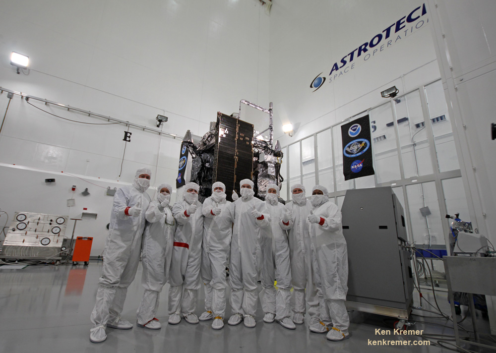
GOES-R weather observation satellite instrument suite. Credit: NASA/NOAATim Gasparinni, GOES-R program manager for Lockheed Martin, and Ken Kremer/University Today pose with GOES-R revolutionary weather satellite inside Astrotech Space Operations cleanroom, in Titusville, FL, and built by NASA/NOAA/Lockheed Martin/Harris. Credit: Ken Kremer/kenkremer.com
Chris Hadfield recently explained how humanity should create a Moon base before attempting to colonize Mars. Credit: Foster + Partners is part of a consortium set up by the European Space Agency to explore the possibilities of 3D printing to construct lunar habitations.
Credit: ESA/Foster + Partners
Ever since we began sending crewed missions to the Moon, people have been dreaming of the day when we might one day colonize it. Just imagine, a settlement on the lunar surface, where everyone constantly feels only about 15% as heavy as they do here on Earth. And in their spare time, the colonists get to do all kinds of cool research trek across the surface in lunar rovers. Gotta admit, it sounds fun!
More recently, the idea of prospecting and mining on the Moon has been proposed. This is due in part to renewed space exploration, but also the rise of private aerospace companies and the NewSpace industry. With missions to the Moon schedules for the coming years and decades, it seems logical to thinking about how we might set up mining and other industries there as well?
Proposed Methods:
Several proposals have been made to establish mining operations on the Moon; initially by space agencies like NASA, but more recently by private interests. Many of the earliest proposals took place during the 1950s, in response to the Space Race, which saw a lunar colony as a logical outcome of lunar exploration.
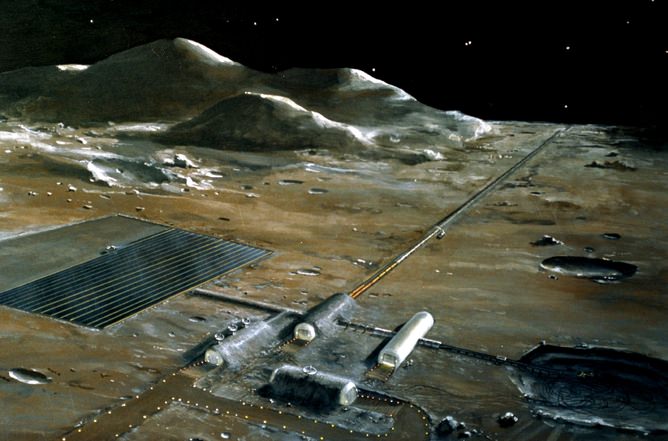
Building a lunar base might be easier if astronauts could harvest local materials for the construction, and life support in general. Credit: NASA/Pat Rawlings
For instance, in 1954 Arthur C. Clarke proposed a lunar base where inflatable modules were covered in lunar dust for insulation and communications were provided by a inflatable radio mast. And in 1959, John S. Rinehart – the director of the Mining Research Laboratory at the Colorado School of Mines – proposed a tubular base that would “float” across the surface.
Since that time, NASA, the US Army and Air Force, and other space agencies have issued proposals for the creation of a lunar settlement. In all cases, these plans contained allowances for resource utilization to make the base as self-sufficient as possible. However, these plans predated the Apollo program, and were largely abandoned after its conclusion. It has only been in the past few decades that detailed proposals have once again been made.
For instance, during the Bush Administration (2001-2009), NASA entrtained the possibility of creating a “lunar outpost”. Consistent with their Vision for Space Exploration (2004), the plan called for the construction of a base on the Moon between 2019 and 2024. One of the key aspects of this plan was the use of ISRU techniques to produce oxygen from the surrounding regolith.
These plans were cancelled by the Obama administration and replaced with a plan for a Mars Direct mission (known as NASA’s “Journey to Mars“). However, during a workshop in 2014, representatives from NASA met with Harvard geneticist George Church, Peter Diamandis from the X Prize Foundation and other experts to discuss low-cost options for returning to the Moon.
The workshop papers, which were published in a special issue of New Space, describe how a settlement could be built on the Moon by 2022 for just $10 billion USD. According to their papers, a low-cost base would be possible thanks to the development of the space launch business, the emergence of the NewSpace industry, 3D printing, autonomous robots, and other recently-developed technologies.
In December of 2015, an international symposium titled “Moon 2020-2030 – A New Era of Coordinated Human and Robotic Exploration” took place at the the European Space Research and Technology Center. At the time, the new Director General of the ESA (Jan Woerner) articulated the agency’s desire to create an international lunar base using robotic workers, 3D printing techniques, and in-situ resources utilization.
In 2010, NASA established the Robotic Mining Competition, an annual incentive-based competition where university students design and build robots to navigate a simulated Martian environment. One of the most-important aspects of the competition is creating robots that can rely on ISRU to turn local resources into usable materials. The applications produced are also likely to be of use during future lunar missions.
An early lunar outpost design based on a module design (1990). Credit: NASA/Cicorra Kitmacher
And the NewSpace industry has also been producing some interesting proposals of late. In 2010, a group of Silicon Valley entrepreneurs came together for create Moon Express, a private company that plans to offer commercial lunar robotic transportation and data services, as well as the a long-term goal of mining the Moon. In December of 2015, they became the first company competing for the Lunar X Prize to build and test a robotic lander – the MX-1.
In 2010, Arkyd Astronautics (renamed Planetary Resources in 2012) was launched for the purpose of developing and deploying technologies for asteroid mining. In 2013, Deep Space Industries was formed with the same purpose in mind. Though these companies are focused predominantly on asteroids, the appeal is much the same as lunar mining – which is expanding humanity’s resource base beyond Earth.
Resources:
Based on the study of lunar rocks, which were brought back by the Apollo missions, scientists have learned that the lunar surface is rich in minerals. Their overall composition depends on whether the rocks came from lunar maria (large, dark, basaltic plains formed from lunar eruptions) or the lunar highlands.
Moon rocks from the Apollo 11 mission. Credit: NASA
Rocks obtained from lunar maria showed large traces of metals, with 14.9% alumina (Al²O³), 11.8% calcium oxide (lime), 14.1% iron oxide, 9.2% magnesia (MgO), 3.9% titanium dioxide (TiO²) and 0.6% sodium oxide (Na²O). Those obtained from the lunar highlands are similar in composition, with 24.0% alumina, 15.9% lime, 5.9% iron oxide, 7.5% magnesia, and 0.6% titanium dioxide and sodium oxide.
These same studies have shown that lunar rocks contain large amounts of oxygen, predominantly in the form of oxidized minerals. Experiments have been conducted that have shown how this oxygen could be extracted to provide astronauts with breathable air, and could be used to make water and even rocket fuel.
The Moon also has concentrations of Rare Earth Metals (REM), which are attractive for two reasons. On the one hand, REMs are becoming increasingly important to the global economy, since they are used widely in electronic devices. On the other hand, 90% of current reserves of REMs are controlled by China; so having a steady access to an outside source is viewed by some as a national security matter.
Similarly, the Moon has significant amounts of water contained within its lunar regolith and in the permanently shadowed areas in its north and southern polar regions.This water would also be valuable as a source of rocket fuel, not to mention drinking water for astronauts.
Spectra gathered by the NASA Moon Mineralogy Mapper (M3) on India’s Chandrayaan-1 mission, showing the presence of water in Moon’s polar regions. Credit: ISRO/NASA/JPL-Caltech/Brown University/USGS
In addition, lunar rocks have revealed that the Moon’s interior may contain significant sources of water as well. And from samples of lunar soil, it is calculated that adsorbed water could exist at trace concentrations of 10 to 1000 parts per million. Initially, it was though that concentrations of water within the moon rocks was the result of contamination.
But since that time, multiple missions have not only found samples of water on the lunar surface, but revealed evidence of where it came from. The first was India’s Chandrayaan-1 mission, which sent an impactor to the lunar surface on Nov. 18th, 2008. During its 25-minute descent, the impact probe’s Chandra’s Altitudinal Composition Explorer (CHACE) found evidence of water in the Moon’s thin atmosphere.
In November 2009, the NASA LCROSS space probe made similar finds around the southern polar region, as an impactor it sent to the surface kicked up material shown to contain crystalline water. In 2012, surveys conducted by the Lunar Reconnaissance Orbiter (LRO) revealed that ice makes up to 22% of the material on the floor of the Shakleton crater (located in the southern polar region).
Hydrogen detected in the polar regions of the Moon point towards the presence of water. Credit: NASA
It has been theorized that all this water was delivered by a combination of mechanisms. For one, regular bombardment by water-bearing comets, asteroids and meteoroids over geological timescales could have deposited much of it. It has also been argued that it is being produced locally by the hydrogen ions of solar wind combining with oxygen-bearing minerals.
But perhaps the most valuable commodity on the surface of the Moon might be helium-3. Helium-3 is an atom emitted by the Sun in huge amounts, and is a byproduct of the fusion reactions that take place inside. Although there is little demand for helium-3 today, physicists think they’ll serve as the ideal fuel for fusion reactors.
The Sun’s solar wind carries the helium-3 away from the Sun and out into space – eventually out of the Solar System entirely. But the helium-3 particles can crash into objects that get in their way, like the Moon. Scientists haven’t been able to find any sources of helium-3 here on Earth, but it seems to be on the Moon in huge quantities.
Benefits:
From a commercial and scientific point of view, there are several reasons why Moon mining would be beneficial to humanity. For starters, it would be absolutely essential to any plans to build a settlement on the Moon, as in-situ resource utilization (ISRU) would be far more cost effective than transporting materials from Earth.
Artist concept of a base on the Moon. Credit: NASA, via Wikipedia
Also, it is predicted that the proposed space exploration efforts for the 21st century will require large amounts of materiel. That which is mined on the Moon would be launched into space at a fraction of the cost of what is mined here on Earth, due to the Moon’s much lower gravity and escape velocity.
In addition, the Moon has an abundance of raw materials that humanity relies on. Much like Earth, it is composed of silicate rocks and metals that are differentiated between a geochemically distinct layers. These consist of is iron-rich inner core, and iron-rich fluid outer core, a partially molten boundary layer, and a solid mantle and crust.
In addition, it has been recognized for some time that a lunar base – which would include resource operations – would be a boon for missions farther into the Solar System. For missions heading to Mars in the coming decades, the outer Solar System, or even Venus and Mercury, the ability to be resupplied from an lunar outpost would cut the cost of individual missions drastically.
Challenges:
Naturally, the prospect of setting up mining interests on the Moon also presents some serious challenges. For instance, any base on the Moon would need to be protected from surface temperatures, which range from very low to high – 100 K (-173.15 °C;-279.67 °F) to 390 K (116.85 °C; 242.33 °F) – at the equator and average 150 K (-123.15 °C;-189.67 °F) in the polar regions.
Schematic showing the stream of charged hydrogen ions carried from the Sun by the solar wind.Credit: University of Maryland/F. Merlin/McREL]Radiation exposure is also an issue. Due to the extremely thin atmosphere and lack of a magnetic field, the lunar surface experiences half as much radiation as an object in interplanetary space. This means that astronauts and/or lunar workers would at a high risk of exposure to cosmic rays, protons from solar wind, and the radiation caused by solar flares.
Then there’s the Moon dust, which is an extremely abrasive glassy substance that has been formed by billions of years of micrometeorite impacts on the surface. Due to the absence of weathering and erosion, Moon dust is unrounded and can play havoc with machinery, and poses a health hazard. Worst of all, its sticks to everything it touches, and was a major nuisance for the Apollo crews!
And while the lower gravity is attractive as far as launches are concerned, it is unclear what the long-term health effects of it will be on humans. As repeated research has shown, exposure to zero-gravity over month-long periods causes muscular degeneration and loss of bone density, as well as diminished organ function and a depressed immune system.
A lunar base, as imagined by NASA in the 1970s. Image Credit: NASA
And while there has been plenty of speculation about a “loophole” which does not expressly forbid private ownership, there is no legal consensus on this. As such, as lunar prospecting and mining become more of a possibility, a legal framework will have to be worked out that ensures everything is on the up and up.
Though it might be a long way off, it is not unreasonable to think that someday, we could be mining the Moon. And with its rich supplies of metals (which includes REMs) becoming part of our economy, we could be looking at a future characterized by post-scarcity!
President Obama meeting with President-elect Donald Trump to discuss the transition of power. Credit: whitehouse.gov
For almost a week now, NASA has been preparing for the transition between the Obama administration and that o Donald Trump, the president-elect. Unfortunately, little seems clear at this point, as the Trump campaign has yet to send representatives to speak to them, or give any indication of what the future budget environment might look like.
In lieu of clear statements, speculation has been the norm, and has been based almost entirely on statements made during the election. And with many important missions approaching, NASA has been understandably antsy. Luckily, with the appointment of a Agency Research Team (ART), it appears that the much-needed meeting may be on the way.
This news is certainly a welcome relief in a post-election atmosphere characterized for the most part by uncertainty and ambiguity. And it certainly is good news for NASA administrators, who have been getting increasingly anxious about what the new administration’s policies will mean for their future.
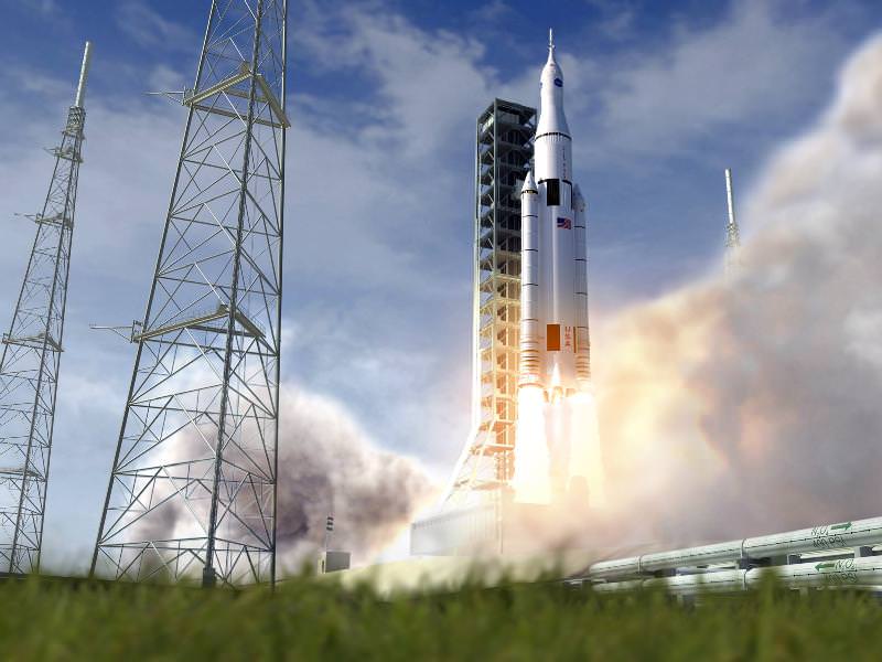
Artist’s conception of NASA’s Space Launch System (SLS) with the Orion crewed deep space capsule. Credit: NASA
“The new administration has not yet named its transition team members that interface with NASA, so we don’t yet know who we’ll be talking to. We are prepared to talk with them when they arrive… We hope to be building on the consensus we’ve achieved on the phases of exploration, the progression of human exploration from the ISS all the way to the surface of Mars.”
Once the election wrapped up after Nov. 8th, it was rumored that Mark Albrecht – the former executive secretary of the National Space Council during George H.W. Bush’s presidency – would be leading the NASA transition efforts. However, these rumors were not followed by any formal announcement, and no other individuals were named to the team.
This was certainly disconcerting, since NASA and other large agencies are used to meeting with transitional teams within days of an election. This is seen as essential for ensuring that there is continuity, or that they are apprised of changes long before they take effect. Given the nature of their work, NASA planners need to know in advance what kind of budgets they will have to work with, since it will determine what missions they can do.
NASA’s Journey to Mars. NASA is developing the capabilities needed to send humans to an asteroid by 2025 and Mars in the 2030s. Credit: NASA/JPL
As Williams indicated, NASA is particularly concerned about their “Journey to Mars“, a long-term goal which requires a consistent commitment in terms of financial resources. And while transitional funding was made available for fiscal year 2017 – thanks to the NASA Transition Authorization Act of 2016 – NASA is looking far beyond the coming year.
In the coming years, NASA will need a solid commitment from the Trump presidency to ensure the completion and testing of the Space Launch System (SLS) – the successor to the Space Shuttle Program. They also require a multi-billion dollar commitment to continue testing the Orion Multipurpose Crew Vehicle, not to mention the several crewed missions they hope to conduct using both.
Another thing that is central to mounting a crewed mission to Mars in the 2030s are the ongoing studies aboard the ISS. In particular, NASA hopes to use long-duration stays aboard the station to determine the risks to astronaut health. A crewed mission to Mars will spend several months in space, during which time they will be living in zero-gravity conditions and exposed to a great deal of radiation.
In addition, NASA hopes to mount a crewed mission to an asteroid in the coming decade. The plan entails sending a robotic spacecraft to capture and tow a Near-Earth Object (NEO) into lunar orbit – known as the Asteroid Robotic Redirect Missions (ARRM). This is to be followed by a crewed Orion spacecraft being sent to explore the asteroid, which will develop key systems and expertise for the coming mission to Mars.
NASA’s new budget could mean the end of their Asteroid Redirect Mission. Image: NASA (Artist’s illustration)
Unfortunately, the Transition Authorization Act contained some strongly-worded language about the robotic asteroid mission. Essentially, it was deemed as not falling within the original budget constraints of $1.25 billion (it is now estimated at $1.4 billion). NASA planners were therefore encouraged to find “a more cost effective and scientifically beneficial means to demonstrate the technologies needed for a human mission to Mars.”
As such, NASA is very interested to know if the new administration will make the necessary commitment to fund the ARRM, or if they need to scrub it at this point and go back to the drawing board. One way or another, NASA needs to know what it will be capable of doing in the coming years so that they can develop a plan for what they intend to do.
The current state of uncertainty has been largely attributed to the fact that the Trump campaign engaged in little planning before the election. While various statements were made about the important role NASA plays, nothing concrete was laid out. And Trump even went so far as to say that long-term exploration goals would depend upon the economic climate.
One can only hope that the new Agency Research Team will have an agenda prepared when they meet with NASA administrators. We can also hope that it won’t impede NASA’s more ambitious efforts for the coming years. The agency has made it clear that its plans to explore Mars are in keeping with the goal of remaining the leader in the field of space exploration and research. If they can’t get there in the time period desired, someone else just might!
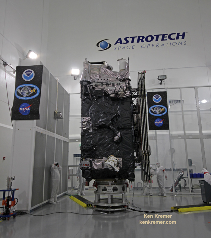
The NASA/NOAA GOES-R (Geostationary Operational Environmental Satellite - R Series) being processed at Astrotech Space Operations, in Titusville, FL, in advance of launch on a ULA Atlas V on Nov. 19, 2016. GOES-R will be America’s most advanced weather satellite. Credit: Ken Kremer/kenkremer.com
The NASA/NOAA GOES-R (Geostationary Operational Environmental Satellite – R Series) being processed at Astrotech Space Operations, in Titusville, FL, in advance of planned launch on a ULA Atlas V slated for Nov. 19, 2016. GOES-R will be America’s most advanced weather satellite. Credit: Ken Kremer/kenkremer.com
KENNEDY SPACE CENTER, FL – After an ironic detour due to Hurricane Matthew, liftoff of the game changing NASA/NOAA next generation GOES-R geostationary weather observation satellite offering a “dramatic leap in capability” is finally on track for this weekend on Nov. 19 from the Florida Space Coast.
And Universe Today recently got an up close look and briefing about the massive probe inside the cleanroom processing facility at Astrotech Space Operations in Titusville, Fl.
“We are bringing the nation a new capability .. that’s a dramatic leap .. to scan the entire hemisphere in about 5 minutes,” said Greg Mandt, NOAA GOES-R program manager during a briefing in the Astrotech cleanroom.
“GOES-R has both weather and space weather detection capabilities!” Tim Gasparrini, GOES-R program manager for Lockheed Martin, told Universe Today during a cleanroom interview.
Astrotech is located just a few miles down the road from NASA’s Kennedy Space Center and the KSC Visitor Complex housing the finest exhibits of numerous spaceships, hardware items and space artifacts.
The NASA/NOAA GOES-R (Geostationary Operational Environmental Satellite – R Series) being processed at Astrotech Space Operations, in Titusville, FL, in advance of planned launch on a ULA Atlas V slated for Nov. 19, 2016. GOES-R will be America’s most advanced weather satellite. Credit: Ken Kremer/kenkremer.com
GOES-R, which stands for Geostationary Operational Environmental Satellite – R Series – is a new and advanced transformational weather satellite that will vastly enhance the quality, speed and accuracy of weather forecasting available to forecasters for Earth’s Western Hemisphere.
Liftoff of the NASA/NOAA GOES-R weather satellite atop a United Launch Alliance (ULA) Atlas V rocket is now scheduled for Saturday, Nov. 19 at 5:42 p.m. from Space Launch Complex 41 (SLC-41) on Cape Canaveral Air Force Station, shortly after sunset.
The launch window extends for an hour from 5:42-6:42 p.m. EST.
GOES-R is the first in a new series of American’s most powerful and most advanced next generation weather observation satellites. It is designed to last for a 15 year orbital lifetime.
Once in orbit it will be known as GOES-16. TV viewers are presently accustomed to seeing daily streams of imagery from the GOES-East and GOES-West weather observation satellites currently in orbit.
What’s the big deal about GOES-R?
Audiences will notice big changes from GOES-R once it becomes operational because it will provide images of weather patterns and severe storms as regularly as every five minutes or as frequently as every 30 seconds.
“These images can be used to aid in weather forecasts, severe weather outlooks, watches and warnings, lightning conditions, maritime forecasts and aviation forecasts.
“It also will assist in longer term forecasting, such as in seasonal predictions and drought outlooks. In addition, space weather conditions will be monitored constantly, including the effects of solar flares to provide advance notice of potential communication and navigation disruptions. It also will assist researchers in understanding the interactions between land, oceans, the atmosphere and climate.”
GOES-R was built by prime contractor Lockheed Martin and is the first of a four satellite series – comprising GOES-R, S, T, and U that will be keep the GOES satellite system operational through 2036.
All four of the revolutionary 11,000 pound satellites are identical. The overall cost is about $11 Billion.
“This is a very exciting time,” explained Greg Mandt, the NOAA GOES-R program manager during the Astrotech cleanroom briefing.
“This is the culmination of about 15 years of intense work for the great team of NOAA and NASA and our contractors Lockheed Martin and Harris.”
“We are bringing the nation a new capability. The GOES program has been around for about 40 years and most every American sees it every night on the weather broadcasts when they see go to the satellite imagery. And what’s really exciting is that for the first time in that 40 years we are really end to end replacing the entire GOES system. The weather community is really excited about what we are bringing.”
“It’s a dramatic leap in capability – like moving from black and white TV to HDTV.”
“We will be able to scan the entire hemisphere in about 5 minutes and do things so much faster with double the resolution.”
The NASA/NOAA/Lockheed Martin/Harris GOES-R team gives a big thumbs up for the dramatic leap in capability this next gen weather observation satellite will provide – during media briefing at Astrotech Space Operations, in Titusville, FL. Launch is set for Nov. 19, 2016. Credit: Ken Kremer/kenkremer.com
It was built in facilities in Bucks County, Pennsylvania and Denver, Colorado. It arrived at Astrotech in August for final processing and checkouts of the spacecraft and instruments.
The gigantic school bus sized satellite is equipped with a suite of six instruments or sensors that are the most advanced of their kind. They will be used for three types of observations: Earth sensing, solar imaging, and space environment measuring. They will point to the Earth, the Sun and the in-situ environment of the spacecraft.
The suite includes the Advanced Baseline Imager (ABI), Geostationary Lightning Mapper (GLM), Solar Ultraviolet Imager (SUVI), Extreme Ultraviolet and X-Ray Irradiance Sensors (EXIS), Space Environment In-Situ Suite (SEISS), and the Magnetometer (MAG).
The two Earth-pointing instruments are on the top of the spacecraft – namely ABI and GLM.
“ABI is the premier instrument on the spacecraft. When you turn on the news and see a severe storm picture, that’s the one it comes from. It takes pictures in the visible as well as the infrared (IR), near infrared (IR),” Tim Gasparrini, GOES-R program manager for Lockheed Martin, told Universe Today during a cleanroom interview.
“It is looking for things like moisture, vegetation, aerosols and fire. So it looks across a broad spectrum to determine the environmental conditions on Earth.”
ABI offers 3 times more spectral channels with 4 times greater resolution and scans 5 times faster than ever before, compared to the current GOES satellites.
The GOES-R ABI will view the Earth with 16 different spectral bands (compared to five on current GOES), including two visible channels, four near-infrared channels, and ten infrared channels, according to the mission fact sheet.
It will also carry the first operational lightning mapper ever flown in space – GLM – built by Lockheed Martin. It has a single-channel, near-infrared optical transient detector.
“This is the first lightning mapper in space and at geostationary orbit.”
“GLM takes a picture of a scene on the Earth 500 times per second. And it compares those images for a change in the scene that can detect lightning, using an algorithm,” Gasparrini told me.
“The importance of that is lightning is a precursor to severe weather. So they are hoping that GLM will up to double the tornado warning time. So instead of 10 minutes warning you get 20 minutes warning, for example.”
GLM will measure total lightning (in-cloud, cloud-to-cloud and cloud-to-ground) activity continuously over the Americas and adjacent ocean regions with near-uniform spatial resolution of approximately 10 km.
Side view of NASA/NOAA GOES-R next gen weather observation satellite showing solar panels and instruments inside Astrotech Space Operations cleanroom, in Titusville, FL. Launch is set for Nov. 19, 2016. Credit: Ken Kremer/kenkremer.com
“The two solar pointing instruments are located on a platform that constantly points them at the sun – SUVI (built by Lockheed Martin and EXIS. SUVI looks at the sun in the ultraviolet and EXIS looks at the x-ray wavelengths.”
The instruments work in concert.
“SUVI detects a solar flare on he sun and EXIS measures the intensity of the flare. As it comes towards the Earth, NOAA then uses the DSCOVR satellite [launched last year] as sort of a warning buoy about 30 minutes before the Earth. This gives a warning that a geomagnetic storm is heading toward the Earth.”
“When the storm reaches the Earth, the magnetometer instrument (MAG) on GOES-R then measures the influence of the magnetic storm on the magnetic field of the Earth.”
“Then the SEISS instrument, a charged particle detector, measures the charged particle effect of the storm on the Earth at geostationary orbit.”
“So GOES-R has both weather and space weather detection capabilities!” Gasparini elaborated.
The huge bus sized satellite measures 6.1 m x 5.6 m x 3.9 m (20.0 ft x 18.4 ft x 12.8 ft) with a three-axis stabilized spacecraft bus.
It has a dry mass of 2,857 kg (6,299 lbs) and a fueled mass of 5,192 kg (11,446 lbs) at launch.
The instruments are very sensitive to contamination and the team is taking great care to limit particulate and molecular contaminants in the cleanroom. Some of the instruments have contamination budget limits of less than 10 angstroms – smaller than the diameter of a typical molecule. So there can’t even be a single layer of molecules on the instruments surface after 15 years on orbit.
GOES-R can also multitask according to a NASA/NOAA factsheet.
“It can scan the Western Hemisphere every 15 minutes, the Continental U.S. every 5 minutes and areas of severe weather every 30-60 seconds. All at the same time!”
GOES-R will blastoff on a ULA Atlas V in the very powerful 541 configuration, augmented by four solid rocket boosters on the first stage. The payload fairing is 5 meters (16.4 feet) in diameter and the upper stage is powered by a single-engine Centaur.
It will be launched to a Geostationary orbit some 22,300 miles above Earth.
The Atlas V booster has been assembled inside the Vertical Integration Facility (VIF) at SLC-41 and will be rolled out to the launch pad Friday morning, Nov. 18 with the GOES-R weather satellite encapsulated inside the nose cone.
The weather forecast shows a 80 percent chance of favorable weather conditions for Saturday’s sunset blastoff.
GOES-R logo. Credit: NASA/NOAA
Stay tuned here for Ken’s continuing Earth and Planetary science and human spaceflight news.
Learn more about GOES-R weather satellite, Heroes and Legends at KSCVC, OSIRIS-REx, InSight Mars lander, ULA, SpaceX and Orbital ATK missions, Juno at Jupiter, SpaceX AMOS-6 & CRS-9 rocket launch, ISS, ULA Atlas and Delta rockets, Orbital ATK Cygnus, Boeing, Space Taxis, Mars rovers, Orion, SLS, Antares, NASA missions and more at Ken’s upcoming outreach events:
Nov 17-20: “GOES-R weather satellite launch, OSIRIS-Rex, SpaceX and Orbital ATK missions to the ISS, Juno at Jupiter, ULA Delta 4 Heavy spy satellite, SLS, Orion, Commercial crew, Curiosity explores Mars, Pluto and more,” Kennedy Space Center Quality Inn, Titusville, FL, evenings
GOES-R infographicTim Gasparinni, GOES-R program manager for Lockheed Martin, and Ken Kremer/University Today pose with GOES-R revolutionary weather satellite inside Astrotech Space Operations cleanroom, in Titusville, FL, and built by NASA/NOAA/Lockheed Martin/Harris. Credit: Ken Kremer/kenkremer.com
It was with great fanfare that Elon Musk announced SpaceX’s plans to colonize Mars with the Interplanetary Transport System.
I really wish they’d stuck to their original name, the BFR, the Big Fabulous Rocket, or something like that.
The problem is that Interplanetary Transport System is way too close a name to another really cool idea, the Interplanetary Transport Network, which gives you an almost energy free way to travel across the entire Solar System. Assuming you’re not in any kind of rush.
When you imagine rockets blasting off for distant destinations, you probably envision pointing your rocket at your destination, firing the thrusters until you get there. Maybe turning around and slowing down again to land on the alien world. It’s how you might drive your car, or fly a plane to get from here to there.
But if you’ve played any Kerbal Space Program, you know that’s not how it works in space. Instead, it’s all about orbits and velocity. In order to get off planet Earth, you have be travelling about 8 km/s or 28,000 km/h sideways.
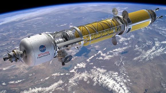
Artist’s concept of a Bimodal Nuclear Thermal Rocket in Low Earth Orbit. Credit: NASA
So now, you’re orbiting the Earth, which is orbiting the Sun. If you want to get to Mars, you have raise your orbit so that it matches Mars. The absolute minimum energy needed to make that transfer is known as the Hohmann transfer orbit. To get to Mars, you need to fire your thrusters until you’re going about 11.3 km/s.
Then you escape the pull of Earth, follow a nice curved trajectory, and intercept the trajectory of Mars. Assuming you timed everything right, that means you intercept Mars and go into orbit, or land on its surface, or discover a portal to hell dug into a research station on Phobos.
If you want to expend more energy, go ahead, you’ll get there faster.
But it turns out there’s another way you can travel from planet to planet in the Solar System, using a fraction of the energy you would use with the traditional Hohmann transfer, and that’s using Lagrange points.
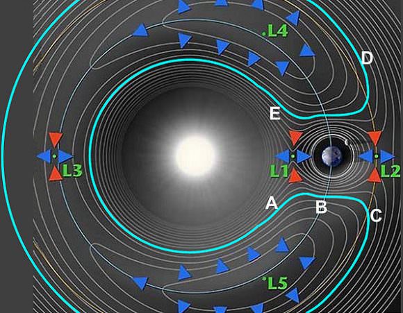
We did a whole article on Lagrange points, but here’s a quick refresher. The Lagrange points are places in the Solar System where the gravity between two objects balances out in five places. There are five Lagrange points relating to the Earth and the Sun, and there are five Lagrange points relating to the Earth and the Moon. And there are points between the Sun and Jupiter, etc.
Illustration of the Sun-Earth Lagrange Points. Credit: NASA
Three of these points are unstable. Imagine a boulder at the top of a mountain. It doesn’t take much energy to keep it in place, but it’s easy to knock it out of balance so it comes rolling down.
Now, imagine the whole Solar System with all these Lagrange points for all the objects gravitationally interacting with each other. As planets go around the Sun, these Lagrange points get close to each other and even overlap.
And if you time things right, you can ride along in one gravitationally balanced point, and the roll down the gravity hill into the grasp of a different planet. Hang out there for a little bit and then jump orbits to another planet.
In fact, you can use this technique to traverse the entire Solar System, from Mercury to Pluto and beyond, relying only on the interacting gravity of all these worlds to provide you with the velocity you need to make the journey.
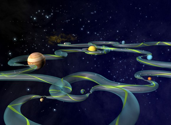
Welcome to the Interplanetary Transport Network, or Interplanetary Superhighway.
Unlike a normal highway, though, the actual shape and direction these pathways take changes all the time, depending on the current configuration of the Solar System.
A stylized example of one of the many, ever-changing routes along the ITN. Credit: NASA
If you think this sounds like science fiction, you’ll be glad to hear that space agencies have already used a version of this network to get some serious science done.
NASA greatly extended the mission of the International Sun/Earth Explorer 3, using these low energy transfers, it was able to perform its primary mission and then investigate a couple of comets.
The Japanese Hiten spacecraft was supposed to travel to the Moon, but its rocket failed to get enough velocity to put it into the right orbit. Researchers at NASA’s Jet Propulsion Laboratory calculated a trajectory that used the Lagrange points to help it move slowly and get to the Moon any way.
NASA’s Genesis Mission used the technique to capture particles from the solar wind and bring them back to the Earth.
There have been other missions to use the technique, and missions have been proposed that might exploit this technique to fully explore all the moons of Jupiter or Saturn, for example. Traveling from moon to moon when the gravity points line up.
It all sounds too good to be true, so here’s the downside. It’s slow. Really, painfully slow.
Like it can take years and even decades to move from world to world.
Imagine in the far future, there are space stations positioned at the major Lagrange points around the planets in the Solar System. Maybe they’re giant rotating space stations, like in 2001, or maybe they’re hollowed out asteroids or comets which have been maneuvered into place.
Exterior view of a Stanford torus. Bottom center is the non-rotating primary solar mirror, which reflects sunlight onto the angled ring of secondary mirrors around the hub. Painting by Donald E. Davis
They hang out at the Lagrange points using minimal fuel for station keeping. If you want to travel from one planet to another, you dock your spacecraft at the space station, refuel, and then wait for one of these low-energy trajectories to open up.
Then you just kick away from the Lagrange point, fall into the gravity well of your destination, and you’re on your way.
In the far future, we could have space stations at all the Lagrange points, and slow ferries that move from world to world along low energy trajectories, bringing cargo from world to world. Or taking passengers who can’t afford the high velocity Hohmann transfer technique.
You could imagine the space stations equipped with powerful lasers that fill your ship’s solar sails with the photons it needs to take you to the next destination. But then, I’m a sailor, so maybe I’m overly romanticizing it.
Here’s another, even more mind-bending concept. Astronomers have observed these networks open up between interacting galaxies. Want to transfer from the Milky Way to Andromeda? Just get your spacecraft to the galactic Lagrange point in a few billion years as they pass through each other. With very little energy, you’ll be able to join the cool kids in Andromeda.
I love this idea that colonizing and traveling across the Solar System doesn’t actually need to take enormous amounts of energy. If you’re patient, you can just ride the gravitational currents from world to world. This might be one of the greatest gifts the Solar System has made available to us.

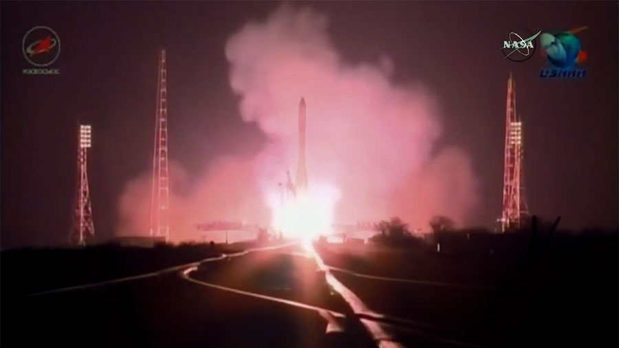
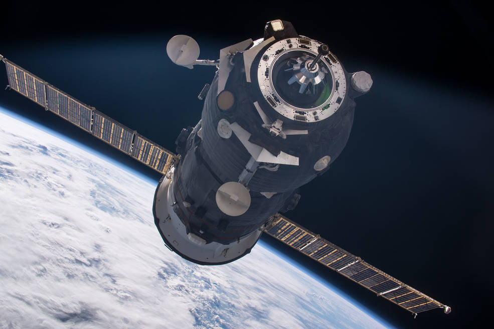
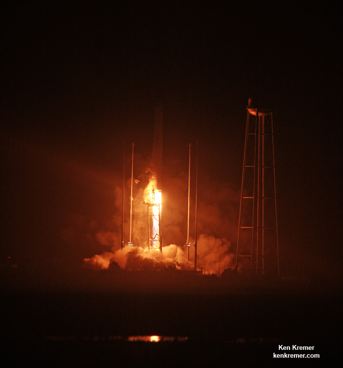
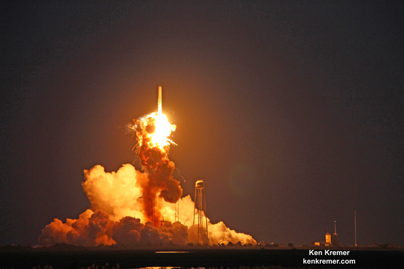
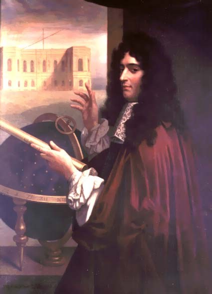
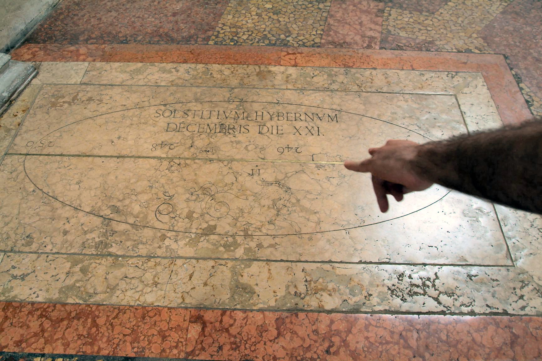
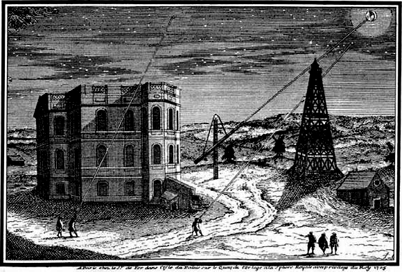


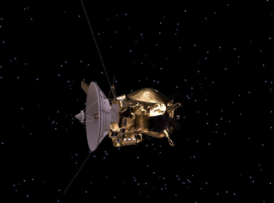
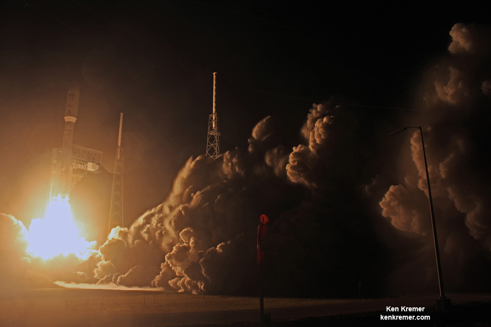
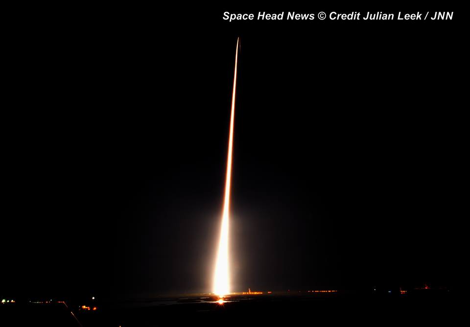
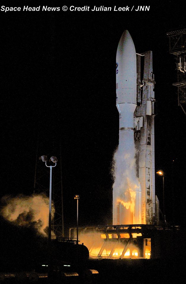
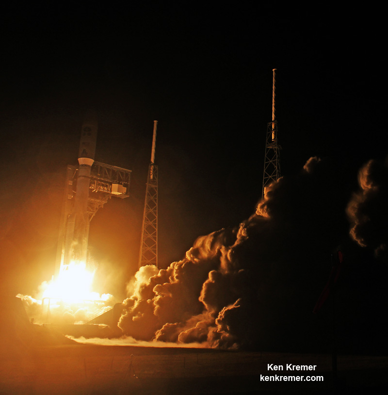
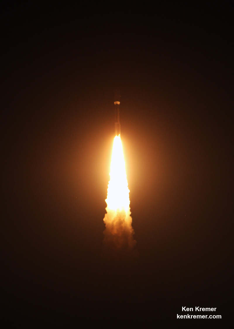
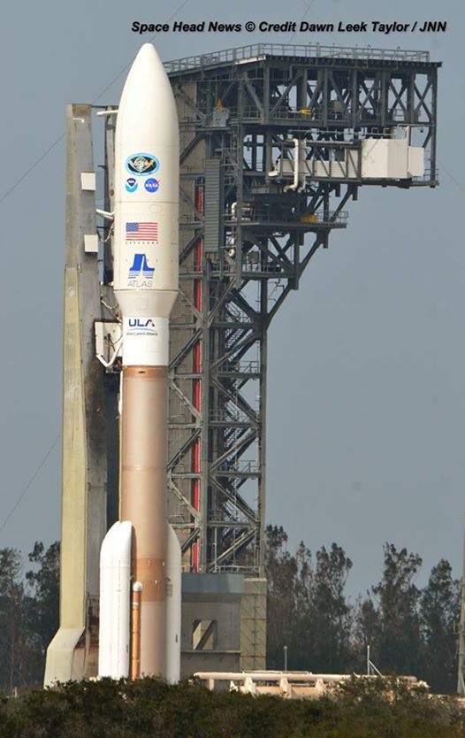
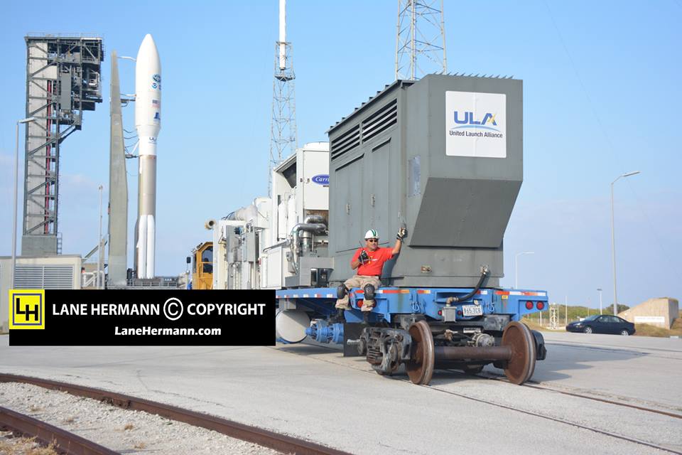
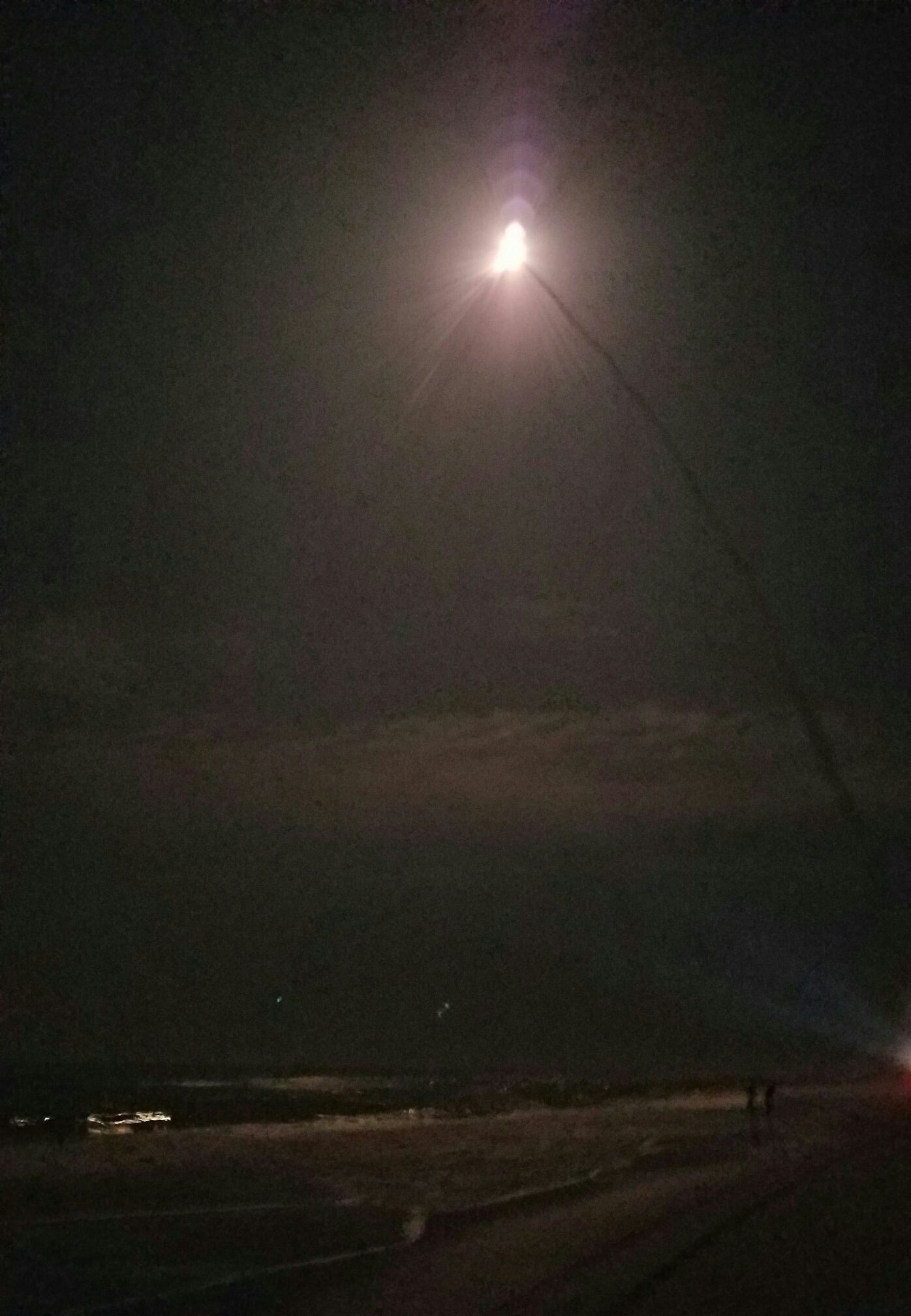

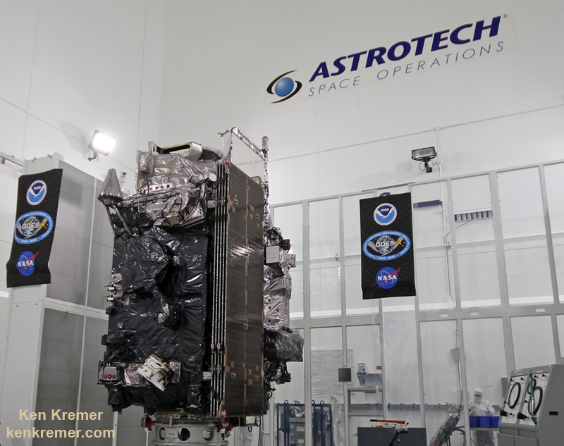

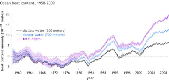
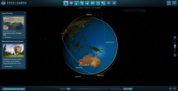
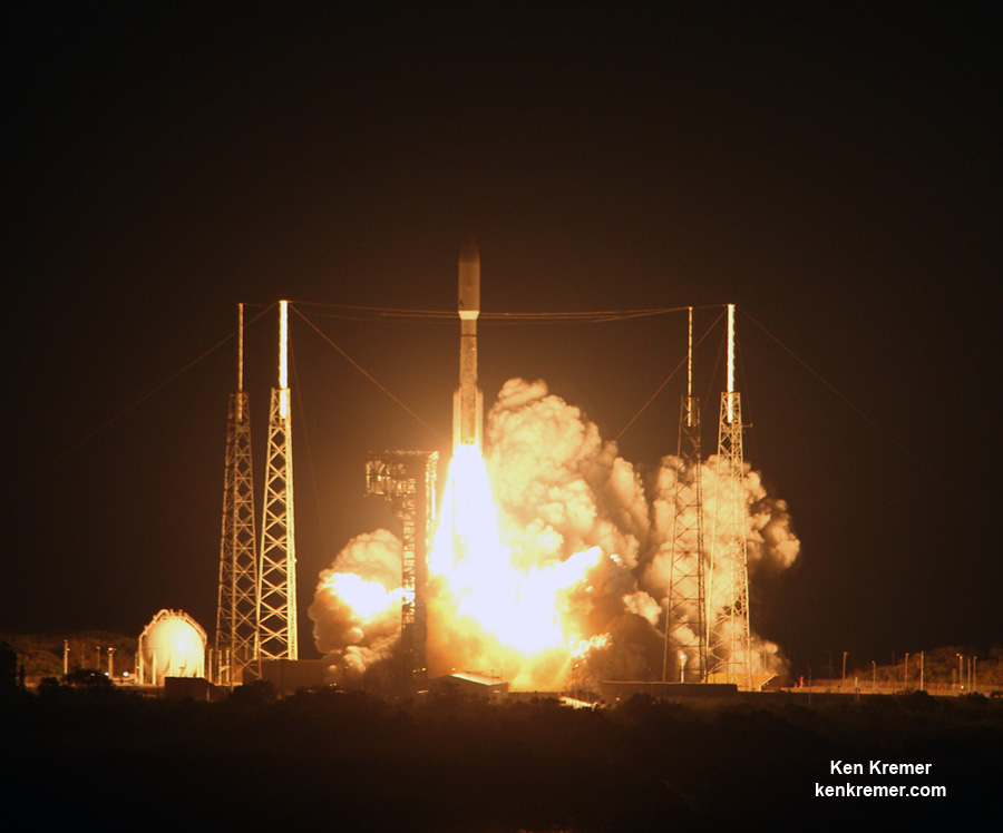
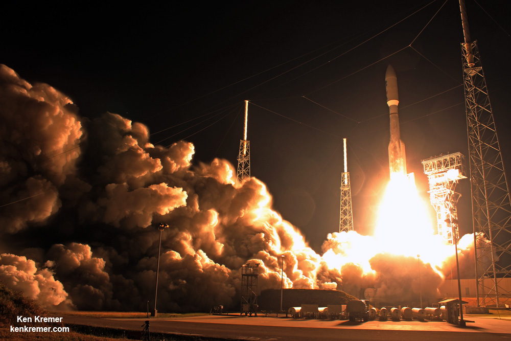
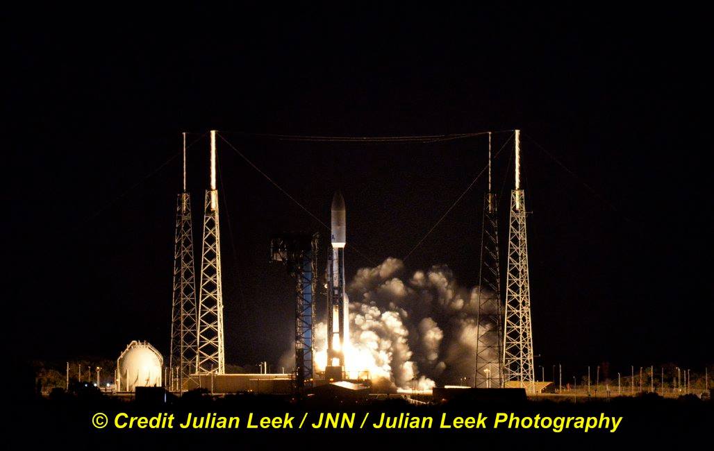
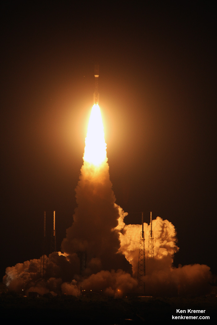
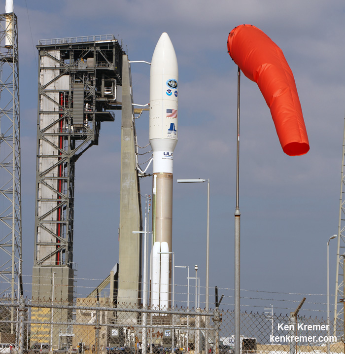
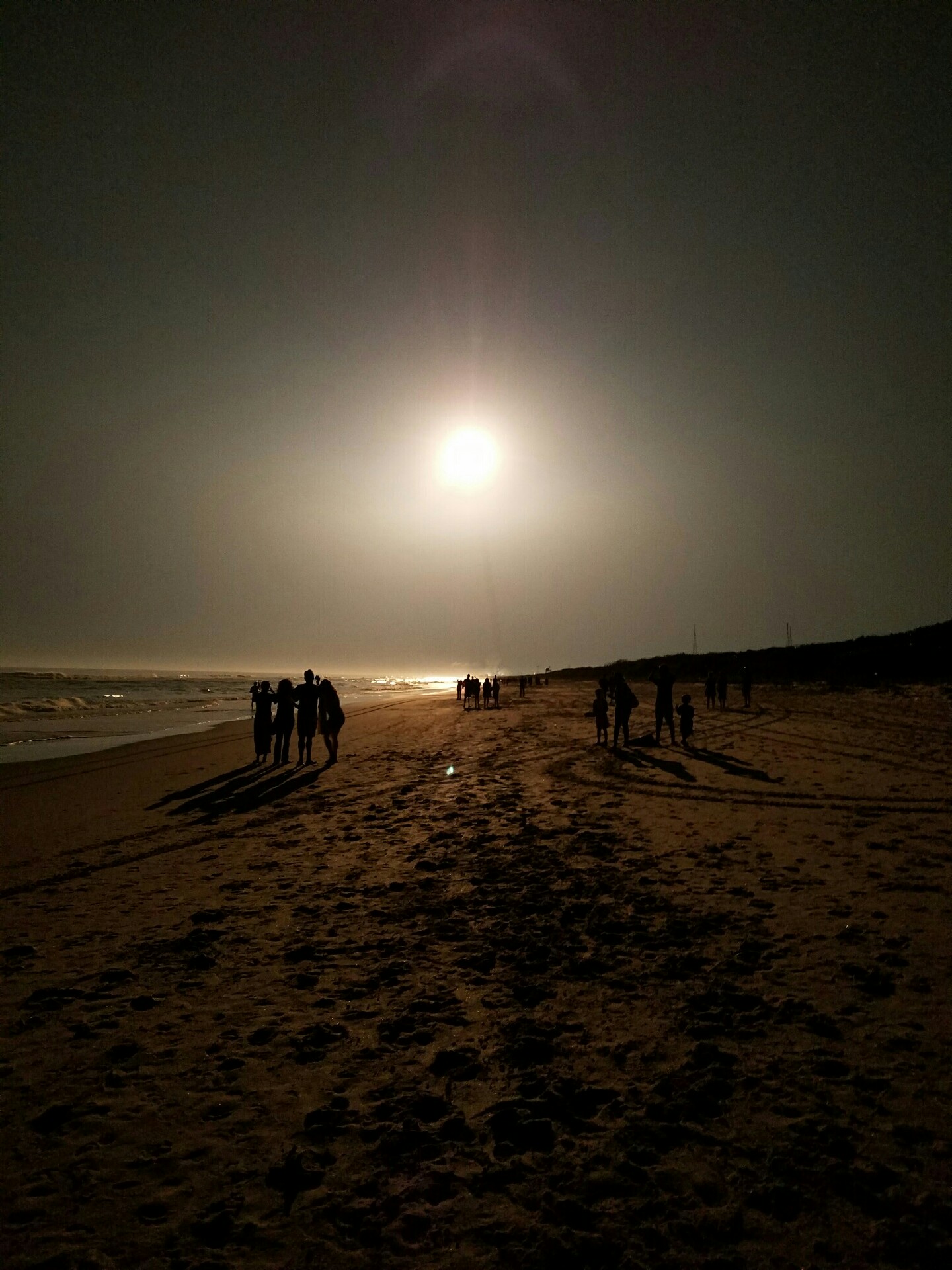
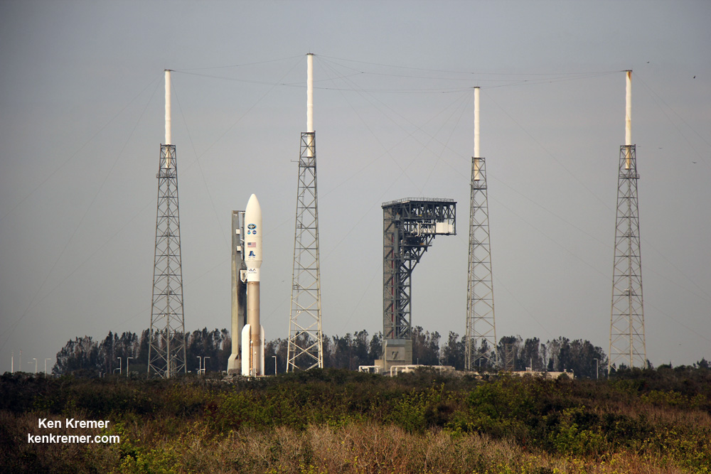
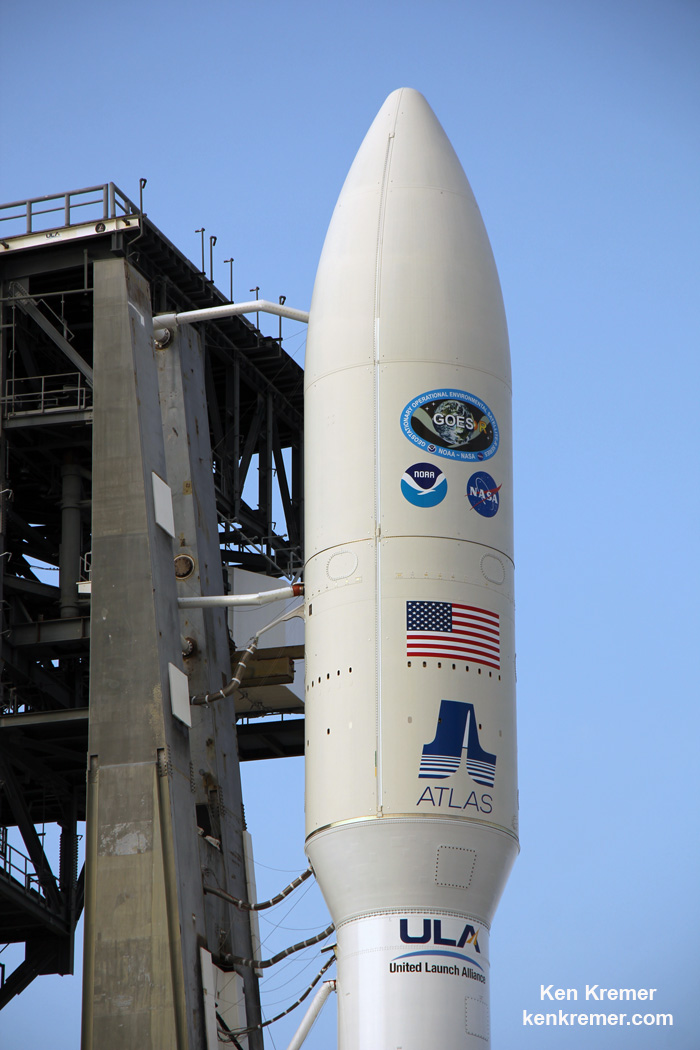
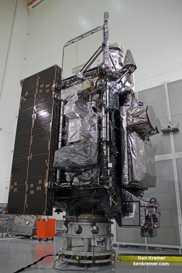
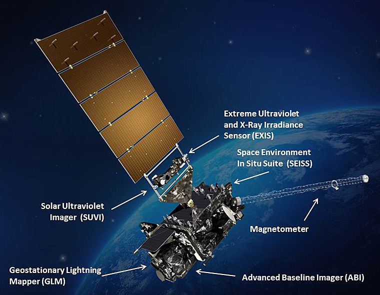
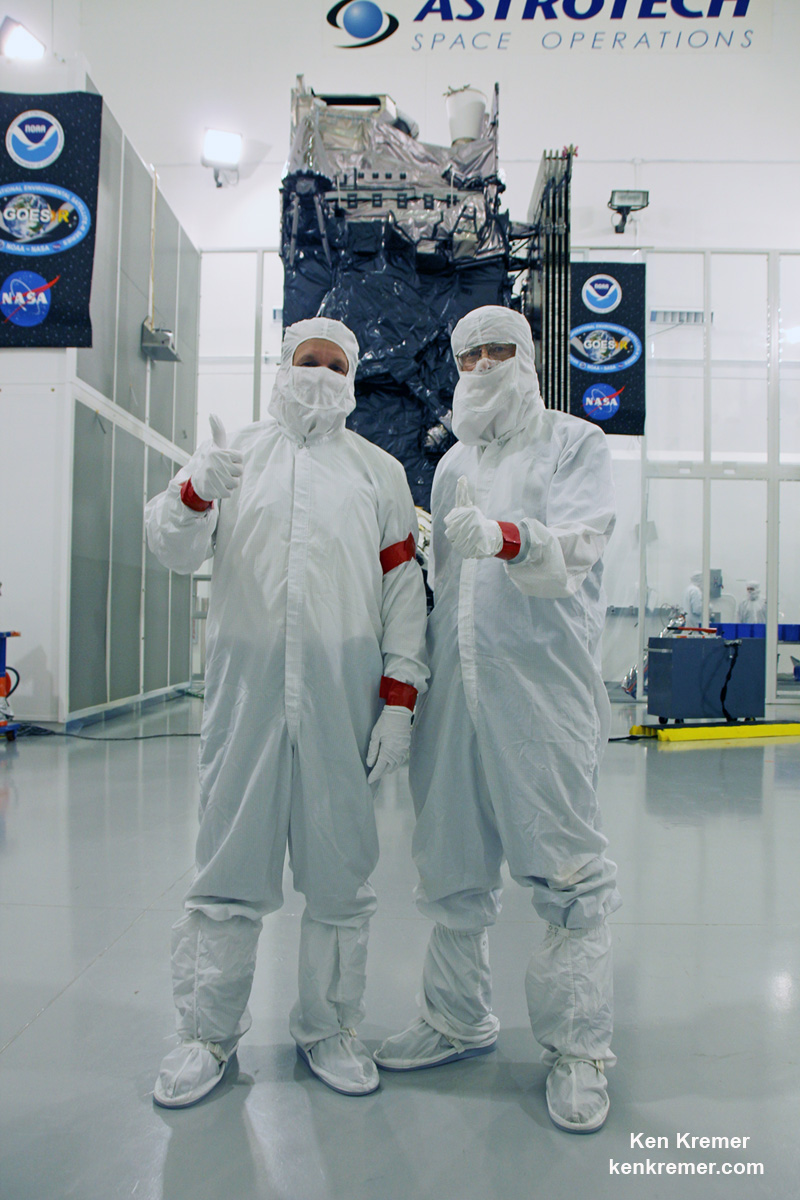
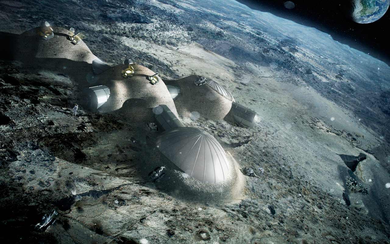
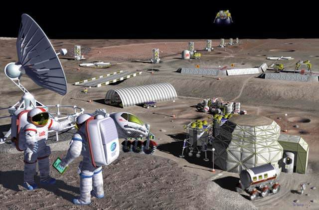
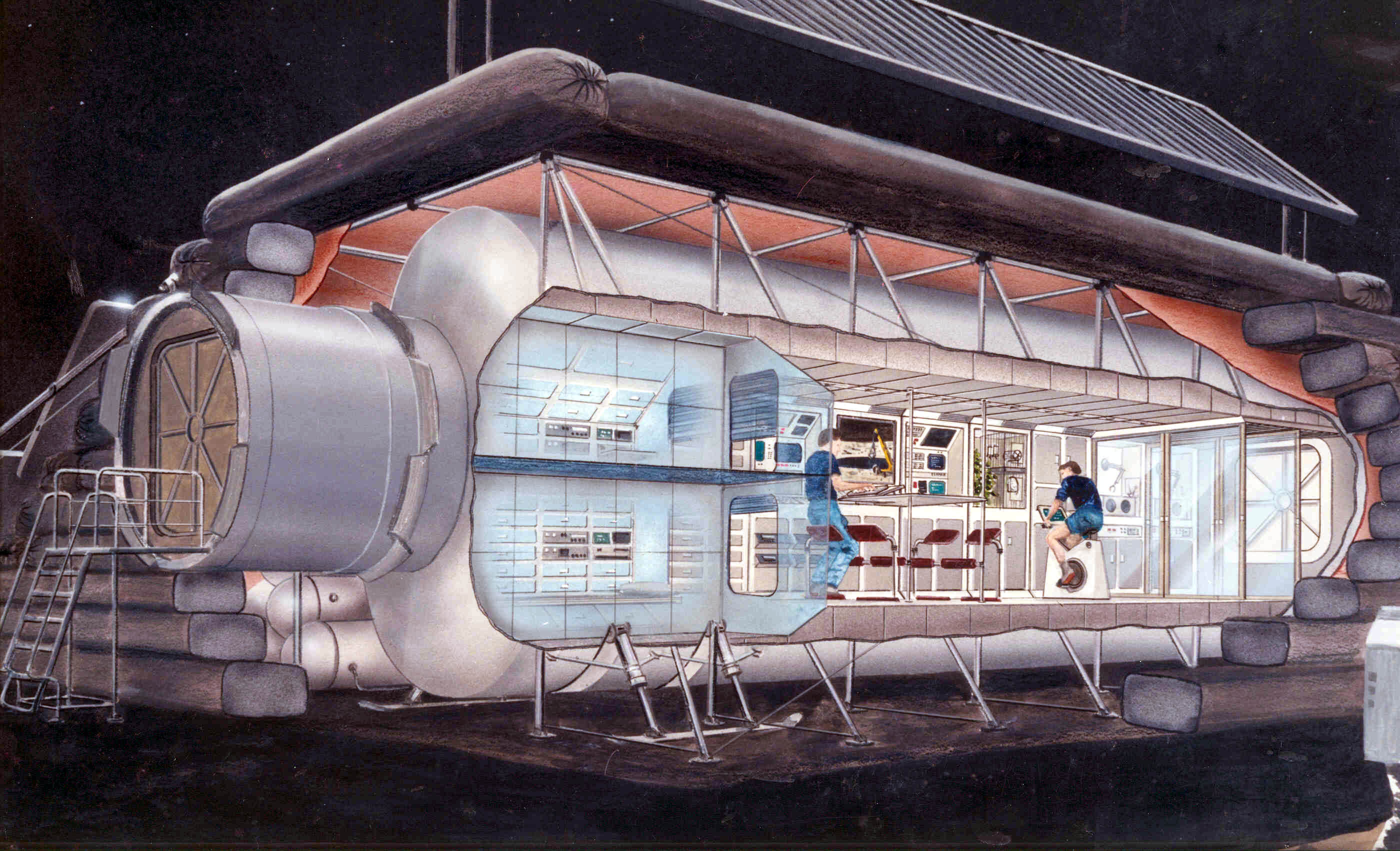
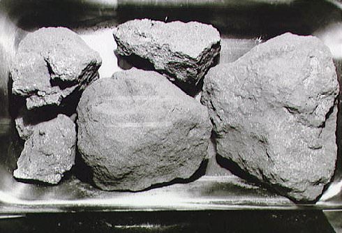
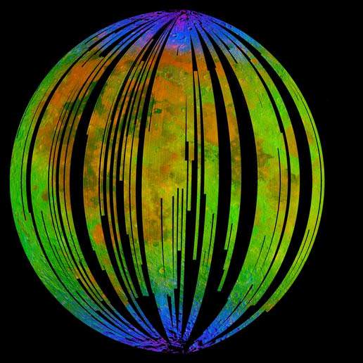
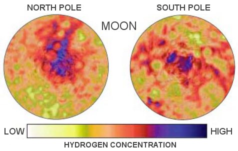
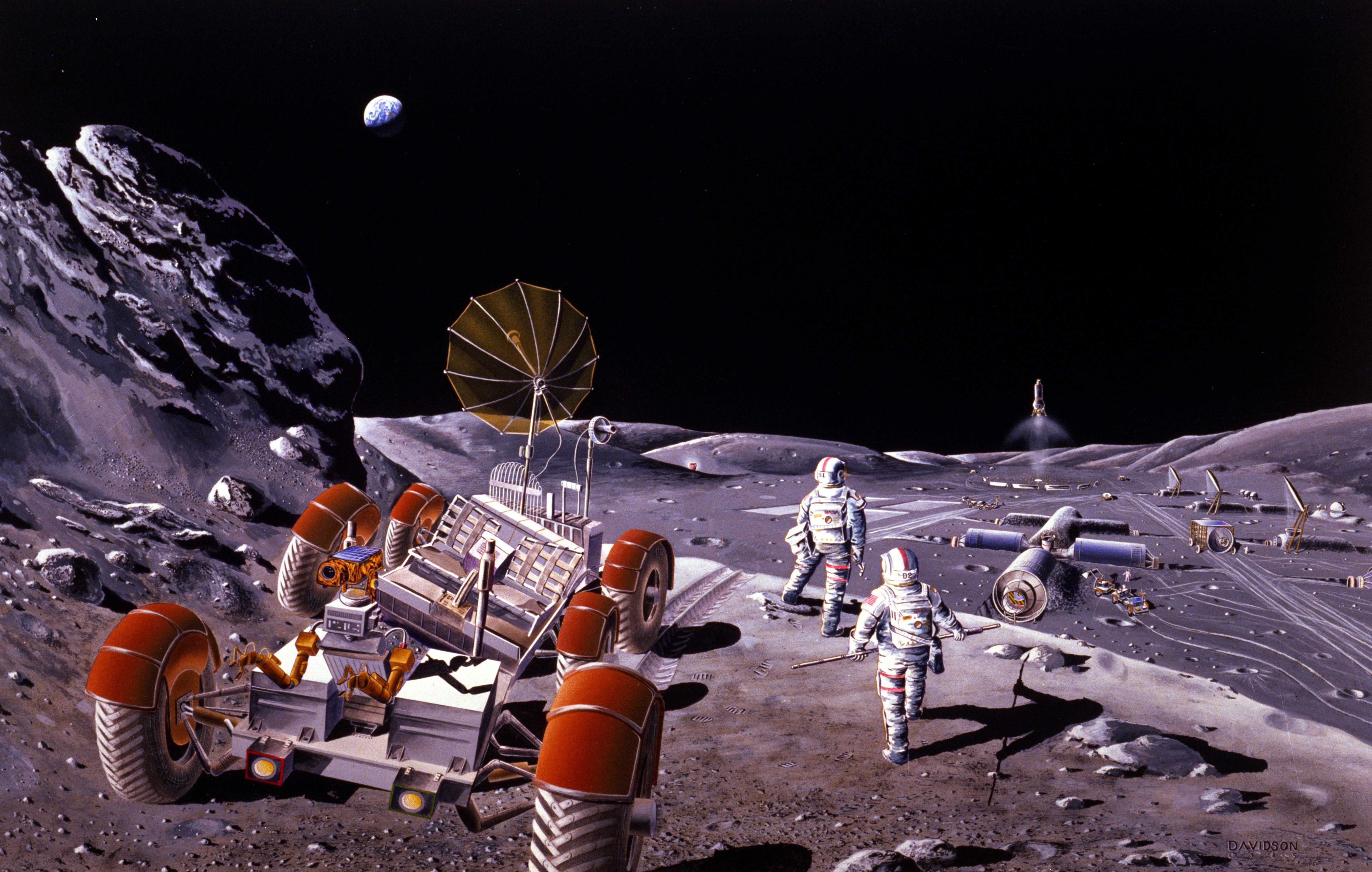
![Schematic showing the stream of charged hydrogen ions carried from the Sun by the solar wind. One possible scenario to explain hydration of the lunar surface is that during the daytime, when the Moon is exposed to the solar wind, hydrogen ions liberate oxygen from lunar minerals to form OH and H2O, which are then weakly held to the surface. At high temperatures (red-yellow) more molecules are released than adsorbed. When the temperature decreases (green-blue) OH and H2O accumulate. [Image courtesy of University of Maryland/F. Merlin/McREL]](https://www.universetoday.com/wp-content/uploads/2009/09/water-on-the-moon.jpg)