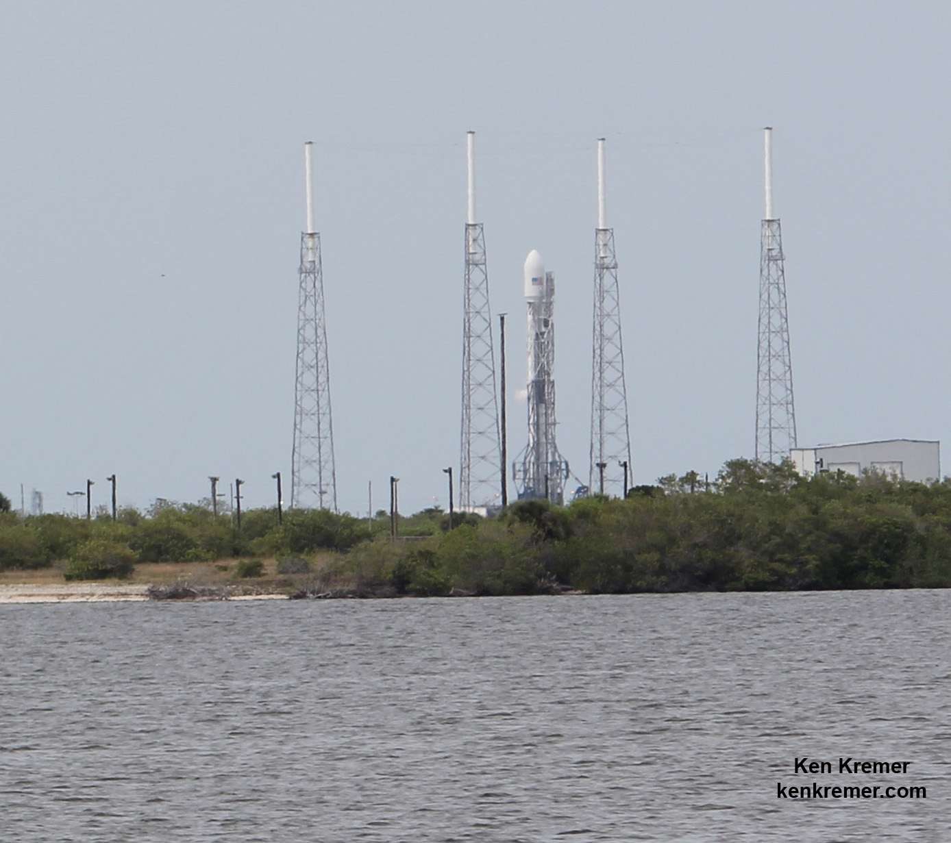
SpaceX Falcon 9 rocket with SES-8 communications satellite awaits launch from Pad 40 at Cape Canaveral, FL, file photo. Credit: Ken Kremer/kenkremer.com
SpaceX Falcon 9 rocket after successful static hot-fire test on June 13, 2014 on Pad 40 at Cape Canaveral, FL. Launch is slated for Friday, June 20, 2014 on ORBCOMM OG2 mission with six OG2 satellites. Credit: Ken Kremer/kenkremer.comSpaceX announced today (Dec. 10) that the aerospace firm is now targeting Dec. 19 as the target date for the ‘Return to Flight’ of their Falcon 9 rocket, and comes approximately six months after their last launch in late June 2015 ended suddenly in a catastrophic mid-air calamity resulting in total destruction of the rocket carrying out a critical cargo mission for NASA to the International Space Station (ISS).
The Falcon 9 ‘Return to Flight’ launch attempt from Cape Canaveral, Florida was confirmed by SpaceX CEO and chief designer Elon Musk via twitter this morning.
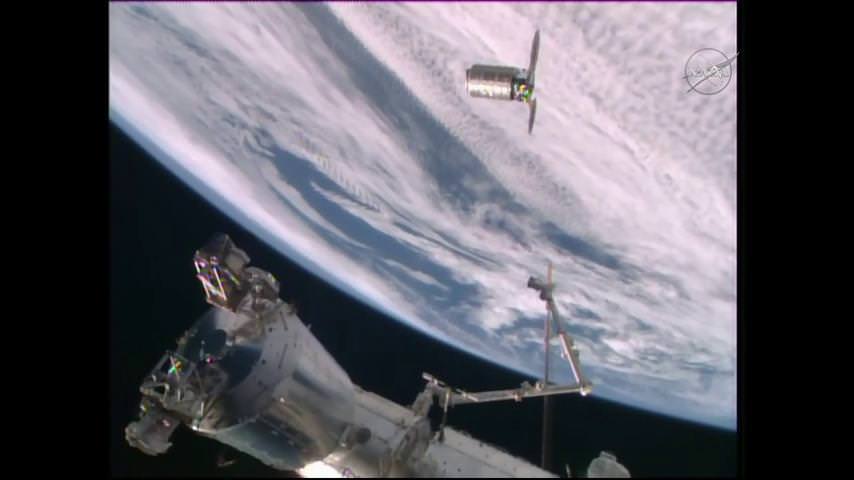
@OrbitalATK’s #Cygnus spacecraft is moving toward its capture point at the International Space Station as astronaut maneuver the Canadian-built robotic arm to reach out for dramatic vehicle grappling on Dec. 9, 2015. Credit: NASA TV
@OrbitalATK’s #Cygnus spacecraft is moving toward its capture point at the International Space Station as astronauts maneuver the Canadian-built robotic arm to reach out for dramatic vehicle grappling on Dec. 9, 2015. Credit: NASA TV
Story/photos updated
The commercial Cygnus cargo spaceship, loaded with over three tons of critically needed supplies and research experiments, successfully rendezvoused and docked with the International Space Station (ISS) this morning (Dec. 9) after blazing to orbit on Sunday, Dec. 6, and thereby successfully resumed the American resupply chain to orbit – just in time for Christmas in Space!
The Orbital ATK Cygnus CRS-4 resupply vessel arrived in the vicinity of the massive orbiting outpost around 530 a.m. EST today with pinpoint accuracy after precisely firing its maneuvering thrusters to home in on the complex during a two day orbital chase.
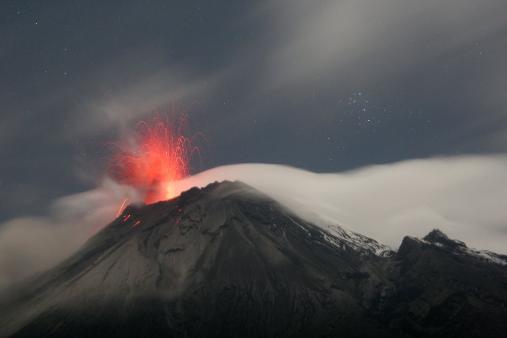
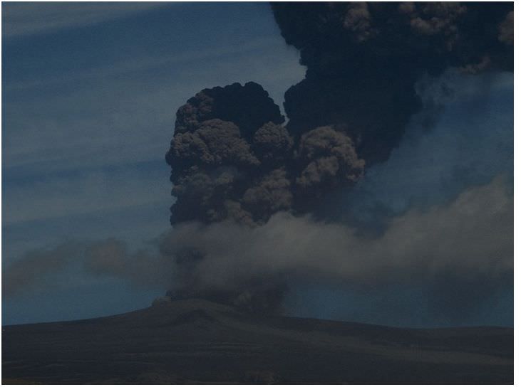
Tungurahua ("throat of fire"), an active stratovolcano in Ecuador. Credit: Patrick Taschler
Without a doubt, volcanoes are one of the most powerful forces of nature a person can bear witness to. Put simply, they are what results when a massive rupture takes place in the Earth’s crust (or any planetary-mass object), spewing hot lava, volcanic ash, and toxic fumes onto the surface and air. Originating from deep within the Earth’s crust, volcanoes leave a lasting mark on the landscape.
But what are the specific parts of a volcano? Aside from the “volcanic cone” (i.e. the cone-shaped mountain), a volcano has many different parts and layers, most of which are located within the mountainous region or deep within the Earth. As such, any true understanding of their makeup requires that we do a little digging (so to speak!)
While volcanoes come in a number of shapes and sizes, certain common elements can be discerned. The following gives you a general breakdown of a volcanoes specific parts, and what goes into making them such a titanic and awesome natural force.
Magma Chamber:
A magma chamber is a large underground pool of molten rock sitting underneath the Earth’s crust. The molten rock in such a chamber is under extreme pressure, which in time can lead to the surrounding rock fracturing, creating outlets for the magma. This, combined with the fact that the magma is less dense than the surrounding mantle, allows it to seep up to the surface through the mantle’s cracks.
Lava cooling after an eruption from Kilauea, a shield volcano near Kalapana, Hawaii Credit: kalapanaculturaltours.com
When it reaches the surface, it results in a volcanic eruption. Hence why many volcanoes are located above a magma chamber. Most known magma chambers are located close to the Earth’s surface, usually between 1 km and 10 km deep. In geological terms, this makes them part of the Earth’s crust – which ranges from 5–70 km (~3–44 miles) deep.
Lava:
Lava is the silicate rock that is hot enough to be in liquid form, and which is expelled from a volcano during an eruption. The source of the heat that melts the rock is known as geothermal energy – i.e. heat generated within the Earth that is leftover from its formation and the decay of radioactive elements. When lava first erupted from a volcanic vent (see below), it comes out with a temperature of anywhere between 700 to 1,200 °C (1,292 to 2,192 °F). As it makes contact with air and flows downhill, it eventually cools and hardens.
Main Vent:
A volcano’s main vent is the weak point in the Earth’s crust where hot magma has been able to rise from the magma chamber and reach the surface. The familiar cone-shape of many volcanoes are an indication of this, the point at which ash, rock and lava ejected during an eruption fall back to Earth around the vent to form a protrusion.
Throat:
The uppermost section of the main vent is known as the volcano’s throat. As the entrance to the volcano, it is from here that lava and volcanic ash are ejected.
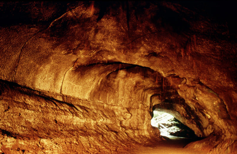
Thurston lava tube is located on Kilauea in Hawaii. Credit: P. Mouginis-Mark, LPI
Crater:
In addition to cone structures, volcanic activity can also lead to circular depressions (aka. craters) forming in the Earth. A volcanic crater is typically a basin, circular in form, which can be large in radius and sometimes great in depth. In these cases, the lava vent is located at the bottom of the crater. They are formed during certain types of climactic eruptions, where the volcano’s magma chamber empties enough for the area above it to collapse, forming what is known as a caldera.
Pyroclastic Flow:
Otherwise known as a pyroclastic density current, a pyroclastic flow refers to a fast-moving current of hot gas and rock that is moving away from a volcano. Such flows can reach speeds of up to 700 km/h (450 mph), with the gas reaching temperatures of about 1,000 °C (1,830 °F). Pyroclastic flows normally hug the ground and travel downhill from their eruption site.
Their speeds depend upon the density of the current, the volcanic output rate, and the gradient of the slope. Given their speed, temperature, and the way they flow downhill, they are one of the greatest dangers associated with volcanic eruptions and are one of the primary causes of damage to structures and the local environment around an eruption site.
Ash Cloud:
Volcanic ash consists of small pieces of pulverized rock, minerals and volcanic glass created during a volcanic eruption. These fragments are generally very small, measuring less than 2 mm (0.079 inches) in diameter. This sort of ash forms as a result of volcanic explosions, where dissolved gases in magma expand to the point where the magma shatters and is propelled into the atmosphere. The bits of magma then cool, solidifying into fragments of volcanic rock and glass.
Because of their size and the explosive force with which they are generated, volcanic ash is picked up by winds and dispersed up to several kilometers away from the eruption site. Due to this dispersal, ash an also have a damaging effect on the local environment, which includes negatively affecting human and animal health, disrupting aviation, disrupting infrastructure, and damaging agriculture and water systems. Ash is also produced when magma comes into contact with water, which causes the water to explosively evaporate into steam and for the magma to shatter.
Volcanic Bombs:
In addition to ash, volcanic eruptions have also been known to send larger projectiles flying through the air. Known as volcanic bombs, these ejecta are defined as those that measure more than 64mm (2.5 inches) in diameter, and which are formed when a volcano ejects viscous fragments of lava during an eruption. These cool before they hit the ground, are thrown many kilometers from the eruption site, and often acquire aerodynamic shapes (i.e. streamlined in form).
While the term applies to any ejecta larger than a few centimeters, volcanic bombs can sometimes be very large. There have been recorded instances where objects measuring several meters were retrieved hundreds of meters from an eruptions. Small or large, volcanic bombs are a significant volcanic hazard and can often cause serious damage and multiple fatalities, depending on where they land. Luckily, such explosions are rare.
Secondary Vent:
On large volcanoes, magma can reach the surface through several different vents. Where they reach the surface of the volcano, they form what is referred to as a secondary vent. Where they are interrupted by accumulated ash and solidified lava, they become what is known as a Dike. And where these intrude between cracks, pool and then crystallize, they form what is called a Sill.
Cross-section of a stratovolcano: 1. Magma chamber 2. Bedrock 3. Vent 4. Base 5. Sill 6. Dike 7. Layers of ash 8. Flank 9. Layers of lava 10. Throat 11. Parasitic cone 12. Lava flow 13. Vent 14. Crater 15. Ash cloud. Credit: MesserWoland
Secondary Cone:
Also known as a Parasitic Cone, secondary cones build up around secondary vents that reach the surface on larger volcanoes. As they deposit lava and ash on the exterior, they form a smaller cone, one that resembles a horn on the main cone.
Yes indeed, volcanoes are as powerful as they are dangerous. And yet, without these geological phenomena occasionally breaking through the surface and reigning down fire, smoke, and clouds of ash, the world as we know it would be a very different place. More than likely, it would be a geologically dead one, with no change or evolution in its crust. I think we can all agree that while such a world would be much safer, it would also be painfully boring!
Orbital ATK’s Cygnus Spacecraft carrying vital cargo to resupply the International Space Station lifts-off aboard a United Launch Alliance Atlas V rocket on Dec. 6, 2015. Credit: Ken Kremer/kenkremer.com
Orbital ATK’s Cygnus Spacecraft carrying vital cargo to resupply the International Space Station lifts-off aboard a United Launch Alliance Atlas V rocket. Credit: Ken Kremer/kenkremer.com
Story/photos updated
KENNEDY SPACE CENTER, FL – Today’s spectacular blastoff of a United Launch Alliance Atlas V rocket carrying an Orbital ATK Cygnus commercial resupply spacecraft ignited the restart of critically needed American cargo mission to the International Space Station (ISS) following a pair of launch failures over the past year.
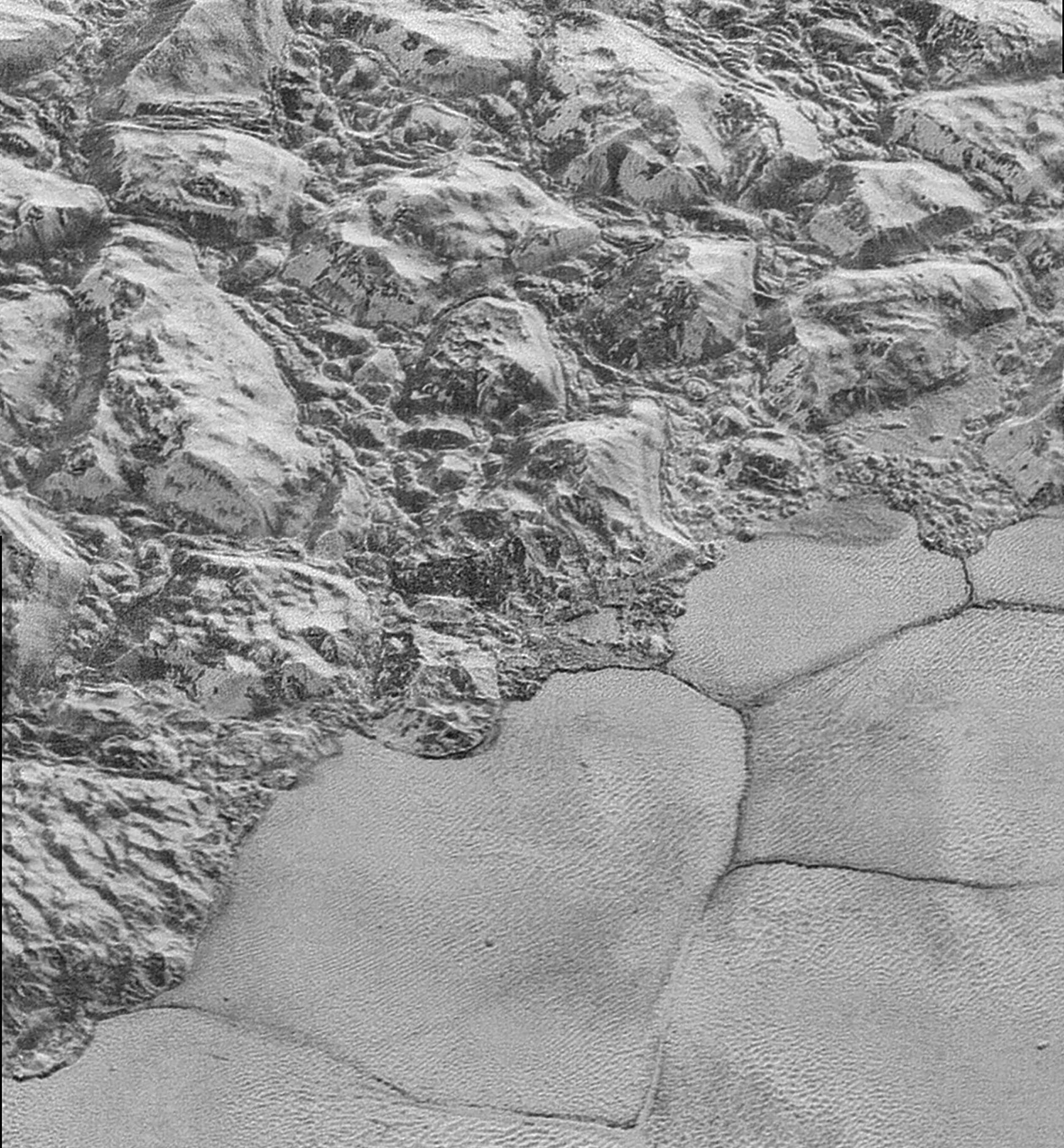
The Mountainous Shoreline of Sputnik Planum on Pluto. Great blocks of Pluto’s water-ice crust appear jammed together in the informally named al-Idrisi mountains. Some mountain sides appear coated in dark material, while other sides are bright. Credit: NASA/Johns Hopkins University Applied Physics Laboratory/Southwest Research Institute.
The New Horizons spacecraft has been slowly sending back all the images and data it gathered during its July flyby of the Pluto system. The latest batch of images to arrive here on Earth contains some of the highest resolution views yet that it captured of Pluto’s surface, taken during the spacecraft’s closest approach.
The images show a wide variety of spectacular craters, mountains and glaciers. The New Horizons team said the images have resolutions of about 250-280 feet (77-85 meters) per pixel – revealing features less than half the size of a city block on the diverse surface of the distant dwarf planet. The images are six times better than the resolution of the global Pluto map New Horizons obtained. Continue reading “Our Highest Resolution Views Yet of Pluto’s Surface”
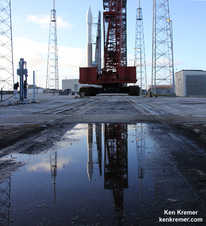
Reflection view of Orbital ATK Cygnus CRS-4 spacecraft poised for blastoff to ISS on ULA Atlas V on Dec. 5, 2015 from Cape Canaveral Air Force Station, Florida. Credit: Ken Kremer/kenkremer.com
Reflection view of Orbital ATK Cygnus CRS-4 spacecraft poised for blastoff to ISS on ULA Atlas V on Dec. 5, 2015 from Cape Canaveral Air Force Station, Florida. Credit: Ken Kremer/kenkremer.com
KENNEDY SPACE CENTER, FL – The unplanned ‘Happy Marriage’ of United Launch Alliance (ULA) and Orbital ATK is set to give birth Sunday, Dec. 6, to a Cygnus cargo freighter bound for the International Space Station (ISS).
Following two scrubs and a three day due to intense and wide spread rain squalls and excessive blustery winds, the third time is hopefully the charm for the Orbital ATK Cygnus resupply ship set for blastoff atop the venerable ULA Atlas V booster.
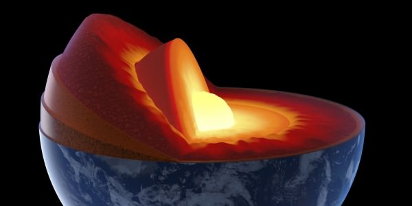
The Earth's layers, showing the Inner and Outer Core, the Mantle, and Crust. Credit: discovermagazine.com
There is more to the Earth than what we can see on the surface. In fact, if you were able to hold the Earth in your hand and slice it in half, you’d see that it has multiple layers. But of course, the interior of our world continues to hold some mysteries for us. Even as we intrepidly explore other worlds and deploy satellites into orbit, the inner recesses of our planet remains off limit from us.
However, advances in seismology have allowed us to learn a great deal about the Earth and the many layers that make it up. Each layer has its own properties, composition, and characteristics that affects many of the key processes of our planet. They are, in order from the exterior to the interior – the crust, the mantle, the outer core, and the inner core. Let’s take a look at them and see what they have going on.
Modern Theory:
Like all terrestrial planets, the Earth’s interior is differentiated. This means that its internal structure consists of layers, arranged like the skin of an onion. Peel back one, and you find another, distinguished from the last by its chemical and geological properties, as well as vast differences in temperature and pressure.
Our modern, scientific understanding of the Earth’s interior structure is based on inferences made with the help of seismic monitoring. In essence, this involves measuring sound waves generated by earthquakes, and examining how passing through the different layers of the Earth causes them to slow down. The changes in seismic velocity cause refraction which is calculated (in accordance with Snell’s Law) to determine differences in density.
Model of a flat Earth, with the continents modeled in a disk-shape and Antarctica as an ice wall. Credit: Wikipedia Commons
These are used, along with measurements of the gravitational and magnetic fields of the Earth and experiments with crystalline solids that simulate pressures and temperatures in the Earth’s deep interior, to determine what Earth’s layers looks like. In addition, it is understood that the differences in temperature and pressure are due to leftover heat from the planet’s initial formation, the decay of radioactive elements, and the freezing of the inner core due to intense pressure.
History of Study:
Since ancient times, human beings have sought to understand the formation and composition of the Earth. The earliest known cases were unscientific in nature – taking the form of creation myths or religious fables involving the gods. However, between classical antiquity and the medieval period, several theories emerged about the origin of the Earth and its proper makeup.
Most of the ancient theories about Earth tended towards the “Flat-Earth” view of our planet’s physical form. This was the view in Mesopotamian culture, where the world was portrayed as a flat disk afloat in an ocean. To the Mayans, the world was flat, and at it corners, four jaguars (known as bacabs) held up the sky. The ancient Persians speculated that the Earth was a seven-layered ziggurat (or cosmic mountain), while the Chinese viewed it as a four-side cube.
By the 6th century BCE, Greek philosophers began to speculate that the Earth was in fact round, and by the 3rd century BCE, the idea of a spherical Earth began to become articulated as a scientific matter. During the same period, the development of a geological view of the Earth also began to emerge, with philosophers understanding that it consisted of minerals, metals, and that it was subject to a very slow process of change.
Illustration of Edmond Halley’s model of a Hallow Earth, one that was made up of concentric spheres. Credit: Wikipedia Commons/Rick Manning
However, it was not until the 16th and 17th centuries that a scientific understanding of planet Earth and its structure truly began to advance. In 1692, Edmond Halley (discoverer of Halley’s Comet) proposed what is now known as the “Hollow-Earth” theory. In a paper submitted to Philosophical Transactions of Royal Society of London, he put forth the idea of Earth consisting of a hollow shell about 800 km thick (~500 miles).
Between this and an inner sphere, he reasoned there was an air gap of the same distance. To avoid collision, he claimed that the inner sphere was held in place by the force of gravity. The model included two inner concentric shells around an innermost core, corresponding to the diameters of the planets Mercury, Venus, and Mars respectively.
Halley’s construct was a method of accounting for the values of the relative density of Earth and the Moon that had been given by Sir Isaac Newton, in his Philosophiæ Naturalis Principia Mathematica (1687) – which were later shown to be inaccurate. However, his work was instrumental to the development of geography and theories about the interior of the Earth during the 17th and 18th centuries.
Another important factor was the debate during the 17th and 18th centuries about the authenticity of the Bible and the Deluge myth. This propelled scientists and theologians to debate the true age of the Earth, and compelled the search for evidence that the Great Flood had in fact happened. Combined with fossil evidence, which was found within the layers of the Earth, a systematic basis for identifying and dating the Earth’s strata began to emerge.
The growing importance of mining in the 17th and 18th centuries, particularly for precious metals, led to further developments in geology and Earth sciences. Credit: minerals.usgs.gov
The development of modern mining techniques and growing attention to the importance of minerals and their natural distribution also helped to spur the development of modern geology. In 1774, German geologist Abraham Gottlob Werner published Von den äusserlichen Kennzeichen der Fossilien (On the External Characters of Minerals) which presented a detailed system for identifying specific minerals based on external characteristics.
In 1741, the National Museum of Natural History in France created the first teaching position designated specifically for geology. This was an important step in further promoting knowledge of geology as a science and in recognizing the value of widely disseminating such knowledge. And by 1751, with the publication of the Encyclopédieby Denis Diderot, the term “geology” became an accepted term.
By the 1770s, chemistry was starting to play a pivotal role in the theoretical foundation of geology, and theories began to emerge about how the Earth’s layers were formed. One popular idea had it that liquid inundation, like the Biblical Deluge, was responsible for creating all the geological strata. Those who accepted this theory became known popularly as the Diluvianists or Neptunists.
Another thesis slowly gained currency from the 1780s forward, which stated that instead of water, strata had been formed through heat (or fire). Those who followed this theory during the early 19th century referred to this view as Plutonism, which held that the Earth formed gradually through the solidification of molten masses at a slow rate. These theories together led to the conclusion that the Earth was immeasurably older than suggested by the Bible.
HMS Beagle in the Galapagos Islands, painted by John Chancellor. Credit: hmsbeagleproject.otg
In the early 19th century, the mining industry and Industrial Revolution stimulated the rapid development of the concept of the stratigraphic column – that rock formations were arranged according to their order of formation in time. Concurrently, geologists and natural scientists began to understand that the age of fossils could be determined geologically (i.e. that the deeper the layer they were found in was from the surface, the older they were).
During the imperial period of the 19th century, European scientists also had the opportunity to conduct research in distant lands. One such individual was Charles Darwin, who had been recruited by Captain FitzRoy of the HMS Beagle to study the coastal land of South America and give geological advice.
Darwin’s discovery of giant fossils during the voyage helped to establish his reputation as a geologist, and his theorizing about the causes of their extinction led to his theory of evolution by natural selection, published in On the Origin of Species in 1859.
During the 19th century, the governments of several countries including Canada, Australia, Great Britain and the United States began funding geological surveys that would produce geological maps of vast areas of the countries. Thought largely motivated by territorial ambitions and resource exploitation, they did benefit the study of geology.
The Earth’s Tectonic Plates. Credit: msnucleus.org
By this time, the scientific consensus established the age of the Earth in terms of millions of years, and the increase in funding and the development of improved methods and technology helped geology to move farther away from dogmatic notions of the Earth’s age and structure.
By the early 20th century, the development of radiometric dating (which is used to determine the age of minerals and rocks), provided the necessary the data to begin getting a sense of the Earth’s true age. By the turn of the century, geologists now believed the Earth to be 2 billion years old, which opened doors for theories of continental movement during this vast amount of time.
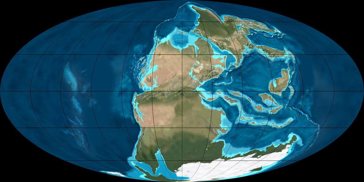
In 1912, Alfred Wegener proposed the theory of Continental Drift, which suggested that the continents were joined together at a certain time in the past and formed a single landmass known as Pangaea. In accordance with this theory, the shapes of continents and matching coastline geology between some continents indicated they were once attached together.
The super-continent Pangea during the Permian period (300 – 250 million years ago). Credit: NAU Geology/Ron Blakey
Research into the ocean floor also led directly to the theory of Plate Tectonics, which provided the mechanism for Continental Drift. Geophysical evidence suggested lateral motion of continents and that oceanic crust is younger than continental crust. This geophysical evidence also spurred the hypothesis of paleomagnetism, the record of the orientation of the Earth’s magnetic field recorded in magnetic minerals.
Then there was the development of seismology, the study of earthquakes and the propagation of elastic waves through the Earth or through other planet-like bodies, in the early 20th century. By measuring the time of travel of refracted and reflected seismic waves, scientists were able to gradually infer how the Earth was layered and what lay deeper at its core.
For example, in 1910, Harry Fielding Ried put forward the “elastic rebound theory”, based on his studies of the 1906 San Fransisco earthquake. This theory, which stated that earthquakes occur when accumulated energy is released along a fault line, was the first scientific explanation for why earthquakes happen, and remains the foundation for modern tectonic studies.
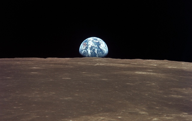
Earth viewed from the Moon by the Apollo 11 spacecraft. Credit: NASA
Then in 1926, English scientist Harold Jeffreys claimed that below the crust, the core of the Earth is liquid, based on his study of earthquake waves. And then in 1937, Danish seismologist Inge Lehmann went a step further and determined that within the earth’s liquid outer core, there is a solid inner core.
By the latter half of the 20th century, scientists developed a comprehensive theory of the Earth’s structure and dynamics had formed. As the century played out, perspectives shifted to a more integrative approach, where geology and Earth sciences began to include the study of the Earth’s internal structure, atmosphere, biosphere and hydrosphere into one.
This was assisted by the development of space flight, which allowed for Earth’s atmosphere to be studied in detail, as well as photographs taken of Earth from space. In 1972, the Landsat Program, a series of satellite missions jointly managed by NASA and the U.S. Geological Survey, began supplying satellite images that provided geologically detailed maps, and have been used to predict natural disasters and plate shifts.
Earth’s Layers:
The Earth can be divided into one of two ways – mechanically or chemically. Mechanically – or rheologically, meaning the study of liquid states – it can be divided into the lithosphere, asthenosphere, mesospheric mantle, outer core, and the inner core. But chemically, which is the more popular of the two, it can be divided into the crust, the mantle (which can be subdivided into the upper and lower mantle), and the core – which can also be subdivided into the outer core, and inner core.
The inner core is solid, the outer core is liquid, and the mantle is solid/plastic. This is due to the relative melting points of the different layers (nickel–iron core, silicate crust and mantle) and the increase in temperature and pressure as depth increases. At the surface, the nickel-iron alloys and silicates are cool enough to be solid. In the upper mantle, the silicates are generally solid but localized regions of melt exist, leading to limited viscosity.
In contrast, the lower mantle is under tremendous pressure and therefore has a lower viscosity than the upper mantle. The metallic nickel–iron outer core is liquid because of the high temperature. However, the intense pressure, which increases towards the inner core, dramatically changes the melting point of the nickel–iron, making it solid.
The differentiation between these layers is due to processes that took place during the early stages of Earth’s formation (ca. 4.5 billion years ago). At this time, melting would have caused denser substances to sink toward the center while less-dense materials would have migrated to the crust. The core is thus believed to largely be composed of iron, along with nickel and some lighter elements, whereas less dense elements migrated to the surface along with silicate rock.
Earth’s Crust:
The crust is the outermost layer of the planet, the cooled and hardened part of the Earth that ranges in depth from approximately 5-70 km (~3-44 miles). This layer makes up only 1% of the entire volume of the Earth, though it makes up the entire surface (the continents and the ocean floor).
The Earth’s layers (strata) shown to scale. Credit: pubs.usgs.gov
The thinner parts are the oceanic crust, which underlies the ocean basins at a depth of 5-10 km (~3-6 miles), while the thicker crust is the continental crust. Whereas the oceanic crust is composed of dense material such as iron magnesium silicate igneous rocks (like basalt), the continental crust is less dense and composed of sodium potassium aluminum silicate rocks, like granite.
The uppermost section of the mantle (see below), together with the crust, constitutes the lithosphere – an irregular layer with a maximum thickness of perhaps 200 km (120 mi). Many rocks now making up Earth’s crust formed less than 100 million (1×10⁸) years ago. However, the oldest known mineral grains are 4.4 billion (4.4×10⁹) years old, indicating that Earth has had a solid crust for at least that long.
Upper Mantle:
The mantle, which makes up about 84% of Earth’s volume, is predominantly solid, but behaves as a very viscous fluid in geological time. The upper mantle, which starts at the “Mohorovicic Discontinuity” (aka. the “Moho” – the base of the crust) extends from a depth of 7 to 35 km (4.3 to 21.7 mi) downwards to a depth of 410 km (250 mi). The uppermost mantle and the overlying crust form the lithosphere, which is relatively rigid at the top but becomes noticeably more plastic beneath.
Compared to other strata, much is known about the upper mantle, thanks to seismic studies and direct investigations using mineralogical and geological surveys. Movement in the mantle (i.e. convection) is expressed at the surface through the motions of tectonic plates. Driven by heat from deeper in the interior, this process is responsible for Continental Drift, earthquakes, the formation of mountain chains, and a number of other geological processes.
Computer simulation of the Earth’s field in a period of normal polarity between reversals. Credit: science.nasa.govThe mantle is also chemically distinct from the crust, in addition to being different in terms of rock types and seismic characteristics. This is due in large part to the fact that the crust is made up of solidified products derived from the mantle, where the mantle material is partially melted and viscous. This causes incompatible elements to separate from the mantle, with less dense material floating upward and solidifying at the surface.
The crystallized melt products near the surface, upon which we live, are typically known to have a lower magnesium to iron ratio and a higher proportion of silicon and aluminum. These changes in mineralogy may influence mantle convection, as they result in density changes and as they may absorb or release latent heat as well.
In the upper mantle, temperatures range between 500 to 900 °C (932 to 1,652 °F). Between the upper and lower mantle, there is also what is known as the transition zone, which ranges in depth from 410-660 km (250-410 miles).
Lower Mantle:
The lower mantle lies between 660-2,891 km (410-1,796 miles) in depth. Temperatures in this region of the planet can reach over 4,000 °C (7,230 °F) at the boundary with the core, vastly exceeding the melting points of mantle rocks. However, due to the enormous pressure exerted on the mantle, viscosity and melting are very limited compared to the upper mantle. Very little is known about the lower mantle apart from that it appears to be relatively seismically homogeneous.
The internal structure of Earth. Credit: Wikipedia Commons/Kelvinsong
Outer Core:
The outer core, which has been confirmed to be liquid (based on seismic investigations), is 2300 km thick, extending to a radius of ~3,400 km. In this region, the density is estimated to be much higher than the mantle or crust, ranging between 9,900 and 12,200 kg/m3. The outer core is believed to be composed of 80% iron, along with nickel and some other lighter elements.
Denser elements, like lead and uranium, are either too rare to be significant or tend to bind to lighter elements and thus remain in the crust. The outer core is not under enough pressure to be solid, so it is liquid even though it has a composition similar to that of the inner core. The temperature of the outer core ranges from 4,300 K (4,030 °C; 7,280 °F) in the outer regions to 6,000 K (5,730 °C; 10,340 °F) closest to the inner core.
Because of its high temperature, the outer core exists in a low viscosity fluid-state that undergoes turbulent convection and rotates faster than the rest of the planet. This causes eddy currents to form in the fluid core, which in turn creates a dynamo effect that is believed to influence Earth’s magnetic field. The average magnetic field strength in Earth’s outer core is estimated to be 25 Gauss (2.5 mT), which is 50 times the strength of the magnetic field measured on Earth’s surface.
Inner Core:
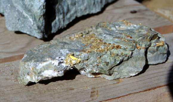
Like the outer core, the inner core is composed primarily of iron and nickel and has a radius of ~1,220 km. Density in the core ranges between 12,600-13,000 kg/m³, which suggests that there must also be a great deal of heavy elements there as well – such as gold, platinum, palladium, silver and tungsten.
Artist’s illustration of Earth’s core, inner core, and inner-inner core. Credit: Huff Post Science
The temperature of the inner core is estimated to be about 5,700 K (~5,400 °C; 9,800 °F). The only reason why iron and other heavy metals can be solid at such high temperatures is because their melting temperatures dramatically increase at the pressures present there, which ranges from about 330 to 360 gigapascals.
Because the inner core is not rigidly connected to the Earth’s solid mantle, the possibility that it rotates slightly faster or slower than the rest of Earth has long been considered. By observing changes in seismic waves as they passed through the core over the course of many decades, scientists estimate that the inner core rotates at a rate of one degree faster than the surface. More recent geophysical estimates place the rate of rotation between 0.3 to 0.5 degrees per year relative to the surface.
Recent discoveries also suggest that the solid inner core itself is composed of layers, separated by a transition zone about 250 to 400 km thick. This new view of the inner core, which contains an inner-inner core, posits that the innermost layer of the core measures 1,180 km (733 miles) in diameter, making it less than half the size of the inner core. It has been further speculated that while the core is composed of iron, it may be in a different crystalline structure that the rest of the inner core.
What’s more, recent studies have led geologists to conjecture that the dynamics of deep interior is driving the Earth’s inner core to expand at the rate of about 1 millimeter a year. This occurs mostly because the inner core cannot dissolve the same amount of light elements as the outer core.
The freezing of liquid iron into crystalline form at the inner core boundary produces residual liquid that contains more light elements than the overlying liquid. This in turn is believed to cause the liquid elements to become buoyant, helping to drive convection in the outer core. This growth is therefore likely to play an important role in the generation of Earth’s magnetic field by dynamo action in the liquid outer core. It also means that the Earth’s inner core, and the processes that drive it, are far more complex than previously thought!
Yes indeed, the Earth is a strange and mysteries place, titanic in scale as well as the amount of heat and energy that went into making it many billions of years ago. And like all bodies in our universe, the Earth is not a finished product, but a dynamic entity that is subject to constant change. And what we know about our world is still subject to theory and guesswork, given that we can’t examine its interior up close.
As the Earth’s tectonic plates continue to drift and collide, its interior continues to undergo convection, and its core continues to grow, who knows what it will look like eons from now? After all, the Earth was here long before we were, and will likely continue to be long after we are gone.
When humans finally blast off for another world, where will we be going? Will we return to the Moon, and take over where the Apollo astronauts left off, or will we press onto Mars, and set foot on a whole new planet?
Humanity is going to need to make a difficult choice in the next few years. One that will have implications for the very future of space exploration: classic Star Wars or the new Trilogy? Star Trek fans feel your pain.
But also, we’ll need to figure out whether we should push on with the human exploration of Mars, so that Mark Watney can fulfill his potato destiny, or return to the Moon and build Moonbase Alpha. It’s surprisingly difficult to choose.
First, the case for the Moon. Obviously, the Moon is close. It’s just a few hundred thousand kilometers away, and it only takes astronauts a few days to get there, land on the surface and continue our scientific exploration of this world – which we still know very little about.
Why is the far side so different from the near side? Are there lava tubes and even vast underground caverns that future colonists could live in? It would be great to get more geologist boots on the regolith to find out.
Although it’s expensive, going to the Moon could eventually pay for itself. There are vast reserves of Helium-3 just sitting on the surface of the Moon. This material is rare on Earth, and could be used for future fusion energy planets. Not to mention other valuable minerals and elements that might just be lying around, ready for collection and used for space-based manufacturing.
The Moon makes sense as a testing ground, for humanity to perfect the techniques of surviving and thriving off planet Earth. If we can make it there, then we stand a chance of going the distance as a true interplanetary species.
The big problem with the Moon is that it’s completely inhospitable to human life. There’s no atmosphere, no protection from the Sun’s radiation, enormous temperature variations and a gravity so low it could be lethal over the long term.
The lunar regolith is like tiny shards of glass that would get everywhere, into everything, and be a constant danger to anyone living on the Moon.You couldn’t imagine a worse place to live.
The Moon is close but it sucks, what about Mars? Mars is much much farther than the Moon; the average distance to Mars is about 225 million kilometers.
Mars, as photographed with the Mars Global Surveyor, is identified with the Roman god of war. Credit: NASA
This means that a journey to Mars with even a short visit to the surface will take the better part of 2 years. Astronauts will be beyond any kind of rescue and completely reliant on their spacecraft and supplies for that entire journey.
During their voyage, they’ll be bombarded with radiation from the Sun and there’ll be no protection on the surface on the planet either, because Mars doesn’t have a global magnetosphere like Earth.
But once they do get to Mars, they’ll have a world that’s much more earthlike. The temperatures are extreme, but can be reasonable at the equator, in the middle of the day. There’s a slight atmosphere, and stronger gravity – maybe your bones won’t waste away if you spend too long there.
To say there’s science to be done on Mars is an understatement. There are so many different terrains, with different geologic features. There’s the outstanding question of whether there was ever life on Mars, and if it’s there now. We’d really like to know the answer.
The Martian regolith is smoother and safer than the lunar version, having been weathered down by wind over millennia. It would still get everywhere, but it wouldn’t give you lung disease.
We now know there are vast reserves of water under the surface of Mars, and astronauts will be able to use this for all kinds of projects, like growing plants, drinking water, breathable atmosphere and even rocket fuel.
Venus imaged by Magellan Image Credit: NASA/JPL
Sending humans to Mars is much more complicated and expensive than sending them to the Moon, and the level of space-based infrastructure would be much greater. Assuming we did this right, we’d have much more technology and a stronger presence in space.
Both Mars and the Moon have their pros and cons, but there’s another world that you might want to consider: Venus.
Although Venus is mostly a terrible hellscape, completely worthless down on the surface, where it’s hot enough to melt lead, and the atmospheric pressure is as bad as being a kilometer under the ocean. Did I mention it rains sulphuric acid?
But high up in the cloud tops of Venus, around 50 km altitude, the evil planet becomes downright habitable. You wouldn’t need to wear a spacesuit to regulate the delightful room temperature atmosphere. And you wouldn’t need a pressure suit, because it’s already perfect Earth pressure. You would, however, still need to worry about the sulphuric acid rain. And unless you’ve evolved to breathe carbon dioxide, you’ll need to keep a supply of oxygen handy.
NASA has already proposed sending dirigibles to Venus, filled with our breathable atmosphere for buoyancy, to explore. So maybe the next planet we set foot on, will be the one that we can never set foot on. Hmm, that sounded better in my brain.
You know what, I can’t choose. We should go back to the Moon, we should send humans to Mars, and we should explore Venus too. No matter where we go in the Solar System, it’s going to be an enormous undertaking. We’re going to need to develop new technologies, and risk the lives of everyone involved. But the rewards will be great, moving us one huge leap towards becoming a true interplanetary species.
So now it’s time for you to decide. The fate of humanity rests on your shoulders. Should we press on to Mars, or focus our energy on the Moon or even Venus? Give us your suggestions in the comments below.
Orbital ATK Cygnus spacecraft poised for blastoff to ISS on ULA Atlas V on Dec. 3, 2015 from Cape Canaveral Air Force Station, Florida. Credit: Ken Kremer/kenkremer.com
Orbital ATK Cygnus CRS-4 spacecraft poised for blastoff to ISS on ULA Atlas V on Dec. 3, 2015 from Cape Canaveral Air Force Station, Florida. Credit: Ken Kremer/kenkremer.com
KENNEDY SPACE CENTER, FL – In the shadow of the spanking new commercial crew access tower that our astronauts will soon ascend to restore America’s human access to space, the first ever Atlas V rocket that will launch a commercial Cygnus cargo freighter to the International Space Station (ISS) is poised for blastoff on Thursday, December 3, from the Florida Space Coast and resume the train of critically needed American cargo launches to the orbiting science laboratory.
The stakes are high for NASA and the ISS partners following a string of three cargo mission mishaps over the past year resulting from a trio of launch failures by both US and Russian rocket providers involving Orbital ATK, SpaceX and Roscosmos.
According to a new study, EDLS hardware that has been jettisoned on Mars could create problems for future missions to the same landing sites. Credit: NASA
On future missions, a silver, metallic-based thermal control coating will be bonded to the Orion crew module’s back shell tiles. Credit: NASA
In the wake of NASA’s supremely successful inaugural test flight of the Oriondeep space capsule on the EFT-1 mission in Dec. 2014, NASA is beefing up the critical thermal protection system (TPS) that will protect astronauts from the searing heats experienced during reentry as the human rated vehicle plunges through the Earth’s atmosphere after returning from ambitious expeditions to the Moon and beyond.
Based in part on lessons learned from EFT-1, engineers are refining Orion’s heat shield to enhance the design, ease manufacturing procedures and significantly strengthen is heat resistant capabilities for the far more challenging space environments and missions that lie ahead later this decade and planned further out in the future as part of NASA’s agency-wide ‘Journey to Mars’ initiative to send humans to the Red Planet in the 2030s.


![Computer simulation of the Earth's field in a period of normal polarity between reversals.[1] The lines represent magnetic field lines, blue when the field points towards the center and yellow when away. The rotation axis of the Earth is centered and vertical. The dense clusters of lines are within the Earth's core](https://www.universetoday.com/wp-content/uploads/2010/03/Geodynamo_Between_Reversals-e1449100829326.gif)