Mars 2020 Rover is Going to be Taking a Chunk of Mars Back to… Mars?

This artist's rendition depicts NASA's Mars 2020 rover studying its surroundings. Credit: NASA

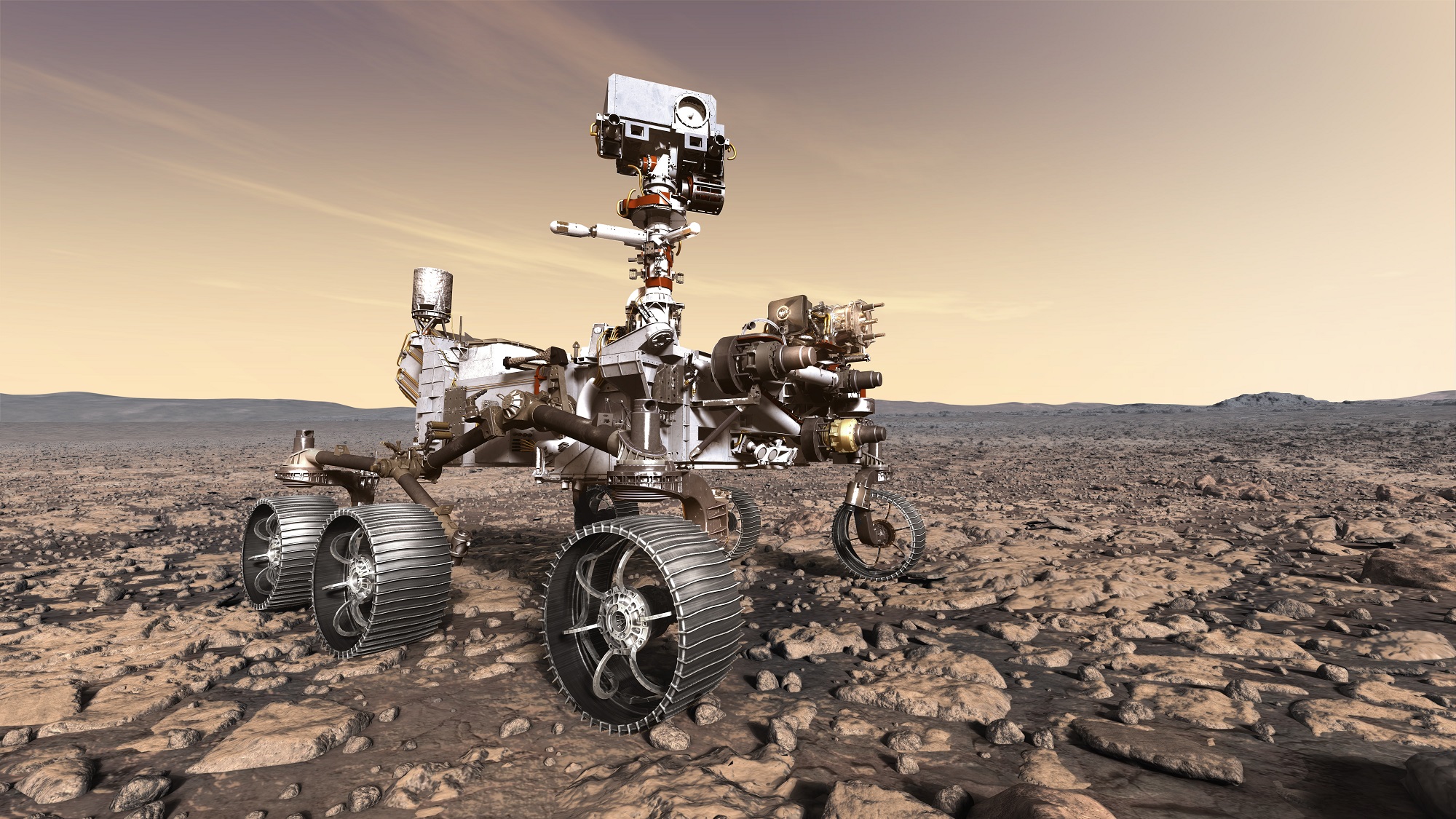
In July of 2020, the Mars 2020 rover – the latest from NASA’s Mars Exploration Program – will begin its long journey to the Red Planet. Hot on the heels of the Opportunity and Curiosity rovers, the Mars 2020 rover will attempt to answer some of the most pressing questions we have about Mars. Foremost among these is whether or not the planet had habitable conditions in the past, and whether or not microbial life existed there.

To this end, the Mars 2020 rover will obtain drill samples of Martian rock and set them aside in a cache. Future crewed missions may retrieve these samples and bring them back to Earth for analysis. However, in a recent announcement, NASA indicated that a piece of a Martian meteor will accompany the Mars 2020 rover back to Mars, which will be used to calibrate the rover’s high-precious laser scanner.

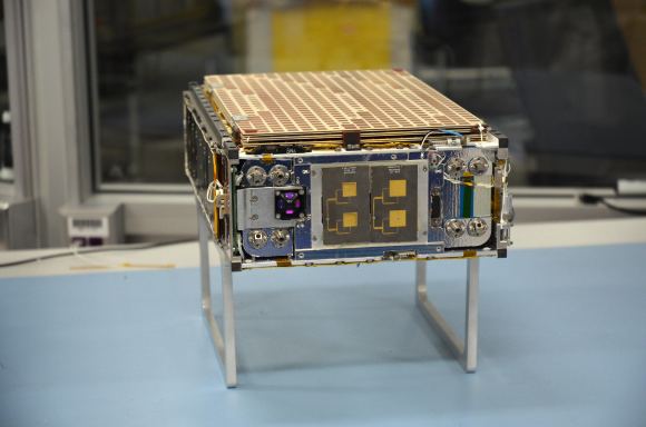
This laser scanner is known as the Scanning Habitable Environments with Raman and Luminescence for Organics and Chemicals (SHERLOC) instrument. The laser’s resolution is capable of illuminating even the finest features in rock samples, which could include fossilized microorganisms. But in order to achieve this, the laser requires a calibration target so that the science team can fine-tune its settings.

Mounted on the rover’s robotic arm, SHERLOC uses spectrometers, a laser and a camera to search for organics and minerals that have been altered by watery environments and may be signs of past microbial life. Credit: NASA

Ordinarily, these calibration targets involve pieces of rock, metal or glass, samples that are the result of a complex geological history. However, when addressing the SHERLOC’s calibration needs, JPL scientists came up with a rather innovative idea. For billions of years, Mars has experienced impacts that have sent pieces of its surface into orbit. In some cases, those pieces came to Earth in the form of meteorites, some of which have been identified.

While these meteorites are rare and not identical to the geologically diverse samples the Mars 2020 rover will collect, they are well-suited for target practice. As Luther Beegle of JPL, the principle investigator for SHERLOC, said in a recent NASA press statement:

“We’re studying things on such a fine scale that slight misalignments, caused by changes in temperature or even the rover settling into sand, can require us to correct our aim. By studying how the instrument sees a fixed target, we can understand how it will see a piece of the Martian surface.”

In this respect, the Mars 2020 rover is in good company. For example, Curiosity’s used its Chemistry and Camera (ChemCham) instrument – which relies on laser-induced breakdown spectroscopy (LIBS) – to determine the elemental compositions of rock and soil samples it has obtained. Similarly, the Opportunity rover’s Miniature Thermal Emission Spectrometer (Mini-TES) allowed this rover to detect the composition of rocks from a distance.

Rohit Bhartia of NASA’s Mars 2020 mission holds a slice of a meteorite scientists have determined came from Mars. Credit: NASA/JPL-Caltech

However, SHERLOC is unique in that it will be the first instrument deployed to Mars that uses Raman and fluorescence spectroscopy. Raman spectroscopy consists of subjecting materials to light in the visible, near infrared, or near ultraviolet range and measuring how the photons respond. Based on how their energy levels shift up or down, scientists are able to determine the presence of certain elements.

Fluorescence spectroscopy relies on ultraviolet lasers to excite the electrons in carbon-based compounds, which causes chemicals that are known to form in the presence of life (i.e. biosignatures) to glow. SHERLOC will also photograph the rocks it studies, which will allow the science team to map the chemical signatures it finds across the surface of Mars.

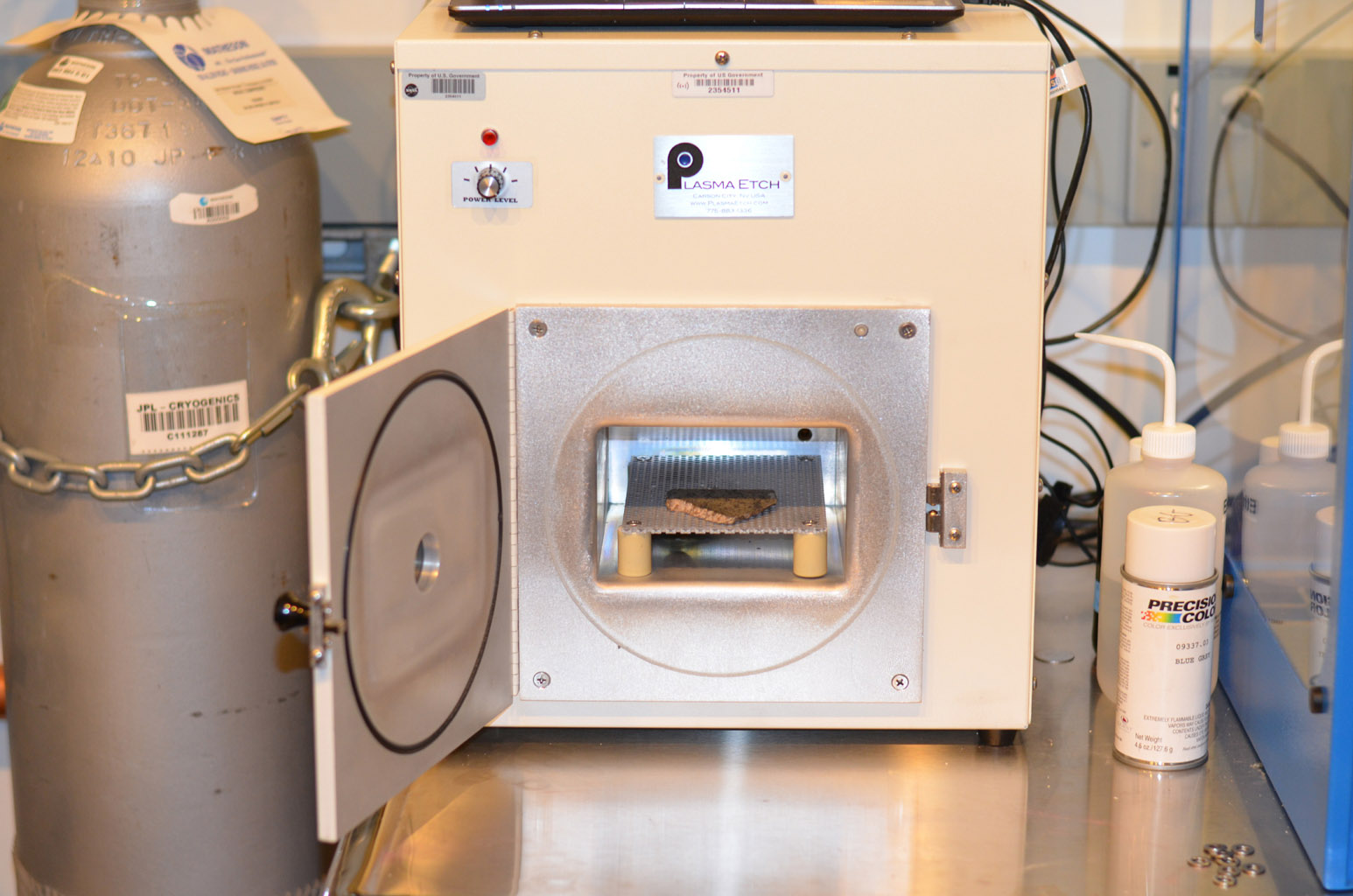
For their purposes, the SHERLOC team needed a sample that would be solid enough to withstand the intense vibrations caused by launch and landing. They also needed one that contained the right chemicals to test SHERLOC’s sensitivity to biosignatures. With the help of the Johnson Space Center and the Natural History Museum in London, they ultimately decided on a sample from the Sayh al Uhaymir 008 meteorite (aka. SaU008).

This meteorite, which was found in Oman in 1999, was more rugged that other samples and could be sliced without the rest of the meteorite flaking. As a result, SaU008 will be the first Martian meteorite sample that helps scientists look for past signs of life on Mars. It will also be the first Martian meteorite to have a piece of itself returned to the surface of Mars – though technically not the first to be sent back.

A slice of a meteorite scientists have determined came from Mars placed inside an oxygen plasma cleaner, which removes organics from the outside of surfaces. Credit: NASA/JPL-Caltech

That honor goes to Zagami, a meteorite retrieved in Nigeria in 1962, which had a piece of itself sent back to Mars aboard the Mars Global Surveyor (MGS) in 1999. That mission ended in 2007, so this chunk has been floating around in orbit of Mars ever since. In addition, the team behind Mars 2020‘s SuperCam instrument will also be adding a Martian meteorite for their own calibration tests.

Along with bits of SaU008, the Mars 2020 payload will include samples of advanced materials. Aside from also being used to calibrate SHERLOC, these materials will be tested to see how they hold up to Martian weather and radiation. If they prove to be tough enough to survive on the Martian surface, these materials could be used in the manufacture of space suits, gloves and helmets for future astronauts.

As Marc Fries, a SHERLOC co-investigator and curator of extraterrestrial materials at Johnson Space Center, put it:

“The SHERLOC instrument is a valuable opportunity to prepare for human spaceflight as well as to perform fundamental scientific investigations of the Martian surface. It gives us a convenient way to test material that will keep future astronauts safe when they get to Mars.”

With every robotic mission sent to Mars, NASA and other space agencies are working towards the day when astronauts’ boots will finally touch down on the Red Planet. When the first crewed mission to Mars are conducted (currenty scheduled for the 2030s), they will be following in the tracks of some truly intrepid robotic explorers!

Further Reading: NASA

James Webb Makes The Journey From Houston To Los Angeles; Last Stop Before It Heads To The Launch Facility In 2019

A look inside the cavernous cargo hold of the C5 aircraft that carried the James Webb to California. Image: NASA/Chris Gunn

The two halves of the James Webb Space Telescope are now in the same location and ready to take the next step on JWST’s journey. On February 2nd, Webb’s Optical Telescope and Integrated Science instrument module (OTIS) arrived at Northrop Grumman Aerospace Systems in Redondo Beach, California. The integrated spacecraft, consisting of the spacecraft bus and sunshield, were already there, waiting for OTIS so they could join together and become a complete spacecraft.

“The team will begin the final stages of integration of the world’s largest space telescope.” – Scott Willoughby, Northrop Grumman’s Program Manage for the JWST.

“It’s exciting to have both halves of the Webb observatory – OTIS and the integrated spacecraft element – here at our campus,” said Scott Willoughby, vice president and program manager for Webb at Northrop Grumman. “The team will begin the final stages of integration of the world’s largest space telescope.”

The Space Telescope for Air, Road, and Sea (STTARS) is a custom-designed container that holds the James Webb’s Optical Telescope and Integrated Science (OTIS) instrument module. In this image its being unloaded from a U.S. military C-5 Charlie aircraft at Los Angeles International Airport (LAX) on Feb. 2, 2018. Image: NASA/Chris Gunn

OTIS arrived from the Johnson Space Center in Houston, where it had successfully completed its cryogenic testing. To prepare for that journey, OTIS was placed inside a custom shipping container designed to protect the delicate and expensive Webb Telescope from any damage. That specially designed container is called the Space Telescope Transporter for Air, Road and Sea (STTARS).

STTARS is a massive container, measuring 4.6 meters (15 feet) wide, 5.2 meters (17 feet) tall, and 33.5 meters feet (110) long, and weighing approximately 75,000 kilograms (almost 165,000 pounds). It’s much larger than the James Webb itself, but even then, the primary mirror wings and the secondary mirror tripod must be folded into flight configuration in order to fit.

The Space Telescope Transporter for Air, Road and Sea (STTARS) NASA’s at Johnson Space Center in Houston. Image: NASA/Chris Gunn

The next step for the JWST is to join the spacecraft itself with OTIS. Once that happens, JWST will be complete and fully integrated. Then there’ll be more tests called observatory-level testing. After that, another journey inside STTARS to Kouru, French Guiana, where the JWST will be launched in 2019.

“This is a major milestone.” – Eric Smith, director of the James Webb Space Telescope Program at NASA.

“This is a major milestone,” said Eric Smith, director of the James Webb Space Telescope Program at NASA. “The Webb observatory, which is the work of thousands of scientists and engineers across the globe, will be carefully tested to ensure it is ready to launch and enable scientists to seek the first luminous objects in the universe and search for signs of habitable planets.”

You can’t fault people, either NASA personnel or the rest of us, for getting excited about each development in the James Webb Space Telescope story. Every time the thing twitches or moves, our excitement re-spawns. It seems like everything that happens with the JWST is now a milestone in its long, uncertain journey. It’s easy to see why.

The Space Telescope That Almost Wasn’t

The James Webb ran into a lot of problems during its development. As can be expected for a ground-breaking, technology-pushing project like the Webb, it’s expensive. In 2011, when the project was well underway, it was revealed that the Webb would cost $8.8 billion, much more than the initial budget of $1.6 billion. The House of Representatives cancelled the project, then restored it, though funding was capped at $8 billion.

That was the main hurdle facing the development of the JWST, but there were others, including timeline delays. The most recent timeline change moved the launch date from 2017 to Spring 2019. As of now, the James Webb is on schedule, and on target to meet its revised budget.

The First “Super Telescope”

The JWST is the first of the “Super Telescopes” to be in operation. Once it’s in place at LaGrange Point 2 (L2), about 1.5 million km (930,000 miles) from Earth, it will begin observing, primarily in infrared. It will surpass both the Hubble Telescope and the Spitzer Telescope, and will “look back in time” to some of oldest stars and galaxies in the universe. It will also examine exoplanets and contribute to the search for life.

Now That NASA’s Missing IMAGE Satellite Has Been Found, Talking To It Is Going To Be Difficult

This picture shows NASA's IMAGE spacecraft undergoing launch preparations in early 2000. Credit: NASA

It’s easy to imagine the excitement NASA personnel must have felt when an amateur astronomer contacted NASA to tell them that he might have found their missing IMAGE satellite. After all, the satellite had been missing for 10 years.

IMAGE, which stands for Imager for Magnetopause-to-Aurora Global Exploration, was launched on March 25th, 2000. In Dec. 2005 the satellite failed to make routine contact, and in 2007 it failed to reboot. After that, the mission was declared over.

NASA’s IMAGE satellite. Credit: NASA

It’s astonishing that after 10 years, the satellite has been found. It’s even more astonishing that it was an amateur who found it. As if the story couldn’t get any more interesting, the amateur astronomer who found it—Scott Tilly of British Columbia, Canada—was actually looking for a different missing satellite: the secret ZUMA spy satellite launched by the US government on January 7, 2018. (If you’re prone to wearing a tin foil hat, now might be a good time to reach for one.)

NASA’s half-ton IMAGE satellite being launched from Vandenberg Air Force Base on March 25th, 2000. IMAGE was the first satellite designed to actually “see” most of the major charged particle systems in the space surrounding Earth. Image: NASA

After Tilly contacted NASA, they hurried to confirm that it was indeed IMAGE that had been found. To do that, NASA employed 5 separate antennae to seek out any radio signals from the satellite. As of Monday, Jan. 29, signals received from all five sites were consistent with the radio frequency characteristics expected of IMAGE.

In a press release, NASA said, “Specifically, the radio frequency showed a spike at the expected center frequency, as well as side bands where they should be for IMAGE. Oscillation of the signal was also consistent with the last known spin rate for IMAGE.”

“…the radio frequency showed a spike at the expected center frequency…” – NASA Press Release confirming the discovery of IMAGE

Then, on January 30, the Johns Hopkins Applied Physics Lab (JHUAPL) reported that they had successfully collected telemetry data from the satellite. In that signal was the ID code 166, the code for IMAGE. There were probably some pretty happy people at NASA.

So, now what?

A diagram of NASA’s IMAGE satellite. Image: NASA

NASA’s next step is to confirm without a doubt that this is indeed IMAGE. That means capturing and analyzing the data in the signal. That will be a technical challenge, because the types of hardware and operating systems used in the IMAGE Mission Operations Center no longer exist. According to NASA, “other systems have been updated several versions beyond what they were at the time, requiring significant reverse-engineering.” But that should be no problem for NASA. After all, they got Apollo 13 home safely, didn’t they?

If NASA is successful at decoding the data in the signal, the next step is to attempt to turn on IMAGE’s science payload. NASA has yet to decide how to proceed if they’re successful.

IMAGE was the first spacecraft designed to “see the invisible,” as they put it back then. Prior to IMAGE, spacecraft examined Earth’s magnetosphere by detecting particles and fields they encountered as they passed through them. But this method had limited success. The magnetosphere is enormous, and simply sampling a small path—while better than nothing—did not give us an accurate understanding of it.

During its mission, IMAGE did a lot of great science. In July 2000, a spectacular solar storm caused auroras as far south as Mexico. IMAGE captured these images of those poweful auroras. Credit: NASA

IMAGE was going to do things differently. It used 3-dimensional imaging techniques to measure simultaneously the densities, energies and masses of charged particles throughout the inner magnetosphere. To do this, IMAGE carried a payload of 7 instruments:

  • High Energy Neutral Atom (HENA) imager
  • Medium Energy Neutral Atom (MENA) imager
  • Low Energy Neutral Atom (LENA) imager
  • Extreme Ultraviolet (EUV) imager
  • Far Ultraviolet (FUV) imager
  • Radio Plasma Imager (RPI)
  • Central Instrument Data Processor (CIDP)

These instruments allowed IMAGE to not only do great science, and to capture great images, but also to create some stunning never-seen-before movies of auroral activity.

This is a fascinating story, and it’ll be interesting to see if NASA can establish meaningful contact with IMAGE. Will it have a treasure trove of unexplored data on-board? Can it be re-booted and brought back into service? We’ll have to wait and see.

This story is also interesting culturally. IMAGE was in service at a time when the internet wasn’t as refined as it is currently. NASA has mastered the internet and public communications now, but back then? Not so much. For example, to build up interest around the mission, NASA gave IMAGE its own theme song, titled “To See The Invisible.” Yes, seriously.

But that’s just a side-note. IMAGE was all about great science, and it accomplished a lot. You can read all about IMAGE’s science achievements here.

Icy Worlds Like Europa and Enceladus Might Actually be too Soft to Land On

The moons of Europa and Enceladus, as imaged by the Galileo and Cassini spacecraft. Credit: NASA/ESA/JPL-Caltech/SETI Institute

Some truly interesting and ambitious missions have been proposed by NASA and other space agencies for the coming decades. Of these, perhaps the most ambitious include missions to explore the “Ocean Worlds” of the Solar System. Within these bodies, which include Jupiter’s moon Europa and Saturn’s moon Enceladus, scientists have theorized that life could exist in warm-water interior oceans.

By the 2020s and 2030s, robotic missions are expected to reach these worlds and set down on them, sampling ice and exploring their plumes for signs of biomarkers. But according to a new study by an international team of scientists, the surfaces of these moons may have extremely low-density surfaces. In other words, the surface ice of Europa and Enceladus could be too soft to land on.

The study, titled “Laboratory simulations of planetary surfaces: Understanding regolith physical properties from remote photopolarimetric observations“, was recently published in the scientific journal Icarus. The study was led by Robert M.Nelson, the Senior Scientist at the Planetary Science Institute (PSI) and included members from NASA’s Jet Propulsion Laboratory, the California Polytechnic State University at Pomona, and multiple universities.

Artist’s rendering of a possible Europa Lander mission, which would explore the surface of the icy moon in the coming decades. Credit: NASA/JPL-Caltech

For the sake of their study, the team sought to explain the unusual negative polarization behavior at low phase angles that has been observed for decades when studying atmosphereless bodies. This  polarization behavior is thought to be the result of extremely fine-grained bright particles. To simulate these surfaces, the team used thirteen samples of aluminum oxide powder (Al²O³).

Aluminum oxide is considered to be an excellent analog for regolith found on high aldebo Airless Solar System Bodies (ASSB), which include Europa and Encedalus as well as eucritic asteroids like 44 Nysa and 64 Angelina.  The team then subjected these samples to photopolarimetric examinations using the goniometric photopolarimeter at Mt. San Antonio College.

What they found was that the bright grains that make up the surfaces of Europa and Enceladus would measure about a fraction of a micron and have a void space of about 95%. This corresponds to material that is less dense than freshly-fallen snow, which would seem to indicate that these moon’s have very soft surfaces.  Naturally, this does not bode well for any missions that would attempt to set down on Europa or Enceladus’ surface.

But as Nelson explained in PSI press release, this is not necessarily bad news, and such fears have been raised before:

“Of course, before the landing of the Luna 2 robotic spacecraft in 1959, there was concern that the Moon might be covered in low density dust into which any future astronauts might sink. However, we must keep in mind that remote visible-wavelength observations of objects like Europa are only probing the outermost microns of the surface.”

Enceladus in all its glory. NASA has announced that Enceladus, Saturn’s icy moon, has hydrogen in its oceans. Image: NASA/JPL/Space Science Institute

So while Europa and Enceladus may have surfaces with a layer of low-density ice particles, it does not rule out that their outer shells are solid. In the end, landers may be forced to contend with nothing more than a thin sheet of snow when setting down on these worlds. What’s more, if these particles are the result of plume activity or action between the interior and the surface, they could hold the very biomarkers the probes are looking for.

Of course, further studies are needed before any robotic landers are sent to bodies like Europa and Enceladus. In the coming years, the James Webb Space Telescope will be conducting studies of these and other moons during its first five months in service. This will include producing maps of the Galilean Moons, revealing things about their thermal and atmospheric structure, and searching their surfaces for signs of plumes.

The data the JWST obtains with its advanced suite of spectroscopic and near-infrared instruments will also provide additional constraints on their surface conditions. And with other missions like the ESA’s proposed Europa Clipper conducting flybys of these moons, there’s no shortage to what we can learn from them.

Beyond being significant to any future missions to ASSBs, the results of this study are also likely to be of value when it comes to the field of terrestrial geo-engineering. Essentially, scientists have suggested that anthropogenic climate change could be mitigated by introducing aluminum oxide into the atmosphere, thus offsetting the radiation absorbed by greenhouse gas emissions in the upper atmosphere. By examining the properties of these grains, this study could help inform future attempts to mitigate climate change.

This study was made possible thanks in part to a contract provided by NASA’s Jet Propulsion Laboratory to the PSI. This contract was issued in support of the NASA Cassini Saturn Orbiter Visual and Infrared Mapping Spectrometer instrument team.

Further Reading: Planetary Science Institute, Icarus

NASA’s Insight Lander Spreads Its Solar Wings. It’ll Fly To Mars In May, 2018

The Insight lander responds to commands to spread its solar arrays during a January 23, 2018 test at the Lockheed Martin clean room in Littleton, Colorado. Image: Lockheed Martin Space

May 2018 is the launch window for NASA’s next mission to Mars, the InSight Lander. InSight is the next member of what could be called a fleet of human vehicles destined for Mars. But rather than working on the question of Martian habitability or suitability for life, InSight will try to understand the deeper structure of Mars.

InSight stands for Interior Exploration using Seismic Investigations, Geodesy and Heat Transport. InSight will be the first robotic explorer to visit Mars and study the red planet’s deep interior. The work InSight does should answer questions about the formation of Mars, and those answers may apply to the history of the other rocky planets in the Solar System. The lander, (InSight is not a rover) will also measure meteorite impacts and tectonic activity happening on Mars currently.

This video helps explain why Mars is a good candidate to answer questions about how all our rocky planets formed, not just Mars itself.

InSight was conceived as part of NASA’s Discovery Program, which are missions focused on important questions all related to the “content, origin, and evolution of the solar system and the potential for life elsewhere”, according to NASA. Understanding how our Solar System and its planets formed is a key part of the Discovery Program, and is the question InSight was built to answer.

This artist's illustration of InSight on a photo background of Mars shows the lander fully deployed. The solar arrays are open, and in the foreground two of its instruments are shown. On the left is the SEIS instrument, and on the right is the HP3 probe. Image: NASA/Lockheed Martin
This artist’s illustration of InSight on a photo background of Mars shows the lander fully deployed. The solar arrays are open, and in the foreground two of its instruments are shown. On the left is the SEIS instrument, and on the right is the HP3 probe. Image: NASA/Lockheed Martin

To do its work, InSight will deploy three instruments: SEIS, HP³, and RISE.

SEIS

This is InSight’s seismic instrument, designed to take the Martian pulse. It stands for Seismic Experiment for Internal Structure.

In this image, InSight's Instrument Deployment Arm is practicing placing SEIS on the surface. Image: NASA/Lockheed Martin
In this image, InSight’s Instrument Deployment Arm is practicing placing SEIS on the surface. Image: NASA/Lockheed Martin

SEIS sits patiently under its dome, which protects it from Martian wind and thermal effects, and waits for something to happen. What’s it waiting for? For seismic waves caused by Marsquakes, meteorite impacts, or by the churning of magma deep in the Martian interior. These waves will help scientists understand the nature of the material that first formed Mars and the other rocky planets.

HP³

HP³ is InSight’s heat probe. It stands for Heat Flow and Physical Properties Probe. Upon deployment on the Martian surface, HP³ will burrow 5 meters (16 ft.) into Mars. No other instrument has ever pierced Mars this deeply. Once there, it will measure the heat flowing deeply within Mars.

In this image, the Heat Flow and Physical Properties Probe is shown inserted into Mars. Image: NASA

Scientists hope that the heat measured by HP³ will help them understand whether or not Mars formed from the same material that Earth and the Moon formed from. It should also help them understand how Mars evolved after it was formed.

RISE

RISE stands for Rotation and Interior Structure Experiment. RISE will measure the Martian wobble as it orbits the Sun, by precisely tracking InSight’s position on the surface. This will tell scientists a lot about the deep inner core of Mars. The idea is to determine the depth at which the Martian core is solid. It will also tell us which elements are present in the core. Basically, RISE will tell us how Mars responds to the Sun’s gravity as it orbits the Sun. RISE consists of two antennae on top of InSight.

The two RISE antennae are shown in this image. RISE will reveal information about the Martian core by tracking InSight's position while Mars orbits the Sun. Image: NASA/Lockheed Martin
The two RISE antennae are shown in this image. RISE will reveal information about the Martian core by tracking InSight’s position while Mars orbits the Sun. Image: NASA/Lockheed Martin

InSight will land at Elysium Planitia which is a flat and smooth plain just north of the Martian equator. This is considered a perfect location or InSight to study the Martian interior. The landing sight is not far from where Curiosity landed at Gale Crater in 2012.

InSight will land at Elysium Planitia, just north of the Martian equator. Image: NASA/JPL-CalTech

InSight will be launched to Mars from Vandenberg Air Force Base in California by an Atlas V-401 rocket. The trip to Mars will take about 6 months. Once on the Martian surface, InSight’s mission will have a duration of about 728 Earth days, or just over 1 Martian year.

InSight won’t be launching alone. The Atlas that launches the lander will also launch another NASA technology experiment. MarCO, or Mars Cube One, is two suitcase-size CubeSats that will travel to Mars behind InSight. Once in orbit around Mars, their job is to relay InSight data as the lander enters the Martian atmosphere and lands. This will be the first time that miniaturized CubeSat technology will be tested at another planet.

One of the MarCO Cubesats that will be launched with InSight. This will be the first time that CubeSat technology will be tested at another planet. Image: NASA/JPL-CalTech

If the MarCO experiment is successful, it could be a new way of relaying mission data to Earth. MarCO will relay news of a successful landing, or of any problems, much sooner. However, the success of the InSight lander is not dependent on a successful MarCO experiment.

NASA’s Aqua Satellite Watches Ships Crossing the Atlantic Ocean

Images acquired of the Aqua satellite of the sea lanes off the coast of Portugal, taken on January 16th, 2018. Credit: NASA/Jeff Schmaltz, LANCE/EOSDIS Rapid Response

Earth, when viewed from space, is a pretty spectacular thing to behold. From orbit, one can see every continent, landmass, and major feature. Weather patterns are also eerily clear from space, with everything from hurricanes to auroras appearing as a single system. On top of that, it is only from orbit that the full extent of human activity can be truly appreciated.

For instance, when one hemisphere of Earth passes from day into night, one can see the patchwork of urban development by picking out the filamentary structure of lights. And as NASA’s Aqua satellite recently demonstrated with a high-resolution image it captured over the Atlantic Ocean, ships criss-crossing the ocean can also create some beautiful patterns.

As part of the NASA-centered international Earth Observing System (EOS), the Aqua satellite was launched on May 4th, 2002, to collect information on Earth’s water cycle. Using a suite of six Earth-observing instruments, this satellite has gathered global data on ocean evaporation, water vapor in the atmosphere, clouds, precipitation, soil moisture, sea ice, land ice, and snow cover.

NASA’s Aqua Earth-observing satellite. Credit: NASA

The image was acquired on January 16th, 2018, by the Moderate Resolution Imaging Spectroradiometer (MODIS). Pictured in this image are ships off the coast of Portugal and Spain producing cloud trails known as ship tracks. Some of these tracks stretch for hundreds of kilometers and grow broader with distance – i.e. the narrow ends are the youngest while the broader, wavier ends are older.

These clouds form when water vapor condenses around tiny particles of pollution emitted by the ship’s exhaust. This is due to the fact that some particles generated by ships (like sulfates) are soluble in water and seeds clouds. This also causes light hitting these clouds to scatter in many directions, making them appear brighter and thicker than unpolluted maritime clouds (which are seeded by larger particles like sea salt).

As always, seeing things from space provides an incredible sense of perspective. This is especially helpful when attempting to monitor and model something as complex as Earth’s environment and humanity’s impact on it. And of course, it also allows for some breathtaking photos!

Further Reading: NASA

This is Ice in Antarctica, Flowing in Slow Motion Like Water Going Through River Rapids

A view of mountains and glaciers in Antarctica’s Marie Byrd Land seen during the Nov. 2, 2014, IceBridge survey flight. Credit: NASA / Michael Studinger

One of the benefits of the Space Age is the way it has allowed human beings to see Earth in all of its complexity and splendor. In addition, it has allowed us to conduct studies of Earth’s surface and atmosphere from orbit, which helps us to see the impact we have on our the planet. It is with this purpose in mind that NASA’s Earth Observation Program has been monitoring the Arctic and Antarctic for many years.

For instance, Operation IceBridge has spent much of the past decade monitoring the Antarctic ice sheet for signs of cracks and flows. The purpose of this is to determine how and at what rate the ice sheet is changing due to Climate Change. Recently, NASA crews conducted a flight over the southern Antarctic Peninsula as part of Operation IceBridge ninth year, which resulted in some stunning pictures of the icy landscape.

The flight took place on November 4th, 2017, as part of IceBridge’s “Endurance West” mission to study sea ice. The path they chose follows the ground track of NASA’s Ice, Cloud, and land Elevation Satellite-2 (ICESat-2), an ice-mapping satellite that is scheduled for launch in late 2018. This path began at the northern tip of the Antarctic Peninsula and then moved southward across the Weddell Sea.

Semi-permanent cracks on the Antarctic Peninsula. Credit: NASA/Digital Mapping System.

The images the crew took aboard their P3 research plane were captured by a Digital Mapping System, a downward-pointing camera that collects thousands of high-resolution photographs during a single flight. While traveling over the southern Antarctic Peninsula, they imaged a landscape that resembled rapids, where the motion of rivers becomes amplified as the water flows through steeper, narrower terrain.

In a similar fashion, as ice flows through narrower canyons and down steeper bedrock, more fractures appear at the surface. But of course, the rate at which this takes place is much slower, which can make discerning movement in the ice sheet rather difficult. The first image (shown above) shows ice flowing into the southern part of the George VI ice shelf, which is located in Palmer Land south of the Seward Mountains.

In this location, cracks are likely to be a regular feature that form as the ice flows over the bedrock. However, since the ice flow is relatively slow (even on the steeper part of the bedrock), the surface cracks are not as dramatic as in other regions. For example, the second image (shown below), which shows a heavily crevassed glacier that measures about 21 km (13 mi) long and 11 km (7 mi) wide.

The glacier appears to be flowing west from the Dyer Plateau to George VI Sound while the north side merges with the Meiklejohn Glacier. The third image (bottom) shows a heavily crevassed glacier north of Creswick Peaks that also flows west into George VI Sound. In short, the pictures confirm that ice on the southern end of the Antarctic Peninsula is flowing towards the ocean.

A heavily crevassed glacier flows west from the Dyer Plateau. Credit: NASA/Digital Mapping System

The purpose of IceBridge, which has been conducting regular measurements in the Antarctic Peninsula since 2009, has been to study just how fast and to what extent Climate Change has been impacting the region. While ice sheet loss is a well-documented phenomenon, scientists have known for some time that the most dramatic losses in Antarctica occur along its western side.

In addition, research has shown that the southern part of the peninsula is particularly vulnerable, as the glaciers and ice shelves there have become destabilized and are slowly feeding into the sea. And unlike sea ice, the land ice in this region has the potential to raise sea levels around the world. As Michael Studinger, the project manager for IceBridge, describes the operation:

“IceBridge exists because we need to understand how much ice the Greenland and Antarctic ice sheets will contribute to sea level rise over the next couple of decades. In order to do this, we need to measure how much the ice surface elevation is changing from year to year.”

Knowing how significant the impact of Climate Change will be is the first step in developing countermeasures. It also serves as a stark reminder that the problem exists, and that solutions need to be found before it is too late.

Further Reading: NASA Earth Observatory

Just Like Earth, Titan Has a “Sea Level” for its Lakes and Seas

Ligeia Mare, shown in here in data obtained by NASA's Cassini spacecraft, is the second largest known body of liquid on Saturn's moon Titan. It is filled with liquid hydrocarbons, such as ethane and methane, and is one of the many seas and lakes that bejewel Titan's north polar region. Credit: NASA/JPL-Caltech/ASI/Cornell

Thanks to the Cassini mission, we have learned some truly amazing things about Saturn and its largest moon, Titan. This includes information on its dense atmosphere, its geological features, its methane lakes, methane cycle, and organic chemistry. And even though Cassini recently ended its mission by crashing into Saturn’s atmosphere, scientists are still pouring over all of the data it obtained during its 13 years in the Saturn system.

And now, using Cassini data, two teams led by researchers from Cornell University have released two new studies that reveal even more interesting things about Titan. In one, the team created a complete topographic map of Titan using Cassini’s entire data set. In the second, the team revealed that Titan’s seas have a common elevation, much like how we have a “sea level” here on Earth.

The two studies recently appeared in the Geophysical Research Letters, titled “Titan’s Topography and Shape at the End of the Cassini Mission” and “Topographic Constraints on the Evolution and Connectivity of Titan’s Lacustrine Basins“. The studies were led by Professor Paul Corlies and Assistant Professor Alex Hayes of Cornell University, respectively, and included members from The Johns Hopkins University Applied Physics Laboratory, NASA’s Jet Propulsion Laboratory, the US Geological Survey (USGS), Stanford University, and the Sapienza Universita di Roma.

This true-color image of Titan, taken by the Cassini spacecraft, shows the moon's thick, hazy atmosphere. Image: By NASA - http://photojournal.jpl.nasa.gov/catalog/PIA14602, Public Domain, https://commons.wikimedia.org/w/index.php?curid=44822294
This true-color image of Titan, taken by the Cassini spacecraft, shows the moon’s thick, hazy atmosphere. Credit: NASA

In the first paper, the authors described how topographic data from multiple sources was combined to create a global map of Titan. Since only about 9% of Titan was observed with high-resolution topography (and 25-30% in lower resolution) the remainder of the moon was mapped with an interpolation algorithm. Combined with a global minimization process, this reduced errors that would arise from such things as spacecraft location.

The map revealed new features on Titan, as well as a global view of the highs and lows of the moon’s topography. For instance, the maps showed several new mountains which reach a maximum elevation of 700 meters (about 3000 ft). Using the map, scientists were also able to confirm that two locations in the equatorial regions are depressions that could be the result of ancient seas that have since dried up or cryovolcanic flows.

The map also suggests that Titan may be more oblate than previously thought, which could mean that the crust varies in thickness. The data set is available online, and the map which the team created from it is already proving its worth to the scientific community. As Professor Corlies explained in a Cornell press release:

“The main point of the work was to create a map for use by the scientific community… We’re measuring the elevation of a liquid surface on another body 10 astronomical units away from the sun to an accuracy of roughly 40 centimeters. Because we have such amazing accuracy we were able to see that between these two seas the elevation varied smoothly about 11 meters, relative to the center of mass of Titan, consistent with the expected change in the gravitational potential. We are measuring Titan’s geoid. This is the shape that the surface would take under the influence of gravity and rotation alone, which is the same shape that dominates Earth’s oceans.”

False-color mosaic of Titan’s northern lakes, made from infrared data collected by NASA’s Cassini spacecraft. Credit: NASA

Looking ahead, this map will play an important role when it comes tr scientists seeking to model Titan’s climate, study its shape and gravity, and its surface morphology. In addition, it will be especially helpful for those looking to test interior models of Titan, which is fundamental to determining if the moon could harbor life. Much like Europa and Enceladus, it is believed that Titan has a liquid water ocean and hydrothermal vents at its core-mantle boundary.

The second study, which also employed the new topographical map, was based on Cassini radar data that was obtained up to just a few months before the spacecraft burned up in Saturn’s atmosphere. Using this data, Assistant Professor Hayes and his team determined that Titan’s seas follow a constant elevation relative to Titan’s gravitational pull. Basically, they found that Titan has a sea level, much like Earth. As Hayes explained:

“We’re measuring the elevation of a liquid surface on another body 10 astronomical units away from the sun to an accuracy of roughly 40 centimeters. Because we have such amazing accuracy we were able to see that between these two seas the elevation varied smoothly about 11 meters, relative to the center of mass of Titan, consistent with the expected change in the gravitational potential. We are measuring Titan’s geoid. This is the shape that the surface would take under the influence of gravity and rotation alone, which is the same shape that dominates Earth’s oceans.”

This common elevation is important because liquid bodies on Titan appear to be connected by something resembling an aquifer system. Much like how water flows underground through porous rock and gravel on Earth, hydrocarbons do the same thing under Titan’s icy surface. This ensures that there is transference between large bodies of water, and that they share a common sea level.

Artist concept of Cassini’s last moments at Saturn. Credit: NASA/JPL.

“We don’t see any empty lakes that are below the local filled lakes because, if they did go below that level, they would be filled themselves,”  said Hayes. “This suggests that there’s flow in the subsurface and that they are communicating with each other. It’s also telling us that there is liquid hydrocarbon stored on the subsurface of Titan.”

Meanwhile, smaller lakes on Titan appear at elevations several hundred meters above Titan’s sea level. This is not dissimilar to what happens on Earth, where large lakes are often found at higher elevations. These are known as “Alpine Lakes”, and some well-known examples include Lake Titicaca in the Andes, Lakes Geneva in the Alps, and Paradise Lake in the Rockies.

Last, but not least, the study also revealed the vast majority of Titan’s lakes are found within sharp-edged depressions that are surrounded by high ridges, some of which are hundreds of meters high. Here too, there is a resemblance to features on Earth – such as the Florida Everglades – where underlying material dissolves and causes the surface to collapse, forming holes in the ground.

The shape of these lakes indicate that they may be expanding at a constant rate, a process known as uniform scarp retreat. In fact, the largest lake in the south – Ontario Lacus – resembles a series of smaller empty lakes that have coalesced to form a single feature. This process is apparently due to seasonal change, where autumn in the southern hemisphere leads to more evaporation.

While the Cassini mission is no longer exploring the Saturn system, the data it accumulated during its multi-year mission is still bearing fruit. Between these latest studies, and the many more that will follow, scientists are likely to reveal a great deal more about this mysterious moon and the forces that shape it!

Further Reading: NASA, Cornell University, Geophysical Research Letters

James Webb Wraps up 3 Months in the Freezer. It’s Ready for Space

The James Webb Space Telescope inside a cleanroom at NASA’s Johnson Space Center in Houston. Credit: NASA/JSC

When the James Webb Space Telescope finally takes to space, it will study some of the most distant objects in the Universe, effectively looking back in time to see the earliest light of the cosmos. It will also study extra-solar planets around nearby stars and even bodies within the Solar System. In this respect, the JWST is the natural successor to Hubble and other pioneering space telescopes.

It is therefore understandable why the world is so eager for the JWST to be launched into space (which is now scheduled to take place in 2019). And recently, the telescope passed another major milestone along the road towards deployment. After spending three months in a chamber designed to simulate the temperatures and vacuum conditions of space, the JWST emerged and was given a clean bill of health.

The tests took place inside Chamber A, a thermal vacuum testing facility located at the Johnson Space Center in Houston, Texas. This chamber was built back in 1965 as part of NASA’s race to the Moon, where it conducted tests to ensure that the Apollo command and service modules were space-worthy. Beginning in mid-July, the telescope was put into the chamber and subjected to temperatures ranging from 20 to 40 K (-253 to -233 °C; 423 to 387 °F).

NASA’s James Webb Space Telescope sits in Chamber A at NASA’s Johnson Space Center in Houston awaiting the colossal door to close in July 2017 for cryogenic testing. Credits: NASA/Chris Gunn

Once the temperature and vacuum conditions were just right, a team of NASA engineers began testing the alignment of the JWST’s 18 primary mirror segments to make sure they would act as a single, 6.5-meter telescope. As Bill Ochs – the James Webb telescope project manager at NASA’s Goddard Space Flight Center – indicated to ArsTechnica, this latest test has shown that the telescope is indeed space-worthy.

“We now have verified that NASA and its partners have an outstanding telescope and set of science instruments,” he said. “We are marching toward launch.”

The team of engineers also tested the JWST’s guidance and optical systems by simulating the light of a distant star. Not only was the telescope able to detect the light, its optical systems were able to process it. The telescope was also able to track the simulated star’s movement, which demonstrated that the JWST will be able to acquire and hold research targets once it is in space.

Many tests are still needed before the JWST can take to space next year. These will be conducted at Northrop Grumman’s company headquarters in Los Angeles, where the telescope will be transported after leaving the Johnson Space Center in late January or early February. Once there, the optical instrument will mated to the spacecraft and sunshield to complete the construction of the telescope.

The sunshield test unit on NASA’s James Webb Space Telescope is unfurled for the first time. Credit: NASA

These tests are necessary since NASA will be hard-pressed to service the telescope once it is in space. This is due to the fact that it will be operating at the Earth-Sun L2 Lagrange Point (which will place farther away from Earth than the Moon) for a minimum of five years. At this distance, any servicing missions will be incredibly difficult, time-consuming and expensive to mount.

However, once the JWST has passed its entire battery of tests and NASA is satisfied it is ready to take to space, it will be shipped off to the Guiana Space Center in Kourou, French Guiana. Once there, it will launch aboard a European Space Agency (ESA) Ariane V booster. Originally, this was scheduled to take place in October of 2017, but is now expected to take place no earlier than Spring of 2018.

When the James Webb Space Telescope is operational, it is expected to reveal some truly amazing things about our Universe. In addition to looking farther into space than any previous telescope (and further back in time), its other research goals include studying nearby exoplanets in unprecedented detail, circumstellar debris disks, supermassive black holes at the centers of galaxies, and even searching for life in the Solar System by examining Jupiter’s moons.

For this reason, NASA can be forgiven for pushing the launch back to make sure everything is in working order. But of course, we can be forgiven for wanting to see it launched as soon as possible! There are mysteries out there that are just waiting to be revealed, and some amazing scientific finds that need to be followed up on.

In the meantime, be sure to check out this video about the JWST, courtesy of NASA:

Further Reading: ArsTechnica, NASA

Lava Tube Openings Found Near the Moon’s North Pole

Artist's impression of a lunar base created with 3-d printing techniques. Credits: ESA/Foster + Partners

Between NASA, the Chinese National Space Agency, the European Space Agency and Roscosmos, there’s no shortage of plans for returning to the Moon and creating a permanent base there. Naturally, these plans have given rise to questions of where such bases should be built. So far, the top contenders have been lava tubes that have been spotted in various locations across the surface of the Moon and in the polar regions.

Whereas the polar regions are permanently shaded and appear to have abundant ice water, stable lava tubes would offer protection against the elements and harmful radiation. However, according to a new discovery presented at NASA’s Lunar Science for Landed Missions Workshop, it appears that there is a location on the Moon that ticks off both boxes – a possible lava tube that is located in the norther polar region!

This discovery was detailed in an abstract titled “Philolaus Crater: Exploring Candidate Lava Tubes And Skylights Near The Lunar North Pole“. The author was Pascal Lee, the co-founder and chairman of the Mars Institute, a planetary scientist at the SETI Institute, and the Principal Investigator of the Haughton-Mars Project (HMP) at NASA’s Ames Research Center.

NASA Lunar Reconnaissance Orbiter image showing some of the newly discovered lava tube skylight candidates at Philolaus Crater near the North Pole of the Moon. Credit: NASA/LRO/SETI Institute/Mars Institute/Pascal Lee

These pits were identified based on an analysis of imaging data from NASA’s Lunar Reconnaissance Orbiter (LRO). These images indicated the presence of small pits in the northeastern floor of the Philolaus Crater, a 70 km (43 mi)-diameter impact crater located about 550 km (340 mi) from the Moon’s North Pole. These pits could potentially be “skylights”, holes in the surface that lead to subterranean recesses.

Each pit appears to be a rimless depression measuring roughly 15 to 30 meters (50 to 11 ft) across and have shadowed interiors. Moreover, the pits are located along winding channels known as “sinous rilles” that are present along the floor of the Philolaus Crater. On the moon, these channels are thought to be the result of subterranean lava tubes that have since collapsed, or partially collapsed.

If water ice is present in the region, then these skylights could allow future explorers access to subsurface water ice that is less tainted by regolith. This presents a number of opportunities for research, and future long-term missions to the lunar surface. As Pascal Lee explained:

“The highest resolution images available for Philolaus Crater do not allow the pits to be identified as lava tube skylights with 100 percent certainty, but we are looking at good candidates considering simultaneously their size, shape, lighting conditions and geologic setting.”

In recent years, over 200 pits have been discovered by other researchers on the Moon, many of which were identified as possible skylights leading to underground lava tubes. However, this latest discovery is the first to place a possible skylight and lava tube within the Moon’s polar regions. These regions have become the focal point of research in recent years due to the fact that water ice is known to exist in the polar regions.

Within these permanently-shadowed cratered regions – particularly the South Pole-Aitken Basin – water ice is known to exist within the regolith. As a result, multiple proposals have been made to create lunar bases in the polar regions. However, there remains the challenge of how to get to that water (which would require drilling) and the fact that a permanently-shadowed region would not allow access to solar power.

This new discovery is therefore exciting for three reasons. For one, it would allow for much easier access to lunar polar ice that would be much more pure than anything drilled from the surface. Second, solar power would be available nearby, just outside each skylight. And third, these openings could provide access to a stable lava tube that contains water ice itself, much as lava tubes on Earth do.

Philolaus Crater also offers two additional bonuses when it comes a lunar settlement. Given that the crater formed in the Copernican Era (i.e. the last 1.1 billion years) it is relatively young as lunar craters go. As such, it would offer scientists with plenty of opportunities to study the Moon’s more recent geological history. Also, since the Philolaus Crater is on the near-side on the Moon, it would allow direct communications with Earth.

And as Lee added, a base in this location would also allow for some amazing views:

“We would also have a beautiful view of Earth. The Apollo landing sites were all near the Moon’s equator, such that the Earth was almost directly overhead for the astronauts. But from the Philolaus skylights, Earth would loom just over the crater’s mountainous rim, near the horizon to the southeast.”

Looking ahead, Lee and his colleagues indicate that further exploration is needed to verify whether or not these pits are lava tube skylights and whether or not they contain ice. In the future, astronauts and robots could be sent to the polar regions of the Moon in order to seek out and explore caves that have been identified from orbit. As Lee explained, this will have benefits that go far beyond lunar exploration.

“Exploring lava tubes on the Moon will also prepare us for the exploration of lava tubes on Mars,” he said. “There, we will face the prospect of expanding our search for life into the deeper underground of Mars where we might find environments that are warmer, wetter, and more sheltered than at the surface.”

And as Bill Diamond – president and CEO of the SETI Institute – explained, this discovery highlights the true nature of exploration, which goes well beyond orbiters and robotic explorers:

“This discovery is exciting and timely as we prepare to return to the Moon with humans. It also reminds us that our exploration of planetary worlds is not limited to their surface, and must extend into their mysterious interiors”.

The Lunar Science for Landed Missions Workshop was convened by the Solar System Exploration Research Virtual Institute (SSERVI) at NASA’s Ames Research Center. The purpose of the workshop was to examine the range of scientific investigations that could be conducted on the Moon, including in-situ science, network science and sample return missions.

Further Reading: SETI