This Is the Very First Photo of Earth From Space

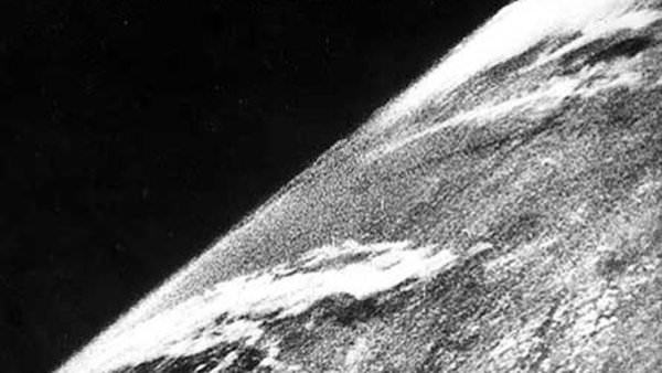
The first photo of Earth from space was taken on Oct. 24, 1947 (Credit: White Sands Missile Range/Applied Physics Laboratory)

These days we see photos of our planet taken from space literally every day. Astronauts living aboard the International Space Station, weather and Earth-observing satellites in various orbits, even distant spacecraft exploring other planets in our Solar System… all have captured images of Earth from both near and far. But there was a time not that long ago when there were no pictures of Earth from space, when a view of our planet against the blackness of the cosmos was limited to the imagination of dreamers and artists and there was nothing but the Moon orbiting our world.

On this day in 1946, before Apollo, before Mercury, even before Sputnik, that was no longer the case.

The image above shows the first photo captured of Earth from space, taken by a camera mounted to a V-2 rocket that was launched from the U.S. Army’s White Sands Missile Range in New Mexico. Taken to the United States by the dozen from Germany after the end of World War II, the V-2 (for “Vergeltungswaffe 2”) missiles were used by the Army to improve on their own rocket designs and also by scientists who were permitted to fill their payloads with experiments.

On October 24, 1946, a V-2 was launched from the Missile Range while a mounted 35mm movie camera captured images every 1.5 seconds. It reached an altitude of 65 miles before crashing back to Earth and, while the camera was destroyed on impact, the film cassette survived. The grainy photo seen above was on that roll, one of our first views of Earth from above the atmosphere.

(Okay, technically there’s still atmosphere above 65 miles — even the ISS orbiting at 260-plus statute miles has to give itself a boost to compensate for drag now and again — but the official aeronautical delineation of “space” begins at about 62 miles, or 100 km: the Kármán Line. V-2 #13 passed that mark in 1946 by 3 miles.)

In the following years more V-2 rockets would be launched, some reaching heights of 100 miles, giving us many more detailed views of our planet as it looks from space and prompting Clyde Holliday, the APL engineer who developed the mounted film cameras, to envision that “the entire land area of the globe might be mapped in this way.”
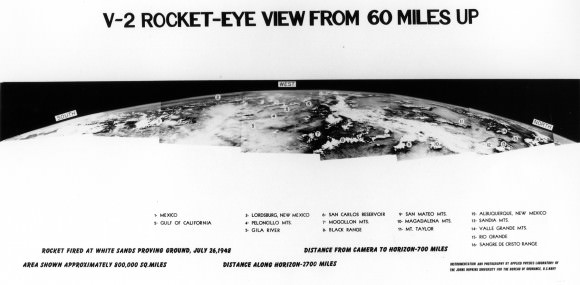
Assembled panorama of V-2 images taken from an altitude of 60 miles in 1948 (JHUAPL/US Navy)

Now, 68 years later, seeing pictures of Earth from space are a much more common, if no less amazing, occurrence. But it all started with that one launch of a missile designed for war but repurposed for science.

Read more here in an article for Smithsonian’s Air & Space by Tony Reichhardt, and watch a contemporary news reel below about the 1946 V-2 launch:

Source: Air & Space

35 Years Ago: Our First Family Portrait of the Earth and Moon

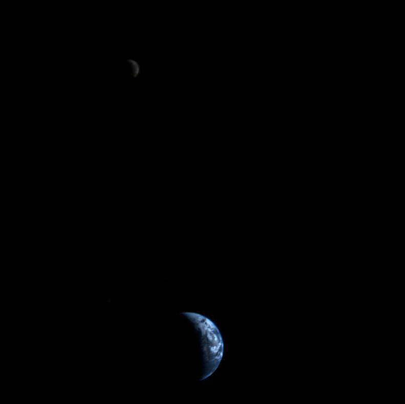
A crescent Earth and Moon as seen by Voyager 1 on September 18, 1977 (NASA)

35 years ago today, September 18, 1977, NASA’s Voyager 1 spacecraft turned its camera homeward just about two weeks after its launch, capturing the image above from a distance of 7.25 million miles (11.66 million km). It was the first time an image of its kind had ever been taken, showing the entire Earth and Moon together in a single frame, crescent-lit partners in space.

The view of Earth shows eastern Asia, the western Pacific Ocean and part of the Arctic. Voyager 1 was actually positioned directly above Mt. Everest when the images were taken (the final color image was made from three separate images taken through color filters.)

The Moon was brightened in the original NASA images by a factor of three, simply because Earth is so much brighter that it would have been overexposed in the images were they set to expose for the Moon. (Also I extended the sides of the image a bit above to fit better within a square format.)

Read the latest on Voyager 1: Winds of Change at the Edge of the Solar System

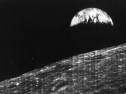
Previous images may have shown the Earth and Moon together, but they were taken from orbit around one or the other and as a result didn’t have both worlds fully — and in color! — within a single frame like this one does. In fact, it was only 11 years earlier that the very first image of Earth from the Moon was taken, acquired by NASA’s Lunar Orbiter I spacecraft on August 23, 1966.

It’s amazing to think what was happening in the world when Voyager took that image:
• World population was 4.23 billion (currently estimated to be 7.04 billion)
• The Space Shuttle Enterprise made its first test flight from a 747
• Star Wars, Close Encounters of the Third Kind and Saturday Night Fever were out in U.S. theaters
• Charlie Chaplin and Elvis Presley died
• U.S. federal debt was “only” $706 billion (now over $16 trillion!)
• And, of course, both Voyagers launched on their Grand Tour of the Solar System, ultimately becoming the most distant manmade objects in existence
(See more world stats and events here.)

Image: NASA/JPL

“Once a photograph of the Earth, taken from outside, is available – once the sheer isolation of the Earth becomes known – a new idea as powerful as any in history will be let loose.”
– Sir Fred Hoyle

The First Photo From The Moon

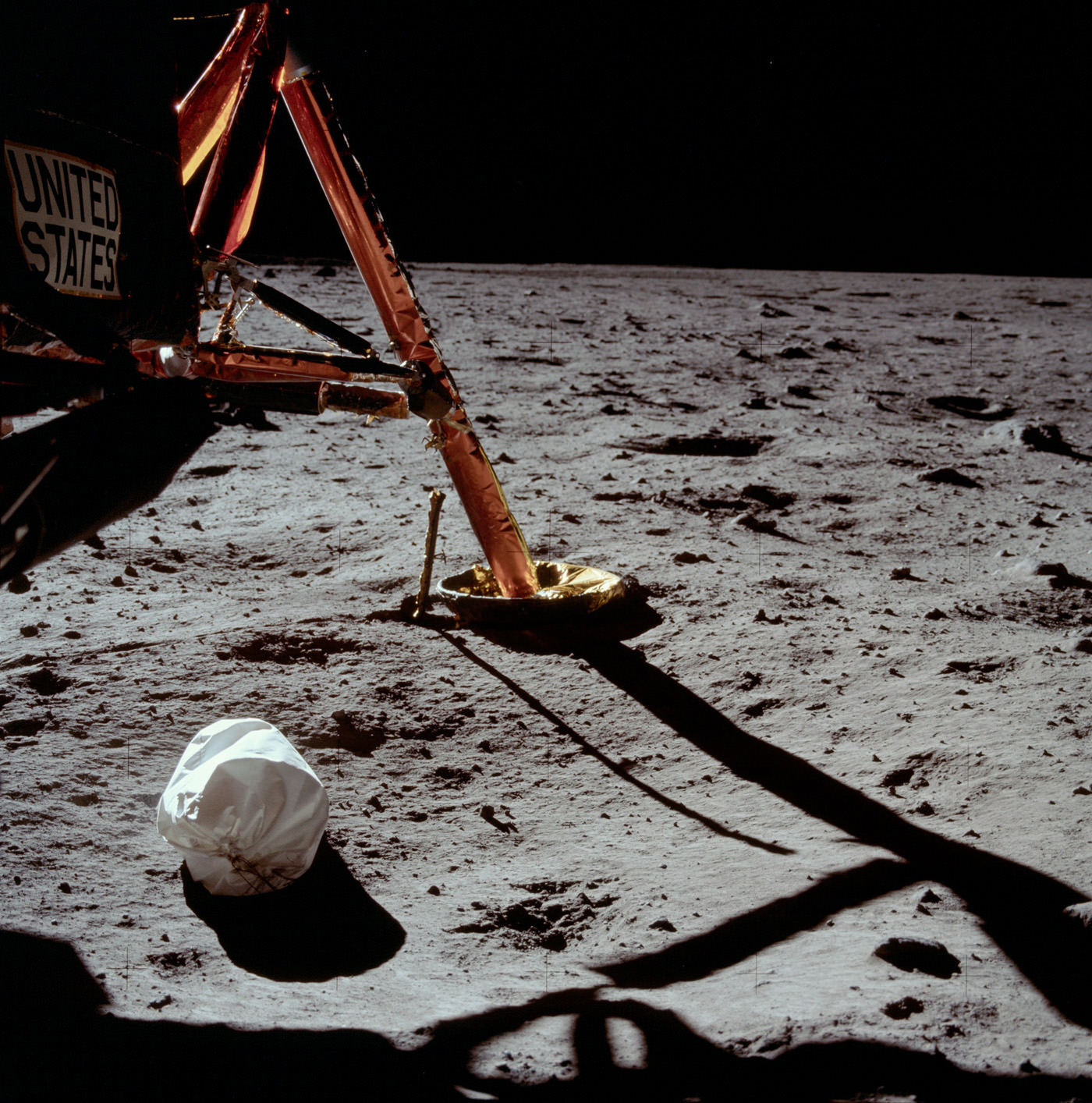
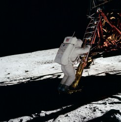
“That’s one small step for a man, one giant leap for mankind.” After speaking these historic words at 10:56 EDT on July 20, 1969, marking the moment that humanity first placed a foot on a world other than its own, Apollo 11 commander Neil Armstrong began his work documenting the lunar surface before him.

The image above is the first photo taken by Armstrong after exiting Eagle, the landing module — and the first photograph ever taken by a person standing on the surface of another world.

After this image, Armstrong took several more images of the surrounding landscape before fellow astronaut Edwin “Buzz” Aldrin, Jr. exited the module as well. The third man on the mission, Michael Collins, remained in lunar orbit piloting the command module Columbia.
The rest, as they say, is history.

Armstrong, as were all the Apollo mission astronauts, was trained in the use of a modified Hasselblad 500 EL camera, which took wonderfully detailed images on large-format film. Most of the photos they brought back have been high-quality scanned by Kipp Teague and are available online at the Apollo Image Gallery.

Today is the 43rd anniversary of the first lunar landing. More than just a page in the history books, it marks a shining moment for all of humanity when the combined ingenuity and courage of many, many people succeeded in the daunting task of, in President Kennedy’s words from May 25, 1961, “landing a man on the moon and returning him safely to Earth.”

Images: NASA. Scans by Kipp Teague.

Tomorrow’s Transit Will be the First Photographed From Space

Venus photographed from the ISS (ESA/NASA)

[/caption]

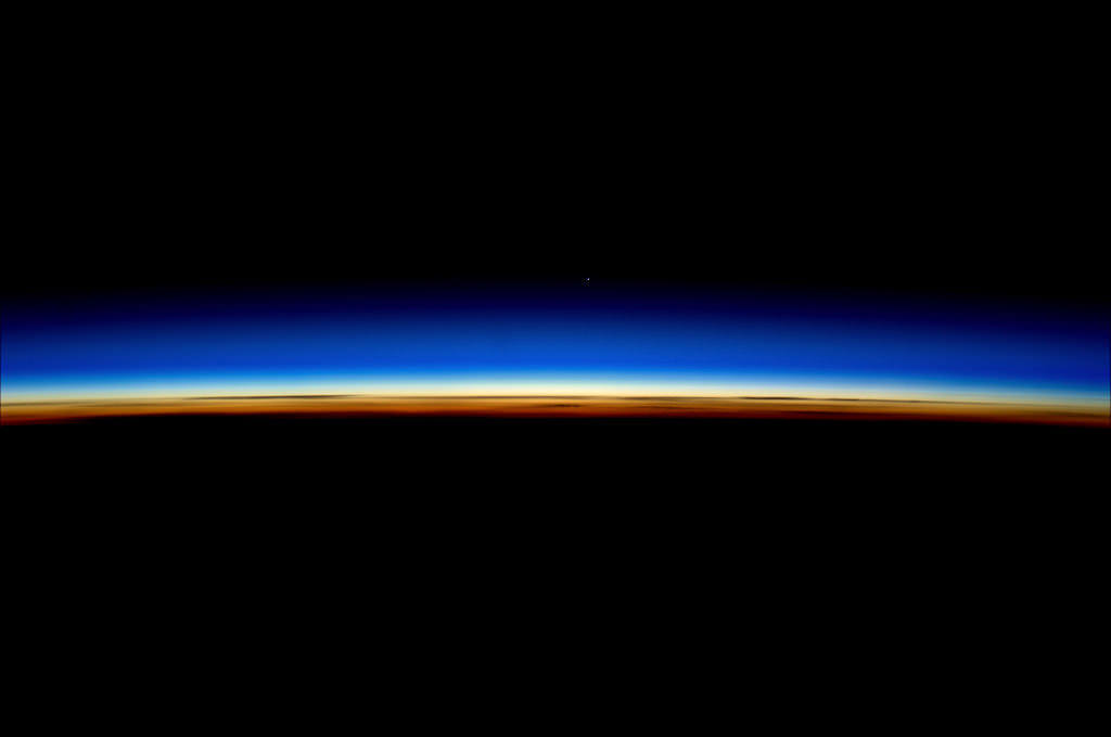
ESA astronaut Andre Kuipers captured this stunning image of Earth’s limb with Venus shining brightly above on the morning of June 4, 2012. While it’s a fantastic shot in its own right, it’s just a warm-up for tomorrow’s big transit event, which will be watched by millions of people all over the world — as well as a select few aboard the ISS!

While many people will be taking advantage of this last opportunity to see Venus pass across the face of the Sun — a relatively rare event that’s only happened six times since the invention of the telescope, and won’t occur again until 2117 — the crew of the International Space Station is preparing to become the first astronaut to photograph it from space!

Transit of Venus by NASA's TRACE spacecraft Image credit: NASA/LMSAL
Transit of Venus in 2004 by NASA's TRACE spacecraft. Image credit: NASA/LMSAL

Expedition 31 flight engineer Don Pettit knew he’d be up in orbit when this transit takes place, and he went prepared.

“I’ve been planning this for a while,” says Pettit. “I knew the Transit of Venus would occur during my rotation, so I brought a solar filter with me when my expedition left for the ISS in December 2011.”

(See more of Don Pettit’s in-orbit photography: Timelapse of a Moonrise Seen From The ISS)

Even though the 2004 transit happened while the ISS was manned, the crew then didn’t have filters through with to safely view it.

Pettit will be shooting the transit through the windows of the cupola. He’ll even be removing a scratch-resistant layer first, in order to get the sharpest, clearest images possible — only the third time that’s ever been done.

Don’s images should be — no pun intended — brilliant.

“I’ll be using a high-end Nikon D2Xs camera and an 800mm lens with a full-aperture white light solar filter,” he says.

And if you want to follow along with the transit as it’s seen from down here on Earth, be sure to tune in to Universe Today’s live broadcast on Tuesday, June 5 at 5 p.m. EDT where Fraser Cain will be hosting a marathon event along with guests Pamela Gay, Phil Plait (a.k.a. the Bad Astronomer) and more as live views are shared from around the world.

Unless you plan on being around in 2117, this will be your last chance to witness a transit of Venus!

Read more about Don Pettit’s photo op on NASA Science News here.

From Russia With Love: A Singularly Stunning Image of Earth

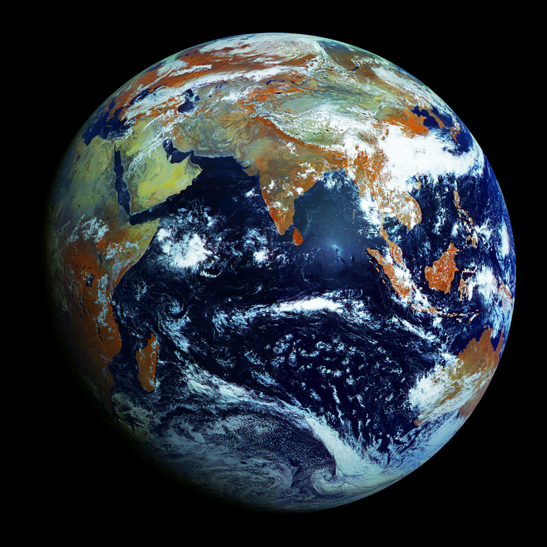
Full-disk image of Earth from Russia's Elektro-L satellite. (NTs OMZ)

[/caption]

Unlike most satellite images of Earth, this one was not assembled from multiple swath scans or digitally projected onto a globe model — it’s the full disk of our planet in captured as a single, enormous 121 megapixel image, acquired by Russia’s Elektro-L weather-forecasting satellite.

Like NASA’s GOES satellites, Elektro-L is parked in a geostationary orbit approximately 36,000 km (22,300 miles) above our planet. Unlike NASA’s satellites, however, Elektro-L captures images in near-infrared as well as visible wavelengths, providing detail about not only cloud movement but also vegetation variations. Its wide-angle Multichannel Scanning Unit (MSU) takes images every 15-30 minutes, showing the same viewpoint of Earth across progressive times of the day.

At a resolution of 0.62 miles per pixel, full-size Elektro-L images are some of the most detailed images of Earth acquired by a weather satellite.

Download the full-size image here (100+ megabytes).

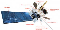
Elektro-L diagram. © 2009 Anatoly Zak

Launched aboard a Zenit rocket on January 20, 2011, Elektro-L was the first major spacecraft to be developed in post-Soviet Russia. Parked over Earth at 76 degrees east longitude, Elektro-L provides local and global weather forecasting and analysis of ocean conditions, as well as “space weather” monitoring — measurements of solar radiation and how it interacts with Earth’s magnetic field. Its initial lifespan is projected to be ten years.

A second Elektro-L satellite is anticipated to launch in 2013.

Image credit: Russian Federal Space Agency / Research Center for Earth Operative Monitoring (NTS OMZ). See more images and video from Elektro-L on James Drake’s Planet Earth here. (Tip of the geostationary hat to Jesus Diaz at Gizmodo.)

Take a Peek Inside Curiosity’s Shell

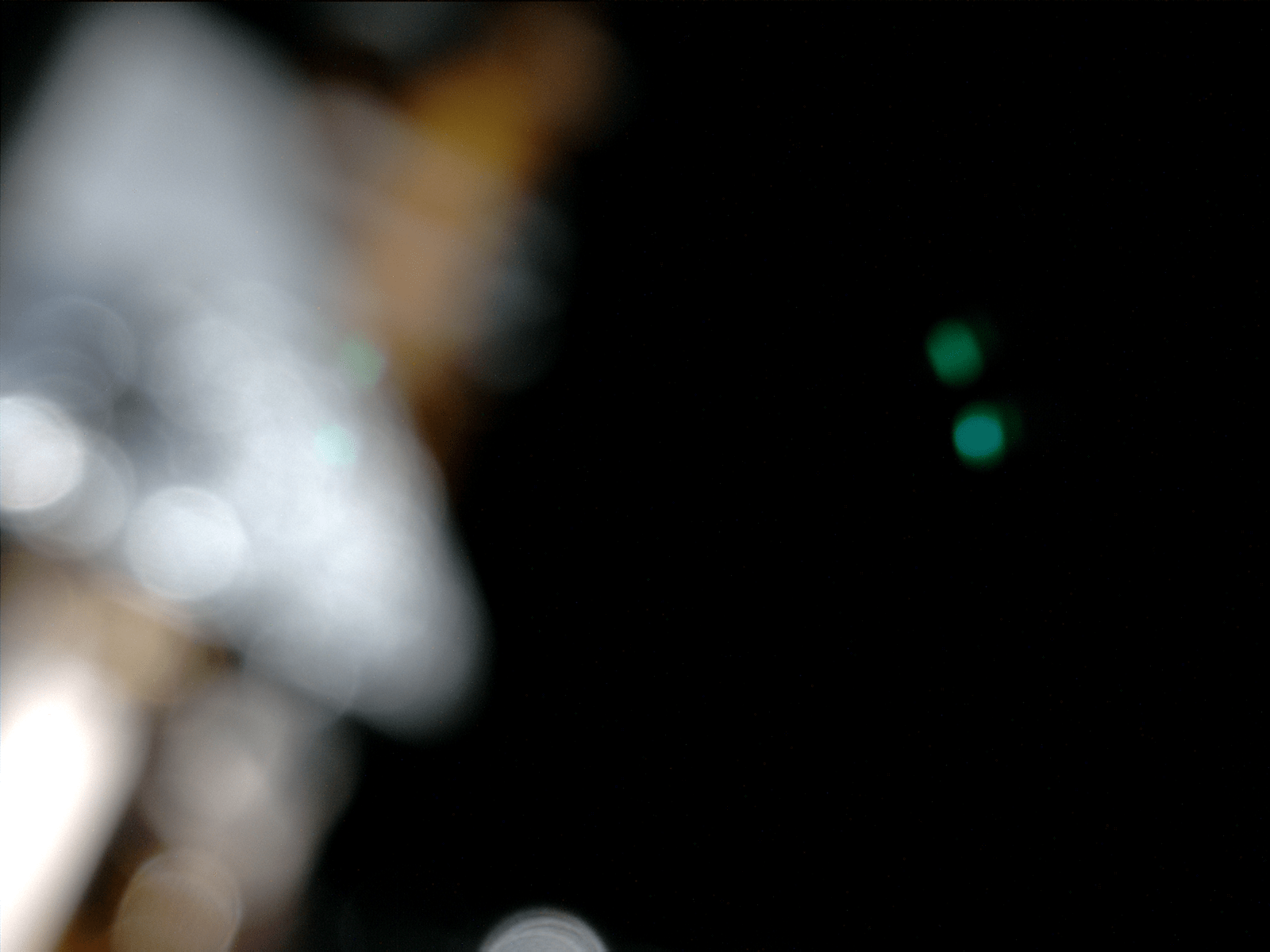
LED-lit image from Mars Science Laboratory inside its shell (NASA/JPL-Caltech/Malin Space Science Systems)

[/caption]

Take a look around Curiosity’s cozy cabin! Ok, there’s really not much to see (she didn’t get a window seat) but when the image above was taken by the rover’s Mars Hand Lens Imager (MAHLI) camera on April 20, the spacecraft she’s tucked into was just over 120 million km (74 million miles) from Earth, en route to Mars. In other words, just past those blurry components and outside that dark shell is real outer space… that’s cool!

This color image was planned by the MSL team, used to confirm that MAHLI is operating as it should. The two green dots are reflections of the camera’s LED lights, and the rusty-orange out-of-focus parts are cables. The silver thing is a bracket holding said cables.

So why is this fancy camera taking blurry pictures (and the folks at NASA are happy about it?) Since MAHLI is designed to take both close-up images of rocks on Mars as well as landscape shots, it has a focusing motor. But when it’s not in use — such as during its current 11-month-long cruise to Mars — the motor puts the focusing lens into a safe position to protect it from damage during launch, entry and landing.

Where is Curiosity now?

Positioned this way, MAHLI can only focus on objects 2 cm (less than an inch) away from its lens, and there simply aren’t any inside the capsule.

Of course, once Curiosity arrives at Mars and completes her exciting landing at Gale Crater, MAHLI will have plenty of things to take pictures of! Until then we’ll be patient, it can take a rest and we can rest assured that it’s working just fine.

Keep up with the latest news from the Mars Science Laboratory team here.

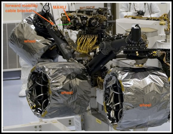
Labeled parts of the MSL rover (NASA/Kim Shiflett; cropping/annotation by Malin Space Science Systems)

San Diego-based Malin Space Science Systems (MSSS) built and operates the Mars Hand Lens Imager (MAHLI) aboard the Curiosity Mars rover. MSSS also built and operates the rover’s Mastcams and Mars Descent Imager. Read more about their contributions to Curiosity’s exploration mission here.

Beautiful Pics

How Cold is Space
Backpacking

Here are some beautiful pics of space and astronomy.

[/caption]

This is a picture of NASA Mission Specialist Bruce McCandless floating free above the Earth. He was testing out a new backpack that let astronauts perform spacewalks without the need for a cumbersome tether.

Long Shadows on the Lunar Surface

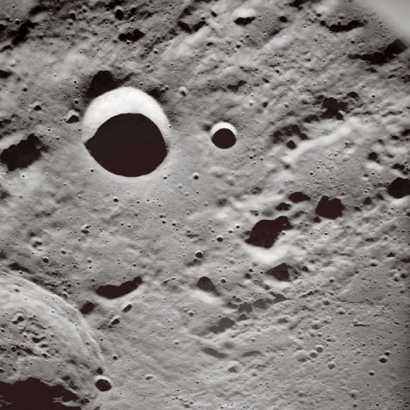
This is a very oblique angle view of craters on the Moon taken by the crew of Apollo 10 as they circled around the Moon. This was the last mission before astronauts actually landed onto the Moon.

A Moment Frozen in Time

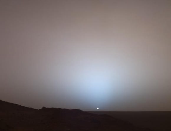
This is a picture of the Sun captured from the surface of Mars. This picture was taken by NASA’s Spirit rover just as the Sun was setting.

Montage of Neptune and Triton

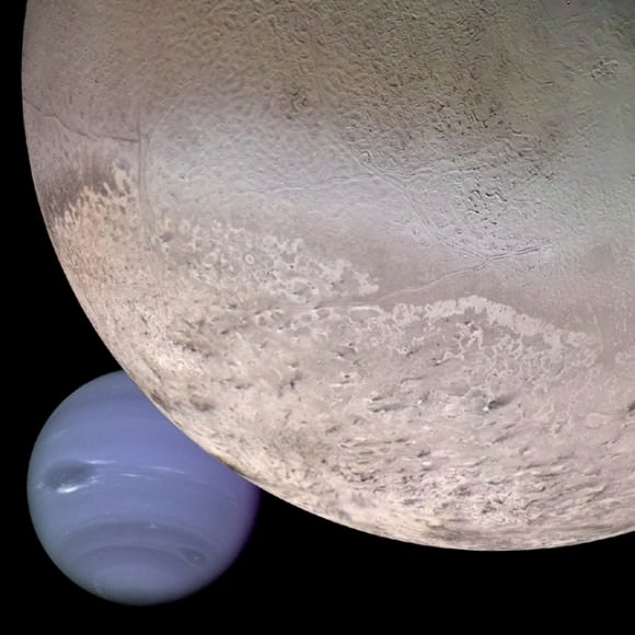
Here’s a montage of Neptune and its largest moon Triton. These pictures were taken separately by NASA’s Voyager 2 spacecraft when it made its flyby of the planet in 1989. The pictures were then merged together into this mosaic.

Into the Heart of Darkness

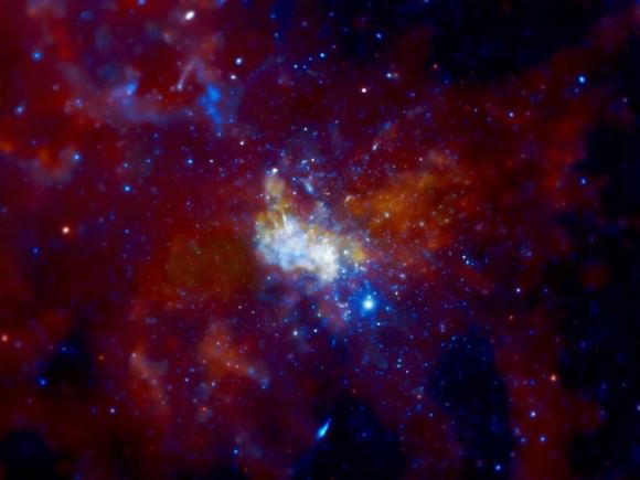
This is a photo of the supermassive black hole at the heart of the Milky Way. Well, it’s actually the region around the black hole, known as Sagittarius A*.

We’ve written many articles for Universe Today with beautiful pics. Here’s an image of the Veil Nebula complex from Johannes Schedler, and here’s a picture of NGC 2903 from Warren Keller.

If you’d like more amazing photographs, the best place to look is NASA’s Astronomy Picture of the Day. I also recommend you check out the website for the Hubble Space Telescope.

We’ve recorded many episodes of Astronomy Cast, including one about Hubble. Check it out, Episode 88: The Hubble Space Telescope.

Space Wallpapers

Earthrise
Earthrise

Here are some amazing space wallpapers. If you want to make one of these your computer desktop wallpaper, just click on the image. That will take you to a much larger version of the image. You can then right-click on the image and choose, “Set as Desktop Background”. That will make any of these space wallpapers your desktop background.

[/caption]

This is one of the most famous space photographs every taken. It’s called “Earthrise”, and it was captured by the crew of Apollo 8 as they were orbiting around the Moon. They saw the Earth rising over the Moon’s horizon and captured this amazing photograph.


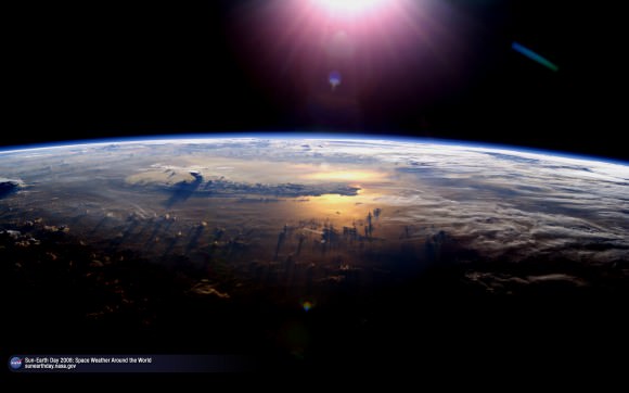
Earth from space
Earth from space

NASA created this amazing wallpaper as part of its celebration for Sun-Earth day in 2008. You can see the Sun shining just outside of the photograph above.


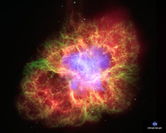
Supernova 1054 AD
Supernova 1054 AD

Almost 1000 years ago, a star detonated in the sky as a supernova, shining brilliantly for a few days. After it faded away, it was replaced by this amazing nebula.


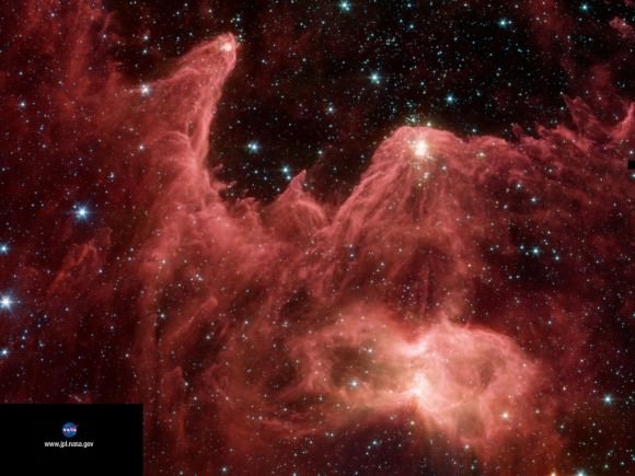
Star formation in the Eagle Nebula

This amazing space wallpaper shows active star formation in the Eagle Nebula. These newly forming stars are blasting out huge clouds of gas and dust into space.


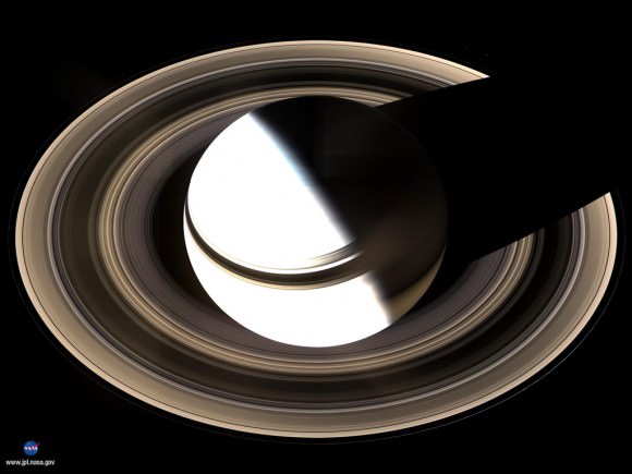
Saturn wallpaper
Saturn wallpaper

Here’s a beautiful image of Saturn captured by NASA’s Cassini spacecraft during a time that it was positioned over the planet’s pole.

We have got lots of image galleries here in Universe Today. Here are some Earth wallpapers, and here are some Venus wallpapers.

You can also download some cool space wallpapers from NASA’s JPL, and here are some wallpapers from Hubble.

You might also want to try listening to an episode of Astronomy Cast. Here’s an episode just about the Hubble Space Telescope.