What Is The World’s Widest River?

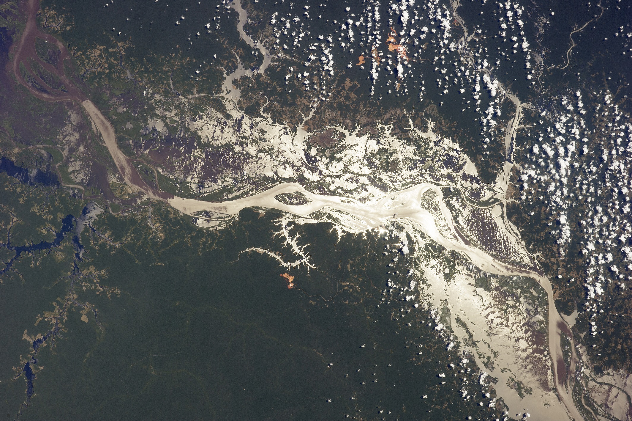
The Amazon River near Lago do Erepecu (north of this image) in 2014. Credit: NASA

The Amazon River is a heck of a big tributary. Besides being one of the LONGEST rivers in the world, it also happens to be the WIDEST. While its estimated length of 4,000 miles (6,400 kilometers) puts it under the Nile River, that statistic could be amended as some believe it’s even longer than that.

Nevertheless, its width puts it at a big river that carries more volume than the Nile. We have a few more facts about the Amazon below.

According to Extreme Science, even during the dry season it is about 6.8 miles (11 kilometers) wide, which is still a respectable width. When things get rainy, however, that’s when stuff really begins to open up. It more than doubles its width to 24.8 miles (40 kilometers).

If that’s enough for you, consider the amount of land it covers. Dry season, Extreme Science says, sees it at 42,471 square miles (110,000 square kilometers), or roughly the land area of Cuba. That astonishing statistic triples during the wet season, when it reaches 135,135 square miles (350,000 square kilometers) — about approximate to Germany’s size.
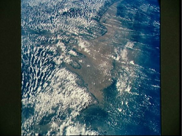
Mouth of the Amazon River as seen from STS-58
Mouth of the Amazon River as seen from STS-58. Credit: NASA

All of this makes the South American river the largest drainage system in the world, according to Encyclopedia Britannica. Its recorded source is in the Andes Mountains and it flows down to its Atlantic Ocean mouth off the coast of Brazil. But as we’ve noted before, there’s controversy both to its source and to its actual length.

The Amazon basin (the areas that are affected by the river) cover a good portion of South America, the encyclopedia adds: Brazil, Peru, Columbia, Ecuador, Bolivia and Venezuela. But it’s Brazil that has most of the basin and two-thirds of the stream.

Aboriginals in the region have explored the river for centuries, but its name comes from European exploration of the river, the encyclopedia says. “Amazon” is a reference from Europe’s first reported explorer, Spanish soldier Francisco de Orellana, who said the fierce female warriors in battle in the area reminded him of Amazons in Greek mythology.
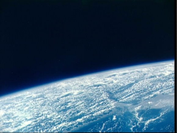
Mouth of Amazon River, Brazil as seen from the Gemini 9-A spacecraft
Mouth of Amazon River, Brazil as seen from the Gemini 9-A spacecraft. Credit: NASA

Many of these statistics could change if the source of the Amazon River is also changed. National Geographic says there at least six possible origin points, based on methods ranging from satellite observation to GPS to “ground truth” examinations. You can see more details about the ongoing quest in this article.

Universe Today has articles on the longest river  and Europe’s longest river. Astronomy Cast has an episode on Earth you should watch.

Rivers of Rock

The Moon may not have ever had liquid water on its surface — despite the use of the term mare, Latin for “sea” and moniker for the large regions of darker material visible from Earth — but liquid did indeed flow on the Moon in ages past… liquid rock, briefly set loose by the impacts that formed its ubiquitous craters.

When large meteorites impacted the Moon, crust at the site would melt and get flung outwards, flowing downhill as rivers of rock and creating streams and pools of melted material before cooling and solidifying. There the rivers would remain, a permanently-hardened testament to the event that made them.

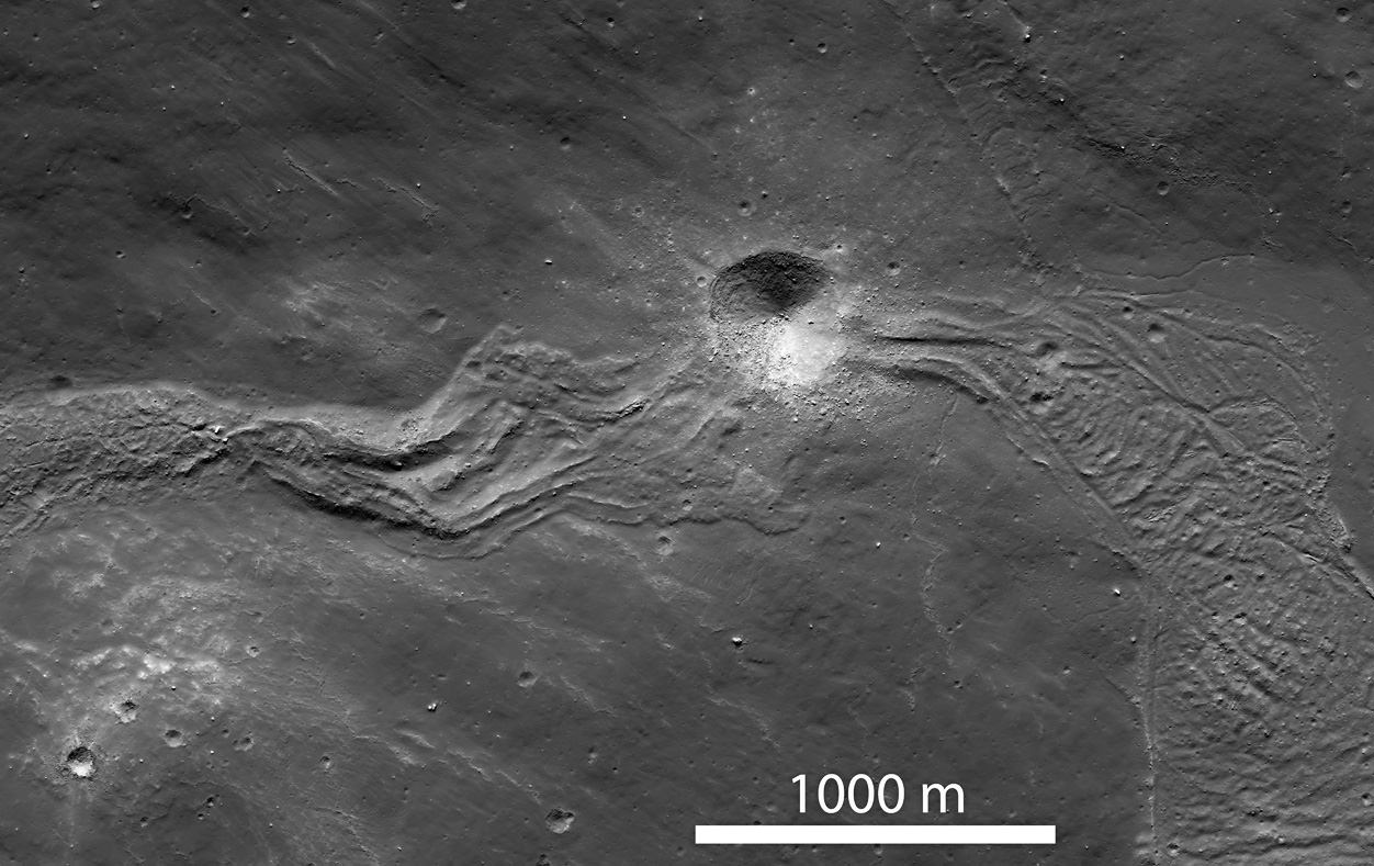
The image above, part of a NAC scan acquired by NASA’s Lunar Reconnaissance Orbiter on March 9, shows a solidified melt flow dating back to the creation of Tycho crater approximately 108 million years ago –which may sound like a long time but it’s actually very recent for large-scale lunar features.

The flow is interrupted by a younger, 400-meter-wide crater that impacted the lunar surface along its length. Since it punches through the melt flow as well as the local surface, it would be a great place for future astronaut geologists to explore!

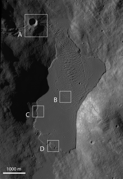
Taken under slightly different lighting conditions, the image below shows a large melt pond that the flow above terminates in. The pond is about 4500 meters long by 2100 meters across (2.8 x 1.3 miles).

Such images wouldn’t be possible without the awesome Lunar Reconnaissance Orbiter. Launched on June 18, 2009, LRO explores the lunar surface from an altitude of only 50 km (31 miles). Read more on the LRO site here.

Image credits: NASA/GSFC/Arizona State University

Pictures of Rivers

Mississippi river delta

Here are some cool pictures of rivers taken by various spacecraft.

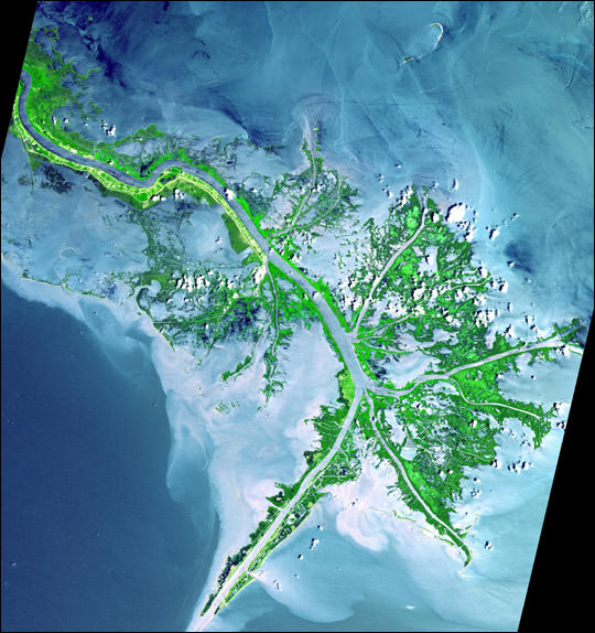
Here’s a picture of the Mississippi river delta. The image was captured by Advanced Spaceborne Thermal Emission and Reflection Radiometer (ASTER) aboard NASA’s Terra satellite.


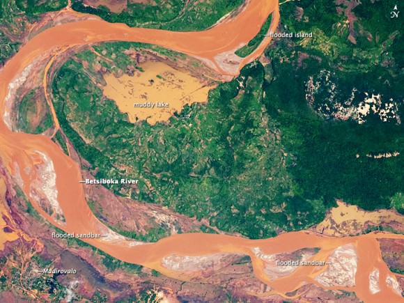
Betsiboka River flooding

This is an image of flooding on the Betsiboka River in Madagascar. The flooding was created by Tropical Storm Eric, which swept through the region in early 2009. This photograph was taken by astronauts on board the International Space Station.


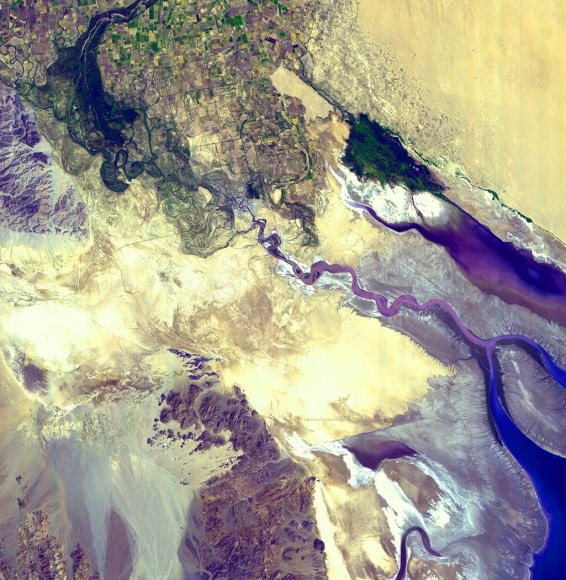
Colorado River Delta

People rely on the Colorado River so much that very little of it actually reaches the ocean. Instead, almost all of the water that flows through the river is used for irrigation along its route.


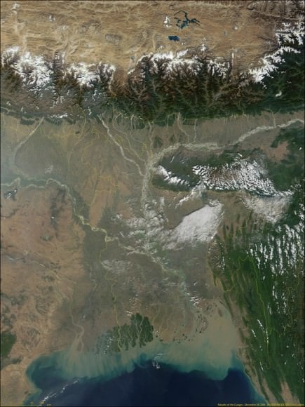
Ganges river delta. Image credit: NASA

This is a picture of the river delta for the Ganges. In fact, the Ganges combined with the Brahmaputra River make up the largest river delta in the world. The rivers flood from snow melt in the nearby Himalayas.


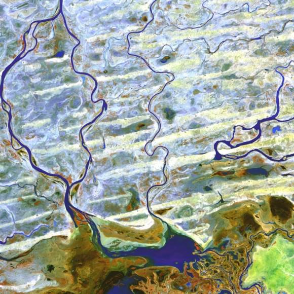
Niger River
Niger River

This is a picture of the Niger River. It was captured by the ASTER instrument on board NASA’s Terra Earth Observation satellite.

We have written many articles with pictures of rivers for Universe Today. Here’s an article about flooding in the Red River, and here’s an image of the Yangtze River from space.

We have also recorded an episode of Astronomy Cast all about the Earth. Listen to it here, Episode 51: Earth.