An Unexpected Ending for Deep Impact

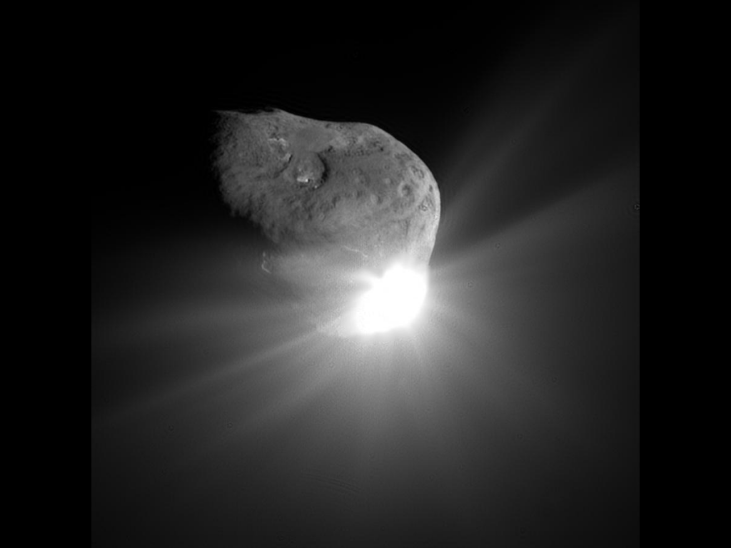
Comet Tempel 1 a minute after being struck by Deep Impact's impactor on July 4, 2005 (NASA/JPL-Caltech/UMD)

After almost 9 years in space that included an unprecedented July 4th impact and subsequent flyby of a comet, an additional comet flyby, and the return of approximately 500,000 images of celestial objects, NASA’s Deep Impact/EPOXI mission has officially been brought to a close.

The project team at NASA’s Jet Propulsion Laboratory has reluctantly pronounced the mission at an end after being unable to communicate with the spacecraft for over a month. The last communication with the probe was Aug. 8. Deep Impact was history’s most traveled comet research mission, having journeyed a total of about 4.7 billion miles (7.58 billion kilometers).

“Deep Impact has been a fantastic, long-lasting spacecraft that has produced far more data than we had planned,” said Mike A’Hearn, the Deep Impact principal investigator at the University of Maryland in College Park. “It has revolutionized our understanding of comets and their activity.”
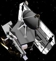
Artist's rendering of the Deep Impactor flyby spacecraft (NASA)
Artist’s rendering of the Deep Impactor flyby spacecraft (NASA)

Launched in January 2005, the spacecraft first traveled about 268 million miles (431 million kilometers) to the vicinity of comet Tempel 1. On July 3, 2005, the spacecraft deployed an impactor into the path of comet to essentially be run over by its nucleus on July 4. This caused material from below the comet’s surface to be blasted out into space where it could be examined by the telescopes and instrumentation of the flyby spacecraft.  Sixteen days after that comet encounter, the Deep Impact team placed the spacecraft on a trajectory to fly back past Earth in late December 2007 to put it on course to encounter another comet, Hartley 2 in November 2010, thus beginning the spacecraft’s new EPOXI mission.

“Six months after launch, this spacecraft had already completed its planned mission to study comet Tempel 1,” said Tim Larson, project manager of Deep Impact at JPL. “But the science team kept finding interesting things to do, and through the ingenuity of our mission team and navigators and support of NASA’s Discovery Program, this spacecraft kept it up for more than eight years, producing amazing results all along the way.”

The spacecraft’s extended mission culminated in the successful flyby of comet Hartley 2 on Nov. 4, 2010. Along the way, it also observed six different stars to confirm the motion of planets orbiting them, and took images and data of the Earth, the Moon and Mars. These data helped to confirm the existence of water on the Moon, and attempted to confirm the methane signature in the atmosphere of Mars.  One sequence of images is a breathtaking view of the Moon transiting across the face of Earth.
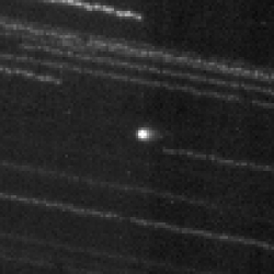
This image of comet ISON C/2012 S1 from NASA’s Deep Impact/EPOXI  spacecraft clearly shows the coma and nucleus on Jan. 17 and 18, 2013 beyond the orbit of Jupiter. Credit: NASA.
This image of comet ISON C/2012 S1 from NASA’s Deep Impact/EPOXI spacecraft clearly shows the coma and nucleus on Jan. 17 and 18, 2013 beyond the orbit of Jupiter. Credit: NASA.

The spacecraft’s extended mission culminated in the successful flyby of comet Hartley 2 on Nov. 4, 2010. In January 2012, Deep Impact performed imaging and accessed the composition of distant comet C/2009 P1 (Garradd).

It took images of comet ISON this year and collected early images of comet ISON in June.

After losing contact with the spacecraft last month, mission controllers spent several weeks trying to uplink commands to reactivate its onboard systems. Although the exact cause of the loss is not known, analysis has uncovered a potential problem with computer time tagging that could have led to loss of control for Deep Impact’s orientation. That would then affect the positioning of its radio antennas, making communication difficult, as well as its solar arrays, which would in turn prevent the spacecraft from getting power and allow cold temperatures to ruin onboard equipment, essentially freezing its battery and propulsion systems.

Without battery power, the Deep Impact spacecraft is now adrift and silent, spinning out of control through the solar system.
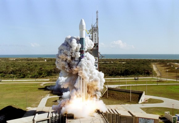
Launch of Deep Impact aboard a Boeing Delta II from Cape Canaveral AFB on Jan. 12, 2005 (NASA)
Launch of Deep Impact aboard a Boeing Delta II rocket from Cape Canaveral AFS on Jan. 12, 2005 (NASA)

“Despite this unexpected final curtain call, Deep Impact already achieved much more than ever was envisioned. Deep Impact has completely overturned what we thought we knew about comets and also provided a treasure trove of additional planetary science that will be the source data of research for years to come.”

– Lindley Johnson, Program Executive for the Deep Impact mission

It’s a sad end for a hardworking spacecraft, but over the course of its 8 1/2 years in space Deep Impact provided many significant results for the science community. Here are the top five, according to the mission’s principal investigator Michael A’Hearn.

Read more about the Deep Impact mission here.

Source: NASA press release

Feast Your Mind on This: Strange “Brain Terrain” on Mars

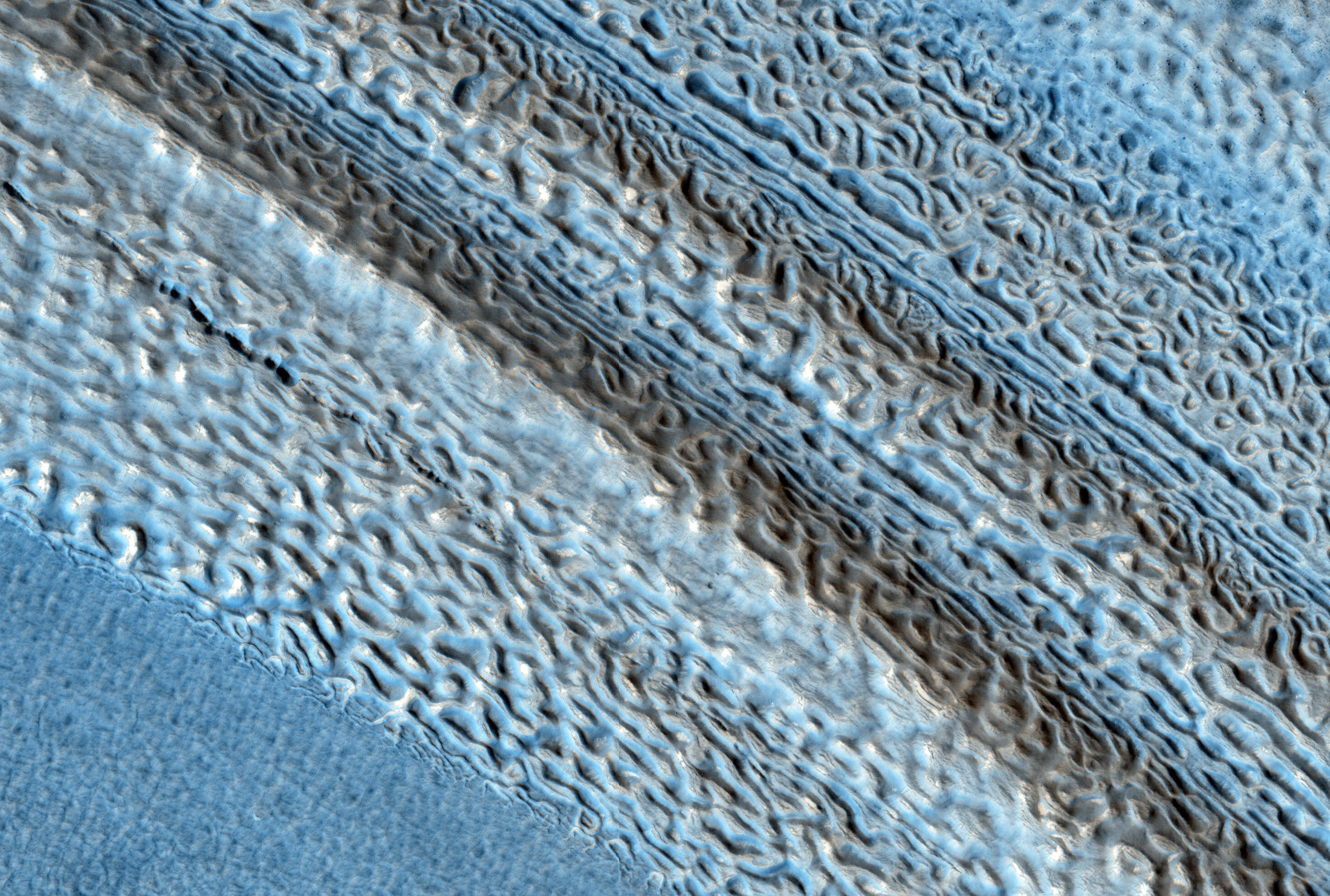
HiRISE image of lobate landforms called "brain terrain" that wrap around a small hill on Mars

It doesn’t take much thought to understand why this landscape on Mars is called “brain terrain” — the swirling lobes of ice, part of a large glacial deposit in Mars’ northern hemisphere, uncannily resemble the texture of a brain — or at the very least a brain coral!

What causes this strange landscape? Find out below:

It’s suggested that brain terrain is the result of the thermal stress and contraction, followed by sublimation, of these large ice deposits, laid down during a mid-latitude glaciation period ten to 100 million years ago. (Read more in this 2009 paper by Brown University’s Joseph Levy et al.)

This image was obtained by the HiRISE camera aboard the Mars Reconnaissance orbiter on August 23, 2013. See the original RGB color scan here.

Source: University of Arizona’s HiRISE site

A “Mini Jet” Juts from Saturn’s F Ring

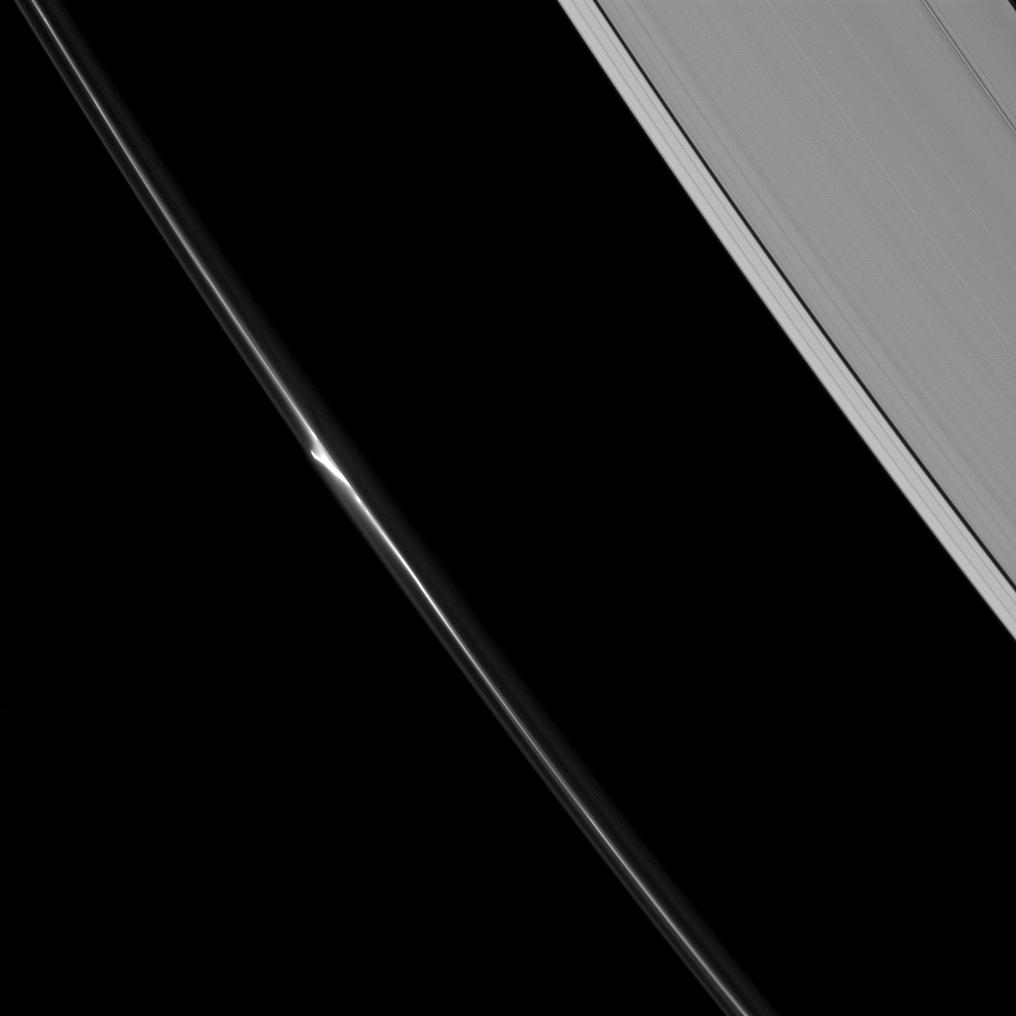
A bright "mini-jet" spotted in Saturn's F ring

We all know that Saturn’s moon Enceladus has a whole arsenal of geysers jetting a constant spray of ice out into orbit (and if you didn’t know, learn about it here) but Enceladus isn’t the only place in the Saturnian system where jets can be found — there are some miniature versions hiding out in the thin F ring as well!

Watch the 50-mile-wide Prometheus dip into the F ring (CLICK TO PLAY) NASA/JPL/SSI. Animation by J. Major.

The image above, captured by the Cassini spacecraft on June 20, 2013, shows a segment of the thin, ropy F ring that encircles Saturn just beyond the A ring (visible at upper right). The bright barb near the center is what scientists call a mini jet, thought to be caused by small objects getting dragged through the ring material as a result of repeated passings by the shepherd moon Prometheus.

Coincidentally, it’s gravitational perturbations by Prometheus that help form the objects — half-mile-wide snowball-like clusters of icy ring particles — in the first place.

Unlike the dramatic jets on Enceladus, which are powered by tidal stresses that flex the moon’s crust, these mini jets are much more subtle and occur at the casual rate of 4 mph (2 meters/second)… about the speed of a brisk walk.

The reflective jets themselves can be anywhere from 25 to 112 miles (40 to 180 kilometers) long.

See more images of mini jets — also called “classic trails” — below:

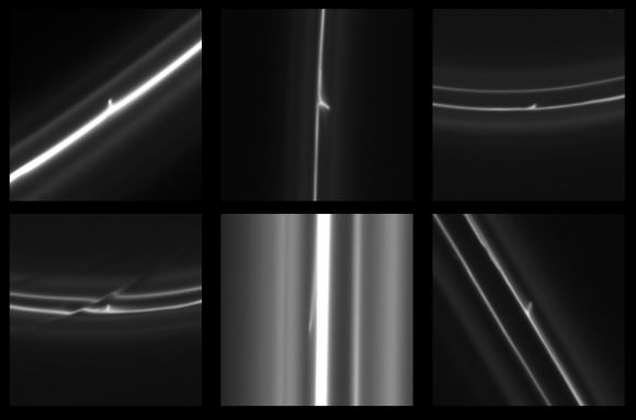
Various images of mini jets captured by Cassini from 2005 to 2008.

Over 500 of these features have been imaged by Cassini since 2005. Read more about mini jets here.

(And don’t worry, Enceladus… these little jets are interesting but they have nothing on you!)

Source: Cassini Imaging Central Laboratory for OPerationS (CICLOPS)

Image credits: NASA/JPL-Caltech/SSI/QMUL. 

Humanoid Shape Spotted on Mercury

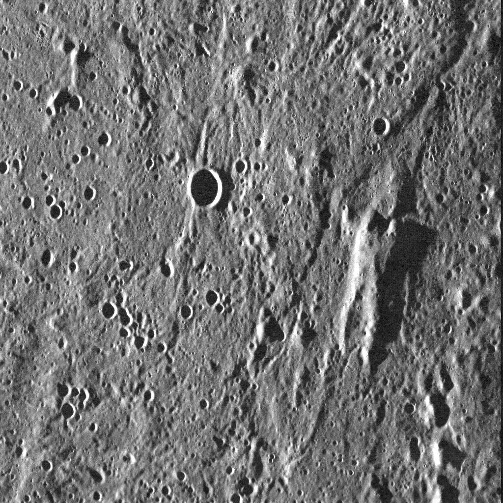
This elevated rise on Mercury resembles a vaguely humanoid shape

You’ve all heard of the “face on Mars” and the “man in the Moon” — well I guess this would be the “man on Mercury!” And I feel like I’ve seen him somewhere before…

"Oh, they've encased him in carbonite. He should be quite well protected."
“Oh, they’ve encased him in carbonite. He should be quite well protected.”

In yet another instance of the phenomenon known as pareidolia, it’s hard not to see the vaguely human shape in this image of Mercury’s surface, acquired by the MESSENGER spacecraft in July 2011. But what looks like a person with upraised arms (resembling, the team suggests, a certain carbonite-encased space smuggler) is really an ancient block of surface crust that juts from the floor of Mercury’s vast Caloris basin — likely the remnants of harder material predating the basin-forming impact 3.9 billion years ago. The low angle of sunlight from the west helps to highlight the surface shapes.

The image above shows an area 96 km (59.7 mi.) across.

If Jabba really wanted to keep his favorite wall decoration safe, perhaps he should have put it on Mercury…

Read more on the MESSENGER site here.

Credit: NASA/Johns Hopkins University Applied Physics Laboratory/Carnegie Institution of Washington

“Oddball” Asteroid is Really a Comet

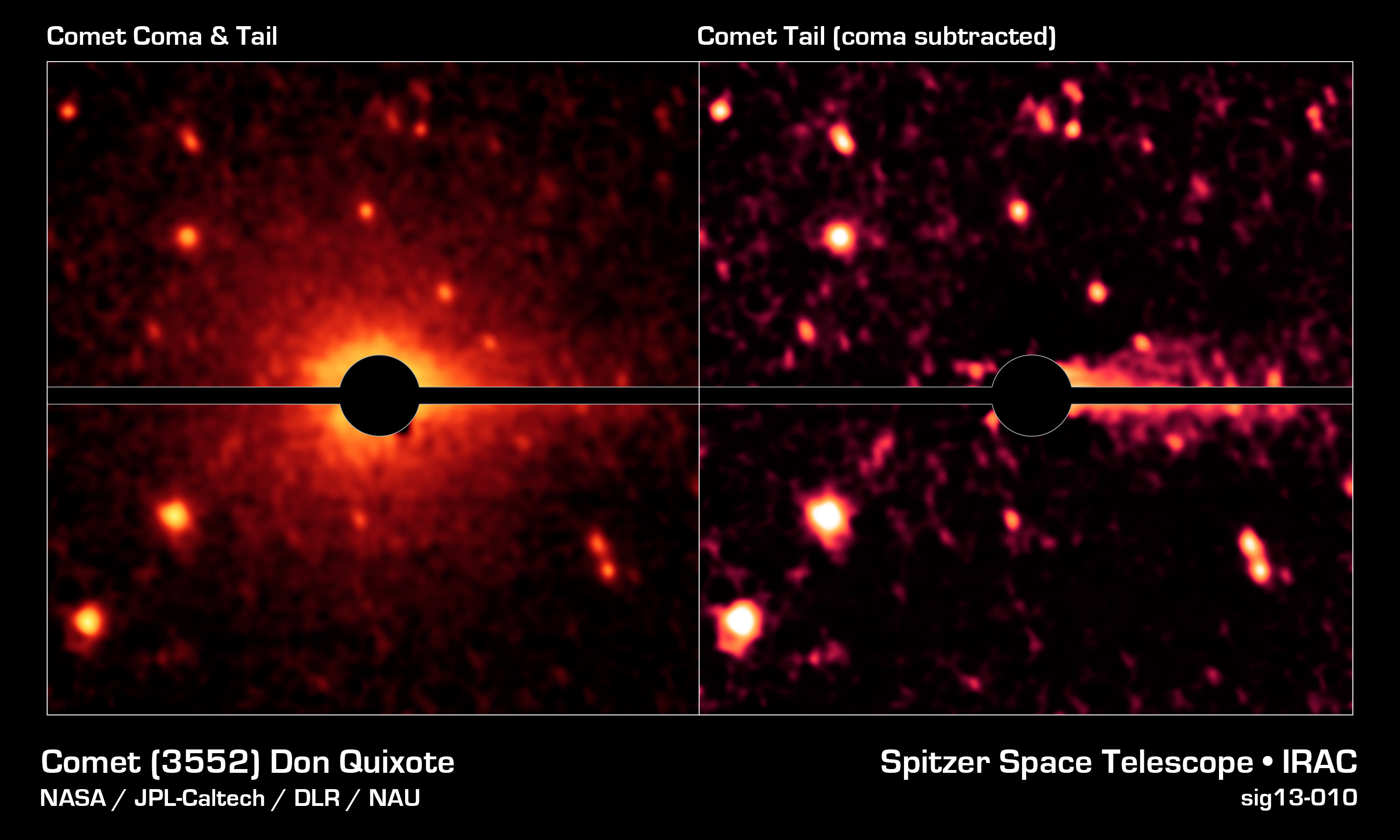
Spitzer image of an asteroid's surprise coma and tail (NASA/JPL-Caltech/DLR/NAU)

It’s a case of mistaken identity: a near-Earth asteroid with a peculiar orbit turns out not to be an asteroid at all, but a comet… and not some Sun-dried burnt-out briquette either but an actual active comet containing rock and dust as well as CO2 and water ice. The discovery not only realizes the true nature of one particular NEO but could also shed new light on the origins of water here on Earth.

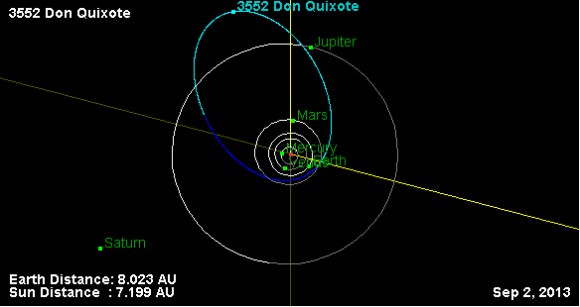
JPL Near-Earth Object database map of 3552 Don Quixote's orbit
JPL Near-Earth Object database map of 3552 Don Quixote’s orbit

Designated 3552 Don Quixote, the 19-km-wide object is the third largest near-Earth object — mostly rocky asteroids that orbit the Sun in the vicinity of Earth.

According to the IAU, an asteroid is coined a near-Earth object (NEO) when its trajectory brings it within 1.3 AU from the Sun and within 0.3 AU of Earth’s orbit.

About 5 percent of near-Earth asteroids are thought to actually be dead comets. Today an international team including Joshua Emery, assistant professor of earth and planetary sciences at the University of Tennessee, have announced that Don Quixote is neither.

an asteroid is coined a Near Earth Asteroid (NEA) when its trajectory brings it within 1.3 AU from the Sun and  hence within 0.3 AU of the Earth's orbit.
An asteroid is coined a near-Earth object (NEO) when its trajectory brings it within 1.3 AU from the Sun and within 0.3 AU of Earth’s orbit. (IAU)

“Don Quixote has always been recognized as an oddball,” said Emery. “Its orbit brings it close to Earth, but also takes it way out past Jupiter. Such a vast orbit is similar to a comet’s, not an asteroid’s, which tend to be more circular — so people thought it was one that had shed all its ice deposits.”

Read more: 3552 Don Quixote… Leaving Our Solar System?

Using the NASA/JPL Spitzer Space Telescope, the team — led by Michael Mommert of Northern Arizona University — reexamined images of Don Quixote from 2009 when it was at perihelion and found it had a coma and a faint tail.

Emery also reexamined images from 2004, when Quixote was at its farthest distance from the Sun, and determined that the surface is composed of silicate dust, which is similar to comet dust. He also determined that Don Quixote did not have a coma or tail at this distance, which is common for comets because they need the sun’s radiation to form the coma and the sun’s charged particles to form the tail.

The researchers also confirmed Don Quixote’s size and the low, comet-like reflectivity of its surface.

“The power of the Spitzer telescope allowed us to spot the coma and tail, which was not possible using optical telescopes on the ground,” said Emery. “We now think this body contains a lot of ice, including carbon dioxide and/or carbon monoxide ice, rather than just being rocky.”

This discovery implies that carbon dioxide and water ice might be present within other near-Earth asteroids and may also have implications for the origins of water on Earth, as comets are thought to be the source of at least some of it.

The amount of water on Don Quixote is estimated to be about 100 billion tons — roughly the same amount in Lake Tahoe.

“Our observations clearly show the presence of a coma and a tail which we identify as molecular line emission from CO2 and thermal emission from dust. Our discovery indicates that more NEOs may harbor volatiles than previously expected.”

– Mommert et al., “Cometary Activity in Near–Earth Asteroid (3552) Don Quixote “

The findings were presented Sept. 10 at the European Planetary Science Congress 2013 in London.

Source: University of Tennessee press release

__________________

3552 Quixote isn’t the only asteroid found to exhibit comet-like behavior either — check out Elizabeth Howell’s recent article, “Asteroid vs. Comet: What the Heck is 3200 Phaethon?” for a look at another NEA with cometary aspirations.

A Mercurial Milestone: 1,000 Featured Images from MESSENGER!

The MESSENGER team celebrates 1,000 featured images of the innermost planet!

It’s been nearly two and a half years since the NASA-sponsored MESSENGER mission entered orbit around Mercury — the first spacecraft ever to do so — and today the MESSENGER team celebrated the 1,000th featured image on the mission site with a mosaic of discovery highlights, seen above.

“I thought it sensible to produce a collage for the 1,000th web image because of the sheer volume of images the team has already posted, as no single picture could encompass the enormous breadth of Mercury science covered in these postings,” explained MESSENGER Fellow Paul Byrne, of the Carnegie Institution of Washington. “Some of the images represent aspects of Mercury’s geological characteristics, and others are fun extras, such as the U.S. Postal Service’s Mercury stamp. The ‘1,000’ superimposed on the collage is a reminder of the major milestone the team has reached in posting 1,000 featured images — and even a motivation to post 1,000 more.”

See the very first image MESSENGER obtained from orbit below:

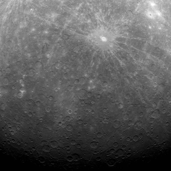
The Mercury Dual Imaging System (MDIS) team has posted a new image to the MESSENGER website approximately once per business day since March 29, 2011, when this first image of Mercury's surface obtained from orbit was made public.
The Mercury Dual Imaging System (MDIS) team has posted a new image to the MESSENGER website approximately once per business day since March 29, 2011, when this first image of Mercury’s surface obtained from orbit was made public.

“During this two-year period, MESSENGER’s daily web image has been a successful mechanism for sharing results from the mission with the public at large,” said Nancy Chabot, MDIS Instrument Scientist at the Johns Hopkins University Applied Physics Laboratory (APL). Chabot has been leading the release of web images since MESSENGER’s first flyby of Mercury in January 2008.

Read more: 5 Mercury Secrets Revealed by MESSENGER

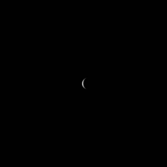
“The first image I released was this one, as MESSENGER approached Mercury for the mission’s first Mercury flyby,” said Chabot. “Mercury was just a small crescent in the image, but it was still very exciting for me. We were obtaining the first spacecraft images of Mercury since Mariner 10 transmitted its final image in 1975, and this was just the beginning of the flood of images that followed.”

One of the first spacecraft images of Mercury since Mariner 10 transmitted its final image in 1975

The herculean effort involved in posting a new image every business day was made possible by a small team of scientists in addition to Chabot and Byrne, including APL’s David Blewett, Brett Denevi, Carolyn Ernst, Rachel Klima, Nori Laslo, and Heather Meyer.

“Creating images and captions for the MESSENGER Image Gallery has been fun and interesting,” Blewett said. “Working on a Gallery release gives me a chance take a break from my regular research and look all around Mercury’s surface for an image that the general public might find to be engaging from a scientific, artistic, or humorous perspective (and sometimes all three!).”

Watch: Take a Spin Around Mercury

“The posting of the 1,000th image of Mercury on our web gallery is a wonderful benchmark, but there’s much more to come,” adds MESSENGER Principal Investigator Sean Solomon of Columbia University’s Lamont-Doherty Earth Observatory. “MESSENGER’s altitude at closest approach is steadily decreasing, and in a little more than six months our spacecraft will be able to view Mercury at closer range than ever before with each orbit. Stay tuned!”

Source: MESSENGER news release

Image credits: NASA/Johns Hopkins University Applied Physics Laboratory/Carnegie Institution of Washington

MESSENGER (MErcury Surface, Space ENvironment, GEochemistry, and Ranging) is a NASA-sponsored scientific investigation of the planet Mercury and the first space mission designed to orbit the planet closest to the Sun. The MESSENGER spacecraft launched on August 3, 2004, and entered orbit about Mercury on March 17, 2011 (March 18, 2011 UTC).

Titan Has a Fancy Collar

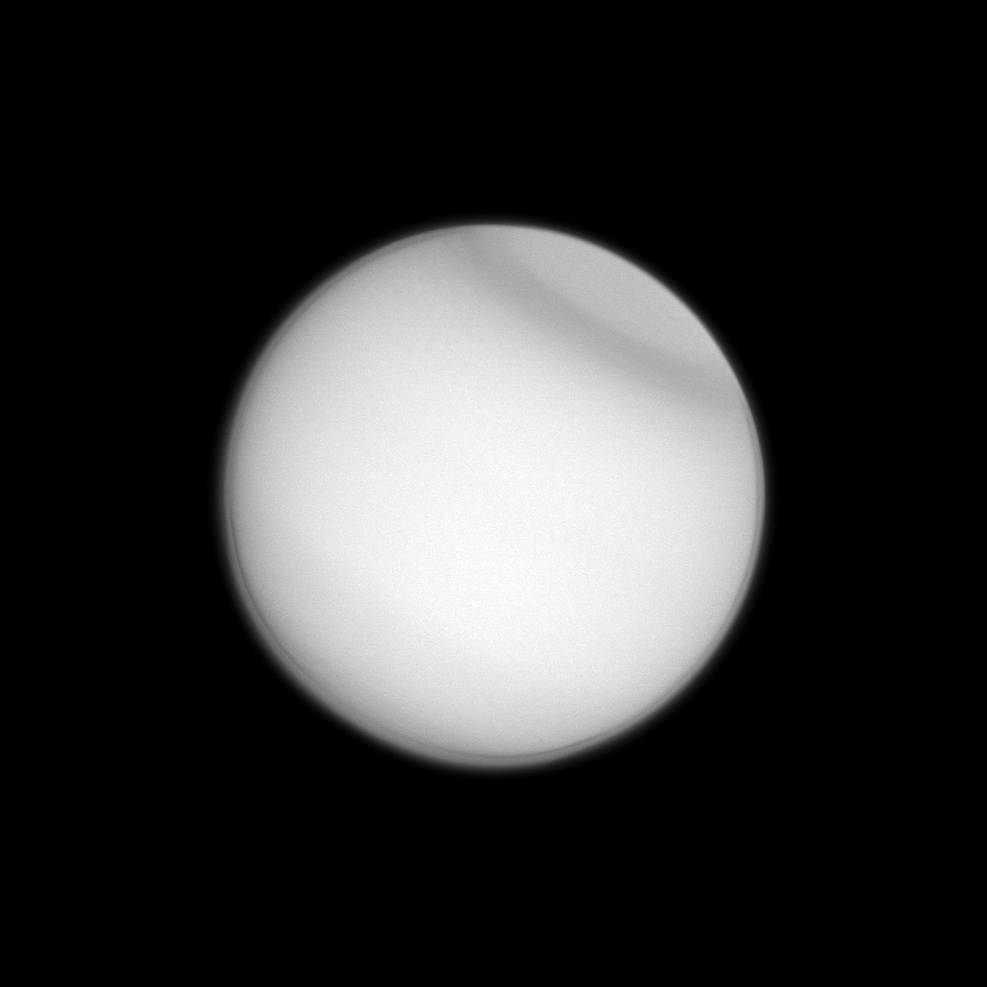
UV image of Titan acquired by Cassini on April 13 (NASA/JPL-Caltech/SSI)

As high summer slowly but steadily approaches on Saturn, Cassini is opening a window to the seasonal changes that occur not only on the ringed planet but also its moons. Here we can see a dark band developing around Titan’s north polar latitudes, a “fancy collar” made visible in ultraviolet wavelengths.

Polar collars have previously been seen by both Hubble and Voyager 2, and in fact a southern version was observed by HST 5 years after the planet’s 1995 equinox.

This summer collar is thought to be part of a seasonal process, related to the migration of upper-level haze material within Titan’s atmosphere.

Source: CICLOPS (Cassini Imaging Central Laboratory for OPerationS)

An Illustrative Explanation Of Our Solar System

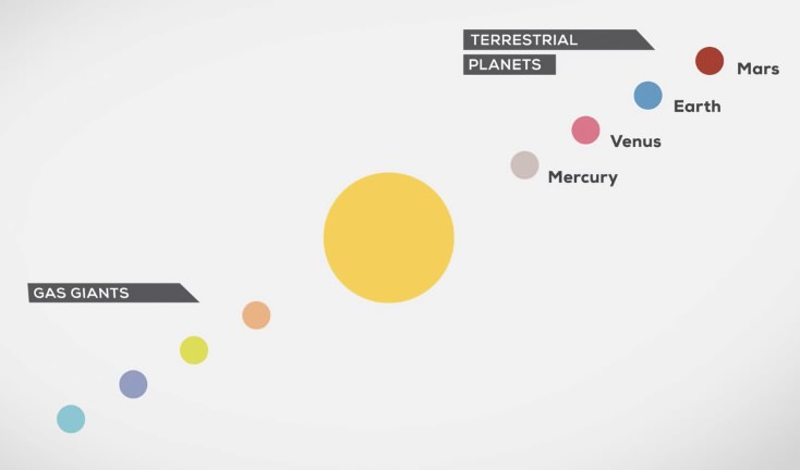
The Solar System: Our Home in Space (screenshot) © Philipp Dettmer Information Design

The Solar System: it’s our home in space, the neighborhood that we all grew up in and where — unless we figure out a way to get somewhere else — all of our kids and grandkids and great-great-great-great-times-infinity-great-grandkids will grow up too. That is, of course, until the Sun swells up and roasts Earth and all the other inner planets to a dry crunchy crisp before going into a multi-billion year retirement as a white dwarf.

But until then it’s a pretty nice place to call home, if I may say so myself.

Edu-film designer Philipp Dettmer and his team have put together a wonderful little animation explaining the basic structure of the Solar System using bright, colorful graphics and simple shapes to illustrate the key points of our cosmic neighborhood. It won’t teach you everything you’ll ever need to know about the planets and it’s not advisable to use it as a navigation guide, but it is fun to watch and well-constructed, with nice animation by Stephan Rether and narration by Steve Taylor.

Check out the full video below:

“Through information design, concepts can be made easy and accessible when presented in a short, understandable edu-film or perhaps an infographic. Whether explaining the vastness of the universe or the tiniest building blocks of life – all information can be presented in a way that everyone understands. Regardless of prior knowledge.”
– Philipp Dettmer

(And come on, admit it… you learned something new from this!)

Credit: Philipp Dettmer Information Design. HT to Colin Lecher at Salon.

Voyager 1: Is It In or Is It Out?

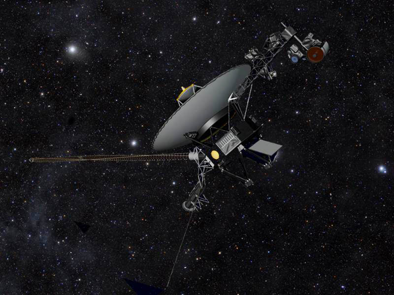
Has Voyager 1 actually left the Solar System? Some researchers are saying yes. (Image: NASA/JPL-Caltech)

Nearly 18.7 billion kilometers from Earth — about 17 light-hours away — NASA’s Voyager 1 spacecraft is just about on the verge of entering interstellar space, a wild and unexplored territory of high-energy cosmic particles into which no human-made object has ever ventured. Launched in September 1977, Voyager 1 will soon become the first spacecraft to officially leave the Solar System.

Or has it already left?

I won’t pretend I haven’t heard it before: Voyager 1 has left the Solar System! Usually followed soon after by: um, no it hasn’t. And while it might all seem like an awful lot of flip-flopping by supposedly-respectable scientists, the reality is there’s not a clear boundary that defines the outer limits of our Solar System. It’s not as simple as Voyager rolling over a certain mileage, cruising past a planetary orbit, or breaking through some kind of discernible forcefield with a satisfying “pop.” (Although that would be cool.)

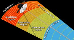
The outer edge of the heliosphere has been found to contain many different regions, which Voyager 1 has been passing through since 2004. (NASA/JPL-Caltech)

Rather, scientists look at Voyager’s data for evidence of a shift in the type of particles detected. Within the transitionary zone that the spacecraft has most recently been traveling through, low-energy particles from the Sun are outnumbered by higher-energy particles zipping through interstellar space, also called the local interstellar medium (LISM). Voyager’s instruments have been detecting dramatic shifts in the concentrations of each for over a year now, unmistakably trending toward the high-energy end — or at least showing a severe drop-off in solar particles — and researchers from the University of Maryland are claiming that this, along with their model of a porous solar magnetic field, indicates Voyager has broken on through to the other side.

Read more: Voyagers Find Giant Jacuzzi-like Bubbles at Edge of Solar System

“It’s a somewhat controversial view, but we think Voyager has finally left the Solar System, and is truly beginning its travels through the Milky Way,” said Marc Swisdak, UMD research scientist and lead author of a new paper published this week in The Astrophysical Journal Letters.

According to Swisdak, fellow UMD plasma physicist James F. Drake, and Merav Opher of Boston University, their model of the outer edge of the Solar System  fits recent Voyager 1 observations — both expected and unexpected. In fact, the UMD-led team says that Voyager passed the outer boundary of the Sun’s magnetic influence, aka the heliopause… last year.

Read more: Winds of Change at the Edge of the Solar System

But, like some of last year’s claims, these conclusions aren’t shared by mission scientists at NASA.

“Details of a new model have just been published that lead the scientists who created the model to argue that NASA’s Voyager 1 spacecraft data can be consistent with entering interstellar space in 2012,” said Ed Stone, Voyager project scientist at Caltech, in a press release issued today. “In describing on a fine scale how magnetic field lines from the sun and magnetic field lines from interstellar space can connect to each other, they conclude Voyager 1 has been detecting the interstellar magnetic field since July 27, 2012. Their model would mean that the interstellar magnetic field direction is the same as that which originates from our sun.

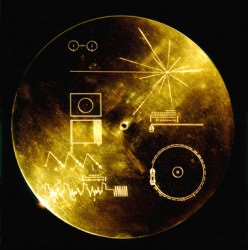
The famous "Golden Record" carried aboard both Voyager 1 and 2 contains images, sounds and greetings from Earth. (NASA)
The famous “Golden Record” carried aboard both Voyager 1 and 2 contains images, sounds and greetings from Earth. (NASA)

“Other models envision the interstellar magnetic field draped around our solar bubble and predict that the direction of the interstellar magnetic field is different from the solar magnetic field inside. By that interpretation, Voyager 1 would still be inside our solar bubble.”

Stone says that further discussion and investigation will be needed to “reconcile what may be happening on a fine scale with what happens on a larger scale.”

Whether still within the Solar System — however it’s defined — or outside of it, the bottom line is that the venerable Voyager spacecraft are still conducting groundbreaking research of our cosmic neighborhood, 36 years after their respective launches and long after their last views of the planets. And that’s something nobody can argue about.

“The Voyager 1 spacecraft is exploring a region no spacecraft has ever been to before. We will continue to look for any further developments over the coming months and years as Voyager explores an uncharted frontier.”

– Ed Stone, Voyager project scientist

Built by JPL and launched in 1977, both Voyagers are still capable of returning scientific data from a full range of instruments, with adequate power and propellant to remain operating until 2020.

Read the full UMD news release here, and find out more about the Voyager mission on the NASA/JPL website here.

_____________

Note: The definition of “Solar System” used in this article is in reference to the Sun’s magnetic influence, the heliosphere, and all that falls within its outermost boundary, the heliopause (wherever that is.) Objects farther out are still gravitationally held by the Sun, such as distant KBOs and Oort Cloud comets, but orbit within the interstellar medium. 

See the Curiosity Mars Panorama on Permanent Display at the US National Mall

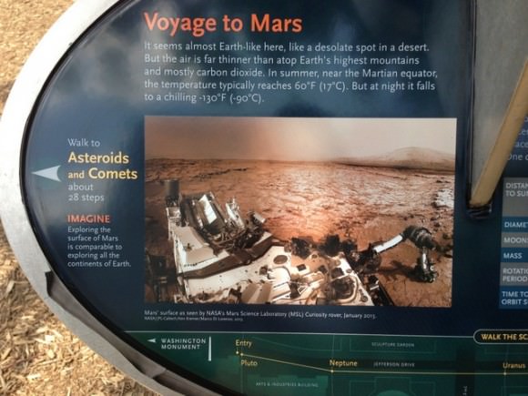
A mosaic by the Mars Science Laboratory Curiosity rover, assembled by Ken Kremer and Marco Di Lorenzo is now part of the permanent Solar System Exhibit outside the National Air and Space Museum on the US National Mall in Washington, D.C. Image courtesy Ken Kremer.

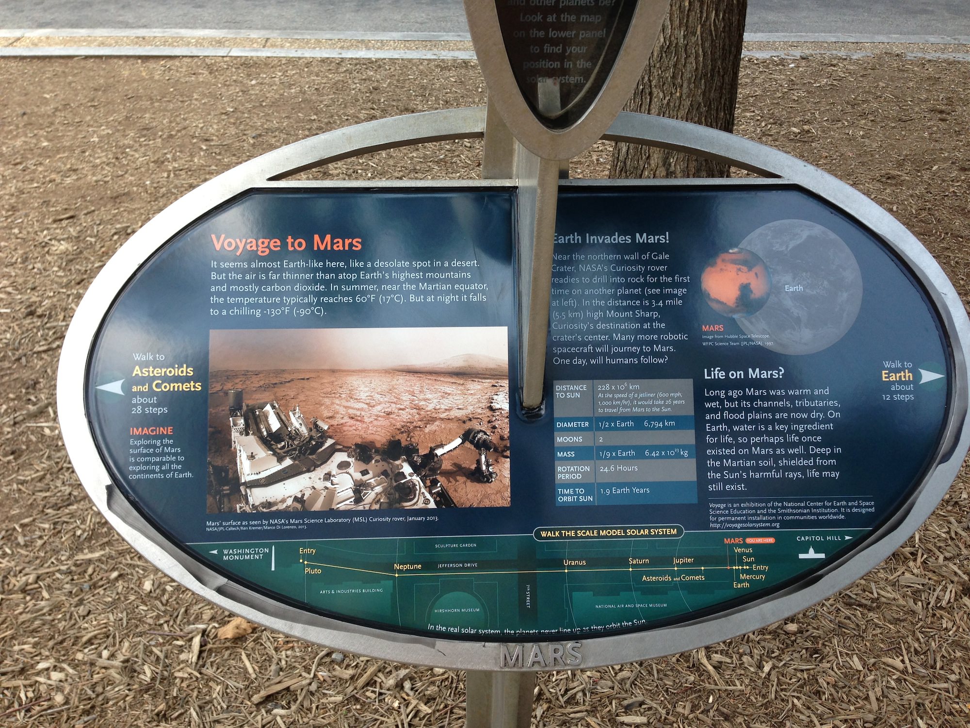
Congratulations to Universe Today writer Ken Kremer and his partner in image editing, Marco Di Lorenzo, who have had one of the panoramas they created from the Curiosity rover’s imagery included in a permanent Solar System exhibit outside the National Air and Space Museum on the US National Mall in Washington, D.C. The exhibit is called “Voyage” and was created by the National Center for Earth and Space Science Education (NCESSE) and is sponsored in part by NASA.

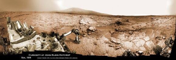
Ken said the NCESSE contacted him a few months ago back to use the mosaic — from Sol 169 of Curiosity’s time on Mars — and the project is finally complete. “They liked and chose it because it evokes a human presence on Mars with the rover in the foreground,” Ken said.

The exhibit is a one to 10-billion scale model of our Solar System—spanning 600 meters (6,000 feet) from the National Air and Space Museum to the Smithsonian Castle Building, and Ken and Marco’s image from the Curiosity rover is part of the information about Mars.

Here’s a description of the exhibit from NCESSE website:

“The Voyage exhibition on the National Mall, installed in 2001, was created through a partnership between Challenger Center for Space Science Education, the Smithsonian Institution, and NASA. A summer 2013 update of this exhibition’s content was undertaken by the National Center for Earth and Space Science Education and the Smithsonian Institution, through a grant from the District of Columbia Space Grant Consortium. To learn more, and view photo albums of all Voyage exhibitions, visit the Voyage National Program page.”

Here’s a closeup of Ken and Marco’s mosaic:

Close up of the Mars placard for the Voyager Solar System exhibit. Image courtesy of Ken Kremer.

And a full view of the image is below.

You can learn more about the exhibit at the NCESSE Voyage webpage. Again, congratulations to Ken and Marco!

Curiosity accomplished Historic 1st drilling into Martian rock at John Klein outcrop on Feb 8, 2013 (Sol 182), shown in this context mosaic view of the Yellowknife Bay basin taken on Jan. 26 (Sol 169). The robotic arm is pressing down on the surface at John Klein outcrop of veined hydrated minerals - dramatically back dropped with  her ultimate destination; Mount Sharp.  Credit: NASA/JPL-Caltech/Ken Kremer/Marco Di Lorenzo
Curiosity accomplished Historic 1st drilling into Martian rock at John Klein outcrop on Feb 8, 2013 (Sol 182), shown in this context mosaic view of the Yellowknife Bay basin taken on Jan. 26 (Sol 169). The robotic arm is pressing down on the surface at John Klein outcrop of veined hydrated minerals – dramatically back dropped with her ultimate destination; Mount Sharp. Credit: NASA/JPL-Caltech/Ken Kremer/Marco Di Lorenzo