This Early Impact Devastated Life then Gave it a Boost

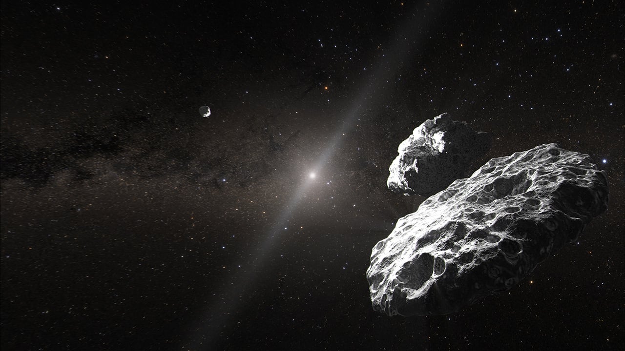
This graphic depicts what happened when the S2 meteorite struck Earth about 3.26 billion years ago. Initially, it was devastating but eventually it lead to mass blooms. Image Credit: Drabon et al. 2024.

Most of us know about the impact that wiped out the dinosaurs about 66 million years ago. It’s a scientific fact that’s entered mainstream knowledge, maybe because so many of us shared a fascination with dinosaurs as children. However, it’s not the only catastrophic impact that shaped life on Earth.

There was an even more ancient one about 3.26 billion years ago, and its repercussions shaped early life in a unique way.

Continue reading “This Early Impact Devastated Life then Gave it a Boost”

The Asteroid That Killed the Dinosaurs Also Flooded the World's Coastlines With a Catastrophic Tsunami

Earth and possibly its Moon were hit by impactors that killed off the dinosaurs
Artistic rendition of the Chicxulub impactor striking ancient Earth, with Pterosaur observing. Could pieces of the same impact swarm have hit the Moon, too? Credit: NASA

For decades, scientists have theorized that a massive impact caused the Cretaceous-Paleogene extinction event. This event occurred about 66 million years ago and caused the mass extinction of about 75% of all plant and animal species on Earth (including the non-avian dinosaurs). With the discovery of the massive Chicxulub crater in the Yucatan Peninsula (southern Mexico) in the 1970s, scientists concluded that they’d found the impact responsible. Based on all the available data, the Chicxulub Impact event is believed to have been as powerful as 100,000 billion metric tons (110,231 U.S tons) of TNT.

This blast was more powerful than all the nuclear devices in the world combined and sent an estimated 25 trillion metric tons (~27.5 US tons) of hot dust, ash, and steam into the atmosphere, creating a global winter. But according to new research led by the University of Michigan, an international team of geologists has determined that the impact also created a global tsunami. According to their findings, this tsunami was 30,000 times more powerful than the 2004 Indian Ocean tsunami, one of the largest and most devastating tsunamis on record.

Continue reading “The Asteroid That Killed the Dinosaurs Also Flooded the World's Coastlines With a Catastrophic Tsunami”

What Is an Earthquake?

The "Global Tectonic and Volcanic Activity of the Last One Million Years" map. Credit: NASA/DTAM

For people who live on or near an active fault line – such as the San Andreas Fault in California, the Median Tectonic Line in Japan, or the Sunda Megathrust of southeast Asia – earthquakes are a regular part of life. Oftentimes, they can take the form of minor tremors that come and go without causing much damage.

But at other times, they are cataclysmic, causing widespread destruction and death tolls in the thousands or more. But what exactly is an earthquake? What geological forces lead to this destructive force? Where do they typically happen, and how many different types are there? And most importantly, how can we be better prepared for them?

Definition:

An earthquake is defined as a perceptible tremor in the surface of the Earth, which is caused by seismic waves resulting from the sudden release of energy in the Earth’s crust. Sometimes, they are detected because of the transfer of this energy to structures, causing noticeable shaking and noise. At other times, they can be violent enough to throw people and level entire cities.

Global earthquake epicenters, 1963–1998. Credit: NASA/DTAM

Generally, the term is used to describe any seismic event that generates seismic waves. An earthquake’s point of initial rupture is called its focus or hypocenter, while the point on the Earth directly above it (i.e. the most immediately-effected area) is called the epicenter.

Causes:

The structure of the Earth’s crust, which is divided into several “tectonic plates”, is responsible for most earthquakes. These plates are constantly in motion due to convection in the Earth’s semi-viscous upper mantle. Over time, these plates will separate and crash into each other, creating visible boundaries called faults.

When plates collide, they remain locked until enough pressure builds that one of them is forced under the other (a process known as subduction). This process occurs over the course of millions of years, and occasionally results in a serious release of energy, frictional heating and cracking along the fault lines (aka. an earthquake).

The energy waves that result are divided into two categories  – surface waves and body waves. Surface waves are so-named because they are the energy that reaches the surface of the Earth, while body waves refer to the energy that remains within the planet’s interior.

The Earth's Tectonic Plates. Credit: msnucleus.org
Map of the Earth’s Tectonic Plates. Credit: msnucleus.org

It is estimated that only 10% or less of an earthquake’s total energy is radiated as seismic energy, while the rest is used to power the fracture growth or is converted into friction heat. However, what reaches the surface triggers all of the effects that we humans associate with earthquakes – i.e. tremors that vary in duration and intensity.

Occasionally, earthquakes can happen away from fault lines. These are due to some plate boundaries being located in regions of continental lithosphere, where deformation is spread out over a much larger area than the plate boundary. Under these conditions, earthquakes are related to strains developed within the broader zone of deformation.

Earthquakes within a plate (called “intraplate earthquakes”) can also happen as a result of internal stress fields, which are caused by interaction with neighboring plates, as well as sedimentary loading or unloading.

Aside from naturally occurring earthquakes (aka. tectonic earthquakes) that occur along tectonic plate lines (fault lines), there are also those that fall under the heading of “human-made earthquakes”. These are all the result of human activity, which is most often the result of nuclear testing.

A 23 kiloton tower shot called BADGER, fired on April 18, 1953 at the Nevada Test Site, as part of the Operation Upshot–Knothole nuclear test series. Credit: NNSA
Earthquakes can also be caused by human-made factors, such as nuclear testing. Credit: NNSA

This type of earthquake can been felt all from considerable distance after the detonation of a nuclear weapon. There is very little actual data that is readily available on this type of earthquake, but, compared to tectonic activity, it can be easily predicted and controlled.

Measurements:

Scientists measure earthquakes using seismometers, which measures sound waves through the Earth’s crust. There is also a method of measuring the intensity of an earthquake. It is known as the Richter Scale, which grades earthquakes from 1 to 10 based on their intensity.

Although there is no upper limit to the scale, most people set ten as the upper limit because no earthquakes equal to or greater than ten have been recorded. Scientist hypothesize that level 10 earthquakes were probably more common in prehistoric times, especially as the result of meteor impacts.

Effects of Earthquakes:

Earthquakes can happen on land or at sea, and can therefore trigger other natural disasters. In the case of those that take place on land, displacement of the ground is often the result, which can cause landslides or even volcanoes. When they take place at sea, the displacement of the seabed often results, causing a tsunami.

Map of major earthquakes around the world. Credit: USGS / Google Maps / AJAX / SODA
Map of earthquakes around the world in a seven day period. Credit: USGS / Google Maps / AJAX / SODA

Even though major earthquakes do not happen that often, they can cause substantial damage. In addition to the aforementioned natural disasters they can cause, earthquakes can also trigger fires when gas or electrical lines are damaged and floods when dams are destroyed.

Some of the most devastating earthquakes in history include the 1556 Shaanxi earthquake, which occurred on January 1556 in China. This quake resulted in widespread destruction of housing in the region – most of the housing being dwellings carved directly out of the silt stone mountain – and led to over 830,000 deaths.

The 1976 Tangshan earthquake, which took place in north-eastern China, was the deadliest of the 20th century, leading to he deaths of between 240,000 and 655,000 people. The 1960 Chilean earthquake is the largest earthquake that has been measured on a seismograph, reaching 9.5 magnitude on May 22nd, 1960.

And then there was the 2004 Indian Ocean earthquake, a seismic event that also triggered a massive tsunami that caused devastation throughout southeast Asia. This quake reached 9.1 – 9.3 on the Richter Scale, struck coastal communities with waves measuring up to 30 meters (100 ft) high, and caused the deaths of 230,000 people in 14 countries.

 A village near the coast of Sumatra that was devastated by the 2004 Tsunami. Credit: US Navy
A village near the coast of Sumatra that was devastated by the 2004 Tsunami. Credit: Wikipedia Commons/US Navy

Warning Systems:

More than 3 million earthquakes occur each year, which works out to about 8,000 earthquakes each day. Most of these occur in specific regions, mainly because they usually happen along the borders of tectonic plates. Despite being difficult to predict (except where human agency is the cause) some early warning methods have been devised.

For instance, using seismological data obtained in well-understood fault regions, earthquakes can be reasonably predicted weeks or months in advance. Regional notifications are also used whenever earthquakes are in progress, but before the shocks have struck, allowing people time to seek shelter in time.

Much like volcanoes, tornadoes, and debris flows, earthquakes are a force of nature that is not to be taken lightly. While they are a regular feature of our planet’s geological activity, they have had a considerable impact on human societies. And just like the eruption that buried Pompeii or the Great Flood, they are remembered long after they strike!

We have written many interesting articles about earthquakes here at Universe Today. Here’s Famous Earthquakes, What Causes Earthquakes?, What are Earthquake Fault Lines?, What are the Different Types of Earthquakes? and The Sun Doesn’t Cause Earthquakes,

For more information, you should check out earthquakes and how earthquakes work.

Astronomy Cast has an episode on the subject – Episode 51: Earth

Sources:

Japan Quake May Have Shortened Earth Days, Moved Axis

TerraSAR-X Change Analysis of Sendai Area, Japan. Map show coastal area of Sendai effected by 9,0 magnitude Earthquake that triggered ensuing destructive Tsunami. Credit: Deutsches Zentrum fur Luft- und Raumfahrt (DLR) - German Aerospace Center

[/caption]

The terribly destructive magnitude 9.0 earthquake which struck Japan on March 11, may have had another effect – Shortening the length of each Earth day and shifting its axis. Did you notice any change ?

Well according to NASA, the changes are so small that you won’t notice the difference.

Based on initial calculations conducted by Richard Gross, a research scientist at NASA’s Jet Propulsion Laboratory, the earthquake should have caused Earth to rotate just slightly faster, shortening the length of the day by about 1.8 microseconds (a microsecond is one millionth of a second), according to a statement released by NASA.

A reader posted this link to before and after photos

Gross used complex modeling and estimates of fault slippage to perform a preliminary theoretical calculation of how the earth’s rotation may have been affected.

Calculations by Gross also indicate that the position of Earth’s figure axis could have shifted by about 17 centimeters (6.5 inches), towards 133 degrees east longitude. The figure axis is the axis about which Earth’s mass is balanced.
Earth’s figure axis is therefore different and offset from the north-south axis by about 10 meters.

“This shift in Earth’s figure axis will cause Earth to wobble a bit differently as it rotates, but it will not cause a shift of Earth’s axis in space-only external forces such as the gravitational attraction of the sun, moon and planets can do that,” according to the NASA statement.

The estimates for both the shortening in the Earth’s rotation and shift in the figure axis are preliminary and will very likely change as more data is collected and the calculations are refined.

The March 11 earthquake was the fifth largest since 1900. So far, over 4000 people are confirmed dead and the overall death total may exceed 10,000.

Several heavily damaged nuclear reactors at the Fukushima plant are in danger of meltdown as hero workers inside put their lives on the line to avoid a catastrophic failure and try to prevent the spread of lethal radiation.

This view of Earth comes from NASA's Moderate Resolution Imaging Spectroradiometer aboard the Terra satellite

Previously, Gross had calculated the affects of the magnitude 8.8 Chilean quake in 2010 and found them to be slightly smaller compared to the Japanese quake. He calculated a shortening in the length of day of about 1.26 microseconds and shifting of Earth’s figure axis of about 8 centimeters (3 inches). These affects are dependent on the magnitude of the quake, exactly where it is located as well as how the particulars of how the fault slips.

In fact, Earth’s rotation is changing all the time as a result of continual changes in atmospheric winds and oceanic currents and these effects are about 550 times larger than the Japanese earthquake.

“Over the course of a year, the length of the day increases and decreases by about a millisecond,” says Gross. Indeed, the effects of earthquakes on changing rotation are so tiny that they are smaller than the margin of error in the measurements themselves.

By comparison, measurements of the figure axis are much more reliable and meaningful. Changes to the figure axis can be accurately measured to within about 5 centimeters. This means that the estimated 17 centimeter shift from the Japanese quake may be real after accounting for the effects of the atmospheric winds and ocean currents. Further research is needed as more data are collected and analyzed.

“These changes in Earth’s rotation are perfectly natural and happen all the time. People shouldn’t worry about them,” said Gross.

Source: NASA Press Release:

Tsunami Pictures

Sri Lanka Tsunami pictures

Tsunamis are some of the most devastating natural disasters. The recent Boxing Day Tsunami was generated by an enormous earthquake off the coast of Indonesia on December 26, 2004. Coastlines in Asia were inundated with enormous tsunami surges, killing more than 200,000 people.

Here are some Tsunami pictures capture by satellite that show before and after images of the regions affected by the tsunami.

[/caption]

This photograph shows the devastation that happened in Sri Lanka on December 26th. This picture was taken by the DigitalGlobe Quickbird satellite, and shows how the whole coastline was inundated with water.

Devastation in Indonesia

Perhaps the most devastation from the tsunami occurred in Indonesia. This is an image of the town of Lhoknga, Indonesia. It was completely wiped off the map by the tsunami, except for the white mosque in the center of town.


Northern Sumatra
Northern Sumatra

This photograph, captured by NASA’s Terra satellite shows how the whole northwest coast of the island of Sumatra was hit hard by the tsunami. It looks like the vegetation was just scraped back from the edge of the island.

We have written many articles about the devastation from the 2004 tsunami. Here’s an article about how GPS could be used for a tsunami warning system.

You can get many more tsunami pictures from NASA from their Earth observation page.

What Causes Tides?

The Earth is a water-dominated planet. (Image credit: Ian O'Neill)

Tides refer to the rise and fall of our oceans’ surfaces. It is caused by the attractive forces of the Moon and Sun’s gravitational fields as well as the centrifugal force due to the Earth’s spin. As the positions of these celestial bodies change, so do the surfaces’ heights. For example, when the Sun and Moon are aligned with the Earth, water levels in ocean surfaces fronting them are pulled and subsequently rise.

The Moon, although much smaller than the Sun, is much closer. Now, gravitational forces decrease rapidly as the distance between two masses widen. Thus, the Moon’s gravity has a larger effect on tides than the Sun. In fact, the Sun’s effect is only about half that of the Moon’s.

Since the total mass of the oceans does not change when this happens, part of it that was added to the high water regions must have come from somewhere. These mass-depleted regions then experience low water levels. Hence, if water on a beach near you is advancing, you can be sure that in other parts of the world, it is receding.

Most illustrations containing the Sun, Moon, Earth and tides depict tides to be most pronounced in regions near or at the equator. On the contrary, it is actually in these regions where the difference in high tide and low tide are not as great as those in other places in the world.

This is because the bulging of the oceans’ surface follows the Moon’s orbital plane. Now, this plane is not in line with the Earth’s equatorial plane. Instead, it actually makes a 23-degree angle relative to it. This essentially allows the water levels at the equator to seesaw within a relatively smaller range (compared to the ranges in other places) as the orbiting moon pulls the oceans’ water.

Not all tides are caused by the relative positions of these celestial bodies. Some bodies of water, like those that are relatively shallow compared to oceans, experience changing water levels because of variations in the surrounding atmospheric pressure. There are also other extreme situations wherein tides are manifested but have nothing to do with astronomical positioning.

A tidal wave or tsunami, for example, makes use of the word ‘tide’ and actually exhibits rise and fall of water levels (in fact, it is very noticeable). However, this phenomena is caused entirely by a displacement of a huge amount of water due to earthquakes, volcanic eruptions, underwater explosions, and others. All these causes take place on the Earth’s surface and have nothing to do with the Moon or Sun.

A thorough study of tides was conducted by Isaac Newton and included in his published work entitled Philosophiæ Naturalis Principia Mathematica.

We have some related articles here that may interest you:

There’s more about it at NASA. Here are a couple of sources there:

Here are two episodes at Astronomy Cast that you might want to check out as well:

Sources:
Princeton University
NASA
NOAA

Famous Earthquakes

Earthquakes are among the most devastating forces of nature. What we have are seven of the world’s most famous earthquakes, chronologically listed below. Not all included here are necessarily the strongest (in terms of magnitude) but they made the headlines when they hit. Here they are:

Shaanxi Earthquake of 1556

– This was the deadliest quake ever recorded. It claimed the lives of about 830,000 people. At that time, most inhabitants in the affected areas were living in Yaodongs or artificial caves. They were buried alive when the huge tremors caused the cliffs in which these caves were located in, to collapse.

San Francisco Earthquake of 1906

– Although its tremors were also felt in Southern Oregon, it is the resulting fire in San Francisco that had a more devastating impact on the economy. Is has been often compared recently to Hurricane Katrina because of its similar economic bearing.

The Great Chilean Earthquake of 1960

– Like the one that hit Asia in 2004, this 9.5-rated quake resulted in a massive tsunami reaching up to as high as 10.7 meters. This magnitude is the highest recorded ever. Although the tsunami originated in Cañete, Chile, the waves raced north-westward to Japan and the Philippines, wreaking havoc there.

Great Alaska Earthquake of 1964

– With a magnitude of 9.2, it is the second strongest earthquake to be ever recorded. It caused tsunamis, landslides, and resulted in major landscape changes. Some places near Kodiak is said to have been raised 9.1 meters high, while those near Portage were dropped by 2.4 meters. Here are more articles about Alaska earthquakes.

Great Tangshan Earthquake of 1976

– This is the deadliest quake of the 20th Century, with the number of deaths hitting somewhere near 250,000. Weak building structures and the time this disaster struck (4 am) contributed a lot to that sickening number.

Bam Earthquake of 2003

– The death toll in this tremor reached over 26,000. Like the one in Tangshan, the use of poor construction materials was one of the leading culprits for the deaths. Most of the affected buildings were made of mud bricks.

Indian Ocean Earthquake of 2004

– The resulting tsunami that killed 230,000 people was caused by a subduction between the India and Burma plate. Its 30 m-high waves destroyed virtually everything in its path, making this quake not only one of the most famous earthquakes but also one of the famous natural disasters in history.

Excluding poor building infrastructure, we can see that high death tolls in these famous earthquakes result when the tremors are accompanied by tsunamis. This happens when the quake’s epicenter is found at the bottom of the ocean.

You can read more about famous earthqueakes here in Universe Today. Here are the links:

There’s more about it at USGS. Here are a couple of sources there:

Here are two episodes at Astronomy Cast that you might want to check out as well:

Sources:
http://en.wikipedia.org/wiki/1906_San_Francisco_earthquake
http://en.wikipedia.org/wiki/2006_Hawaii_earthquake
http://en.wikipedia.org/wiki/1556_Shaanxi_earthquake
http://earthquake.usgs.gov/earthquakes/world/events/1960_05_22.php
http://en.wikipedia.org/wiki/1964_Alaska_earthquake
http://en.wikipedia.org/wiki/1976_Tangshan_earthquake
http://en.wikipedia.org/wiki/2003_Bam_earthquake
http://en.wikipedia.org/wiki/2004_Indian_Ocean_earthquake_and_tsunami