Dawn Probe Finds Evidence of Subsurface Ice on Vesta

Artist's concept of the Dawn spacecraft arriving at Vesta. Image credit: NASA/JPL-Caltech

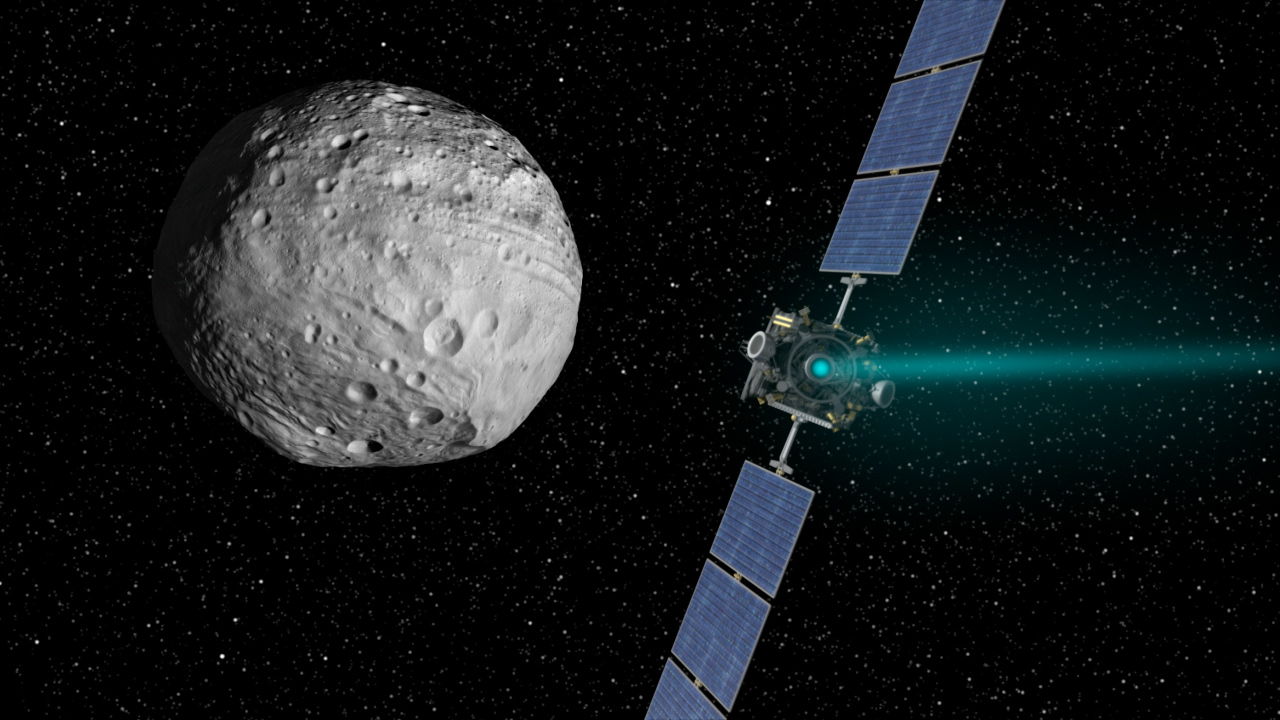
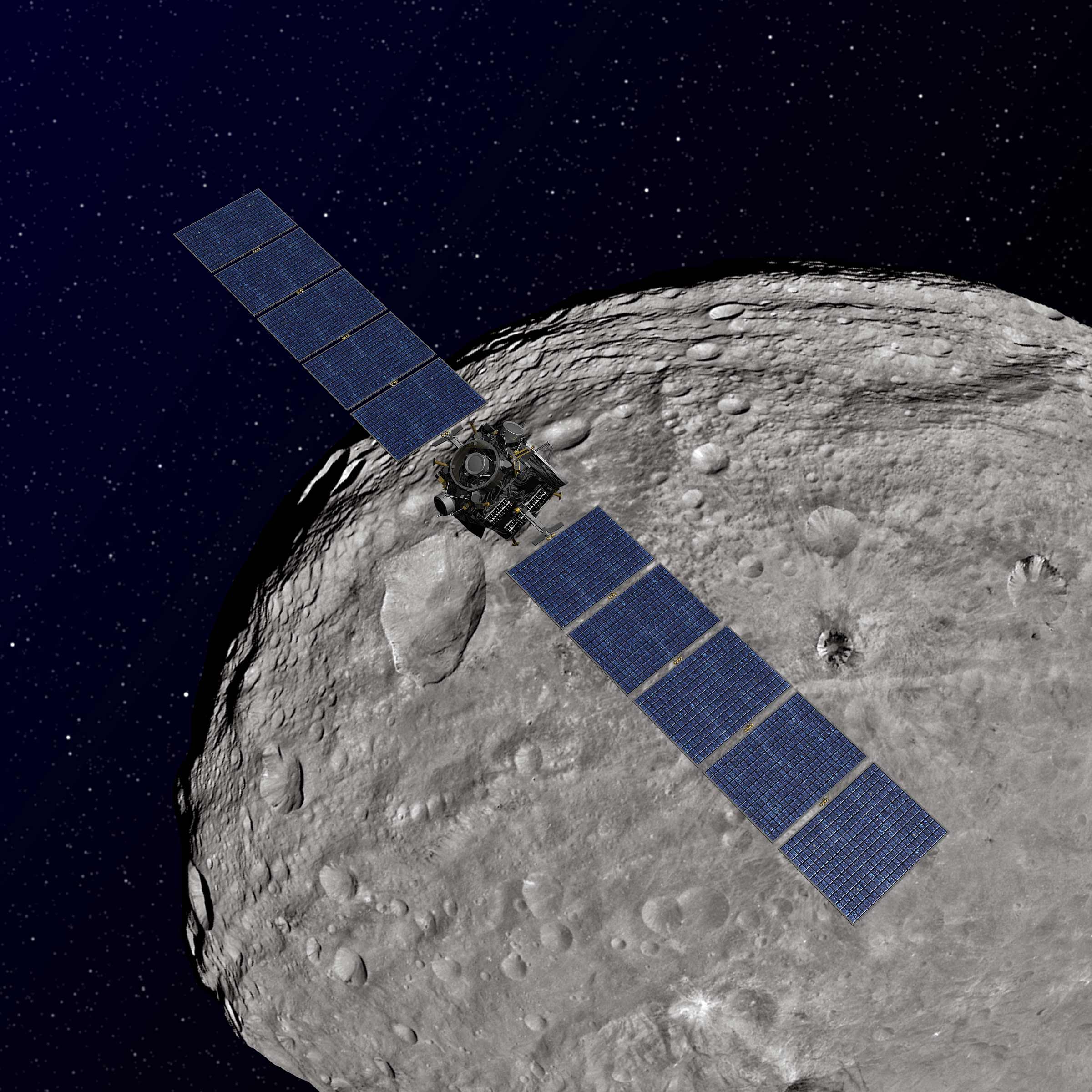
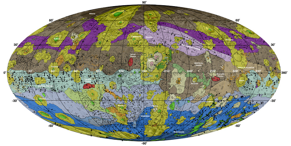
In 2011, NASA’s Dawn spacecraft established orbit around the large asteroid (aka. planetoid) known as Vesta. Over the course of the next 14 months, the probe conducted detailed studies of Vesta’s surface with its suite of scientific instruments. These findings revealed much about the planetoid’s history, its surface features, and its structure – which is believed to be differentiated, like the rocky planets.

In addition, the probe collected vital information on Vesta’s ice content. After spending the past three years sifting through the probe’s data, a team of scientists has produced a new study that indicates the possibility of subsurface ice. These findings could have implications when it comes to our understanding of how Solar bodies formed and how water was historically transported throughout the Solar System.

Their study, titled “Orbital Bistatic Radar Observations of Asteroid Vesta by the Dawn Mission“, was recently published in the scientific journal Nature Communications. Led by Elizabeth Palmer, a graduate student from Western Michigan University, the team relied on data obtained by the communications antenna aboard the Dawn spacecraft to conduct the first orbital bistatic radar (BSR) observation of Vesta.

Artist rendition of Dawn spacecraft orbiting Vesta. Credit: NASA/JPL-Caltech

This antenna – the High-Gain telecommunications Antenna (HGA) – transmitted X-band radio waves during its orbit of Vesta to the Deep Space Network (DSN) antenna on Earth. During the majority of the mission, Dawn’s orbit was designed to ensure that the HGA was in the line of sight with ground stations on Earth. However, during occultations – when the probe passed behind Vesta for 5 to 33 minutes at a time – the probe was out of this line of sight.

Nevertheless, the antenna was continuously transmitting telemetry data, which caused the HGA-transmitted radar waves to be reflected off of Vesta’s surface. This technique, known as bistatic radar (BSR) observations has been used in the past to study the surfaces of terrestrial bodies like Mercury, Venus, the Moon, Mars, Saturn’s moon Titan, and the comet 67P/CG.

But as Palmer explained, using this technique to study a body like Vesta was a first for astronomers:

“This is the first time that a bistatic radar experiment was conducted in orbit around a small body, so this brought several unique challenges compared to the same experiment being done at large bodies like the Moon or Mars. For example, because the gravity field around Vesta is much weaker than Mars, the Dawn spacecraft does not have to orbit at a very high speed to maintain its distance from the surface. The orbital speed of the spacecraft becomes important, though, because the faster the orbit, the more the frequency of the ‘surface echo’ gets changed (Doppler shifted) compared to the frequency of the ‘direct signal’ (which is the unimpeded radio signal that travels directly from Dawn’s HGA to Earth’s Deep Space Network antennas without grazing Vesta’s surface). Researchers can tell the difference between a ‘surface echo’ and the ‘direct signal’ by their difference in frequency—so with Dawn’s slower orbital speed around Vesta, this frequency difference was very small, and required more time for us to process the BSR data and isolate the ‘surface echoes’ to measure their strength.”

This high-res geological map of Vesta is derived from Dawn spacecraft data. Brown colors represent the oldest, most heavily cratered surface. Credit: NASA/JPL-Caltech/ASU

By studying the reflected BSR waves, Palmer and her team were able to gain valuable information from Vesta’s surface. From this, they observed significant differences in surface radar reflectivity. But unlike the Moon, these variations in surface roughness could not be explained by cratering alone and was likely due to the existence of ground-ice. As Palmer explained:

“We found that this was the result of differences in the roughness of the surface at the scale of a few inches.  Stronger surface echoes indicate smoother surfaces, while weaker surface echoes have bounced off of rougher surfaces. When we compared our surface roughness map of Vesta with a map of subsurface hydrogen concentrations—which was measured by Dawn scientists using the Gamma Ray and Neutron Detector (GRaND) on the spacecraft—we found that extensive smoother areas overlapped areas that also had heightened hydrogen concentrations!”

In the end, Palmer and her colleagues concluded that the presence of buried ice (past and/or present) on Vesta was responsible for parts of the surface being smoother than others. Basically, whenever an impact happened on the surface, it transferred a great deal of energy to the subsurface. If buried ice was present there, it would be melted by the impact event, flow to the surface along impact-generated fractures, and then freeze in place.

Much in the same way that moon’s like Europa, Ganymede and Titania experience surface renewal because of the way cryovolcanism causes liquid water to reach the surface (where it refreezes), the presence of subsurface ice would cause parts of Vesta’ surface to be smoothed out over time. This would ultimately lead to the kinds of uneven terrain that Palmer and her colleagues witnessed.

The planetoid Vesta, which was studied by the Dawn probe between July 2011 and September 2012. Credit: NASA

This theory is supported by the large concentrations of hydrogen that were detected over smoother terrains that measure hundreds of square kilometers. It is also consistent with geomorphological evidence obtained from the Dawn Framing Camera images, which showed signs of of transient water flow over Vesta’s surface. This study also contradicted some previously-held assumptions about Vesta.

As Palmer noted, this could also have implications as far as our understanding of the history and evolution of the Solar System is concerned:

Asteroid Vesta was expected to have depleted any water content long ago through global melting, differentiation, and extensive regolith gardening by impacts from smaller bodies. However, our findings support the idea that buried ice may have existed on Vesta, which is an exciting prospect since Vesta is a protoplanet that represents an early stage in the formation of a planet. The more we learn about where water-ice exists throughout the Solar System, the better we will understand how water was delivered to Earth, and how much was intrinsic to Earth’s interior during the early stages of its formation.”

This work was sponsored by NASA’s Planetary Geology and Geophysics program, a JPL-based effort that focuses on fostering the research of terrestrial-like planets and major satellites in the Solar System. The work was also conducted with the assistance of the USC’s Viterbi School of Engineering as part of an ongoing effort to improve radar and microwave imaging to locate subsurface sources of water on planets and other bodies.

Further Reading: USC, Nature Communications

How Do We Terraform Saturn’s Moons?

The moons of Saturn, from left to right: Mimas, Enceladus, Tethys, Dione, Rhea; Titan in the background; Iapetus (top) and irregularly shaped Hyperion (bottom). Some small moons are also shown. All to scale. Credit: NASA/JPL/Space Science Institute

Continuing with our “Definitive Guide to Terraforming“, Universe Today is happy to present our guide to terraforming Saturn’s Moons. Beyond the inner Solar System and the Jovian Moons, Saturn has numerous satellites that could be transformed. But should they be?

Around the distant gas giant Saturn lies a system of rings and moons that is unrivaled in terms of beauty. Within this system, there is also enough resources that if humanity were to harness them – i.e. if the issues of transport and infrastructure could be addressed – we would be living in an age a post-scarcity. But on top of that, many of these moons might even be suited to terraforming, where they would be transformed to accommodate human settlers.

As with the case for terraforming Jupiter’s moons, or the terrestrial planets of Mars and Venus, doing so presents many advantages and challenges. At the same time, it presents many moral and ethical dilemmas. And between all of that, terraforming Saturn’s moons would require a massive commitment in time, energy and resources, not to mention reliance on some advanced technologies (some of which haven’t been invented yet).

Continue reading “How Do We Terraform Saturn’s Moons?”

How Do We Terraform Jupiter’s Moons?

Surface features of the four members at different levels of zoom in each row

Continuing with our “Definitive Guide to Terraforming“, Universe Today is happy to present to our guide to terraforming Jupiter’s Moons. Much like terraforming the inner Solar System, it might be feasible someday. But should we?

Fans of Arthur C. Clarke may recall how in his novel, 2010: Odyssey Two (or the movie adaptation called 2010: The Year We Make Contact), an alien species turned Jupiter into a new star. In so doing, Jupiter’s moon Europa was permanently terraformed, as its icy surface melted, an atmosphere formed, and all the life living in the moon’s oceans began to emerge and thrive on the surface.

As we explained in a previous video (“Could Jupiter Become a Star“) turning Jupiter into a star is not exactly doable (not yet, anyway). However, there are several proposals on how we could go about transforming some of Jupiter’s moons in order to make them habitable by human beings. In short, it is possible that humans could terraform one of more of the Jovians to make it suitable for full-scale human settlement someday.

Continue reading “How Do We Terraform Jupiter’s Moons?”

A Star With A Disk Of Water Ice? Meet HD 100546

Young stars have a disk of gas and dust around them called a protoplanetary disk. Credit: NASA/JPL-Caltech

It might seem incongruous to find water ice in the disk of gas and dust surrounding a star. Fire and ice just don’t mix. We would never find ice near our Sun.

But our Sun is old. About 5 billion years old, with about 5 billion more to go. Some younger stars, of a type called Herbig Ae/Be stars (after American astronomer George Herbig,) are so young that they are surrounded by a circumstellar disk of gas and dust which hasn’t been used up by the formation of planets yet. For these types of stars, the presence of water ice is not necessarily unexpected.

Water ice plays an important role in a young solar system. Astronomers think that water ice helps large, gaseous, planets to form. The presence of ice makes the outer section of a planetary disk more dense. This increased density allows the cores of gas planets to coalesce and form.

Young solar systems have what is called a snowline. It is the boundary between terrestrial and gaseous planets. Beyond this snowline, ice in the protoplanetary disk encourages gas planets to form. Inside this snowline, the lack of water ice contributes to the formation of terrestrial planets. You can see this in our own Solar System, where the snowline must have been between Mars and Jupiter.

A team of astronomers using the Gemini telescope observed the presence of water ice in the protoplanetary disk surrounding the star HD 100546, a Herbig Ae/Be star about 320 light years from us. At only 10 million years old, this star is rather young, and it is a well-studied star. The Hubble has found complex, spiral patterns in the disk, and so far these patterns are unexplained.

HD 100546 is also notable because in 2013, research showed the probable ongoing formation of a planet in its disk. This presented a rare opportunity to study the early stages of planet formation. Finding ice in the disk, and discovering how deep it exists in the disk, is a key piece of information in understanding planet formation in young solar systems.

Finding this ice took some clever astro-sleuthing. The Gemini telescope was used, with its Near-Infrared Coronagraphic Imager (NICI), a tool used to study gas giants. The team installed H2O ice filters to help zero in on the presence of water ice. The protoplanetary disk around young stars, as in the case of HD 100546, is a mixed up combination of dusts and gases, and isolating types of materials in the disk is not easy.

Water ice has been found in disks around other Herbig Ae/Be stars, but the depth of distribution of that ice has not been easy to understand. This paper shows that the ice is present in the disk, but only shallowly, with UV photo desorption processes responsible for destroying water ice grains closer to the star.

It may seem trite so say that more study is needed, as the authors of the study say. But really, in science, isn’t more study always needed? Will we ever reach the end of understanding? Certainly not. And certainly not when it comes to the formation of planets, which is a pretty important thing to understand.

How Do We Terraform The Moon?

Artist's concept of a terraformed moon. According to a new study, the Moon may have had periods of habitability in its past where it had an atmosphere and liquid water on its surface. Credit: Ittiz

Welcome back to our ongoing series, “The Definitive Guide To Terraforming”! We continue with a look at the Moon, discussing how it could one day be made suitable for human habitation.

Ever since the beginning of the Space Age, scientists and futurists have explored the idea of transforming other worlds to meet human needs. Known as terraforming, this process calls for the use of environmental engineering techniques to alter a planet or moon’s temperature, atmosphere, topography or ecology (or all of the above) in order to make it more “Earth-like”. As Earth’s closest celestial body, the Moon has long been considered a potential site.

All told, colonizing and/or terraforming the Moon would be comparatively easy compared to other bodies. Due to its proximity, the time it would take to transport people and equipment to and from the surface would be significantly reduced, as would the costs of doing so. In addition, it’s proximity means that extracted resources and products manufactured on the Moon could be shuttled to Earth in much less time, and a tourist industry would also be feasible.

Continue reading “How Do We Terraform The Moon?”

Flowing Ice, Exotic Mountains and Backlit Haze Highlight Pluto as Never Seen Before

Backlit by the sun, Pluto’s atmosphere rings its silhouette like a luminous halo in this image taken by NASA’s New Horizons spacecraft around midnight EDT on July 15. This global portrait of the atmosphere was captured when the spacecraft was about 1.25 million miles (2 million kilometers) from Pluto and shows structures as small as 12 miles across. The image, delivered to Earth on July 23, is displayed with north at the top of the frame. Credits: NASA/JHUAPL/SwRI

Spectacular imagery of huge regions of flowing ice, monumental mountain ranges and a breathtakingly backlit atmospheric haze showing Pluto as we’ve never seen it before, were among the newest discoveries announced today, July 24, by scientists leading NASA’s New Horizons mission which sped past the planet for humanity’s first ever up-close encounter only last week.

New Horizon’s revealed Pluto be an unexpectedly vibrant “icy world of wonders” as it barreled by the Pluto-Charon double planet system last Tuesday, July 14, at over 31,000 mph (49,600 kph).

The scientists publicly released a series of stunning new images and science discoveries at Pluto that exceeded all pre-flyby expectations.

“The images of Pluto are spectacular,” said John Grunsfeld, NASA’s associate administrator for the Science Mission Directorate, at today’s media briefing.

“We knew that a mission to Pluto would bring some surprises, and now — 10 days after closest approach — we can say that our expectation has been more than surpassed. With flowing ices, exotic surface chemistry, mountain ranges, and vast haze, Pluto is showing a diversity of planetary geology that is truly thrilling.”

New Horizons discovers flowing ices in Pluto’s heart-shaped feature. In the northern region of Pluto’s Sputnik Planum (Sputnik Plain), swirl-shaped patterns of light and dark suggest that a surface layer of exotic ices has flowed around obstacles and into depressions, much like glaciers on Earth.  Credits: NASA/JHUAPL/SwRI
New Horizons discovers flowing ices in Pluto’s heart-shaped feature. In the northern region of Pluto’s Sputnik Planum (Sputnik Plain), swirl-shaped patterns of light and dark suggest that a surface layer of exotic ices has flowed around obstacles and into depressions, much like glaciers on Earth. Credits: NASA/JHUAPL/SwRI

Over 50 gigabits of data were collected during the encounter and flyby periods of the highest scientific activity in the most critical hours before and after the spacecrafts closest approach to Pluto, its largest moon Charon and its quartet of smaller moons.

Data from the flyby is now raining back to Earth, but slowly due to limited bandwidth of an average “downlink” of only about 2 kilobits per second via its two transmitters.

“So far we’ve seen only about 5% of the encounter data,” said Jim Green, director of Planetary Science at NASA Headquarters in Washington.

At that pace it will take about 16 months to send all the flyby science data back to Earth.

Among the top highlights is the first view ever taken from the back side of Pluto, a backlit view that humans have never seen before.

It shows a global portrait of the planets extended atmosphere and was captured when NASA’s New Horizons spacecraft was about 1.25 million miles (2 million kilometers) from Pluto. It shows structures as small as 12 miles across.

“The silhouette of Pluto taken after the flyby and show a remarkable haze of light representing the hazy worlds extended atmosphere,” Alan Stern, principal investigator for New Horizons at the Southwest Research Institute (SwRI) in Boulder, Colorado, said at the media briefing.

“The image is the equivalent of the Apollo astronauts Earth-rise images.”

“It’s the first image of Pluto’s atmosphere!” said Michael Summers, New Horizons co-investigator at George Mason University in Fairfax, Virginia, at the briefing.

“We’ve known about the atmosphere for over 25 years,” and now we can see it. There are haze layers and it shows structure and weather. There are two distinct layers of haze. One at about 30 miles (50 kilometers) and another at about 50 miles (80 kilometers) above the surface.”

“The haze extend out about 100 miles! Which is five times more than expected.”

This annotated image of the southern region of Sputnik Planum illustrates its complexity, including the polygonal shapes of Pluto’s icy plains, its two mountain ranges, and a region where it appears that ancient, heavily-cratered terrain has been invaded by much newer icy deposits. The large crater highlighted in the image is about 30 miles (50 kilometers) wide, approximately the size of the greater Washington, DC area.  Credits: NASA/JHUAPL/SwRI
This annotated image of the southern region of Sputnik Planum illustrates its complexity, including the polygonal shapes of Pluto’s icy plains, its two mountain ranges, and a region where it appears that ancient, heavily-cratered terrain has been invaded by much newer icy deposits. The large crater highlighted in the image is about 30 miles (50 kilometers) wide, approximately the size of the greater Washington, DC area. Credits: NASA/JHUAPL/SwRI

The image was taken by New Horizons’ high resolution Long Range Reconnaissance Imager (LORRI) while looking back at Pluto, barely seven hours after closest approach at 7:49 a.m. EDT on July 14, and gives significant clues about the atmosphere’s dynamics and interaction with the surface. It captures sunlight streaming through the atmosphere.

“The hazes detected in this image are a key element in creating the complex hydrocarbon compounds that give Pluto’s surface its reddish hue.”

Methane (CH4) in the upper atmosphere break down by interaction of UV radiation and forms ethylene and acetylene which leads to more complex hydrocarbons known as tholins – which the team says is responsible for Pluto’s remarkable reddish hue.

The team also released new LORRI images showing “extensive evidence of exotic ices flowing across Pluto’s surface and revealing signs of recent geologic activity, something scientists hoped to find but didn’t expect.”

The images focuses on Sputnik Planum, a Texas-sized plain, which lies on the western, left half of Pluto’s bilobed and bright heart-shaped feature, known as Tombaugh Regio.

Pluto and Charon are shown in a composite of natural-color images from New Horizons. Images from the Long Range Reconnaissance Imager (LORRI) were combined with color data from the Ralph instrument to produce these views, which portray Pluto and Charon as an observer riding on the spacecraft would see them. The images were acquired on July 13 and 14, 2015.   Credit: NASA/JHUAPL/SWRI
Pluto and Charon are shown in a composite of natural-color images from New Horizons. Images from the Long Range Reconnaissance Imager (LORRI) were combined with color data from the Ralph instrument to produce these views, which portray Pluto and Charon as an observer riding on the spacecraft would see them. The images were acquired on July 13 and 14, 2015. Credit: NASA/JHUAPL/SWRI

New imagery and spectral evidence from the Ralph instrument was presented that appears to show the flow of nitrogen ices in geologically recent times across a vast region. They appear to flow similar to glaciers on Earth. There are also carbon monoxide and methane ices mixed in with the water ices.

“We’ve only seen surfaces like this on active worlds like Earth and Mars,” said mission co-investigator John Spencer of SwRI. “I’m really smiling.”

“At Pluto’s temperatures of minus-390 degrees Fahrenheit, these ices can flow like a glacier,” said Bill McKinnon, deputy leader of the New Horizons Geology, Geophysics and Imaging team at Washington University in St. Louis.

“In the southernmost region of the heart, adjacent to the dark equatorial region, it appears that ancient, heavily-cratered terrain has been invaded by much newer icy deposits.”

“We see the flow of viscous ice that looks like glacial flow.”

Four images from New Horizons’ Long Range Reconnaissance Imager (LORRI) were combined with color data from the Ralph instrument to create this enhanced color global view of Pluto. (The lower right edge of Pluto in this view currently lacks high-resolution color coverage.) The images, taken when the spacecraft was 280,000 miles (450,000 kilometers) away, show features as small as 1.4 miles (2.2 kilometers), twice the resolution of the single-image view taken on July 13.  Credits: NASA/JHUAPL/SwRI
Four images from New Horizons’ Long Range Reconnaissance Imager (LORRI) were combined with color data from the Ralph instrument to create this enhanced color global view of Pluto. (The lower right edge of Pluto in this view currently lacks high-resolution color coverage.) The images, taken when the spacecraft was 280,000 miles (450,000 kilometers) away, show features as small as 1.4 miles (2.2 kilometers), twice the resolution of the single-image view taken on July 13. Credits: NASA/JHUAPL/SwRI

If the spacecraft remains healthy as expected, the science team plans to target New Horizons to fly by another smaller Kuiper Belt Object (KBO) as soon as 2018.

Watch for Ken’s continuing coverage of the Pluto flyby. He was onsite reporting live on the flyby and media briefings for Universe Today from the Johns Hopkins University Applied Physics Laboratory (APL), in Laurel, Md.

Stay tuned here for Ken’s continuing Earth and planetary science and human spaceflight news.

Ken Kremer

Hi Res mosaic of ‘Tombaugh Regio’ shows the heart-shaped region on Pluto and focuses on icy mountain ranges of ‘Norgay Montes’ and ice plains of ‘Sputnik Planum.’ The new mosaic combines highest resolution imagery captured by NASA’s New Horizons LORRI imager during history making closest approach flyby on July 14, 2015, draped over a wider, lower resolution view of Tombaugh Regio.   Inset at left shows possible wind streaks.  Inset at right shows global view of Pluto with location of huge heart-shaped region in context.  Annotated with place names.  Credit: NASA/JHUAPL/SWRI/ Marco Di Lorenzo/Ken Kremer/kenkremer.com
Hi Res mosaic of ‘Tombaugh Regio’ shows the heart-shaped region on Pluto and focuses on icy mountain ranges of ‘Norgay Montes’ and ice plains of ‘Sputnik Planum.’ The new mosaic combines highest resolution imagery captured by NASA’s New Horizons LORRI imager during history making closest approach flyby on July 14, 2015, draped over a wider, lower resolution view of Tombaugh Regio. Inset at left shows possible wind streaks. Inset at right shows global view of Pluto with location of huge heart-shaped region in context. Annotated with place names. Credit: NASA/JHUAPL/SWRI/ Marco Di Lorenzo/Ken Kremer/kenkremer.com

Wow! Water Ice Clouds Suspected In Brown Dwarf Beyond The Solar System

Artist's conception of brown dwarf WISE J085510.83-071442.5, which may host water ice clouds in its atmosphere. Credit: Rob Gizis (CUNY BMCC / YouTube (screenshot)

What are planetary atmospheres made of? Figuring out the answer to that question is a big step on the road to learning about habitability, assuming that life tends to flourish in atmospheres like our own.

While there is a debate about how indicative the presence of, say, oxygen or water is of life on Earth-like planets, astronomers do agree more study is required to learn about the atmospheres of planets beyond our solar system.

Which is why this latest find is so exciting — one astronomy team says it may have spotted water ice clouds in a brown dwarf (an object between the size of a planet and a star) that is relatively close to our solar system. The find is tentative and also in an object that likely does not host life, but it’s hoped that telescopes may get better at examining atmospheres in the future.

The object is called WISE J085510.83-071442.5, or W0855 for short. It’s the coldest brown dwarf ever detected, with an average temperature between 225 degrees Kelvin (-55 Fahrenheit, or -48 Celsius) and 265 Kelvin (17 Fahrenheit, or -8 Celsius.) It’s believed to be about three to 10 times the mass of Jupiter.

Astronomers looked at W0855 with an infrared mosaic imager on the 6.5-meter Magellan Baade telescope, which is located at Las Campanas Observatory in Chile. The team obtained 151 images across three nights in May 2014.

Astronomers plotted the brown dwarf on a color-magnitude chart, which is a variant of famous Hertzsprung-Russell diagram used to learn more about stars by comparing their absolute magnitude against their spectral types. “Color-Magnitude diagrams are a tool for investigating atmospheric properties of the brown dwarf population as well as testing model predictions,” the authors wrote in their paper.

Based on previous work on brown dwarf atmospheres, the team plotted W0855 and modelled it, discovering it fell into a range that made water ice clouds possible. It should be noted here that water ice is known to exist in all four gas giants of our own Solar System: Jupiter, Saturn, Uranus, and Neptune.

“Non-equilibrium chemistry or non-solar metallicity may change predictions,” the authors cautioned in their paper. “However, using currently available model approaches, this is the first candidate outside our own solar system to have direct evidence for water clouds.”

The research, led by the Carnegie Institution for Science’s Jacqueline Faherty, was published in Astrophysical Journal Letters. A preprint version of the paper is available on Arxiv.

Source: Carnegie Institution for Science