[/caption]
You have to admit, the news is a little weird: 5,000 blackbirds falling dead from the sky in Arkansas; tens of thousands of dead fish in Chesapeake Bay; 50-100 dead birds found strewn in lawns in Sweden; 40,000 dead crabs washed up on England’s shores; 530 penguins, numerous other seabirds, five dolphins, and three giant sea turtles dead in Brazil; 200 American Coots dead on a Texas bridge; hundreds of snapper fish dead in New Zealand. And the list keeps growing.
Eerie coincidence? Or just a symptom of the digital age where news travels faster than you can say “The End is Nigh?”
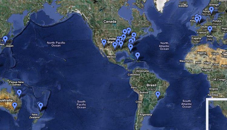
You can now keep track of what is being called “Aflockalypse” on Google Maps.
Google Maps links reports of animal deaths, as well as reports of birds that have succumbed to the bird flu. By clicking on the blue balloons on the map you will be given a link that will provide the original news report. You can also click the links in the left side panel of the map.
The map provides a quick look at where the mass, unexplained deaths are taking place. But some say the map could help solve the mystery, as there has been suggestions the map could be overlaid on a current global oil exploration map to test the hypothesis that the deaths could have been caused by ground penetrating tomography.
This isn’t the first time that unexplained mass animal deaths have occurred — see this article on Time for the “Top 10 Strange Mass Animal Deaths” — but it seems unprecedented to have them happen all over the world within a few days.
Or is it? Others have suggested that the internet age allows us to connect the dots where there are none to be connected. The dead birds in Arkansas on New Years Eve — seemingly the first report of mass animal deaths — have been attributed to them flying through a fireworks display, and there could be logical reasons for the others, too.
Find out more by interacting with the Google Map.

